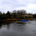
Long Island is fully entrenched in its late-spring transition mode, and the fishing is breaking wide open. After a period of inconsistent weather and stubborn water temperatures, warming trends have finally triggered aggressive, pre-spawn and post-migration feeding windows. Massive schools of baitfish have flooded into the western sound and south shore bays, bringing trophy-class predators right behind them.
Anglers should exercise standard seasonal caution. Unpredictable winds out of the north and south have occasionally churned up the open ocean and Long Island Sound, turning a calm morning into a choppy, challenging afternoon. Always keep a close eye on the marine forecast before heading out. Furthermore, if you are boating or kayaking, wearing your personal flotation device (PFD) is absolutely critical. While the air temperature might feel like summer, the water temperatures in the Sound and ocean are still cold enough to make hypothermia a very real and immediate risk. Stained water is prevalent near creek mouths due to recent runoff, which will dictate your lure color choices, but overall, the current conditions are prime for serious angling action.
From the editor
Tired of fishing with strangers you can’t trust?
Nautrek is the first social network for serious anglers — verified partners, real trips, cost splitting and intel sharing without burning your spots. Private beta now open.
The trophy-class striped bass migration has officially settled into Long Island waters. We are no longer just picking away at scattered, resident schoolies. There is a massive influx of adult menhaden (bunker) pouring into the bays, harbors, and open Sound, and the cow stripers are right on their tails. Anglers are consistently reporting fish pushing past the 40-pound and 45-pound marks. These heavyweights are actively corralling baitfish into shallow waters, providing world-class opportunities for both boat and surf anglers.
Sleeper Pick: Weakfish
While the majority of the local fleet is hyper-focused on the striped bass migration or the opening weeks of fluke season, weakfish have been surprisingly lively and abundant this year. Often referred to as "tide runners," these beautiful, iridescent purple and gold fish are currently providing excellent light-tackle action in the back bays. They are a fantastic target for anglers looking to escape the heavy boat traffic, offering spirited fights and excellent table fare.
Baitfish Report
Adult bunker are the main course right now. You can easily spot their presence by looking for "nervous water" or large dark patches flipping on the surface. In addition to the bunker, we are seeing solid numbers of squid and mackerel moving through the south shore inlets. This diverse forage base is jumpstarting the bottom fishing bite and keeping the pelagic species highly active. Match your artificial presentations to these large-profile baitfish for the best results.
TACTICAL STRATEGY
Striped Bass Tactics
Where: Focus your efforts on the Western Long Island Sound harbors, the North Fork rips, and the South Shore inlets. Specifically, target the shallow flats and drop-offs near the mouth of Jamaica Bay. Work the 10 to 15-foot transition zones where the bass are actively pinning bunker schools against underwater structure and sandbars.
Lure: Large topwater walkers and glide baits are producing violent, explosive strikes. Throw a 9-inch topwater plug, a large swimming darter, or a heavy flutter spoon if the fish are holding deeper in the water column.
Color: Bone or white is ideal for topwater plugs to mimic the pale belly of a distressed bunker. In stained, off-color water near the creek mouths, switch to bright chartreuse to maximize underwater visibility and trigger reaction strikes.
Bait: Live adult bunker is the absolute ticket for trophy fish right now. Snag and drop (where legal) or fish them on a traditional fish-finder rig with a heavy fluorocarbon leader.
Timing: The most consistent pattern is the topwater bite surrounding slack low-tide windows, particularly during low-light periods at dawn and dusk when the larger bass feel confident pushing into the shallows.
Recommended Gear Checklist:
Medium-heavy fast action spinning rod (7 to 8 feet)
30-pound braided main line
50-pound fluorocarbon leader
Non-offset inline circle hooks (Sizes 8/0 to 9/0)
Pro Tip: When fishing live or cut bait for striped bass, ensure you are utilizing inline, non-offset circle hooks. Not only is it required by law, but utilizing a larger size hook prevents gut-hooking and ensures a safe, healthy release for these crucial breeder-sized females.
Fluke & Weakfish Tactics
Where: For fluke, focus on the Narrow Bay area of Moriches and the sandy drop-offs inside Shinnecock Inlet. For weakfish, target the Peconic Bays, Great South Bay, and the deeper holes near the Shinnecock Canal.
Lure & Bait: For early-season fluke, drift whole squid or spearing on a traditional high-low rig. Alternatively, bounce a 1-ounce to 2-ounce white bucktail tipped with a chartreuse swimming mullet soft plastic. For weakfish, small pink or bubblegum soft plastics threaded onto a light 3/8-ounce jighead are absolutely deadly.
Pro Tip: When targeting early-season fluke, water temperature dictates everything. Focus your drifts on the outgoing tide in the late afternoon. The water pulling out of the shallow, sun-baked mud flats will be several degrees warmer than the incoming ocean water, which heavily activates the flounder's metabolism and triggers a feeding frenzy.
REGULATIONS SNAPSHOT
Understanding and adhering to current New York State Marine Regulations is critical. Here is what you need to know for the primary targets:
Always verify local Department of Environmental Conservation (DEC) postings at your specific boat ramp or marina, as emergency regulations and mid-season adjustments can occur.
REGIONAL ALTERNATIVE
If the spring winds are howling out of the north or south, making the Sound and the Ocean completely unfishable, do not cancel your trip. Instead, pivot your strategy to Long Island's highly productive freshwater ponds and lakes. The New York DEC heavily stocks local waters throughout the spring, providing incredible light-tackle opportunities that are completely protected from coastal gales.
Access & Targets
Locations like Massapequa Reservoir, Upper Twin Pond, and Lake Ronkonkoma receive thousands of Brown and Rainbow Trout. Massapequa Reservoir offers excellent, well-maintained shoreline access along its paved paths, while Lake Ronkonkoma features multiple public access points and an easy boat launch for kayaks and small craft. Your primary targets here are the stocked trout, ranging from aggressive yearlings to two-year-old holdovers, as well as the massive, often-overlooked European Carp that cruise the shallows.
Tactical Approach
For the trout, scale down your gear significantly. Toss 1/8-ounce gold or silver spoons, or drift small, live nightcrawlers under a sensitive slip float right along the 8 to 12-foot drop-offs. If you want to test your drag against a freshwater heavyweight, target the European Carp. Pack a medium-heavy spinning rod and fish sweet corn or specialized dough baits right on the bottom near the newly forming weed lines in the warmest, shallowest coves.
Pro Tip: When targeting stocked trout in these suburban lakes, pay close attention to the wind direction. Plankton, insects, and other forage naturally get pushed against the windward shore. The trout know this, and will actively patrol these wind-blown banks looking for an easy, concentrated meal. Cast directly into the wind for the highest hookup ratios.
Tight lines!
Editor's Choice: Must-Have Gear
FISHINGSIR Next-Gen Waterproof Chest Waders
★★★★★4.4 (7,370+ reviews)
2-Ply Tech: Upgraded nylon with 2.5x higher density than standard fabrics.
100% Waterproof: Lab-approved intrusion resistance with taped visible seams.
Ultra-Lightweight: Designed for all-day comfort while hunting or fishing.
As an Amazon Associate I earn from qualifying purchases. #ad
Loading forecast...
Live Fishing Conditions: Tides, Weather & Waves
Get real‑time tides, marine weather, swell and solunar activity for each spot so you know exactly when conditions line up for your best chance at a bite.
🎣
Long Island
Loading coordinates...
🌤️
WEATHER CONDITIONS
--°F
--°C
Loading...
🌡️
Feels Like--°F--°C
💧
Humidity--%
💨
Wind-- mph-- km/h
🧭
Direction--
📊
Pressure-- inHg-- hPa
☀️
UV Index--
🌊
MARINE CONDITIONS
🌊Wave Height
-- ft
-- m
Loading...
🧭Wave Direction
--°
Loading...
⏱️Wave Period
-- s
Loading...
📈Tide Status
-- ft
-- m
Loading...
🌙
LUNAR & SOLUNAR
🌕
Loading...
Illumination: --%
Major Period--:-- - --:----:-- - --:--
Minor Period--:-- - --:----:-- - --:--
🌅Sunrise--:--
🌇Sunset--:--
📅
24-HOUR FORECAST
Loading fishing conditions...
Fishing Spots Map
🎣
Book a Fishing Charter near Long Island Fishing Report Today 🎣
Local guides & charters. Verified captains, instant booking, best price guaranteed.
There was an error loading the map. Please try refreshing the page.
Info
Local Access & Facilities
The waters surrounding Long Island offer a study in contrasts, demanding versatility from any angler looking to master its diverse topography. From the rocky, current-swept shorelines of the north shore to the expansive, eelgrass-laden flats of the Great South Bay, this region is a complex matrix of tidal ecosystems. Seasoned skippers know that success here requires an intimate understanding of the barrier islands, the brackish estuaries, and the daily tidal flushes that dictate fish movement.
The atmosphere shifts dramatically depending on your launch point. On the north shore, Target Rock National Wildlife Refuge presents a rugged, half-mile stretch of rocky beach backed by mature oak-hickory forests. Down south, the vibe transitions to the immense, windswept salt marshes of Wertheim National Wildlife Refuge and the remote barrier dunes of Fire Island. The Carmans River, a designated scenic river, cuts directly through these southern woodlands, creating a vital artery for both fresh and saltwater species.
Targeting the local biomass means navigating these distinct zones. The daily tidal push from Huntington Bay into the brackish ponds of the north shore creates a dynamic feeding ground for predatory fish and puddle ducks alike. Meanwhile, the southern estuaries provide a haven for baitfish, drawing heavy-hitting game species into the shallows. Understanding the logistical realities of these access points is the first step to executing a flawless trip.
Access & Getting There
Navigating the major arteries of New York traffic is the primary hurdle for any dawn patrol mission. The Long Island Expressway (I-495) and Sunrise Highway (NY 27E) serve as the main corridors for anglers hauling trailers. To reach the premier southern access points near Wertheim National Wildlife Refuge, you will need to take Exit 68S or Exit 58S onto the William Floyd Parkway (CR 46S). From there, a quick jog onto Montauk Highway and Smith Road puts you right at the entrance.
For those running smaller vessels or kayaks, local launch realities dictate your timeline. There is a dedicated kayak launch situated exactly 5.8 miles from the central fishing grounds, along with unnamed boat launches at the 2.2-mile and 5.5-mile marks. If you are targeting the barrier island, understand that Watch Hill is accessible strictly by private boat or the Watch Hill Ferry. The ferry terminal is located at 150 West Avenue in Patchogue, requiring careful parking strategy during peak summer weekends.
💡 Captain's Tip: Ferry Terminal Logistics
When launching via the Watch Hill Ferry from Patchogue, the terminal parking lot fills rapidly. Drop your heavy gear at the loading zone first, then secure your vehicle. If dragging a cart, ensure it has balloon tires to handle the transition from the dock to the sandy trails of Fire Island.
Weather contingencies are critical when crossing the Great South Bay. The open water can chop up violently when southerly winds oppose an outgoing tide. If conditions deteriorate, the leeward side of the barrier islands offers protected navigation channels. Conversely, if you are fishing the north shore near Target Rock, strong northerly blows will push heavy surf directly onto the rocky beaches, making shore access treacherous.
Parking for mainland access points requires strategic planning. Lot 1 in Stony Brook is a prime staging area located just 4.6 miles from the northern grounds, and crucially, it remains open 24 hours on weekends. Further south, the Elite Paving lot in Oakdale sits 7.7 miles from the center but operates on strict weekday hours. Always secure your vehicle and avoid leaving visible gear in the bed of your truck at these transient lots.
Long Island Pre-Trip Checklist
Facilities & Amenities
The caliber of local infrastructure can make or break an extended expedition. For those running larger offshore vessels, the Watch Hill area boasts a massive 175-slip transient marina. This facility is fully equipped with water hookups, shore power, and a dedicated pump-out station, making it an ideal basecamp for multi-day trips on the Great South Bay. A small convenience store and snack bar operate seasonally to keep the crew fueled.
When it comes to outfitting your vessel, local knowledge beats big-box retailers every time. Cow Harbor Bait & Tackle is the premier hub for north shore anglers, while Smith Point Bait Beach & Tackle handles the heavy surfcasting gear needed for the southern beaches. If you need local intel or a guided run, Captain Fish Port Jefferson operates around the clock to put clients on the meat.
Facility Name
Type
Distance
Contact
Captain Fish Port Jefferson
Charter Operator
6.7 miles
(631) 974-4933
Smith Point Bait Beach & Tackle
Bait & Tackle
13.1 miles
(631) 729-6889
Cow Harbor Bait & Tackle
Bait & Tackle
13.6 miles
(631) 239-1631
Harts Cove Bait & Tackle
Bait & Tackle
17.7 miles
(631) 878-7514
Negative knowledge is just as vital for trip planning. It is critical to note that the premium accommodations at Fire Island—specifically the Watch Hill Bayview House and The Bayberry Dunes House—do not provide bed sheets or towels. You must pack your own linens alongside your tackle. Furthermore, pets are strictly prohibited at these National Park Service sites, so leave the boat dog at home if you plan to stay ashore.
For mainland lodging that accommodates dawn patrol hours, luxury Camper Rentals in Shoreham operates 24 hours a day, located 12.9 miles from the grounds. If you secure a beach house at Watch Hill, you will find fully equipped kitchens featuring microwaves, blenders, and ranges. This allows you to process and cook your catch immediately, right on the deck overlooking the Atlantic Ocean.
💡 Captain's Tip: Provisioning for Watch Hill
Ice and specialized bait are not reliably available on the barrier island. Purchase all your flats of bunker, heavy lead, and block ice on the mainland at Smith Point Bait Beach & Tackle before crossing the bay. Once you are on Fire Island, you are at the mercy of the seasonal general store.
Permits, Regulations & Fees
The waters and marshlands of this region are heavily protected for a reason. The 2,550 acres of the Wertheim National Wildlife Refuge and the 209 acres of the Seatuck National Wildlife Refuge serve as critical nurseries for the entire local fishery. These mixed-oak woodlands, saltmarshes, and subtidal zones filter excess nutrients and provide cover for juvenile gamefish. Respecting the boundaries of these refuges ensures the biomass remains healthy for future seasons.
Access rules vary drastically between the different zones. Target Rock National Wildlife Refuge is open to the public and serves as an extremely popular shore fishing location. However, Seatuck National Wildlife Refuge is strictly closed to public entry to protect sensitive avian habitats and potential transplant sites for the endangered sandplain gerardia. Anglers must view Seatuck from South Bay Avenue in Islip and fish the adjacent public waters.
Fishing regulations across the board are enforced by the State Fishing Agency. Size limits, bag limits, and seasonal closures are strictly monitored, especially around the inlet bottlenecks where fish stack up during tidal swings. If you plan to push into the Otis Pike Fire Island High Dune Wilderness for remote surfcasting, you must secure a backcountry camping permit via Recreation.gov. Accessing this zone from Davis Park requires a grueling one-mile hike through soft sand.
Cultural and environmental respect is paramount. The saltmarshes are currently battling invasive Phragmites, making it crucial that anglers clean their boots and gear to prevent spreading the exotic plant. Stick to designated trails when crossing the dunes to reach the oceanfront. Trampling the native smooth cordgrass and hightide bush not only destroys the ecosystem but accelerates coastal erosion.
Events & Seasonal Information
The rhythm of the fishery here is entirely dictated by the shifting seasons. From May to mid-October, the Watch Hill Visitor Center and its associated marina are fully operational. This is the peak window for transient boaters and offshore crews staging for pelagic runs. During this time, the barrier island beaches are lifeguarded, and the local fleet is out in full force chasing migrating schools of striped bass and bluefish.
As summer fades into early autumn, the landscape transforms. The hightide bush surrounding the brackish ponds at Target Rock erupts in distinctive white flowers, signaling the start of the fall run. This is when the daily tidal floods from Huntington Bay bring aggressive predators tight to the rocky shorelines. The cooling water temperatures trigger massive bait migrations out of the Carmans River, creating explosive surface feeds across the bay.
💡 Local Alert: Off-Peak Accommodations
During the off-peak season, the National Park Service may accommodate shorter stays at the Fire Island beach houses on a limited, case-by-case basis. If you are planning a late-fall strike mission, email park staff directly to request a modified reservation outside the standard system minimums.
Timing your daily approach requires careful attention to the wind clock. Summer trade winds generally pick up by mid-morning, turning the open bay into a washing machine. Savvy skippers plan their bay crossings before 10:00 AM, utilizing the calm dawn conditions. Conversely, shore anglers at Target Rock prefer the moving water of the incoming tide, regardless of the time of day, as it pushes bait against the half-mile stretch of rocky beach.
Contact Information & Resources
Self-reliance is the rule when operating in the remote stretches of the Great South Bay and Fire Island. The primary managing agency for the wildlife refuges is the U.S. Fish and Wildlife Service, reachable at 631-286-0485. For matters concerning the barrier island, the National Park Service at Fire Island can be contacted at 631-569-2100. Always keep these numbers programmed in your VHF radio or satellite communicator.
Safety on the rocky beaches of the north shore requires proper footwear; felt-soled boots or heavy cleats are highly recommended to navigate the slick, algae-covered stones at Target Rock. When boating the southern estuaries, always monitor the local weather buoy data, as conditions can deteriorate faster than the forecast predicts. For precise locations, live weather conditions, and interactive access maps, consult the live dashboard and maps below.
🎣
Long Island
Centereach • New York • 40.8515, -73.0994
🅿️
Parking
5
Mr Parking Lot
⭐ 5.013.8 mi
📍Lorel professional building, 1488 Deer Pk Rd, North Babylon, NY 11703, USA
Our spot reports combine data-driven forecasts with curated local information. The forecast is generated by our proprietary Fishing Score algorithm (0–100%), which analyzes real-time data from Open-Meteo API, validated against NOAA CO-OPS tide gauges and USGS water-monitoring stations. The model weights tide dynamics (35%), wave energy (25%), wind patterns (20%) and time of day (20%)—factors shown to influence fish feeding behavior through marine-biology research and decades of charter log data.
Access, facilities and services information for each fishing spot is sourced from official datasets such as Recreation.gov (RIDB), state park & wildlife agencies, and geospatial providers like Google Maps. These sections undergo scheduled re-validation every 3–6 months to ensure that boat ramps, park access, contact details and local services remain accurate.
Narrative sections (catches, seasonal behavior, local tips) are synthesized from these data sources and refined following the Fishing Reports Today editorial guidelines, combining bibliographic research from ichthyology and oceanography with expert angler experience. Our team reviews reports on a regular basis, while the forecast model itself updates every 6 hours for real-time accuracy.
⚠️ Important: Always verify current local regulations, access restrictions and weather conditions before fishing. These reports are intended as a planning aid, not a guarantee of catches or safety. When in doubt, contact local authorities or park managers listed on the page.
To provide the best experiences, we use technologies like cookies to store and/or access device information. Consenting to these technologies will allow us to process data such as browsing behavior or unique IDs on this site. Not consenting or withdrawing consent, may adversely affect certain features and functions.
Functional Always active
The technical storage or access is strictly necessary for the legitimate purpose of enabling the use of a specific service explicitly requested by the subscriber or user, or for the sole purpose of carrying out the transmission of a communication over an electronic communications network.
Preferences
The technical storage or access is necessary for the legitimate purpose of storing preferences that are not requested by the subscriber or user.
Statistics
The technical storage or access that is used exclusively for statistical purposes.The technical storage or access that is used exclusively for anonymous statistical purposes. Without a subpoena, voluntary compliance on the part of your Internet Service Provider, or additional records from a third party, information stored or retrieved for this purpose alone cannot usually be used to identify you.
Marketing & Affiliates
The technical storage or access is required to create user profiles to send advertising, or to track the user on a website or across several websites for similar marketing purposes, including affiliate tracking for products recommended in our reports.


Leave a Reply