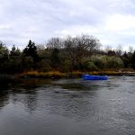
The late-spring and early-summer transition is firmly established across Long Island Sound, and the local Bridgeport fishery is breaking wide open. Warming water trends have finally triggered aggressive, post-migration feeding windows for predatory species. However, anglers must exercise standard seasonal caution. Unpredictable thermal winds out of the north and south can occasionally churn up the open Sound, turning a glass-calm morning into a choppy, challenging afternoon. Always keep a close eye on the marine forecast and radar before heading out past the harbor breakwalls.
Furthermore, if you are boating or kayak fishing along the coast, wearing your personal flotation device (PFD) remains absolutely critical. While the ambient air temperature might feel like the peak of summer, the water temperatures in the deeper sections of the Sound are still cold enough to make hypothermia a risk during prolonged exposure. Stained water is prevalent after heavy afternoon thunderstorms, so adjust your navigation and lure colors accordingly.
🎣Nautrek
Private Beta
J
M
R
100+ anglers on the waitlist
The fishing network where your reputation matters.
Find trusted captains, join real trips with cost splitting, and build your Angler Rank. Your spots stay private — you decide who sees your intel.
The trophy-class striped bass migration has officially settled into Long Island Sound waters. We are no longer just picking away at scattered, resident schoolies in the tidal rivers. There is a massive influx of adult menhaden pouring into the bays, harbors, and open Sound, and the cow stripers are right on their tails. Anglers are consistently reporting fish pushing past the 40-pound and 45-pound marks. These heavyweights are actively corralling baitfish into shallow waters, providing world-class opportunities for both boat and surf anglers.
Secondary Target: Bluefish & Summer Flounder
Gator bluefish have arrived in force, often found tearing through the same bait pods as the stripers. Below the surface chaos, summer flounder (fluke) are setting up on sandy shoals and channel edges, waiting to ambush injured bait drifting down from the topwater feeds.
Sleeper Pick: Black Sea Bass
While the fleet chases surface feeds, the bottom fishing is quietly turning red hot. Black sea bass are stacking up on deeper structure, wrecks, and rock piles just outside Bridgeport Harbor. They are highly aggressive, provide excellent table fare, and offer a reliable fallback when the pelagic bite shuts down under the high midday sun.
Baitfish Report
Adult bunker (menhaden) are the main course right now. You can easily spot their presence by looking for nervous water, diving birds, or large dark patches flipping on the surface. In addition to the bunker, we are seeing solid numbers of squid and mackerel moving through the deeper channels. This diverse forage base is jumpstarting the bottom fishing bite and keeping the pelagic species highly active. Match your artificial presentations to these large-profile baitfish for the best results.
TACTICAL STRATEGY
Where to Deploy
Focus your efforts around the Bridgeport Harbor channel edges and the rocky groins off Seaside Park. For boaters, Penfield Reef just to the west of the city is a prime holding zone. Work the 15 to 25-foot drop-offs where tidal currents force baitfish into tight, vulnerable pods. Shore anglers should target the public access areas along Seaside Park, focusing specifically on the points where the sweeping current creates visible rip lines and eddies.
Lure Selection & Tackle
To match the adult bunker, you need to throw large-profile artificials. A 9-inch resin topwater walker, a large wooden pencil popper, or a 2-ounce white bucktail jig paired with a 6-inch curly tail grub will get crushed. Large flutter spoons are also highly effective when dropped into deep schools of bait and jigged vertically. For tackle, utilize a 7.5 to 8-foot medium-heavy fast action rod paired with a 4000 to 5000 size spinning reel, spooled with 30-pound braided line.
Color Patterns
Stick to bone, white, or metallic silver in clear water to perfectly mimic bunker and squid. If the afternoon winds or a recent storm stain the water, switch to chartreuse or yellow to increase visibility and draw reaction strikes.
Bait & Rigging
Live adult bunker is the absolute ticket for trophy stripers. Snag or cast-net your bait, then rig it on an 8/0 inline circle hook attached to a 3-foot, 50-pound fluorocarbon leader. If you are chunking fresh bunker from the shore, fish it on a standard fish-finder rig with a pyramid sinker to keep it pinned to the bottom without feeling unnatural to a taking fish.
Timing the Bite
Moving water is the absolute key to success in the Sound. The most violent feeding frenzies are occurring during the first two hours of the outgoing tide. Combine this tidal window with low-light conditions at dawn or dusk, and you have the optimal strike window for a personal best.
Pro Tip: When throwing large topwater walkers, do not set the hook on the initial splash. Wait until you physically feel the weight of the fish on your rod before sweeping the tip. Striking too early will pull the lure right out of the striper's mouth.
Pro Tip: If the bluefish are thick and biting off your expensive topwater lures, switch to a single-hook tin or a heavy spoon. You will save money and spend less time re-tying leaders.
REGULATIONS SNAPSHOT
Local Connecticut Department of Energy and Environmental Protection (DEEP) regulations are strictly enforced. Always verify current postings at your local boat ramp or marina, as emergency mid-season adjustments can occur, but keep these primary seasonal rules in mind:
Species
Size Limit
Bag Limit
Season & Gear Notes
Striped Bass
28 inches to less than 31 inches (Slot)
1 fish per angler
Open year-round. Inline circle hooks mandatory when fishing with bait.
Summer Flounder (Fluke)
19 inches (17 inches at Enhanced Shore Sites)
3 fish per angler
Mid-season size increase to 19.5 inches applies later in summer.
Black Sea Bass
15 inches
5 fish per angler
Bag limit increases to 7 fish later in the fall.
Scup (Porgy)
9 inches
30 fish per angler
Highly abundant; excellent target for family fishing trips.
Pro Tip: Seaside Park is officially designated by CT DEEP as an Enhanced Opportunity Shore Fishing site. This means shore-bound anglers can harvest fluke at a reduced minimum length of 17 inches, making it a fantastic location for a productive meat trip.
REGIONAL ALTERNATIVE
The Housatonic River & Bunnells Pond
If unpredictable winds make the open waters of Long Island Sound unfishable, you have two excellent backup plans located just minutes from Bridgeport.
Option 1: Housatonic River Mouth (Saltwater)
Head slightly east to the mouth of the Housatonic River in Stratford. The river offers sheltered coves and protected shorelines that remain fishable even during a stiff blow. The target species here remain striped bass and bluefish, which push up into the river to feed on the tidal flush. Quick tactical approaches include:
Accessing the water via the state boat ramp under I-95 or fishing from the shores of Short Beach.
Downsizing your tackle slightly to throw 1-ounce pencil poppers over the sandbars at first light.
Drifting chunk baits along the main channel edge where the depth drops rapidly from 8 to 20 feet.
Option 2: Bunnells Pond (Freshwater)
If the salt is completely blown out, head inland to Bunnells Pond located within Beardsley Park right in Bridgeport. This is a designated Community Fishing Water stocked heavily with trout in the spring by CT DEEP, and it also holds healthy populations of largemouth bass and panfish. Quick tactical approaches include:
Targeting the deeper drop-offs with inline spinners or small spoons for holdover trout.
Working the weed edges with weedless soft plastics for aggressive largemouth bass.
Using simple bobber-and-worm rigs near the shoreline to keep kids entertained with constant bluegill action.
Tight lines!
Editor's Choice: Must-Have Gear
FISHINGSIR Next-Gen Waterproof Chest Waders
★★★★★4.4 (7,370+ reviews)
2-Ply Tech: Upgraded nylon with 2.5x higher density than standard fabrics.
100% Waterproof: Lab-approved intrusion resistance with taped visible seams.
Ultra-Lightweight: Designed for all-day comfort while hunting or fishing.
As an Amazon Associate I earn from qualifying purchases. #ad
Loading forecast...
Live Fishing Conditions: Tides, Weather & Waves
Get real‑time tides, marine weather, swell and solunar activity for each spot so you know exactly when conditions line up for your best chance at a bite.
🎣
Bridgeport, CT
Loading coordinates...
🌤️
WEATHER CONDITIONS
--°F
--°C
Loading...
🌡️
Feels Like--°F--°C
💧
Humidity--%
💨
Wind-- mph-- km/h
🧭
Direction--
📊
Pressure-- inHg-- hPa
☀️
UV Index--
🌊
MARINE CONDITIONS
🌊Wave Height
-- ft
-- m
Loading...
🧭Wave Direction
--°
Loading...
⏱️Wave Period
-- s
Loading...
📈Tide Status
-- ft
-- m
Loading...
🌙
LUNAR & SOLUNAR
🌕
Loading...
Illumination: --%
Major Period--:-- - --:----:-- - --:--
Minor Period--:-- - --:----:-- - --:--
🌅Sunrise--:--
🌇Sunset--:--
📅
24-HOUR FORECAST
Loading fishing conditions...
Fishing Spots Map
🎣
Book a Fishing Charter near Bridgeport, CT Fishing Report Today 🎣
Local guides & charters. Verified captains, instant booking, best price guaranteed.
There was an error loading the map. Please try refreshing the page.
Info
Local Access & Facilities
Bridgeport, Connecticut, stands as a pivotal industrial gateway to the rich waters of Long Island Sound. For the seasoned angler, this location offers a stark contrast between heavy urban infrastructure and the raw, productive biological diversity of the Sound. The fishery here is defined by its deep-water harbor access, allowing captains to quickly transition from the protected waters of the Black Rock area to the open swells where pelagics and groundfish hunt. Unlike the manicured marinas further down the Gold Coast, Bridgeport retains a working-waterfront atmosphere where functionality reigns supreme.
The strategic value of launching from Bridgeport lies in its central positioning. To the west, the jagged coastline offers structure-oriented fishing; to the south, the open Sound provides deep channels; and directly across the water lies the New York shoreline, including the productive grounds off Huntington. While the backdrop is often steel and concrete, the water teeming beneath the surface holds striped bass, bluefish, and tautog that draw serious sportfishing fleets. This is a location for the angler who prioritizes access and efficiency over aesthetics.
However, navigating an urban fishery requires a specific set of logistical skills. The density of the surrounding city means that "dawn patrol" is not just a preference but a necessity to beat the commuter traffic on I-95 and secure trailer parking. The facilities here are robust but scattered, requiring the visiting captain to have a pre-planned route for bait, fuel, and launch. The following guide breaks down the essential logistics for executing a successful trip out of Bridgeport.
Access & Getting There
Navigating the Urban Corridor
Reaching the Bridgeport waterfront typically involves navigating the congested I-95 corridor or the Merritt Parkway. For anglers towing heavy center consoles, I-95 is the standard route, but it is notorious for bottlenecks, particularly during the morning rush hour between 6:00 AM and 9:00 AM. Seasoned locals know that hitting the exit ramps before 5:30 AM is critical to maintaining a stress-free launch schedule. The surface streets leading to the harbor can be narrow and lined with parked cars, so wide turns and careful trailer management are essential when approaching the water.
The primary boat access points are situated around the harbor perimeter, specifically near coordinates 41.169 and 41.172. These ramps are designed to handle the tidal fluctuations of the Sound, but the urban setting presents unique challenges. Lighting at these facilities is generally functional, but shadows from nearby industrial structures can obscure ramp edges during pre-dawn launches. It is advisable to have adequate deck lighting on your vessel or a spotter to assist with backing down the ramp.
💡 Captain's Tip: Trailer Security
In high-density urban launch sites, trailer security is paramount. Use a high-quality coupler lock and consider a wheel boot if you plan to be on the water for an extended duration or overnight. While local patrols are present, the high volume of traffic in the area makes visual deterrence your best line of defense.
Launch Realities and Parking
The data indicates three distinct boat ramps and two shore access points in the immediate vicinity. Parking availability varies significantly by season and day of the week. Unlike sprawling rural recreational areas, the parking lots here are finite. On weekends during the height of the striped bass run, these lots can reach capacity by sunrise. If you arrive late, you may find yourself navigating tight side streets looking for overflow parking, which is far from ideal when towing a 25-foot rig.
For those fishing from shore, the access points near 41.183 and 41.186 offer family-friendly entry to the water. These spots are suitable for casting plugs or soaking bait, but anglers should be mindful of the tides. High tide often pushes anglers back against riprap or bulkheads, limiting mobility. Always check the tide charts relative to your arrival time to ensure you have fishable shoreline available.
Weather Contingencies
Long Island Sound is known for its "chop" when the wind opposes the tide. A strong southwest wind, common in summer afternoons, can stack up steep waves against an outgoing tide, making the return trip to Bridgeport Harbor bumpy. If the forecast calls for winds exceeding 15 knots from the southwest, consider launching earlier to return before the afternoon breeze stiffens. In the event of a complete blowout on the Sound, Hop Brook Lake offers a freshwater alternative approximately 24 miles inland, providing a sheltered option for trout fishing.
Bridgeport, CT Pre-Trip Checklist
Facilities & Amenities
Local Tackle and Gear Support
The Bridgeport area is serviced by a mix of specialized tackle shops and general marine suppliers. For the saltwater angler, Black Rock Bait and Tackle LLC is the strategic hub. Located just 3.1 miles from the center of the fishing zone at 3309 Fairfield Ave, this shop opens at 8:00 AM on weekdays and 6:00 AM on weekends. It is the go-to spot for fresh bunker, eels, and local intelligence on what the bass are hitting. Their proximity to the water makes them the last stop for ice and bait before hitting the ramp.
For those requiring more specialized gear or charter information, Endorfin Fishing CT in Fairfield (3.7 miles away) operates with extensive hours, potentially offering more flexibility for off-hours coordination. If you are targeting freshwater species or heading inland toward the lakes, Bounty Hunters Custom Bait & Tackle in Newtown (15.3 miles away) offers highly rated custom baits, though it is a significant detour from the saltwater harbor.
💡 Captain's Tip: The Sunday Gap
Note that Black Rock Bait and Tackle closes early at 2:00 PM on Sundays. If you are planning an afternoon or sunset tide on Sunday, you must secure your bait in the morning. Do not rely on finding fresh bait open late on Sunday evenings in this specific area.
Automotive and Trailer Services
Mechanical failures with tow vehicles are a nightmare scenario. In the immediate vicinity, H. Sandoval Foreign Car Inc. in Milford (4.8 miles away) is a highly-rated option for vehicle repairs, though they are closed on weekends. For trailer tires or motorcycle-class gear (sometimes useful for small engine parts or tie-downs), Cycle Gear in Orange is about 10 miles out. It is crucial to note that specialized boat trailer repair shops are not explicitly listed in the immediate radius, so carrying a spare hub, grease, and a functional jack is mandatory for self-reliance.
Facility Name
Type
Distance
Key Notes
Black Rock Bait and Tackle
Bait & Tackle
3.1 miles
Opens 6 AM Sat/Sun. Primary saltwater shop.
Endorfin Fishing CT
Charter/Gear
3.7 miles
5-Star Rating. Located in Fairfield.
H. Sandoval Foreign Car Inc.
Auto Repair
4.8 miles
Mon-Fri only. 4.7 Star Rating.
Union Station Garage
Parking
15.7 miles
Located in New Haven. Open 24 Hours.
Lodging and Camping Logistics
Accommodation directly on the water in Bridgeport is limited for anglers towing boats. The data suggests looking inland for camping options. Camp Cedarcrest in Orange (11.4 miles) and Webb Mountain Campsites in Monroe (13.6 miles) provide the nearest outdoor lodging. These locations are far enough from the harbor that you will need to factor in a 25-30 minute drive to the ramp in the morning. For those crossing the Sound or fishing the NY side, Luxury Camper Rentals in Shoreham, NY offers a different type of accommodation, though it requires logistical planning to access from the CT side without a ferry or long drive.
Permits, Regulations & Fees
Jurisdictional Awareness
Fishing out of Bridgeport places you on the border of two distinct regulatory zones: Connecticut and New York. The state line runs through the middle of Long Island Sound. Anglers venturing more than halfway across the Sound—perhaps chasing birds toward Target Rock National Wildlife Refuge on the New York side—must possess a valid New York marine fishing registry in addition to their Connecticut license. Enforcement on the water is active, and "I didn't know I crossed the line" is rarely accepted as a valid excuse.
Protected Areas and Refuges
Target Rock National Wildlife Refuge, located roughly 21 miles across the water from Bridgeport, allows shore fishing but operates under strict federal refuge guidelines. If you are boating over to fish the shoreline (staying in the water), standard state regulations apply. However, if you land on the refuge beach, you are subject to specific access hours and gear restrictions designed to protect local wildlife, particularly nesting birds. The refuge consists of 80 acres of mature forest and rocky beach, and while it is a "popular shore fishing location," it is also a sanctuary. Respecting the "Kapu" (restrictions) here is vital for continued angler access.
Hop Brook Lake, managed by the Army Corps of Engineers, is another regulated zone nearby. As a stocked trout fishery, it likely carries specific seasonal trout stamp requirements in addition to the standard freshwater license. The lake prohibits gas motors (electric or paddle only), which is a critical detail for captains thinking of dropping their center console in for a freshwater rinse—it simply isn't allowed.
💡 Captain's Tip: The Freshwater Backup
If the Sound is blown out by heavy weather, Hop Brook Lake (23.9 miles away) is a viable "Plan B." However, leave the big boat at home. This is a canoe/kayak or shore fishing venue. Ensure you have your inland fishing license and trout stamp current before diverting here.
Events & Seasonal Information
The Seasonal Rhythms
The fishing calendar in Bridgeport is dictated by water temperature and migration patterns. The spring arrival of striped bass in the harbor typically kicks off the season, followed by bluefish and fluke. The Target Rock area across the Sound is noted for its "brackish pond" and tidal mixing, creating a unique biological hotspot that often holds bait late into the season. The high tide bush blooming in early autumn at Target Rock signals the start of the fall run, a prime time for surfcasters targeting blitzing fish along the rocky beaches.
Winter Operations
While saltwater fishing slows in the deep winter, the region does not shut down. Hop Brook Lake remains a recreational hub, with cross-country skiing popular on the trails. This indicates that the area sees significant freezing temperatures. Anglers attempting to fish the harbor in late December or January for holdover bass must be wary of ice on the boat ramps. The freshwater mix in the harbor surface layer can freeze overnight, turning a steep concrete ramp into a skating rink. Carrying a bag of rock salt or sand in the truck bed is a professional move during the winter months.
Contact Information & Resources
For the most current information regarding access status, gate closures, or emergency assistance, direct communication with the managing agencies is recommended. Do not rely solely on third-party apps for critical closures.
Weir Farm National Historical Park (Visitor Info): (203) 834-1896 – Located at 735 Nod Hill Road, Wilton, CT.
Target Rock National Wildlife Refuge: (631) 286-0485 – For regulations regarding the NY shoreline and refuge access.
Hop Brook Lake (USACE): (203) 729-8840 – For current water levels and stocking info.
Black Rock Bait and Tackle: (203) 345-1835 – For real-time fishing reports and bait availability.
Safety Note: In an on-water emergency, VHF Channel 16 is the primary lifeline to the Coast Guard. Cell service can be spotty in the middle of the Sound. Always file a float plan with a reliable contact on land before departing the dock.
For precise locations of the boat ramps, real-time wind conditions, and detailed bathymetry of the surrounding waters, consult the live dashboard and interactive maps below.
Our spot reports combine data-driven forecasts with curated local information. The forecast is generated by our proprietary Fishing Score algorithm (0–100%), which analyzes real-time data from Open-Meteo API, validated against NOAA CO-OPS tide gauges and USGS water-monitoring stations. The model weights tide dynamics (35%), wave energy (25%), wind patterns (20%) and time of day (20%)—factors shown to influence fish feeding behavior through marine-biology research and decades of charter log data.
Access, facilities and services information for each fishing spot is sourced from official datasets such as Recreation.gov (RIDB), state park & wildlife agencies, and geospatial providers like Google Maps. These sections undergo scheduled re-validation every 3–6 months to ensure that boat ramps, park access, contact details and local services remain accurate.
Narrative sections (catches, seasonal behavior, local tips) are synthesized from these data sources and refined following the Fishing Reports Today editorial guidelines, combining bibliographic research from ichthyology and oceanography with expert angler experience. Our team reviews reports on a regular basis, while the forecast model itself updates every 6 hours for real-time accuracy.
⚠️ Important: Always verify current local regulations, access restrictions and weather conditions before fishing. These reports are intended as a planning aid, not a guarantee of catches or safety. When in doubt, contact local authorities or park managers listed on the page.
To provide the best experiences, we use technologies like cookies to store and/or access device information. Consenting to these technologies will allow us to process data such as browsing behavior or unique IDs on this site. Not consenting or withdrawing consent, may adversely affect certain features and functions.
Functional Always active
The technical storage or access is strictly necessary for the legitimate purpose of enabling the use of a specific service explicitly requested by the subscriber or user, or for the sole purpose of carrying out the transmission of a communication over an electronic communications network.
Preferences
The technical storage or access is necessary for the legitimate purpose of storing preferences that are not requested by the subscriber or user.
Statistics
The technical storage or access that is used exclusively for statistical purposes.The technical storage or access that is used exclusively for anonymous statistical purposes. Without a subpoena, voluntary compliance on the part of your Internet Service Provider, or additional records from a third party, information stored or retrieved for this purpose alone cannot usually be used to identify you.
Marketing & Affiliates
The technical storage or access is required to create user profiles to send advertising, or to track the user on a website or across several websites for similar marketing purposes, including affiliate tracking for products recommended in our reports.


Leave a Reply