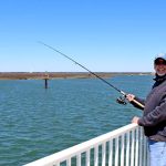
Welcome to the ultimate guide for navigating the shifting sands and dynamic backwaters of Corsons Inlet, New Jersey. Situated between Ocean City and Strathmere, this undeveloped barrier island ecosystem is a premier destination for anglers seeking moving water and diverse structure. As the coastal waters settle into their summer patterns, baitfish are flooding the estuaries, and predatory fish are actively feeding in the channels and shallows. Here is your comprehensive, data-backed intelligence report for targeting the inlet and surrounding back bays.
1. GO/NO-GO STATUS
Verdict: GO (WITH CAUTION)
Conditions are highly favorable for back-bay and inlet fishing, but the dynamic nature of this specific inlet dictates a cautious approach. As water temperatures climb into the optimal feeding zones, heavy baitfish movement is triggering aggressive bites. However, the mouth of Corsons Inlet is notorious for rapidly shifting sandbars and unpredictable shoaling that can become bone-dry at low tide and drop to 30 feet just yards away.
From the editor
Tired of fishing with strangers you can’t trust?
Nautrek is the first social network for serious anglers — verified partners, real trips, cost splitting and intel sharing without burning your spots. Private beta now open.
Boaters must navigate the unnavigable-looking cuts with extreme care, preferably on an incoming tide when visibility is highest and the water level offers a buffer. If ocean winds howl from the east or northeast, the inlet mouth will become treacherous and unfishable, but the sheltered back-bay sedge banks and Intracoastal Waterway (ICW) channels will remain highly productive.
Wading anglers and surfcasters should be particularly mindful of the soft mud and sudden drop-offs near the sod banks. While the water is warming, extended exposure still warrants breathable chest waders. A tightly secured wading belt is non-negotiable here due to the strong tidal pull that funnels through the narrow inlet mouth.
2. SPECIES INTEL
Recent biological ground-truth data reveals a highly active food web in the region, dictating exactly what you should be targeting and what you should be throwing.
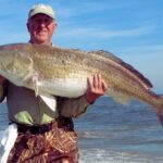
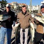
Summer Flounder are aggressively pushing into the surrounding backwaters, inlet channels, and shallow bays to take advantage of the warming water and abundant forage. Simultaneously, resident and migratory Striped Bass are actively staging around the inlet mouth, bridge pilings, and sandbars to intercept bait dropping out of the marshes on the ebb tide.
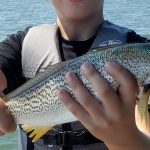
Sleeper Pick: Weakfish (Tiderunners)
Often overlooked by anglers laser-focused on fluke and stripers, weakfish are infiltrating the backwaters. These beautiful "tiderunners" offer spectacular light-tackle action, particularly around submerged shell beds, mud flats, and creek mouths in the low-light hours.
Baitfish Report: Match the Hatch
The estuaries are currently flushing out massive amounts of spearing (silversides), grass shrimp, and mud minnows (mummichogs). We are also seeing the first scouting schools of peanut bunker and adult menhaden entering the inlet. Match your lure profiles to these slender, 3-to-5-inch baitfish for the highest hookup ratios.
3. TACTICAL STRATEGY
Where to Deploy
Avoid aimless casting into the open ocean. Focus your efforts on the Russ Chattin Bridge pilings, where the tidal flow creates natural ambush eddies. For wading anglers, the sandbars on the Ocean City side of the inlet mouth offer excellent drops. Work the 8-to-12-foot drop-offs where the shallow flats dump into the main inlet channel. During the outgoing tide, position yourself near the back-bay sedge banks, such as the outflow near Weakfish Creek, where warmer, sun-baked water empties from the shallows.
Lure Selection
For Flounder: 3/8oz to 1/2oz white bucktail jigs tipped with a 4-inch curly-tail grub or synthetic scented bait.
For Weakfish & Stripers: 1/4oz to 1/2oz leadhead jigs paired with 5-inch soft plastic jerkbaits. Small swimming plugs like crystal minnow imitations are also highly effective when retrieved slowly.
Pro Tip:If your soft plastics are constantly getting bitten in half, small bluefish have moved into the zone. Immediately switch to a small metal spoon or a diamond jig to save your plastics and hook the choppers.
Color Patterns
In the stained backwaters, use rootbeer, pink (an absolute necessity for weakfish), or gold flake to mimic the local mummichogs and grass shrimp. Near the inlet mouth in clearer water, pearl white or chartreuse-and-white perfectly imitates fleeing spearing and menhaden.
Bait & Rigging
For early-season stripers, soaking fresh surf clams on a fish-finder rig with a 5/0 to 7/0 inline circle hook is a proven tactic along the beachfront and inlet mouth. If targeting flounder in the back bays, drift live mummichogs on a traditional high-low rig.
Timing the Bite
Striped bass and bluefish feed most heavily on the incoming tide as clean, highly oxygenated ocean water pushes into the inlet. Conversely, weakfish and summer flounder locations produce much better on the outgoing (ebb) tide, picking off bait flushed from the marsh. Low-light conditions—predawn, dusk, and night—are absolutely critical for fooling the larger, heavily pressured weakfish and stripers.
Pro Tip:At night, check the shadow lines under the bridge connecting the islands. Moving water combined with artificial light creates a massive feeding zone for stripers and bluefish intercepting bait. Cast into the light and retrieve your lure into the shadows where the predators are waiting.
Pro Tip:When drifting for summer flounder, your drift speed is critical. If wind and tide are pushing your boat faster than 1.5 knots, your bucktail won't maintain contact with the bottom. Use a drift sock to slow your vessel, ensuring your presentation stays in the strike zone.
4. REGULATIONS SNAPSHOT
Before hitting the water, ensure you are compliant with current New Jersey Division of Fish and Wildlife regulations. Note that all marine anglers must register with the free NJ Saltwater Recreational Registry Program prior to fishing.
Species
Season
Minimum Size
Bag Limit
Summer Flounder (Fluke)
May 4 – Sep 25
18 inches
3 per person
Striped Bass
Mar 1 – Dec 31 (Bays/Rivers)
28 to 31 inches (Slot Limit)
1 per person
Weakfish
Open Year-Round
13 inches
1 per person
Bluefish
Open Year-Round
No Minimum Size
3 per person (Private/Shore)
Important Regulatory Note: Striped bass fishing with natural bait requires the mandatory use of non-offset inline circle hooks to reduce catch-and-release mortality. Gaffing striped bass is strictly prohibited.
5. REGIONAL ALTERNATIVE
If the winds are howling out of the northeast and the mouth of Corsons Inlet is churning with dangerous, unfishable breakers, do not force the issue. Head a few miles south to Townsends Inlet (situated between Sea Isle City and Avalon). Townsends offers deeper, much more stable channels and robust structure that is less prone to the rapid, dangerous shoaling seen at Corsons.
Alternative Tactics: Access the Avalon seawall or the bridge area. The deeper water here is excellent for dropping heavier bucktails (1oz to 1.5oz) for doormat flounder, or drifting live eels and fresh bunker chunks along the bridge pilings for staging striped bass. The concrete structure provides a bit more shelter and predictable currents when the barrier island beaches are blown out, keeping you on the fish even when the weather refuses to cooperate.
Tight lines!
Editor's Choice: Must-Have Gear
FISHINGSIR Next-Gen Waterproof Chest Waders
★★★★★4.4 (7,370+ reviews)
2-Ply Tech: Upgraded nylon with 2.5x higher density than standard fabrics.
100% Waterproof: Lab-approved intrusion resistance with taped visible seams.
Ultra-Lightweight: Designed for all-day comfort while hunting or fishing.
As an Amazon Associate I earn from qualifying purchases. #ad
Loading forecast...
Live Fishing Conditions: Tides, Weather & Waves
Get real‑time tides, marine weather, swell and solunar activity for each spot so you know exactly when conditions line up for your best chance at a bite.
🎣
Corsons Inlet
Loading coordinates...
🌤️
WEATHER CONDITIONS
--°F
--°C
Loading...
🌡️
Feels Like--°F--°C
💧
Humidity--%
💨
Wind-- mph-- km/h
🧭
Direction--
📊
Pressure-- inHg-- hPa
☀️
UV Index--
🌊
MARINE CONDITIONS
🌊Wave Height
-- ft
-- m
Loading...
🧭Wave Direction
--°
Loading...
⏱️Wave Period
-- s
Loading...
📈Tide Status
-- ft
-- m
Loading...
🌙
LUNAR & SOLUNAR
🌕
Loading...
Illumination: --%
Major Period--:-- - --:----:-- - --:--
Minor Period--:-- - --:----:-- - --:--
🌅Sunrise--:--
🌇Sunset--:--
📅
24-HOUR FORECAST
Loading fishing conditions...
Fishing Spots Map
🎣
Book a Fishing Charter near Corsons Inlet Fishing Report Today 🎣
Local guides & charters. Verified captains, instant booking, best price guaranteed.
There was an error loading the map. Please try refreshing the page.
Info
Local Access & Facilities
Corsons Inlet Pre-Trip Checklist
Local Access & Facilities
Corsons Inlet serves as a dynamic and rugged interface between the Atlantic Ocean and the back bay estuaries of New Jersey. For the expert angler, this location offers more than just a place to cast a line; it is a complex hydrological system defined by shifting sandbars, strong tidal currents, and rich biodiversity. The area is heavily influenced by the surrounding federally protected lands, creating a fishery that feels remote despite its proximity to major shore towns.
The atmosphere here is dictated by the raw elements of the barrier island coast. Unlike the manicured bulkheads of inner harbors, the access points near Corsons Inlet and the adjacent Great Egg Harbor River are often flanked by salt marshes and dunes. This is prime territory for those targeting migratory game fish that patrol the cuts and channels. The water here demands respect, with conditions changing rapidly based on wind direction and tidal flow.
Seasoned captains frequenting this zone know that success relies on understanding the interplay between the protected wildlife refuges and the open ocean. The nutrient-rich waters flowing from the Cape May National Wildlife Refuge and Edwin B. Forsythe National Wildlife Refuge feed the baitfish populations that attract larger predators. Whether you are navigating the channels by boat or stalking the surf, this fishery rewards those who prepare for a rugged, natural environment.
💡 Captain's Tip: Tides and Topography
The bottom topography at Corsons Inlet shifts frequently due to coastal storms and strong tidal exchanges. Never rely solely on older charts. Scout the inlet at low tide to identify new sandbars and cuts before running the channel in low-light conditions.
Access & Getting There
Reaching the prime fishing grounds around Corsons Inlet and the Great Egg Harbor River generally involves navigating the Garden State Parkway. This is the primary artery for the Jersey Shore. During the summer season, traffic on the Parkway can be heavy, particularly on Friday afternoons and Saturday mornings. Experienced locals plan their transit to avoid the peak congestion windows between 10:00 AM and 2:00 PM.
For those towing vessels, the approach requires vigilance. The access roads leading toward the water, such as Sea Isle Boulevard or the routes through Upper Township, can be narrow with soft shoulders. When heading to the Great Egg Harbor River access points, particularly near Estell Manor, be prepared for rural two-lane roads. The boat ramps in this region vary in quality; some are improved concrete suitable for larger center consoles, while others are unimproved sand or gravel launches best suited for skiffs and kayaks.
Parking is a critical logistical consideration. The Stone Harbor Public Parking lot, located approximately 10.9 miles away, is a reliable option for those needing ample space, rated highly for its accessibility. Closer to the action, the Municipal Parking - Beta Lot in Ocean City (7.5 miles away) offers access, but trailer parking restrictions may apply during peak summer months. Always verify signage upon arrival, as municipal ordinances shift with the seasons.
Weather plays a massive role in accessibility. The inlet is exposed to the Atlantic, and an opposing wind-against-tide scenario can make the mouth of the inlet treacherous for small craft. When the winds howl from the northeast, the Great Egg Harbor River offers more protected water. Conversely, during strong westerly winds, the surf zones may flatten out, but the flies in the marsh areas can become intense.
💡 Captain's Tip: Dawn Patrol Logistics
Public lots like the Beta Lot in Ocean City open at 7:00 AM. If you are planning a "dawn patrol" launch to beat the sunrise, ensure your chosen ramp or parking area allows 24-hour access or has an early-bird gate system to avoid ticketing or towing.
Facilities & Amenities
The infrastructure surrounding Corsons Inlet caters to a mix of serious sportfishing and family recreation. While the inlet itself is natural, the surrounding towns of Ocean View, Somers Point, and Cape May Court House provide essential support services. Anglers should not expect fuel docks immediately adjacent to every remote launch; topping off tanks at highway stations before hitching the boat is standard procedure here.
For bait and tackle, the local shops are specialized and well-stocked. Boulevard Bait & Tackle in Ocean View is the nearest strategic outpost, located just 3.9 miles from the core fishing zones. It opens early on weekends, making it a vital stop for fresh bait and local intelligence. Further north, Tight Lines Bait and Tackle in Somers Point (8.8 miles away) is a powerhouse for gear, operating with extended hours that accommodate the serious night angler.
The charter fleet in this region is diverse. Moover Fishing Adventures and Badfish Fishing Charters operate out of the Ocean City and Somers Point areas, specializing in back-bay and nearshore light tackle pursuits. For those looking for heavy offshore capability, Salty Grunt Sportfishing out of Cape May (20.6 miles south) is a known entity for accessing deeper water. These operators often book weeks in advance during the fall run.
Lodging options vary from rugged to retro-chic. For the angler towing a boat who wants to stay close to the launch, Ocean Isle Campground is merely 3 miles away and offers a practical base camp. For a more comfortable, roof-over-head experience, the historic Caribbean Motel in Wildwood Crest offers a classic "Doo Wop" era vibe, though it is a 17-mile drive. It is listed on the National Register of Historic Places and provides a unique cultural touchpoint after a long day on the water.
💡 Captain's Tip: Fuel Management
There are no fuel docks directly within the primitive launch areas of the wildlife refuges. The nearest reliable marine fuel is often found at larger marinas in Somers Point or Cape May. Plan your range accordingly, especially if running hard against the tide.
Permits, Regulations & Fees
Fishing around Corsons Inlet places you within the jurisdiction of multiple agencies, and compliance is mandatory. The area is heavily regulated to protect sensitive coastal habitats. Much of the surrounding land falls under the Cape May National Wildlife Refuge or the Edwin B. Forsythe National Wildlife Refuge. These are federal lands managed by the U.S. Fish & Wildlife Service, and their primary mission is conservation.
While a general saltwater fishing registration is required by the state of New Jersey (which is free), specific activities within the refuges may require additional permits. For example, the Holgate Wilderness Area within the Forsythe Refuge requires a beach buggy permit for vehicle access during the open season (September 1 to March 31). This is strictly enforced to protect nesting shorebirds like the Piping Plover. Access to these areas is often closed completely during nesting season, typically spring through late summer.
Anglers must respect "Kapu" style restrictions—areas designated as "Closed Area" or "Restricted" are not suggestions. These zones often protect fragile marsh grasses or critical resting grounds for migratory birds. The Great Egg Harbor River is a designated National Scenic and Recreational River, meaning its visual and ecological character is federally protected. Do not alter the shoreline, cut vegetation, or leave trash. Local enforcement officers patrol these waters regularly.
Events & Seasonal Information
The rhythm of life at Corsons Inlet is dictated by migration. The spring and fall are the peak activity windows. The Cape May Peninsula acts as a funnel for migratory birds, and the waters below teem with baitfish during these transitions. The fall run, typically from late September through November, sees the highest traffic of anglers targeting stripers and bluefish blitzing on bait exiting the estuaries.
Summer brings the tourist crowds and recreational boat traffic. During July and August, the "dawn patrol" is essential not just for the bite, but to secure parking and avoid the midday flotilla of jet skis and pontoon boats. The winds generally follow a pattern of calm mornings with a stiff sea breeze kicking up by 11:00 AM, known locally as the "southerlies." This afternoon chop can make the inlet rough for smaller skiffs.
Special events often center around the historic nature of the area. The Caribbean Motel hosts events throughout the season, and various surf fishing tournaments occur along the beaches of Ocean City and Strathmere in the autumn. Check with Boulevard Bait & Tackle for the latest tournament schedules and weigh-in station locations.
Contact Information & Resources
For the most current information on access closures, permit requirements, and safety alerts, direct contact with the managing agencies is recommended. Self-reliance is key in this environment; always file a float plan with a shore contact before heading out.
Cape May National Wildlife Refuge:(609) 463-0994 (Headquarters in Cape May Court House)
Edwin B. Forsythe National Wildlife Refuge:(609) 652-1665 (Oceanville)
Great Egg Harbor River (NPS): Contact via Atlantic County Parks or NPS Northeast Region.
Caribbean Motel (Reservations):(800) 678-8946
For precise locations of boat ramps, real-time wind conditions, and detailed bathymetry, consult the live dashboard and interactive maps below.
🎣
Corsons Inlet
Upper Township • New Jersey • 39.1946, -74.6638
🅿️
Parking
5
Park Place Parking
⭐ 5.016.8 mi
📍148 S Dr Martin Luther King Blvd, Atlantic City, NJ 08401, USA
Our spot reports combine data-driven forecasts with curated local information. The forecast is generated by our proprietary Fishing Score algorithm (0–100%), which analyzes real-time data from Open-Meteo API, validated against NOAA CO-OPS tide gauges and USGS water-monitoring stations. The model weights tide dynamics (35%), wave energy (25%), wind patterns (20%) and time of day (20%)—factors shown to influence fish feeding behavior through marine-biology research and decades of charter log data.
Access, facilities and services information for each fishing spot is sourced from official datasets such as Recreation.gov (RIDB), state park & wildlife agencies, and geospatial providers like Google Maps. These sections undergo scheduled re-validation every 3–6 months to ensure that boat ramps, park access, contact details and local services remain accurate.
Narrative sections (catches, seasonal behavior, local tips) are synthesized from these data sources and refined following the Fishing Reports Today editorial guidelines, combining bibliographic research from ichthyology and oceanography with expert angler experience. Our team reviews reports on a regular basis, while the forecast model itself updates every 6 hours for real-time accuracy.
⚠️ Important: Always verify current local regulations, access restrictions and weather conditions before fishing. These reports are intended as a planning aid, not a guarantee of catches or safety. When in doubt, contact local authorities or park managers listed on the page.
To provide the best experiences, we use technologies like cookies to store and/or access device information. Consenting to these technologies will allow us to process data such as browsing behavior or unique IDs on this site. Not consenting or withdrawing consent, may adversely affect certain features and functions.
Functional Always active
The technical storage or access is strictly necessary for the legitimate purpose of enabling the use of a specific service explicitly requested by the subscriber or user, or for the sole purpose of carrying out the transmission of a communication over an electronic communications network.
Preferences
The technical storage or access is necessary for the legitimate purpose of storing preferences that are not requested by the subscriber or user.
Statistics
The technical storage or access that is used exclusively for statistical purposes.The technical storage or access that is used exclusively for anonymous statistical purposes. Without a subpoena, voluntary compliance on the part of your Internet Service Provider, or additional records from a third party, information stored or retrieved for this purpose alone cannot usually be used to identify you.
Marketing & Affiliates
The technical storage or access is required to create user profiles to send advertising, or to track the user on a website or across several websites for similar marketing purposes, including affiliate tracking for products recommended in our reports.


Leave a Reply