Spring conditions are fully primed along the South Jersey coast, making Brigantine a premier destination for both surfcasters and boaters right now. Water temperatures have crossed that critical migration threshold, triggering massive movements of bait and predators. The surf zones are highly active, and the back bays are warming rapidly, drawing in early-season flatfish that are eager to feed. Weather patterns have been generally favorable, though spring in the Northeast always requires vigilance. Always keep an eye on those incoming spring tidal swings and prevailing easterly winds, which can quickly churn up the surf and make the inlet treacherous for smaller vessels. If the ocean side gets too rough or the swell makes holding bottom impossible, the sheltered waters of Absecon Bay offer a perfect, safe refuge with excellent fishing opportunities. Overall, conditions are optimal, and anglers should be taking full advantage of this prime seasonal window.
SPECIES INTEL
Primary Targets
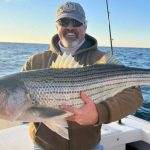
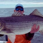
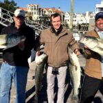
Striped Bass: The spring run is in full swing, and these linesiders are the undisputed kings of the surf right now. They are actively cruising the sandbars, troughs, and jetties, intercepting the massive schools of baitfish pushing north along the Atlantic seaboard. Both resident holdovers and large migratory fish are in the mix.
From the editor
Tired of fishing with strangers you can’t trust?
Nautrek is the first social network for serious anglers — verified partners, real trips, cost splitting and intel sharing without burning your spots. Private beta now open.
Summer Flounder (Fluke): With the season newly opened, the backwaters are holding solid numbers of aggressive flatfish. They are seeking out the warmest water they can find, particularly on the shallow flats that get baked by the afternoon sun, making the bays highly productive before the ocean waters warm up.
Bluefish: Yellow-eyed demons are running the beaches and inlets. These aggressive feeders are providing excellent light-tackle action, often pushing bait right up against the sod banks or blitzing in the surf zone.
Sleeper Pick
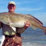
Black Drum: Often caught as a bycatch by striper anglers, these booming bottom-feeders are moving through the deeper sloughs and channels. If you are soaking bait in the surf or the deeper holes of the inlet, don't be surprised if your rod doubles over with a 20- to 60-pound drum. Weakfish are another excellent, often-overlooked sleeper in the back bays, occasionally hitting bloodworms or pink soft plastics at night around lighted docks and bridge pilings.
Baitfish Report
The forage base is incredibly diverse right now, which means you need to be prepared to match the hatch. Current baitfish in the area include:
Adult Atlantic Menhaden (Bunker): Moving along the beachfront, drawing the largest striped bass and bluefish.
Surf Clams: Churned up by spring storms, these are a staple for bottom-cruising stripers and drum.
Spearing and Silversides: Flooding the back bays and inlets, serving as the primary forage for early-season fluke.
Grass Shrimp and Bloodworms: Essential micro-forage for weakfish, small stripers, and panfish in the sod bank creeks.
TACTICAL STRATEGY
The Surf and Jetties (Striped Bass & Bluefish)
Where: The North End (accessible via 4x4 permit) and the Absecon Inlet jetty at the south end of the island are your absolute best strike zones. Brigantine is unique because its surf holds more sandbars than neighboring islands, creating deep, fish-holding troughs. Focus on the cuts and rips between these sandbars where bait gets funneled during an outgoing tide.
Bait & Lures: Fresh or salted surf clams (locally known as "Rotters") are the top producers for both striped bass and black drum. Rig them on a 7/0 to 8/0 inline circle hook using a fish-finder rig with a 36-inch, 50-pound fluorocarbon leader. If you prefer casting artificials, throw 1- to 2-ounce white bucktails tipped with a curly tail grub, or large wooden swimming plugs and metal lips in bunker patterns.
Timing: The last two hours of the incoming tide and the first two hours of the outgoing are prime, especially when these tides align with dawn or dusk windows.
Pro Tip: When fishing the surf, do not just cast as far as you can. Many of the largest striped bass are cruising the "lip" right where the waves crash on the beach, rooting out sand fleas and disoriented bait. Drop a bait in the first trough just a few yards from the dry sand.
The Cove and Absecon Bay (Summer Flounder)
Where: The Cove, located on the western side of the island connecting Absecon Inlet to Saint George's Bay, features a 12-foot channel edge that is a highway for migrating fluke. Surf casters can walk the edge here, while boaters can set up a drift just off the bank. Further back, Absecon Bay's shallow mud flats and sod bank drop-offs are holding great numbers of fish.
Lures & Bait: Light tackle is the name of the game in these shallow backwaters. Use a 3/8 to 3/4-ounce leadhead jig or bucktail (chartreuse, pink, or white) tipped with a 4-inch Gulp! Alive Swimming Mullet. Alternatively, drift live minnows on a standard top-and-bottom rig. Keep your braided mainline light, around 10 to 15 pounds, to cut through the current and maintain bottom contact without needing excessive weight.
Timing: Target the shallow mud flats during the late afternoon on an outgoing tide. The sun heats the shallow water all day, and as it drains into the channels, it carries warmth and bait right to waiting ambush predators.
Pro Tip: When working bucktails for fluke, keep your rod tip high and use sharp, erratic twitches. You want the jig to dart aggressively off the bottom to trigger reaction strikes from flatfish that are still waking up from their winter lethargy. Never drag the jig lazily through the mud.
Back Bay Sod Banks (Nighttime Stripers & Weakfish)
Where: The sod banks buffeting the contours of Absecon Bay, specifically near the narrow passage known as "The Stakes" leading into Absecon Creek.
Lures & Bait: Drifting live eels or spotting them along the sod banks at night is a killer tactic for larger bass. For weakfish, scale down to a 1/4-ounce jig head with a bubblegum or purple soft plastic, or drift bloodworms under a float.
Pro Tip: Approach sod banks with absolute stealth. Cut your outboard early and use a trolling motor or the wind to drift into position. Spring stripers in shallow water are highly sensitive to hull slap and engine noise.
REGULATIONS SNAPSHOT
Note: Always verify current marine regulations locally as they are subject to in-season changes by the state fisheries council.
If the coastal winds are howling out of the east, making the Brigantine surf unfishable and Absecon Inlet too treacherous to navigate, pack up your gear and head slightly north to the mainland side of Barnegat Bay or the sheltered waters of Great Egg Harbor Bay in Somers Point. Both locations offer miles of protected sedge banks and deep channels that are shielded from heavy ocean swells. In these sheltered backwaters, you can easily target early-season striped bass using small paddle-tail swimbaits (4 to 5 inches in pearl white) or by soaking clam bellies on the bottom. The wind will be broken by the barrier islands and mainland contours, giving you a clean, manageable drift for fluke and highly fishable conditions even when the ocean is boiling over.
Tight lines!
Editor's Choice: Must-Have Gear
FISHINGSIR Next-Gen Waterproof Chest Waders
★★★★★4.4 (7,370+ reviews)
2-Ply Tech: Upgraded nylon with 2.5x higher density than standard fabrics.
100% Waterproof: Lab-approved intrusion resistance with taped visible seams.
Ultra-Lightweight: Designed for all-day comfort while hunting or fishing.
As an Amazon Associate I earn from qualifying purchases. #ad
Loading forecast...
Live Fishing Conditions: Tides, Weather & Waves
Get real‑time tides, marine weather, swell and solunar activity for each spot so you know exactly when conditions line up for your best chance at a bite.
🎣
Brigantine
Loading coordinates...
🌤️
WEATHER CONDITIONS
--°F
--°C
Loading...
🌡️
Feels Like--°F--°C
💧
Humidity--%
💨
Wind-- mph-- km/h
🧭
Direction--
📊
Pressure-- inHg-- hPa
☀️
UV Index--
🌊
MARINE CONDITIONS
🌊Wave Height
-- ft
-- m
Loading...
🧭Wave Direction
--°
Loading...
⏱️Wave Period
-- s
Loading...
📈Tide Status
-- ft
-- m
Loading...
🌙
LUNAR & SOLUNAR
🌕
Loading...
Illumination: --%
Major Period--:-- - --:----:-- - --:--
Minor Period--:-- - --:----:-- - --:--
🌅Sunrise--:--
🌇Sunset--:--
📅
24-HOUR FORECAST
Loading fishing conditions...
Fishing Spots Map
🎣
Book a Fishing Charter near Brigantine Fishing Report Today 🎣
Local guides & charters. Verified captains, instant booking, best price guaranteed.
There was an error loading the map. Please try refreshing the page.
Info
Local Access & Facilities
Brigantine and the Forsythe Refuge: A Tactical Overview
Sitting just north of the neon glow of Atlantic City, Brigantine offers a stark, biological contrast that seasoned anglers recognize immediately as prime feeding ground. This barrier island, anchored by the massive Edwin B. Forsythe National Wildlife Refuge, represents one of the most significant tidal wetland complexes on the Jersey Shore. For the expert angler, this isn't just a beach town; it is a gateway to over 48,000 acres of protected southern New Jersey coastal habitat, where salt marshes intersect with shallow coves to create a nutrient-rich nursery for game fish.The atmosphere here shifts rapidly from the manicured residential canals of the island to the rugged, wind-swept estuaries of the refuge. The topography is defined by its hydrology; 78 percent of the refuge is salt marsh, meaning the fishing pressure and strategies here are entirely dictated by the tide. Unlike the deep-water harbors to the north, Brigantine requires a skipper who understands thin water and the intricate network of thoroughfares that drain the marsh.Target species here follow the rhythms of the Atlantic Flyway. The same biological density that attracts migratory water birds draws in the predatory fish that hunt the channels. While the casual crowd sticks to the surf, the pros know that the real potential lies in working the edges of the sedge banks and the tidal outflows where the refuge waters meet the open bay.
💡 Captain's Tip: Watch the Gate Clock
Access to the Edwin B. Forsythe National Wildlife Refuge is strictly controlled. The gate on Great Creek Road opens at sunrise and closes promptly at sunset. Do not get locked in while chasing a twilight bite; federal officers patrol the area and the closure times are enforced without exception.
Access & Getting There
Reaching Brigantine requires navigating the congestion radiating from Atlantic City, but the route is straightforward for those who plan around the casino traffic. Most anglers will approach via the Garden State Parkway. If you are heading to the main refuge headquarters and the popular "Wildlife Drive," you will want to exit onto US Route 9 and head toward Oceanville. The primary entry point is Great Creek Road, which dead-ends directly at the refuge gate.For those trailering boats, the logistical reality in Brigantine is distinct from the mainland. The primary launch point is the 5th Street Boat Ramp. This facility is located on the bay side and provides direct access to the back bays. However, veteran captains know that parking here can be tight, especially during the summer weekends when recreational traffic peaks. The ramp is functional, but you must be mindful of the tide; low water can make launching larger center consoles tricky.Weather plays a critical role in accessibility here. The refuge roads and the causeway entering Brigantine are susceptible to flooding during moon tides or strong northeasters. When the wind howls out of the northeast, the water stacks up in the back bays, potentially covering access roads. Conversely, a hard west wind can blow the water out of the shallow coves, leaving unwary boaters stranded on the mudflats.Parking strategies vary depending on your specific destination. For shore-bound anglers, the Absecon Station Parking Lot 1 offers a park-and-ride option about 6.7 miles away, but for direct access, you are looking at street parking or the limited lots within the refuge. If you are venturing near the boardwalks or city center, Park Place Parking is available but is a 4.5-mile haul from the prime fishing grounds, making it less than ideal for hauling gear.
💡 Captain's Tip: Wind Direction Matters
The shallow bays behind Brigantine are extremely sensitive to wind-driven tides. A sustained West wind can drop water levels significantly lower than the tide charts predict. If you are drafting more than 2 feet, stick to the marked channels on a west wind or risk spending your afternoon waiting for the flood tide on a mud bank.
Brigantine Pre-Trip Checklist
Facilities & Amenities
Brigantine presents a unique logistical challenge: while it has excellent water access, it is somewhat of a "gear desert" compared to other Jersey Shore fishing hubs. There are very few tackle shops directly on the island. Serious anglers need to arrive fully stocked. If you need heavy tackle or specialized offshore gear, you will likely need to drive to Fin-atics Marine Supply in Ocean City, nearly 14 miles away, or head inland to Scott's Bait & Tackle in Little Egg Harbor.The local charter fleet, however, is top-tier. Get Hooked Fishing Charters operates directly out of Brigantine, located just 0.4 miles from the central access points. This proximity makes them the premier choice for anglers who want to maximize water time without a commute. For those looking for variety, Capt. Jack's and LBI Fishing Charters operate out of Long Beach Island, roughly 11 to 13 miles to the north, requiring a drive or a boat ride across the bay.It is critical to note what is missing. There is no major commercial fuel dock explicitly listed in the immediate refuge area. Captains should ensure their tanks are topped off at highway stations before crossing the bridge into Brigantine. Ice and provisions should also be purchased on the mainland, as island prices are higher and availability can be spotty early in the morning.For lodging, the options on the island are largely residential rentals. The closest reliable commercial lodging for a "dawn patrol" start is Marriott's Fairway Villas in Galloway, about 6.2 miles away. For those towing campers or looking for a more rustic experience, Belhaven Lake RV Resort and Ocean Isle Campground offer facilities, but they are located 18 to 22 miles away, adding significant travel time to your morning.
Facility Name
Type
Distance
Notes
Get Hooked Fishing Charters
Charter
0.4 miles
Local operator, closest to the ramp.
Scott's Bait & Tackle
Shop
11.0 miles
Reliable bait source, opens 5 AM.
Fin-atics Marine Supply
Shop
14.4 miles
Specialized heavy tackle inventory.
Tight Lines Bait and Tackle
Shop
13.5 miles
Open until 8 PM or later.
Permits, Regulations & Fees
Fishing within the Brigantine area, and specifically within the Edwin B. Forsythe National Wildlife Refuge, requires strict adherence to both state and federal regulations. The refuge was established to protect migratory birds, and as such, human activity is secondary to wildlife conservation. While a specific refuge permit is not currently required for general entry, anglers must possess a valid New Jersey state fishing registration.Special attention must be paid to the Holgate Wilderness Area. This pristine stretch of barrier beach is a critical nesting habitat. It is physically closed to all public access—including pedestrians and vehicles—from September 1 through March 31. During the open season, surf fishing vehicles are permitted, but you must obtain a separate beach buggy permit from Long Beach Township. Failure to secure this permit or driving in closed zones will result in significant federal fines.Culturally, the land here is significant. The refuge lies on the indigenous homelands of the Lenni Lenape, the "true people" who were the first to harvest seafood from these waters. Anglers are expected to treat the land with "Kapu" (respect), ensuring that no trash is left behind and that the delicate salt marsh vegetation is not trampled. The rule is simple: stay on designated trails and launch areas. Bushwhacking through the marsh damages the very habitat that sustains the fishery.
💡 Captain's Tip: The Holgate Closure
Do not plan a surf fishing trip to the Holgate spit during the fall run without checking the calendar. The area is strictly closed until March 31. If you are targeting the fall striped bass migration, you must stick to the open beaches of Brigantine proper or the designated areas along Wildlife Drive.
Events & Seasonal Information
The fishing calendar in Brigantine is inextricably linked to the seasons of the Atlantic Flyway. The refuge was originally established in 1939 to protect this corridor, and the arrival of baitfish in the spring and fall mirrors the bird migrations. The spring warm-up usually triggers activity in the shallow bays first, as the dark mud bottoms of the marshes absorb heat faster than the open ocean.Summer brings a different rhythm. The "greenhead" flies on the marsh can be brutal when the wind dies, making early morning or late evening trips essential not just for the bite, but for angler sanity. This is also when the boat traffic at the 5th Street Ramp is heaviest. The heavy tackle shops like Fin-atics gear up for the offshore run during these months, catering to the crews chasing pelagics out of the nearby inlets.Fall is the peak season for the serious surf caster. As the water temperatures drop, the striped bass move south along the coast. The Holgate Wilderness Area reopens in the spring, but the prime access for the fall run is often limited to the main Brigantine beaches. Timing your trips around the sunrise gate openings at the refuge is crucial during the shorter days of autumn.
Contact Information & Resources
For the most current information regarding access closures, road conditions on Wildlife Drive, and specific regulation changes, the primary authority is the Edwin B. Forsythe National Wildlife Refuge. They can be reached at 609-652-1665 or via email at forsythe@fws.gov. The headquarters is located at Great Creek Road, Oceanville, NJ 08231.In the event of an on-water emergency, the Coast Guard monitors VHF Channel 16. However, cell service can be spotty in the deep marsh channels, so a VHF radio is a mandatory piece of safety equipment. For issues regarding beach buggy permits for the northern stretches, contact Long Beach Township at 609-361-1200.For precise locations of the boat ramps, real-time wind conditions, and the exact boundaries of the closed wilderness zones, consult the live dashboard and interactive maps below.
🎣
Brigantine
Brigantine • New Jersey • 39.4084, -74.3771
🅿️
Parking
5
Park Place Parking
⭐ 5.04.5 mi
📍148 S Dr Martin Luther King Blvd, Atlantic City, NJ 08401, USA
Our spot reports combine data-driven forecasts with curated local information. The forecast is generated by our proprietary Fishing Score algorithm (0–100%), which analyzes real-time data from Open-Meteo API, validated against NOAA CO-OPS tide gauges and USGS water-monitoring stations. The model weights tide dynamics (35%), wave energy (25%), wind patterns (20%) and time of day (20%)—factors shown to influence fish feeding behavior through marine-biology research and decades of charter log data.
Access, facilities and services information for each fishing spot is sourced from official datasets such as Recreation.gov (RIDB), state park & wildlife agencies, and geospatial providers like Google Maps. These sections undergo scheduled re-validation every 3–6 months to ensure that boat ramps, park access, contact details and local services remain accurate.
Narrative sections (catches, seasonal behavior, local tips) are synthesized from these data sources and refined following the Fishing Reports Today editorial guidelines, combining bibliographic research from ichthyology and oceanography with expert angler experience. Our team reviews reports on a regular basis, while the forecast model itself updates every 6 hours for real-time accuracy.
⚠️ Important: Always verify current local regulations, access restrictions and weather conditions before fishing. These reports are intended as a planning aid, not a guarantee of catches or safety. When in doubt, contact local authorities or park managers listed on the page.
To provide the best experiences, we use technologies like cookies to store and/or access device information. Consenting to these technologies will allow us to process data such as browsing behavior or unique IDs on this site. Not consenting or withdrawing consent, may adversely affect certain features and functions.
Functional Always active
The technical storage or access is strictly necessary for the legitimate purpose of enabling the use of a specific service explicitly requested by the subscriber or user, or for the sole purpose of carrying out the transmission of a communication over an electronic communications network.
Preferences
The technical storage or access is necessary for the legitimate purpose of storing preferences that are not requested by the subscriber or user.
Statistics
The technical storage or access that is used exclusively for statistical purposes.The technical storage or access that is used exclusively for anonymous statistical purposes. Without a subpoena, voluntary compliance on the part of your Internet Service Provider, or additional records from a third party, information stored or retrieved for this purpose alone cannot usually be used to identify you.
Marketing & Affiliates
The technical storage or access is required to create user profiles to send advertising, or to track the user on a website or across several websites for similar marketing purposes, including affiliate tracking for products recommended in our reports.


Leave a Reply