0%

Corsons Inlet Fishing Report Today 🎣

1 year ago Β· Updated 6 days ago

This week at Corsons Inlet

Updated November 16, 2026

  • Recent high winds and storms made for a quiet week overall, but conditions are subsiding and the bite is expected to improve (The Fisherman / Fin-Atics report, Nov 2).
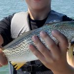
  • Schoolie striped bass are active in the back bay creeks and around bridges at night, hitting soft plastics (The Fisherman / Fin-Atics report, Nov 2).
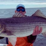
  • Surf anglers are landing slightly larger striped bass up to 30 inches using fresh bunker chunks and clams (The Fisherman / Fin-Atics report, Nov 2).
  • The inlet has been producing consistent striped bass action on small plugs and soft baits during the morning hours (The Fisherman / Fin-Atics report, Nov 2).

Sources consulted: onwaterapp.com, thefisherman.com

1. GO / NO-GO

CAUTION. The fall run is officially underway, but recent weeks of heavy coastal winds and storms have churned up the surf and made conditions challenging. As the weather subsides this week, the water will clear and the bite should fire up again. Keep a close eye on the marine forecast before heading out, especially if you plan to fish the open beach. Corsons Inlet is notorious for its rapidly shifting sand shoals and strong tidal rips, so waders must exercise extreme caution near the point during the outgoing tide, as the drop-offs are steep and the current is unforgiving.

2. WHAT'S BITING

  • Primary target: Striped bass. The fall migration is pushing through, with large numbers of schoolie to mid-sized stripers intercepting bait as it flushes out of the back bays.
  • Sleeper pick: Tautog (Blackfish). While most anglers are casting into the surf for bass, the bridge pilings and submerged structure inside the inlet are holding solid numbers of blackfish packing on weight for the winter.
  • Forage: The water is currently holding peanut bunker, finger mullet, and an increasing presence of sand eels in the wash. Matching your presentation to this forage is the key to hooking up.

3. HOW AND WHERE TO FISH IT

Pedestrian access and a boat launch are available on the Ocean City side of Route 619 (Bay Avenue), and Mobile Sport Fishing Vehicle Permits allow 4x4 access to the state park sands. Focus your efforts on the sandy point of the inlet and the immediate beachfront wrapping around the ocean side. The drop-offs and rip lines formed by the outgoing tide are the primary ambush zones for striped bass. Inside the inlet, the sod banks lining the bay side are excellent for working artificials.

For the sand eel bite, use an Ava 007 or A.O.K. T-Hex metal jig in chrome or green. When bass are pushing peanut bunker, switch to a metal-lipped swimmer, a bone-colored Yo-Zuri Crystal Minnow, or soft plastic paddletails on jigheads. If you prefer soaking bait, utilize fresh surf clams or chunked bunker on a fish-finder rig cast into the deeper holes just off the sandbars during the incoming tide.

If you want to target tautog, focus on the concrete pilings of the Rush Chattin Bridge and any hard, rocky structure along the ICW outflow channels. Use green crabs cut in half on a simple single-hook bottom rig or a 1/2-ounce tog jig.

Moving water is critical here; plan your trips around the first two hours of the outgoing tide or the last two hours of the incoming tide for the best feeding activity. Low light conditions at dawn, dusk, and night tides are consistently producing the largest fish.

Pro Tip: When wading the sod banks inside the inlet at night, switch to a 5-inch pink Zoom bait or Fin-S fish on a 1/4- to 1/2-ounce leadhead to effectively target striped bass holding in the current seams.

4. REGULATIONS

Please verify current season dates, size minimums, and daily bag limits for striped bass and tautog directly with the New Jersey Division of Fish and Wildlife before you keep any fish, as coastal regulations are strictly enforced.

5. NEARBY ALTERNATIVE

If the surf at Corsons Inlet is too churned up from recent winds, head north to the sheltered back bays behind Ocean City or south to Townsends Inlet. Both areas offer excellent protected water for targeting schoolie striped bass with soft plastics around bridge pilings and dock lights after dark.

Beta testers wanted
Tired of fishing with strangers you can’t trust?
Nautrek is the social network for serious anglers — verified partners, real trips, cost splitting and intel sharing without burning your spots. We’re looking for Android beta testers.
Become a beta tester — Free →Android · free invite via Google Play
Nautrek app

Loading forecast...

Live Fishing Conditions: Tides, Weather & Waves

Get real‑time tides, marine weather, swell and solunar activity for each spot so you know exactly when conditions line up for your best chance at a bite.

🎣

Corsons Inlet

Loading coordinates...

🌀️

WEATHER CONDITIONS

Weather
-- Β°F
--Β°C

Loading...

🌑️
Feels Like --Β°F --Β°C
πŸ’§
Humidity --%
πŸ’¨
Wind -- mph -- km/h
🧭
Direction --
πŸ“Š
Pressure -- inHg -- hPa
β˜€οΈ
UV Index --
🌊

MARINE CONDITIONS

🌊 Wave Height
-- ft
-- m
Loading...
🧭 Wave Direction
--Β°
Loading...
⏱️ Wave Period
-- s
Loading...
πŸ“ˆ Tide Status
-- ft
-- m
Loading...
πŸŒ™

LUNAR & SOLUNAR

πŸŒ•

Loading...

Illumination: --%

Major Period --:-- - --:-- --:-- - --:--
Minor Period --:-- - --:-- --:-- - --:--
πŸŒ… Sunrise --:--
πŸŒ‡ Sunset --:--
πŸ“…

24-HOUR FORECAST

Loading fishing conditions...

Fishing Spots Map

🎣
Book a Fishing Charter near Corsons Inlet Fishing Report Today 🎣

Local guides & charters. Verified captains, instant booking, best price guaranteed.

See Available Trips β†’

My location
Loading map...

Local Access & Facilities

Corsons Inlet Pre-Trip Checklist

Local Access & Facilities

Corsons Inlet serves as a dynamic and rugged interface between the Atlantic Ocean and the back bay estuaries of New Jersey. For the expert angler, this location offers more than just a place to cast a line; it is a complex hydrological system defined by shifting sandbars, strong tidal currents, and rich biodiversity. The area is heavily influenced by the surrounding federally protected lands, creating a fishery that feels remote despite its proximity to major shore towns.

The atmosphere here is dictated by the raw elements of the barrier island coast. Unlike the manicured bulkheads of inner harbors, the access points near Corsons Inlet and the adjacent Great Egg Harbor River are often flanked by salt marshes and dunes. This is prime territory for those targeting migratory game fish that patrol the cuts and channels. The water here demands respect, with conditions changing rapidly based on wind direction and tidal flow.

Seasoned captains frequenting this zone know that success relies on understanding the interplay between the protected wildlife refuges and the open ocean. The nutrient-rich waters flowing from the Cape May National Wildlife Refuge and Edwin B. Forsythe National Wildlife Refuge feed the baitfish populations that attract larger predators. Whether you are navigating the channels by boat or stalking the surf, this fishery rewards those who prepare for a rugged, natural environment.

πŸ’‘ Captain's Tip: Tides and Topography

The bottom topography at Corsons Inlet shifts frequently due to coastal storms and strong tidal exchanges. Never rely solely on older charts. Scout the inlet at low tide to identify new sandbars and cuts before running the channel in low-light conditions.

Access & Getting There

Reaching the prime fishing grounds around Corsons Inlet and the Great Egg Harbor River generally involves navigating the Garden State Parkway. This is the primary artery for the Jersey Shore. During the summer season, traffic on the Parkway can be heavy, particularly on Friday afternoons and Saturday mornings. Experienced locals plan their transit to avoid the peak congestion windows between 10:00 AM and 2:00 PM.

For those towing vessels, the approach requires vigilance. The access roads leading toward the water, such as Sea Isle Boulevard or the routes through Upper Township, can be narrow with soft shoulders. When heading to the Great Egg Harbor River access points, particularly near Estell Manor, be prepared for rural two-lane roads. The boat ramps in this region vary in quality; some are improved concrete suitable for larger center consoles, while others are unimproved sand or gravel launches best suited for skiffs and kayaks.

Parking is a critical logistical consideration. The Stone Harbor Public Parking lot, located approximately 10.9 miles away, is a reliable option for those needing ample space, rated highly for its accessibility. Closer to the action, the Municipal Parking - Beta Lot in Ocean City (7.5 miles away) offers access, but trailer parking restrictions may apply during peak summer months. Always verify signage upon arrival, as municipal ordinances shift with the seasons.

Weather plays a massive role in accessibility. The inlet is exposed to the Atlantic, and an opposing wind-against-tide scenario can make the mouth of the inlet treacherous for small craft. When the winds howl from the northeast, the Great Egg Harbor River offers more protected water. Conversely, during strong westerly winds, the surf zones may flatten out, but the flies in the marsh areas can become intense.

πŸ’‘ Captain's Tip: Dawn Patrol Logistics

Public lots like the Beta Lot in Ocean City open at 7:00 AM. If you are planning a "dawn patrol" launch to beat the sunrise, ensure your chosen ramp or parking area allows 24-hour access or has an early-bird gate system to avoid ticketing or towing.

Facilities & Amenities

The infrastructure surrounding Corsons Inlet caters to a mix of serious sportfishing and family recreation. While the inlet itself is natural, the surrounding towns of Ocean View, Somers Point, and Cape May Court House provide essential support services. Anglers should not expect fuel docks immediately adjacent to every remote launch; topping off tanks at highway stations before hitching the boat is standard procedure here.

For bait and tackle, the local shops are specialized and well-stocked. Boulevard Bait & Tackle in Ocean View is the nearest strategic outpost, located just 3.9 miles from the core fishing zones. It opens early on weekends, making it a vital stop for fresh bait and local intelligence. Further north, Tight Lines Bait and Tackle in Somers Point (8.8 miles away) is a powerhouse for gear, operating with extended hours that accommodate the serious night angler.

Facility NameTypeDistanceKey Notes
Boulevard Bait & TackleTackle Shop3.9 milesClosest option; opens 6:30 AM Fri-Sun.
Tight Lines Bait and TackleTackle Shop8.8 milesOpen until 10:00 PM Fri/Sat; highly rated.
K & D Family MarinaMarina/Bait16.0 milesLocated in West Wildwood; full service.
Ocean Isle CampgroundLodging3.0 milesNearest accommodation; trailer friendly.

The charter fleet in this region is diverse. Moover Fishing Adventures and Badfish Fishing Charters operate out of the Ocean City and Somers Point areas, specializing in back-bay and nearshore light tackle pursuits. For those looking for heavy offshore capability, Salty Grunt Sportfishing out of Cape May (20.6 miles south) is a known entity for accessing deeper water. These operators often book weeks in advance during the fall run.

Lodging options vary from rugged to retro-chic. For the angler towing a boat who wants to stay close to the launch, Ocean Isle Campground is merely 3 miles away and offers a practical base camp. For a more comfortable, roof-over-head experience, the historic Caribbean Motel in Wildwood Crest offers a classic "Doo Wop" era vibe, though it is a 17-mile drive. It is listed on the National Register of Historic Places and provides a unique cultural touchpoint after a long day on the water.

πŸ’‘ Captain's Tip: Fuel Management

There are no fuel docks directly within the primitive launch areas of the wildlife refuges. The nearest reliable marine fuel is often found at larger marinas in Somers Point or Cape May. Plan your range accordingly, especially if running hard against the tide.

Permits, Regulations & Fees

Fishing around Corsons Inlet places you within the jurisdiction of multiple agencies, and compliance is mandatory. The area is heavily regulated to protect sensitive coastal habitats. Much of the surrounding land falls under the Cape May National Wildlife Refuge or the Edwin B. Forsythe National Wildlife Refuge. These are federal lands managed by the U.S. Fish & Wildlife Service, and their primary mission is conservation.

While a general saltwater fishing registration is required by the state of New Jersey (which is free), specific activities within the refuges may require additional permits. For example, the Holgate Wilderness Area within the Forsythe Refuge requires a beach buggy permit for vehicle access during the open season (September 1 to March 31). This is strictly enforced to protect nesting shorebirds like the Piping Plover. Access to these areas is often closed completely during nesting season, typically spring through late summer.

Anglers must respect "Kapu" style restrictionsβ€”areas designated as "Closed Area" or "Restricted" are not suggestions. These zones often protect fragile marsh grasses or critical resting grounds for migratory birds. The Great Egg Harbor River is a designated National Scenic and Recreational River, meaning its visual and ecological character is federally protected. Do not alter the shoreline, cut vegetation, or leave trash. Local enforcement officers patrol these waters regularly.

Events & Seasonal Information

The rhythm of life at Corsons Inlet is dictated by migration. The spring and fall are the peak activity windows. The Cape May Peninsula acts as a funnel for migratory birds, and the waters below teem with baitfish during these transitions. The fall run, typically from late September through November, sees the highest traffic of anglers targeting stripers and bluefish blitzing on bait exiting the estuaries.

Summer brings the tourist crowds and recreational boat traffic. During July and August, the "dawn patrol" is essential not just for the bite, but to secure parking and avoid the midday flotilla of jet skis and pontoon boats. The winds generally follow a pattern of calm mornings with a stiff sea breeze kicking up by 11:00 AM, known locally as the "southerlies." This afternoon chop can make the inlet rough for smaller skiffs.

Special events often center around the historic nature of the area. The Caribbean Motel hosts events throughout the season, and various surf fishing tournaments occur along the beaches of Ocean City and Strathmere in the autumn. Check with Boulevard Bait & Tackle for the latest tournament schedules and weigh-in station locations.

Contact Information & Resources

For the most current information on access closures, permit requirements, and safety alerts, direct contact with the managing agencies is recommended. Self-reliance is key in this environment; always file a float plan with a shore contact before heading out.

  • Cape May National Wildlife Refuge: (609) 463-0994 (Headquarters in Cape May Court House)
  • Edwin B. Forsythe National Wildlife Refuge: (609) 652-1665 (Oceanville)
  • Great Egg Harbor River (NPS): Contact via Atlantic County Parks or NPS Northeast Region.
  • Caribbean Motel (Reservations): (800) 678-8946

For precise locations of boat ramps, real-time wind conditions, and detailed bathymetry, consult the live dashboard and interactive maps below.
🎣

Corsons Inlet

Upper Township β€’ New Jersey β€’ 39.1946, -74.6638
πŸ…ΏοΈ

Parking

5
Park Place Parking
⭐ 5.0 16.8 mi
πŸ“ 148 S Dr Martin Luther King Blvd, Atlantic City, NJ 08401, USA
πŸ•’
Monday: Open 24 hours
Tuesday: Open 24 hours
Wednesday: Open 24 hours
Thursday: Open 24 hours
Friday: Open 24 hours
Saturday: Open 24 hours
Sunday: Open 24 hours
πŸš— Get Directions
Stone Harbor Public Parking
⭐ 4.9 10.9 mi
πŸ“ 9319 2nd Ave, Stone Harbor, NJ 08247, USA
πŸš— Get Directions
Municipal Parking - Beta Lot
⭐ 4.8 7.5 mi
πŸ“ 843 Atlantic Ave, Ocean City, NJ 08226, USA
πŸ•’
Monday: 7:00β€―AM – 7:00β€―PM
Tuesday: 7:00β€―AM – 7:00β€―PM
Wednesday: 7:00β€―AM – 7:00β€―PM
Thursday: 7:00β€―AM – 7:00β€―PM
Friday: 7:00β€―AM – 7:00β€―PM
Saturday: 7:00β€―AM – 7:00β€―PM
Sunday: 7:00β€―AM – 7:00β€―PM
πŸš— Get Directions
Municipal Parking - Delta Lot
⭐ 4.8 7.5 mi
πŸ“ 827 Moorlyn Terrace, Ocean City, NJ 08226, USA
πŸ•’
Monday: 7:00β€―AM – 7:00β€―PM
Tuesday: 7:00β€―AM – 7:00β€―PM
Wednesday: 7:00β€―AM – 7:00β€―PM
Thursday: 7:00β€―AM – 7:00β€―PM
Friday: 7:00β€―AM – 7:00β€―PM
Saturday: 7:00β€―AM – 7:00β€―PM
Sunday: 7:00β€―AM – 7:00β€―PM
πŸš— Get Directions
🐟

Bait & Tackle

4
Tight Lines Bait and Tackle
⭐ 4.9 8.8 mi
πŸ“ 830 Bay Ave, Somers Point, NJ 08244, USA
πŸ•’
Monday: 6:00β€―AM – 8:00β€―PM
Tuesday: 6:00β€―AM – 8:00β€―PM
Wednesday: 6:00β€―AM – 8:00β€―PM
Thursday: 6:00β€―AM – 8:00β€―PM
Friday: 6:00β€―AM – 10:00β€―PM
Saturday: 6:00β€―AM – 10:00β€―PM
Sunday: 6:00β€―AM – 8:00β€―PM
πŸš— Get Directions
Boulevard Bait & Tackle
⭐ 4.9 3.9 mi
πŸ“ 535 Sea Isle Blvd, Ocean View, NJ 08230, USA
πŸ•’
Monday: Closed
Tuesday: Closed
Wednesday: Closed
Thursday: Closed
Friday: 6:30β€―AM – 4:00β€―PM
Saturday: 6:30β€―AM – 4:00β€―PM
Sunday: 6:30β€―AM – 12:00β€―PM
πŸš— Get Directions
Hands Too Bait and Tackle
⭐ 4.8 20.9 mi
πŸ“ 970 NJ-109, Cape May, NJ 08204, USA
πŸ•’
Monday: 6:00β€―AM – 5:00β€―PM
Tuesday: 6:00β€―AM – 5:00β€―PM
Wednesday: 6:00β€―AM – 5:00β€―PM
Thursday: 6:00β€―AM – 5:00β€―PM
Friday: 6:00β€―AM – 6:00β€―PM
Saturday: 6:00β€―AM – 6:00β€―PM
Sunday: 6:00β€―AM – 5:00β€―PM
πŸš— Get Directions
🚀

Fishing Charters

4
Moover Fishing Adventures
⭐ 5.0 6.4 mi
πŸ“ 102 Spruce Rd, Ocean City, NJ 08226, USA
πŸ•’
Monday: Open 24 hours
Tuesday: Open 24 hours
Wednesday: Open 24 hours
Thursday: Open 24 hours
Friday: Open 24 hours
Saturday: Open 24 hours
Sunday: Open 24 hours
πŸš— Get Directions
Salty Grunt Sportfishing
⭐ 5.0 20.6 mi
πŸ“ 926 Ocean Dr, Cape May, NJ 08204, USA
πŸ•’
Monday: Open 24 hours
Tuesday: Open 24 hours
Wednesday: Open 24 hours
Thursday: Open 24 hours
Friday: Open 24 hours
Saturday: Open 24 hours
Sunday: Open 24 hours
πŸš— Get Directions
Badfish Fishing Charters
⭐ 5.0 9.0 mi
πŸ“ 680 Bay Ave, Somers Point, NJ 08244, USA
πŸ•’
Monday: Open 24 hours
Tuesday: Open 24 hours
Wednesday: Open 24 hours
Thursday: Open 24 hours
Friday: Open 24 hours
Saturday: Open 24 hours
Sunday: Open 24 hours
πŸš— Get Directions
Avalon Fishing Charters
⭐ 5.0 6.9 mi
πŸ“ 701 Old Avalon Blvd Unit #4, Avalon, NJ 08202, USA
πŸ•’
Monday: Open 24 hours
Tuesday: Open 24 hours
Wednesday: Open 24 hours
Thursday: Open 24 hours
Friday: Open 24 hours
Saturday: Open 24 hours
Sunday: Open 24 hours
πŸš— Get Directions
🏠

Lodging

5
Cape May Crossing
⭐ 5.0 20.7 mi
πŸ“ 878 NJ-109, Cape May, NJ 08204, USA
πŸ•’
Monday: 8:30β€―AM – 5:30β€―PM
Tuesday: 8:30β€―AM – 5:30β€―PM
Wednesday: 8:30β€―AM – 5:30β€―PM
Thursday: 8:30β€―AM – 5:30β€―PM
Friday: 8:30β€―AM – 5:30β€―PM
Saturday: Closed
Sunday: Closed
πŸš— Get Directions
βš“

Boat Ramps

3
🚻

Restrooms

3
πŸ‘¨β€πŸ‘©β€πŸ‘§β€πŸ‘¦

Family Friendly

2
β™Ώ

Accessibility

β™Ώ

Wheelchair Access

Not Confirmed

πŸ•

Pets Allowed

Not Confirmed

⚠️ Some accessibility info not officially confirmed. Please verify with location directly.

πŸ“ Showing 26 facilities on map
🎣
Book a Fishing Charter near Corsons Inlet Fishing Report Today 🎣

Local guides & charters. Verified captains, instant booking, best price guaranteed.

See Available Trips β†’

πŸ“Š

About Our Fishing Reports & Forecasts

Our spot reports combine data-driven forecasts with curated local information. The forecast is generated by our proprietary Fishing Score algorithm (0–100%), which analyzes real-time data from Open-Meteo API, validated against NOAA CO-OPS tide gauges and USGS water-monitoring stations. The model weights tide dynamics (35%), wave energy (25%), wind patterns (20%) and time of day (20%)β€”factors shown to influence fish feeding behavior through marine-biology research and decades of charter log data.

Access, facilities and services information for each fishing spot is sourced from official datasets such as Recreation.gov (RIDB), state park & wildlife agencies, and geospatial providers like Google Maps. These sections undergo scheduled re-validation every 3–6 months to ensure that boat ramps, park access, contact details and local services remain accurate.

Narrative sections (catches, seasonal behavior, local tips) are synthesized from these data sources and refined following the Fishing Reports Today editorial guidelines, combining bibliographic research from ichthyology and oceanography with expert angler experience. Our team reviews reports on a regular basis, while the forecast model itself updates every 6 hours for real-time accuracy.

⚠️ Important: Always verify current local regulations, access restrictions and weather conditions before fishing. These reports are intended as a planning aid, not a guarantee of catches or safety. When in doubt, contact local authorities or park managers listed on the page.

Learn more about our methodology & data sources β†’

Leave a Reply

Your email address will not be published. Required fields are marked *