Point Pleasant Beach, Nueva Jersey Fishing Report Today 🎣
9 months ago · Updated 1 week ago
Point Pleasant Beach Summer Fishing Report
Welcome to the heart of the summer fishing season in Point Pleasant Beach, New Jersey. As the coastal waters warm and baitfish flood into the Manasquan River and surrounding inlets, we are seeing some of the most dynamic inshore and nearshore fisheries of the year light up. Whether you are working the fast-moving currents of the Point Pleasant Canal, bouncing jigs in the Manasquan River, or soaking baits in the suds, the local bite is highly productive right now.
1. GO/NO-GO STATUS
Verdict: GO
Current seasonal conditions are prime for anglers looking to capitalize on the summer run. The weather pattern has stabilized into classic summer conditions, featuring manageable southwest winds in the 10 to 15-knot range and ocean swells hovering comfortably around two to three feet. These mild seas make nearshore reef and wreck fishing highly accessible for smaller center consoles, while the surf zone remains clean and free of excessive weed.
From the editor
Tired of fishing with strangers you can’t trust?
Nautrek is the first social network for serious anglers — verified partners, real trips, cost splitting and intel sharing without burning your spots. Private beta now open.
Water temperatures have crossed the critical threshold to push summer flounder deep into the river systems and activate the nearshore bottom fish. Anglers should always exercise standard caution when navigating the Manasquan Inlet during outgoing tides stacked against an incoming swell, but overall, environmental conditions are excellent. Prep your gear, check your tide charts, and get on the water.
2. SPECIES INTEL
Primary Targets
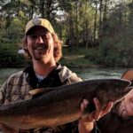
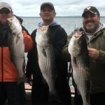
Summer Flounder (Fluke) and Striped Bass are currently stealing the show. Fluke are aggressively feeding in the Manasquan River and along the inlet walls, while resident and migrating striped bass are holding tight to structure in the canal and cruising the surf line.
Sleeper Pick
Weakfish (Gray Trout). Often overlooked by anglers who are hyper-focused on fluke, respectable weakfish measuring up to 20 inches have quietly moved into the Manasquan River. They are holding in the middle of the water column and offer fantastic light-tackle action for those willing to scale down their presentations.
Baitfish Report
The forage base is incredibly diverse right now, which means matching the hatch is essential. We are seeing massive schools of sand eels and squid on the nearshore reefs and around the inlet. Inside the river, killies and spearing are the primary forage. Most notably, there is a significant emergence of sand fleas (mole crabs) occurring right in the surf wash, providing an absolute feast for cruising striped bass and black drum.
3. TACTICAL STRATEGY
The Manasquan River and Inlet
For summer flounder, focus your efforts on the channel edges, drop-offs, and current seams inside the Manasquan River. The key is to keep your presentation as vertical as possible. Utilize a 1/8-ounce to 1/4-ounce jighead paired with a 4-inch to 5-inch soft plastic jerk shad. Pearl white and chartreuse are the top-producing colors in the slightly stained river water. If you are fishing the inlet walls, upsize to a 1-ounce or 2-ounce white bucktail tipped with a squid strip or live killie, working it slowly along the bottom during the outgoing tide.
Pro Tip:When targeting fluke in the river, do not just drag your jig. Impart short, sharp snaps of the rod tip to make the soft plastic dart erratically. This mimics a fleeing spearing and triggers aggressive reaction strikes from larger flatfish.
Point Pleasant Canal
The Point Pleasant Canal is a notorious tackle-eater due to its rocky bottom and ripping currents, but it holds heavy concentrations of striped bass, tautog, and bluefish. Access the water via the Point Pleasant Fishing Access Wildlife Management Area on Beach Boulevard. The absolute best bite happens during the narrow window of slack tide. Throw live eels or drift heavy bucktails deep into the structure. For artificials, drifting a 5-inch swim shad just above the rocks is highly effective.
Pro Tip:Never try to fight the peak current in the canal. Plan your trip meticulously around the tide charts, aiming to fish the last hour of the incoming, the slack, and the first hour of the outgoing. This is when the fish push out of the eddies and hunt openly.
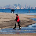
The Surf Zone
Beach anglers are finding steady action with striped bass by fishing the last two hours of the incoming tide and the first two hours of the outgoing. Because of the heavy sand flea presence, fresh clam baits and live sand fleas fished on a high-low rig are outperforming artificials during the daylight hours. If you prefer plugging, arrive at the finger jetties north of the inlet at first light and throw metal lip swimmers or poppers for topwater blowups.
4. REGULATIONS SNAPSHOT
Staying compliant is critical. Below are the current summer regulations for our primary local targets in New Jersey marine waters:
Note: Striped bass regulations strictly require the use of non-offset circle hooks when fishing with natural bait. Always measure fish from the tip of the snout to the tip of the tail (with the exception of black sea bass, which excludes the tail filament).
5. REGIONAL ALTERNATIVE
If the ocean swells kick up unexpectedly or the inlet becomes too treacherous to navigate, pack up and head slightly inland to the Metedeconk River or the northern stretches of Barnegat Bay. These sheltered backwaters offer excellent protection from heavy southwest winds.
In the Metedeconk, you can find phenomenal light-tackle action for schoolie striped bass and bluefish around the sod banks and residential docks. Downsize your tackle to a medium-light spinning setup and cast small topwater walkers or 3-inch paddle tails at dawn and dusk. The shallow flats in the upper bay also warm up faster than the ocean, making them a great backup spot to drift for early-season summer flounder using small bucktails tipped with natural bait.
Pro Tip:When fishing the back bays after a heavy rain or wind event, look for clean water. Fluke are visual predators; if the water looks like chocolate milk, keep moving until you find a clearer incoming tide line.
Tight lines!
Editor's Choice: Must-Have Gear
FISHINGSIR Next-Gen Waterproof Chest Waders
★★★★★4.4 (7,370+ reviews)
2-Ply Tech: Upgraded nylon with 2.5x higher density than standard fabrics.
100% Waterproof: Lab-approved intrusion resistance with taped visible seams.
Ultra-Lightweight: Designed for all-day comfort while hunting or fishing.
As an Amazon Associate I earn from qualifying purchases. #ad
Loading forecast...
Live Fishing Conditions: Tides, Weather & Waves
Get real‑time tides, marine weather, swell and solunar activity for each spot so you know exactly when conditions line up for your best chance at a bite.
🎣
Point Pleasant Beach, Nueva Jersey
Loading coordinates...
🌤️
WEATHER CONDITIONS
--°F
--°C
Loading...
🌡️
Feels Like--°F--°C
💧
Humidity--%
💨
Wind-- mph-- km/h
🧭
Direction--
📊
Pressure-- inHg-- hPa
☀️
UV Index--
🌊
MARINE CONDITIONS
🌊Wave Height
-- ft
-- m
Loading...
🧭Wave Direction
--°
Loading...
⏱️Wave Period
-- s
Loading...
📈Tide Status
-- ft
-- m
Loading...
🌙
LUNAR & SOLUNAR
🌕
Loading...
Illumination: --%
Major Period--:-- - --:----:-- - --:--
Minor Period--:-- - --:----:-- - --:--
🌅Sunrise--:--
🌇Sunset--:--
📅
24-HOUR FORECAST
Loading fishing conditions...
Fishing Spots Map
🎣
Book a Fishing Charter near Point Pleasant Beach, Nueva Jersey Fishing Report Today 🎣
Local guides & charters. Verified captains, instant booking, best price guaranteed.
There was an error loading the map. Please try refreshing the page.
Info
Local Access & Facilities
Point Pleasant Beach serves as one of the most pivotal saltwater gateways in New Jersey, offering anglers direct access to the Atlantic Ocean and the productive intracoastal waterways of the Manasquan River. Situated at the northern end of the barrier island, this location is defined by its maritime heritage and a robust fleet of sportfishing vessels that target everything from inshore flounder to offshore pelagics. The atmosphere here is distinctly nautical; unlike quieter stretches of the coastline, Point Pleasant is a bustling hub where the hum of diesel engines and the smell of salt spray are constant companions. For the serious angler, the proximity to the Manasquan Inlet creates a strategic advantage, allowing for rapid deployment into open water.
The fishery here is characterized by its versatility. The local topography supports a wide array of species, making it a favorite for captains who need options when conditions shift. Whether you are launching a private vessel to work the ridges or boarding one of the area's renowned head boats, the infrastructure is designed to support heavy fishing pressure. The water here can be dynamic, influenced by the convergence of the river outflow and the ocean swell, requiring skippers to be attentive to tide cycles and wind direction. It is a location that rewards preparation and local knowledge, particularly regarding the movement of bait along the coast.
While the immediate area is developed and convenient, the region also serves as a staging ground for reaching federally protected waters further north. The blend of accessible urban amenities with the rugged potential of the open Atlantic makes Point Pleasant Beach a premier destination for seasoned crews. The following guide details the logistical realities of fishing this storied coast, from navigating the boat ramps to understanding the local service ecosystem.
Access & Getting There
Reaching the fishing grounds off Point Pleasant Beach requires navigating a mix of local roads and coastal highways. The primary access for boaters trailering their own vessels is the Manasquan Boat Launch. Located approximately 2.9 miles from the central reference point on Stockton Avenue, this facility is the logistical heart for private boaters in the area. The launch is positioned to provide access to the inlet, but captains should be mindful of the distance to the open ocean and plan fuel consumption accordingly. Traffic in this coastal corridor can be heavy, particularly during the summer tourist season, so trailering crews should plan their arrival times to avoid mid-morning congestion on the main arteries leading into town.
💡 Captain's Tip: Weekend Launch Strategy
The Gabriel Tackle Co. opens at 6:00 AM on Saturdays and Sundays. Plan your launch timing to align with their opening hours if you need fresh bait, as midweek opening times are later (8:00 AM).
Parking for vehicles with trailers can be a critical bottleneck in New Jersey's coastal towns. While there are general parking areas like Lot 1 (1.3 miles away), this is likely suited for standard vehicles or shore anglers. For those requiring extensive space for rigs, options are more dispersed. Snapbox Self-Storage and Country Club Services are listed in the vicinity (approx. 13.5 miles away), which may serve as options for long-term storage rather than day-use parking. It is essential to verify trailer permissions at any municipal lot before dropping the hitch, as enforcement is strict in beach communities.
For shore-based anglers or those looking to scout the water before launching, there are identified shore access points roughly 1.3 to 1.7 miles from the center. These spots are noted as being suitable for shore fishing and families, offering a lower-stress alternative to the boat ramp hustle. When accessing these points, be aware that weather conditions on the Jersey Shore can change rapidly; a shift in the wind can turn a calm surf into a hazardous zone quickly. Always monitor the marine forecast, particularly for small craft advisories that might affect the feasibility of using the Manasquan Boat Launch.
Point Pleasant Beach, Nueva Jersey Pre-Trip Checklist
Facilities & Amenities
The infrastructure around Point Pleasant Beach is tailored to the needs of the sportfishing community, though specialized services are spread out across the neighboring townships. For bait and terminal tackle, the primary resource is Gabriel Tackle Co., located in Brick Township, approximately 3.3 miles from the spot. This shop holds a high reputation among locals (4.9 rating) and is essential for acquiring fresh bait before hitting the water. Note their operating hours carefully: while they open early on weekends, weekday operations begin at 8:00 AM, which may be late for the dawn patrol crowd targeting early bites.
The charter fleet in this region is world-class, offering options for anglers who prefer to leave the navigation to a professional. Jersey Nutz Sport Fishing and Charter Boat Miss Michele III are both based directly in Point Pleasant Beach, less than 2 miles from the center. Notably, both operations are listed with 24-hour availability, suggesting they are tuned into the erratic schedules of offshore fishing, including overnight canyon runs or pre-dawn departures. For those willing to travel slightly further for specific captains, Kill Shot Charters LLC and Chasin' Tail Sportfishing operate out of the broader region (20+ miles away), expanding the options for specialized trips.
💡 Captain's Tip: 24-Hour Fleet Access
Local charters like Jersey Nutz Sport Fishing and Miss Michele III operate around the clock. If you are planning an overnight offshore trip or an ultra-early departure, these outfits are equipped to accommodate non-standard schedules.
Accommodation for traveling anglers is available but requires a short drive from the immediate waterfront. The Pine Grove Day Camp area in Wall Township (4.8 miles away) and the Allaire State Park Group Campsite (4.5 miles away) offer proximity for those seeking a more rustic or group-oriented stay. For those towing campers or looking for mobile home facilities, Land O Pines Mobile Home Park is located about 15.9 miles inland in Jackson Township. The table below summarizes key facilities for trip planning:
Facility Name
Type
Distance
Key Notes
Gabriel Tackle Co.
Bait & Tackle
3.3 miles
Opens 6 AM Sat/Sun; 8 AM Weekdays.
Jersey Nutz Sport Fishing
Charter
1.7 miles
Open 24 Hours. Rated 4.8.
Manasquan Boat Launch
Boat Ramp
2.9 miles
Located on Stockton Avenue.
Allaire State Park
Camping
4.5 miles
Group campsite available.
Permits, Regulations & Fees
Fishing in the Point Pleasant Beach area falls under the jurisdiction of the State Fishing Agency. Anglers must adhere strictly to state-level size limits, bag limits, and seasonal closures, which are vigorously enforced to ensure the sustainability of the fishery. While specific permit prices are not detailed in the immediate data, it is standard protocol for all saltwater anglers in New Jersey to be part of the saltwater registry. Always consult the latest official state digest before retaining any catch.
For those venturing further north toward the Gateway National Recreation Area at Sandy Hook (approximately 22 miles away), federal regulations apply. This area is a significant ecological zone managed by the National Park Service. While access to the general park area may be open, specific activities often require permits or fees. For instance, the Sandy Hook Canoe Cruise is a ticketed facility. Furthermore, parking at Sandy Hook—specifically the "Sandy Hook Beach Parking" and "Season Beach Parking"—often involves a fee structure, particularly during the peak summer season. The Sandy Hook Beach Parking facility handles timed entries and can be contacted at 732-872-5970 for current capacity and fee information.
💡 Captain's Tip: Know Your Boundaries
If you run north to fish the waters near Sandy Hook (22 miles away), remember you are entering the influence of the Gateway National Recreation Area. Federal rules regarding protected zones and shoreline access may differ from state waters.
It is also important to note cultural and environmental respect. The RIDB data indicates no specific "Kapu" or indigenous restrictions for this specific coordinate, but the general rule of the sea applies: respect private property near shore access points and maintain a clean wake in the harbor. The Sandy Hook area specifically mentions the presence of Diamondback terrapins and shoreline nesting birds; anglers operating in the back bays should be vigilant not to disturb wildlife in these sensitive habitats.
Events & Seasonal Information
The fishing calendar in Point Pleasant is driven by the seasons of the North Atlantic. Summer brings the height of activity, not just for fishing but for the general tourism that supports the local economy. During these months, the Gateway National Recreation Area hosts interpretive programs like the Sandy Hook Canoe Cruise, where rangers lead tours to Skeleton Hill Island. While this is more of an eco-tour than a fishing event, it highlights the biological diversity of the bay that supports the game fish populations. Participants in these events can expect to see horseshoe crabs, shorebirds, and various fish species, providing excellent insight into the local food web.
Seasonality also dictates access. The Sandy Hook Season Beach Parking facility is noted as "(Deactivated)" in some data sets, implying that certain access points may close or change status outside of the primary operating window. Anglers planning trips in the shoulder seasons (spring and fall) should verify that parking lots and support facilities are open. The fall run is particularly famous in this region, as migratory stripers move along the coast, often bringing anglers out in force well past the typical summer season.
Contact Information & Resources
Safe and legal fishing relies on up-to-date information. For issues related to the federal lands to the north, the Gateway National Recreation Area can be reached at 732-872-5970. This is the primary contact for inquiries regarding the Sandy Hook Canoe Cruise and beach parking facilities. For local access questions closer to Point Pleasant, utilizing the contact numbers for local marinas and the bait shops listed above is recommended.
Safety is paramount when operating in the Atlantic. There are no specific environmental alerts currently listed for this spot, but conditions change hourly. Always file a float plan with a reliable contact on land. For precise locations of the boat ramps, bait shops, and real-time weather conditions, consult the live dashboard and interactive maps below.
Our spot reports combine data-driven forecasts with curated local information. The forecast is generated by our proprietary Fishing Score algorithm (0–100%), which analyzes real-time data from Open-Meteo API, validated against NOAA CO-OPS tide gauges and USGS water-monitoring stations. The model weights tide dynamics (35%), wave energy (25%), wind patterns (20%) and time of day (20%)—factors shown to influence fish feeding behavior through marine-biology research and decades of charter log data.
Access, facilities and services information for each fishing spot is sourced from official datasets such as Recreation.gov (RIDB), state park & wildlife agencies, and geospatial providers like Google Maps. These sections undergo scheduled re-validation every 3–6 months to ensure that boat ramps, park access, contact details and local services remain accurate.
Narrative sections (catches, seasonal behavior, local tips) are synthesized from these data sources and refined following the Fishing Reports Today editorial guidelines, combining bibliographic research from ichthyology and oceanography with expert angler experience. Our team reviews reports on a regular basis, while the forecast model itself updates every 6 hours for real-time accuracy.
⚠️ Important: Always verify current local regulations, access restrictions and weather conditions before fishing. These reports are intended as a planning aid, not a guarantee of catches or safety. When in doubt, contact local authorities or park managers listed on the page.
To provide the best experiences, we use technologies like cookies to store and/or access device information. Consenting to these technologies will allow us to process data such as browsing behavior or unique IDs on this site. Not consenting or withdrawing consent, may adversely affect certain features and functions.
Functional Always active
The technical storage or access is strictly necessary for the legitimate purpose of enabling the use of a specific service explicitly requested by the subscriber or user, or for the sole purpose of carrying out the transmission of a communication over an electronic communications network.
Preferences
The technical storage or access is necessary for the legitimate purpose of storing preferences that are not requested by the subscriber or user.
Statistics
The technical storage or access that is used exclusively for statistical purposes.The technical storage or access that is used exclusively for anonymous statistical purposes. Without a subpoena, voluntary compliance on the part of your Internet Service Provider, or additional records from a third party, information stored or retrieved for this purpose alone cannot usually be used to identify you.
Marketing & Affiliates
The technical storage or access is required to create user profiles to send advertising, or to track the user on a website or across several websites for similar marketing purposes, including affiliate tracking for products recommended in our reports.


Leave a Reply