Forked River Fishing Report: Estuary Action and Bay Transitions
1. GO/NO-GO STATUS
Verdict: GO
Water temperatures in the Barnegat Bay watershed and the Forked River transition zones have firmly settled into early summer patterns. The back bays are warming nicely, kicking the estuary food web into high gear. With stable weather patterns taking hold, the conditions are optimal for both boat and shore anglers. Boaters should remain vigilant of afternoon thermal winds that can whip up a steep chop in the open bay, particularly when the wind bucks an outgoing tide near the Barnegat Inlet. If you are navigating a skiff or a fishing kayak, plan your open-water forays for the morning hours and retreat to the sheltered waters of the river branches or leeward sedge banks by mid-afternoon. The water clarity is currently excellent, running gin-clear on the incoming tides, which makes sight-fishing and light-tackle presentations highly effective.
2. SPECIES INTEL
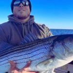
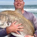
Primary Target: Summer Flounder (Fluke) and Striped Bass
From the editor
Tired of fishing with strangers you can’t trust?
Nautrek is the first social network for serious anglers — verified partners, real trips, cost splitting and intel sharing without burning your spots. Private beta now open.
Summer flounder have aggressively moved onto the shallow mudflats and channel edges, feeding heavily to pack on weight after their offshore migration. They are currently the premier target for anglers drifting the channels leading out of the river into Barnegat Bay. Striped bass are transitioning into their summer routine, with resident fish holding tight to structure, bridge pilings, and deeper holes during the heat of the day, then prowling the shallows under the cover of darkness.
Sleeper Pick: White Catfish and Weakfish
Many saltwater purists completely overlook the brackish transition zones of the upper Forked River. White catfish and bullheads are incredibly active right now, providing rod-bending action when the open bay is blown out by heavy winds. Meanwhile, weakfish (often called tide runners) are showing up as a prized bycatch along the deeper sedge banks. These beautiful, iridescent fish are a welcome surprise for light-tackle anglers targeting fluke.
Baitfish Report
The forage base is rich and diverse right now. Match your presentations to these prevalent food sources:
Spearing (Silversides): Found schooling heavily along the marsh edges and drop-offs.
Grass Shrimp: Clinging to the sod banks, dock pilings, and submerged vegetation.
Peanut Bunker: Juvenile menhaden are beginning to school up in the marinas, creeks, and shallow coves.
Marine Worms: Getting flushed out of the mudflats during the harder moon tides.
3. TACTICAL STRATEGY
Where to Deploy
For summer flounder, focus your drifts along the 8 to 12-foot drop-offs where the Forked River empties into Barnegat Bay. The channel edges near the Oyster Creek outflow are also holding solid concentrations of feeding fluke, utilizing the structure as an ambush point. If you are targeting resident striped bass, work the shadow lines around local marina docks or the sod banks near Forked River Bay Front Park during the outgoing tide. For those chasing the brackish water bite, the upper reaches near Lower Lake offer excellent access to hungry catfish and panfish.
Lure Selection and Colors
For fluke, a 1/2-ounce to 3/4-ounce S&S Bucktail jig paired with a teaser hook tied 15 inches above is deadly. Tip both the jig and the teaser with a 4-inch Berkley Gulp! Swimming Mullet. Pink Shine, Nuclear Chicken, and Chartreuse are currently outproducing other colors in the slightly stained tidal water. For stripers, throw 4-inch soft plastic paddletails (pearl white or bunker pattern) on a 3/8-ounce lead head, or walk a topwater Zara Spook over the flats at first light to trigger explosive surface strikes.
Pro Tip:When drifting for fluke, keep your line as vertical as possible. If the wind or tide causes your line to scope out, upsize your bucktail weight immediately. A bouncing jig that constantly kicks up small puffs of sand is the ultimate trigger for a flatfish waiting in ambush.
Bait and Rigging
Live killies (minnows) and fresh spearing drifted on a standard high-low bottom rig or a three-way swivel setup will tempt the most stubborn flatfish. If you are targeting striped bass with bait, fresh bloodworms or clam bellies are the ticket. Remember that New Jersey law strictly mandates the use of non-offset inline circle hooks when fishing for striped bass with natural bait to reduce release mortality.
Pro Tip:For the brackish water sleeper pick, set up in the upper reaches of the Forked River near Lower Lake with a simple slip-sinker rig and nightcrawlers or cut bait. The white catfish stack up in the deeper holes waiting for food to wash downstream. Keep your drag relatively loose, as these fish often make aggressive initial runs.
Timing the Bite
The last two hours of the incoming tide and the first two hours of the outgoing tide are providing the most consistent action across the board. The moving water flushes baitfish out of the marshes and funnels them into the main channels, ringing the dinner bell for predators. For striped bass, prioritize the dawn and dusk windows to avoid the bright midday sun, which pushes them into deeper, cooler water.
4. REGULATIONS SNAPSHOT
Staying compliant is critical for the conservation of our local fisheries. Here is a quick reference for current New Jersey marine regulations for our primary targets in the Forked River and Barnegat Bay area:
Note: Anglers participating in the Striped Bass Bonus Program may harvest one additional striped bass per permit at 24 inches to less than 28 inches in length. Always verify the latest updates, circle hook requirements, and specific zone boundaries with the NJDEP Fish & Wildlife division before hitting the water.
5. REGIONAL ALTERNATIVE
If the wind is howling out of the east and turning Barnegat Bay into a washing machine, making boat drifts impossible, pack up and head to Island Beach State Park. Surf fishing offers a fantastic, weather-resistant backup plan. The park provides miles of accessible Atlantic shoreline where you can cast past the breakers for cruising bluefish and striped bass using heavy metal spoons (like a Hopkins or Kastmaster) or chunked bunker on a fish-finder rig.
Additionally, Island Beach State Park features a special shore-based summer flounder regulation. Anglers fishing from the beach here only need to meet a 16-inch minimum size limit (with a 2 fish bag limit), making it an excellent spot to drag a light bucktail and Gulp! combo through the wash for a keeper flatfish without ever needing to step foot on a boat.
Pro Tip:When fishing the surf at Island Beach State Park, look for cuts and breaks in the sandbars where the water rushes back out to sea. These "rips" act as natural funnels for baitfish, and predators will stack up just outside the drop-off waiting for an easy meal.
Tight lines!
Editor's Choice: Must-Have Gear
FISHINGSIR Next-Gen Waterproof Chest Waders
★★★★★4.4 (7,370+ reviews)
2-Ply Tech: Upgraded nylon with 2.5x higher density than standard fabrics.
100% Waterproof: Lab-approved intrusion resistance with taped visible seams.
Ultra-Lightweight: Designed for all-day comfort while hunting or fishing.
As an Amazon Associate I earn from qualifying purchases. #ad
Loading forecast...
Live Fishing Conditions: Tides, Weather & Waves
Get real‑time tides, marine weather, swell and solunar activity for each spot so you know exactly when conditions line up for your best chance at a bite.
🎣
Forked River
Loading coordinates...
🌤️
WEATHER CONDITIONS
--°F
--°C
Loading...
🌡️
Feels Like--°F--°C
💧
Humidity--%
💨
Wind-- mph-- km/h
🧭
Direction--
📊
Pressure-- inHg-- hPa
☀️
UV Index--
🌊
MARINE CONDITIONS
🌊Wave Height
-- ft
-- m
Loading...
🧭Wave Direction
--°
Loading...
⏱️Wave Period
-- s
Loading...
📈Tide Status
-- ft
-- m
Loading...
🌙
LUNAR & SOLUNAR
🌕
Loading...
Illumination: --%
Major Period--:-- - --:----:-- - --:--
Minor Period--:-- - --:----:-- - --:--
🌅Sunrise--:--
🌇Sunset--:--
📅
24-HOUR FORECAST
Loading fishing conditions...
Fishing Spots Map
🎣
Book a Fishing Charter near Forked River Fishing Report Today 🎣
Local guides & charters. Verified captains, instant booking, best price guaranteed.
There was an error loading the map. Please try refreshing the page.
Info
Local Access & Facilities
Forked River serves as a critical strategic waypoint for anglers targeting the rich waters of New Jersey. Situated at the convergence of the Pine Barrens and the salt marshes, this location offers unique access to the Barnegat Bay ecosystem. The area is defined by its proximity to the Jacques Cousteau National Estuarine Research Reserve, one of the least disturbed estuaries in the urban Northeast. This is not merely a launch point; it is a transition zone where tannin-stained river water meets the Atlantic brine, creating productive grounds for striped bass, fluke, and blue crab.
The atmosphere here is distinctly different from the commercial bustle of Point Pleasant or the resort energy of Atlantic City. It feels more rugged and focused on the estuary, catering to serious private boaters and kayakers who understand the nuances of tidal marshes. While the area supports a strong local fishing culture, it lacks the heavy commercial tourism infrastructure found further north, making it a quieter alternative for those looking to escape the summer crowds. The primary draw here is the ability to work the sod banks and channels of the reserve or make the run to the inlet for ocean access.
Anglers launching here are typically targeting seasonal runs of migratory bass or working the bottom for summer flounder. The topography requires a keen eye for depth changes, as the estuarine environment is dynamic and shallow in areas. Whether you are running a center console or paddling a kayak, Forked River places you in the heart of a massive, protected wetland system that demands respect and navigational awareness.
Access & Getting There
Reaching Forked River generally involves navigating the Garden State Parkway. For those towing vessels, Exit 58 (Route 539) is the standard gateway, leading south toward the water. Traffic on the Parkway can be heavy during summer weekends, particularly on Friday evenings and Sunday afternoons. Seasoned locals know to time their arrival for the pre-dawn hours to avoid the inevitable congestion that builds up on Route 9 as beach traffic filters in.
💡 Captain's Tip: Trailer Strategy
The Garden State Parkway can be a bottleneck. If you are towing a wide beam boat, plan your transit for early morning. Local roads like Route 9 are narrow and often clogged with stop-and-go traffic, which can be hard on transmissions and trailer brakes.
The primary launch facility identified for this area is the Sands Point Boat Ramp, located approximately 2.2 miles from the central hub. This facility offers trailer parking, but capacity can be an issue during the height of the striped bass run. The ramp condition is generally serviceable, but low tide can make launching larger deep-draft vessels tricky. Always check the tide tables before committing to a launch time, especially if your draft exceeds 3 feet.
Parking for non-boaters or those meeting a vessel is available at several locations. The Barnegat Branch Trail Parking is roughly 2 miles away and is a good overflow option for vehicles without trailers. For those looking for long-term parking or staging areas further out, the Garden State Parkway Park And Ride in Wall Township is available 24 hours a day, though it is a significant distance (23.3 miles) from the water. Closer to the water, ensure you are not parking in private residential zones, as enforcement is strict.
Forked River Pre-Trip Checklist
Facilities & Amenities
Forked River functions more as a launching pad than a full-service resort town. While there are essential services nearby, the specialized heavy-tackle shops and large charter fleets are located in neighboring towns. The closest dedicated outfitter is Barnegat Bay Bait & Tackle in Waretown, roughly 4.7 miles away. This shop is well-regarded by locals and opens at 7:00 AM on weekends, which may be late for the hardcore dawn patrol crowd. You will need to secure your bait the night before if you plan on pushing off the dock before sunrise.
It is critical to note a gap in immediate services: there is no major commercial charter fleet docked directly at this specific coordinate. The heavy hitters, such as Jersey Nutz Sport Fishing and Charter Boat Miss Michele III, are based out of Point Pleasant Beach, approximately 19.6 miles to the north. Similarly, LBI Fishing Charters operates out of Beach Haven, roughly 19 miles south. Anglers looking to hire a pro should expect a 30-minute drive to meet their boat.
💡 Captain's Tip: Stock Up Early
Since local bait shops like Barnegat Bay Bait & Tackle may not open until 7:00 AM, buy your ice, fuel, and bait the evening before. The local marina amenities are geared towards day-use, and early morning options are limited.
Accommodation in the immediate vicinity is rustic. The Joseph A Citta Scout Reservation and Pilgrim Lake Campgrounds offer camping options for those who prefer to stay close to nature. For standard hotels, you will likely need to travel north to Bay Head or Spring Lake. The Bentley Inn in Bay Head is a highly-rated option roughly 17 miles away. Below is a breakdown of the nearest essential facilities for planning your logistics.
Facility Name
Type
Distance
Notes
Barnegat Bay Bait & Tackle
Bait Shop
4.7 miles
Closes Mon; Opens 7 AM Tue-Sun.
Sands Point Boat Ramp
Boat Launch
2.2 miles
Trailer parking available.
Snapbox Self-Storage
Parking
13.8 miles
Secure storage option; closes 8 PM.
Seaside Heights Fishing Club
Club/Info
9.7 miles
Good source for local reports.
Permits, Regulations & Fees
Fishing in this region places you within the influence of the Jacques Cousteau National Estuarine Research Reserve. This 115,000-acre reserve is a unique patchwork of federal and state lands managed for long-term research. While recreational fishing is a permitted and celebrated activity here, anglers must be hyper-aware of research equipment. Buoys, markers, and submerged sensors are common throughout the Mullica River-Great Bay ecosystem. Interfering with this equipment is a serious federal offense.
Standard New Jersey state fishing regulations apply to all waters here. There are no specific "permits" required simply to enter the reserve waters, but you must possess a valid state saltwater registry if you are targeting marine species. The New Jersey Pinelands National Reserve also encompasses parts of this area. As the country's first National Reserve, the emphasis here is on low-impact usage. Respect private property signs along the sod banks, as many areas bordering the water are privately owned or protected conservation easements.
💡 Captain's Tip: Know the Zones
This area contains specific protected zones within the Jacques Cousteau Reserve. While fishing is allowed, keep an eye out for "Research Area" signage or temporary closures for scientific monitoring. Navigating carefully preserves our access to this pristine estuary.
If you are utilizing the shore access points, such as those near the Barnegat Branch Trail, be mindful of parking fees or municipal restrictions that may change seasonally. Enforcement is consistent, especially regarding trailer parking in non-designated areas. Always check the signage at the Sands Point Boat Ramp for the most current fee structure, as municipal ordinances can shift without widespread online notice.
Events & Seasonal Information
The fishing calendar at Forked River is dictated by the migration of striped bass and the warming waters of the bay. The spring run typically sees anglers targeting bass in the shallower estuarine waters before they move to the ocean. Summer is dominated by the fluke (summer flounder) season, where drift fishing in the channels becomes the primary technique. The boat traffic increases significantly from Memorial Day through Labor Day, turning the main channels into choppy thoroughfares.
Weather patterns here are heavily influenced by the Atlantic Ocean. The afternoon sea breeze is a reliable phenomenon in the summer; seasoned captains know that the bay can turn from glass to a 2-foot chop by 1:00 PM when the southerly winds kick up. This is particularly important for kayakers or small skiff operators to monitor. Winter fishing is viable but requires preparation for biting winds that sweep across the flat marshlands with zero obstruction.
Contact Information & Resources
For official information regarding the reserve and environmental conditions, the Jacques Cousteau National Estuarine Research Reserve is the primary authority. They can be reached for inquiries regarding research zones or educational programs. The New Jersey Pinelands Commission manages the broader land use regulations in the region. In the event of an on-water emergency, the Coast Guard and State Marine Police patrol these waters, but response times can vary depending on your location within the complex estuary system.
Self-reliance is key when fishing the backwaters. Cell reception can be spotty in the deeper sections of the reserve. Ensure you have a VHF radio and visual distress signals. For precise locations of the boat ramps, bait shops, and real-time weather data, consult the live dashboard and interactive maps below.
Our spot reports combine data-driven forecasts with curated local information. The forecast is generated by our proprietary Fishing Score algorithm (0–100%), which analyzes real-time data from Open-Meteo API, validated against NOAA CO-OPS tide gauges and USGS water-monitoring stations. The model weights tide dynamics (35%), wave energy (25%), wind patterns (20%) and time of day (20%)—factors shown to influence fish feeding behavior through marine-biology research and decades of charter log data.
Access, facilities and services information for each fishing spot is sourced from official datasets such as Recreation.gov (RIDB), state park & wildlife agencies, and geospatial providers like Google Maps. These sections undergo scheduled re-validation every 3–6 months to ensure that boat ramps, park access, contact details and local services remain accurate.
Narrative sections (catches, seasonal behavior, local tips) are synthesized from these data sources and refined following the Fishing Reports Today editorial guidelines, combining bibliographic research from ichthyology and oceanography with expert angler experience. Our team reviews reports on a regular basis, while the forecast model itself updates every 6 hours for real-time accuracy.
⚠️ Important: Always verify current local regulations, access restrictions and weather conditions before fishing. These reports are intended as a planning aid, not a guarantee of catches or safety. When in doubt, contact local authorities or park managers listed on the page.
To provide the best experiences, we use technologies like cookies to store and/or access device information. Consenting to these technologies will allow us to process data such as browsing behavior or unique IDs on this site. Not consenting or withdrawing consent, may adversely affect certain features and functions.
Functional Always active
The technical storage or access is strictly necessary for the legitimate purpose of enabling the use of a specific service explicitly requested by the subscriber or user, or for the sole purpose of carrying out the transmission of a communication over an electronic communications network.
Preferences
The technical storage or access is necessary for the legitimate purpose of storing preferences that are not requested by the subscriber or user.
Statistics
The technical storage or access that is used exclusively for statistical purposes.The technical storage or access that is used exclusively for anonymous statistical purposes. Without a subpoena, voluntary compliance on the part of your Internet Service Provider, or additional records from a third party, information stored or retrieved for this purpose alone cannot usually be used to identify you.
Marketing & Affiliates
The technical storage or access is required to create user profiles to send advertising, or to track the user on a website or across several websites for similar marketing purposes, including affiliate tracking for products recommended in our reports.


Leave a Reply