Sandy Hook Bay Fall Fishing Report & Tactical Guide
Go/No-Go Status
Status: GO (With Wind Awareness)
Current seasonal conditions in Sandy Hook Bay are prime for the annual fall run, making this a definitive "GO" for anglers. Water temperatures have begun their steady autumn descent into the upper 50s and low 60s, triggering aggressive feeding behavior across multiple species. However, safety and comfort dictate a close watch on the wind forecast. The bay is highly exposed to strong Northwest cold fronts typical of this season, which can stack up dangerous chop against an incoming tide. Conversely, the inside of Sandy Hook offers an excellent lee during Easterly or Southeasterly blows, providing fishable water when the open ocean is blown out. Always monitor the marine forecast for gale warnings before crossing the open bay.
Species Intel
Primary Target: Striped Bass
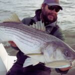
The striped bass migration is the main event right now. Large migratory females are pushing into the bay system, intercepting massive schools of bait flushing out of the local rivers. The bite is aggressive, and fish are actively feeding in the water column and crashing baits on the surface during low-light hours. You will find a mix of slot-sized fish and over-slot breeders staging along the channel edges and shoals.
From the editor
Tired of fishing with strangers you can’t trust?
Nautrek is the first social network for serious anglers — verified partners, real trips, cost splitting and intel sharing without burning your spots. Private beta now open.
While the fleet chases diving birds for stripers, the rock piles and artificial reefs inside and just outside the bay are holding excellent numbers of tautog. Most anglers overlook the early fall blackfish bite, but the water temperatures are absolutely perfect for them right now. They are feeding heavily on crabs to pack on weight before winter, offering consistent rod-bending action and excellent table fare.
Baitfish Report
The forage base is currently dominated by peanut bunker (juvenile Atlantic menhaden) and adult bunker. We are also seeing the tail end of the mullet run pushing along the beaches and into the bay. Sand eels are beginning to show up on the deeper shoals. When you see surface feeding, pay close attention to the size of the bait spraying out of the water; matching the profile of the peanut bunker versus the adult bunker is critical for consistent hookups.
Tactical Strategy
Where to Target
To intercept the striped bass, focus your efforts on the drop-offs near Flynn's Knoll and Roamer Shoal. The 15 to 25-foot depth contours are holding large pods of bunker, and the bass are sitting directly below them. The "Rip" at the very tip of Sandy Hook is another high-percentage zone, especially where the currents collide on the outgoing tide. For tautog, anchor up precisely over the rock piles at the Sandy Hook Reef or the breakwater walls near the Atlantic Highlands municipal harbor. You must be positioned directly over the structure; if you are casting to the rocks rather than dropping straight down, you are in the wrong spot.
Pro Tip:When fishing the tip of Sandy Hook, the most violent rips and best feeding windows occur during the middle two hours of the outgoing tide, as bait is flushed from the Raritan and Navesink systems directly into the waiting mouths of staging stripers.
Lure Selection
Topwater: 7-inch to 9-inch pencil poppers (Bone or Yellow) for dawn and dusk surface feeds.
Subsurface/Jigging: 9-inch NLBN paddletails on 1oz to 2oz jig heads. If the fish are deep, employ 5oz to 7oz flutter spoons in silver or white, dropping them to the bottom and sweeping them upward with long, aggressive rod lifts.
Hard Baits: Rapala X-Rap Magnum or large metal-lipped swimmers for trolling the channel edges.
Color Patterns
Water clarity in the bay can vary daily based on wind and tide. In clear water, stick to natural profiles like silver, white, and olive to mimic the bunker. Following a blow or heavy rain when the water turns stained, switch to chartreuse or bone-white to maximize visibility and contrast.
Bait & Rigging
For striped bass, live-lining adult bunker is incredibly effective. Snag or cast-net your baits, and rig them on an 8/0 to 10/0 non-offset inline circle hook (mandatory by regulation). Fish them unweighted or with a 1oz to 2oz egg sinker depending on the current. For tautog, use a standard snafu rig or a 3/4oz to 1.5oz bottom jig tipped with half a green crab or Asian shore crab. Trim the legs off the crab to release the scent and prevent the bait from spinning in the current.
Pro Tip:When tautog fishing, do not set the hook on the initial rapid-fire taps. Wait for the heavy, solid pull that indicates the fish has fully crushed the crab and taken the hook into its mouth.
Timing the Bite
The golden hours of dawn and dusk remain supreme for topwater striped bass action. However, tidal movement is far more important than the time of day. Plan your trips around the outgoing tide, particularly the first three hours of the ebb, which creates the strongest feeding currents along the shoals and points.
Regulations Snapshot
Always verify with the New Jersey Division of Fish and Wildlife before harvesting, but here are the current recreational regulations for our primary targets in these waters:
Species
Size Limit
Bag Limit
Season Status
Striped Bass
28 inches to less than 31 inches
1 per angler/day
Open (Marine Waters)
Tautog (Blackfish)
15 inches minimum
1 per angler/day
Open (Increases to 5 on Nov 16)
Bluefish
No minimum size
5 (Private) / 7 (For-Hire)
Open Year-Round
Summer Flounder (Fluke)
18 inches minimum
3 per angler/day
Closed for the season
Note: Striped bass fishing requires non-offset circle hooks when using natural bait. Federal waters (beyond 3 miles) are strictly closed to striped bass fishing and possession. Ensure you have your free NJ Saltwater Recreational Registry permit before hitting the water.
Regional Alternative: Navesink River
If a hard Northwest wind makes Sandy Hook Bay unfishable or unsafe for small vessels, retreat into the protected waters of the Navesink River. The river offers excellent shelter from prevailing winds and holds a massive population of schoolie striped bass, along with occasional larger holdovers. Access the river via the Oceanic Bridge area or the municipal ramps in Red Bank. Downsize your tackle to 1/2oz bucktails, 4-inch paddle tails, or small popping plugs. Work the shadow lines of the bridges at night, or target the shallow mudflats during the day where the sun warms the water, concentrating the remaining peanut bunker. It is a lighter-tackle game, but it can save a blown-out day on the bay.
Tight lines!
Editor's Choice: Must-Have Gear
FISHINGSIR Next-Gen Waterproof Chest Waders
★★★★★4.4 (7,370+ reviews)
2-Ply Tech: Upgraded nylon with 2.5x higher density than standard fabrics.
100% Waterproof: Lab-approved intrusion resistance with taped visible seams.
Ultra-Lightweight: Designed for all-day comfort while hunting or fishing.
As an Amazon Associate I earn from qualifying purchases. #ad
Loading forecast...
Live Fishing Conditions: Tides, Weather & Waves
Get real‑time tides, marine weather, swell and solunar activity for each spot so you know exactly when conditions line up for your best chance at a bite.
🎣
Sandy Hook Bay, New Jersey
Loading coordinates...
🌤️
WEATHER CONDITIONS
--°F
--°C
Loading...
🌡️
Feels Like--°F--°C
💧
Humidity--%
💨
Wind-- mph-- km/h
🧭
Direction--
📊
Pressure-- inHg-- hPa
☀️
UV Index--
🌊
MARINE CONDITIONS
🌊Wave Height
-- ft
-- m
Loading...
🧭Wave Direction
--°
Loading...
⏱️Wave Period
-- s
Loading...
📈Tide Status
-- ft
-- m
Loading...
🌙
LUNAR & SOLUNAR
🌕
Loading...
Illumination: --%
Major Period--:-- - --:----:-- - --:--
Minor Period--:-- - --:----:-- - --:--
🌅Sunrise--:--
🌇Sunset--:--
📅
24-HOUR FORECAST
Loading fishing conditions...
Fishing Spots Map
🎣
Book a Fishing Charter near Sandy Hook Bay, New Jersey Fishing Report Today 🎣
Local guides & charters. Verified captains, instant booking, best price guaranteed.
There was an error loading the map. Please try refreshing the page.
Info
Local Access & Facilities
The waters surrounding Sandy Hook Bay, New Jersey, offer a dynamic theater for seasoned anglers. Positioned at the apex where the Atlantic Ocean funnels into the bustling New York Harbor, this barrier peninsula boasts a rich maritime history and complex hydrodynamics. The area is defined by its striking contrasts, featuring pristine salt marshes and rolling sand dunes set against the distant, towering skyline of the city. For decades, the military presence of Fort Hancock preserved this peninsula as an open-space sanctuary, allowing vital marine habitats to thrive untouched by heavy commercial development.
Today, the fishery attracts dedicated surfcasters and seasoned skippers navigating the shifting shoals. The bay side offers sheltered pockets like Horseshoe Cove, while the ocean side faces the raw power of Atlantic swells. Surf fishing is a deep-rooted tradition here, with anglers targeting migrating predators that use the hook as a navigational landmark. Whether you are launching a skiff to work the harbor channels or hiking over the dunes for a dawn tide, understanding the logistical nuances of this federal reserve is critical for a successful expedition.
Access & Getting There
Navigating to Sandy Hook requires timing your commute against the notorious regional traffic. Most anglers arrive via the Garden State Parkway, taking Exit 117 to Route 36 East. You will follow this coastal artery for roughly 12 miles before crossing the Highlands Bridge. Once over the bridge, stay right to enter the park. During peak summer weekends, this two-lane gateway becomes heavily congested, making the pre-dawn arrival a necessity rather than a suggestion.
For captains hauling vessels, the U.S. Coast Guard Station Sandy Hook area provides a primary boat launch equipped with trailer parking. However, be aware that motorized boats are strictly prohibited from landing on the peninsula's beaches. If you run a smaller skiff or kayak, non-motorized and car-top boats can be launched directly from Beach Area C and Horseshoe Cove. Horseshoe Cove remains a favorite among local watermen for its protected waters when the ocean swells turn treacherous.
Parking strategy is paramount for surfcasters. The "M" Lot near the Nine Gun Battery and the designated fishing beach are the premier staging grounds. If you plan to work the bayside marshes, the Spermaceti Cove Parking Lot serves as an excellent central hub. Always secure your vehicle and ensure your trailer is maneuvered cleanly, as the lots fill to capacity quickly during the summer months.
💡 Captain's Tip: Launch Wind Contingencies
When heavy easterly swells or stiff trade winds batter the ocean side, utilize the launch points near Horseshoe Cove. The peninsula acts as a natural windbreak, offering significantly calmer waters for small craft and kayakers working the interior bay.
Sandy Hook Bay, New Jersey Pre-Trip Checklist
Facilities & Amenities
While Sandy Hook is surrounded by urban infrastructure, the immediate peninsula operates with rugged, limited amenities. For your morning bait and tackle needs, Up Front Bait and Tackle in nearby Keyport is the definitive choice for the dawn patrol, opening its doors at 5:00 AM. If you are arriving later, Keyport Bait and Tackle opens at 9:00 AM and provides heavy-duty gear suited for the harbor's demanding currents.
If you prefer to leave the navigation to the local pros, the regional fleet is highly capable. Just Sayin Sportfishing Charters operates out of Keyport, while Gypsea Fishing Charters runs from Brooklyn, offering heavy-hitting expertise for navigating the complex harbor shipping lanes. These captains understand the intricate tidal rips that define the local bite.
Understanding what is missing is just as important as knowing what is available. Camp Gateway offers overnight staging, but it is strictly tent-only. Prepare to hike your heavy surf gear up to 0.25 miles from the parking area to your site. Furthermore, the campground lacks showers, electrical outlets, and public wifi. Anglers must be entirely self-sufficient, bringing their own power banks and maintaining pristine coolers, as localized ice and fuel are not available directly on the sand.
💡 Captain's Tip: The Quarter-Mile Gear Haul
If you are staging a multi-day surfcasting trip at Camp Gateway, invest in a heavy-duty beach cart with balloon tires. The mandatory 0.25-mile walk from the lot to the campsites will quickly exhaust anyone trying to hand-carry coolers, rods, and heavy tackle boxes.
Facility / Service
Distance
Operating Hours / Notes
Up Front Bait and Tackle
10.8 miles
Opens 5:00 AM - Ideal for dawn patrol
Keyport Fishing Pier
10.5 miles
Open 24 hours
The Parking Spot Haynes
18.6 miles
Open 24 hours - Trailer staging option
Camp Gateway
1.3 miles
No electricity, no showers, 0.25-mile walk-in
Permits, Regulations & Fees
Fishing within the Gateway National Recreation Area requires strict adherence to both federal park rules and state angling laws. The peninsula has served as a federal reserve for over two centuries, and this protection extends to its fragile coastal ecosystems. Anglers are expected to respect the historical integrity of landmarks like the Sandy Hook Proving Ground and maintain a zero-impact footprint along the dunes.
Surf fishing is widely permitted across the ocean beaches, but there is a critical seasonal caveat. From Memorial Day weekend through Labor Day, surfcasting is strictly prohibited when lifeguards are on duty, which runs from 10:00 AM to 6:00 PM. Dedicated anglers must plan their sessions around the early morning tides or the late evening bite to remain compliant and avoid conflicts with swimmers.
Additionally, the spring and summer months trigger localized beach closures to protect endangered shorebird nesting sites, specifically for the Piping Plover. These protected zones are clearly marked with posted signs. Ignoring these closures carries heavy federal penalties and damages the conservation efforts that keep this fishery viable. Always verify current size limits and seasonal catch closures with the State Fishing Agency before making your first cast.
Events & Seasonal Information
The rhythm of Sandy Hook Bay is heavily dictated by the shifting seasons and the influx of summer tourism. During the peak summer months, the peninsula transforms into a bustling recreation hub. Millions of visitors flock to the guarded beaches, which drastically limits daytime surfcasting opportunities. Seasoned locals know that summer fishing here is strictly a nocturnal or dawn affair, capitalizing on the quiet hours before the crowds descend.
Spring brings a different dynamic, marked by the arrival of migratory shorebirds and the subsequent beach closures. This is also the time when the waters begin to warm, activating the local baitfish populations in the salt marshes of Spermaceti Cove. Wading anglers must exercise extreme caution during these transitional seasons, as the shifting sandbars are notorious for sudden, dangerous drop-offs.
Fall is arguably the premier season for serious anglers. As the summer crowds dissipate and the lifeguard stations are boarded up, access opens entirely. The cooling waters trigger aggressive feeding patterns, and the multi-use paths become quiet staging grounds for those chasing the autumn runs.
💡 Captain's Tip: Beat the Lifeguard Clock
During the summer, the 10:00 AM to 6:00 PM lifeguard shift effectively shuts down the ocean-side surfcast. Focus your efforts on the pre-dawn incoming tides, and transition to the unprotected bayside marshes once the ocean beaches close to fishing.
Contact Information & Resources
Safety and self-reliance are paramount when fishing the dynamic waters of the New York Harbor entrance. The area is jointly overseen by the National Parks of New York Harbor and the Gateway National Recreation Area. For immediate park information, unstaffed season inquiries can be directed to the main office at (732) 266-3352, while the summer staff can be reached at (347) 630-1124.
Given the heavy commercial shipping traffic and treacherous tidal rips, boaters should maintain constant radio contact and monitor weather channels closely. The proximity of the U.S. Coast Guard Station provides a layer of security, but captains must remain vigilant. For precise locations and real-time conditions, consult the live dashboard and maps below.
🎣
Sandy Hook Bay, New Jersey
Middletown Township • New Jersey • 40.4669, -74.0094
Our spot reports combine data-driven forecasts with curated local information. The forecast is generated by our proprietary Fishing Score algorithm (0–100%), which analyzes real-time data from Open-Meteo API, validated against NOAA CO-OPS tide gauges and USGS water-monitoring stations. The model weights tide dynamics (35%), wave energy (25%), wind patterns (20%) and time of day (20%)—factors shown to influence fish feeding behavior through marine-biology research and decades of charter log data.
Access, facilities and services information for each fishing spot is sourced from official datasets such as Recreation.gov (RIDB), state park & wildlife agencies, and geospatial providers like Google Maps. These sections undergo scheduled re-validation every 3–6 months to ensure that boat ramps, park access, contact details and local services remain accurate.
Narrative sections (catches, seasonal behavior, local tips) are synthesized from these data sources and refined following the Fishing Reports Today editorial guidelines, combining bibliographic research from ichthyology and oceanography with expert angler experience. Our team reviews reports on a regular basis, while the forecast model itself updates every 6 hours for real-time accuracy.
⚠️ Important: Always verify current local regulations, access restrictions and weather conditions before fishing. These reports are intended as a planning aid, not a guarantee of catches or safety. When in doubt, contact local authorities or park managers listed on the page.
To provide the best experiences, we use technologies like cookies to store and/or access device information. Consenting to these technologies will allow us to process data such as browsing behavior or unique IDs on this site. Not consenting or withdrawing consent, may adversely affect certain features and functions.
Functional Always active
The technical storage or access is strictly necessary for the legitimate purpose of enabling the use of a specific service explicitly requested by the subscriber or user, or for the sole purpose of carrying out the transmission of a communication over an electronic communications network.
Preferences
The technical storage or access is necessary for the legitimate purpose of storing preferences that are not requested by the subscriber or user.
Statistics
The technical storage or access that is used exclusively for statistical purposes.The technical storage or access that is used exclusively for anonymous statistical purposes. Without a subpoena, voluntary compliance on the part of your Internet Service Provider, or additional records from a third party, information stored or retrieved for this purpose alone cannot usually be used to identify you.
Marketing & Affiliates
The technical storage or access is required to create user profiles to send advertising, or to track the user on a website or across several websites for similar marketing purposes, including affiliate tracking for products recommended in our reports.



Leave a Reply