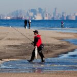
Current seasonal conditions across the Red Bank region dictate a definitive "GO" for anglers looking to exploit the backwater estuaries. We are transitioning into a stable early-summer weather pattern, characterized by crisp, comfortable mornings in the upper 50s and afternoon highs cresting into the low 80s. This consistent solar heating is rapidly warming the local surface water temperatures, which are currently pushing through the mid-to-upper 60s and triggering aggressive feeding windows across the tidal flats.
Safety Advisory: While the weather is highly cooperative, the primary hazard right now is recreational boat traffic. The Navesink and Shrewsbury rivers become heavily congested on weekends. By midday, the main channels can turn into a washing machine of overlapping wakes. Kayak anglers and those in small skiffs should plan to launch at first light and complete their trips by late morning to avoid the chop. Additionally, always keep an eye on the western horizon for sudden afternoon thermal thunderstorms that can produce localized, heavy gusts.
🎣Nautrek
Private Beta
J
M
R
100+ anglers on the waitlist
The fishing network where your reputation matters.
Find trusted captains, join real trips with cost splitting, and build your Angler Rank. Your spots stay private — you decide who sees your intel.
While many trophy hunters immediately head for deep ocean reefs, the shallow waters of the Twin Rivers are currently holding an impressive class of "doormat" fluke. These estuarine flounder behave much differently than their deep-water counterparts. They aggressively push into extremely shallow water to corral bait against the mudflats and bulkheads. Because they cannot sound to the depths when hooked, the fight is lateral, fast, and incredibly fun on light tackle.
Sleeper Pick: Weakfish
Often overlooked by the fleet chasing striped bass and fluke, the weakfish bite is quietly materializing in the deeper, shaded holes of the river system. These stunning, iridescent predators roam the same shallow flats and channels alongside schoolie stripers. They require a bit of finesse and a lighter drag setting due to their notoriously soft mouths—hence the name weakfish—but they offer a highly rewarding challenge for the dedicated light-tackle angler.
Baitfish Report: Match the Hatch
The Navesink and Shrewsbury rivers act as a massive nursery and holding pen for diverse forage. The waters are currently teeming with a variety of baitfish, and to trigger strikes from resident predators, you must match this small-profile forage. Leave the massive ocean-sized baits at home and focus on imitating the following:
Mummichogs (Killies): These hardy baitfish are the primary forage for shallow-water fluke. They congregate tightly around muddy banks and marsh grass.
Atlantic Silversides (Spearing): Often seen flashing in the current rips, these slender baitfish are a favorite target for weakfish and schoolie stripers.
Grass Shrimp: Swarming around dock pilings and bulkheads, these tiny crustaceans are the secret weapon for triggering bites when the fish are acting finicky.
Peanut Bunker: Juvenile Atlantic menhaden are beginning to push into the coves, providing a high-protein meal for larger predators patrolling the channel edges.
TACTICAL STRATEGY
Fishing the Red Bank estuaries requires a completely different approach than open-ocean bottom bouncing. You must scale down your tackle and think like a shallow-water hunter.
Where to Look
Focus your efforts on the residential docks and bulkheads lining the Navesink River, particularly the stretches running east-to-west where tidal flow creates natural ambush points. Target the depth transitions from 4 feet down to 16 feet. Use your marine electronics to locate tightly packed schools of bait holding near the bottom, then set up your drift to drag directly over these micro-ledges. The fish will be facing up-current, waiting for the tide to deliver their next meal. Keep a close eye on your sounder; if you mark a sudden drop-off littered with bait, circle back and repeat your drift, as fluke will stack up heavily in these localized depressions.
Lure Selection and Color
Ditch the heavy sinkers and massive jigs. Deploy a 1/4oz to 3/8oz bucktail jig, or a lightweight lead-head, tipped with a 4-inch Berkley Gulp! Swimming Mullet or Nemesis. When the water is stained from outgoing tidal flow or recent rain, rely on high-visibility colors like Chartreuse or Nuclear Chicken. If you are fishing the cleaner water of the incoming flood tide, Pearl White or Pink Shine will perfectly mimic local spearing and grass shrimp.
Bait and Rigging
If you prefer soaking natural bait, live killies or fresh spearing are the top producers. Rig them on a lightweight fish-finder rig with the absolute minimum amount of lead required to hold bottom. A short, 15-inch fluorocarbon leader (15 to 20-pound test) tied to a fine-wire circle hook will ensure a natural presentation without spooking line-shy fish.
Timing the Bite
The most productive feeding windows are occurring during the last two hours of the incoming tide and the first hour of the outgoing tide. This high-water period floods the shallowest flats, allowing predators to access crabs and shrimp that were previously high and dry.
Pro Tip: When targeting fluke in these shallow rivers, do not be afraid to cast directly under residential docks and slowly jig your presentation back to the boat. Fluke will utilize the shade of the docks to ambush baitfish seeking shelter from the mid-morning sun.
Pro Tip: Downsize your braided main line to 10 or 15-pound test. The thinner diameter cuts through the tidal current with far less resistance, allowing you to use lighter jigs while maintaining crucial contact with the bottom.
REGULATIONS SNAPSHOT
Compliance is critical. The New Jersey Department of Environmental Protection (NJDEP) strictly enforces the following 2026 recreational saltwater limits for the region. Note that cleaning or filleting fish with a minimum size limit while at sea is strictly prohibited.
Species
Minimum Size
Bag Limit
Season & Special Rules
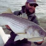
Striped Bass
28" to less than 31" (Slot)
1 per angler
Inline, non-offset circle hooks are MANDATORY when using natural bait. No gaffing allowed.
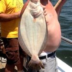
Summer Flounder (Fluke)
18 inches
3 per angler
Standard bottom rigs permitted. Must be landed whole.
If a hard coastal wind renders the open channels of the Two Rivers or nearby Raritan Bay unfishable, you need a solid backup plan. Pivot your strategy inland and explore the deep, sheltered tidal creeks branching off the main stem of the Navesink River. The heavy tree lines and high bulkheads in these narrow tributaries effectively block heavy winds, creating a comfortable and highly productive micro-fishery.
Scale your tackle down to ultralight spinning gear and target White Perch and holdover schoolie Striped Bass. A traditional high-low rig tipped with small pieces of live bloodworm is deadly here. Alternatively, throw a 1/16oz to 1/8oz tungsten tear-drop jig tipped with a Berkley Gulp! bloodworm snippet. Work the structure tightly around small creek bridges and submerged timber where these fish stage to intercept current-swept forage.
Pro Tip: If you can procure live grass shrimp, use them as chum to get the White Perch feeding aggressively in the creeks. Once a frenzy starts, drift a single shrimp on a small baitholder hook under a slip float for non-stop, light-tackle action.
Tight lines!
Editor's Choice: Must-Have Gear
FISHINGSIR Next-Gen Waterproof Chest Waders
★★★★★4.4 (7,370+ reviews)
2-Ply Tech: Upgraded nylon with 2.5x higher density than standard fabrics.
100% Waterproof: Lab-approved intrusion resistance with taped visible seams.
Ultra-Lightweight: Designed for all-day comfort while hunting or fishing.
As an Amazon Associate I earn from qualifying purchases. #ad
Loading forecast...
Live Fishing Conditions: Tides, Weather & Waves
Get real‑time tides, marine weather, swell and solunar activity for each spot so you know exactly when conditions line up for your best chance at a bite.
🎣
Red Bank NJ
Loading coordinates...
🌤️
WEATHER CONDITIONS
--°F
--°C
Loading...
🌡️
Feels Like--°F--°C
💧
Humidity--%
💨
Wind-- mph-- km/h
🧭
Direction--
📊
Pressure-- inHg-- hPa
☀️
UV Index--
🌊
MARINE CONDITIONS
🌊Wave Height
-- ft
-- m
Loading...
🧭Wave Direction
--°
Loading...
⏱️Wave Period
-- s
Loading...
📈Tide Status
-- ft
-- m
Loading...
🌙
LUNAR & SOLUNAR
🌕
Loading...
Illumination: --%
Major Period--:-- - --:----:-- - --:--
Minor Period--:-- - --:----:-- - --:--
🌅Sunrise--:--
🌇Sunset--:--
📅
24-HOUR FORECAST
Loading fishing conditions...
Fishing Spots Map
🎣
Book a Fishing Charter near Red Bank NJ Fishing Report Today 🎣
Local guides & charters. Verified captains, instant booking, best price guaranteed.
There was an error loading the map. Please try refreshing the page.
Info
Local Access & Facilities
Red Bank NJ Pre-Trip Checklist
Local Access & Facilities
Situated on the historic banks of the Navesink River, Red Bank serves as a strategic, albeit sophisticated, gateway to some of the most productive water in the Northeast. This isn't just a picturesque river town; it is the upper vascular system of the Sandy Hook Bay complex. For the serious angler, this location offers a protected launch point that eventually opens up to the ripping currents of the Shrewsbury River and the open Atlantic beyond the Hook. The bottom topography here transitions from the mud and clay of the riverbeds to the sandy channels that funnel migratory striped bass and fluke.
The atmosphere in Red Bank is distinct from the rugged, surf-casting culture of the outer beaches. Here, the vibe is a blend of suburban manicure and serious boating heritage. While the town itself offers high-end dining and walkable streets, the water access points are strictly business for captains looking to intercept the dawn bite. You are launching into a system where tidal flow dictates everything; the interplay between the Navesink and Shrewsbury rivers creates nutrient-rich pinch points that hold bait long before it reaches the ocean.
The primary draw for experts in this zone is the versatility of the fishery. In the shoulder seasons, the backwaters hold holdover stripers and winter flounder, while the main run brings heavy migratory bass right past the local docks. However, navigating the logistical landscape—from parking restrictions to bridge clearances—requires local intelligence. This guide breaks down the essential access points and facilities required to execute a successful trip in the Red Bank and Sandy Hook region.
💡 Captain's Tip: Tides Matter Here
The Navesink River currents can be deceivingly strong, especially near the bridges. When launching at the public ramps, ensure your engine is warmed up and reliable before drifting off the trailer, as the current can pin you against pilings quickly during a moon tide.
Access & Getting There
Reaching Red Bank is generally straightforward via the Garden State Parkway, arguably the most critical artery for New Jersey anglers. Exit 109 provides the most direct route into town. However, veteran captains know that summer traffic on the Parkway—and subsequently on Route 35—can be brutal. On weekends between Memorial Day and Labor Day, the "shore traffic" phenomenon is real. To ensure you are rigging up at the ramp by sunrise, plan to cross the Driscoll Bridge well before 6:00 AM.
For trailer boaters, the primary launch facility identified in the immediate vicinity is the Public Boat Ramp, located approximately 2.3 miles from the town center. While convenient, local ramps in this river system can be tight and often suffer from slick conditions at low tide. It is imperative to check the tide tables for the Navesink River specifically, not just Sandy Hook, as the lag time can be significant. There are also unnamed shore access points and street-end launches suitable for kayaks and car-toppers, particularly near the Marine Park Playground area, which offers family-friendly shore fishing access.
Weather plays a massive role in access strategies here. The Navesink is generally protected from the ocean swell, making it a viable "Save the Day" spot when the Atlantic is heaving. However, a strong Northwest wind can funnel down the river, creating a nasty chop that makes loading boats difficult. If the forecast calls for sustained winds over 15 knots from the NW, consider launching closer to the lee of the land or utilizing the facilities further east toward Gateway National Recreation Area.
Parking requires a defensive strategy. In town, street parking is heavily regulated, and trailer parking is non-existent outside of designated ramp lots. For those meeting a charter or carpooling, the Park & Ride on Hope Road in Eatontown (4.3 miles away) is a reliable rendezvous point with ample space. It operates from 4:00 AM to 2:00 AM, covering the vast majority of fishing windows. Avoid leaving vehicles in unauthorized retail lots, as towing is aggressive in this area.
Facilities & Amenities
Red Bank itself is more of a dining and cultural hub than a bait-and-tackle epicenter. For serious provisioning, you will need to travel slightly west to Keyport or south toward the coast. The local infrastructure for heavy gear is situated about 9 to 10 miles away. This means you must buy your flats of butterfish, eels, or clam chum before you get stuck in the final traffic stretch to the ramp. Do not expect to find a full-service offshore outfitter directly at the water's edge in downtown Red Bank.
Keyport Bait and Tackle (9.6 miles away) is a staple for the region, carrying the fresh bunk and specialized rigs required for Raritan Bay fishing. Similarly, Up Front Bait and Tackle offers early hours, opening at 5:00 AM most days, which is critical for the dawn patrol crowd. If you are heading further south or launching closer to the inlet, Dockside Bait and Tackle in Sewaren is another reliable option, though further out at 17 miles. The table below details the nearest reliable amenities for anglers.
💡 Captain's Tip: The "Iron Triangle" of Bait
Since Red Bank lacks a dedicated heavy-tackle shop right on the water, stop in Keyport on your way in. Up Front Bait and Tackle opens at 5:00 AM, allowing you to load up on fresh bunker and ice before hitting the Red Bank ramps.
Regarding charter operations, the heavy hitters and "party boats" are not docked in the Navesink. The major fleets, such as Gambler Deep Sea Fishing and Jersey Nutz Sport Fishing, operate out of Point Pleasant Beach, roughly 17 miles to the south. These operations are world-class for offshore seabass, fluke, and tuna trips. If you are looking for a head boat experience, you will need to drive south to the Manasquan Inlet area. Red Bank is better suited for private boaters or arranging pickups with smaller, light-tackle guide skiffs.
Lodging and Logistics: If you are trailing a boat and need a place to crash, options with trailer space are limited in the immediate downtown. Allaire State Park (15 miles away) offers camping facilities for those who prefer a rustic base camp. For standard accommodations, you may need to look toward the highway corridors in Eatontown or Tinton Falls. Note that the Gateway National Recreation Area also offers camping opportunities, specifically at Sandy Hook, which puts you right in the surf casting zone.
Facility Name
Type
Distance
Notes / Hours
Keyport Bait and Tackle
Bait & Tackle
9.6 mi
Rated 5/5. Open 10am-6pm (Check seasonal hours).
Up Front Bait and Tackle
Bait & Tackle
9.8 mi
Opens 5:00 AM. Critical for early starts.
Gambler Deep Sea Fishing
Charter / Headboat
16.9 mi
Located in Point Pleasant. Deep sea specialist.
Park & Ride (Eatontown)
Parking
4.3 mi
Open 4:00 AM - 2:00 AM. Good for carpooling.
Gateway NRA (Sandy Hook)
Access / Rec Area
16.9 mi
Major ocean access, camping, and surf fishing.
Permits, Regulations & Fees
Fishing the waters around Red Bank falls under the jurisdiction of the New Jersey Division of Fish and Wildlife. A critical requirement for all anglers targeting anadromous or marine species is the New Jersey Saltwater Recreational Registry Program (NJSRRP). This is a free registration, but it is mandatory. Law enforcement patrols both the ramps and the water frequently, and failure to produce your registry certificate is a common way to ruin a trip.
When accessing the Gateway National Recreation Area (Sandy Hook), federal rules apply. This is National Park Service land. While fishing is generally allowed, there are specific zones for swimming where surf casting is prohibited during lifeguarded hours. Additionally, nighttime fishing permits are often required for access to Sandy Hook after dark. These "fishing passes" allow you to park in designated lots overnight to fish the tide, a popular tactic for the fall run striper crowd.
Cultural respect and local ordinances are also paramount. The Navesink River is lined with high-value private property. Anglers must respect "Kapu" (forbidden) zones regarding private docks and bulkheads. Do not tie up to private pilings or trespass on private seawalls to fish. Stick to the designated Marine Park areas or public easements. Furthermore, the Statue of Liberty National Monument and National Parks of New York Harbor are nearby; these areas have strict security zones. approaching too close to security perimeters can result in immediate intervention by the Coast Guard.
Events & Seasonal Information
The fishing calendar here is dictated by migration. The spring run (April-June) sees large striped bass moving into Raritan Bay and up the Navesink to feed on bunker schools. This is the busiest time of year, and boat ramps can reach capacity by 5:00 AM on weekends. Summer shifts the focus to fluke (summer flounder) and bluefish, with recreational boat traffic increasing significantly. The river can become a washing machine of wakes by midday on a Saturday in July.
Fall (September-November) is the second peak season, often referred to as the "Fall Run." As water temperatures drop, fish pour out of the rivers and move south along the beach. This is excellent time for surf casting at nearby Sandy Hook. In terms of organized events, the Gateway National Recreation Area hosts unique activities like the Sandy Hook Canoe Cruise. These ranger-led paddling tours offer a stealthy way to observe the flats and channels near Skeleton Hill Island, providing excellent intel on bottom structure and bait concentrations without the noise of an outboard.
💡 Captain's Tip: Summer Wind Patterns
In the summer, the thermal seabreeze kicks in like clockwork around 11:00 AM. If you are fishing the open bay or the ocean side of Sandy Hook, plan your run back to the Navesink before the afternoon South wind builds a steep chop against the outgoing tide.
Contact Information & Resources
For official information regarding access status, closures, or permits, direct your inquiries to the managing federal agencies. The Gateway National Recreation Area can be reached at (718) 354-4606. They are the authority on beach access and the Sandy Hook unit. For the National Parks of New York Harbor, the contact number is (917) 731-1997.
Safety on the water is the responsibility of the captain. In an emergency, VHF Channel 16 is the standard for hailing the Coast Guard. However, for non-emergency questions regarding ramp conditions or local parking availability, calling the local bait shops like Keyport Bait and Tackle (732-377-0270) often yields the most real-time intelligence. Always file a float plan with a reliable contact on land before heading out.
For precise locations, real-time wind conditions, and detailed bathymetry of the Navesink channels, consult the live dashboard and interactive maps below.
🎣
Red Bank NJ
Red Bank • New Jersey • 40.3471, -74.0643
🅿️
Parking
5
Tower Center II Investment Group
⭐ 5.020.4 mi
📍2 Tower Center Blvd, East Brunswick, NJ 08816, USA
Our spot reports combine data-driven forecasts with curated local information. The forecast is generated by our proprietary Fishing Score algorithm (0–100%), which analyzes real-time data from Open-Meteo API, validated against NOAA CO-OPS tide gauges and USGS water-monitoring stations. The model weights tide dynamics (35%), wave energy (25%), wind patterns (20%) and time of day (20%)—factors shown to influence fish feeding behavior through marine-biology research and decades of charter log data.
Access, facilities and services information for each fishing spot is sourced from official datasets such as Recreation.gov (RIDB), state park & wildlife agencies, and geospatial providers like Google Maps. These sections undergo scheduled re-validation every 3–6 months to ensure that boat ramps, park access, contact details and local services remain accurate.
Narrative sections (catches, seasonal behavior, local tips) are synthesized from these data sources and refined following the Fishing Reports Today editorial guidelines, combining bibliographic research from ichthyology and oceanography with expert angler experience. Our team reviews reports on a regular basis, while the forecast model itself updates every 6 hours for real-time accuracy.
⚠️ Important: Always verify current local regulations, access restrictions and weather conditions before fishing. These reports are intended as a planning aid, not a guarantee of catches or safety. When in doubt, contact local authorities or park managers listed on the page.
To provide the best experiences, we use technologies like cookies to store and/or access device information. Consenting to these technologies will allow us to process data such as browsing behavior or unique IDs on this site. Not consenting or withdrawing consent, may adversely affect certain features and functions.
Functional Always active
The technical storage or access is strictly necessary for the legitimate purpose of enabling the use of a specific service explicitly requested by the subscriber or user, or for the sole purpose of carrying out the transmission of a communication over an electronic communications network.
Preferences
The technical storage or access is necessary for the legitimate purpose of storing preferences that are not requested by the subscriber or user.
Statistics
The technical storage or access that is used exclusively for statistical purposes.The technical storage or access that is used exclusively for anonymous statistical purposes. Without a subpoena, voluntary compliance on the part of your Internet Service Provider, or additional records from a third party, information stored or retrieved for this purpose alone cannot usually be used to identify you.
Marketing & Affiliates
The technical storage or access is required to create user profiles to send advertising, or to track the user on a website or across several websites for similar marketing purposes, including affiliate tracking for products recommended in our reports.


Leave a Reply