0%

Montauk Fishing Report Today 🎣

7 months ago Β· Updated 3 weeks ago

Montauk fishing Report Today

Go/No-Go Status: CAUTION – PIVOT TO INLAND WATERS

As we navigate the volatile early spring transition in Montauk, current marine conditions dictate a strict CAUTION for offshore and open-surf anglers. We are currently facing a formidable weather pattern characterized by persistent southwesterly winds howling at 20 to 30 knots, with gale-force gusts pushing up to 40 knots. These winds will eventually shift to the northwest, creating confused and treacherous cross-seas. Offshore wave heights are building to a dangerous 8 to 10 feet. Combined with chilling air temperatures in the mid-40s and ocean water temperatures hovering around a sluggish 40 degrees, the open ocean, the Point, and exposed surf zones are currently unfishable and unsafe.

Verdict: UNSAFE FOR OFFSHORE – TRY ALTERNATIVE. Stow your heavy surfcasting gear and offshore trolling setups. This is the time to pivot to protected freshwater bodies or highly sheltered back-bay estuaries where the wind is broken by the tree line and the water can warm up slightly. Fort Pond, located right in the heart of Montauk, is your primary audible for bending a rod under these blown-out conditions.

Biological Species Intel

Based on recent biological ground-truth data and verified citizen science observations from the surrounding 50-kilometer radius, we are seeing a distinct awakening of early spring forage and predator activity. Relying on this biological intelligence is crucial when official fishing reports are thin.

🎣 Nautrek
Private Beta
J
M
R
100+ anglers on the waitlist

The fishing network where your reputation matters.

Find trusted captains, join real trips with cost splitting, and build your Angler Rank. Your spots stay private — you decide who sees your intel.

✓ Verified anglers ✓ Real trips ✓ Spot privacy
Join the Waitlist — Free →

No spam. First 500 get founder perks.

Nautrek App
  • Primary Target: Bluegill and Yellow/White Perch. Panfish activity is officially waking up in the region. Verified biological observations put Bluegill at the top of the active feeding list in regional freshwater systems, including our fallback locations.
  • Sleeper Pick: Holdover Striped Bass and Largemouth Bass. While the marine striped bass season is currently closed for harvest, catch-and-release anglers in tidal rivers can find sluggish but hungry holdovers. In freshwater, largemouth bass are beginning to stage near drop-offs.
  • Baitfish Report: Biological trackers have confirmed the presence of American Gizzard Shad in the Bridgehampton area and Atlantic Silversides in nearby coastal estuaries. This is critical intelligence. Gizzard shad are large, high-protein forage, and predators in both fresh and brackish water are heavily keyed in on these specific profiles right now. You must match this hatch to trigger a strike.

Tactical Strategy: Fort Pond Finesse

Where to Deploy

With the salt blown out, head directly to Fort Pond. This 180-acre, spring-fed kettle lake offers depths up to 25 feet and plenty of accessible shoreline. Focus your efforts near the DEC boat ramp on the south end, accessible via South Erie Street. The terrain here transitions from shallow flats to rocky drop-offs in 8 to 15 feet of water. These rocky transition zones hold heat better than mud bottoms and act as natural ambush points for bass and jumbo panfish waiting to intercept passing baitfish.

Gear and Presentation

To capitalize on the current bite, finesse and patience are mandatory in these cold-water conditions.

  • Lure Selection: To match the local Atlantic Silverside and Gizzard Shad forage, throw a 5/8-ounce suspending jerkbait (such as a Rapala Husky Jerk) or a 1-ounce realistic glide bait like the Savage Gear Shine Glider. For the highly active Bluegill and Perch, downsize dramatically to a 1/16-ounce tungsten teardrop jig or a micro Ned rig.
  • Color Patterns: Opt for silver sides with a black or blue back to perfectly mimic the Gizzard Shad and Silversides. For panfish jigs, natural earth tones, motor oil, or a pop of chartreuse work best in the slightly stained spring water.
  • Bait: Small live freshwater shiners or a piece of nightcrawler suspended 2 to 3 feet under a sensitive slip float will consistently out-produce artificials for panfish during cold fronts.

Timing the Bite

Forget the crack of dawn. In early spring, the best bite occurs during the warmest part of the day. Focus your efforts between 2:00 PM and 5:00 PM. Target the northern and eastern shorelines, as these areas receive the most direct afternoon sunlight, which can raise the local water temperature by a crucial degree or two, triggering a brief but intense feeding window.

Pro Tip: Work your suspending jerkbaits with painfully long pauses. In 40-degree water, a bass will often follow the bait and stare at it for 5 to 10 seconds before committing to a strike. If you think you are fishing your lure too slowly, slow down even more.

Regulations Snapshot

Compliance is non-negotiable. Please note that early spring is a heavily regulated transition period to protect spawning fish. Always ensure you are enrolled in the NY Recreational Marine Fishing Registry if you decide to target coastal waters.

SpeciesWater TypeCurrent Status & Key Limits
Striped BassMarineCLOSED (Season typically opens April 15. Catch-and-release only in permitted holdover areas)
Winter FlounderMarineCLOSED (Season typically opens April 1)
Bluegill / SunfishFreshwaterOPEN (Year-round season, 25 fish daily bag limit)
WalleyeFreshwaterCLOSED (Season opens May 1. Incidental catches must be released immediately)

Pro Tip: Fort Pond is famous for its jumbo, near-state-record Walleye. However, because the season is currently closed to protect their spawn, do not actively target them. If you accidentally hook a walleye while fishing for bass or panfish, keep the fish in the water while unhooking to ensure a safe, zero-impact release.

Regional Alternative: Ashaway, Rhode Island

If the winds on the tip of Long Island are simply too brutal and Fort Pond is taking on whitecaps, taking a drive to the mainland offers excellent fallback opportunities. Recent biological data highlights the Ashaway, Rhode Island area as a verified hot spot for early spring Bluegill and baitfish activity.

The Ashaway Audible

Target the sheltered, tree-lined coves of Ashville Pond or Barber Pond in the Hopkinton and South Kingstown areas. Rhode Island trout waters are currently closed until the second Saturday in April, which means you must avoid designated trout streams and focus strictly on warm-water ponds.

Target the shallow, dark-bottomed bays of these ponds. A simple worm under a bobber or a micro-tube jig pitched near submerged timber or remaining weed beds will yield steady action from Bluegill and early-season Largemouth Bass. Remember that fishing in Rhode Island requires a separate state freshwater fishing license, which can be easily obtained online before you travel.

Tight lines!

Editor's Choice: Must-Have Gear

FISHINGSIR Next-Gen Waterproof Chest Waders

β˜…β˜…β˜…β˜…β˜… 4.4 (7,370+ reviews)
  • 2-Ply Tech: Upgraded nylon with 2.5x higher density than standard fabrics.
  • 100% Waterproof: Lab-approved intrusion resistance with taped visible seams.
  • Ultra-Lightweight: Designed for all-day comfort while hunting or fishing.
Check Availability on Amazon

βœ“ Amazon's Choice | 100+ bought last month

πŸ›’ Tactical Gear for this Spot

Bandit Walleye Deep

Mandatory for reaching deep schools in 35-50ft mud flats.

Check Price on Amazon #ad

As an Amazon Associate I earn from qualifying purchases. #ad

Loading forecast...

Live Fishing Conditions: Tides, Weather & Waves

Get real‑time tides, marine weather, swell and solunar activity for each spot so you know exactly when conditions line up for your best chance at a bite.

🎣

Montauk

Loading coordinates...

🌀️

WEATHER CONDITIONS

Weather
-- Β°F
--Β°C

Loading...

🌑️
Feels Like --Β°F --Β°C
πŸ’§
Humidity --%
πŸ’¨
Wind -- mph -- km/h
🧭
Direction --
πŸ“Š
Pressure -- inHg -- hPa
β˜€οΈ
UV Index --
🌊

MARINE CONDITIONS

🌊 Wave Height
-- ft
-- m
Loading...
🧭 Wave Direction
--Β°
Loading...
⏱️ Wave Period
-- s
Loading...
πŸ“ˆ Tide Status
-- ft
-- m
Loading...
πŸŒ™

LUNAR & SOLUNAR

πŸŒ•

Loading...

Illumination: --%

Major Period --:-- - --:-- --:-- - --:--
Minor Period --:-- - --:-- --:-- - --:--
πŸŒ… Sunrise --:--
πŸŒ‡ Sunset --:--
πŸ“…

24-HOUR FORECAST

Loading fishing conditions...

Fishing Spots Map

🎣
Book a Fishing Charter near Montauk Fishing Report Today 🎣

Local guides & charters. Verified captains, instant booking, best price guaranteed.

See Available Trips β†’

My location
Loading map...

Local Access & Facilities

The End of the Line: Fishing Montauk

Montauk, often referred to simply as "The End," represents the ultimate convergence of land and sea for New York anglers. Situated at the easternmost tip of Long Island, this fishery is defined by its rugged coastline, sweeping bluffs, and the collision of Atlantic currents that create a nutrient-rich ecosystem. The atmosphere here is distinct from the manicured lawns of the Hamptons to the west; it is raw, salt-worn, and entirely dedicated to the pursuit of game fish.

The topography is characterized by a mix of sandy stretches and rocky structures, with areas like the Amagansett National Wildlife Refuge showcasing unique double dune systems rarely seen elsewhere. For the boat angler, the water drops off quickly into the deep Atlantic, while surfcasters patrol the rocky shorelines that fringe the peninsula. The vibe is serious and historic, echoing decades of sportfishing heritage where the Atlantic Ocean meets Block Island Sound.

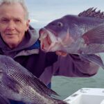
Prospective anglers flock here primarily for the legendary runs of striped bass, bluefish, and false albacore that blitz the shoreline during the migration. Whether you are launching a heavy center console to head offshore or wading the suds with a surf rod, Montauk offers a dynamic and challenging environment that demands respect and preparation.

Access & Getting There

Reaching Montauk requires a commitment to travel, as it sits at the very terminus of Route 27 (Sunrise Highway). During the height of the summer season, traffic on this single artery can be brutal, with significant congestion building up through the Hamptons. Seasoned captains know to time their arrival for the pre-dawn hours, not only to catch the bite but to beat the gridlock that forms by mid-morning.

For those trailing boats, the drive requires vigilance. Once you pass East Hampton, the road narrows and winds through rolling hills. There are several launch points available in the area. The data indicates three distinct boat ramps in the immediate vicinity, suitable for trailer parking. However, access points can be tide-dependent. It is crucial to check the specific ramp conditions, as some local launches can become slick or shallow during extreme low tides.

πŸ’‘ Captain's Tip: Beat the Traffic

Route 27 is the only way in or out. Plan to cross the Shinnecock Canal well before 6:00 AM to avoid the "Hamptons crawl." If you are trailering a wide beam vessel, early transport is mandatory to navigate the narrower sections of the highway safely.

Parking is a critical logistical component in Montauk. The Montauk Station offers a reliable landmark and parking area roughly 0.8 miles from the central fishing zones. For those looking to access the shoreline via state lands, the Shadmoor State Preserve Trail Parking is located approximately 1.2 miles away. Anglers with recreational vehicles should head to the Montauk County Park, RV Beach Parking, situated about 3.1 miles from the main hub, which provides ample space for larger rigs.

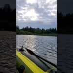
Weather plays a massive role in accessibility here. The point is exposed to the open Atlantic. When strong easterly winds whip up, the ocean side becomes unfishable and dangerous for small craft. In these conditions, smart anglers retreat to the leeward side or explore the protected waters of the nearby wildlife refuges, though access there may be restricted to shore fishing or kayaking.

Montauk Pre-Trip Checklist

Facilities & Amenities

Montauk's infrastructure is built around the fisherman. The local shops are specialized and understand the "dawn patrol" schedule. A standout facility is Westlake Bait & Tackle Shop, located 2.3 miles from the center. This shop is a staple for the fleet, opening its doors at 5:00 AM daily to ensure you have fresh bait and ice before the sun breaks the horizon. Closer to town, Cool Gear Fishing offers additional support just under a mile away.

For those needing gear repairs or specialized tackle further up the island, Greenie Supply & Tackle in Southold operates 24 hours a day, though it is a significant drive (23.5 miles) and better utilized as a stop on your way in or out. The table below outlines the key logistical hubs for anglers in the immediate region.

Facility NameTypeDistanceKey Notes
Westlake Bait & TackleBait & Tackle2.3 milesOpens 5:00 AM. Hub for local intel.
Cool Gear FishingSupply0.9 milesClose proximity to town center.
Montauk StationParking0.8 milesReliable parking option.
Hither Hills State ParkCamping3.5 milesPopular campground for multi-day trips.

Lodging options cater to the outdoor enthusiast. Hither Hills State Park Campground is the premier spot for surfcasters who want to sleep within earshot of the breaking waves. For a more secluded experience, the Paumanok Path Campsite offers accommodations roughly 1.5 miles away. Note that camping spots fill up months in advance during the striped bass run, so reservations are essential.

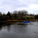
It is important to note a gap in immediate charter availability within the specific dataset provided for the town center. The closest listed operator, Captain Mike Smith Fishing Adventures, is based out of Niantic, CT, over 23 miles away across the sound. Anglers looking to hire a boat should physically visit the local docks in Montauk Harbor to find unlisted local skippers or rely on the shore access points if a pre-booked charter is not secured.

Permits, Regulations & Fees

Fishing in Montauk falls under the jurisdiction of the State Fishing Agency (New York State DEC). Saltwater registries are generally required, and enforcement is active, particularly regarding size limits on striped bass. The area is also surrounded by sensitive federal lands that have specific rules to protect migratory species and dune structures.

Amagansett National Wildlife Refuge, located about 10 miles west, protects a rare double dune system. Anglers accessing the water here must respect the fragile vegetation; walking on the dunes is strictly prohibited to prevent erosion. Similarly, the Elizabeth Alexandra Morton National Wildlife Refuge, roughly 21 miles away, features the "Jessup’s Neck" peninsula. This area provides three miles of undeveloped shoreline, but the bluffs are steep and heavily eroded. Accessing the water here requires caution and adherence to designated paths.

πŸ’‘ Captain's Tip: Bluff Safety

When fishing near Morton Refuge or the Montauk bluffs, stay clear of the cliff edges. The soil is sandy and unstable, with drops approaching 50 feet. Always access the beach through designated low-lying trails.

Cultural respect is also paramount. Many access points border private lands or historically significant areas. The rule of thumb in Montauk is to leave no trace. Carry out all trash, especially fishing line, which poses a severe threat to the bird populations protected in the nearby refuges.

Events & Seasonal Information

The rhythm of Montauk is dictated by the migration. The fall run is the headline event, usually peaking from September through November. During this time, the waters around the point boil with activity as baitfish are pushed against the shoreline. This is when the parking lots at Shadmoor and Montauk Point reach capacity before sunrise.

Birding and fishing often intersect here. The Block Island National Wildlife Refuge, located 12 miles offshore (accessible only by boat or ferry), is a critical stopover for migratory songbirds in the fall. For the boat angler, the presence of these birds often signals the location of bait schools. If you are making the run to Block Island, be aware that the crossing can be treacherous in a stiff wind, but the payoff is often solitude and pristine fishing grounds.

Spring and summer offer a different pace. The beaches at refuges like Elizabeth A. Morton are utilized by piping plovers and terns for nesting. During these months, sections of the beach may be closed to foot traffic and off-road vehicles to protect the hatchlings. Always check the local bulletin boards at the access points for temporary closures.

Contact Information & Resources

For official information regarding access and current conditions on federal lands, contact the managing offices directly. The Amagansett National Wildlife Refuge can be reached at 631-286-0485. For inquiries regarding the Elizabeth Alexandra Morton National Wildlife Refuge, call 631-725-7598. If you are planning a trip offshore to the Block Island National Wildlife Refuge, the contact number is (401) 364-9124.

Safety is your personal responsibility. Cell reception can be spotty near the bluffs and offshore. Ensure you have a VHF radio if boating and leave a float plan with someone on land. The Atlantic Ocean at Montauk is unforgiving; always check the marine forecast before committing to a trip.

For precise locations of the boat ramps, specific parking lots, and real-time weather conditions, consult the live dashboard and interactive maps below.

🎣

Montauk

Montauk β€’ New York β€’ 41.0359, -71.9545
πŸ…ΏοΈ

Parking

5
Park And Ride
⭐ 5.0 23.0 mi
πŸ“ 745 N Rd, Groton, CT 06340, USA
πŸ•’
Monday: Open 24 hours
Tuesday: Open 24 hours
Wednesday: Open 24 hours
Thursday: Open 24 hours
Friday: Open 24 hours
Saturday: Open 24 hours
Sunday: Open 24 hours
πŸš— Get Directions
Montauk County Park, RV Beach Parking
⭐ 5.0 3.1 mi
πŸ“ Montauk, NY 11954, USA
πŸš— Get Directions
Parking Lot
⭐ 4.8 2.8 mi
πŸ“ County Rd 77, Montauk, NY 11954, USA
πŸš— Get Directions
🐟

Bait & Tackle

4
Greenie Supply & Tackle
⭐ 5.0 23.5 mi
πŸ“ 300 Old Main Rd, Southold, NY 11971, USA
πŸ•’
Monday: Open 24 hours
Tuesday: Open 24 hours
Wednesday: Open 24 hours
Thursday: Open 24 hours
Friday: Open 24 hours
Saturday: Open 24 hours
Sunday: Open 24 hours
πŸš— Get Directions
Westlake Bait & Tackle Shop
⭐ 5.0 2.3 mi
πŸ“ 352 W Lake Dr, Montauk, NY 11954, USA
πŸ•’
Monday: 5:00β€―AM – 7:00β€―PM
Tuesday: 5:00β€―AM – 7:00β€―PM
Wednesday: 5:00β€―AM – 7:00β€―PM
Thursday: 5:00β€―AM – 7:00β€―PM
Friday: 5:00β€―AM – 7:00β€―PM
Saturday: 5:00β€―AM – 7:00β€―PM
Sunday: 5:00β€―AM – 7:00β€―PM
πŸš— Get Directions
Weekapaug Bait and Tackle
⭐ 4.9 22.6 mi
πŸ“ 664 Atlantic Ave, Westerly, RI 02891, USA
πŸ•’
Monday: 8:00β€―AM – 4:00β€―PM
Tuesday: 8:00β€―AM – 4:00β€―PM
Wednesday: 8:00β€―AM – 4:00β€―PM
Thursday: 8:00β€―AM – 4:00β€―PM
Friday: 8:00β€―AM – 4:00β€―PM
Saturday: 8:00β€―AM – 4:00β€―PM
Sunday: 8:00β€―AM – 4:00β€―PM
πŸš— Get Directions
🚀

Fishing Charters

1
Captain Mike Smith Fishing Adventures
⭐ 5.0 23.3 mi
πŸ“ 133 Main St Slip #118, Niantic, CT 06357, USA
πŸ•’
Monday: 8:00β€―AM – 8:00β€―PM
Tuesday: 8:00β€―AM – 8:00β€―PM
Wednesday: 8:00β€―AM – 8:00β€―PM
Thursday: 8:00β€―AM – 8:00β€―PM
Friday: 8:00β€―AM – 8:00β€―PM
Saturday: 8:00β€―AM – 2:00β€―PM
Sunday: 8:00β€―AM – 8:00β€―PM
πŸš— Get Directions
🏠

Lodging

5
Camp Hero Picnic Area
⭐ 5.0 4.6 mi
πŸ“ 347F+2P, Camp Hero State Pk, Montauk, NY 11954, USA
πŸš— Get Directions
iCAMP Hamptons - STEAM Summer Camp
⭐ 5.0 19.0 mi
πŸ“ 2685 Montauk Hwy, Bridgehampton, NY 11932, USA
πŸ•’
Monday: 8:00β€―AM – 5:00β€―PM
Tuesday: 8:00β€―AM – 5:00β€―PM
Wednesday: 8:00β€―AM – 5:00β€―PM
Thursday: 8:00β€―AM – 5:00β€―PM
Friday: 8:00β€―AM – 5:00β€―PM
Saturday: Closed
Sunday: Closed
πŸš— Get Directions
Hither Hills State Park Campground
⭐ 4.7 3.5 mi
πŸ“ Hither Hills State Park Campsite, 170 Old Montauk Hwy, Montauk, NY 11954, USA
πŸš— Get Directions
βš“

Boat Ramps

3
🚻

Restrooms

3
πŸ‘¨β€πŸ‘©β€πŸ‘§β€πŸ‘¦

Family Friendly

2
β™Ώ

Accessibility

β™Ώ

Wheelchair Access

Not Confirmed

πŸ•

Pets Allowed

Not Confirmed

⚠️ Some accessibility info not officially confirmed. Please verify with location directly.

πŸ“ Showing 23 facilities on map
🎣
Book a Fishing Charter near Montauk Fishing Report Today 🎣

Local guides & charters. Verified captains, instant booking, best price guaranteed.

See Available Trips β†’

πŸ“Š

About Our Fishing Reports & Forecasts

Our spot reports combine data-driven forecasts with curated local information. The forecast is generated by our proprietary Fishing Score algorithm (0–100%), which analyzes real-time data from Open-Meteo API, validated against NOAA CO-OPS tide gauges and USGS water-monitoring stations. The model weights tide dynamics (35%), wave energy (25%), wind patterns (20%) and time of day (20%)β€”factors shown to influence fish feeding behavior through marine-biology research and decades of charter log data.

Access, facilities and services information for each fishing spot is sourced from official datasets such as Recreation.gov (RIDB), state park & wildlife agencies, and geospatial providers like Google Maps. These sections undergo scheduled re-validation every 3–6 months to ensure that boat ramps, park access, contact details and local services remain accurate.

Narrative sections (catches, seasonal behavior, local tips) are synthesized from these data sources and refined following the Fishing Reports Today editorial guidelines, combining bibliographic research from ichthyology and oceanography with expert angler experience. Our team reviews reports on a regular basis, while the forecast model itself updates every 6 hours for real-time accuracy.

⚠️ Important: Always verify current local regulations, access restrictions and weather conditions before fishing. These reports are intended as a planning aid, not a guarantee of catches or safety. When in doubt, contact local authorities or park managers listed on the page.

Learn more about our methodology & data sources β†’

Leave a Reply

Your email address will not be published. Required fields are marked *