


Welcome to the ancient spine of the state. The Frostproof region sits along the Lake Wales Ridge, offering seasoned anglers a unique blend of prehistoric sandhill topography and highly productive freshwater habitats. This is not your typical manicured coastal marina setup. Instead, expect a rugged, authentic central Florida environment where dark, tannin-stained waters hold serious trophy potential.
The overarching vibe here is quiet and utilitarian, tailored for the serious freshwater sportsman rather than the casual tourist. Wheelchair-accessible shorelines provide inclusive access for families and shore-bound casters, but the primary draw remains the deep-water structures and vegetation lines accessible by boat. The surrounding landscape is a stark contrast of arid, ancient scrubland bleeding into rich, aquatic ecosystems.
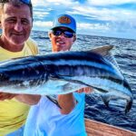
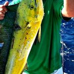
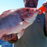
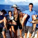
Expert skippers and dawn-patrol warriors come here with specific targets in mind. Based on the specialized local fleets and guides operating in the sector, the primary pursuits are heavyweight largemouth bass, slab crappie, and aggressive panfish. Navigating this fishery requires an understanding of both the pristine local ecosystems and the somewhat limited ramp infrastructure.
Access & Getting There
Navigating to the Frostproof fishing grounds requires traversing central Florida's arterial routes, primarily Highway 60 and US-17. Traffic is generally manageable before dawn, but seasoned captains know to watch for heavy agricultural transport vehicles during the early morning hours. Your primary insertion points are the Lakeshore Boat Launch located roughly 7.2 miles from the central zone, alongside two other local ramps.
The boat launch realities here dictate a highly self-reliant approach. While these ramps offer dedicated trailer parking and sufficient draft for standard bass boats, they are strictly bare-bones operations. You will not find manicured docks, fuel pumps, or dockhands waiting to catch your lines. Trailer maneuvering requires skill, especially when the water levels fluctuate during the dry season.
Weather plays a pivotal role in how you approach these access points. Central Florida is notorious for shifting winds that can turn an open lake into a choppy mess within minutes. During heavy morning blows, position your vessel carefully upon approach, as the ramps lack protective breakwaters. Always secure your gear before backing down the incline.
Parking your rig requires strategic planning if the main ramp lots fill up. While the ramps have trailer spaces, overflow options like Diler Martin are a distant 12.7 miles away. If you are staging a multi-day tournament run and need secure, 24-hour overnight parking for massive rigs, the Amtrak station lot is 23.7 miles out.
💡 Captain's Tip: Ramp Readiness
Since the local boat ramps completely lack artificial lighting, launching before sunrise requires high-lumen headlamps and a well-rehearsed backing routine. Stage your tackle and prep your boat at the hotel before hitting the ramp to avoid bottlenecking the launch.
Florida Pre-Trip Checklist
Facilities & Amenities
The local infrastructure caters heavily to the dawn patrol crowd, provided you know where to look. Shiners Unlimited and Bridgemaster Fishing Products are the undisputed go-to hubs for live bait and tackle. Both establishments open their doors at 6:00 AM, allowing you to load up on premium shiners long before the morning bite peaks.
If you need heavy-duty gear or specialized equipment later in the day, Great Outdoors Shops LLC opens at 8:00 AM. For those looking to learn the local waters, the fleet caliber is defined by operators like Corky & Tangie's Bass, Crappie and PanFishing Tours. They run around-the-clock operations and hold a stellar reputation for putting clients on trophy panfish.
Negative knowledge is critical for a smooth trip to Frostproof. Be explicitly aware that the local boat ramps have absolutely zero amenities. There are no public restrooms, no shower facilities, and most importantly, no fish cleaning stations at the launch sites. You must haul your catch back to camp for processing, so pack heavy-duty coolers and plenty of ice.
Lodging logistics are highly favorable for anglers who want to sleep close to the water. The Black Bear Campsite is situated a mere 4768 feet from the prime zones, making it the ultimate staging ground. For a more traditional angler's retreat, Grape Hammock Fish Camp opens early and caters specifically to the boating crowd.
| Facility Name | Category | Distance | Opening Hour |
|---|---|---|---|
| Shiners Unlimited | Bait & Tackle | 8.8 miles | 6:00 AM |
| Bridgemaster Fishing Products | Bait & Tackle | 11.0 miles | 6:00 AM |
| Black Bear Campsite | Lodging | 4768 feet | N/A |
| Grape Hammock Fish Camp | Lodging | 16.1 miles | 6:30 AM |
| Lake Kissimmee State Park | Lodging | 14.0 miles | 8:00 AM |
Permits, Regulations & Fees
Understanding the regulatory and environmental landscape is vital for anyone fishing the Frostproof region. The navigable waters are overseen by the State Fishing Agency, which dictates strict size limits and seasonal closures for bass and crappie. Always consult the latest state rulebook before keeping your catch, as local slot limits frequently shift to protect breeding populations.
Beyond the water, the surrounding land holds immense ecological significance. The Lake Wales Ridge National Wildlife Refuge is a highly sensitive, protected zone established in 1993 to recover endangered plants and endemic invertebrates. This ancient scrub ecosystem is a rare remnant of Florida's prehistoric islands and contains prime examples of imperiled sandhill habitats.
It is absolutely critical to understand that there is no public access to the refuge tracts, which include Carter Creek, Flamingo Villas, Lake McLeod, and Snell Creek. These areas protect extremely rare species like the Florida ziziphus and scrub lupine. Anglers must respect these boundaries and strictly avoid trespassing on refuge shorelines to cast or anchor.
Cultural respect and environmental stewardship go hand in hand here. The high density of imperiled ecosystems means that even minor disturbances from off-road vehicles or careless foot traffic near protected banks can cause irreversible damage. Stay on designated navigable waters and utilize only official shore access points for family fishing.
💡 Captain's Tip: Boundary Awareness
Keep your marine GPS updated with the latest federal land boundaries. The Lake Wales Ridge protected tracts often border navigable waters, and stepping ashore in a restricted zone to untangle a line can result in severe federal penalties. Stay on the water.
Events & Seasonal Information
The rhythms of the Frostproof fishery are dictated by central Florida's distinct seasonal shifts. Winter and early spring trigger the massive largemouth bass spawn, drawing seasoned tournament anglers from across the country. During this time, the shallows come alive, and precision casting around submerged vegetation becomes paramount for landing a trophy.
As the season transitions into the brutal heat of summer, the tactical approach must change entirely. Surface water temperatures skyrocket by midday, pushing the crappie and bass into deeper, cooler thermal refuges. Dawn and dusk become the only viable windows for aggressive topwater action, making early bait shop runs essential.
Weather timing is an essential survival skill during the warmer months. Localized heating predictably spawns violent afternoon thunderstorms that roll across the ridge. Seasoned skippers plan to be off the water or safely tucked into a protected cove by early afternoon to avoid sudden lightning strikes and severe squalls.
Contact Information & Resources
Maintaining self-reliance is the golden rule when operating in this sector. Because the launch sites lack basic facilities and harbor masters, you are entirely responsible for your own safety protocols. Always file a float plan with your lodging host, whether you are staying at Hunnewell's Cottages or camping locally, and ensure your VHF radios are fully charged.
For official inquiries regarding land boundaries and protected species, the Lake Wales Ridge National Wildlife Refuge management can be reached via their Titusville mailing address or by phone. General fishing regulations, bag limits, and licensing requirements should be verified directly through the State Fishing Agency portals prior to launching your vessel.
Prepare your vessel, double-check your safety gear, and ensure your live wells are operational before leaving the pavement. For precise locations and real-time conditions, consult the live dashboard and maps below.
Leave a Reply