Brevard County Fishing Report: Space Coast Summer Action
GO/NO-GO STATUS
Verdict: GO — WITH CAUTION FOR HEAT AND WEATHER
The Space Coast has officially transitioned into its full-blown summer pattern, making this a highly productive but demanding time to be on the water. Water temperatures in the Indian River Lagoon and nearshore Atlantic have rapidly climbed into the mid-to-upper 80s, while inland freshwater lakes are pushing 90 degrees by midday. The primary environmental factors to navigate right now are the relentless heat and the predictable cycle of afternoon thunderstorms. Anglers must plan to be off the open water by early afternoon to avoid dangerous lightning strikes and severe squalls that develop over the mainland.
Additionally, coastal anglers should note that heavy sargassum seaweed is currently pushing onto the beaches and into the inlets. This influx makes surf fishing extremely frustrating, as lines become fouled within minutes. To maximize your success and comfort, shift your primary focus to the sheltered inshore lagoons and inland freshwater reservoirs, where the action remains red hot and the waters are free of pelagic weed.
From the editor
Tired of fishing with strangers you can’t trust?
Nautrek is the first social network for serious anglers — verified partners, real trips, cost splitting and intel sharing without burning your spots. Private beta now open.
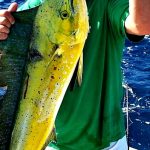
The inshore spotlight is firmly on Redfish (Red Drum) patrolling the Indian River and Banana River lagoons, alongside Florida-strain Largemouth Bass dominating the freshwater scene at Fellsmere Reservoir (Headwaters Lake). Both species are feeding with immense aggression during the low-light hours to fuel up before the midday heat suppresses their metabolism.
Sleeper Pick
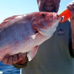
Mangrove Snapper. Often overlooked by anglers chasing glory fish like Tarpon or Snook, Mangrove Snapper are currently stacking up in impressive numbers around the Sebastian Inlet jetties, bridge pilings, and nearshore reefs. They offer aggressive strikes, fight brilliantly on light tackle, and provide some of the best table fare available on the Space Coast.
Baitfish Report
The local forage base is highly active and densely concentrated. Offshore and near the beaches, massive schools of pogies (Atlantic menhaden) are getting pushed to the surface by predatory fish like King Mackerel and Tarpon. Inside the lagoon systems, finger mullet and glass minnows are holding tight to the mangrove shorelines and spoil islands. In the freshwater sector, bluegill and threadfin shad are the primary targets for large predatory bass, dictating lure color selection.
TACTICAL STRATEGY
Inshore: Indian River Lagoon & Sebastian Inlet
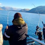
The inshore saltwater bite requires stealth, early starts, and precise casting. With the water warming rapidly, gamefish are utilizing deeper edges adjacent to their shallow feeding grounds.
Where: Focus your efforts on the eastern mangrove shorelines near Melbourne Beach and the spoil islands just north of Sebastian Inlet. Target the 3-to-5-foot drop-offs that run adjacent to the shallow grass flats. Predatory fish use these ledges to ambush bait being flushed out by the falling tide.
Lure: A 3-inch paddle tail swimbait rigged on a 1/8-ounce weedless tungsten jig head is producing consistent strikes. If the floating lagoon grass is thick, switch to a weedless soft plastic jerkbait rigged on a wide-gap hook.
Color: In the slightly stained waters of the lagoon, Electric Chicken (a vibrant pink and chartreuse blend) or a classic pearl white are perfectly mimicking the local mullet and topminnows.
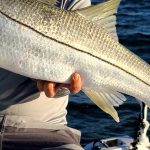
Bait: For live bait purists, free-lining live pigfish or select-sized shrimp pitched tight into the mangrove roots will entice wary Redfish and Snook that refuse artificial presentations.
Timing: This is strictly an early game. You want your vessel launched and lines in the water at first light. The optimal bite window closes rapidly by 10:00 AM as the sun gets high and water temperatures peak.
Pro Tip: When fishing the mangrove shorelines, skip your paddle tail or live bait as far back under the overhanging branches as possible. During the summer months, Redfish and Snook will tuck themselves deep into the shade to escape the intense sun and ambush passing forage.
Freshwater: Headwaters Lake (Fellsmere Reservoir)
Headwaters Lake remains a world-class bass fishery, but the summer heat dictates a mandatory shift in tactics from the shallow flats to deeper structural features.
Where: Abandon the ultra-shallow flats by mid-morning and focus your sonar on the deep pits, submerged canals, and the edges of thick hydrilla trenches. Bass are moving into these deeper, cooler zones to regulate their body temperature and ambush bait.
Lure: Start the morning with an 80mm or 110mm Whopper Plopper for explosive topwater action along the vegetation lines. As the sun rises, transition to a 1/2-ounce bladed jig (Chatterbait) or a 6-inch jointed swimbait worked slowly along the deep grass edges.
Color: Gizzard shad patterns are highly effective for swimbaits. For bladed jigs and soft plastics, stick to Green Pumpkin Magic or Gooseberry to mimic the local bluegill population.
Bait: Wild golden shiners are the ultimate ticket for trophy bass. Free-line large shiners near the deep drop-offs and hydrilla edges, allowing them to swim naturally into the strike zone.
Timing: The topwater bite is frantic from dawn until about 8:30 AM. Afterward, you must slow down your presentation significantly and drag baits through the deeper holes.
Pro Tip: When fishing deep hydrilla edges with soft plastics, utilize a stop-and-go retrieve. Pull the bait a few inches to create a subtle vibration, then let it sit completely still on a slack line. Summer bass are often lethargic and will strike out of reaction during the pause.
REGULATIONS SNAPSHOT
Florida's Space Coast has strictly enforced regulations to protect its world-class fisheries. Always verify with the Florida Fish and Wildlife Conservation Commission (FWC) before harvesting, but here is your current seasonal baseline:
Species
Size Limit
Bag Limit
Season & Special Rules
Common Snook
28" to 32" Slot
1 per angler
CLOSED for summer (Catch & Release only)
Redfish
N/A
0 (Catch & Release)
Catch & Release ONLY in the Indian River Lagoon region
Largemouth Bass (Headwaters)
N/A
0 (Catch & Release)
Catch & Release ONLY; Circle hooks mandatory for natural bait over 3 inches
Mangrove Snapper
10" Minimum
5 per harvester
Open year-round; excellent summer target
REGIONAL ALTERNATIVE
If the coastal winds make the Indian River Lagoon unmanageable, or if the Sebastian Inlet is choked with summer sargassum weed, head inland to the legendary Stick Marsh / Farm 13. Located just adjacent to Headwaters Lake, this historic fishery offers a brilliant backup plan that is heavily shielded from coastal gusts.
Launch your vessel at the Fellsmere Grade Road boat ramp. Stick Marsh is famous for its dense, submerged timber and deep irrigation canals. Because it is highly protected from coastal winds, it remains fishable even when the beaches are blown out. Target Black Crappie by drifting live Missouri minnows over the deeper open-water pits, or hunt for Florida Largemouth Bass by dragging Texas-rigged 10-inch plastic worms in Junebug or Red Shad directly through the submerged wood.
Pro Tip: Navigation in Stick Marsh requires extreme caution. The lake is essentially a flooded forest, and submerged stumps sit just inches below the surface. Keep your outboard trimmed up, idle through unmarked areas, and rely heavily on your trolling motor once you leave the main channels to avoid lower unit damage.
Tight lines!
Editor's Choice: Must-Have Gear
FISHINGSIR Next-Gen Waterproof Chest Waders
★★★★★4.4 (7,370+ reviews)
2-Ply Tech: Upgraded nylon with 2.5x higher density than standard fabrics.
100% Waterproof: Lab-approved intrusion resistance with taped visible seams.
Ultra-Lightweight: Designed for all-day comfort while hunting or fishing.
As an Amazon Associate I earn from qualifying purchases. #ad
Loading forecast...
Live Fishing Conditions: Tides, Weather & Waves
Get real‑time tides, marine weather, swell and solunar activity for each spot so you know exactly when conditions line up for your best chance at a bite.
🎣
Brevard County
Loading coordinates...
🌤️
WEATHER CONDITIONS
--°F
--°C
Loading...
🌡️
Feels Like--°F--°C
💧
Humidity--%
💨
Wind-- mph-- km/h
🧭
Direction--
📊
Pressure-- inHg-- hPa
☀️
UV Index--
🌊
MARINE CONDITIONS
🌊Wave Height
-- ft
-- m
Loading...
🧭Wave Direction
--°
Loading...
⏱️Wave Period
-- s
Loading...
📈Tide Status
-- ft
-- m
Loading...
🌙
LUNAR & SOLUNAR
🌕
Loading...
Illumination: --%
Major Period--:-- - --:----:-- - --:--
Minor Period--:-- - --:----:-- - --:--
🌅Sunrise--:--
🌇Sunset--:--
📅
24-HOUR FORECAST
Loading fishing conditions...
Fishing Spots Map
🎣
Book a Fishing Charter near Brevard County Fishing Report Today 🎣
Local guides & charters. Verified captains, instant booking, best price guaranteed.
There was an error loading the map. Please try refreshing the page.
Info
Local Access & Facilities
The waters of Brevard County offer a diverse and technical fishery that demands respect from even the most seasoned saltwater anglers. situated along the famous Space Coast, this region is defined by the complex estuarine systems of the Indian River Lagoon and the nearshore Atlantic waters off Rockledge and Merritt Island. The vibe here shifts rapidly from the industrial energy of the causeways to the silent, mangrove-lined flats that hold trophy inshore game.For the expert angler, this area presents a unique set of logistical challenges and opportunities. While the casual weekend warrior might stick to the causeway bridges, the serious captain knows that success here depends on understanding the specific access points and the distinct rhythms of the lagoon. Whether you are poling a skiff for redfish or launching a center console for an offshore run, understanding the local infrastructure is as critical as your tide chart.
💡 Captain's Tip: Dawn Patrol Logistics
The wind on the open lagoon can become unmanageable by mid-morning. Plan your launch to be on the water well before sunrise. Utilize 24-hour shops like Sea & Tech Outfitters to secure bait the night before so you aren't waiting in line when the bite is hot.
Access & Getting There
Navigating to the prime fishing grounds in Brevard County generally involves utilizing the major arteries of Highway 50 or the Merritt Island Causeway. Traffic in this region can be deceptive; while the roads are wide, the congestion around Port Canaveral due to cruise ship schedules can create significant delays. If you are towing a trailer, avoid the port area during mid-morning turnover times on weekends.The boat launch situation requires a strategic approach. The data indicates multiple launch points within a few miles of Rockledge, but conditions vary. Many ramps in this area are heavily used by recreational boaters and jet skis. For a serious fishing expedition, aim to launch at the outlying ramps to avoid the "zoo" atmosphere of the main harbor points. Be aware that during strong trade winds, the windward side of the lagoon can make retrieving a boat difficult due to chop at the ramp.Parking is a critical consideration here. The area is heavily serviced by cruise parking lots, such as Park N Cruise and Lots of Honor, which are distinct from trailer parking. Do not assume all large lots welcome boat trailers. Secure your vehicle at designated ramp parking areas. If you are shore fishing, access points near Rockledge offer family-friendly entry, but always check local signage regarding overnight parking to avoid towing.
Brevard County Pre-Trip Checklist
Facilities & Amenities
The infrastructure in Brevard County is robust, catering to both the heavy-tackle offshore crowd and the technical inshore fly fisherman. Unlike remote fisheries where supplies are scarce, the challenge here is selecting the right provider for your specific needs. The local shops are specialized, and knowing which one to hit can save you valuable fishing time.For live bait and tackle, Sea & Tech Outfitters Florida LLC in Melbourne is a standout resource for the serious captain because it operates 24 hours a day. This is invaluable for alpine starts or late-night snook missions. Closer to the coast, Cocoa Beach Bait & Tackle Rentals and the Cocoa Beach Fishing Center provide reliable service and local intelligence on what is running in the surf and nearshore waters.
Facility Name
Type
Key Feature
Distance
Sea & Tech Outfitters
Bait & Tackle
Open 24 Hours
13.7 miles
Florida Fly Co. Charters
Guide Service
Technical Inshore/Fly
11.7 miles
Fired Up Fishing Charters
Charter
Offshore/Nearshore
11.6 miles
Wickham Park
Lodging/Camp
Trailer Friendly
7.8 miles
Accommodations in the area are plentiful, but for the traveling angler with a boat, Wickham Park offers a strategic advantage. Located roughly 8 miles from the core fishing spots, it provides camping facilities that can accommodate trailers, unlike many of the beachside hotels. For those seeking a more resort-style stay, Outdoor Resorts in Melbourne Beach is an option, though it is a further drive (approx. 19 miles) from the central Rockledge launch zones.
💡 Captain's Tip: Fuel Management
While there are marinas in the region, seasoned skippers often fuel up at highway stations before hitting the ramp. Marina fuel docks can have irregular hours or long queues on weekends. Plan your fuel stops along Highway 50 or near Merritt Island before you hitch up.
Permits, Regulations & Fees
Navigating the regulatory landscape here is essential, particularly regarding protected lands. The most critical piece of "negative knowledge" for this area concerns the St. Johns National Wildlife Refuge. Located west of Titusville, this area was established to protect the now-extinct dusky seaside sparrow and currently protects the black rail and wood stork.St. Johns NWR is strictly managed by the staff from Merritt Island NWR. Unlike other refuges that may offer seasonal hunting or fishing, St. Johns NWR has no public access. There are no boat ramps, no hiking trails, and no visitor centers within its boundaries. Do not attempt to enter or launch from this area; it is a dedicated conservation zone for sensitive nesting habitat.Fishing regulations for the accessible waters are managed by the State Fishing Agency. Anglers must possess a valid saltwater fishing license. Be mindful of specific slot limits for Red Drum and Snook, which are strictly enforced in this high-pressure fishery. If you are utilizing the shore access points, respect private property lines. Much of the waterfront is residential, and maintaining good relationships with locals ensures these access points remain open.
Events & Seasonal Information
The fishing calendar in Brevard County is dictated by water temperature and wind patterns. The region supports year-round fishing, but the tactics shift dramatically. Summer brings calm mornings ideal for topwater action, followed by predictable and violent afternoon thunderstorms. Winter brings cold fronts that push fish into the deeper residential canals and dredged holes near the causeways.Charter availability often reflects the seasonal runs. Operators like Reaper Fishing Charters and Captain Micah Fishing Charters run extensive hours, with some listing 24-hour availability, indicating a strong night-fishing culture likely targeting Snook around dock lights or bridge pilings.
💡 Captain's Tip: The Weekend War
This is a popular boating destination. If you are targeting popular spots near the Merritt Island Causeway, the water turns into a washing machine of boat wakes by 10:00 AM on Saturdays. Focus your technical fishing on weekdays or strictly at dawn/dusk.
Contact Information & Resources
For official inquiries regarding conservation zones, specifically the nearby refuges, contact the St. Johns National Wildlife Refuge management office at 321-861-0667. They are the authority on boundary lines and protected species in the marshlands west of Titusville.Safety on these waters is paramount. The Indian River Lagoon is shallow and unforgiving to lower units; run aground here, and you may be waiting hours for the tide to turn. Ensure you have a reliable tow boat contact saved in your phone. For emergencies, standard 911 protocols apply, but local marine patrol maintains a heavy presence due to the proximity of the Port.For precise locations, real-time wind conditions, and detailed ramp maps, consult the live dashboard and interactive widgets below.
Our spot reports combine data-driven forecasts with curated local information. The forecast is generated by our proprietary Fishing Score algorithm (0–100%), which analyzes real-time data from Open-Meteo API, validated against NOAA CO-OPS tide gauges and USGS water-monitoring stations. The model weights tide dynamics (35%), wave energy (25%), wind patterns (20%) and time of day (20%)—factors shown to influence fish feeding behavior through marine-biology research and decades of charter log data.
Access, facilities and services information for each fishing spot is sourced from official datasets such as Recreation.gov (RIDB), state park & wildlife agencies, and geospatial providers like Google Maps. These sections undergo scheduled re-validation every 3–6 months to ensure that boat ramps, park access, contact details and local services remain accurate.
Narrative sections (catches, seasonal behavior, local tips) are synthesized from these data sources and refined following the Fishing Reports Today editorial guidelines, combining bibliographic research from ichthyology and oceanography with expert angler experience. Our team reviews reports on a regular basis, while the forecast model itself updates every 6 hours for real-time accuracy.
⚠️ Important: Always verify current local regulations, access restrictions and weather conditions before fishing. These reports are intended as a planning aid, not a guarantee of catches or safety. When in doubt, contact local authorities or park managers listed on the page.
To provide the best experiences, we use technologies like cookies to store and/or access device information. Consenting to these technologies will allow us to process data such as browsing behavior or unique IDs on this site. Not consenting or withdrawing consent, may adversely affect certain features and functions.
Functional Always active
The technical storage or access is strictly necessary for the legitimate purpose of enabling the use of a specific service explicitly requested by the subscriber or user, or for the sole purpose of carrying out the transmission of a communication over an electronic communications network.
Preferences
The technical storage or access is necessary for the legitimate purpose of storing preferences that are not requested by the subscriber or user.
Statistics
The technical storage or access that is used exclusively for statistical purposes.The technical storage or access that is used exclusively for anonymous statistical purposes. Without a subpoena, voluntary compliance on the part of your Internet Service Provider, or additional records from a third party, information stored or retrieved for this purpose alone cannot usually be used to identify you.
Marketing & Affiliates
The technical storage or access is required to create user profiles to send advertising, or to track the user on a website or across several websites for similar marketing purposes, including affiliate tracking for products recommended in our reports.


Leave a Reply