0%

Florida Fishing Report Today 🎣

4 months ago · Updated 1 week ago

florida fishing Report Today

Central Florida Winter Fishing Report

Central Florida Freshwater Report: Winter Patterns & Verified Catches

Region: Polk County / Peace River Basin (Frostproof, Lake Wales, Zolfo Springs)
Report Status: GO (With Cold Front Caution)
Biological Data Source: Verified Citizen Science Observations (Dec 19 - Jan 18)

As we settle into mid-January, Central Florida's freshwater fishery is dictated almost entirely by cold fronts. The biological data confirms that despite cooler water temperatures, resident species like Florida Gar and invasive Blue Tilapia are active in shallow, sun-exposed areas. While the "Bass Capital" reputation holds true, this week's verified intel points to excellent opportunities for multi-species anglers willing to target what is currently biting best.

1. GO/NO-GO STATUS

Verdict: GO - Target stable weather windows.

Seasonal Advisory: January in Polk County means water temperatures in the low-to-mid 60s. Fish metabolism slows down, making them sluggish during early mornings. The bite will turn on significantly from 11:00 AM to 3:00 PM as the sun warms the shallows.
Safety Note: If wading the Peace River or banking at Circle B Bar, be hyper-aware of alligator activity. Gators bask on banks in winter to thermoregulate, making them more visible but also more concentrated on the shoreline.


2. SPECIES INTEL (Verified Bio-Data)

Primary Target: Florida Gar

  • Status: Active / Verified
  • Recent Catch: Zolfo Springs (Peace River), Jan 15.
  • Why Now: While gamefish get lockjaw during cold snaps, Gar are air-breathers that often hold high in the water column to absorb solar heat. They are abundant, aggressive, and offer exciting fights on light tackle when other species shut down.

Sleeper Pick: Blue Tilapia

  • Status: High Activity / Invasive
  • Recent Catch: Bok Tower Gardens Area / Lake Hancock.
  • Why Now: These invasives are temperature sensitive. In winter, they stack up tightly near any warm water source or shallow, dark-bottomed bays that retain heat. They are currently visible in schools, making them prime targets for sight-fishing.

Baitfish & Forage Report

Wild Shiners & Minnows: The primary forage right now. Bass and Crappie are gorging on baitfish schools moving toward creek mouths or deeper vegetation lines. If you aren't using live shiners, your artificials must mimic a 3-4 inch struggling baitfish.


3. TACTICAL STRATEGY

Scenario A: River Monster Hunting (Peace River @ Zolfo Springs)

The Setup: The Peace River is currently low, concentrating fish in deeper pools.
Target: Florida Gar & Channel Catfish.
Tactics:

  • Where: Launch at the Zolfo Springs boat ramp or fish the bank. Look for eddies behind bridge pilings or fallen timber where current breaks.
  • Rigging: Use a float rig. Set a bobber 2-3 feet deep with a #1/0 circle hook.
  • Bait: Cut bait is king. Use a chunk of mullet, chicken liver, or a cut bluegill head. The scent is crucial in muddy winter water.
  • Pro Tip: Gar have bony mouths. When your float goes down, wait 10 seconds before setting the hook to let them swallow the bait, or use a fraying nylon rope lure (no hook) that tangles in their teeth.

Scenario B: Invasive Control (Lake Hancock / Circle B Bar Reserve)

The Setup: Shallow, nutrient-rich water that warms up fast.
Target: Blue Tilapia.
Tactics:

  • Where: Focus on the Alligator Alley trail pier or shoreline clearings. Look for "bowls" or depressions in the sand/mud (spawning beds).
  • Lure/Bait: Tilapia are vegetarians/omnivores. A dough ball or small piece of bread pinched on a #8 hook is deadly. For artificials, use a 1/16oz beetle spin in white/chartreuse moved very slowly through bedding areas.
  • Timing: Mid-day sun (High Noon) makes these fish visible for sight casting.

Scenario C: Trophy Bass (Regional Standard)

The Setup: Pre-spawn staging.
Target: Largemouth Bass.
Tactics:

  • Where: Lake Kissimmee or Walk-in-Water. Focus on the outside edges of Kissimmee Grass lines in 4-6 feet of water.
  • Lure: 1/2oz Lipless Crankbait (Red or Gold) ripped through the grass. The reaction strike triggers lethargic fish. Alternatively, a slow-rolled Chatterbait with a swimbait trailer.

4. REGULATIONS SNAPSHOT

SpeciesBag LimitSize LimitNotes
Florida GarNo LimitNoneLicense required. (Do not confuse with Alligator Gar - 1 per day/tag required).
Blue TilapiaUnlimitedNoneConditional Species: Cannot be transported alive. Catch & keep or immediate release only.
Largemouth Bass5 per dayNoneOnly one fish over 16" allowed per angler.
Crappie (Specks)25 per dayNoneGreat eating size right now.

5. REGIONAL ALTERNATIVE

If the Peace River is blown out or too low:
Head to Lake Kissimmee State Park (approx. 30 mins east of Zolfo Springs).
Why: It offers bank access to the canal and lake frontage which stays fishable even when river levels fluctuate.
Target: Speckled Perch (Crappie) drifting minnows under slip-floats near the canal locks/docks.

Tight lines!

Loading forecast...

Live Fishing Conditions: Tides, Weather & Waves

Get real‑time tides, marine weather, swell and solunar activity for each spot so you know exactly when conditions line up for your best chance at a bite.

🎣

Florida

Loading coordinates...

🌤️

WEATHER CONDITIONS

Weather
-- °F
--°C

Loading...

🌡️
Feels Like --°F --°C
💧
Humidity --%
💨
Wind -- mph -- km/h
🧭
Direction --
📊
Pressure -- inHg -- hPa
☀️
UV Index --
🌊

MARINE CONDITIONS

🌊 Wave Height
-- ft
-- m
Loading...
🧭 Wave Direction
--°
Loading...
⏱️ Wave Period
-- s
Loading...
📈 Tide Status
-- ft
-- m
Loading...
🌙

LUNAR & SOLUNAR

🌕

Loading...

Illumination: --%

Major Period --:-- - --:-- --:-- - --:--
Minor Period --:-- - --:-- --:-- - --:--
🌅 Sunrise --:--
🌇 Sunset --:--
📅

24-HOUR FORECAST

Loading fishing conditions...

Fishing Spots Map

My location
Loading map...

Local Access & Facilities

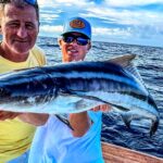
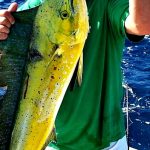
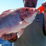
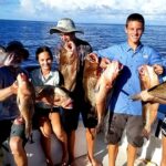
The Indian River Lagoon surrounding Melbourne, Florida, represents one of the most biologically diverse estuarine systems in the Northern Hemisphere. For the serious angler, this isn't just a body of water; it is a complex, 156-mile labyrinth of brackish water where the temperate zone meets the subtropics. The fishery here is defined by its interconnectivity—a massive highway for marine life transitioning between the Atlantic Ocean and the sheltered flats. Unlike the deep-drop fisheries found further offshore, the focus here is on the intricate margins: the mangrove shorelines, the seagrass beds, and the historic spoil islands that dot the waterway.

The atmosphere is a unique collision of urban accessibility and profound, federally protected wilderness. To the west, the city of Melbourne provides modern infrastructure, while just miles away, the Pelican Island National Wildlife Refuge stands as a testament to American conservation history. This area demands a technical approach; the water is often shallow, the bottom composition varies from soft mud to hard sand, and the presence of protected species like the Florida manatee and Green sea turtle requires constant vigilance at the helm. It is a fishery that rewards the naturalist as much as the tactician, where understanding the migration patterns of birds and baitfish is as critical as gear selection.

💡 Captain's Tip: Tides and Topography

The Indian River Lagoon is not a typical tidal estuary; it is wind-driven as much as it is lunar. When the trade winds kick up, water levels can stack on the leeward shorelines. Local skippers know that a strong north wind can drain the flats, making areas that were navigable in the morning impassable by noon. Always cross-reference your tide charts with the wind forecast.

Access & Getting There

Reaching the prime fishing grounds in Melbourne requires navigating the I-95 corridor, which serves as the primary artery for the region. For anglers trailering vessels from the north or south, Exit 180 (US-192) provides the most direct route to the Melbourne Causeway area. Traffic on I-95 is generally fluid, but congestion spikes significantly during the morning rush (7:00 AM – 9:00 AM) and evening commute. Once you exit onto US-192, you are essentially driving a straight shot east toward the lagoon and the barrier island. The transition from highway speeds to local surface streets happens quickly, so heavy haulers should prepare for sudden stops near the Melbourne Square Mall area.

For those targeting the southern reaches near the refuges, Exit 156 (Fellsmere/Sebastian) connects to County Road 512. This route is more rural and scenic, leading you toward the Sebastian Inlet zone. A critical logistical note for captains looking to launch near the historic Pelican Island: access here is unique. The refuge features the "Jungle Trail," a historic sandy road that runs along the lagoon. While scenic, it can be washboard-rough. If you are towing a skiff with a lighter trailer, take this road slowly to avoid suspension damage. The primary public boat launch points are situated near the causeways, with immediate access available at the 1900 S Harbor City Blvd area, which places you directly in the mix of the Melbourne harbor activity.

Parking for trailers is a strategic consideration in Melbourne. The lot at 1900 S Harbor City Blvd is centrally located and rated highly for accessibility, sitting just over a quarter-mile from the water. However, like many urban launches, it lacks infinite capacity. During peak tarpon runs or holiday weekends, this lot can reach capacity before sunrise. There are secondary parking options listed in the data, such as Lots of Honor on Sea Ray Drive, but these are significantly further (over 20 miles) and likely serve the Port Canaveral area rather than the Melbourne lagoon fishery. Stick to the immediate harbor lots for efficiency. If you are shore fishing or launching a kayak, the designated parking areas along Jungle Trail offer proximity to the quiet backwaters, but be advised that security here is passive; leave valuables at home.

💡 Captain's Tip: The Jungle Trail Launch

When accessing the southern lagoon via Jungle Trail, be aware that heavy rains can turn the hard-packed sand into slick mud. 4WD is recommended for trailering in this sector during the wet season (June through September). Also, there are no wash-down facilities on this rustic stretch—plan to flush your engine immediately upon returning to civilization.

Florida Pre-Trip Checklist

Facilities & Amenities

The infrastructure in Melbourne caters to a mix of recreational boaters and hardcore anglers. However, the distribution of high-quality amenities is not uniform. You will not find a "one-stop-shop" mega-marina on every corner; instead, the area relies on specialized independent businesses. For bait and tackle, the standout option for the early riser is Saltwater Cowboy Bait & Tackle in Melbourne Beach. Crucially, they open their doors at 5:00 AM daily. This is the only shop in the immediate vicinity that accommodates the true "dawn patrol" angler. If you need live shrimp or specialized terminal tackle before the sun breaks the horizon, this is your only reliable waypoint.

In contrast, other facilities operate on a more relaxed tourist schedule. Cocoa Beach Bait & Tackle and the Cocoa Beach Fishing Center are excellent outfitters with high ratings, but they are located nearly 20 miles north and open later (9:00 AM and 6:00 AM, respectively). Relying on them for a Melbourne launch will cost you an hour of drive time. Similarly, Buck Tail Bait & Tackle serves the southern sector in Grant-Valkaria (10.9 miles away) and opens at 6:00 AM. Plan your logistics accordingly: if you are launching in Melbourne at 5:30 AM, buy your non-perishable gear the day before or drive to Saltwater Cowboy.

Regarding accommodations, the angler's choice depends heavily on the vessel situation. Outdoor Resorts in Melbourne Beach offers a resort-style experience very close to the water (4.2 miles), ideal for those who want comfort after a long day on the skiff. For those preferring a more rugged or budget-friendly base camp, Wickham Park provides camping facilities roughly 7 miles from the harbor. This is a massive municipal park with ranger oversight, making it a secure place to park a rig overnight. Note that there are no fuel docks directly associated with the NWR access points; you must fuel up at roadside stations along US-1 or A1A before hitching the boat. The lack of on-water fuel in the refuge zones is a critical "negative knowledge" point—running dry in the shallows of the lagoon is a long, hot drift.

Facility NameTypeDistance & LocationOpening Time
Saltwater Cowboy Bait & TackleBait & Tackle11.3 mi (Melbourne Beach)05:00 AM
Salt & Savagery Adventure ChartersCharter4.5 mi (Melbourne Beach)24 Hours
Buck Tail Bait & TackleBait & Tackle10.9 mi (Grant-Valkaria)06:00 AM
Wickham ParkLodging/Camp7.0 mi (Melbourne)Ranger Hours

Permits, Regulations & Fees

Fishing the Indian River Lagoon places you in the middle of a delicate and heavily regulated ecosystem. The overarching management comes from the State Fishing Agency, and a standard Florida saltwater fishing license is mandatory for all anglers aboard. However, the complexity increases when you enter the boundaries of the local National Wildlife Refuges. Both Archie Carr National Wildlife Refuge and Pelican Island National Wildlife Refuge enforce strict conservation measures. These are not merely administrative boundaries; they are vital biological zones.

Pelican Island holds the distinction of being the nation's first National Wildlife Refuge, established by President Theodore Roosevelt in 1903. The specific 3-acre island known as "Pelican Island Proper" is closed to public access to prevent erosion and disturbance to nesting birds. The surrounding waters are open to boating and fishing, but strict "no-wake" and "pole-and-troll" zones are common. The area is also a candidate Marine Protected Area. You must respect the buffers around bird rookeries. If you flush birds off a roost, you are too close and likely in violation of federal harassment laws.

The Archie Carr National Wildlife Refuge, stretching 20.5 miles along the coast, is globally significant for sea turtles. It hosts 20-35% of all Loggerhead and Green Sea Turtle nests in the United States. During nesting season (typically May through October), restrictions on beach lighting and shoreline access are aggressively enforced. Culturally, this area was first inhabited by the Ais people for thousands of years. The concept of "Kapu" (sacred restrictions) applies to the respect required for these lands. Do not disturb middens or historical artifacts found along the shorelines. Additionally, the lagoon is a sanctuary for the Florida Manatee. Federal laws mandate severe penalties for harassing or striking a manatee; polarized sunglasses are essential gear for spotting these slow-moving mammals in the tannic water.

💡 Captain's Tip: Manatee Zones

Manatee zones are strictly enforced by radar and patrol vessels in this sector. "Idle Speed" means fully settled off plane, no wake. Ignorance of the zone boundaries is not a valid defense. Watch for the posted white and orange waterway markers, especially near the Melbourne Causeway and refuge entrances.

Events & Seasonal Information

The fishing calendar in Melbourne is dictated by biological migrations and weather patterns. The spring and fall months trigger massive bird migrations through the Atlantic Flyway, utilizing Pelican Island as a refueling stop. For the angler, this influx of avian life often signals the movement of bait schools (mullet and menhaden) which in turn fire up the predatory fish. The visual cues of diving birds are your best fish-finders during these transition seasons.

Summer brings the sea turtle nesting season to the Archie Carr beaches. While this primarily affects surf fishing and beach access at night, it brings a heightened law enforcement presence to the water and shoreline. During the summer months, the heat on the lagoon can be oppressive. The most productive window is the "dawn patrol" from 5:30 AM to 9:00 AM, before the sun drives fish into the deep mangrove shadows and the trade winds chop up the open basins. Winter fishing is viable but dependent on cold fronts; after a front passes, the water clears, and sight-fishing on the flats becomes world-class, provided you can handle the stiff north winds.

Contact Information & Resources

For official information regarding access status, closures, and permits, direct contact with the managing agencies is recommended. The Pelican Island National Wildlife Refuge can be reached at 772-581-5557 or via email at pelicanisland@fws.gov. Their physical address for the visitor center is on Wildlife Way in Vero Beach. For inquiries specific to the sea turtle nesting grounds, the Archie Carr National Wildlife Refuge office is available at 772-562-3909.

Safety on the water is the skipper's responsibility. In an emergency, standard marine VHF channels should be monitored, but cellular coverage is generally reliable throughout the Melbourne harbor area. Always file a float plan, especially when venturing into the remote backwaters of the refuges where boat traffic is thin.

For precise locations of the boat ramps, real-time wind conditions, and detailed proximity of the tackle shops mentioned above, consult the live dashboard and interactive maps below.

🎣

Florida

Melbourne • Florida • 28.0799, -80.5998
🅿️

Parking

5
Royal Garage Door Service LLC.
⭐ 5.0 24.6 mi
📍 3442 Tipperary Dr, Merritt Island, FL 32953, USA
🕒
Monday: 8:00 AM – 9:30 PM
Tuesday: 8:00 AM – 9:00 PM
Wednesday: 8:00 AM – 9:00 PM
Thursday: 8:00 AM – 9:00 PM
Friday: 8:00 AM – 9:00 PM
Saturday: 8:00 AM – 6:30 PM
Sunday: 8:00 AM – 6:30 PM
🚗 Get Directions
Lots of Honor
⭐ 5.0 22.9 mi
📍 1680 Sea Ray Dr, Merritt Island, FL 32952, USA
🕒
Monday: 7:00 AM – 1:00 PM
Tuesday: 7:00 AM – 1:00 PM
Wednesday: 7:00 AM – 1:00 PM
Thursday: 7:00 AM – 1:00 PM
Friday: 7:00 AM – 1:00 PM
Saturday: 7:00 AM – 1:00 PM
Sunday: 7:00 AM – 1:00 PM
🚗 Get Directions
1900 S Harbor City Blvd Parking
⭐ 5.0 0.3 mi
📍 1900S S Harbor City Blvd, Melbourne, FL 32901, USA
🚗 Get Directions
Bob's Bicycle Shop
⭐ 4.9 4.1 mi
📍 510 E Eau Gallie Blvd, Indian Harbour Beach, FL 32937, USA
🕒
Monday: 10:00 AM – 6:00 PM
Tuesday: 10:00 AM – 6:00 PM
Wednesday: 10:00 AM – 6:00 PM
Thursday: 10:00 AM – 6:00 PM
Friday: 10:00 AM – 6:00 PM
Saturday: 10:00 AM – 5:00 PM
Sunday: Closed
🚗 Get Directions
Park N Cruise | Port Canaveral Cruise Parking
⭐ 4.8 22.9 mi
📍 1700 Sea Ray Dr, Merritt Island, FL 32953, USA
🕒
Monday: 7:00 AM – 2:00 PM
Tuesday: Closed
Wednesday: 7:00 AM – 2:00 PM
Thursday: 7:00 AM – 2:00 PM
Friday: 7:00 AM – 2:00 PM
Saturday: 7:00 AM – 2:00 PM
Sunday: 7:00 AM – 2:00 PM
🚗 Get Directions
🐟

Bait & Tackle

5
Saltwater Cowboy Bait & Tackle
⭐ 5.0 11.3 mi
📍 6680 S Hwy A1A, Melbourne Beach, FL 32951, USA
🕒
Monday: 5:00 AM – 6:00 PM
Tuesday: 5:00 AM – 6:00 PM
Wednesday: 5:00 AM – 6:00 PM
Thursday: 5:00 AM – 6:00 PM
Friday: 5:00 AM – 6:00 PM
Saturday: 5:00 AM – 7:00 PM
Sunday: 5:00 AM – 7:00 PM
🚗 Get Directions
Cocoa Beach Fishing Center
⭐ 4.9 20.4 mi
📍 6300 N Atlantic Ave, Cape Canaveral, FL 32920, USA
🕒
Monday: 6:00 AM – 6:00 PM
Tuesday: 6:00 AM – 6:00 PM
Wednesday: 6:00 AM – 6:00 PM
Thursday: 6:00 AM – 6:00 PM
Friday: 6:00 AM – 6:00 PM
Saturday: 6:00 AM – 6:00 PM
Sunday: 6:00 AM – 4:00 PM
🚗 Get Directions
Cocoa Beach Bait & Tackle Rentals
⭐ 4.9 19.6 mi
📍 1872 E Merritt Island Cswy, Merritt Island, FL 32952, USA
🕒
Monday: 9:00 AM – 5:00 PM
Tuesday: Closed
Wednesday: 9:00 AM – 5:00 PM
Thursday: 9:00 AM – 5:00 PM
Friday: 9:00 AM – 5:00 PM
Saturday: 9:00 AM – 5:00 PM
Sunday: 9:00 AM – 5:00 PM
🚗 Get Directions
Buck Tail Bait & Tackle
⭐ 4.8 10.9 mi
📍 5120 U.S. Rte 1, Grant-Valkaria, FL 32949, USA
🕒
Monday: 6:00 AM – 5:00 PM
Tuesday: 6:00 AM – 5:00 PM
Wednesday: 6:00 AM – 5:00 PM
Thursday: 6:00 AM – 5:00 PM
Friday: 6:00 AM – 6:00 PM
Saturday: 6:00 AM – 6:00 PM
Sunday: 6:00 AM – 2:00 PM
🚗 Get Directions
Stick Marsh Bait & Tackle Shop
⭐ 4.7 21.6 mi
📍 9 S Mulberry St, Fellsmere, FL 32948, USA
🕒
Monday: 5:30 AM – 5:30 PM
Tuesday: 5:30 AM – 5:30 PM
Wednesday: 5:30 AM – 5:30 PM
Thursday: 5:30 AM – 5:30 PM
Friday: 5:30 AM – 5:30 PM
Saturday: 6:00 AM – 4:00 PM
Sunday: 6:00 AM – 3:00 PM
🚗 Get Directions
🚤

Fishing Charters

5
Fired Up Fishing Charters
⭐ 5.0 22.7 mi
📍 726 Scallop Dr, Cape Canaveral, FL 32920, USA
🕒
Monday: 7:00 AM – 8:45 PM
Tuesday: 7:00 AM – 8:45 PM
Wednesday: 7:00 AM – 8:45 PM
Thursday: 7:00 AM – 8:45 PM
Friday: 7:00 AM – 8:45 PM
Saturday: 7:00 AM – 8:45 PM
Sunday: 7:00 AM – 8:45 PM
🚗 Get Directions
Salt & Savagery Adventure Charters
⭐ 5.0 4.5 mi
📍 345 Richards Rd, Melbourne Beach, FL 32951, USA
🕒
Monday: Open 24 hours
Tuesday: Open 24 hours
Wednesday: Open 24 hours
Thursday: Open 24 hours
Friday: Open 24 hours
Saturday: Open 24 hours
Sunday: Open 24 hours
🚗 Get Directions
Kraken Down Charters
⭐ 5.0 20.4 mi
📍 806 Indian River Dr, Sebastian, FL 32958, USA
🕒
Monday: Open 24 hours
Tuesday: Open 24 hours
Wednesday: Open 24 hours
Thursday: Open 24 hours
Friday: Open 24 hours
Saturday: Open 24 hours
Sunday: Open 24 hours
🚗 Get Directions
Southern Mayhem Fishing Charters LLC
⭐ 5.0 16.5 mi
📍 1101 Minutemen Causeway, Cocoa Beach, FL 32931, USA
🕒
Monday: 7:00 AM – 7:00 PM
Tuesday: 7:00 AM – 7:00 PM
Wednesday: 7:00 AM – 7:00 PM
Thursday: 7:00 AM – 7:00 PM
Friday: 7:00 AM – 7:00 PM
Saturday: 7:00 AM – 7:00 PM
Sunday: 7:00 AM – 7:00 PM
🚗 Get Directions
Sebastian River & Inlet Fishing Charters
⭐ 5.0 20.3 mi
📍 717 Coolidge St, Sebastian, FL 32958, USA
🕒
Monday: 8:00 AM – 8:00 PM
Tuesday: 8:00 AM – 8:00 PM
Wednesday: 8:00 AM – 8:00 PM
Thursday: 8:00 AM – 8:00 PM
Friday: 8:00 AM – 8:00 PM
Saturday: 8:00 AM – 8:00 PM
Sunday: 8:00 AM – 8:00 PM
🚗 Get Directions
🏠

Lodging

5
Outdoor Resorts, Melbourne Beach
⭐ 4.8 4.2 mi
📍 214 Horizon Ln, Melbourne Beach, FL 32951, USA
🕒
Monday: 11:30 AM – 2:30 PM
Tuesday: 11:30 AM – 2:30 PM
Wednesday: 11:30 AM – 2:30 PM
Thursday: 11:30 AM – 2:30 PM
Friday: 11:30 AM – 2:30 PM
Saturday: 11:30 AM – 2:30 PM
Sunday: Closed
🚗 Get Directions
BC44B
⭐ 4.6 10.7 mi
📍 Grant-Valkaria, FL 32949, USA
🕒
Monday: Open 24 hours
Tuesday: Open 24 hours
Wednesday: Open 24 hours
Thursday: Open 24 hours
Friday: Open 24 hours
Saturday: Open 24 hours
Sunday: Open 24 hours
🚗 Get Directions

Boat Ramps

3
🚻

Restrooms

3
👨‍👩‍👧‍👦

Family Friendly

2

Accessibility

Wheelchair Access

Available

🐕

Pets Allowed

Not Confirmed

⚠️ Some accessibility info not officially confirmed. Please verify with location directly.

📍 Showing 28 facilities on map

📊

About Our Fishing Reports & Forecasts

Our spot reports combine data-driven forecasts with curated local information. The forecast is generated by our proprietary Fishing Score algorithm (0–100%), which analyzes real-time data from Open-Meteo API, validated against NOAA CO-OPS tide gauges and USGS water-monitoring stations. The model weights tide dynamics (35%), wave energy (25%), wind patterns (20%) and time of day (20%)—factors shown to influence fish feeding behavior through marine-biology research and decades of charter log data.

Access, facilities and services information for each fishing spot is sourced from official datasets such as Recreation.gov (RIDB), state park & wildlife agencies, and geospatial providers like Google Maps. These sections undergo scheduled re-validation every 3–6 months to ensure that boat ramps, park access, contact details and local services remain accurate.

Narrative sections (catches, seasonal behavior, local tips) are synthesized from these data sources and refined following the Fishing Reports Today editorial guidelines, combining bibliographic research from ichthyology and oceanography with expert angler experience. Our team reviews reports on a regular basis, while the forecast model itself updates every 6 hours for real-time accuracy.

⚠️ Important: Always verify current local regulations, access restrictions and weather conditions before fishing. These reports are intended as a planning aid, not a guarantee of catches or safety. When in doubt, contact local authorities or park managers listed on the page.

Learn more about our methodology & data sources

Leave a Reply

Your email address will not be published. Required fields are marked *