


The Industrial Coast: Fishing the Illawarra Transition Zone
The Illawarra region represents one of New South Wales' most dynamic fishing frontiers, a place where the dramatic escarpment plunges into the Tasman Sea, creating a unique interface between heavy industry and pristine marine environments. For the serious angler, this area offers a stark contrast to the manicured tourist harbors found further north. Here, you are just as likely to be casting against the backdrop of steelworks infrastructure as you are drifting over ancient reef systems. The topography is defined by the proximity of the continental shelf to the shore, allowing for deep-water access relatively close to land, while the expansive Lake Illawarra system provides a vital nursery for estuarine species.
The vibe in the Illawarra is utilitarian and focused. This is not a place for leisurely yachting; it is a working coast where commercial fleets rub shoulders with hardcore recreational captains. The water here can be deceptive; calm mornings often give way to stiff southerlies that whip up steep chops against the breakwalls. The bottom structure is a mix of sandy flats, artificial reefs formed by industrial runoff points, and jagged natural reef systems that hold substantial populations of bottom dwellers. It is a fishery that rewards technical knowledge and the ability to adapt to shifting industrial and natural patterns.
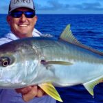
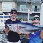
Target species here run the gamut from estuarine staples to pelagic heavyweights. Inside the breakwalls and near the lake entrance, anglers target flathead, bream, and whiting with light tackle. However, the real draw for the expert crowd is the offshore potential. The close proximity of deep water means Kingfish, Snapper, and even Marlin in the summer months are viable targets for trailer boats launching from the local ramps. Understanding the logistical pulse of this region—from the specific opening times of bait shops to the intricacies of the boat ramps—is the difference between a successful haul and a frustrated morning on the tarmac.
Access & Getting There
Accessing the prime fishing grounds of the Illawarra requires navigating a mix of highway traffic and local industrial routes. The primary artery is the Princes Highway, which connects the various coastal suburbs. For anglers towing trailer boats, this route is generally wide and well-maintained, but bottlenecks frequently occur during the morning commute near the Wollongong and Shellharbour interchanges. The drive is scenic, flanked by the escarpment on the west and the ocean on the east, but drivers must remain vigilant for heavy haulage trucks that frequent the industrial zones near Port Kembla.
The boat launch situation in the Illawarra is functional but demands respect. The data indicates several launch points within a 4-mile radius of the central Kembla Grange area. These ramps are the lifeblood of the local fleet. While generally serviceable, veteran skippers know that the surge can be an issue at ramps exposed to the easterly swell. It is critical to inspect the ramp conditions before committing to a launch, especially during lower tides where algae growth on the concrete can make traction treacherous for two-wheel-drive vehicles. The ramps here are working pieces of infrastructure, often busy with commercial traffic, so efficiency on the ramp is not just a courtesy; it is a requirement.
💡 Captain's Tip: Beat the Industrial Shift
Traffic around Port Kembla and the highway interchanges spikes heavily between 6:30 AM and 8:00 AM due to shift changes at the steelworks and local industry. To ensure a smooth run to the ramp, aim to be on the water and parked well before 6:00 AM. This "dawn patrol" strategy not only avoids the gridlock but gets you on the reef before the mid-morning winds kick in.
Parking is a strategic consideration in this region. The Cringila Hills Mountain Bike Park Carpark is located approximately 4.5 miles from the central fishing zone. While highly rated (4.7 stars), it is primarily designed for recreational cyclists. Anglers looking for overflow parking or shore access nearby should be cautious about leaving trailers in non-designated spots. For those looking for shore-based access, the Wollongong Innovation Campus Car Park is roughly 7.5 miles away, offering a paved and secure location, though it is geared more towards commuters than heavy marine rigs.
Weather contingencies are paramount when planning access in this sector. The Illawarra coast is exposed to the full force of the Tasman Sea. When the "Southerly Buster" winds blow, the open ocean ramps become untenable. In these conditions, the savvy captain shifts focus to the more protected waters of Lake Illawarra or seeks out leeward launch points tucked behind the massive breakwalls of the harbor. Always have a "Plan B" launch site in mind, as conditions can deteriorate rapidly, turning a simple retrieval into a dangerous operation.
Illawarra Pre-Trip Checklist
Facilities & Amenities
The infrastructure supporting the Illawarra fishery is robust, catering to a community that fishes hard. The local tackle shops are specialized and well-stocked, reflecting the diverse needs of the region's anglers. Windang Bait & Tackle, located 6.6 miles from the center, is a cornerstone for the local fleet. With a stellar 4.8-star rating, this shop is optimized for the early riser. Their hours are specifically tuned to the angler's rhythm: they open at 6:00 AM on weekdays and, crucially, at 5:00 AM on weekends. This allows captains to grab fresh bait, ice, and terminal tackle before the sun breaches the horizon.
For those requiring a mid-morning resupply or heavy gear upgrades, Fergo's Tackle World Wollongong is the primary hub. Located 6.2 miles away, this shop carries a 4.7-star rating and offers the depth of inventory expected from a major retailer. However, note their operating hours: they open at 9:00 AM and are closed on Sundays. This is critical "negative knowledge" for the weekend warrior—if you break a rod tip on Sunday morning, Fergo's will not be an option, so reliance on Windang Bait & Tackle becomes essential.
💡 Captain's Tip: Sunday Logistics
Fergo's Tackle World is closed on Sundays. If you are planning a weekend trip, ensure you have all your heavy tackle, lures, and spares sorted by Saturday afternoon. For last-minute bait and ice on a Sunday morning, Windang Bait & Tackle is your only dedicated option, opening at 5:00 AM.
The charter fleet in the Illawarra is professional and focuses heavily on reef and game fishing. Shell Cove Fishing Charters (9.8 miles away) and Shellharbour Fishing Charters (6.9 miles away) both boast perfect 5-star ratings, indicating a high level of customer satisfaction and local expertise. These operators generally target Kingfish, Snapper, and seasonal pelagics. Pro Perch Fishing Charters, slightly closer at 7.3 miles, suggests a specialization in estuary or light-tackle reef work, providing an option for those seeking finesse fishing over heavy game dragging.
Accommodation options for the traveling angler vary significantly in distance and style. For those towing boats who prefer a mobile base camp, Campervans Australia is located just 6 miles away in Albion Park Rail. This proximity to the ramps makes it an excellent logistical choice. Conversely, more traditional lodging like the Links House Hotel Bowral is over 21 miles inland—too far for a practical "dawn patrol" launch unless you enjoy a long, dark drive towing a boat down the mountain passes. Surf Camp Australia, situated 21.3 miles south, offers a coastal vibe but is also a significant distance from the primary launch zones of Kembla Grange.
| Facility Name | Type | Distance | Key Logistics |
|---|---|---|---|
| Windang Bait & Tackle | Bait & Tackle | 6.6 miles | Opens 5 AM Sat/Sun; 6 AM Weekdays. Top Rating (4.8). |
| Fergo's Tackle World | Bait & Tackle | 6.2 miles | Opens 9 AM. CLOSED SUNDAYS. |
| Shell Cove Charters | Charter | 9.8 miles | 5-Star Rating. Deep water focus. |
| Pro Perch Charters | Charter | 7.3 miles | 5-Star Rating. Estuary/Light Tackle focus. |
| Campervans Australia | Lodging | 6.0 miles | Nearest accommodation option suitable for trailers. |
Permits, Regulations & Fees
Fishing in the Illawarra falls under the jurisdiction of the NSW State Fishing Agency. Strict adherence to these regulations is not merely a legal obligation but a contribution to the sustainability of this heavily pressured fishery. A recreational fishing fee receipt is required for all anglers in New South Wales waters, unless specifically exempt. These fees contribute directly to the maintenance of the very ramps and artificial reefs that sustain the local sport.
The region is a patchwork of industrial zones and marine protected areas. Anglers must be acutely aware of exclusion zones surrounding the commercial shipping channels of Port Kembla. These are active working ports, and straying into the shipping lane is a federal offense that carries heavy fines. Furthermore, specific sanctuary zones may exist in the broader marine park network; checking the latest zoning map from the State Fishing Agency is mandatory before dropping a line. Ignorance of a sanctuary zone boundary is not a valid defense.
Culturally, the Illawarra has a deep indigenous history, and many coastal headlands and rock platforms are significant to the local Aboriginal people. "Kapu," or a sense of sacred restriction, may apply to certain areas, particularly those with historical middens or rock art. Beyond the legalities, it is expected that visiting anglers treat the land with respect. This means packing out all trash, particularly discarded fishing line which poses a threat to the abundant seabird life on the offshore islands. Access to private property for shore fishing is strictly by permission only; trespassing to reach a "secret spot" jeopardizes access for everyone.
Events & Seasonal Information
The fishing calendar in the Illawarra is dictated by the seasons of the Southern Hemisphere. The summer months (December through February) bring the warm East Australian Current closer to shore, carrying with it the prized pelagic species like Marlin and Mahi Mahi. This is the high season for the charter fleet, and booking well in advance with operators like Shell Cove Fishing Charters is recommended. The boat ramps will be at maximum capacity during these months, particularly on weekends with favorable forecasts.
Winter brings a different rhythm. As the water cools, the focus shifts to the resident Snapper populations on the inshore reefs and the "silver ghosts" (Mulloway) in the estuary systems and off the breakwalls. The winter westerlies can groom the seas close to shore, providing flat, fishable water in the mornings, but the cold can be biting. This is the time for the dedicated local who values solitude over the chaotic summer rush.
💡 Captain's Tip: The Wind Clock
The prevailing pattern here is a calm morning followed by a strengthening Northeast sea breeze in summer or a stiff Southerly in winter. Plan your day to be doing your most exposed, offshore fishing between 5:00 AM and 10:00 AM. By 11:00 AM, the wind often stands the chop up, making the run back to the ramp uncomfortable and wet.
Contact Information & Resources
For all inquiries regarding fishing regulations, licensing, and marine park boundaries, the NSW State Fishing Agency is the primary authority. They provide the definitive word on bag limits, size restrictions, and seasonal closures. For maritime safety, the local Roads and Maritime Services (RMS) oversees boating regulations. In an emergency on the water, the standard contact is via VHF radio on channel 16 or by dialing 000 for immediate police or ambulance assistance. Self-reliance is key; always carry the mandatory safety gear, including EPIRBs and flares, as the Tasman Sea is unforgiving.
For real-time updates on ramp status or specific local bite reports, the staff at Windang Bait & Tackle (Ph: (02) 4244 1456) are an invaluable resource, often having the most current "word on the water." Similarly, Fergo's Tackle World (Ph: (02) 4225 7233) can provide insights on gear requirements for the current season. For precise locations, real-time weather conditions, and detailed interactive maps of the boat ramps and facilities mentioned, consult the live dashboard and widgets below.



Leave a Reply