Jervis Bay Spring Fishing Report & Pro Guide Intel
Welcome to the ultimate angler's briefing for Jervis Bay, New South Wales. As a Senior Fishing Editor and local Pro Guide, I have broken down the current estuarine, inshore, and offshore bites to ensure you maximize your time on the water. Spring is a dynamic transitional period on the South Coast. The shallows are warming, baitfish are schooling tightly, and the pelagic species are beginning their aggressive seasonal movements. Whether you are running offshore to the Banks or hiding from the wind inside the bay, here is the verified intelligence you need to bend a rod.
1. GO/NO-GO STATUS
Verdict: CAUTION - PLAN YOUR ZONES CAREFULLY
Current seasonal conditions dictate a strategic approach. We are experiencing moderate to strong southerly winds with gusts pushing 40 km/h, which is typical for this transitional spring pattern. Barometric pressure is holding steady around 1030 hPa, keeping the bite active, but the wind chop requires respect.
🎣Nautrek
Private Beta
J
M
R
100+ anglers on the waitlist
The fishing network where your reputation matters.
Find trusted captains, join real trips with cost splitting, and build your Angler Rank. Your spots stay private — you decide who sees your intel.
Offshore runs to the continental shelf or the Sir John Young Banks are currently restricted to large, seaworthy vessels with highly experienced skippers. For small craft and kayaks, the open ocean is a strict NO-GO. However, Jervis Bay's massive protected harbor offers excellent refuge. The northern shorelines and protected beaches are highly fishable, making this a "GO" for anglers willing to adapt their tactics and stay inside the heads.
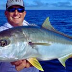
Kingfish (Seriola lalandi) and Snapper (Pagrus auratus) are the undisputed headline acts right now. Snapper are aggressively feeding over the gravel beds and inshore reef structures as they bulk up during the spring transition. Kingfish are actively patrolling the deep-water headlands and prominent points, hunting the dense bait balls pushing into the bay.
While the offshore crowd obsesses over pelagics, the estuarine shallows are waking up. Dusky Flathead (Platycephalus fuscus) are moving into the warming shallows along current lines and drop-offs. Because the spring sun heats the shallow sand flats faster than the deep water, these ambush predators are highly active and largely ignored by the fleet.
Baitfish Report
Forage is abundant. Massive schools of slimy mackerel and yellowtail scad are holding near the entrance of the bay. Inside the bay, Southern Calamari (squid) are thick over the kelp and expansive seagrass beds. Matching your presentation to these three primary forage species is the key to triggering strikes.
3. TACTICAL STRATEGY
Where to Deploy
For Snapper, bypass the featureless sand and focus your efforts on the Middle Ground reef, located mid-way across the entrance to the bay. If the wind allows you to tuck near the cliffs, the deeper reef edges around Longnose Point and Point Perpendicular are holding excellent numbers of fish. For the sleeper Dusky Flathead, head to Currumbene Creek near Huskisson; target the 1.5 to 3-meter drop-offs where the outgoing tide pulls bait off the warming sand flats.
Lure Selection
When targeting Snapper on artificials, use 7 to 14-gram (1/4 to 1/2 oz) jig heads equipped with extra-strong 3/0 hooks. Pair these with 5 to 7-inch jerkshad style soft plastics. For the estuarine Flathead, downsize to a 1/8oz tungsten jig head rigged with a 3-inch paddle tail swim-bait to stay tight to the bottom in the tidal sweep.
Color Theory
Water clarity in Jervis Bay is famously gin-clear right now. Natural presentations are mandatory. Opt for pilchard, blue/silver, or translucent squid patterns for your plastics. If the sky clouds over or you are fishing the deeper 30-meter marks, switch to high-contrast colors like "Nuclear Chicken" or luminescent white to maintain visibility.
Bait & Rigging
Live bait is king for Jervis Bay pelagics. Catch your slimy mackerel or squid early. Rig live squid on a two-hook snell rig using 6/0 to 9/0 non-offset circle hooks, tethered to a 40-60lb fluorocarbon leader. For Snapper, a traditional paternoster rig baited with fresh squid strips or salted slimy mackerel fillets dropped over the gravel beds is producing consistent limits.
Pro Tip:When targeting Snapper with bait, a steady, unbroken trail of berley (chum) is non-negotiable. Deploy a mix of crushed pilchards and tuna oil to draw fish up from the reef structure and into your strike zone.
Timing the Bite
The Kingfish bite is heavily concentrated around the first two hours of daylight. Snapper are feeding best during the low-light twilight periods and precisely on the tide changes when the current slacks, allowing your baits to sit naturally in the strike zone.
Pro Tip:In the clear spring water, shadows are your enemy. Fish the western shorelines in the morning to take advantage of the cliff shadows, extending your low-light bite window by an extra hour.
4. REGULATIONS SNAPSHOT
Compliance is critical, especially in a highly monitored region like this. Here are the current rules for our primary targets:
Yellowtail Kingfish: Minimum legal length is 65cm. The daily bag limit is 5 per angler.
Snapper: Minimum legal length is 30cm. The daily bag limit is 10 per angler.
Dusky Flathead: Minimum legal length is 36cm. The daily bag limit is 10 per angler, but you are only permitted to keep one fish over 70cm to protect the large breeding females.
Critical Advisory: Jervis Bay is a designated Marine Park (JBMP). There are strict sanctuary zones where fishing is entirely prohibited, including areas like Hare Bay and sections around Bowen Island. Ignorance is no excuse; download the FishSmart NSW app to track your GPS location relative to sanctuary boundaries before you cast.
5. REGIONAL ALTERNATIVE
If the southerly winds intensify and Jervis Bay becomes too choppy to fish comfortably or safely, do not pack up your gear. Drive a few minutes south to St Georges Basin.
This massive, landlocked estuary is closed to commercial fishing and operates as a world-class light tackle sport fishery. It is highly protected from ocean swells and heavy winds. Launch at Sanctuary Point or Sussex Inlet and target the extensive weed edges in 2 to 4 meters of water. The Basin is famous for trophy-sized Dusky Flathead and aggressive Bream. Throw small metal blade baits or 2.5-inch grub-style soft plastics, working them with a slow, hopping retrieve across the bottom. It is a fantastic, highly productive backup plan that frequently out-produces the ocean on windy spring days.
Tight lines!
Editor's Choice: Must-Have Gear
FISHINGSIR Next-Gen Waterproof Chest Waders
★★★★★4.4 (7,370+ reviews)
2-Ply Tech: Upgraded nylon with 2.5x higher density than standard fabrics.
100% Waterproof: Lab-approved intrusion resistance with taped visible seams.
Ultra-Lightweight: Designed for all-day comfort while hunting or fishing.
As an Amazon Associate I earn from qualifying purchases. #ad
Loading forecast...
Live Fishing Conditions: Tides, Weather & Waves
Get real‑time tides, marine weather, swell and solunar activity for each spot so you know exactly when conditions line up for your best chance at a bite.
🎣
Jervis Bay
Loading coordinates...
🌤️
WEATHER CONDITIONS
--°F
--°C
Loading...
🌡️
Feels Like--°F--°C
💧
Humidity--%
💨
Wind-- mph-- km/h
🧭
Direction--
📊
Pressure-- inHg-- hPa
☀️
UV Index--
🌊
MARINE CONDITIONS
🌊Wave Height
-- ft
-- m
Loading...
🧭Wave Direction
--°
Loading...
⏱️Wave Period
-- s
Loading...
📈Tide Status
-- ft
-- m
Loading...
🌙
LUNAR & SOLUNAR
🌕
Loading...
Illumination: --%
Major Period--:-- - --:----:-- - --:--
Minor Period--:-- - --:----:-- - --:--
🌅Sunrise--:--
🌇Sunset--:--
📅
24-HOUR FORECAST
Loading fishing conditions...
Fishing Spots Map
My location
Loading map...
Unable to load map
There was an error loading the map. Please try refreshing the page.
Info
Local Access & Facilities
The Jervis Bay Fishery: An Angler’s Overview
Jervis Bay represents one of the premier saltwater playgrounds in New South Wales, offering a unique blend of protected bay waters and immediate access to the high-energy Tasman Sea. For the serious angler, this location is defined by its striking contrasts: deep, clear waters bordered by the white sands of Hyams Beach and the rugged cliffs of Point Perpendicular. The topography here allows for a diverse range of target species, from flathead and snapper on the inshore drifts to marlin and tuna patrolling the continental shelf just offshore. The infrastructure in Vincentia and neighboring Huskisson is well-developed, catering to both trailer boat captains and land-based game fishermen.
The atmosphere in Jervis Bay is distinct from the industrial harbors further north. It retains a village feel despite being a world-class fishery. The waters here are often crystal clear, requiring refined presentations and lighter fluorocarbon leaders, even when targeting larger game. Whether you are launching a center console for a dawn patrol run to the canyons or stalking the flats, the local geography provides fishable water in almost any wind direction, provided you understand the leeward protection offered by the bay's distinct horseshoe shape.
For the traveling angler, the primary logistical hub is the Vincentia and Huskisson corridor. This area houses the critical infrastructure—specialized tackle outfitters, reliable boat ramps, and charter fleets—necessary for a successful campaign. The proximity of the launch ramps to the open ocean is a significant advantage here, allowing crews to maximize lines-in time rather than burning fuel on long transits. The following guide details the on-the-ground realities of accessing and fishing this spectacular Australian coastline.
Access & Getting There
Accessing Jervis Bay generally involves transit via the Princes Highway, the main artery connecting the South Coast. Traffic flow can be heavy during holiday peaks, particularly around Nowra, so seasoned skippers plan their haul to avoid mid-day bottlenecks. Once you turn off the highway toward Vincentia, the roads open up, but caution is required when towing wide beams on the narrower coastal streets. The primary access points for boaters are concentrated around the Huskisson area, which serves as the gateway to the bay.
The boat launch situation in this region is robust but requires specific local knowledge. The data indicates multiple launch facilities, including a primary ramp near Wollamia. This ramp is a favored staging ground for the local charter fleet, including JB Fishing Charters. The Wollamia ramp typically offers better protection from the prevailing winds compared to more exposed sites. When launching here, be mindful of the tidal influence in the creek; low tide can make retrieval tricky for deep-draft vessels. There are also launch points closer to the open bay, approximately 1.2 miles and 2.9 miles from the central Vincentia spot, though exposure to swell can be a factor at these outer ramps.
💡 Captain's Tip: Trailer Logistics
While Currambene St Carpark is centrally located in Huskisson, data indicates it does not offer dedicated trailer parking. For those hauling boats, prioritize the Wollamia ramp area or the Stoney Creek Carpark (7.5 miles away) for secure vehicle staging. Always scout your parking radius before committing to a turn on the tight village streets.
Shore-based anglers have excellent options as well. There are two designated shore access points noted in the local data, located at coordinates roughly 35.07 S and 35.08 S. These spots are suitable for shore fishing and are family-friendly, suggesting safe footing and reasonable proximity to parking. However, the Stoney Creek Carpark is a considerable distance (7.5 miles) from the central fishing grounds, so plan your gear load-out accordingly. You do not want to be hiking miles in waders with heavy surf gear if you can avoid it.
Weather contingencies are critical in Jervis Bay. The bay is large enough to develop a significant chop when the winds oppose the tide. If the forecast calls for stiff winds, the Wollamia launch offers a sheltered creek entry, allowing you to gauge conditions before committing to the open bay. Conversely, the ramps closer to the heads can be surged by ocean swells, making solo launching hazardous. Always check the conditions at the ramp before unstrapping the transom.
Jervis Bay Pre-Trip Checklist
Facilities & Amenities
The logistical backbone of a fishing trip is the quality of local support services. Jervis Bay is serviced by a mix of generalist marine stores and highly specialized tackle shops. For serious game fishermen, JB Lures Australia in Huskisson is a critical waypoint. Located just 2.2 miles from the center of the action on Nowra St, this shop is renowned for marlin lures and heavy-tackle terminal gear. If you are chasing billfish, this is where you get the local intel on skirt colors and rigging techniques. Another key local outfitter is Big Tuna Pty Ltd on Snapper Rd, roughly 3.4 miles away, catering to the broader saltwater market.
For those driving in from the north, McCallum's Tackle World Nowra is a strategic stop. Located on the Princes Highway about 11.9 miles from the spot, it opens at 8:30 AM. This is the place to load up on bulk items, ice, and bait before the final leg of the drive. Note that Tweed Bait is listed as a resource, but it is located in Ulladulla, nearly 25 miles south. Do not rely on this for a last-minute bait run if you are launching in Huskisson; stock up locally or in Nowra.
💡 Captain's Tip: Fuel & Provisions
The marina facilities in Huskisson are excellent, but fuel docks can get busy during the summer run. McCallum's Tackle World in Nowra is your best bet for heavy provisioning before you hit the coast. If you need bait at odd hours, Tweed Bait in Ulladulla is open 24 hours, but it is a 45-minute drive south—only viable if you are transiting through that area.
The charter fleet in Jervis Bay is world-class, reflecting the quality of the fishery. JB Fishing Charters operates out of the Wollamia boat ramp and is a top-tier option for those wanting local expertise on the grounds. Discover Jervis Bay and Tekin III - Spirit of Jervis Bay operate out of Huskisson (Voyager Park area), focusing on getting anglers onto the fish quickly. For those looking to fish further south, Ulladulla Fishing Charters operates out of Fishermens Wharf but is a significant distance (23.8 miles) from the Jervis Bay epicenter.
Accommodation options are plentiful and angler-friendly. Sanddancers Jervis Bay Holiday Accommodation in Vincentia is extremely convenient, located less than a mile from the water, making it perfect for minimizing travel time before dawn. Anchor Bay Motel in Greenwell Point (11.2 miles away) and Holiday Haven Currarong (7.5 miles away) offer alternatives for those who might be fishing the northern shoals or the Shoalhaven River system. Worrowing Jervis Bay offers a more secluded stay about 4 miles inland.
Facility Name
Type
Distance & Location
Notes for Anglers
JB Lures Australia
Tackle Specialist
2.2 mi (Huskisson)
Specialized game fishing gear; Marlin lure experts.
Big Tuna Pty Ltd
Bait & Tackle
3.4 mi (Huskisson)
Local bait and general tackle supplies.
McCallum's Tackle World
Tackle Shop
11.9 mi (South Nowra)
Major outfitter; stop here on the drive in.
Currambene St Carpark
Parking
2.6 mi (Huskisson)
Good for cars; no dedicated trailer parking listed.
Wollamia Boat Ramp
Launch
3.5 mi (Wollamia)
Protected creek launch; base for charter fleet.
Permits, Regulations & Fees
Fishing in New South Wales is a regulated activity managed by the State Fishing Agency. A recreational fishing license is generally required for all anglers, including those fishing from private boats or the shore. The fee structure is typically necessary to support conservation efforts and maintain the high quality of the fishery. While the data indicates that specific fees are "not required" for the listed boat ramps, this often refers to the launch fee itself rather than the fishing license. Always carry a valid NSW recreational fishing fee receipt, as fisheries officers patrol these waters frequently.
Jervis Bay is home to complex marine zoning. It is imperative to understand the boundaries of the Jervis Bay Marine Park. While the provided data notes "No environmental alerts detected," this does not negate the existence of sanctuary zones where fishing is prohibited. These zones are established to protect biodiversity and often include areas around Huskisson and the headlands. Ignorance of these zones is not a valid defense; utilize GPS mapping cards that highlight sanctuary boundaries to avoid heavy fines and gear confiscation.
Cultural respect is also paramount. The area has significant indigenous heritage. Anglers should be respectful of "Kapu" or restricted areas, particularly around headlands or undeveloped shorelines. Accessing shore spots often involves crossing or parking near private property or reserve land. The Currambene St Carpark and Sanctuary Point Carpark are public assets; treating them with respect ensures continued access for the fishing community. Keep noise down during early morning launches to respect local residents.
Events & Seasonal Information
The fishing calendar in Jervis Bay is dictated by the East Australian Current and the seasonal migration of pelagic species. Summer and early autumn are generally the peak times for the bluewater enthusiasts, as warm water pushes marlin, mahi-mahi, and tuna within range of the Huskisson fleet. The presence of specialized shops like JB Lures underscores the importance of the game fishing season here. During these months, the boat ramps at Wollamia can be chaotic before sunrise, so plan for extra time.
Winter brings a different rhythm, with cooler water temperatures activating the inshore species. This is prime time for targeting large snapper over the reefs and squid in the weed beds. The westerly winds common in winter can flatten the seas close to shore, offering excellent conditions for small boat anglers. However, these same winds can make the return trip wet and cold if you venture too far wide. The Holiday Haven Currarong accommodation is popular during these cooler months for anglers targeting the northern reefs.
💡 Captain's Tip: The Dawn Patrol
Local charters like Discover Jervis Bay often operate on strict schedules. If you are fishing privately, try to beat the commercial fleet to the bait grounds. The wind in this region often picks up by mid-morning (10:00 AM), so the most productive fishing usually happens in that first window of light.
Contact Information & Resources
Safety is the primary responsibility of every skipper. The Jervis Bay area is patrolled, but self-reliance is key. For immediate emergencies, standard emergency numbers apply. For on-water assistance or local inquiries, the charter operators can often provide radio checks or advice on conditions. JB Fishing Charters can be reached at 0414 757 822, and they are a valuable resource for understanding the current bite. Discover Jervis Bay is available at 0410 418 216.
For tackle and bait inquiries, JB Lures Australia can be contacted at 0422 429 385. If you are staying in Nowra, McCallum's Tackle World is reachable at (02) 4421 2418. Always monitor the local weather channels and log your trip with a shore contact before heading past the heads. The ocean here is unforgiving, and conditions can change rapidly.
For precise locations of the boat ramps, detailed parking maps, and real-time weather conditions, consult the live dashboard and interactive maps below.
Our spot reports combine data-driven forecasts with curated local information. The forecast is generated by our proprietary Fishing Score algorithm (0–100%), which analyzes real-time data from Open-Meteo API, validated against NOAA CO-OPS tide gauges and USGS water-monitoring stations. The model weights tide dynamics (35%), wave energy (25%), wind patterns (20%) and time of day (20%)—factors shown to influence fish feeding behavior through marine-biology research and decades of charter log data.
Access, facilities and services information for each fishing spot is sourced from official datasets such as Recreation.gov (RIDB), state park & wildlife agencies, and geospatial providers like Google Maps. These sections undergo scheduled re-validation every 3–6 months to ensure that boat ramps, park access, contact details and local services remain accurate.
Narrative sections (catches, seasonal behavior, local tips) are synthesized from these data sources and refined following the Fishing Reports Today editorial guidelines, combining bibliographic research from ichthyology and oceanography with expert angler experience. Our team reviews reports on a regular basis, while the forecast model itself updates every 6 hours for real-time accuracy.
⚠️ Important: Always verify current local regulations, access restrictions and weather conditions before fishing. These reports are intended as a planning aid, not a guarantee of catches or safety. When in doubt, contact local authorities or park managers listed on the page.
To provide the best experiences, we use technologies like cookies to store and/or access device information. Consenting to these technologies will allow us to process data such as browsing behavior or unique IDs on this site. Not consenting or withdrawing consent, may adversely affect certain features and functions.
Functional Always active
The technical storage or access is strictly necessary for the legitimate purpose of enabling the use of a specific service explicitly requested by the subscriber or user, or for the sole purpose of carrying out the transmission of a communication over an electronic communications network.
Preferences
The technical storage or access is necessary for the legitimate purpose of storing preferences that are not requested by the subscriber or user.
Statistics
The technical storage or access that is used exclusively for statistical purposes.The technical storage or access that is used exclusively for anonymous statistical purposes. Without a subpoena, voluntary compliance on the part of your Internet Service Provider, or additional records from a third party, information stored or retrieved for this purpose alone cannot usually be used to identify you.
Marketing
The technical storage or access is required to create user profiles to send advertising, or to track the user on a website or across several websites for similar marketing purposes.



Leave a Reply