0%

Central Coast Fishing Report Today 🎣

11 months ago · Updated 2 weeks ago

Central Coast Estuary and Offshore Angling Assessment

Welcome to the ultimate guide for navigating the winter waters of the Central Coast, New South Wales. As a professional guide operating across these diverse waterways—from the shallow weed beds of Tuggerah Lakes to the deep, tidal flows of Brisbane Water—I have compiled this comprehensive tactical report to ensure your next outing is highly productive. During these cooler months, understanding tidal movements, water clarity, and species-specific winter habits is the key to turning a quiet session into a memorable one.

1. GO/NO-GO STATUS

Verdict: GO - WITH CAUTION FOR OFFSHORE

The current seasonal conditions provide excellent opportunities within the estuaries, making it a definitive "GO" for enclosed waters. The cooler water temperatures have cleared up the systems significantly, pushing predatory fish to hunt more aggressively during low-light periods. However, coastal rock platforms and offshore reefs require vigilance. Winter ground swells can be deceptive and highly dangerous along the headlands near Terrigal and Avoca. If you are venturing outside the heads, monitor the swell period closely and ensure your vessel is equipped for sudden southerly wind changes.

🎣 Nautrek
Private Beta
J
M
R
100+ anglers on the waitlist

The fishing network where your reputation matters.

Find trusted captains, join real trips with cost splitting, and build your Angler Rank. Your spots stay private — you decide who sees your intel.

✓ Verified anglers ✓ Real trips ✓ Spot privacy
Join the Waitlist — Free →

No spam. First 500 get founder perks.

Nautrek App

Pro Tip: When the offshore swell exceeds 1.5 meters with a southerly wind, abandon the rock platforms and focus your efforts on the sheltered bays of Brisbane Water, where the surrounding hills provide excellent windbreaks.

2. SPECIES INTEL

Primary Target: Yellowfin and Black Bream

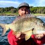
The cooler months trigger the annual bream spawning run, concentrating large numbers of mature fish around the estuary mouths and deeper channels. These fish are actively feeding to sustain their energy, making them highly susceptible to well-presented baits and lures. They are currently the most reliable target across the Central Coast.

Sleeper Pick: Luderick (Blackfish)

Often overlooked by lure-centric anglers, the humble Luderick provides world-class sport fishing during the winter. They congregate in massive schools around rocky outcrops, bridge pylons, and breakwalls. Pound for pound, they offer an exceptional fight on light float gear and are currently holding in excellent numbers.

Baitfish Report

The estuaries are currently holding dense pockets of hardyheads (glassies) and winter whiting. You will also find that the remnant prawn populations have retreated to deeper, warmer holes. Matching your lure profile to a small, translucent baitfish or a fleeing prawn will yield the best strike rates.

3. TACTICAL STRATEGY

Where to Deploy

For Bream, focus your attention on the deeper channels of The Entrance and the pylons surrounding the Rip Bridge in Brisbane Water. Do not waste time in the ultra-shallow flats right now; instead, target the 10 to 15-foot drop-offs where the sand meets the ribbon weed. For Luderick, the rock walls at the mouth of Brisbane Water and the Ocean Baths at The Entrance are prime holding zones.

Lure Selection

When targeting Bream on the drop-offs, utilize a 2.5-inch curl tail grub rigged on a 1/16oz or 1/12oz jig head with a size 2 hook. Alternatively, a small 35mm to 40mm sinking blade or vibration bait is incredibly effective when hopped slowly along the channel floor.

Color Patterns

Because the winter water is gin-clear, natural and translucent colors are mandatory. Opt for "Motor Oil" or "Bloodworm" plastics, which have a UV reactive quality that excels in clear water. For hardbodies and blades, silver, clear ghost, and natural prawn finishes are outperforming darker silhouettes.

Bait and Rigging

If you prefer soaking a bait, fresh Hawkesbury River prawns or live yabbies (nippers) are the top tier for Bream and Flathead. Rig these on a running sinker rig using a long, 6lb fluorocarbon leader to outsmart line-shy fish. For the Luderick, fresh green cabbage weed or string weed suspended under a perfectly weighted stem float is the only way to go. Ensure your bait is drifting naturally just inches above the structure.

Timing the Bite

Tide is everything. The Bream bite is peaking during the last two hours of the run-out tide, as bait is forced off the shallow weed beds into the deeper channels. Conversely, target Luderick during the top of the tide—the last hour of the run-in and the first hour of the run-out—when the water flow slows down enough to allow your float to drift naturally along the rock faces.

Pro Tip: In crystal clear winter water, downsize your leader. Dropping from an 8lb to a 4lb fluorocarbon leader can increase your strike rate by tenfold when targeting pressured Bream around bridge pylons.

4. REGULATIONS SNAPSHOT

Compliance with local fisheries regulations is essential for the sustainability of our waterways. Below is a quick reference guide for our current primary targets under New South Wales Department of Primary Industries regulations:

SpeciesMinimum Legal LengthDaily Bag Limit
Bream (Black/Yellowfin)25 cm10 (in total)
Luderick27 cm10
Tailor30 cm10
Mulloway (Jewfish)70 cm1

Note: Always ensure you carry a valid NSW Recreational Fishing Fee receipt (fishing license) when fishing these waters.

5. REGIONAL ALTERNATIVE

Lake Macquarie Backup Plan

If the coastal estuaries of the Central Coast are blown out by heavy southerly winds or excessive rain runoff, make the short drive north to Lake Macquarie. Being a much larger and deeper body of water, it handles adverse weather exceptionally well. Focus your efforts on the western shorelines around Wangi Wangi or Belmont, which offer protection from southerly blows.

Target the deep water drop-offs (20 to 30 feet) using heavy soft plastics (1/4oz to 3/8oz jig heads) or soft vibes for winter Flathead and schooling Tailor. The key here is to find the bait balls on your sounder and drop your lures directly through the schools. It is a highly reliable fallback location that frequently produces trophy-sized fish when other systems shut down.

Tight lines!

Editor's Choice: Must-Have Gear

FISHINGSIR Next-Gen Waterproof Chest Waders

★★★★★ 4.4 (7,370+ reviews)
  • 2-Ply Tech: Upgraded nylon with 2.5x higher density than standard fabrics.
  • 100% Waterproof: Lab-approved intrusion resistance with taped visible seams.
  • Ultra-Lightweight: Designed for all-day comfort while hunting or fishing.
Check Availability on Amazon

✓ Amazon's Choice | 100+ bought last month

🛒 Tactical Gear for this Spot

Bandit Walleye Deep

Mandatory for reaching deep schools in 35-50ft mud flats.

Check Price on Amazon #ad

As an Amazon Associate I earn from qualifying purchases. #ad

Loading forecast...

Live Fishing Conditions: Tides, Weather & Waves

Get real‑time tides, marine weather, swell and solunar activity for each spot so you know exactly when conditions line up for your best chance at a bite.

🎣

Central Coast

Loading coordinates...

🌤️

WEATHER CONDITIONS

Weather
-- °F
--°C

Loading...

🌡️
Feels Like --°F --°C
💧
Humidity --%
💨
Wind -- mph -- km/h
🧭
Direction --
📊
Pressure -- inHg -- hPa
☀️
UV Index --
🌊

MARINE CONDITIONS

🌊 Wave Height
-- ft
-- m
Loading...
🧭 Wave Direction
--°
Loading...
⏱️ Wave Period
-- s
Loading...
📈 Tide Status
-- ft
-- m
Loading...
🌙

LUNAR & SOLUNAR

🌕

Loading...

Illumination: --%

Major Period --:-- - --:-- --:-- - --:--
Minor Period --:-- - --:-- --:-- - --:--
🌅 Sunrise --:--
🌇 Sunset --:--
📅

24-HOUR FORECAST

Loading fishing conditions...

Fishing Spots Map


My location
Loading map...

Local Access & Facilities

The Central Coast of New South Wales represents a dynamic intersection of estuarine complexity and nearshore potential, offering a diverse playground for the serious angler. Situated between the bustling metropolis of Sydney and the industrial hub of Newcastle, this region—specifically around the Palm Grove and Gosford corridor—provides a strategic staging ground for accessing the expansive Brisbane Water and the Hawkesbury River systems. The topography here shifts dramatically from the dense, gum-tree lined ridges of the hinterland to the intricate waterways that carve through the sandstone geology, creating a fishery that demands versatility from its captains. Whether you are targeting bream in the structure-laden creeks or heading out for coastal pelagics, the local atmosphere is one of deceptive tranquility that masks a highly active marine ecosystem.

For the traveling angler or the seasoned local looking to refine their logistics, the area around Palm Grove serves as a central hub, though it requires a tactical approach to navigation and timing. The vibe here is distinctly Australian coastal—laid back but serious about its water sports. Unlike the manicured, concrete-heavy harbors of major cities, the access points here often blend seamlessly with the natural bushland, requiring a heightened level of awareness regarding tides and trailer management. The primary game here is often dictated by the estuarine flows, where the tidal exchange between the ocean and the expansive interior lakes drives the feeding windows.

Understanding the logistical layout is paramount for a successful expedition in this region. The distance between your accommodation in the hinterland and the salt water requires careful planning, particularly regarding bait acquisition and boat launching. This is not a "walk to the dock" fishery; it is a destination that favors the mobile angler equipped with a reliable vehicle and a well-maintained trailer. The following guide breaks down the essential infrastructure, from the most reliable boat ramps to the tackle shops that open early enough to support a true dawn patrol.

Access & Getting There

Navigating to the prime fishing grounds from Palm Grove involves traversing a mix of arterial roads and local thoroughfares that can be deceptive in their travel times. The primary access corridor often involves utilizing the Pacific Highway or the M1, depending on your approach direction. While the distance to the water may seem short on a map, the winding nature of the coastal roads means you should budget extra time, particularly during the morning rush or weekend holiday traffic. Experienced skippers know that the "short cut" through the back roads can often lead to delays when towing a wide-beam vessel, so sticking to the main haulage routes toward Gosford is generally the prudent choice.

The centerpiece of the boating logistics in this zone is the Gosford City Park Dane Drv Boat Ramp. Located approximately 8.4 miles from the central reference point, this facility is the primary launch candidate for accessing the broader waterway. The ramp is situated along Dane Drive, offering direct access to the northern reaches of Brisbane Water. While the ramp is paved and features trailer parking, captains should be acutely aware of the specific amenities—or lack thereof. Data indicates that while parking is available, the site does not feature on-site restrooms, showers, or fish cleaning stations. This means all boat preparation and biological waste management must be handled off-site or with onboard systems. You must arrive fully self-contained.

💡 Captain's Tip: Ramp Readiness

Since the Gosford City Park ramp lacks wash-down and cleaning facilities, seasoned pros bring a 5-gallon jerry can of freshwater to rinse trailer brakes immediately after retrieval, rather than waiting until they get home.

For those looking to wet a line without a vessel, the Banksia Picnic Area offers a viable shore access point roughly 4.3 miles away. This location is particularly suitable for family outings or light tackle estuary reconnaissance. The terrain here allows for bank fishing, but as with all shore entry points in this region, footwear is non-negotiable due to the potential for sharp oysters and uneven sandstone ledges. There is also a secondary, unnamed shore access point nearby that is suitable for shore casting; however, parking notes are sparse, suggesting this is a drop-off zone or requires finding street parking further afield.

Parking for trailers is a critical consideration. While the Gosford City Park ramp has designated trailer spots, overflow parking in the region can be tricky. The Stoney Creek Car Park, located 4.8 miles away, is a highly-rated parking area, but it is essential to verify if it can accommodate a boat trailer before committing to it as a staging area. Avoid generic commercial lots like the loading docks listed in general databases; stick to the designated recreational parking areas to avoid fines or tow-aways. Security is generally good in these high-visibility areas, but the standard rule applies: never leave high-value electronics or tackle visible in the truck bed.

Central Coast Pre-Trip Checklist

Facilities & Amenities

The quality of your fishing trip often hinges on the quality of your support network on land. In this region, the bait and tackle landscape is robust, but the shops are spread out, requiring you to choose your provider based on your route to the ramp. West Gosford Bait & Tackle is the closest dedicated outfitter, located 7.2 miles from the center. Rated exceptionally high by locals, this shop is the logical pitstop for those launching at Gosford. However, for the serious angler planning a pre-dawn assault, checking operating hours is vital.

For those heading out on a Saturday morning mission, Empire Fishing and Boating in Woy Woy (12.5 miles away) is a strategic asset. With opening hours starting at 6:00 AM on Saturdays, it is one of the few shops that accommodates the early riser looking to beat the sunrise. They are open seven days a week, making them a reliable backup if you break a guide or run out of leader material on a Sunday. Hot Tackle Morisset, although further out at 16.3 miles, maintains a stellar reputation and opens at 7:00 AM on weekends. This shop is likely the better option if you are approaching the region from the north.

💡 Captain's Tip: The Sunday Gap

Note that West Gosford Bait & Tackle and Seacoast Fishing are listed as closed on Sundays. If you are planning a weekend trip, buy your frozen bait and terminal tackle on Saturday or route your drive through Woy Woy to hit Empire Fishing.

The following table outlines the key logistical details for local provisioning:

EstablishmentDistanceSpecialization & Notes
West Gosford Bait & Tackle7.2 milesClosest to main ramp; closed Sun/Mon/Tue/Wed (Check hours carefully).
Empire Fishing and Boating12.5 milesOpens 6 AM Sat; Reliable 7-day operation; Woy Woy location.
Seacoast Fishing12.4 milesKincumber location; Closed Sun-Wed; Good for mid-week afternoon prep.
Hot Tackle Morisset16.3 milesHigh rating (4.9); Opens 7 AM weekends; Northern approach option.

Regarding charter operations, the region supports a fleet of knowledgeable captains who specialize in the local waterways. Hawkesbury Fishing Charters, based in Davistown (12.5 miles away), offers access to the legendary Hawkesbury River system, known for its mulloway and kingfish. Hardys Bay Charters operates out of Killcare (14.9 miles away) and provides another excellent gateway to the broken bay and offshore grounds. These operators are essential resources for transient anglers who want to learn the specific seasonal patterns before taking their own vessels out.

Accommodation in the area ranges from rustic to refined. For the angler who wants to be close to nature, Elebanah Luxury Camping in Avoca Beach offers a unique stay 12.9 miles from the spot. On the higher end, Bells at Killcare Boutique Hotel provides luxury amenities roughly 14.9 miles away, perfect for a trip that balances hard fishing with relaxation. For a standard stay, Tiarri Terrigal is a solid option. When booking, always verify trailer parking availability with the host, as many boutique locations may not have the turning radius required for a 20-foot boat.

Permits, Regulations & Fees

Fishing in New South Wales is a regulated activity managed by the State Fishing Agency. The primary requirement for all recreational anglers is the payment of the NSW Recreational Fishing Fee. This applies to spearfishers, hand liners, hand gatherers, trap setters, and bait collectors. It is imperative to carry your receipt or digital license at all times, as fisheries officers frequent the boat ramps at Gosford and the shore access points at Banksia.

The regulations here are in place to ensure the sustainability of the fishery, particularly for slow-growing estuarine species. Bag and size limits are strictly enforced. While the specific data for this location does not indicate unique "permit required" zones beyond the standard state license, anglers should always be vigilant for local signage. Protected areas, such as marine sanctuaries or specific "Kapu" (restricted) zones related to cultural heritage or conservation, may exist within the broader waterway system. Ignorance of these zones is not a valid defense.

There are no specific launch fees listed for the Gosford City Park ramp in the provided data, which is a significant advantage for the frequent angler. However, "free" access often correlates with high traffic. The cultural etiquette here dictates efficiency on the ramp. Prepare your vessel in the parking lot—straps off, bungs in, battery on—before approaching the water. Blocking the ramp while you load gear is a major faux pas that will quickly alienate you from the local fleet.

Events & Seasonal Information

The rhythm of the Central Coast fishery is dictated by the seasons and the winds. While specific tournament dates are not provided in the current data, the presence of high-caliber tackle shops like Hot Tackle and Empire Fishing suggests a community that is active year-round. Generally, the warmer months bring increased activity in the estuaries and a push of warm water currents offshore that attract pelagic species. Conversely, the cooler months often see a shift toward targeting resident species in the deeper holes of the river systems.

Timing your day is critical. The wind patterns in this coastal region often follow a diurnal cycle, with calm conditions in the early morning giving way to sea breezes in the afternoon. With shops like Empire Fishing and Boating opening at 6:00 AM on Saturdays, the "dawn patrol" strategy is clearly the local standard. Launching early not only beats the wind but also secures you a parking spot at the popular Gosford City Park ramp before the recreational crowd arrives.

💡 Captain's Tip: Wind Windows

The distance between the ramp and the open ocean or lower estuary can be significant. Always check the midday wind forecast. If the sea breeze is predicted to kick up over 15 knots, plan your return trip to the ramp before noon to avoid a pounding ride home against the chop.

Contact Information & Resources

For emergency situations, safety is the responsibility of the skipper. The local waterways are patrolled, but response times can vary. Ensure your marine radio is functional and tuned to the local repeater channels. For specific inquiries regarding ramp conditions or local maritime rules, contacting the local council or the State Fishing Agency is recommended. While no specific harbor master phone number is listed for the Gosford ramp, local tackle shops like West Gosford Bait & Tackle (Phone: (02) 4324 6522) are often the best source of real-time intelligence regarding water clarity, debris hazards, and recent bite patterns.

Always prioritize safety notes: check weather and ocean conditions before fishing, and wear appropriate footwear and sun protection. The Australian sun is unforgiving, and the UV index can be extreme even on cloudy days. For precise locations, real-time weather overlays, and detailed navigation markers, consult the live dashboard and interactive maps located below.
🎣

Central Coast

Palm Grove • New South Wales • -33.3117, 151.3121
🅿️

Parking

5
APW Motorcycles
⭐ 4.9 10.3 mi
📍 475 The Entrance Rd, Long Jetty NSW 2261, Australia
🕒
Monday: 8:30 AM – 5:30 PM
Tuesday: 8:30 AM – 5:30 PM
Wednesday: 8:30 AM – 5:30 PM
Thursday: 8:30 AM – 5:30 PM
Friday: 8:30 AM – 5:30 PM
Saturday: 9:00 AM – 1:00 PM
Sunday: Closed
🚗 Get Directions
Stoney Creek Car Park
⭐ 4.6 4.8 mi
📍 Strickland Forest Rd, Somersby NSW 2250, Australia
🚗 Get Directions
Woolworths Loading Dock
⭐ 4.5 5.9 mi
📍 50 Wyong Rd, Tuggerah NSW 2259, Australia
🚗 Get Directions
🐟

Bait & Tackle

5
Empire Fishing and Boating
⭐ 5.0 12.5 mi
📍 53 Ocean Beach Rd, Woy Woy NSW 2256, Australia
🕒
Monday: 8:00 AM – 4:00 PM
Tuesday: 8:00 AM – 4:00 PM
Wednesday: 8:00 AM – 4:00 PM
Thursday: 8:00 AM – 8:00 PM
Friday: 8:00 AM – 4:00 PM
Saturday: 6:00 AM – 4:00 PM
Sunday: 8:00 AM – 4:00 PM
🚗 Get Directions
Hot Tackle Morisset
⭐ 4.9 16.3 mi
📍 Unit 1/18 Gateway Blvd, Morisset NSW 2264, Australia
🕒
Monday: 8:30 AM – 5:00 PM
Tuesday: 8:30 AM – 5:00 PM
Wednesday: 8:30 AM – 5:00 PM
Thursday: 8:30 AM – 5:00 PM
Friday: 8:30 AM – 5:00 PM
Saturday: 7:00 AM – 4:00 PM
Sunday: 7:00 AM – 3:00 PM
🚗 Get Directions
West Gosford Bait & Tackle
⭐ 4.9 7.2 mi
📍 182 Manns Rd, West Gosford NSW 2250, Australia
🕒
Monday: Closed
Tuesday: Closed
Wednesday: Closed
Thursday: Closed
Friday: 1:00 – 5:00 PM
Saturday: 1:00 – 5:00 PM
Sunday: Closed
🚗 Get Directions
New Age Fishing
⭐ 4.8 24.5 mi
📍 Shop 6/76-78 Pacific Hwy, Swansea NSW 2281, Australia
🕒
Monday: 8:00 AM – 5:00 PM
Tuesday: 8:00 AM – 5:00 PM
Wednesday: 8:00 AM – 5:00 PM
Thursday: 8:00 AM – 5:00 PM
Friday: 8:00 AM – 5:30 PM
Saturday: 6:30 AM – 5:00 PM
Sunday: 6:30 AM – 4:00 PM
🚗 Get Directions
Seacoast Fishing
⭐ 4.8 12.4 mi
📍 1 Patanga St, Kincumber NSW 2251, Australia
🕒
Monday: Closed
Tuesday: Closed
Wednesday: Closed
Thursday: 11:00 AM – 5:00 PM
Friday: 11:00 AM – 5:00 PM
Saturday: 9:00 AM – 5:00 PM
Sunday: Closed
🚗 Get Directions
🚤

Fishing Charters

2
Hardys Bay Charters
⭐ 5.0 14.9 mi
📍 Hardys Bay Jetty, Araluen Drive Killcare, New South Wales NSW, Killcare NSW 2257, Australia
🕒
Monday: 8:30 AM – 5:00 PM
Tuesday: 8:00 AM – 5:00 PM
Wednesday: 8:00 AM – 5:00 PM
Thursday: 8:00 AM – 5:00 PM
Friday: 8:00 AM – 5:00 PM
Saturday: 8:00 AM – 5:00 PM
Sunday: 8:00 AM – 5:00 PM
🚗 Get Directions
🏠

Lodging

5
Willow's Leap Equestrian
⭐ 4.9 19.8 mi
📍 4822 Great N Rd, Fernances Crossing NSW 2325, Australia
🕒
Monday: 8:00 AM – 6:00 PM
Tuesday: 8:00 AM – 6:00 PM
Wednesday: 8:00 AM – 6:00 PM
Thursday: 8:00 AM – 6:00 PM
Friday: 8:00 AM – 6:00 PM
Saturday: 8:00 AM – 6:00 PM
Sunday: 8:00 AM – 6:00 PM
🚗 Get Directions
Bells at Killcare Boutique Hotel, Restaurant & Spa
⭐ 4.6 14.9 mi
📍 107 The Scenic Rd, Killcare Heights NSW 2257, Australia
🕒
Monday: 8:00 AM – 10:00 PM
Tuesday: 8:00 AM – 10:00 PM
Wednesday: 8:00 AM – 10:00 PM
Thursday: 8:00 AM – 10:00 PM
Friday: 8:00 AM – 10:00 PM
Saturday: 8:00 AM – 10:00 PM
Sunday: 8:00 AM – 10:00 PM
🚗 Get Directions
Grove Gatherings
⭐ 4.6 21.7 mi
📍 718 Webbs Creek Rd, Wisemans Ferry NSW 2775, Australia
🕒
Monday: 8:00 AM – 8:00 PM
Tuesday: 8:00 AM – 8:00 PM
Wednesday: 8:00 AM – 8:00 PM
Thursday: 8:00 AM – 8:00 PM
Friday: 8:00 AM – 8:00 PM
Saturday: 8:00 AM – 8:00 PM
Sunday: 8:00 AM – 8:00 PM
🚗 Get Directions

Boat Ramps

3
🚻

Restrooms

3
👨‍👩‍👧‍👦

Family Friendly

2

Accessibility

Wheelchair Access

Not Confirmed

🐕

Pets Allowed

Not Confirmed

⚠️ Some accessibility info not officially confirmed. Please verify with location directly.

📍 Showing 25 facilities on map

📊

About Our Fishing Reports & Forecasts

Our spot reports combine data-driven forecasts with curated local information. The forecast is generated by our proprietary Fishing Score algorithm (0–100%), which analyzes real-time data from Open-Meteo API, validated against NOAA CO-OPS tide gauges and USGS water-monitoring stations. The model weights tide dynamics (35%), wave energy (25%), wind patterns (20%) and time of day (20%)—factors shown to influence fish feeding behavior through marine-biology research and decades of charter log data.

Access, facilities and services information for each fishing spot is sourced from official datasets such as Recreation.gov (RIDB), state park & wildlife agencies, and geospatial providers like Google Maps. These sections undergo scheduled re-validation every 3–6 months to ensure that boat ramps, park access, contact details and local services remain accurate.

Narrative sections (catches, seasonal behavior, local tips) are synthesized from these data sources and refined following the Fishing Reports Today editorial guidelines, combining bibliographic research from ichthyology and oceanography with expert angler experience. Our team reviews reports on a regular basis, while the forecast model itself updates every 6 hours for real-time accuracy.

⚠️ Important: Always verify current local regulations, access restrictions and weather conditions before fishing. These reports are intended as a planning aid, not a guarantee of catches or safety. When in doubt, contact local authorities or park managers listed on the page.

Learn more about our methodology & data sources

Leave a Reply

Your email address will not be published. Required fields are marked *