Current seasonal conditions across the Mid-Coast region are aligning perfectly for exceptional estuarine and offshore fishing. As we move deep into the autumn transition, the weather patterns are stabilizing, bringing comfortable daytime temperatures and lighter westerly winds. These offshore breezes flatten the ocean swells, making for excellent deep-reef access and crystal-clear conditions inside the estuary. The dropping water temperatures are triggering a massive shift in fish behavior, pushing summer species out and bringing in the highly anticipated cooler-water predators.
While the overall status is a green light, anglers must exercise standard caution around the Forster/Tuncurry bar crossing. The outgoing tide, when stacked against any residual easterly swell, can stand up dangerously and create treacherous pressure waves. Always log on with Marine Rescue, monitor the coastal bar cameras, and time your offshore runs for the top of the tide. For estuarine anglers, the cooling water means less recreational boat traffic, leaving the expansive flats and heavy timber structures wide open for serious fishing.
🎣Nautrek
Private Beta
J
M
R
100+ anglers on the waitlist
The fishing network where your reputation matters.
Find trusted captains, join real trips with cost splitting, and build your Angler Rank. Your spots stay private — you decide who sees your intel.
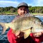
The transition into the cooler months is the absolute golden period for Yellowfin Bream in Wallis Lake. These fish are currently schooling heavily and feeding aggressively to pack on condition before their winter spawning run. You will find them pushing out of the upper reaches and congregating in the lower estuary system, particularly around the heavy oyster leases and rock walls, making them highly accessible and willing to strike a variety of presentations.
Sleeper Pick: Luderick (Blackfish)
Often overlooked by the modern lure-casting crowd, Luderick are beginning their mass migration along the rock walls. These hard-fighting vegetarians offer incredibly consistent action when other species shut down. They are stacking up along the Forster and Tuncurry breakwalls, providing phenomenal light-tackle sport for those willing to float-fish traditional baits like green weed or cabbage harvested from the ocean rocks.
Baitfish Report
The legendary autumn mullet run is officially underway. Large schools of sea mullet are pushing through the channels and out into the ocean, providing a massive protein source for apex predators. Inside the lake, the summer prawn run has largely tapered off, and the primary forage has shifted to slender profiles. Key baitfish currently present include:
Hardyheads: Schooling tightly along the weed edges and sand drop-offs.
Glassies: Holding in the deeper channels and around the bridge pylons.
Whitebait: Frequenting the shallow flats during the top of the tide.
Match your lure profiles to these slender, silver baitfish rather than crustacean imitations to maximize your strike rate.
Tactical Strategy
Where to Find Them
For trophy Bream, focus your efforts on The Paddock—the massive network of oyster leases located near the Forster-Tuncurry bridge. At high tide, target the submerged racks where fish cruise over the top to feed on barnacles and small crabs. As the tide drops, move to the deeper drop-offs and the weed-fringed sand flats around Wallis Island.
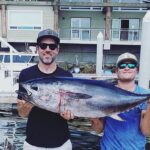
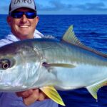
If you are chasing Mulloway (Jewfish), the Forster breakwall is the place to be. Position yourself near the end of the wall where the main channel meets the ocean, paying special attention to the deep eddies forming behind the largest submerged boulders. Offshore anglers should head approximately four kilometres east-north-east of the Wallis Lake entrance to the newly deployed artificial reef complex, sitting in 33 metres of water. This structure features twin steel towers that deflect currents and create upwellings, holding fantastic numbers of Snapper and Kingfish.
Gear & Presentation
When targeting Bream on the flats, a 2.5-inch soft plastic grub in a UV-reactive Motor Oil color is deadly. Rig it on a 1/20oz to 1/16oz hidden-weight jig head to ensure a slow, natural flutter. If you are fishing the oyster racks at high tide, a 70mm surface walking bait or a bent minnow profile in translucent colors will draw explosive topwater strikes.
For the breakwall Mulloway, live yellowtail (yakkas) or freshly caught legal-sized tailor are the ultimate baits. Rig them on a snelled two-hook rig featuring 7/0 or 8/0 octopus circle hooks, using just enough running sinker weight to hold the bottom in the current.
For offshore Snapper at the artificial reef, leave the heavy bottom-bouncing gear at home. Cast 5-inch to 7-inch soft plastic jerk shads in pearl or pilchard colors on 1/4oz to 1/2oz jig heads. Cast ahead of your drift and let the lure sink completely to the bottom on a slack line—most strikes will occur on the drop.
Pro Tip: Because the autumn water in Wallis Lake is remarkably clear, estuarine fish are highly visually oriented. Downsize your fluorocarbon leader to 4lb when fishing the open sand flats to dramatically increase your strike rate. If you are extracting fish from the heavy oyster racks, upsize to 8lb or 10lb, but be prepared to work your lures slower to compensate for the heavier line.
Timing the Bite
Tide is everything in this system. For the oyster leases, the last two hours of the run-up and the first hour of the run-out provide the necessary water depth for fish to access the structure safely. If you are hunting Mulloway off the breakwall, the absolute peak feeding window occurs during the slack water period at the top or bottom of the tide, particularly when this coincides with dawn, dusk, or a moonrise.
Pro Tip: When fishing the shallow weed beds around Wallis Island, look for the isolated white sand patches using polarized sunglasses. Cast your soft plastics completely across the sand patch and hop them slowly into the transition zone. Big flathead and bream use these sandy clearings as ambush points to strike baitfish silhouetted against the lighter bottom.
Regulations Snapshot
Before hitting the water, ensure you are compliant with the latest New South Wales Department of Primary Industries (DPI) regulations. Heavy penalties apply for undersized fish and bag limit breaches.
Species
Minimum Size Limit
Bag Limit
Special Rules
Yellowfin & Black Bream
25cm
20 (Combined)
Possession limit is twice the daily bag limit.
Dusky Flathead
36cm (Slot limit up to 70cm)
5
All fish over 70cm must be released immediately.
Mulloway (Jewfish)
70cm
1
Strictly enforced size and bag limits apply.
Snapper
30cm
10
Handle undersized fish with wet hands before release.
Regional Alternative
If a heavy coastal swell renders the bar unsafe, or strong onshore winds make the main lake uncomfortable, head inland to the Wallamba River. Accessible via the Nabiac boat ramp, this riverine environment offers fantastic shelter from coastal gales. As you travel upstream, the crystal-clear estuarine water takes on a darker, tannin-stained appearance, providing excellent cover for Estuary Perch, Australian Bass, and large river Flathead.
Work the deeper holes and heavily timbered undercut banks with deep-diving crankbaits, vibrating blades, or 1/4oz spinnerbaits. Focus your casting tight against the riparian vegetation, as these predatory native fish will hold hard against the sunken timber waiting to ambush passing baitfish. It is a completely different style of fishing compared to the clear flats of the lower estuary, requiring accurate casting and robust tackle to extract fish from the snags. This alternative is incredibly rewarding and guarantees a bent rod when the coastal weather refuses to cooperate.
Pro Tip: When fishing the upper reaches of the Wallamba River, swap your translucent coastal lures for solid, contrasting colors like black, purple, or chartreuse. The darker, tannin-stained water requires a lure that casts a strong silhouette to help the fish locate your presentation in low visibility.
Tight lines!
Editor's Choice: Must-Have Gear
FISHINGSIR Next-Gen Waterproof Chest Waders
★★★★★4.4 (7,370+ reviews)
2-Ply Tech: Upgraded nylon with 2.5x higher density than standard fabrics.
100% Waterproof: Lab-approved intrusion resistance with taped visible seams.
Ultra-Lightweight: Designed for all-day comfort while hunting or fishing.
As an Amazon Associate I earn from qualifying purchases. #ad
Loading forecast...
Live Fishing Conditions: Tides, Weather & Waves
Get real‑time tides, marine weather, swell and solunar activity for each spot so you know exactly when conditions line up for your best chance at a bite.
🎣
Forster
Loading coordinates...
🌤️
WEATHER CONDITIONS
--°F
--°C
Loading...
🌡️
Feels Like--°F--°C
💧
Humidity--%
💨
Wind-- mph-- km/h
🧭
Direction--
📊
Pressure-- inHg-- hPa
☀️
UV Index--
🌊
MARINE CONDITIONS
🌊Wave Height
-- ft
-- m
Loading...
🧭Wave Direction
--°
Loading...
⏱️Wave Period
-- s
Loading...
📈Tide Status
-- ft
-- m
Loading...
🌙
LUNAR & SOLUNAR
🌕
Loading...
Illumination: --%
Major Period--:-- - --:----:-- - --:--
Minor Period--:-- - --:----:-- - --:--
🌅Sunrise--:--
🌇Sunset--:--
📅
24-HOUR FORECAST
Loading fishing conditions...
Fishing Spots Map
My location
Loading map...
Unable to load map
There was an error loading the map. Please try refreshing the page.
Info
Local Access & Facilities
Forster and its twin town Tuncurry represent one of the most dynamic convergences of estuarine complexity and offshore potential on the New South Wales coast. Situated where the massive Wallis Lake system forces its way into the Tasman Sea, this location offers a distinct dual fishery that challenges even the most seasoned skippers. The defining characteristic here is the aggressive tidal exchange through the channel; the water moves with purpose, scouring deep holes near the bridge and flushing nutrient-rich baitfish out to the waiting pelagics. It is not merely a harbor but a high-velocity food funnel that dictates the feeding windows of every predator in the system.
The atmosphere in Forster is a blend of holiday relaxation and serious maritime industry. Unlike the remote, rugged ledges found further south, this is a manicured coast where concrete infrastructure meets wild currents. The backdrop is dominated by the bridge connecting the two towns, a structure that serves as both a logistical artery and a prime structure for holding fish. For the expert angler, the vibe is one of calculated timing; the crystal-clear waters of the incoming tide offer exceptional sight fishing over the flats, while the dark, churning outflow signals the time to target jewfish and sharks patrolling the channel drop-offs.
Primary targets here shift rapidly with the salinity and depth. Inside the breakwall, the focus is on technical finesse fishing for bream and flathead across the vast lease systems and sand flats. However, just beyond the bar, the continental shelf creates opportunities for marlin, yellowfin tuna, and kingfish. The proximity of the deep water to the ramp means that dawn patrols can effectively target trophy billfish and be back at the dock by lunch, a luxury that few other ports can offer. This accessibility, combined with the intricate challenge of the lake's tidal movements, makes Forster a premier destination for anglers who demand variety.
Access & Getting There
Reaching Forster requires navigating the Pacific Highway and committing to the coastal detour, but the logistical planning begins long before you see the water. The primary access route funnels traffic across the bridge connecting Tuncurry to Forster. Seasoned captains know that this bridge is a significant chokepoint, particularly during school holidays or summer weekends. If you are towing a large vessel, navigating the roundabouts and tight turns in the town center requires patience. The traffic flow is generally manageable in the pre-dawn hours, but afternoon returns can see you idling in line, so planning your extraction time is just as critical as your launch time.
💡 Captain's Tip: Bridge Logistics
The bridge between Forster and Tuncurry is the only artery connecting the two sides of the inlet. If you are launching on the Tuncurry side but staying in Forster, allow an extra 20 minutes for transit during mid-day peak hours. The current rips hard under this bridge, making it a fishing hotspot, but it also distracts drivers—keep your eyes on the road when towing.
Launch realities in this area are dictated by the facilities on either side of the channel. The Tuncurry Slipway, located approximately 2,700 feet from the channel mouth, is a primary asset for those with larger offshore hulls. The ramps here are generally well-maintained, but the tidal influence is undeniable. At low tide, the ramps can become slick with algae, and the drop-off at the end of the concrete can be severe on extreme moon tides. It is imperative to check the tide charts before reversing down; losing a trailer axle over the lip of the ramp is a known hazard here. The current running past the ramp can also be swift, requiring a confident hand at the throttle to load the boat without drifting sideways into the pilings.
Weather contingencies are a critical component of accessing the open ocean from Forster. The bar crossing at the entrance to Wallis Lake is notorious for standing up when the swell opposes the outgoing tide. When the tide is dropping and the swell is pushing in from the southeast, the waves stand up vertically, creating a dangerous washing machine effect. Expert skippers will often wait for the incoming tide to flatten the face of the waves before attempting a crossing. If the wind is howling from the northeast—the prevailing summer trade wind—the channel becomes choppy, but the leeward side of the breakwall offers some protection for launching and retrieval.
Parking strategies differ significantly depending on your target species and vessel. For boaters, the trailer parking at the main ramps is adequate but fills rapidly during the summer pelagic run. Arriving by 5:00 AM is standard procedure to secure a spot that doesn't require a difficult jackknife maneuver. For land-based anglers, the options are more spread out. The Boomerang Beach North Carpark and Boomerang Beach South Carpark, located roughly 11 miles south, are open 24 hours a day. This is vital intelligence for surf casters chasing mulloway at night; you won't get locked in or ticketed for an overnight session. However, closer to town, parking restrictions are strictly enforced, so always verify signage before walking away from your vehicle.
Forster Pre-Trip Checklist
Facilities & Amenities
The infrastructure in Forster caters to a sophisticated fishing fleet, but understanding the specialization of local vendors can save you valuable fishing time. Great Lakes Tackle, located just 3,000 feet from the center of the action in Tuncurry, is a cornerstone for local intelligence. They specialize in the estuary systems and are the go-to source for fresh bait suitable for the lake. On the Forster side, Tackle World sits about 1.9 miles away and offers a robust selection of heavy game gear. If you realize your crimps are too small for 80-pound leader or you need a specific skirted lure for marlin, this is your logistical hub. However, note that most shops here operate on standard retail hours, often opening around 8:00 AM or 9:00 AM. This means if you need bait for a dawn launch, you must purchase it the afternoon prior.
💡 Captain's Tip: The Dawn Patrol Gap
Local tackle shops like Tackle World and Blue Peter Boatshed generally open between 8:00 AM and 9:00 AM. There is effectively zero support for anglers launching at 4:30 AM. Buy your ice, block pilchards, and spare terminal tackle the day before. The only thing open at 5:00 AM is the ocean.
The charter fleet in Forster is well-regarded and diverse. Forster/Manning River Fishing Charters operates directly out of the lake, specializing in navigating the complex sandbars and oyster leases of the estuary. Their knowledge of the "inside" fishery is unmatched. For those looking for a more immersive experience, Minimbah Fishing Lodge is located about 9.2 miles inland. This facility offers a different pace, catering to anglers who want to escape the coastal bustle and focus on the upper reaches of the river systems. The presence of these high-caliber operations confirms the area's status as a serious fishery; they wouldn't survive if the fish weren't there.
A critical piece of "negative knowledge" for visiting captains concerns fuel and ice availability. While there are marinas, transient fuel docks are not always reliably open for early recreational traffic. It is highly recommended to fuel your vessel on the trailer at a highway service station before launching. Additionally, high-quality saltwater ice can be scarce during peak tournament seasons. If you are targeting tuna and need to pack a large kill bag, bring your ice from a bulk supplier in town rather than relying on the limited freezers at the boat ramp kiosks. The Blue Peter Boatshed on Little Street is a fantastic resource for boat hire and basic needs, but it is not a heavy-industrial marina facility.
Lodging logistics in Forster are surprisingly angler-friendly, with several options located within walking distance of the water. Sails Apartments is situated a mere 1,064 feet from the central fishing spots, offering the kind of proximity that allows you to watch the water conditions from your balcony. For those towing caravans or looking for a more communal atmosphere, the NRMA Forster Tuncurry Holiday Park is located 1.1 miles away on the Tuncurry side. This park is accustomed to boat trailers and early risers, making it a strategic base camp. Forster Holiday Village, less than half a mile away, provides another solid option for keeping travel time between bed and boat ramp to an absolute minimum.
Permits, Regulations & Fees
Navigating the regulatory landscape in Forster is essential not just for legal compliance, but for the sustainability of the fishery. The waters here are managed by the State Fishing Agency, and a recreational fishing license is mandatory for all anglers, whether fishing from a boat, the shore, or a kayak. These fees contribute directly to the maintenance of the ramps and the management of the fish stocks. Authorities patrol the ramps and the water frequently, particularly near the bridge and the oyster leases. The "Why" behind these strict rules is evident in the health of the estuary; the biomass of bream and flathead is maintained through rigorous bag and size limits.
Anglers must be acutely aware of the protected zones and commercial infrastructure within Wallis Lake. The lake is one of the most productive oyster-growing regions in the country. The oyster racks are private property and working farms. While they are excellent structures for holding fish, tying off to them is strictly prohibited and culturally disrespectful to the local farmers. Casting lures deep into the racks is a high-risk, high-reward game, but damaging the infrastructure is a surefire way to cause conflict. Furthermore, specific zones within the estuary may be designated as sanctuary zones or habitat protection zones. It is your responsibility to consult the latest marine park maps to ensure you are not drifting into a no-take area.
💡 Captain's Tip: Respect the Racks
The oyster leases in Wallis Lake are private agricultural assets. Never tie your boat to the poles or racks. Drifting and casting parallel to the leases is the accepted technique. If you snag a rack, break off your line rather than climbing onto the infrastructure to retrieve a lure.
Cultural respect extends beyond the oyster leases to the land itself. The area holds significance for the local Indigenous people, and many headlands and coastal features are culturally sensitive. "Kapu" or sacred restrictions may not always be marked with modern signage, but the general rule of thumb is to treat the land with reverence. Leave no trace, pack out all trash, and avoid trampling vegetation on the dunes at access points like Boomerang Beach. Accessing the water is a privilege, and maintaining good relations with the local community ensures that these access points remain open for future seasons.
Events & Seasonal Information
The fishing calendar in Forster is driven by distinct seasonal rhythms that dictate both the target species and the sea conditions. Summer (December through February) is the prime season for the warm currents that bring pelagic species within range of the trailer boat fleet. This is when the water temperature pushes past 75°F, bringing marlin and mahi-mahi close to the shelf. However, this season also brings the strongest northeasterly trade winds. These winds typically kick up around 10:00 AM, meaning the window for comfortable offshore fishing is often limited to the early morning hours. By noon, the sea state can become steep and uncomfortable, forcing smaller boats back into the safety of the lake.
Winter changes the game entirely. As the water cools and the winds shift to the west and southwest, the ocean flattens out, allowing for easier access to the deep reefs. This is the time for bottom bouncing for snapper and pearl perch. Inside the estuary, the colder water triggers the spawning runs of luderick and massive bream. The "Forster Tuncurry Mud Crab" is also a winter target for those running pots. The transition months of autumn are often considered the golden period, offering the best of both worlds: lingering warm water species and the onset of stable weather patterns.
Tournament culture is alive and well in Forster, with several high-profile events taking place throughout the year. The local game fishing clubs host billfish tournaments that attract heavy hitters from up and down the coast. During these weeks, the town transforms; boat ramps become congested, and accommodation is booked months in advance. Conversely, the estuary hosts bream and flathead tournaments that showcase the technical skill required to pull fish from the clear, shallow waters. If you prefer solitude, it is wise to check the local club calendars and avoid these peak competition weekends, as the pressure on the fish and the facilities increases exponentially.
Contact Information & Resources
For any issues regarding maritime safety or infrastructure, the local Roads and Maritime Services and the Marine Rescue NSW base are the primary points of contact. Marine Rescue Forster Tuncurry maintains a radio watch and offers a log-on service for boats heading offshore. This is a critical safety net; logging your trip via radio ensures that someone is watching the clock if you fail to return. The bar crossing conditions are often broadcast or can be checked by calling the local base. Self-reliance is key, but having these numbers programmed into your phone or radio is a non-negotiable safety step.
In terms of immediate logistical support, the local tackle shops—Great Lakes Tackle and Tackle World—serve as unofficial information bureaus. They are the best source for real-time reports on bait availability, water clarity, and recent bar conditions. They can also provide contacts for local mechanics or trailer repair services should you encounter mechanical failure. Trust the local intel; if the shop staff says the bar is too rough, stay in the lake.
For precise locations, real-time facility status, and detailed navigation aids, consult the live dashboard and interactive maps located below.
Our spot reports combine data-driven forecasts with curated local information. The forecast is generated by our proprietary Fishing Score algorithm (0–100%), which analyzes real-time data from Open-Meteo API, validated against NOAA CO-OPS tide gauges and USGS water-monitoring stations. The model weights tide dynamics (35%), wave energy (25%), wind patterns (20%) and time of day (20%)—factors shown to influence fish feeding behavior through marine-biology research and decades of charter log data.
Access, facilities and services information for each fishing spot is sourced from official datasets such as Recreation.gov (RIDB), state park & wildlife agencies, and geospatial providers like Google Maps. These sections undergo scheduled re-validation every 3–6 months to ensure that boat ramps, park access, contact details and local services remain accurate.
Narrative sections (catches, seasonal behavior, local tips) are synthesized from these data sources and refined following the Fishing Reports Today editorial guidelines, combining bibliographic research from ichthyology and oceanography with expert angler experience. Our team reviews reports on a regular basis, while the forecast model itself updates every 6 hours for real-time accuracy.
⚠️ Important: Always verify current local regulations, access restrictions and weather conditions before fishing. These reports are intended as a planning aid, not a guarantee of catches or safety. When in doubt, contact local authorities or park managers listed on the page.
To provide the best experiences, we use technologies like cookies to store and/or access device information. Consenting to these technologies will allow us to process data such as browsing behavior or unique IDs on this site. Not consenting or withdrawing consent, may adversely affect certain features and functions.
Functional Always active
The technical storage or access is strictly necessary for the legitimate purpose of enabling the use of a specific service explicitly requested by the subscriber or user, or for the sole purpose of carrying out the transmission of a communication over an electronic communications network.
Preferences
The technical storage or access is necessary for the legitimate purpose of storing preferences that are not requested by the subscriber or user.
Statistics
The technical storage or access that is used exclusively for statistical purposes.The technical storage or access that is used exclusively for anonymous statistical purposes. Without a subpoena, voluntary compliance on the part of your Internet Service Provider, or additional records from a third party, information stored or retrieved for this purpose alone cannot usually be used to identify you.
Marketing
The technical storage or access is required to create user profiles to send advertising, or to track the user on a website or across several websites for similar marketing purposes.


Leave a Reply