0%

Jordanelle Reservoir Fishing Report Today 🎣

12 months ago Β· Updated 3 weeks ago

Jordanelle Reservoir Fishing Report: Late Summer Strategy

Welcome to the comprehensive late summer fishing report for Jordanelle Reservoir. As a designated Blue Ribbon Fishery nestled in the Wasatch Back, Jordanelle offers a highly diverse multi-species environment. However, fishing this 3,000-plus acre reservoir during the peak of summer requires strategic planning, precise timing, and a deep understanding of thermoclines and boat traffic patterns. Here is your definitive guide to dissecting Jordanelle right now.

1. GO/NO-GO STATUS: CAUTION

Verdict: CAUTION - TIME YOUR OUTING CAREFULLY

Current seasonal conditions dictate a "Caution" rating, not due to a lack of biting fish, but because of extreme recreational boat traffic and high surface temperatures. During the summer months, the Hailstone and Ross Creek areas become congested with wakeboarders, jet skis, and recreational swimmers by mid-morning. The surface chop and noise push fish deep and make boat control difficult for anglers.

🎣 Nautrek
Private Beta
J
M
R
100+ anglers on the waitlist

The fishing network where your reputation matters.

Find trusted captains, join real trips with cost splitting, and build your Angler Rank. Your spots stay private — you decide who sees your intel.

✓ Verified anglers ✓ Real trips ✓ Spot privacy
Join the Waitlist — Free →

No spam. First 500 get founder perks.

Nautrek App

Weather & Water Impact: Surface temperatures are at their seasonal peak, pushing the thermocline down. Algae growth can also lower water clarity in the backs of coves. To fish safely and effectively, you must be on the water before sunrise and off the main lake by 9:00 AM, or launch after 7:00 PM for the night bite. Ensure your vessel has high-visibility flags if you are in a kayak, as you will be sharing the water with fast-moving watercraft.

2. SPECIES INTEL

Primary Target: Smallmouth Bass

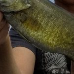
Smallmouth bass remain the most abundant and active species in Jordanelle. Recent electrofishing surveys by the Utah Division of Wildlife Resources (DWR) indicate an overabundance of smaller smallmouth bass, but there are plenty of two-to-three-pound fish actively hunting along rocky transition zones. They provide high catch rates and aggressive strikes during the low-light windows.

Sleeper Pick: Kokanee Salmon

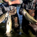
While many anglers beat the banks for bass or soak dough bait for stocked rainbows, the Kokanee salmon fishery is the true sleeper right now. The DWR has heavily invested in planting Kokanee here, and late summer is when these fish school up tightly in deep, cool water before their fall spawning transition. Most casual anglers completely miss them because they lack the electronics to find them or the heavy gear to reach them.

Baitfish & Forage Report

The primary forage base driving the late summer bite consists of juvenile yellow perch, crawfish, and various minnow species (like chubs). Smallmouth bass are heavily keyed in on crawfish molting in the rocks, making bottom-bouncing presentations highly effective. In the pelagic zones, predatory trout and Kokanee are feeding on zooplankton and suspended micro-forage.

3. TACTICAL STRATEGY

To succeed at Jordanelle right now, you need to abandon the shallow shorelines once the sun crests the mountains. Here is the specific breakdown for targeting our primary and sleeper species.

Smallmouth Bass: The Rock Cliff Arm

  • Where: Avoid the main basin near Hailstone during the day. Instead, focus on the Rock Cliff arm and the northern shoreline near the Ross Creek trailhead. Target the 10-to-20-foot depth range where submerged rock piles meet grass lines. The bass use these rocky points to ambush juvenile perch.
  • Lure: A 1/4 oz Tungsten Ned Rig or a 1/8 oz tube jig.
  • Color: Green Pumpkin, Moss Green, or "Goby" patterns. These colors perfectly mimic the local crawfish and blend into the submerged vegetation.
  • Timing: First light until 9:00 AM. Once the sun is high and boat traffic increases, the bass will retreat to depths of 25 feet or more, requiring heavy drop-shot rigs to reach them.

Pro Tip: When fishing the Ned rig around Jordanelle's rock piles, do not over-work the bait. Let the natural water movement flutter the plastic. A dead-stick presentation often triggers strikes from larger, educated smallmouth that ignore fast-moving reaction baits.

Kokanee Salmon: The Deep Basin

  • Where: The open, deep water directly out from the Hailstone boat ramp and along the old river channel leading to the dam face. You must locate schools suspended in 30 to 50 feet of water.
  • Lure: A brightly colored hoochie squid rig trailed 10 to 12 inches behind a silver or UV dodger.
  • Color: Pink, purple, or chartreuse. Rotate colors every 30 minutes until you find what the fish are reacting to on that specific day.
  • Bait: Tip the hooks of your hoochie with white shoepeg corn or maggots scented with garlic or anise.
  • Timing: Pre-dawn trolling is absolutely critical. Troll at exactly 1.5 to 1.8 miles per hour.

Pro Tip: Kokanee have incredibly soft mouths. Use a medium-light or light action trolling rod with a lot of parabolic bend, and never horse the fish to the boat. Keep steady, light pressure to prevent tearing the hooks out.

4. REGULATIONS SNAPSHOT

Understanding the current DWR regulations is crucial, especially given the specific management goals for Jordanelle Reservoir's ecosystem.

SpeciesDaily Bag LimitSpecial Rules & Notes
Smallmouth / Largemouth Bass6 FishNo size restrictions. The DWR encourages the harvest of smaller bass to help balance the population and increase overall fish size.
Trout & Salmon (Combined)4 FishThis aggregate limit includes Rainbow Trout, Brown Trout, Cutthroat, and Kokanee Salmon.
Yellow Perch50 FishExcellent opportunity for a fish fry; target them with small marabou jigs in 15-25 feet of water.
Tiger Muskie1 FishMust be over 40 inches to keep. Handle with extreme care if practicing catch and release.

Note: Jordanelle Reservoir is strictly CLOSED to all spearfishing. Always ensure your watercraft is cleaned, drained, and dried to prevent the spread of aquatic invasive species.

5. REGIONAL ALTERNATIVE: DEER CREEK RESERVOIR

If you arrive at Jordanelle and find the parking lots full, the wind howling through the valley, or the wakeboard traffic simply too dangerous for a small kayak, you have an excellent backup option just minutes away.

Backup Plan: Deer Creek Reservoir

Located just a short drive south on US-189, Deer Creek Reservoir offers a fantastic alternative with slightly different topography and species dynamics.

  • Access Points: The main state park boat ramp or the Wallsburg area for shore and kayak anglers.
  • Target Species: Walleye and Rainbow Trout.
  • Tactical Approach: Deer Creek is famous for its walleye population. If the morning bite at Jordanelle is a bust, head to Deer Creek and target the steep drop-offs and submerged island tops in 15 to 30 feet of water. Use a bottom-bouncer paired with a crawler harness (chartreuse and silver blades) trolled at 1.0 to 1.2 mph. For shore anglers, casting crankbaits or soaking nightcrawlers near the inlet can yield aggressive rainbow trout and the occasional wiper.

Pro Tip: Deer Creek experiences strong canyon winds that typically pick up in the early afternoon. Plan your alternative trip to maximize the mid-morning window before the whitecaps start rolling in.

Whether you are pulling deep dodgers for Kokanee or bouncing tungsten jigs for aggressive smallmouth, Jordanelle requires adaptation and early alarms this time of year. Beat the crowds, stay safe around the recreational boaters, and respect the resource.

Tight lines!

Editor's Choice: Must-Have Gear

FISHINGSIR Next-Gen Waterproof Chest Waders

β˜…β˜…β˜…β˜…β˜… 4.4 (7,370+ reviews)
  • 2-Ply Tech: Upgraded nylon with 2.5x higher density than standard fabrics.
  • 100% Waterproof: Lab-approved intrusion resistance with taped visible seams.
  • Ultra-Lightweight: Designed for all-day comfort while hunting or fishing.
Check Availability on Amazon

βœ“ Amazon's Choice | 100+ bought last month

πŸ›’ Tactical Gear for this Spot

Bandit Walleye Deep

Mandatory for reaching deep schools in 35-50ft mud flats.

Check Price on Amazon #ad

As an Amazon Associate I earn from qualifying purchases. #ad

Loading forecast...

Live Fishing Conditions: Tides, Weather & Waves

Get real‑time tides, marine weather, swell and solunar activity for each spot so you know exactly when conditions line up for your best chance at a bite.

🎣

Jordanelle Reservoir

Loading coordinates...

🌀️

WEATHER CONDITIONS

Weather
-- Β°F
--Β°C

Loading...

🌑️
Feels Like --Β°F --Β°C
πŸ’§
Humidity --%
πŸ’¨
Wind -- mph -- km/h
🧭
Direction --
πŸ“Š
Pressure -- inHg -- hPa
β˜€οΈ
UV Index --
🌊

MARINE CONDITIONS

🌊 Wave Height
-- ft
-- m
Loading...
🧭 Wave Direction
--Β°
Loading...
⏱️ Wave Period
-- s
Loading...
πŸ“ˆ Tide Status
-- ft
-- m
Loading...
πŸŒ™

LUNAR & SOLUNAR

πŸŒ•

Loading...

Illumination: --%

Major Period --:-- - --:-- --:-- - --:--
Minor Period --:-- - --:-- --:-- - --:--
πŸŒ… Sunrise --:--
πŸŒ‡ Sunset --:--
πŸ“…

24-HOUR FORECAST

Loading fishing conditions...

Fishing Spots Map

🎣
Book a Fishing Charter near Jordanelle Reservoir Fishing Report Today 🎣

Local guides & charters. Verified captains, instant booking, best price guaranteed.

See Available Trips β†’

My location
Loading map...

Local Access & Facilities

Jordanelle Reservoir represents a high-altitude convergence of deep-water structure and riverine finesse, situated at 6,130 feet in the shadow of the Uinta Mountains. As a primary feature of the Central Utah Project’s Bonneville Unit, this 3,050-acre impoundment offers a distinct duality for the serious angler: the bustling, developed waters of the Hailstone arm and the quieter, ecologically sensitive zones near Rock Cliff where the Provo River enters the system. While the reservoir is a summer magnet for recreational boating, the seasoned fisherman knows that the subsurface topography holds significant populations of rainbow trout, cutthroat, brown trout, and smallmouth bass.

The atmosphere here shifts dramatically depending on your chosen launch point. To the west, the Hailstone Recreation Area feels like a modern, manicured harbor, offering full amenities against a backdrop of sagebrush hills and Park City ski runs. Conversely, the eastern Rock Cliff area provides a rugged, riparian vibe with wetlands and cottonwoods, demanding a more stealthy approach. The water is clear, cold, and fed by snowmelt, creating a fishery that remains productive even when valley temperatures rise, provided you understand the rhythms of the high-desert winds and recreational traffic.

For the fly angler or light-tackle specialist, Jordanelle serves as a strategic hub. It is positioned between the blue-ribbon flows of the Middle Provo River and the alpine lakes of the Mirror Lake Scenic Byway. Whether you are trolling deep structure for holdover browns or casting streamers along the rocky dikes for smallmouth, success here relies on navigating the "heavy use" summer windows and exploiting the dawn and dusk tranquility.

Access & Getting There

Accessing Jordanelle Reservoir requires navigating the high-traffic corridors connecting Salt Lake City to the Park City resort areas. The reservoir is approximately 35 to 40 miles east of Salt Lake City via I-80 East to U.S. 40 South. The primary artery, U.S. 40, runs along the western shore, providing direct access to the main facilities. While the highway is well-maintained for trailering large vessels, anglers should be aware that commuter traffic and ski tourism can cause significant congestion during peak morning and evening hours.

πŸ’‘ Captain's Tip: Launch Strategy

The "heavy use" designation in summer is not an exaggeration. At the Hailstone main ramp, trailer parking can reach capacity rapidly on weekends. Professional skippers recommend a "dawn patrol" launchβ€”wheels in the water by 6:00 AMβ€”to secure parking and fish the glass before the wakeboard boats arrive.

Hailstone Recreation Area (Main Launch)

The Hailstone entrance, accessed via the Mayflower exit (#8) off U.S. 40, serves as the primary logistical hub for boaters. This is an all-weather access point capable of handling larger deep-V hulls and bass boats. The facility is designed for volume, but the sheer popularity of the park means the ramps can become chaotic by mid-morning. The infrastructure here includes a large wake-free zone, which is critical for kayakers or anglers in smaller skiffs looking to escape the main basin's chop.

Rock Cliff Recreation Area (The Quiet Side)

For those targeting the river inlet or seeking a lower profile, the Rock Cliff entrance offers a completely different experience. Located on the eastern arm, this area is reached by taking State Road 32 East for approximately 7.5 miles. This zone is characterized by wetlands and the inflow of the Provo River. It is a designated nature area, meaning access is more regulated and the vibe is significantly quieter. This is the preferred launch for canoeists, float tubers, and anglers specifically targeting the transition zones where river currents meet the lake's still water.

Parking & Winter Access

Parking is ample but demand-sensitive. The Grand Hyatt Deer Valley Parking and Deer Valley - Jordanelle Express Gondola Parking are located roughly 1.7 to 2.6 miles from the water, primarily serving the resort crowd, but they indicate the level of development surrounding the western shore. For shore anglers, the Nature Center & Picnic Area Parking at Rock Cliff (3.7 miles from the main hub) provides excellent foot access to the boardwalks and river mouth. In winter, access remains open, but conditions on U.S. 40 can deteriorate quickly during storms; 4WD is recommended for towing during the ice fishing season.

Jordanelle Reservoir Pre-Trip Checklist

Facilities & Amenities

The infrastructure around Jordanelle is robust, catering to a mix of high-end tourism and serious outdoor recreation. However, for the angler, the amenities are split between on-site convenience and specialized support in the nearby towns of Heber City and Park City. Understanding where to source gear versus where to launch your boat is key to a smooth trip.

Local Tackle & Guide Support

While the state park offers basic recreational supplies, serious angling provisioning requires a stop in town. Fish Heads Fly Shop, located about 7.7 miles away in Heber City, is the premier outfitter for the area. They specialize in the local hatches and can provide critical intelligence on whether the trout are keying on midges or if the smallmouth bite is active. For conventional gear, anglers often rely on general sporting goods stores in Park City or Heber.

The charter fleet here is heavily skewed toward fly fishing, reflecting the quality of the Provo River drainage. Operators like Local Waters Fly Fishing Guides and Park City Fly Fishing Guides (located 4.8 to 7.2 miles away) are experts in this system. These services are particularly valuable for understanding the seasonal movements of fish between the river and the reservoir body.

πŸ’‘ Captain's Tip: Fuel Management

While there are marina facilities at Hailstone, seasoned boaters often prefer fueling up at the gas stations along U.S. 40 or in Heber City before entering the park to avoid premium dock prices and potential lines. Ensure your tanks are topped off before launching, as the reservoir's 3,050 acres cover a significant amount of water.

Lodging & Base Camps

Accommodation options range from luxury hotels to primitive forest camps, but proximity varies. For those who prefer a roof, the Washington School House Hotel in Park City offers high-end lodging about 5 miles from the water. For anglers towing campers, Jordanelle State Park itself offers camping at Hailstone, though reservations are fiercely competitive.

Alternative camping can be found in the surrounding National Forest lands, though these often require a drive. Redman Campground, situated at 8,300 feet in Big Cottonwood Canyon, offers a scenic alpine setting but is a 9.4-mile drive through canyon roads, making it less convenient for early morning launches than the on-site campgrounds. Ponderosa Group Campground on the Mirror Lake Highway is another option for larger groups, located roughly 11 miles away.

Facility NameTypeDistance & Logistics
Redman CampgroundUSFS Campground9.4 miles away. High elevation (8,300 ft). Dirt parking spurs. Good for base camp if on-site spots are full.
Heber Valley CampPrivate/Church Camp12 miles away. Large facility, often used for groups.
Ponderosa Group CampgroundUSFS Campground11.1 miles away. Located on Scenic Byway 150. Rustic experience.
Fish Heads Fly ShopRetail & Intel7.7 miles (Heber City). Opens 8:00/9:00 AM. Essential for fly selection.

Permits, Regulations & Fees

Jordanelle Reservoir is a multi-jurisdictional waterbody managed by the Utah Division of Parks and Recreation under an agreement with the Bureau of Reclamation. Compliance with state and local regulations is strictly enforced due to the reservoir's status as a culinary water source and a high-use recreation area.

Entry & Launch Fees

A fee is required for entrance to the State Park, which covers access to both Hailstone and Rock Cliff areas. Day-use fees are standard, but frequent visitors should consider the Utah State Parks annual pass. Boat launching often incurs an additional fee separate from the vehicle entry. Reservations for camping and specific day-use pavilions must be made through the Reserve America system, often months in advance for summer weekends.

Fishing Regulations

Fishing is governed by the Utah Division of Wildlife Resources. A valid Utah fishing license is mandatory for all anglers 12 years of age and older. The reservoir is managed for a mix of species, and specific bag limits may apply, particularly for smallmouth bass and trout species. Because of the presence of sensitive native cutthroat trout in the drainage, anglers should be adept at species identification. The Rock Cliff area, being a transition zone for the Provo River, may have specific seasonal closures or tackle restrictions to protect spawning fish; always check the current proclamation guidebook.

Aquatic Invasive Species (AIS)

Utah is aggressive regarding the prevention of Quagga and Zebra mussels. All watercraft launching at Jordanelle are subject to mandatory inspection. Boaters must self-certify that their vessel has been cleaned, drained, and dried. Failure to comply can result in significant fines and the quarantining of your boat. Expect inspection stations at the Hailstone ramp, especially during the peak season.

Events & Seasonal Information

The fishery at Jordanelle follows a distinct seasonal rhythm driven by elevation and water management. The "managed recreation season" is year-round, but the character of the lake changes drastically.

Seasonal Rhythms

Spring (April - June): As the ice recedes and water temperatures climb, trout cruising the shallows and smallmouth bass moving up to spawn create prime angling opportunities. This is also the peak season for birdwatching, with over 66 neotropical migrant species passing through the Rock Cliff wetlands.
Summer (July - August): This is the season of "heavy use." Angling is best restricted to early mornings or late evenings to avoid the recreational boat traffic. The deep water near the dam becomes critical for finding cool-water holding trout.
Fall (September - October): As recreational traffic dies down and water temperatures cool, the brown trout become aggressive. This is often considered the "local's season."
Winter: Ice fishing is a popular pursuit here, targeting perch and trout through the hard deck. Bald Eagles and Northern Pygmy Owls are common winter residents.

πŸ’‘ Captain's Tip: Wind Warning

Situated in a mountain valley, Jordanelle is prone to sudden, violent winds, particularly in the afternoon. The fetch across the main basin can build dangerous chop quickly. Small craft should stick to the protected bays or the wake-free zones when the afternoon thermals kick in.

Contact Information & Resources

For the most current conditions, gate closures, and emergency assistance, direct communication with park management is recommended. The Jordanelle State Park office can be reached at 435-649-9540. For inquiries regarding the Rock Cliff area specifically, the number is 435-782-3030. In the event of an on-water emergency, cell service is generally reliable on the Hailstone side but can be spotty in the Rock Cliff drainage.

For precise locations of the boat ramps, fish cleaning stations, and real-time weather conditions, consult the live dashboard and interactive maps below.
🎣

Jordanelle Reservoir

Hideout β€’ Utah β€’ 40.6177, -111.4093
πŸ…ΏοΈ

Parking

5
Grand Hyatt Deer Valley Parking (Propark)
⭐ 5.0 1.7 mi
πŸ“ 1702 Glencoe Mountain Wy, Park City, UT 84060, USA
πŸ•’
Monday: Open 24 hours
Tuesday: Open 24 hours
Wednesday: Open 24 hours
Thursday: Open 24 hours
Friday: Open 24 hours
Saturday: Open 24 hours
Sunday: Open 24 hours
πŸš— Get Directions
Deer Valley - Jordanelle Express Gondola Parking
⭐ 5.0 2.6 mi
πŸ“ Wasatch County, Mayflower Mountain, UT 84060, USA
πŸš— Get Directions
Nature Center & Picnic Area Parking
⭐ 5.0 3.7 mi
πŸ“ Rock Cliff, Campground Trail, Kamas, UT 84036, USA
πŸš— Get Directions
Deer Valley Free Parking - Top
⭐ 5.0 3.9 mi
πŸ“ Deer Valley Dr S, Park City, UT 84060, USA
πŸš— Get Directions
Park City Storage
⭐ 4.9 8.4 mi
πŸ“ 6447 N Pace Frontage Rd, Park City, UT 84098, USA
πŸ•’
Monday: 9:00β€―AM – 5:00β€―PM
Tuesday: 9:00β€―AM – 5:00β€―PM
Wednesday: 9:00β€―AM – 5:00β€―PM
Thursday: 9:00β€―AM – 5:00β€―PM
Friday: 9:00β€―AM – 5:00β€―PM
Saturday: Closed
Sunday: Closed
πŸš— Get Directions
🐟

Bait & Tackle

1
Fish Heads Fly Shop
⭐ 5.0 7.7 mi
πŸ“ 32 S Main St, Heber City, UT 84032, USA
πŸ•’
Monday: 9:00β€―AM – 5:00β€―PM
Tuesday: 9:00β€―AM – 5:00β€―PM
Wednesday: 9:00β€―AM – 5:00β€―PM
Thursday: 9:00β€―AM – 5:00β€―PM
Friday: 8:00β€―AM – 5:00β€―PM
Saturday: 8:00β€―AM – 5:00β€―PM
Sunday: 8:00β€―AM – 12:00β€―PM
πŸš— Get Directions
🚀

Fishing Charters

5
Local Waters Fly Fishing Guides
⭐ 5.0 7.2 mi
πŸ“ 466 W 400 N, Heber City, UT 84032, USA
πŸ•’
Monday: 6:00β€―AM – 11:00β€―PM
Tuesday: 6:00β€―AM – 11:00β€―PM
Wednesday: 6:00β€―AM – 11:00β€―PM
Thursday: 6:00β€―AM – 11:00β€―PM
Friday: 6:00β€―AM – 11:00β€―PM
Saturday: 6:00β€―AM – 11:00β€―PM
Sunday: 6:00β€―AM – 11:00β€―PM
πŸš— Get Directions
Park City Fly Fishing Guides
⭐ 5.0 4.8 mi
πŸ“ 333 Main St Suite D2, Park City, UT 84060, USA
πŸ•’
Monday: 8:00β€―AM – 8:00β€―PM
Tuesday: 8:00β€―AM – 8:00β€―PM
Wednesday: 8:00β€―AM – 8:00β€―PM
Thursday: 8:00β€―AM – 8:00β€―PM
Friday: 8:00β€―AM – 8:00β€―PM
Saturday: 8:00β€―AM – 8:00β€―PM
Sunday: 8:00β€―AM – 8:00β€―PM
πŸš— Get Directions
Utah Pro Fly Fishing
⭐ 5.0 5.0 mi
πŸ“ 136 Heber Ave #204, Park City, UT 84060, USA
πŸ•’
Monday: 6:30β€―AM – 10:00β€―PM
Tuesday: 6:30β€―AM – 10:00β€―PM
Wednesday: 6:30β€―AM – 10:00β€―PM
Thursday: 6:30β€―AM – 10:00β€―PM
Friday: 6:30β€―AM – 10:00β€―PM
Saturday: 6:30β€―AM – 10:00β€―PM
Sunday: 6:30β€―AM – 10:00β€―PM
πŸš— Get Directions
Utah Troutfitters Park City
⭐ 5.0 10.2 mi
πŸ“ 2855 Olympic Pkwy, Park City, UT 84098, USA
πŸ•’
Monday: 8:00β€―AM – 9:00β€―PM
Tuesday: 8:00β€―AM – 9:00β€―PM
Wednesday: 8:00β€―AM – 9:00β€―PM
Thursday: 8:00β€―AM – 9:00β€―PM
Friday: 8:00β€―AM – 9:00β€―PM
Saturday: 8:00β€―AM – 9:00β€―PM
Sunday: 8:00β€―AM – 9:00β€―PM
πŸš— Get Directions
Fly Fishing at Sundance Resort
⭐ 5.0 18.0 mi
πŸ“ 8841 Alpine Loop Scenic Byway, Sundance, UT 84604, USA
πŸ•’
Monday: 9:00β€―AM – 5:00β€―PM
Tuesday: 9:00β€―AM – 5:00β€―PM
Wednesday: 9:00β€―AM – 5:00β€―PM
Thursday: 9:00β€―AM – 5:00β€―PM
Friday: 9:00β€―AM – 5:00β€―PM
Saturday: 9:00β€―AM – 5:00β€―PM
Sunday: 9:00β€―AM – 5:00β€―PM
πŸš— Get Directions
🏠

Lodging

5
βš“

Boat Ramps

3
🚻

Restrooms

3
πŸ‘¨β€πŸ‘©β€πŸ‘§β€πŸ‘¦

Family Friendly

2
β™Ώ

Accessibility

β™Ώ

Wheelchair Access

Available

πŸ•

Pets Allowed

Not Confirmed

⚠️ Some accessibility info not officially confirmed. Please verify with location directly.

πŸ“ Showing 24 facilities on map
🎣
Book a Fishing Charter near Jordanelle Reservoir Fishing Report Today 🎣

Local guides & charters. Verified captains, instant booking, best price guaranteed.

See Available Trips β†’

πŸ“Š

About Our Fishing Reports & Forecasts

Our spot reports combine data-driven forecasts with curated local information. The forecast is generated by our proprietary Fishing Score algorithm (0–100%), which analyzes real-time data from Open-Meteo API, validated against NOAA CO-OPS tide gauges and USGS water-monitoring stations. The model weights tide dynamics (35%), wave energy (25%), wind patterns (20%) and time of day (20%)β€”factors shown to influence fish feeding behavior through marine-biology research and decades of charter log data.

Access, facilities and services information for each fishing spot is sourced from official datasets such as Recreation.gov (RIDB), state park & wildlife agencies, and geospatial providers like Google Maps. These sections undergo scheduled re-validation every 3–6 months to ensure that boat ramps, park access, contact details and local services remain accurate.

Narrative sections (catches, seasonal behavior, local tips) are synthesized from these data sources and refined following the Fishing Reports Today editorial guidelines, combining bibliographic research from ichthyology and oceanography with expert angler experience. Our team reviews reports on a regular basis, while the forecast model itself updates every 6 hours for real-time accuracy.

⚠️ Important: Always verify current local regulations, access restrictions and weather conditions before fishing. These reports are intended as a planning aid, not a guarantee of catches or safety. When in doubt, contact local authorities or park managers listed on the page.

Learn more about our methodology & data sources β†’

Leave a Reply

Your email address will not be published. Required fields are marked *