Current conditions at Jordanelle Reservoir are prime for summer angling, but consistent success requires strategic timing and adaptability. The surface water temperatures have warmed into the upper sixties to low seventies, meaning the summer thermocline is officially establishing itself and dictating fish movements. The reservoir is completely ice-free, water levels are stable, and you will find excellent access from all major boat ramps and shoreline parking areas.
From a safety and comfort perspective, the primary hazard right now is not weather, but heavy recreational boat traffic and high-altitude sun exposure. As a highly popular summer destination, the main basin near Hailstone gets churned up by wakeboarders, water skiers, and jet skis by mid-morning. Additionally, be prepared for the classic Wasatch Mountain afternoon thermal winds. These winds typically kick up from the west-northwest after lunch and can make open-water navigation choppy and uncomfortable. If you are fishing from a kayak, float tube, or smaller vessel, hug the eastern shorelines or tuck into the Rock Cliff arm to stay out of the wind and heavy wakes. Early mornings offer glass-calm water, highly active fish, and the safest, most productive fishing windows. Bring plenty of water and sun protection, as the UV index at this elevation is intense.
π£Nautrek
Private Beta
J
M
R
100+ anglers on the waitlist
The fishing network where your reputation matters.
Find trusted captains, join real trips with cost splitting, and build your Angler Rank. Your spots stay private — you decide who sees your intel.
Smallmouth bass are the undisputed kings of the rocky structure at Jordanelle. With the water warming, these aggressive predators are highly active along the shoreline drop-offs. They are heavily feeding to recover from the spring spawn, making them the most reliable and entertaining target for both boat and shore anglers right now. The average fish will run two to three pounds, but five-pound bronze-backs are a very real possibility if you locate the right submerged timber or isolated rock piles.
Sleeper Pick: Splake
While most anglers troll the main basin for standard rainbow or brown trout, the true sleeper pick right now is the splake. The Utah Division of Wildlife Resources heavily stocked these sterile brook and lake trout hybrids a few years ago to help manage the fishery, and those fish have now reached maturity. Many are stretching well over the two-foot mark and possess heavy shoulders. Because they are sterile, they focus all their energy on eating and growing rather than spawning. They are currently suspended in the deeper, cooler water columns, aggressively ambushing baitfish.
Baitfish Report
The primary forage driving the smallmouth bass bite is the abundant crawdad population hiding in the rip-rap and chunk rock along the reservoir's edges. You must match your presentations to mimic molting crawdads to trigger the biggest bass. In the open water, juvenile yellow perch and small minnows are the main protein source for the cruising trout and splake. Lures that throw a silver, blue, or chartreuse flash will perfectly replicate these fleeing baitfish in the clear water.
Tactical Strategy
Where to Fish
For smallmouth bass, focus your efforts on the eastern shoreline near the Hailstone Recreation Area. Do not waste time on the featureless mud flats; instead, hunt for the transition zones where baseball-sized rocks give way to larger boulders. Target the rocky points that extend out into the main lake, specifically working the eight to fifteen-foot drop-offs. If you are targeting splake and brown trout, you need to abandon the shallows and head to the main lake basin near the dam, or the deeper river channels in the southern arms. The trout are holding strictly to the thermocline, which is currently sitting between forty and seventy feet down.
Lure and Bait Selection
When chasing smallmouth, a finesse approach is absolutely deadly. Rig a one-quarter ounce tungsten Ned rig paired with a three-inch goby-profile plastic. The tungsten provides a much better feel for the rocky bottom than traditional lead, allowing you to sense the transition lines where bass hunt. Drag this setup painfully slow down the rocky gradients, incorporating random, prolonged pauses to let the bait stand up on the bottom.
If you are trolling for deep-water splake and trout, utilize lead core line or downriggers to pull a Thomas Speedy Shiner, Rapala Original Floater, or a Jakes Spin-A-Lure through the strike zone. If you prefer shore fishing, set up near the Rock Cliff area where deep water is accessible directly from the bank. Use a slip-sinker rig with a clear casting bubble, floating a ball of garlic or corn-scented trout dough bait about three feet off the bottom to keep it visible above the submerged vegetation.
Colors
For the bass plastics, natural crawdad and goby colors are non-negotiable in this clear water environment. Think green pumpkin, watermelon red flake, or subtle browns. For your trolling spoons and hard baits, metallic silver with a blue stripe, or bright chartreuse, will effectively mimic the local yellow perch fry and draw aggressive reaction strikes in the low-light depths.
Timing
The golden hour is absolute. You need to be on the water and making your first casts by first light. The shallow smallmouth bite is furious from dawn until about 9:00 AM. Once the sun penetrates the water column and the recreational boaters arrive, the bass will retreat to deeper, shaded structure and develop lockjaw. For trout, the deep trolling bite can remain consistent through the midday hours, provided you keep your gear strictly within the designated thermocline.
Pro Tip: When fishing the Ned rig on Jordanelle's jagged rock points, use a high-visibility braided main line tied to a ten-foot fluorocarbon leader (eight-pound test). The braid cuts through the wind and telegraphs subtle bites, while the long fluorocarbon leader provides stealth in the clear water and high abrasion resistance against the sharp rocks.
Pro Tip: If you mark suspended fish on your sonar but cannot get them to strike your trolling spoons, they are likely pressured by boat noise and shadows. Let out an additional fifty feet of line to move your lure further behind the boat's wake and prop wash. This simple adjustment often triggers weary splake and brown trout.
Pro Tip: For shore anglers, target the western shoreline near Rock Cliff in the early morning. The steep cliffs provide natural shade over the water for an extra hour or two after sunrise, extending the low-light feeding window for cruising trout and shoreline bass.
Regulations Snapshot
Staying compliant with local Utah Division of Wildlife Resources regulations is critical for preserving this fishery. Here is the current snapshot for Jordanelle Reservoir:
Bass (Largemouth and Smallmouth): Daily limit of six fish, with no size restrictions.
Trout and Salmon: Daily limit of four fish combined, which includes rainbow trout, brown trout, splake, cutthroat, and kokanee salmon.
Yellow Perch: Generous daily limit of fifty fish.
Tiger Muskie: Daily limit of one fish, which must be over forty inches in length.
Special Closures: The reservoir is strictly closed to spearfishing. Additionally, be aware of the statewide autumn kokanee salmon closure; anglers may not possess kokanee at any waterbody statewide from September 10 through November 30 to protect the spawn.
Regional Alternative
If you arrive at Jordanelle and find the main lake blown out by heavy afternoon winds, or if the summer boat traffic is simply too overwhelming, you have two world-class backup plans just a short drive away.
If you want to stick to stillwater fishing from a boat, pack up and make the drive up to Strawberry Reservoir. Located about an hour away, Strawberry is famous for its massive cutthroat trout and kokanee salmon. The higher elevation means cooler water temperatures and less recreational wakeboarding traffic, making it a perfect refuge for serious anglers.
If you prefer to wade, head just minutes downstream to the Middle Provo River, accessible right below the Jordanelle Dam. This blue-ribbon tailwater offers exceptional fly fishing for brown and rainbow trout. Because the water is released from the bottom of the reservoir, it remains ice-cold and clear year
Editor's Choice: Must-Have Gear
FISHINGSIR Next-Gen Waterproof Chest Waders
β β β β β 4.4 (7,370+ reviews)
2-Ply Tech: Upgraded nylon with 2.5x higher density than standard fabrics.
100% Waterproof: Lab-approved intrusion resistance with taped visible seams.
Ultra-Lightweight: Designed for all-day comfort while hunting or fishing.
As an Amazon Associate I earn from qualifying purchases. #ad
Loading forecast...
Live Fishing Conditions: Tides, Weather & Waves
Get realβtime tides, marine weather, swell and solunar activity for each spot so you know exactly when conditions line up for your best chance at a bite.
π£
Jordanelle Reservoir
Loading coordinates...
π€οΈ
WEATHER CONDITIONS
--Β°F
--Β°C
Loading...
π‘οΈ
Feels Like--Β°F--Β°C
π§
Humidity--%
π¨
Wind-- mph-- km/h
π§
Direction--
π
Pressure-- inHg-- hPa
βοΈ
UV Index--
π
MARINE CONDITIONS
πWave Height
-- ft
-- m
Loading...
π§Wave Direction
--Β°
Loading...
β±οΈWave Period
-- s
Loading...
πTide Status
-- ft
-- m
Loading...
π
LUNAR & SOLUNAR
π
Loading...
Illumination: --%
Major Period--:-- - --:----:-- - --:--
Minor Period--:-- - --:----:-- - --:--
π Sunrise--:--
πSunset--:--
π
24-HOUR FORECAST
Loading fishing conditions...
Fishing Spots Map
π£
Book a Fishing Charter near Jordanelle Reservoir Fishing Report Today π£
Local guides & charters. Verified captains, instant booking, best price guaranteed.
There was an error loading the map. Please try refreshing the page.
Info
Local Access & Facilities
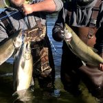
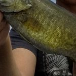
Jordanelle Reservoir represents a high-altitude convergence of deep-water structure and riverine finesse, situated at 6,130 feet in the shadow of the Uinta Mountains. As a primary feature of the Central Utah Projectβs Bonneville Unit, this 3,050-acre impoundment offers a distinct duality for the serious angler: the bustling, developed waters of the Hailstone arm and the quieter, ecologically sensitive zones near Rock Cliff where the Provo River enters the system. While the reservoir is a summer magnet for recreational boating, the seasoned fisherman knows that the subsurface topography holds significant populations of rainbow trout, cutthroat, brown trout, and smallmouth bass.
The atmosphere here shifts dramatically depending on your chosen launch point. To the west, the Hailstone Recreation Area feels like a modern, manicured harbor, offering full amenities against a backdrop of sagebrush hills and Park City ski runs. Conversely, the eastern Rock Cliff area provides a rugged, riparian vibe with wetlands and cottonwoods, demanding a more stealthy approach. The water is clear, cold, and fed by snowmelt, creating a fishery that remains productive even when valley temperatures rise, provided you understand the rhythms of the high-desert winds and recreational traffic.
For the fly angler or light-tackle specialist, Jordanelle serves as a strategic hub. It is positioned between the blue-ribbon flows of the Middle Provo River and the alpine lakes of the Mirror Lake Scenic Byway. Whether you are trolling deep structure for holdover browns or casting streamers along the rocky dikes for smallmouth, success here relies on navigating the "heavy use" summer windows and exploiting the dawn and dusk tranquility.
Access & Getting There
Accessing Jordanelle Reservoir requires navigating the high-traffic corridors connecting Salt Lake City to the Park City resort areas. The reservoir is approximately 35 to 40 miles east of Salt Lake City via I-80 East to U.S. 40 South. The primary artery, U.S. 40, runs along the western shore, providing direct access to the main facilities. While the highway is well-maintained for trailering large vessels, anglers should be aware that commuter traffic and ski tourism can cause significant congestion during peak morning and evening hours.
π‘ Captain's Tip: Launch Strategy
The "heavy use" designation in summer is not an exaggeration. At the Hailstone main ramp, trailer parking can reach capacity rapidly on weekends. Professional skippers recommend a "dawn patrol" launchβwheels in the water by 6:00 AMβto secure parking and fish the glass before the wakeboard boats arrive.
Hailstone Recreation Area (Main Launch)
The Hailstone entrance, accessed via the Mayflower exit (#8) off U.S. 40, serves as the primary logistical hub for boaters. This is an all-weather access point capable of handling larger deep-V hulls and bass boats. The facility is designed for volume, but the sheer popularity of the park means the ramps can become chaotic by mid-morning. The infrastructure here includes a large wake-free zone, which is critical for kayakers or anglers in smaller skiffs looking to escape the main basin's chop.
Rock Cliff Recreation Area (The Quiet Side)
For those targeting the river inlet or seeking a lower profile, the Rock Cliff entrance offers a completely different experience. Located on the eastern arm, this area is reached by taking State Road 32 East for approximately 7.5 miles. This zone is characterized by wetlands and the inflow of the Provo River. It is a designated nature area, meaning access is more regulated and the vibe is significantly quieter. This is the preferred launch for canoeists, float tubers, and anglers specifically targeting the transition zones where river currents meet the lake's still water.
Parking & Winter Access
Parking is ample but demand-sensitive. The Grand Hyatt Deer Valley Parking and Deer Valley - Jordanelle Express Gondola Parking are located roughly 1.7 to 2.6 miles from the water, primarily serving the resort crowd, but they indicate the level of development surrounding the western shore. For shore anglers, the Nature Center & Picnic Area Parking at Rock Cliff (3.7 miles from the main hub) provides excellent foot access to the boardwalks and river mouth. In winter, access remains open, but conditions on U.S. 40 can deteriorate quickly during storms; 4WD is recommended for towing during the ice fishing season.
Jordanelle Reservoir Pre-Trip Checklist
Facilities & Amenities
The infrastructure around Jordanelle is robust, catering to a mix of high-end tourism and serious outdoor recreation. However, for the angler, the amenities are split between on-site convenience and specialized support in the nearby towns of Heber City and Park City. Understanding where to source gear versus where to launch your boat is key to a smooth trip.
Local Tackle & Guide Support
While the state park offers basic recreational supplies, serious angling provisioning requires a stop in town. Fish Heads Fly Shop, located about 7.7 miles away in Heber City, is the premier outfitter for the area. They specialize in the local hatches and can provide critical intelligence on whether the trout are keying on midges or if the smallmouth bite is active. For conventional gear, anglers often rely on general sporting goods stores in Park City or Heber.
The charter fleet here is heavily skewed toward fly fishing, reflecting the quality of the Provo River drainage. Operators like Local Waters Fly Fishing Guides and Park City Fly Fishing Guides (located 4.8 to 7.2 miles away) are experts in this system. These services are particularly valuable for understanding the seasonal movements of fish between the river and the reservoir body.
π‘ Captain's Tip: Fuel Management
While there are marina facilities at Hailstone, seasoned boaters often prefer fueling up at the gas stations along U.S. 40 or in Heber City before entering the park to avoid premium dock prices and potential lines. Ensure your tanks are topped off before launching, as the reservoir's 3,050 acres cover a significant amount of water.
Lodging & Base Camps
Accommodation options range from luxury hotels to primitive forest camps, but proximity varies. For those who prefer a roof, the Washington School House Hotel in Park City offers high-end lodging about 5 miles from the water. For anglers towing campers, Jordanelle State Park itself offers camping at Hailstone, though reservations are fiercely competitive.
Alternative camping can be found in the surrounding National Forest lands, though these often require a drive. Redman Campground, situated at 8,300 feet in Big Cottonwood Canyon, offers a scenic alpine setting but is a 9.4-mile drive through canyon roads, making it less convenient for early morning launches than the on-site campgrounds. Ponderosa Group Campground on the Mirror Lake Highway is another option for larger groups, located roughly 11 miles away.
Facility Name
Type
Distance & Logistics
Redman Campground
USFS Campground
9.4 miles away. High elevation (8,300 ft). Dirt parking spurs. Good for base camp if on-site spots are full.
Heber Valley Camp
Private/Church Camp
12 miles away. Large facility, often used for groups.
Ponderosa Group Campground
USFS Campground
11.1 miles away. Located on Scenic Byway 150. Rustic experience.
Fish Heads Fly Shop
Retail & Intel
7.7 miles (Heber City). Opens 8:00/9:00 AM. Essential for fly selection.
Permits, Regulations & Fees
Jordanelle Reservoir is a multi-jurisdictional waterbody managed by the Utah Division of Parks and Recreation under an agreement with the Bureau of Reclamation. Compliance with state and local regulations is strictly enforced due to the reservoir's status as a culinary water source and a high-use recreation area.
Entry & Launch Fees
A fee is required for entrance to the State Park, which covers access to both Hailstone and Rock Cliff areas. Day-use fees are standard, but frequent visitors should consider the Utah State Parks annual pass. Boat launching often incurs an additional fee separate from the vehicle entry. Reservations for camping and specific day-use pavilions must be made through the Reserve America system, often months in advance for summer weekends.
Fishing Regulations
Fishing is governed by the Utah Division of Wildlife Resources. A valid Utah fishing license is mandatory for all anglers 12 years of age and older. The reservoir is managed for a mix of species, and specific bag limits may apply, particularly for smallmouth bass and trout species. Because of the presence of sensitive native cutthroat trout in the drainage, anglers should be adept at species identification. The Rock Cliff area, being a transition zone for the Provo River, may have specific seasonal closures or tackle restrictions to protect spawning fish; always check the current proclamation guidebook.
Aquatic Invasive Species (AIS)
Utah is aggressive regarding the prevention of Quagga and Zebra mussels. All watercraft launching at Jordanelle are subject to mandatory inspection. Boaters must self-certify that their vessel has been cleaned, drained, and dried. Failure to comply can result in significant fines and the quarantining of your boat. Expect inspection stations at the Hailstone ramp, especially during the peak season.
Events & Seasonal Information
The fishery at Jordanelle follows a distinct seasonal rhythm driven by elevation and water management. The "managed recreation season" is year-round, but the character of the lake changes drastically.
Seasonal Rhythms
Spring (April - June): As the ice recedes and water temperatures climb, trout cruising the shallows and smallmouth bass moving up to spawn create prime angling opportunities. This is also the peak season for birdwatching, with over 66 neotropical migrant species passing through the Rock Cliff wetlands. Summer (July - August): This is the season of "heavy use." Angling is best restricted to early mornings or late evenings to avoid the recreational boat traffic. The deep water near the dam becomes critical for finding cool-water holding trout. 
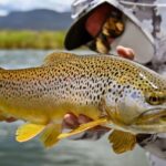
Fall (September - October): As recreational traffic dies down and water temperatures cool, the brown trout become aggressive. This is often considered the "local's season." Winter: Ice fishing is a popular pursuit here, targeting perch and trout through the hard deck. Bald Eagles and Northern Pygmy Owls are common winter residents.
π‘ Captain's Tip: Wind Warning
Situated in a mountain valley, Jordanelle is prone to sudden, violent winds, particularly in the afternoon. The fetch across the main basin can build dangerous chop quickly. Small craft should stick to the protected bays or the wake-free zones when the afternoon thermals kick in.
Contact Information & Resources
For the most current conditions, gate closures, and emergency assistance, direct communication with park management is recommended. The Jordanelle State Park office can be reached at 435-649-9540. For inquiries regarding the Rock Cliff area specifically, the number is 435-782-3030. In the event of an on-water emergency, cell service is generally reliable on the Hailstone side but can be spotty in the Rock Cliff drainage.
For precise locations of the boat ramps, fish cleaning stations, and real-time weather conditions, consult the live dashboard and interactive maps below.
π£
Jordanelle Reservoir
Hideout β’ Utah β’ 40.6177, -111.4093
π ΏοΈ
Parking
5
Grand Hyatt Deer Valley Parking (Propark)
β 5.01.7 mi
π1702 Glencoe Mountain Wy, Park City, UT 84060, USA
Our spot reports combine data-driven forecasts with curated local information. The forecast is generated by our proprietary Fishing Score algorithm (0β100%), which analyzes real-time data from Open-Meteo API, validated against NOAA CO-OPS tide gauges and USGS water-monitoring stations. The model weights tide dynamics (35%), wave energy (25%), wind patterns (20%) and time of day (20%)βfactors shown to influence fish feeding behavior through marine-biology research and decades of charter log data.
Access, facilities and services information for each fishing spot is sourced from official datasets such as Recreation.gov (RIDB), state park & wildlife agencies, and geospatial providers like Google Maps. These sections undergo scheduled re-validation every 3β6 months to ensure that boat ramps, park access, contact details and local services remain accurate.
Narrative sections (catches, seasonal behavior, local tips) are synthesized from these data sources and refined following the Fishing Reports Today editorial guidelines, combining bibliographic research from ichthyology and oceanography with expert angler experience. Our team reviews reports on a regular basis, while the forecast model itself updates every 6 hours for real-time accuracy.
β οΈ Important: Always verify current local regulations, access restrictions and weather conditions before fishing. These reports are intended as a planning aid, not a guarantee of catches or safety. When in doubt, contact local authorities or park managers listed on the page.
To provide the best experiences, we use technologies like cookies to store and/or access device information. Consenting to these technologies will allow us to process data such as browsing behavior or unique IDs on this site. Not consenting or withdrawing consent, may adversely affect certain features and functions.
Functional Always active
The technical storage or access is strictly necessary for the legitimate purpose of enabling the use of a specific service explicitly requested by the subscriber or user, or for the sole purpose of carrying out the transmission of a communication over an electronic communications network.
Preferences
The technical storage or access is necessary for the legitimate purpose of storing preferences that are not requested by the subscriber or user.
Statistics
The technical storage or access that is used exclusively for statistical purposes.The technical storage or access that is used exclusively for anonymous statistical purposes. Without a subpoena, voluntary compliance on the part of your Internet Service Provider, or additional records from a third party, information stored or retrieved for this purpose alone cannot usually be used to identify you.
Marketing & Affiliates
The technical storage or access is required to create user profiles to send advertising, or to track the user on a website or across several websites for similar marketing purposes, including affiliate tracking for products recommended in our reports.
Leave a Reply