


Causey Reservoir Pre-Trip Checklist
Local Access & Facilities
Causey Reservoir represents a distinct shift from the accessible, concrete-lined fisheries found closer to the metropolitan centers of Utah. Situated at an elevation of roughly 5,700 feet within the Uinta-Wasatch-Cache National Forest, this fishery is defined by its steep, canyon-like geography and its role as a primary drainage for the South Fork of the Ogden River. Unlike the sprawling flats of lower reservoirs, Causey is a scenic mountain lake where the water runs deep and cold, flanked by rugged terrain that demands a higher level of logistical preparation from the angler. The atmosphere here is one of alpine seclusion, distinct from the high-traffic recreational boating hubs, offering a quieter, more technical experience for those targeting cold-water species.
The reservoir serves as a critical junction between the high-country runoff and the valley floor, creating a dynamic environment where water levels and temperatures can fluctuate based on the flows from the South Fork. For the seasoned captain or serious angler, the draw here is not just the fishing but the environment itself. It lacks the commercial marina development seen elsewhere, meaning trips here are self-supported endeavors. The vibe is decidedly rustic; you are leaving the manicured parks behind for a location where red rock cliffs meet deep blue water.
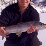
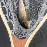
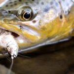
Anglers targeting this water must understand that Causey Reservoir is not designed for high-speed run-and-gun fishing. The topography dictates the strategy, with steep shorelines and specific launch points governing access. While families and recreational tubers frequent the surface during the heat of summer, the dawn and dusk hours belong to those who understand the rhythms of a mountain fishery. The primary pursuit here typically involves trout and kokanee salmon varieties common to these elevations, requiring a tactical approach to depth and structure.
💡 Captain's Tip: Elevation Logistics
You are launching at over 5,000 feet. Ensure your outboard is tuned for altitude if you are running a gas motor, and be prepared for significantly cooler morning temperatures than you experienced in Ogden. The canyon walls shadow the water early in the day, delaying the bite and the warmth.
Access & Getting There
Reaching Causey Reservoir requires navigating the Ogden Canyon, a route that is as scenic as it is potentially congested. The primary artery for access is Highway 39, heading east from Ogden. Experienced locals know that the drive along 12th Street through the canyon can be a bottleneck, particularly on summer weekends or during ski season. The road winds along the river, eventually opening up into the Ogden Valley before climbing again toward the reservoir. You will pass through Huntsville, which serves as your last true outpost for civilization before hitting the canyon proper.
The final approach on Highway 39 toward Monte Cristo leads you to the reservoir turnoffs. The road infrastructure here is maintained for heavy seasonal use, but the gradients are real. Towing heavy glass boats requires attention to transmission temperatures, and breaking distances increase on the descent. The access road specifically to the dam and launches can be narrow in sections, demanding caution when passing other trailers. Winter access changes the dynamic entirely; while the road is generally plowed to a point, the area is adjacent to major winter sports zones like Snowbasin, meaning traffic patterns shift from anglers to skiers.
Causey Reservoir offers three distinct boat launch areas, each with specific utility depending on your vessel size and the water level. The Causey Dam Boat Launch is the primary access point for many, located closest to the main retention structure. For those looking to access the southern arms of the reservoir, the Causey South Boat Launch provides a strategic entry point, roughly 4,000 feet from the dam access. Additionally, the Causey North Boat Launch services the northern reaches. It is critical to note that these "launches" are often more primitive than the concrete super-ramps found at Echo Reservoir. They are functional but require skill to navigate, especially when water levels recede in late summer.
Parking is a tactical consideration here. Unlike the massive lots at Echo or Pineview, the parking footprint at Causey is constrained by the canyon geography. The Wildcat Parking Lot and Earl’s Parking Lot are in the general vicinity, often associated with nearby trailheads or winter sports, but for the angler towing a trailer, early arrival is non-negotiable. The lots adjacent to the ramps do not have infinite capacity for truck-and-trailer combinations. If you arrive after 8:00 AM on a Saturday, you may find yourself unable to turn around, let alone park. The sheer steepness of the surrounding terrain makes overflow parking virtually non-existent.
💡 Captain's Tip: The "South Fork" Traffic
The road to Causey is the same artery used by tubers floating the South Fork Ogden River. On hot July weekends, this two-lane road becomes a parking lot of shuttling vehicles. Plan your exit strategy; leaving the reservoir at 4:00 PM puts you directly into the "tuber traffic" jam heading back to Ogden.
Facilities & Amenities
The infrastructure at Causey Reservoir is defined by what is absent as much as what is present. This is a "pack it in, pack it out" fishery. There are no fuel docks, no on-water restaurants, and no fully stocked marinas on the water itself. For fuel, ice, and food, Huntsville is your nearest reliable logistical hub, located approximately 10 miles west. The Valley House Inn in Huntsville offers a touch of local history and lodging, but for marine-specific needs, you are largely on your own once you leave the valley floor.
The most critical piece of "negative knowledge" for the angler is the location of the nearest tackle shop. The Upland Fly Shop is located in Uintah, over 20 miles away. There is no bait shop at the launch ramp. If you break a rod tip, run out of specific distinct baits, or forget your life jackets, your day is effectively over unless you are willing to drive an hour round-trip. Self-reliance is the rule here. Morgan RV & Boat Storage is available roughly 18 miles away, which is useful for long-term visitors, but it does not solve immediate gear failures on the water.
For multi-day excursions, the area is serviced by Forest Service campgrounds that are well-positioned for the "dawn patrol" launch. Willows Campground and Upper Meadows Campground are both located approximately 2.6 miles from the water, along the South Fork. These are not resort-style campgrounds with hookups and pools; they are facility-style camps designed for proximity to nature. They offer vault toilets and campfire rings, but water hookups are generally absent. The table below details the specific capacities of these key staging areas.
Local Campground Capacities
| Facility Name | Site Types | Max Vehicle Length | Hookups | Season/Notes |
|---|---|---|---|---|
| Willows Campground | 14 Single, 3 Double | 38 Feet | None (Vault Toilets) | Heavy shade, river adjacent |
| Upper Meadows | 9 Single Sites | 38 Feet | None (Vault Toilets) | Popular for tubing access |
Lodging for those who prefer a roof over their heads requires a drive back toward Eden or Huntsville. Columbine Inn and Valley View Recreation Camp provide options, but they are generally 10 to 15 miles from the boat ramp. This distance emphasizes the value of the local campgrounds for serious anglers who want to be on the water before the sun hits the canyon floor.
Permits, Regulations & Fees
Causey Reservoir and its surrounding tributaries fall under the management of the Uinta-Wasatch-Cache National Forest, with specific recreation sites managed by the Utah Recreation Company. Compliance here is strictly enforced, largely due to the heavy mixed-use nature of the area. One of the most critical regulations to be aware of concerns the South Fork Ogden River adjacent to the campgrounds: a life jacket is mandatory for all tubers. While this specifically targets recreational floaters, it indicates the strict safety culture enforced by local rangers.
Camping regulations are rigid, reflecting the high demand for these sites. The reservation window is competitive, and the cancellation policies are strict. A $10.00 service fee is deducted for cancellations, and late cancellations (day before or day of arrival) result in the forfeiture of the first night's fee. This policy is designed to prevent "camping hoarding" where users book sites just in case. For the angler, this means you should book your site the moment your trip dates are confirmed, but also check for last-minute openings from cancellations if you are planning a spur-of-the-moment trip.
While the JSON data indicates that a specific permit is not required for entry into the general reservoir area, standard Utah state fishing licenses are mandatory. The campgrounds themselves operate on a fee basis, and day-use fees may apply at developed recreation sites. Interagency Passes, such as the Senior Annual Pass or Access Pass, can provide discounts on camping fees (usually 50% off the use fee), but these discounts do not apply to double sites or utility fees. Always display your pass or fee receipt prominently on your dashboard to avoid citations while you are out on the water.
💡 Captain's Tip: Quiet Water Etiquette
Because of the canyon acoustics and the presence of non-motorized crafts like kayaks and paddleboards, noise travels extensively here. While not always a regulatory requirement, keeping voices and engine noise low in the narrow arms of the reservoir is considered standard etiquette and helps maintain the bite for wary trout.
Events & Seasonal Information
The rhythm of Causey Reservoir is dictated by the seasons of the high Wasatch mountains. The "hard water" season is significant here; the reservoir freezes over in winter, transitioning the fishery from open water trolling to ice fishing, conditions permitting. However, road access in winter can be the limiting factor. The transition to spring runoff usually occurs in late May or June, during which the water may be stained and floating debris from the South Fork can present navigation hazards for props and hulls.
Summer is the peak operational window, but it brings the "recreational hatch." The campgrounds at Willows and Upper Meadows fill to capacity, and the river becomes a highway of tubers. For the serious angler, this makes the summer season a game of timing. The best fishing occurs in the shoulder months—late September through October—when the recreational crowds have dispersed, the water cools, and the Kokanee begin their staging behaviors. During the height of summer, the bite is almost exclusively an early morning affair before the sun crests the high canyon walls and the heat puts the fish down deep.
There are no major professional tournament circuits that regularly stop at Causey compared to the larger nearby bodies of water like Pineview or Echo. This keeps the fishing pressure relatively localized, but it also means there is less real-time community intelligence available on public forums. You are often fishing against the fish, not other tournament boats.
Contact Information & Resources
For the most current conditions, water levels, and campground status, direct communication with the managing agencies is recommended. The Willows Campground and associated facilities are managed under the Uinta-Wasatch-Cache National Forest jurisdiction. The direct line for the campground management is 385-273-1100. This is your best resource for checking if the campgrounds are open or if fire restrictions are in place.
For broader inquiries regarding the reservoir's water management or downstream flows, the Echo Reservoir contact (which manages the Weber River Project downstream) can sometimes provide context on regional water operations, reachable at 435-336-9894. In terms of safety, cell service can be spotty in the deep canyon sections. It is advisable to file a float plan with someone on shore before heading out. Emergency services will have a delayed response time due to the winding nature of Ogden Canyon.
For precise locations of the boat ramps, real-time weather overlays, and detailed bathymetry where available, consult the live dashboard and interactive maps below.

Leave a Reply