0%

Porcupine Reservoir Fishing Report Today 🎣

5 months ago · Updated 4 weeks ago

FISHING REPORT: Porcupine Reservoir, UT

Report Date: Current Winter Season (January 2026)

Location: Cache County, Utah (Avon Area)

1. GO/NO-GO STATUS

Status: CAUTION / GO (Conditional)

The Verdict: The hard deck is established at Porcupine Reservoir, but the real challenge isn't the ice—it's the road. The final ascent from Avon to the dam is currently a sheet of ice and hard-packed snow. Do not attempt the final hill without 4WD and chains, or better yet, park at the lower turnout and snowmobile/walk the last stretch. Once on the ice, conditions are generally stable near the dam, but avoid the inlet area on the east end where moving water weakens the ice sheet.

Weather Impact: High pressure has settled in, bringing cold nights and bright, sunny days. This often pushes the Kokanee deeper during midday. Plan for sub-freezing temperatures; shelter and heaters are mandatory for full-day sessions.

2. SPECIES INTEL

Based on recent biological data and verified stocking reports, here is your hit list.

Primary Target: Kokanee Salmon

Activity Level: High

Bio-Data Verification: While the citizen science data highlights Brown Trout activity in the Cache region, Porcupine is biologically dominated by Kokanee Salmon right now. DWR surveys confirm a high-density population. These fish are currently suspended in schools, feeding on zooplankton. They are smaller on average (10-12 inches) but plentiful.

Secondary Target: Brown & Rainbow Trout

Activity Level: Moderate

Bio-Data Verification: A confirmed observation of Brown Trout on December 20th in the immediate Cache County vicinity supports the active winter trout pattern. Rainbows are stocked annually and provide consistent action for shoreline anglers. The Brown Trout here are self-sustaining and can grow large, though they are harder to trick through the ice.

Sleeper Pick: Splake

Why: Stocked consistently since 2015, these Brook Trout x Lake Trout hybrids are aggressive winter feeders. They cruise the transition zones between the steep rocky cliffs and the mud bottom. Most anglers mistake them for oddly colored Brookies.

Baitfish/Forage Report

The primary forage here is zooplankton (for Kokanee) and aquatic insects/small sculpin (for Trout). There is no significant baitfish population like Shad to mimic, so keep your presentations small and insect-like.

3. TACTICAL STRATEGY

Zone 1: The Dam (Trout & Splake)

  • Structure: Steep rocky face dropping into 40+ feet of water.
  • Depth: Fish 10–20 feet down over 30–40 feet of water. Trout cruise the wall.
  • The Rig: 1/16 oz tungsten jig in Wonderbread or Chartreuse.
  • Bait: Tip with a wax worm or a small chunk of nightcrawler.
  • Technique: Deadstick one rod (stationary) and jig the other aggressively to call them in.

Zone 2: Mid-Lake Basin (Kokanee Salmon)

  • Structure: Open water basin, suspended schools.
  • Depth: 30 to 45 feet suspended over 60+ feet of water. Use electronics to find the school depth.
  • The Rig: Swedish Pimple (Size 2, Pink/Glow) or a Maniac Cutter spoon.
  • Bait: Essential: Tip hooks with a single Pink Gulp Maggot or a dyed red mealworm. Kokanee are scent-driven.
  • Timing: The bite is best from 7:00 AM to 10:00 AM. Once the sun is high, the schools scatter and drop deeper.

Pro Tip: Porcupine Kokanee have soft mouths. Use a long, noodle-tip ice rod and a snubber if trolling (or light drag if jigging) to prevent tearing the hook out at the hole.

4. REGULATIONS SNAPSHOT (2025-2026)

Critical Update: New regulations for the 2025-2026 season allow anglers to use up to 6 lines while ice fishing at Porcupine Reservoir. You must check your own lines, and if using more than two, each line must be labeled with your name.

SpeciesDaily LimitNotes
Trout & Salmon (Combined)12 Fish TotalOnly 4 may be Rainbow, Brown, or Cutthroat. To keep a full limit of 12, at least 8 must be Kokanee Salmon.
Salmon SeasonOpenPossession closed Sept 10 – Nov 30. Currently OPEN for harvest.

Advisory: There is a mercury consumption advisory for Brown Trout in this reservoir. Catch and release is recommended for larger Browns.

5. REGIONAL ALTERNATIVE

If the road to Porcupine is impassable:

Location: Pineview Reservoir (Huntsville, UT)

  • Distance: ~45 minutes south.
  • Target: Black Crappie and Yellow Perch.
  • Intel: The bio-data indicates verified Black Crappie activity near the Huntsville arm (76G9+97) as recently as December 25th.
  • Tactic: Access at Cemetery Point or the Port Ramp. Fish the weed lines in 12-18 feet of water with micro-tungsten jigs and plastics. Access is paved and plowed regularly.

Tight lines!

Loading forecast...

Live Fishing Conditions: Tides, Weather & Waves

Get real‑time tides, marine weather, swell and solunar activity for each spot so you know exactly when conditions line up for your best chance at a bite.

🎣

Porcupine Reservoir

Loading coordinates...

🌤️

WEATHER CONDITIONS

Weather
-- °F
--°C

Loading...

🌡️
Feels Like --°F --°C
💧
Humidity --%
💨
Wind -- mph -- km/h
🧭
Direction --
📊
Pressure -- inHg -- hPa
☀️
UV Index --
🌊

MARINE CONDITIONS

🌊 Wave Height
-- ft
-- m
Loading...
🧭 Wave Direction
--°
Loading...
⏱️ Wave Period
-- s
Loading...
📈 Tide Status
-- ft
-- m
Loading...
🌙

LUNAR & SOLUNAR

🌕

Loading...

Illumination: --%

Major Period --:-- - --:-- --:-- - --:--
Minor Period --:-- - --:-- --:-- - --:--
🌅 Sunrise --:--
🌇 Sunset --:--
📅

24-HOUR FORECAST

Loading fishing conditions...

Fishing Spots Map

My location
Loading map...

Local Access & Facilities

Porcupine Reservoir Pre-Trip Checklist

Local Access & Facilities

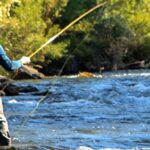
Porcupine Reservoir, located in the high country near Avon, Utah, offers a distinct departure from the manicured experience of typical state parks. Situated in the rugged hills south of the Cache Valley, this fishery is defined by its steep shorelines and deep, cold water fed by the Little Bear River. Unlike the bustling Hyrum Reservoir to the north, Porcupine provides a quieter, more technical angling environment that appeals to those willing to trade paved convenience for solitude.

The atmosphere here is distinctly alpine, with the surrounding terrain rising sharply from the water's edge. The reservoir serves as a critical water storage facility, meaning water levels can fluctuate significantly, altering the structure and access points throughout the season. Anglers visiting this location are typically targeting cold-water species that thrive in the elevation, utilizing the steep drop-offs and submerged creek channels that characterize the bottom topography.

For the serious angler, Porcupine Reservoir represents a logistical balance between remote ruggedness and accessibility. While it lacks the developed marina infrastructure of nearby waters, its proximity to the town of Avon and the broader Hyrum area ensures that essential supplies are never too far out of reach. Success here requires reading the terrain as much as the water, making it a favorite for experienced boaters and shore casters alike.

Access & Getting There

Navigating to the Reservoir

Access to Porcupine Reservoir is generally achieved via Avon, traveling south from the Hyrum area. The primary route involves taking Highway 165 or Highway 101 towards the southern end of the Cache Valley. The drive transitions from the agricultural plains of Hyrum into the canyon roads leading up to the reservoir. Traffic is rarely an issue in this rural sector, though winter conditions can make the final approach treacherous due to snow and ice on the steeper grades.

Boat Launch Realities

The launch facilities at Porcupine are functional but basic compared to the developed marinas at Hyrum State Park. Data indicates two primary boat launch locations situated on the reservoir's perimeter. The first launch point is located approximately 1,464 feet from the main access road, with a second option roughly 3,554 feet away. These are typically unimproved or gravel ramps suitable for trailer boats, but skippers should exercise caution. During late summer drawdowns, the concrete or gravel may end well before the water line, requiring four-wheel drive for safe recovery.

💡 Captain's Tip: Launch Traction

The ramps at Porcupine can become slick or steep as water levels drop in late summer. Ensure your tow vehicle has decent all-terrain tires and 4WD engaged before backing down, especially if the reservoir is below full pool.

Parking & Security

Parking at the reservoir itself is generally informal, centered around the launch areas and designated pull-outs. Unlike the paved, marked lots at Hyrum State Park (10 miles away), you will likely be parking on packed dirt or gravel. Ensure your vehicle and trailer are blocked securely, as the terrain is rarely perfectly level. While crime is low in this remote area, standard precautions apply: stow valuables out of sight. For those with larger rigs or needing long-term storage, 6th West Storage in Logan offers facilities, though it is approximately 18.5 miles distant.

Facilities & Amenities

Bait & Tackle Logistics

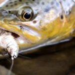
While Porcupine Reservoir is remote, anglers are well-supported by regional shops. The standout resource for the "dawn patrol" crowd is Bear River Outfitters, located approximately 16.8 miles away in Willard. Crucially, this shop is listed as open 24 hours, seven days a week. This is a game-changer for captains needing fresh bait or last-minute terminal tackle before a pre-dawn launch. For specialized gear, Maniac Custom Lures LLC is located about 21.3 miles away in Bear River City, offering custom options that can be the difference-maker on tough bite days.

Lodging & Base Camps

For multi-day trips, the accommodation options range from primitive to organized campgrounds. The closest facility is Cinnamon Creek Camp, located just 1.9 miles from the water in Paradise, Utah. This proximity allows for maximum time on the water. For a more developed camping experience with river access, the Pioneer Campground and Shenoah Picnic Area are excellent alternatives. Situated roughly 7.9 miles away in Blacksmith Fork Canyon, these sites sit at an elevation of 5,600 feet and offer vault toilets, picnic tables, and fire rings under the shade of black willow and box elder trees.

💡 Captain's Tip: Supply Run

There are no fuel docks or convenience stores on the water at Porcupine. Top off your gas tanks and cooler ice in Hyrum or Logan before ascending the canyon road to Avon.

Facility Overview Table

Facility NameTypeDistanceKey Features
Cinnamon Creek CampCamping1.9 milesClosest lodging option; high rating (4.9/5).
Pioneer CampgroundCamping7.9 miles17 single sites; vault toilets; secluded river setting.
Shenoah Picnic AreaDay Use/Camp7.9 milesGroup sites available; river access; 5,600 ft elevation.
Bear River OutfittersRetail16.8 milesOpen 24 Hours; Bait & Tackle.
Hyrum State ParkState Park10.0 milesNearest full-service hub; boat ramp; developed camping.

Permits, Regulations & Fees

Management & Jurisdiction

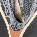
Fishing at Porcupine Reservoir and the surrounding waters falls under the jurisdiction of state agencies, often in coordination with the Bureau of Reclamation for water management. While Hyrum State Park nearby is explicitly managed by Utah State Parks, Porcupine is often subject to standard state fishing regulations. Anglers must possess a valid Utah fishing license. Conservation officers patrol these waters to ensure compliance with bag limits and gear restrictions, which are vital for sustaining the fishery in these high-pressure reservoirs.

Protected Areas & Etiquette

The area surrounding the reservoir, particularly near the Bear River Migratory Bird Refuge (approx. 17 miles west), is sensitive ecological land. The refuge is a Western Hemisphere Shorebird Reserve Network site, hosting millions of migrating birds. While fishing is the priority at Porcupine, anglers should be aware that the broader watershed supports critical habitat. Respect "Kapu" or off-limits areas, particularly near dam infrastructure or designated wildlife zones. Clean, Drain, and Dry protocols are mandatory to prevent the spread of aquatic invasive species between water bodies.

Events & Seasonal Information

Seasonal Rhythms

The fishing calendar in this part of Utah is dictated by elevation and ice. The heavy use season generally runs from April through September. During spring, runoff from the Wellsville Mountains and local canyons can stain the water, affecting visibility and lure selection. Summer brings stable weather, but also recreational boat traffic, making early mornings and late evenings the prime windows for serious angling.

Winter Operations

Winter sports are a recognized activity in the region, and once the ice caps the reservoir, the dynamic shifts entirely to hard-water fishing. Access during winter depends heavily on snow plowing schedules on the county roads leading to Avon. The nearby Hyrum Reservoir maintains year-round access, but the more remote nature of Porcupine means anglers should carry recovery gear and monitor storm fronts closely.

💡 Captain's Tip: Wind Warning

Canyon reservoirs act as funnels for wind. Afternoon thermals can whip up significant chop quickly. Plan your crossing to the leeward side before 11:00 AM to avoid a rough ride back to the ramp.

Contact Information & Resources

Emergency & Agency Contacts

For official information regarding water levels, closures, or camping reservations, the primary point of contact for the region is the Hyrum State Park office, which often serves as an information hub for the surrounding fisheries.
  • Hyrum State Park Office: 435-245-6866
  • Bear River Migratory Bird Refuge: 435-723-5887
  • Shenoah/Pioneer Campground Info: 385-273-1100
Self-reliance is key in this area. Cell service can be spotty in the canyons south of Avon. Always file a float plan with a contact on land before launching.

For precise locations of the boat ramps, real-time weather data, and interactive maps of the shoreline access points, consult the live dashboard and maps below.

🎣

Porcupine Reservoir

Avon • Utah • 41.5190, -111.7373
🅿️

Parking

5
6th West Storage
⭐ 5.0 18.5 mi
📍 2210 N 600 W, Logan, UT 84341, USA
🕒
Monday: 8:00 AM – 9:00 PM
Tuesday: 8:00 AM – 9:00 PM
Wednesday: 8:00 AM – 9:00 PM
Thursday: 8:00 AM – 9:00 PM
Friday: 8:00 AM – 9:00 PM
Saturday: 8:00 AM – 9:00 PM
Sunday: 8:00 AM – 9:00 PM
🚗 Get Directions
Church 24th ward
⭐ 5.0 13.7 mi
📍 650 Anderson Dr, Brigham City, UT 84302, USA
🚗 Get Directions
BRIGHAM CITY UTAH TEMPLE PARKING LOT
⭐ 5.0 14.5 mi
📍 Brigham City, UT 84302, USA
🚗 Get Directions
Weber Institute Parking
⭐ 4.9 24.9 mi
📍 1302 Edvalson St, Ogden, UT 84403, USA
🕒
Monday: 7:30 AM – 4:30 PM
Tuesday: 7:30 AM – 4:30 PM
Wednesday: 7:30 AM – 4:30 PM
Thursday: 7:30 AM – 4:30 PM
Friday: 7:30 AM – 4:30 PM
Saturday: Closed
Sunday: Closed
🚗 Get Directions
🐟

Bait & Tackle

2
Bear River Outfitters
⭐ 5.0 16.8 mi
📍 130 W 1050 N, Willard, UT 84340, USA
🕒
Monday: Open 24 hours
Tuesday: Open 24 hours
Wednesday: Open 24 hours
Thursday: Open 24 hours
Friday: Open 24 hours
Saturday: Open 24 hours
Sunday: Open 24 hours
🚗 Get Directions
🏠

Lodging

5

Boat Ramps

3
🚻

Restrooms

3
👨‍👩‍👧‍👦

Family Friendly

2

Accessibility

Wheelchair Access

Not Confirmed

🐕

Pets Allowed

Not Confirmed

⚠️ Some accessibility info not officially confirmed. Please verify with location directly.

📍 Showing 20 facilities on map

📊

About Our Fishing Reports & Forecasts

Our spot reports combine data-driven forecasts with curated local information. The forecast is generated by our proprietary Fishing Score algorithm (0–100%), which analyzes real-time data from Open-Meteo API, validated against NOAA CO-OPS tide gauges and USGS water-monitoring stations. The model weights tide dynamics (35%), wave energy (25%), wind patterns (20%) and time of day (20%)—factors shown to influence fish feeding behavior through marine-biology research and decades of charter log data.

Access, facilities and services information for each fishing spot is sourced from official datasets such as Recreation.gov (RIDB), state park & wildlife agencies, and geospatial providers like Google Maps. These sections undergo scheduled re-validation every 3–6 months to ensure that boat ramps, park access, contact details and local services remain accurate.

Narrative sections (catches, seasonal behavior, local tips) are synthesized from these data sources and refined following the Fishing Reports Today editorial guidelines, combining bibliographic research from ichthyology and oceanography with expert angler experience. Our team reviews reports on a regular basis, while the forecast model itself updates every 6 hours for real-time accuracy.

⚠️ Important: Always verify current local regulations, access restrictions and weather conditions before fishing. These reports are intended as a planning aid, not a guarantee of catches or safety. When in doubt, contact local authorities or park managers listed on the page.

Learn more about our methodology & data sources

Leave a Reply

Your email address will not be published. Required fields are marked *