Welcome to the latest insider intel for the Ogden River. As a Senior Fishing Editor and local Pro Guide, I have compiled everything you need to successfully navigate this stunning Blue Ribbon Fishery. Whether you are working the wild canyon pockets of the South Fork or the accessible urban stretches of the lower river, precision and stealth are your best friends right now.
1. GO/NO-GO STATUS
Verdict: GO (With Tactical Caution)
Summer conditions have settled in across the Ogden River watershed, dictating a highly strategic approach. Natural flows in the South Fork and releases from Pineview Reservoir are running at typical seasonal levels, rendering the water gin-clear. Wading safety is optimal with highly manageable currents, but this extreme water clarity makes trout exceptionally wary. Careless movement, heavy footfalls, or unnatural shadows will spook fish before you even make a cast.
From the editor
Tired of fishing with strangers you can’t trust?
Nautrek is the first social network for serious anglers — verified partners, real trips, cost splitting and intel sharing without burning your spots. Private beta now open.
Water temperatures are starting in the crisp upper 40s at dawn and climbing into the low 60s by late afternoon. Plan your trips around the low-light windows of early morning and late evening to avoid the midday lull and reduce stress on the fishery. There are no severe weather or runoff hazards currently impacting access, making this a fantastic time to hit the canyon.
Pro Tip:Whirling disease has been detected in this river system. Always Clean, Drain, and Dry your waders and boots thoroughly before moving to new waters to prevent the spread of invasive pathogens.
2. SPECIES INTEL
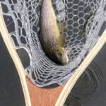
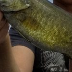
Primary Target: Brown Trout and Rainbow Trout
The South Fork boasts a thriving population of wild, aggressive brown trout that dominate the undercut banks, submerged boulders, and deeper structured pools. Rainbow trout, bolstered by seasonal stocking of catchables from the DNR, are holding in the highly oxygenated riffles and deeper bend pools where cooler water flows continuously.
Sleeper Pick: Mountain Whitefish
Often bypassed or misidentified by anglers fixated solely on trout, these native fish school up tightly in the deeper, slower bend pools. They are incredibly active during the summer months and provide consistent, rod-bending action when the midday trout bite slows down. They fight hard, utilize the current to their advantage, and will readily take a well-drifted nymph.
Baitfish & Forage Report
Aquatic insects are the primary forage right now. Expect to see Pale Morning Duns (PMDs), Caddis, and small Blue Winged Olives (BWOs). Terrestrials like grasshoppers, beetles, and ants are also starting to blow into the river from the high canyon grass, making them a prime caloric target for opportunistic browns waiting near the banks.
3. TACTICAL STRATEGY
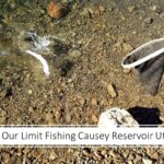
Where: Focus your efforts on the South Fork between Causey Reservoir and Pineview Reservoir. Access the river via Magpie Campground or Memorial Park off Highway 39. Target the transitional zones where shallow 1-2 foot riffles drop into deeper 3-4 foot isolated pools. The meandering sections with undercut banks and overhanging brush are prime holding water for larger browns seeking shade and ambush points.
Lure & Bait: For spin anglers, small inline spinners like a 1/16 oz Panther Martin (black body with a gold blade for clear water) or a 1/8 oz tungsten tear drop jig will produce well in the deeper runs. If you prefer bait, waxworms, mealworms, or a classic nightcrawler drifted naturally without heavy weight will yield fantastic results.
Fly Fishing: The hopper-dropper rig is incredibly effective right now. Tie on a size 10 or 12 foam grasshopper or Stimulator as your indicator fly, and drop a size 16 or 18 beadhead nymph (like a Frenchie, Copper John, or Zebra Midge) about 18 to 24 inches below it. If a wary fish inspects the dry fly and refuses it, they will often engulf the trailing nymph on the way down.
Timing: The first three hours of daylight and the last two hours before dusk are the golden windows. Midday fishing will require dropping down to 6X tippet, micro-nymphs, and targeting the deepest, most shaded pools.
Pro Tip:When fishing the gin-clear South Fork, keep a low profile. Kneel when approaching a promising pool and make your first cast to the tailout before working your way up to the head of the run. If you walk right up to the edge, you have already lost the element of surprise.
4. REGULATIONS SNAPSHOT
Always verify local regulations before hitting the water, but here are the key rules for the Ogden River:
Species
Daily Bag Limit
Size & Harvest Restrictions
Trout (Combined limit including salmon/grayling/hybrids)
4 Fish
No more than 2 under 15 inches; no more than 1 over 22 inches.
Cutthroat & Tiger Trout
Part of 4 Fish Limit
All Cutthroat and Tiger Trout between 15 and 22 inches MUST be immediately released.
Mountain Whitefish
10 Fish
No specific size restrictions.
Critical Closure: From Pineview Dam downstream to the first bridge (approximately 0.5 miles) is STRICTLY CLOSED TO FISHING year-round. Do not cast a line in this sanctuary zone.
5. REGIONAL ALTERNATIVE
If the Ogden River is too crowded, or the low, clear water proves too technical for a relaxing day, head just downstream to Pineview Reservoir. This multi-species hub offers a completely different angling experience and is an excellent backup plan.
Target Species: Smallmouth Bass, Yellow Perch, Black Crappie, and Tiger Muskie.
Access Points: Cemetery Point, Anderson Cove, and various pull-offs along Highway 39.
Tactical Approach: Focus on the rocky points, submerged brush, and weed edges. For smallmouth bass, throw green pumpkin tube jigs or drop-shot rigs in 10 to 15 feet of water early in the morning. As the sun gets high, target the shaded sides of structure.
Pro Tip:When targeting tiger muskie at Pineview, use heavy fluorocarbon leaders and large, flashy inline spinners or glide baits. Employ a figure-eight motion at the side of the boat or bank before lifting your lure out of the water, as these aggressive predators are notorious for following baits to the very end before striking.
Tight lines!
Editor's Choice: Must-Have Gear
FISHINGSIR Next-Gen Waterproof Chest Waders
★★★★★4.4 (7,370+ reviews)
2-Ply Tech: Upgraded nylon with 2.5x higher density than standard fabrics.
100% Waterproof: Lab-approved intrusion resistance with taped visible seams.
Ultra-Lightweight: Designed for all-day comfort while hunting or fishing.
As an Amazon Associate I earn from qualifying purchases. #ad
Loading forecast...
Live Fishing Conditions: Tides, Weather & Waves
Get real‑time tides, marine weather, swell and solunar activity for each spot so you know exactly when conditions line up for your best chance at a bite.
🎣
Ogden River
Loading coordinates...
🌤️
WEATHER CONDITIONS
--°F
--°C
Loading...
🌡️
Feels Like--°F--°C
💧
Humidity--%
💨
Wind-- mph-- km/h
🧭
Direction--
📊
Pressure-- inHg-- hPa
☀️
UV Index--
🌊
MARINE CONDITIONS
🌊Wave Height
-- ft
-- m
Loading...
🧭Wave Direction
--°
Loading...
⏱️Wave Period
-- s
Loading...
📈Tide Status
-- ft
-- m
Loading...
🌙
LUNAR & SOLUNAR
🌕
Loading...
Illumination: --%
Major Period--:-- - --:----:-- - --:--
Minor Period--:-- - --:----:-- - --:--
🌅Sunrise--:--
🌇Sunset--:--
📅
24-HOUR FORECAST
Loading fishing conditions...
Fishing Spots Map
🎣
Book a Fishing Charter near Ogden River Fishing Report Today 🎣
Local guides & charters. Verified captains, instant booking, best price guaranteed.
There was an error loading the map. Please try refreshing the page.
Info
Local Access & Facilities
The Ogden River Fishery: Urban Access to High Country Waters
The Ogden River system presents a unique duality for the serious angler, offering a rare convergence of technical urban tailwaters and rugged, high-country reservoir access within a tight geographic radius. This fishery serves as a critical artery connecting the Wasatch Mountains to the valley floor, providing diverse opportunities ranging from delicate fly presentations in the river corridor to heavy-tackle trolling in the nearby impoundments. For the expert angler, this location is less about a single body of water and more about a strategic hub. You are positioned minutes from the paved urban banks of downtown Ogden and a short canyon drive from the alpine settings of Pineview Reservoir and the South Fork.
The atmosphere here shifts rapidly. In the city center, the river winds through a manicured corridor where access is surprisingly civilized, flanked by concrete and urban infrastructure. Yet, a mere 12th Street drive east transports you into the Uinta-Wasatch-Cache National Forest, where the South Fork offers a classic cottonwood-lined river bottom experience. The proximity of Willard Bay Reservoir to the north adds a warm-water dimension, known for its walleye and wiper fisheries, contrasting sharply with the trout-centric flows of the river itself.
Primary targets vary heavily depending on your specific launch point. The river sections are renowned for Brown and Rainbow Trout, requiring precision drifting and match-the-hatch entomology. Conversely, the nearby reservoirs accessible from this hub attract captains chasing Walleye, Channel Catfish, and Crappie. Understanding the logistical layout of this tri-point fishery—River, South Fork, and Reservoir—is essential for maximizing time on the water.
💡 Captain's Tip: Seasonal Traffic Management
The Ogden Canyon (12th Street) is the primary artery to the upper river and Pineview Reservoir. During summer months, this two-lane road becomes a bottleneck with recreational traffic by 10:00 AM. Pros trailering boats should aim to clear the canyon mouth before 7:00 AM to ensure parking at Anderson Cove or Cemetery Point.
Access & Getting There
Navigating to the Ogden River's prime spots requires understanding the distinction between the urban river corridor and the upper canyon access. For the downtown river stretches, the primary approach is via I-15 to the 12th Street or 24th Street exits. The infrastructure here is surprisingly robust for wading anglers. Unlike remote fisheries where shoulder parking is a gamble, downtown Ogden offers structured parking solutions. The NDA Garage on Kiesel Avenue and the 2238-2298 Grant Ave Garage provide secure, paved options within walking distance of the urban river walk. This is particularly valuable for anglers carrying high-value fly gear who prefer not to leave vehicles in unmonitored lots.
For those hauling vessels to the upper reservoirs, the drive through Ogden Canyon on Highway 39 is scenic but demands attention. The road is narrow with sheer rock walls; wide-beam trailers require careful lane management. Access to the Anderson Cove launch on Pineview Reservoir is located approximately 10 miles east of Ogden. The facility features a paved boat ramp, but seasoned skippers know that water levels can fluctuate late in the season, altering the ramp's usability. The Cemetery Point Picnic Area in Huntsville offers alternative beach and boat access, often serving as a strategic secondary launch when Anderson Cove reaches capacity.
Weather patterns here are dictated by the canyon geography. Winds often funnel through the canyon in the afternoon, creating chop on the lower reservoirs and making fly casting difficult on the river. Willard Bay Reservoir, located 10 miles north, is particularly susceptible to sudden wind events that can turn a calm surface into dangerous chop for smaller craft. When the forecast calls for high winds, the sheltered sections of the South Fork near Magpie Campground offer a protected alternative for wading.
💡 Captain's Tip: Launch Ramp Contingencies
If you are targeting the reservoirs and find the Anderson Cove ramp congested, consider diverting north to Willard Bay's South Marina. It offers all-weather access directly off I-15 and handles larger vessels with ease, though you will be switching target species from Trout/Tiger Muskie to Walleye/Wiper.
Ogden River Pre-Trip Checklist
Facilities & Amenities
The local infrastructure caters to a mix of recreational boaters and serious anglers. For bait and tackle, the area is well-serviced by specialized shops rather than just big-box retailers. Upland Fly Shop in Uintah, roughly 6.5 miles from the central river access, is the premier hub for fly anglers. Their inventory is tailored to the specific hatch patterns of the Ogden and Weber rivers. For those targeting warm water species in the reservoirs, Attack em Baits in Hooper and Black Fly Creations in Layton provide locally tuned lures and heavy tackle expertise.
Boat maintenance and fuel logistics require planning. While the marinas at Willard Bay State Park (North and South) are fully equipped with modern amenities including restrooms and docks, the river access points in the canyon are more primitive. There are no fuel docks on the river or at the smaller canyon campgrounds. Captains must ensure their tanks are topped off at the stations along 12th Street in Ogden before ascending the canyon. Ice and basic provisions are available at the small general store within Anderson Cove Campground, but stock can be limited during peak weekends.
Lodging options favor the camper, with facilities ranging from primitive to developed. Magpie Campground on the South Fork is a favorite for river anglers, offering immediate access to the water for tubing and wading. It is heavily wooded, providing respite from the summer sun. For those requiring more substantial accommodations, Snowbasin Resort offers high-end lodging just a few miles from the upper river access, allowing for a "dawn patrol" launch without the commute from the city. Valley View Recreation Camp and Lomondi Recreation Camp in Eden provide group-focused options for larger fishing parties.
💡 Captain's Tip: River Wading Safety
The urban stretches of the Ogden River may look benign, but flows are controlled by dam releases. Water levels can rise unexpectedly. Always check the release schedules from Pineview Dam before wading the canyon sections, particularly near the narrow choke points.
Permits, Regulations & Fees
Fishing the Ogden River drainage involves navigating a mix of state and federal jurisdictions. The river and its reservoirs are managed under the authority of the Utah Division of Wildlife Resources. A valid Utah fishing license is mandatory for all anglers. Special attention must be paid to the specific regulations on the South Fork of the Ogden River, which often has seasonal closures or tackle restrictions (such as artificial flies and lures only) to protect spawning trout populations. It is the angler's responsibility to consult the current Utah Fishing Guidebook for the specific stretch of water being fished.
Access fees are prevalent in this area. Anderson Cove and Magpie Campground operate under the Uinta-Wasatch-Cache National Forest jurisdiction. These are fee areas, and while the "America the Beautiful" Interagency Passes may provide discounts on camping, they do not always cover day-use concessionaire fees for boat launching. Willard Bay and Antelope Island are Utah State Parks, requiring separate entry fees. The state parks strictly enforce aquatic invasive species (AIS) inspections. Boaters must be prepared to show proof of decontamination or undergo inspection, especially when moving vessels between water bodies.
Cultural and environmental respect is paramount. The canyon areas are high-traffic zones. Anglers are expected to practice "Leave No Trace" principles rigorously. The proximity to the urban center means that any degradation of the resource is immediately felt. Additionally, large sections of the river flow through or near private property; strict adherence to high-water mark laws is essential to maintain angler access rights.
Events & Seasonal Information
The fishery operates on a distinct seasonal rhythm. Spring brings high water in the river due to snowmelt from the Wasatch peaks, shifting the focus to the reservoirs where the walleye bite heats up at Willard Bay. Summer stabilizes the river flows, making the South Fork a prime destination for dry fly action, particularly during the morning and evening caddis hatches. However, summer also brings heavy recreational traffic to Pineview Reservoir, pushing serious anglers to fish early mornings or late nights.
Winter offers a different game entirely. Willard Bay becomes a destination for birding, specifically for spotting bald eagles, but also offers ice fishing opportunities for crappie and walleye when conditions permit. The tailwaters below the dams can remain fishable through the colder months, providing solitude for the hardy angler. While there are no specific major professional tournaments listed for the river itself, the reservoirs frequently host local bass and walleye club tournaments, which can crowd the boat ramps on weekends.
Contact Information & Resources
For the most current conditions and regulation updates, direct communication with managing agencies is recommended. The Ogden Ranger District (801-625-5112) manages the federal lands and campgrounds in the canyon, including Anderson Cove. For information regarding Willard Bay State Park, contact the park office at 435-734-9494. In the event of an emergency on the water, cell reception can be spotty in the deep canyon sections; satellite communication devices are a wise addition to the kit for solo anglers.
For precise locations of boat ramps, tackle shops, and real-time weather conditions, consult the interactive maps and live dashboard widgets below.
Our spot reports combine data-driven forecasts with curated local information. The forecast is generated by our proprietary Fishing Score algorithm (0–100%), which analyzes real-time data from Open-Meteo API, validated against NOAA CO-OPS tide gauges and USGS water-monitoring stations. The model weights tide dynamics (35%), wave energy (25%), wind patterns (20%) and time of day (20%)—factors shown to influence fish feeding behavior through marine-biology research and decades of charter log data.
Access, facilities and services information for each fishing spot is sourced from official datasets such as Recreation.gov (RIDB), state park & wildlife agencies, and geospatial providers like Google Maps. These sections undergo scheduled re-validation every 3–6 months to ensure that boat ramps, park access, contact details and local services remain accurate.
Narrative sections (catches, seasonal behavior, local tips) are synthesized from these data sources and refined following the Fishing Reports Today editorial guidelines, combining bibliographic research from ichthyology and oceanography with expert angler experience. Our team reviews reports on a regular basis, while the forecast model itself updates every 6 hours for real-time accuracy.
⚠️ Important: Always verify current local regulations, access restrictions and weather conditions before fishing. These reports are intended as a planning aid, not a guarantee of catches or safety. When in doubt, contact local authorities or park managers listed on the page.
To provide the best experiences, we use technologies like cookies to store and/or access device information. Consenting to these technologies will allow us to process data such as browsing behavior or unique IDs on this site. Not consenting or withdrawing consent, may adversely affect certain features and functions.
Functional Always active
The technical storage or access is strictly necessary for the legitimate purpose of enabling the use of a specific service explicitly requested by the subscriber or user, or for the sole purpose of carrying out the transmission of a communication over an electronic communications network.
Preferences
The technical storage or access is necessary for the legitimate purpose of storing preferences that are not requested by the subscriber or user.
Statistics
The technical storage or access that is used exclusively for statistical purposes.The technical storage or access that is used exclusively for anonymous statistical purposes. Without a subpoena, voluntary compliance on the part of your Internet Service Provider, or additional records from a third party, information stored or retrieved for this purpose alone cannot usually be used to identify you.
Marketing & Affiliates
The technical storage or access is required to create user profiles to send advertising, or to track the user on a website or across several websites for similar marketing purposes, including affiliate tracking for products recommended in our reports.


Leave a Reply