0%

Midas Pond Fishing Report Today 🎣

12 months ago Β· Updated 2 weeks ago

Midas Pond Fishing Report: Fall Transition

1. GO/NO-GO STATUS

Verdict: GO

Current seasonal conditions at Midas Pond are highly favorable for late summer and early fall angling. As we move through the September transition, the intense summer heat is beginning to break, especially during the morning and evening hours. The water remains fully accessible from the paved paths of Riverfront Park. Anglers should prepare for warm daytime temperatures but excellent, comfortable conditions during the twilight windows. There are no weather or safety advisories currently impacting this community fishery, making it a perfect destination for a quick session.

2. SPECIES INTEL

Primary Target: Channel Catfish

🎣 Nautrek
Private Beta
J
M
R
100+ anglers on the waitlist

The fishing network where your reputation matters.

Find trusted captains, join real trips with cost splitting, and build your Angler Rank. Your spots stay private — you decide who sees your intel.

✓ Verified anglers ✓ Real trips ✓ Spot privacy
Join the Waitlist — Free →

No spam. First 500 get founder perks.

Nautrek App

With the Utah Division of Wildlife Resources focusing heavily on catfish stocking throughout the peak summer months, Channel Catfish remain the most abundant and active target right now. They are well-acclimated to the current water temperatures and are feeding aggressively before the colder late-fall weather sets in and the DWR transitions back to trout.

Sleeper Pick: Largemouth Bass

While most anglers visit Midas Pond for the stocked put-and-take species, there is a resilient population of Largemouth Bass. Because of the heavy pressure this urban pond receives, these bass are cautious but can be coaxed into biting if you finesse them during low-light periods.

Baitfish Report

The primary forage base consists of juvenile Bluegill, Green Sunfish, and various aquatic invertebrates. Matching the hatch means utilizing smaller profile baits with olive, green, or subtle orange accents to mimic the local panfish population.

3. TACTICAL STRATEGY

Where: Midas Pond is a relatively small, circular one-acre body of water. The key to success right now is locating the subtle depth changes. Set up along the western shoreline near the River Front Parkway access and cast toward the deeper central basin. For bass, focus on the immediate drop-offs near the bank where panfish congregate.

Lure: For the sleeper Largemouth Bass, tie on a 1/8oz Ned Rig or a 1/4oz weedless finesse jig. If you are targeting panfish, a 1/64oz tungsten teardrop jig tipped with a wax worm is highly effective.

Color: Water clarity in this urban pond can be slightly stained. Opt for Green Pumpkin or Black/Blue for your plastics to ensure a solid silhouette. For panfish jigs, Chartreuse or Metallic Gold will provide the necessary flash.

Bait: For the primary target (Channel Catfish), skip the artificials. Use a slip-sinker rig with a 1/2oz egg weight, a barrel swivel, and a 12-inch fluorocarbon leader tied to a size 2 circle hook. Bait the hook with a generous chunk of raw shrimp, chicken liver, or a whole threaded nightcrawler.

Timing: The midday bite is notoriously slow right now. Plan your trips for the first two hours of daylight (dawn) or the final two hours before sunset. The catfish bite often peaks right as the sun dips below the horizon.

Pro Tip: When fishing for heavily pressured urban catfish, leave a bit of slack in your line. Channel cats in Midas Pond are notorious for dropping the bait if they feel immediate resistance from a tight line.

4. REGULATIONS SNAPSHOT

  • Daily Bag Limit: 2 fish total (any combination of kept species).
  • Largemouth Bass: Anglers are strongly encouraged to voluntarily practice catch-and-release for all Largemouth Bass to preserve the pond's predatory balance.
  • Common Carp: Do not count toward the daily limit.
  • General Rule: Midas Pond falls under Utah's community pond regulations. The water is only open to fishing during standard park hours.

5. REGIONAL ALTERNATIVE

If Midas Pond is too crowded or the bite shuts down, you don't have to travel far. Kidney Pond and Riverfront Pond are located in the exact same park complex just steps away, offering identical species but potentially less angling pressure on any given day.

If you want a completely different venue, head west to Oquirrh Lake in the Daybreak community of South Jordan. It offers excellent shoreline access, a slightly larger layout, and fantastic opportunities for both Largemouth Bass and Bluegill. Try throwing a 3-inch paddle tail swimbait along the structured edges and bridge pilings for aggressive bass.

Pro Tip: Always keep a secondary rod rigged with a small bobber and a piece of worm. If the main target species are uncooperative, catching the abundant Green Sunfish will keep the action alive, especially if you have young anglers with you.

Tight lines!

Editor's Choice: Must-Have Gear

FISHINGSIR Next-Gen Waterproof Chest Waders

β˜…β˜…β˜…β˜…β˜… 4.4 (7,370+ reviews)
  • 2-Ply Tech: Upgraded nylon with 2.5x higher density than standard fabrics.
  • 100% Waterproof: Lab-approved intrusion resistance with taped visible seams.
  • Ultra-Lightweight: Designed for all-day comfort while hunting or fishing.
Check Availability on Amazon

βœ“ Amazon's Choice | 100+ bought last month

πŸ›’ Tactical Gear for this Spot

Bandit Walleye Deep

Mandatory for reaching deep schools in 35-50ft mud flats.

Check Price on Amazon #ad

As an Amazon Associate I earn from qualifying purchases. #ad

Loading forecast...

Live Fishing Conditions: Tides, Weather & Waves

Get real‑time tides, marine weather, swell and solunar activity for each spot so you know exactly when conditions line up for your best chance at a bite.

🎣

Midas Pond

Loading coordinates...

🌀️

WEATHER CONDITIONS

Weather
-- Β°F
--Β°C

Loading...

🌑️
Feels Like --Β°F --Β°C
πŸ’§
Humidity --%
πŸ’¨
Wind -- mph -- km/h
🧭
Direction --
πŸ“Š
Pressure -- inHg -- hPa
β˜€οΈ
UV Index --
🌊

MARINE CONDITIONS

🌊 Wave Height
-- ft
-- m
Loading...
🧭 Wave Direction
--Β°
Loading...
⏱️ Wave Period
-- s
Loading...
πŸ“ˆ Tide Status
-- ft
-- m
Loading...
πŸŒ™

LUNAR & SOLUNAR

πŸŒ•

Loading...

Illumination: --%

Major Period --:-- - --:-- --:-- - --:--
Minor Period --:-- - --:-- --:-- - --:--
πŸŒ… Sunrise --:--
πŸŒ‡ Sunset --:--
πŸ“…

24-HOUR FORECAST

Loading fishing conditions...

Fishing Spots Map

🎣
Book a Fishing Charter near Midas Pond Fishing Report Today 🎣

Local guides & charters. Verified captains, instant booking, best price guaranteed.

See Available Trips β†’

My location
Loading map...

Local Access & Facilities

Midas Pond Pre-Trip Checklist

Local Access & Facilities

Situated in the heart of South Jordan, Utah, Midas Pond represents a specific style of fishery that requires a tactical approach different from the vast reservoirs or high-alpine lakes common to the region. For the expert angler, this location serves as a strategic access point within the broader Salt Lake Valley watershed, sitting in close proximity to the Jordan River corridor. The area is defined by its suburban-urban interface, where the convenience of city access meets the natural rhythms of the valley's waterways. The topography here is relatively flat, distinct from the rugged canyons to the east, offering a more manicured but technically demanding environment for those targeting local species.

The atmosphere surrounding Midas Pond and the adjacent river sections is one of accessibility mixed with the bustle of the Wasatch Front. Unlike the solitude found in the high Uintas, fishing here requires navigating a multi-use environment where anglers share the periphery with trail users and park-goers. However, seasoned captains know that these urban waters often hold surprising opportunities for those willing to work the edges. The primary draw here is often the convenience of a "dawn patrol" session before the city wakes up, or a technical evening outing targeting the pockets of water that less experienced fishermen overlook. The water conditions can vary significantly based on runoff and local management, making real-time observation of water clarity and levels essential.

While the pond itself offers a contained experience, its location serves as a pivot point for accessing the Jordan River and nearby canyon streams. The proximity to the river adds a dynamic element to the fishery, allowing versatile anglers to switch tactics from still-water presentations to current-based drifts within a short radius. Understanding the layout of South Jordanβ€”specifically the relationship between the residential zones and the riparian corridorsβ€”is critical for maximizing time on the water. The narrative here is less about remote survival and more about urban precision.

Access & Getting There

Reaching the fishing grounds around Midas Pond and the associated South Jordan waterways is a straightforward affair, primarily utilizing the I-15 corridor which serves as the region's main artery. For anglers trailing a skiff or drift boat intended for the nearby river, the most efficient approach is typically via Exit 288 or the 7200 South exit, depending on your direction of travel. Traffic in the Salt Lake Valley can be dense, particularly during the commuter windows of 7:00 AM to 9:00 AM and again from 4:00 PM to 6:00 PM. Experienced locals plan their transit to avoid these bottlenecks, aiming to be at the water's edge well before the morning rush begins.

For those looking to launch small watercraft into the nearby river system, the Jordan River Rotary Park Ramp is the primary logistical hub, located approximately 1.5 miles from the pond area. This ramp offers a functional entry point, though captains should be aware that urban ramps can be slick with algae or mud depending on recent weather events. The Shields Lane Trailhead Ramp, roughly 1.7 miles away, provides an alternative, though access here can be tighter. It is crucial to scout these ramps beforehand, as water levels in the canal and river systems fluctuate due to irrigation demands, potentially leaving ramps high and dry or submerged in swift current.

πŸ’‘ Captain's Tip: Launch Contingencies

During peak irrigation season in late summer, water levels at the Jordan River Rotary Park Ramp can drop significantly. Always have a backup plan for shore launching kayaks or canoes if the concrete ramp is inaccessible due to low flow.

Parking in this suburban interface requires a defensive strategy. While facilities like the Center 53 Office Complex or the Park & Ride on Little Cottonwood Canyon Road offer ample space, they are roughly 7 miles distant and better suited for carpooling rather than direct trailer storage. Closer to the water, parking availability at trailheads like Shields Lane can fill rapidly on weekends. Anglers towing trailers should arrive early to secure a spot that allows for a straight pull-out. Security is generally good in these high-traffic areas, but the standard rule of keeping valuable tackle out of sight applies. When the winter inversions settle in or summer thunderstorms roll off the Oquirrh Mountains, visibility and road traction can degrade instantly; 4WD is recommended for maneuvering trailers on slick, wet pavement.

Facilities & Amenities

The infrastructure surrounding South Jordan is robust, yet specific angling amenities require a bit of travel. Unlike a dedicated marina town, the facilities here are spread across the metro area. For specialized gear, the standout location is B Clawson Fishing Rods in Millcreek, roughly 11.8 miles away. This shop is not a generic big-box store; it is a destination for anglers needing custom rod work or specific advice on local patterns. For those chasing pelagic-style gear or heavy tackle, MagBay Lures in Salt Lake City (18.3 miles) offers equipment that, while ocean-focused, speaks to the caliber of serious outfitters in the region. Tugfish LLC in Eagle Mountain is another resource, though slightly further afield.

Regarding guide services, the area is serviced by reputable outfits that understand the local and nearby canyon waters. Beehive Fishing Company and Mayfly Guide Service are the premier contacts for those seeking local knowledge. These services generally operate out of Salt Lake City but cover the wider drainage. It is important to note a critical gap in immediate amenities: there is no fuel dock or specialized marine mechanic directly at the Midas Pond or immediate river access points. Anglers must ensure their outboards are serviced and tanks are topped off at highway gas stations before leaving the pavement. Ice and provisions should be purchased at local grocery chains in South Jordan as bait shops are not located right at the water's edge.

Facility NameTypeDistanceKey Features
Dogwood Day UseCampground/Picnic9.3 milesFishing access to Big Cottonwood Creek, paved pathways, group sites.
Ledgemere Picnic AreaPicnic Area9.7 milesStocked trout fishing, fire pits, 14 sites, close to SLC.
Jordan River Rotary ParkBoat Launch1.5 milesPrimary river access, trailer parking available.
The Grand America HotelLodging14.6 milesLuxury accommodation, central SLC location.

Lodging options vary from the high-end Grand America Hotel in downtown Salt Lake City to the rustic Timpooneke Campground further up the canyon. For the dedicated angler planning a multi-day trip that includes canyon streams, staying at Dogwood Day Use or Ledgemere Picnic Area (both roughly 9 miles away) offers a strategic advantage. These sites put you directly on Big Cottonwood Creek for evening hatch matching while remaining close enough to South Jordan for a mid-day change of scenery. Be aware that these canyon sites are popular and often require reservations well in advance.

Permits, Regulations & Fees

Fishing in Utah is a regulated privilege managed by the state fishing agency, and strict adherence to these rules is critical for the sustainability of these urban and canyon fisheries. While Midas Pond and the Jordan River may not require specific backcountry permits, a valid state fishing license is mandatory for all anglers. The regulations can vary significantly between the community ponds, the river, and the nearby canyon creeks like Big Cottonwood. For instance, specific tributaries may have artificial-fly-only designations or strict catch-and-release protocols to protect native trout populations.

πŸ’‘ Captain's Tip: Canyon Protocol

When fishing nearby canyon waters like Big Cottonwood Creek, be mindful of "Kapu" or protected areas. These canyons are critical watersheds for Salt Lake City's drinking supply. Wading is often restricted in certain zones to prevent contamination. Always respect signage regarding water contact.

Parking fees and day-use fees are common at the nearby canyon facilities. Dogwood Day Use and Ledgemere operate under the jurisdiction of the Salt Lake Ranger District and often utilize a self-pay station or require digital reservations via Recreation.gov. The cost is generally nominal, often around $10 for day use, but failure to display a pass can result in significant fines. These fees contribute directly to the maintenance of the paved pathways, trash removal, and stocking programs that keep these fisheries viable. Additionally, always check for seasonal closures, particularly during the spring runoff or autumn spawning seasons, when wading can damage redds (spawning beds).

Events & Seasonal Information

The angling calendar in the Salt Lake Valley is dictated by two major forces: the canyon runoff and the valley heat. Early spring brings high water to the nearby Big Cottonwood Creek, making the Jordan River and ponds like Midas more attractive options for stable water. As summer sets in, the valley floor heats up, and the bite in the ponds often shifts to very early morning or late night. This is when the nearby canyons, with their shade and cooler elevations, become the primary focus for fly anglers.

While Midas Pond itself may not host major professional tournaments, the region is active with community fishing events and conservation clean-ups often organized by local shops like Beehive Fishing Company. The Flight Park State Recreation Area, located just 6.2 miles away, is a hub for paragliding but also signals the wind patterns of the area. When the gliders are active, it usually indicates a strong thermal updraft, which can make casting light tackle on the valley floor challenging by mid-afternoon. The "Golden Hour" here is distinct; as the sun drops behind the Oquirrh Mountains, the wind typically lays down, offering a prime window for surface activity.

Contact Information & Resources

For the most current information regarding water levels, stocking reports, and facility status, direct communication with the managing agencies is recommended. The Salt Lake Ranger District Office can be reached at 801-733-2660 for inquiries regarding the canyon picnic areas and stream conditions. For specific questions about the Flight Park State Recreation Area or general state park access nearby, contact 801-533-5127.

Safety in this area involves both environmental and urban awareness. While the water is the primary focus, the proximity to high-traffic roads and multi-use trails requires vigilance. In the event of an emergency, cell service is generally reliable throughout South Jordan and the lower canyons. Anglers should always carry a basic first aid kit and be self-reliant, especially when wading the river sections where varying currents can catch the unprepared off guard.

For precise locations, real-time weather data, and detailed charts of the nearby boat ramps, consult the interactive live dashboard and maps below.
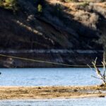
🎣

Midas Pond

South Jordan β€’ Utah β€’ 40.5471, -111.9165
πŸ…ΏοΈ

Parking

5
Gt Asphalt and sons
⭐ 5.0 13.7 mi
πŸ“ 97 N 700 E, American Fork, UT 84003, USA
πŸ•’
Monday: 7:00β€―AM – 7:00β€―PM
Tuesday: 7:00β€―AM – 7:00β€―PM
Wednesday: 7:00β€―AM – 7:00β€―PM
Thursday: 7:00β€―AM – 7:00β€―PM
Friday: 7:00β€―AM – 7:00β€―PM
Saturday: 7:00β€―AM – 7:00β€―PM
Sunday: 7:00β€―AM – 7:00β€―PM
πŸš— Get Directions
Center 53 Office Complex
⭐ 4.6 7.6 mi
πŸ“ 434 W Ascension Way, Murray, UT 84123, USA
πŸ•’
Monday: 7:30β€―AM – 5:30β€―PM
Tuesday: 7:30β€―AM – 5:30β€―PM
Wednesday: 7:30β€―AM – 5:30β€―PM
Thursday: 7:30β€―AM – 5:30β€―PM
Friday: 7:30β€―AM – 5:30β€―PM
Saturday: Closed
Sunday: Closed
πŸš— Get Directions
Park & Ride
⭐ 4.5 7.6 mi
πŸ“ 4385 Little Cottonwood Canyon Rd, Sandy, UT 84092, USA
πŸ•’
Monday: 7:00β€―AM – 12:00β€―AM
Tuesday: 7:00β€―AM – 12:00β€―AM
Wednesday: 7:00β€―AM – 12:00β€―AM
Thursday: 7:00β€―AM – 12:00β€―AM
Friday: 7:00β€―AM – 12:00β€―AM
Saturday: 7:00β€―AM – 12:00β€―AM
Sunday: 7:00β€―AM – 12:00β€―AM
πŸš— Get Directions
🐟

Bait & Tackle

5
MagBay Lures
⭐ 5.0 18.3 mi
πŸ“ 1950 2200 W Unit 300, Salt Lake City, UT 84116, USA
πŸ•’
Monday: 7:00β€―AM – 5:00β€―PM
Tuesday: 7:00β€―AM – 5:00β€―PM
Wednesday: 7:00β€―AM – 5:00β€―PM
Thursday: 7:00β€―AM – 5:00β€―PM
Friday: 7:00β€―AM – 5:00β€―PM
Saturday: 7:00β€―AM – 5:00β€―PM
Sunday: 7:00β€―AM – 5:00β€―PM
πŸš— Get Directions
B Clawson Fishing Rods
⭐ 5.0 11.8 mi
πŸ“ 2258 E Gregson Ave, Millcreek, UT 84109, USA
πŸ•’
Monday: 1:00 – 5:00β€―PM
Tuesday: 1:00 – 5:00β€―PM
Wednesday: 1:00 – 5:00β€―PM
Thursday: 1:00 – 5:00β€―PM
Friday: 1:00 – 5:00β€―PM
Saturday: Closed
Sunday: Closed
πŸš— Get Directions
Silver Lake
⭐ 4.9 17.7 mi
πŸ“ Brighton, UT 84121, USA
πŸ•’
Monday: Open 24 hours
Tuesday: Open 24 hours
Wednesday: Open 24 hours
Thursday: Open 24 hours
Friday: Open 24 hours
Saturday: Open 24 hours
Sunday: Open 24 hours
πŸš— Get Directions
🚀

Fishing Charters

5
Beehive Fishing Company
⭐ 5.0 12.8 mi
πŸ“ 462 E Garfield Ave, Salt Lake City, UT 84115, USA
πŸ•’
Monday: Open 24 hours
Tuesday: Open 24 hours
Wednesday: Open 24 hours
Thursday: Open 24 hours
Friday: Open 24 hours
Saturday: Open 24 hours
Sunday: Open 24 hours
πŸš— Get Directions
Park City Fly Fishing Guides
⭐ 5.0 23.1 mi
πŸ“ 333 Main St Suite D2, Park City, UT 84060, USA
πŸ•’
Monday: 8:00β€―AM – 8:00β€―PM
Tuesday: 8:00β€―AM – 8:00β€―PM
Wednesday: 8:00β€―AM – 8:00β€―PM
Thursday: 8:00β€―AM – 8:00β€―PM
Friday: 8:00β€―AM – 8:00β€―PM
Saturday: 8:00β€―AM – 8:00β€―PM
Sunday: 8:00β€―AM – 8:00β€―PM
πŸš— Get Directions
Fly Fishing at Sundance Resort
⭐ 5.0 20.8 mi
πŸ“ 8841 Alpine Loop Scenic Byway, Sundance, UT 84604, USA
πŸ•’
Monday: 9:00β€―AM – 5:00β€―PM
Tuesday: 9:00β€―AM – 5:00β€―PM
Wednesday: 9:00β€―AM – 5:00β€―PM
Thursday: 9:00β€―AM – 5:00β€―PM
Friday: 9:00β€―AM – 5:00β€―PM
Saturday: 9:00β€―AM – 5:00β€―PM
Sunday: 9:00β€―AM – 5:00β€―PM
πŸš— Get Directions
Utah Pro Fly Fishing
⭐ 5.0 23.1 mi
πŸ“ 136 Heber Ave #204, Park City, UT 84060, USA
πŸ•’
Monday: 6:30β€―AM – 10:00β€―PM
Tuesday: 6:30β€―AM – 10:00β€―PM
Wednesday: 6:30β€―AM – 10:00β€―PM
Thursday: 6:30β€―AM – 10:00β€―PM
Friday: 6:30β€―AM – 10:00β€―PM
Saturday: 6:30β€―AM – 10:00β€―PM
Sunday: 6:30β€―AM – 10:00β€―PM
πŸš— Get Directions
🏠

Lodging

5
βš“

Boat Ramps

3
🚻

Restrooms

3
πŸ‘¨β€πŸ‘©β€πŸ‘§β€πŸ‘¦

Family Friendly

2
β™Ώ

Accessibility

β™Ώ

Wheelchair Access

Not Confirmed

πŸ•

Pets Allowed

Not Confirmed

⚠️ Some accessibility info not officially confirmed. Please verify with location directly.

πŸ“ Showing 28 facilities on map
🎣
Book a Fishing Charter near Midas Pond Fishing Report Today 🎣

Local guides & charters. Verified captains, instant booking, best price guaranteed.

See Available Trips β†’

πŸ“Š

About Our Fishing Reports & Forecasts

Our spot reports combine data-driven forecasts with curated local information. The forecast is generated by our proprietary Fishing Score algorithm (0–100%), which analyzes real-time data from Open-Meteo API, validated against NOAA CO-OPS tide gauges and USGS water-monitoring stations. The model weights tide dynamics (35%), wave energy (25%), wind patterns (20%) and time of day (20%)β€”factors shown to influence fish feeding behavior through marine-biology research and decades of charter log data.

Access, facilities and services information for each fishing spot is sourced from official datasets such as Recreation.gov (RIDB), state park & wildlife agencies, and geospatial providers like Google Maps. These sections undergo scheduled re-validation every 3–6 months to ensure that boat ramps, park access, contact details and local services remain accurate.

Narrative sections (catches, seasonal behavior, local tips) are synthesized from these data sources and refined following the Fishing Reports Today editorial guidelines, combining bibliographic research from ichthyology and oceanography with expert angler experience. Our team reviews reports on a regular basis, while the forecast model itself updates every 6 hours for real-time accuracy.

⚠️ Important: Always verify current local regulations, access restrictions and weather conditions before fishing. These reports are intended as a planning aid, not a guarantee of catches or safety. When in doubt, contact local authorities or park managers listed on the page.

Learn more about our methodology & data sources β†’

Leave a Reply

Your email address will not be published. Required fields are marked *