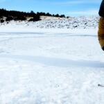
Steinaker Reservoir is completely free of ice, and we are entering the prime open-water spring fishing window. With water temperatures steadily climbing into the low to mid-50s, the spring transition is firing on all cylinders. Safety-wise, the primary hazard right now is the unpredictable high-desert spring wind. Situated at an elevation of 5,520 feet in the Uinta Basin, the reservoir is highly susceptible to rapid barometric shifts. Morning conditions are typically glass-calm, but stiff breezes can whip up significant, dangerous chop on the main basin by early afternoon. Boaters should plan for early launches and keep a close eye on the western horizon.
Lake levels are currently rising toward their early June peak before the summer irrigation drawdowns begin. The main state park boat ramp on the west shoreline is fully operational, offering a two-lane concrete launch with ample parking. Shoreline anglers should exercise extreme caution navigating the rocky banks, as fluctuating water levels can leave slick mud and algae-covered stones in their wake.
🎣Nautrek
Private Beta
J
M
R
100+ anglers on the waitlist
The fishing network where your reputation matters.
Find trusted captains, join real trips with cost splitting, and build your Angler Rank. Your spots stay private — you decide who sees your intel.
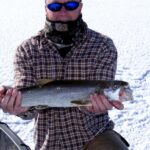
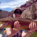
Primary Target: Rainbow Trout Rainbow trout are the undisputed main event during the spring months. The Utah Division of Wildlife Resources manages Steinaker as a Blue Ribbon fishery, and the current bite reflects that premium status. Anglers will encounter a high-density mix of recently planted 10 to 12-inch stockers alongside a robust population of chunky, 16 to 18-inch holdovers. The cooler water temperatures keep these trout highly active throughout the upper water column and aggressively cruising the shallow transition zones.
Sleeper Pick: Largemouth Bass While the majority of the crowd is focused on limits of trout, the largemouth bass are beginning their critical pre-spawn staging. As the water pushes past the 50-degree mark, these fish are migrating from their deep wintering holes into the shallower, sun-warmed transition zones. They are feeding heavily to build energy reserves before nesting, making this one of the best times of the year to stick a trophy-caliber bass.
Baitfish Report The forage base is currently dominated by the local crayfish population, which is just starting to molt and become active along the rocky shorelines. You will also find an overpopulation of green sunfish and juvenile bluegill acting as a secondary protein source for the larger bass and brown trout. For the rainbow trout, the diet consists largely of aquatic insects, including midges and scuds, along with opportunistic feeding on small baitfish.
Tactical Strategy
Trout Tactics
Where: Shore anglers should focus their efforts along the steep east shoreline, accessible via the pull-offs along Highway 191. The bottom drops off quickly to about 20 feet here, providing a perfect ambush wall for cruising trout. Boaters should target the mouth of the cove near the main state park boat ramp on the west side, trolling the 15 to 25-foot contour lines.
Lure & Bait: For hardware, a 1/4 oz Kastmaster in silver/blue or a Rapala Countdown (CD05) in a rainbow trout or black/silver pattern is highly effective. Retrieve with an erratic, stop-and-go cadence to trigger reaction strikes. Fly anglers should strip dark-colored Wooly Buggers (olive, black, or brown, sizes 6-8) on a sinking tip line. If you prefer bait fishing, rig garlic-scented PowerBait on a slip-sinker rig with an 18-inch fluorocarbon leader to keep it suspended just above the bottom vegetation.
Timing: The golden hours for trout are from first light until about 10:00 AM, and again during the last hour of daylight when the surface activity peaks.
Bass Tactics
Where: Head directly to the shallow north shoreline. This sprawling flat averages about 5 feet in depth and warms up significantly faster in the spring sun, acting as a magnet for pre-spawn bass. Look for submerged brush, rocky points, and any staging structure adjacent to the shallows.
Lure & Color: Match the hatch with crayfish imitations. A 3/8 oz football jig in green pumpkin or brown/orange, paired with a matching craw trailer, is your highest percentage play. Work it deliberately and slowly across the rocks, maintaining bottom contact. If the fish are suspended off the points, try a suspending jerkbait in natural baitfish or ghost minnow colors, utilizing long pauses between twitches.
Timing: Unlike the early-morning trout bite, bass will become much more active in the mid-to-late afternoon as the sun reaches its peak and warms the shallow flats by a few crucial degrees.
Essential Gear Checklist
Medium-light spinning rod (7-foot) for long-distance trout casting
Medium-heavy baitcasting setup for dragging bass jigs
Fluorocarbon leader material (6lb for trout, 12lb for bass)
Polarized sunglasses for spotting submerged transition zones and cruising fish
Pro Tip:Wind direction is a critical factor at Steinaker. If a stiff breeze kicks up, do not hide from it. Position yourself so the wind is blowing directly into a rocky shoreline or cove. This wind-driven current pushes warmer surface water, plankton, and baitfish against the bank, creating a predictable feeding frenzy for both trout and bass.
Regulations Snapshot
Steinaker Reservoir operates under specific Utah Division of Wildlife Resources regulations. Always verify with the current proclamation, but keep these key rules in mind:
Species
Daily Bag Limit
Special Regulations
Trout (All Species)
4 Fish
Limit is in the aggregate (combines Rainbow, Brown, etc.).
Largemouth Bass
6 Fish
Only 1 bass may be over 15 inches in length.
Panfish (Bluegill/Sunfish)
50 Fish
Combined total for all panfish species. Anglers are highly encouraged to harvest green sunfish to help manage overpopulation.
Crucial Note: Steinaker Reservoir is strictly closed to the use of underwater spearfishing for largemouth and smallmouth bass from April 1 through the fourth Saturday of June. This closure is designed to protect vulnerable fish on their spawning beds.
Pro Tip:The Utah Department of Environmental Quality maintains an active fish consumption advisory for Largemouth Bass and Bluegill at Steinaker due to elevated mercury levels. Catch and release is highly recommended for these warm-water species, whereas the stocked trout are generally safe for the frying pan.
Regional Alternative
Red Fleet Reservoir
If Steinaker is blown out by heavy winds, experiencing intense boat traffic, or the bite simply shuts down, pack up your gear and head approximately 16 miles away to Red Fleet Reservoir. Known for its stunning red sandstone cliffs and dinosaur tracks, Red Fleet offers a nearly identical dual-threat fishery for Rainbow Trout and Largemouth Bass, with the added bonus of quality Brown Trout and Black Crappie.
The deep, winding, and sheltered coves at Red Fleet often provide significantly better wind protection than Steinaker's open main basin. Target the steep sandstone drop-offs with inline spinners or deep-diving crankbaits to locate suspended fish. For bass, pitch Texas-rigged plastics right against the sheer cliff walls and let them flutter down the water column. The state park facilities at Red Fleet offer excellent shore access, modern restrooms, and a highly protected boat launch, making it a flawless backup plan for any Uinta Basin fishing trip.
Tight lines!
Editor's Choice: Must-Have Gear
FISHINGSIR Next-Gen Waterproof Chest Waders
★★★★★4.4 (7,370+ reviews)
2-Ply Tech: Upgraded nylon with 2.5x higher density than standard fabrics.
100% Waterproof: Lab-approved intrusion resistance with taped visible seams.
Ultra-Lightweight: Designed for all-day comfort while hunting or fishing.
As an Amazon Associate I earn from qualifying purchases. #ad
Loading forecast...
Live Fishing Conditions: Tides, Weather & Waves
Get real‑time tides, marine weather, swell and solunar activity for each spot so you know exactly when conditions line up for your best chance at a bite.
🎣
Steinaker Res
Loading coordinates...
🌤️
WEATHER CONDITIONS
--°F
--°C
Loading...
🌡️
Feels Like--°F--°C
💧
Humidity--%
💨
Wind-- mph-- km/h
🧭
Direction--
📊
Pressure-- inHg-- hPa
☀️
UV Index--
🌊
MARINE CONDITIONS
🌊Wave Height
-- ft
-- m
Loading...
🧭Wave Direction
--°
Loading...
⏱️Wave Period
-- s
Loading...
📈Tide Status
-- ft
-- m
Loading...
🌙
LUNAR & SOLUNAR
🌕
Loading...
Illumination: --%
Major Period--:-- - --:----:-- - --:--
Minor Period--:-- - --:----:-- - --:--
🌅Sunrise--:--
🌇Sunset--:--
📅
24-HOUR FORECAST
Loading fishing conditions...
Fishing Spots Map
🎣
Book a Fishing Charter near Steinaker Res Fishing Report Today 🎣
Local guides & charters. Verified captains, instant booking, best price guaranteed.
There was an error loading the map. Please try refreshing the page.
Info
Local Access & Facilities
Steinaker Reservoir stands as a vibrant emerald oasis set against the arid, dramatic backdrop of the Uinta Basin. Located at an elevation of 5,520 feet, this fishery offers a distinct contrast to the surrounding high desert scrub and red sandstone formations. For the seasoned angler, this 800-acre impoundment serves as a critical gateway fishery, bridging the gap between the high Uinta Mountains and the dinosaur-rich desert floor. The water here is regulated by the Steinaker Dam, creating a stable environment that supports a healthy population of game fish despite the harsh exterior climate.
The atmosphere at Steinaker is deceptively rugged. While the access is paved and manageable, the environment demands respect, characterized by intense high-altitude sun and the stark beauty of the geologic formations like nearby Red Mountain. It is not merely a roadside stop; it is a destination where the water conditions can shift rapidly with the desert winds. Anglers here appreciate the lack of urban congestion, finding a solitude that is becoming increasingly rare in Western fisheries.
The primary draw for expert rods at Steinaker is the dual-threat fishery of Rainbow Trout and Largemouth Bass. The cool water inputs from Ashley Creek maintain temperature gradients that allow trout to thrive, while the structure along the shoreline provides ample cover for bass. Whether you are trolling deep channels or casting toward the rocky banks, the reservoir offers a technical challenge that rewards understanding the specific bottom topography and seasonal water level fluctuations.
Access & Getting There
Reaching Steinaker Reservoir is a straightforward logistical affair, but seasoned captains know that "easy access" can still present challenges during peak transit times. The reservoir is located approximately 7 miles north of Vernal, Utah, directly off U.S. Highway 191. This is a major trucking and travel corridor, so anglers towing wide beams should remain vigilant for heavy commercial traffic, particularly when navigating the grades leading out of the Uinta Basin.
The primary launch facility is the Steinaker Reservoir Boat Ramp. This is an all-weather access point designed to handle standard trailer traffic. The ramp is generally wide enough for efficient launching, but the concrete can become slick with algae during the late summer drawdown. The approach from Highway 191 is paved, reducing the wear and tear on your trailer suspension compared to more remote Uinta waters. However, during winter months, ice on the ramp is a certainty; carry sand or salt if you are attempting a late-season launch before the hard deck forms.
💡 Captain's Tip: Wind Awareness
At 5,520 feet, the Uinta Basin acts as a funnel for high winds. The afternoons often see stiff breezes kicking up chop on the open water. Plan your launch for early dawn to capitalize on the glass-calm surface, and keep an eye on the ridgelines to the west for building cloud cover that signals incoming gusts.
Parking at the reservoir is generally adequate, with designated areas for trailers. However, during the peak summer recreation season (April through October), the lot can fill with recreational boaters and jet skis by mid-morning. For those hauling larger rigs or requiring overnight storage away from the water, the Truck Parking Club locations in Vernal (roughly 4 miles south) offer secure options. The Uintah County Free Parking lot is another logistical asset for dropping a vehicle if you are coordinating a multi-car shuttle.
Steinaker Res Pre-Trip Checklist
Facilities & Amenities
While Steinaker Reservoir feels remote, its proximity to Vernal ensures that critical supplies are never far away. However, on-site amenities are focused strictly on the fundamentals of launching and camping. There is no commercial marina or fuel dock on the water. Captains must ensure their tanks are topped off in Maeser or Vernal before launching. Running out of fuel here means a long drift to the rocks.
For tackle and gear, Basin Sports on West Main Street in Vernal is the local authority. Located just 4.4 miles from the water, this shop services the heavy demands of the region's anglers. Whether you need specific baits for the local bass patterns or replacement hardware for your trailer, this is your primary logistical hub. They open at 9:00 AM, so if you are planning a dawn patrol, you must secure your bait the evening before.
💡 Captain's Tip: Provisioning Strategy
Since there is no on-water ship store, self-reliance is key. Stock your cooler with ample ice and water in Vernal. The high-altitude desert air dehydrates anglers faster than they realize. If you need to make repairs, the proximity to Vernal means auto parts and hardware are close, but you have to pull the boat to get there.
Lodging logistics favor the early riser. The Steinaker State Park Campground offers the ultimate advantage: waking up practically at the boat ramp. These sites offer standard hookups and are suitable for RVs. For those preferring a roof, the East Meadows Mobile Home Park area or hotels in Vernal provide close alternatives. For a more rustic, high-country experience, the Colton Guard Station is about 10 miles away, offering a different vantage point of the region.
Facility Name
Type
Distance
Key Notes
Steinaker Reservoir Boat Ramp
Launch
On-Site
All-weather concrete; trailer parking available.
Basin Sports
Bait & Tackle
4.4 miles
Primary outfitter; opens 9:00 AM.
Steinaker State Park Campground
Lodging
On-Site
RV hookups; immediate water access.
Truck Parking Club
Parking
3.9 miles
Secure overflow parking for large rigs.
Permits, Regulations & Fees
Fishing and boating at Steinaker are managed by the Utah Division of Parks and Recreation. A valid Utah fishing license is mandatory for all anglers. The reservoir is subject to specific state regulations regarding bag limits for trout and bass, which can shift based on biological assessments. It is the skipper's responsibility to check the current proclamation before keeping any catch.
Entry to Steinaker State Park requires a fee. This day-use fee covers access to the boat ramp and parking areas. If you are camping, the entrance fee is typically included in your reservation, but verify this upon arrival. The funds generated here are crucial for maintaining the ramp infrastructure and the fish cleaning stations, ensuring the resource remains viable for future seasons.
Cultural and environmental respect is paramount in the Uinta Basin. The area is rich in history, from dinosaur fossils to Native American heritage. Nearby sites like the Moonshine Arch Trailhead pass near private lands; anglers exploring the shoreline or nearby trails must respect posted private property boundaries. Additionally, aquatic invasive species (AIS) are a major concern in Utah. Mandatory boat inspections may be in effect. Ensure your vessel is "Clean, Drained, and Dry" before arrival to avoid fines or denied access.
Events & Seasonal Information
The rhythm of Steinaker Reservoir is dictated by the extreme seasonal swings of the high desert. The prime open-water season runs from April through October. Spring offers the most aggressive trout bite as the water warms and fish move into the shallows to feed. As summer heat sets in, the bass bite heats up, often requiring early morning or late evening efforts to find fish active in the water column.
Winter transforms the fishery completely. Steinaker is a renowned destination for ice fishing. When the hard deck forms, usually by late December or January, the reservoir attracts hard-water anglers targeting trout. Access during this time is generally good, but the boat ramp becomes a staging area for sleds and ATVs rather than bass boats. The "Carnage" or Rojo Mountain Bike Trail nearby indicates the rugged nature of the terrain—winter storms here are severe, and whiteout conditions can descend rapidly.
💡 Captain's Tip: Summer Traffic
During July and August, the reservoir is a magnet for water sports enthusiasts from Vernal. Wakeboarders and jet skis dominate the main basin from 11:00 AM to 5:00 PM. Serious anglers should plan their drifts for the "golden hours" at dawn and dusk to avoid the heavy wake and noise.
Contact Information & Resources
For the most current conditions, ramp status, and camping reservations, direct communication with the park management is recommended. The Steinaker State Park office can be reached at 435-789-4432. They are the definitive source for real-time data regarding water levels and algae blooms.
In the event of an emergency, cell service is generally reliable due to the proximity to Highway 191, but dead zones exist in the canyon shadows. The local managing agency works in conjunction with the Bureau of Reclamation. For medical emergencies, the nearest facilities are located in Vernal. Always file a float plan with a contact on land, especially when fishing during the shoulder seasons when hypothermia risks are elevated.
For precise locations, real-time weather data, and detailed facility maps, consult the live dashboard and interactive widgets below.
Our spot reports combine data-driven forecasts with curated local information. The forecast is generated by our proprietary Fishing Score algorithm (0–100%), which analyzes real-time data from Open-Meteo API, validated against NOAA CO-OPS tide gauges and USGS water-monitoring stations. The model weights tide dynamics (35%), wave energy (25%), wind patterns (20%) and time of day (20%)—factors shown to influence fish feeding behavior through marine-biology research and decades of charter log data.
Access, facilities and services information for each fishing spot is sourced from official datasets such as Recreation.gov (RIDB), state park & wildlife agencies, and geospatial providers like Google Maps. These sections undergo scheduled re-validation every 3–6 months to ensure that boat ramps, park access, contact details and local services remain accurate.
Narrative sections (catches, seasonal behavior, local tips) are synthesized from these data sources and refined following the Fishing Reports Today editorial guidelines, combining bibliographic research from ichthyology and oceanography with expert angler experience. Our team reviews reports on a regular basis, while the forecast model itself updates every 6 hours for real-time accuracy.
⚠️ Important: Always verify current local regulations, access restrictions and weather conditions before fishing. These reports are intended as a planning aid, not a guarantee of catches or safety. When in doubt, contact local authorities or park managers listed on the page.
To provide the best experiences, we use technologies like cookies to store and/or access device information. Consenting to these technologies will allow us to process data such as browsing behavior or unique IDs on this site. Not consenting or withdrawing consent, may adversely affect certain features and functions.
Functional Always active
The technical storage or access is strictly necessary for the legitimate purpose of enabling the use of a specific service explicitly requested by the subscriber or user, or for the sole purpose of carrying out the transmission of a communication over an electronic communications network.
Preferences
The technical storage or access is necessary for the legitimate purpose of storing preferences that are not requested by the subscriber or user.
Statistics
The technical storage or access that is used exclusively for statistical purposes.The technical storage or access that is used exclusively for anonymous statistical purposes. Without a subpoena, voluntary compliance on the part of your Internet Service Provider, or additional records from a third party, information stored or retrieved for this purpose alone cannot usually be used to identify you.
Marketing & Affiliates
The technical storage or access is required to create user profiles to send advertising, or to track the user on a website or across several websites for similar marketing purposes, including affiliate tracking for products recommended in our reports.


Leave a Reply