


Jensen, Utah, serves as the rugged gateway to one of the West’s most geologically dramatic fisheries. Anglers arriving here are not merely launching into the Green River; they are casting lines in the shadow of the Jurassic period. The area is defined by the high desert topography of Dinosaur National Monument, where the river cuts through the Split Mountain anticline, creating a visual spectacle of twisted rock layers and deep canyons. This is not a manicured harbor environment; it is a raw, high-desert landscape dominated by sagebrush, Fremont cottonwoods, and the relentless flow of the Green and Yampa Rivers.
The fishery here is technically diverse, offering a mix of river currents and reservoir flatwater. While the Green River is the primary artery, known for its trout populations and native species in the cooler tailwaters, the nearby Red Fleet Reservoir offers a completely different game, targeting largemouth bass, bluegill, and sunfish. Experienced anglers know that Jensen is a logistical pivot point. To the north lies the deep canyon country; to the northeast, the reservoirs. Success here depends on understanding the fluctuating flows of the Yampa—the largest free-flowing tributary in the Colorado River system—which dramatically impacts water clarity and levels downstream at the Jensen and Split Mountain access points.
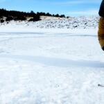
The atmosphere is quiet and utilitarian. You won't find yacht clubs or expansive marinas with dockhands. Instead, you will find functional concrete ramps designed for drift boats, rafts, and trailerable fishing rigs. The vibe is distinctly "high desert expedition." The air is dry, the sun is intense, and the wind can whip through the canyons with little warning. For the serious angler, this isolation is the primary draw, offering access to waters that feel prehistoric in both setting and scale.
Access & Getting There
Reaching the prime fishing grounds around Jensen requires navigating US Highway 40, the primary east-west artery through the Uintah Basin. Traffic is generally light compared to urban centers, but heavy transport trucks frequent this route. From the town of Jensen, Utah State Route 149 is your critical vein heading north into the monument area. This road is paved and generally well-maintained, but anglers towing heavy drift boats or fiberglass bass boats should be mindful of the transition from highway speeds to the slower, winding park roads.
💡 Captain's Tip: The Raft Hatch
The Split Mountain Boat Ramp is the primary take-out for multi-day whitewater rafting trips coming down from the Gates of Lodore. Avoid the ramp between 11:00 AM and 3:00 PM during peak summer months, as commercial raft buses and gear trucks can clog the loading zone.
The primary launch for river anglers is the Split Mountain Boat Ramp, located approximately 12 miles north of Highway 40 via SR 149. This facility is situated adjacent to the Split Mountain Group Campground. The ramp is concrete and wide enough to handle substantial trailers, but the current of the Green River can be deceptive here. The ramp is technically a "take-out" for upstream rafters, meaning the traffic flow is often incoming rather than outgoing. Anglers launching here to fish downstream sections need to coordinate with the flow of river traffic. The varying water levels, dictated by the Yampa’s snowmelt, can leave the bottom of the ramp slick with silt or exposed with drop-offs late in the season.
For those targeting stillwater at Red Fleet Reservoir, access is located roughly 10 miles northeast of Vernal via US-191. This is an all-weather access point, but winter conditions can ice over the roads quickly. The boat launch at Red Fleet is developed, but during low-water years, the ramp can extend far onto the mudflats. It is critical to check current reservoir levels before hauling a deep-V hull to this location, as drought conditions often recede the waterline significantly from the paved ramp.
Rainbow Park Boat Ramp offers a more remote access point, situated roughly 12.6 miles from the core area. Accessing Rainbow Park often involves travel on unpaved or rougher roads compared to the main Split Mountain corridor. This ramp is less crowded but offers fewer amenities. It is a strategic launch for anglers looking to access the Green River sections that are less pressured by the daily commercial raft traffic that concentrates near Split Mountain.
Parking strategies in this region differ by site. At Split Mountain, parking is designed to accommodate buses and trailers, but it fills rapidly during the commercial rafting season. Security is generally good due to the NPS presence, but leaving valuables visible is never advisable. At Green River Campground, the parking pads are paved and can accommodate vehicles up to 62 feet in select sites, making it a viable basecamp for anglers hauling larger rigs. However, shade is sparse, so dashboard sunshades are mandatory to protect marine electronics.
Jensen Pre-Trip Checklist
Facilities & Amenities
Jensen itself is a small community with limited services, functioning primarily as a waypoint rather than a supply hub. Serious provisioning must be done in Vernal, located about 13 miles west. Vernal serves as the logistical heart for the region, housing the major grocery stores, hardware suppliers, and specialized tackle shops. Anglers should not expect to find specialized fly patterns or specific bass lures in Jensen; stock up on heavy leaders and tippets in Vernal before making the final drive to the river.
The local campgrounds serve as the primary accommodation for anglers. The Green River Campground is the flagship facility, located near the river banks. It offers 80 sites but is defined by what it lacks as much as what it offers. There are no electrical hookups, no sewer hookups, and crucially, no potable water fill stations for RV tanks. You must arrive with your freshwater tanks full and your grey/black tanks empty. The campground does provide flush toilets and drinking water spigots, but these are for filling jugs, not piping into a 50-gallon RV reservoir.
💡 Captain's Tip: Fuel Management
There is no fuel dock at the Split Mountain ramp or within the immediate park area. The nearest reliable gas is in Jensen or Vernal. If you are running a jet boat on the river, carry extra jerry cans, as fighting the upstream current burns fuel at double the normal rate.
For those traveling in groups, the Split Mountain Group Campground offers four dedicated sites. These are excellent for fishing clubs or multi-boat convoys, accommodating up to 25 people and six vehicles per site. Like the main campground, these sites have picnic tables and fire rings but lack hookups. The proximity to the water is excellent, often providing riverfront views, but shade is limited to a few Fremont cottonwoods. In the heat of July, the sun exposure can be brutal on equipment and anglers alike.
Accommodations outside of camping are sparse in the immediate vicinity. The JENSEN WC provides nearby parking and basic stopover facilities roughly 1,600 feet from the town center. For those requiring hotel amenities, heavy boat parking, or extensive repairs, retreating to Vernal is the only option. Truck Parking Club locations in Vernal offer secure overnight spots for boat trailers if your lodging does not accommodate them.
Campground Specifications for Anglers
| Facility Name | Max Vehicle Length | Hookups | Water Access | Season |
|---|---|---|---|---|
| Green River Campground | 62 Feet | None | Riverfront / Near Ramp | Apr - Oct |
| Split Mountain Group CG | 60 Feet | None | Adjacent to Ramp | Apr - Oct |
| Steinaker State Park | Varies | Available | Reservoir Access | Year-Round |
Permits, Regulations & Fees
Fishing in this region requires navigating a dual-layer bureaucracy of state and federal regulations. The Green River and Split Mountain areas fall within Dinosaur National Monument, managed by the National Park Service (NPS). While a specific fishing permit from the NPS is not usually required for bank fishing, a valid Utah State Fishing License is mandatory. If you cross state lines while fishing the river (which enters from Colorado), you must hold a valid license for the specific water you are standing in or floating on. Boundaries are strictly enforced.
For boaters, the regulations are stringent regarding aquatic invasive species (AIS). Utah is aggressive about preventing the spread of quagga mussels. If you are launching at Red Fleet Reservoir or the Green River, expect mandatory inspections. Your boat must be Clean, Drained, and Dry. If you have been in infested waters (like Lake Powell) recently, you may be denied launch or subject to decontamination fees. The NPS also requires permits for private river trips on the Green and Yampa rivers if you plan to float specific whitewater sections upstream of the boat ramp.
Cultural respect is codified into law here. The area is rich in Fremont culture history, including petroglyphs and pictographs. These sites are considered Kapu (sacred) and are legally protected. It is illegal to touch, chalk, or alter rock art. Additionally, the Quarry Exhibit Hall protects thousands of dinosaur fossils. Anglers exploring the shorelines should be aware that collecting any rocks, fossils, or artifacts is a federal offense. Access to the river often crosses or borders sensitive riparian zones; tread lightly to prevent erosion.
Fee structures include an entrance fee for Dinosaur National Monument, which is separate from camping fees. The Split Mountain and Green River campgrounds operate on a reservation system via Recreation.gov. "No-shows" are penalized with service fees, so if your fishing trip dates change, cancel your reservation immediately to avoid fines. Red Fleet State Park charges its own day-use and camping fees, payable at the entrance station or iron ranger.
Events & Seasonal Information
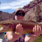
The fishing rhythm in Jensen is dictated by the pulse of the Yampa River. Unlike the dam-controlled Green River upstream at Flaming Gorge, the Yampa is free-flowing. This means spring runoff (May-June) turns the river at Jensen into a high, muddy torrent, often unfishable for sight-oriented predators. The "season" for clear water angling typically stabilizes in late June or early July as the snowmelt subsides. This is when the river drops and clears, opening up opportunities for drift boat fishing.
💡 Captain's Tip: The Wind Window
In the Uintah Basin, calm water is a morning luxury. By 11:00 AM, the thermal winds usually kick up, blowing 15-20 knots through the canyons. Plan your technical casting or reservoir crossings for the dawn hours.
Summer brings the heat and the crowds. The Green River is a highway for rafters from June through August. Anglers seeking solitude should focus on the "shoulder seasons" of late September and October. During autumn, the cottonwoods along the riverbanks turn a brilliant gold, the air cools, and the recreational floating traffic diminishes significantly. This is arguably the finest time for angling, as brown trout become more aggressive prior to their spawn.
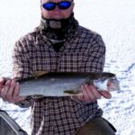
While there are no major professional bass tournaments held directly at the Split Mountain ramp due to the riverine environment, Red Fleet Reservoir and nearby Steinaker Reservoir occasionally host local bass club events. Anglers should check the Utah State Parks calendar, as a tournament weekend can fill the small parking lots at these reservoirs by 5:00 AM. Winter fishing is possible at Red Fleet (ice fishing) for trout and bluegill, but the river access at Split Mountain becomes treacherous with ice shelf buildup along the banks.
Contact Information & Resources
For the most current information on river flows, ramp conditions, and campground status, direct communication with the managing agencies is essential. The Quarry Visitor Center is the primary on-site resource for Dinosaur National Monument.
- Dinosaur National Monument (NPS): (435) 781-7700 – Call for river levels and ramp status.
- Red Fleet State Park: (435) 789-4432 – Contact for reservoir conditions and ice reports.
- Emergency Services: 911 – Note that cell service is spotty in the canyons.
Safety in this high desert environment is about self-reliance. There are no marinas to tow you in if your motor fails on the river. Carry ample water, a comprehensive first-aid kit, and signaling devices. For precise locations of the boat ramps, camping pads, and real-time weather conditions, consult the live dashboard and interactive maps below.


Leave a Reply