


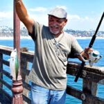
San Diego is a fishery defined by its duality: a bustling, tactical urban harbor and a gateway to the wild, pelagic-rich waters of the Pacific. For the serious angler, the "Big Bay" offers a complex environment of deep channels, expansive eelgrass beds, and military infrastructure that holds massive populations of Spotted Bay Bass, Halibut, and Bonefish. Just beyond the protection of Point Loma, the water drops into the deep blue, where the California current brings Yellowtail, Bluefin Tuna, and Dorado within striking range of the local fleet. This is not a casual cane-pole destination; it is a technical fishery requiring precise logistics, heavy-duty gear, and a keen understanding of how urban development intersects with raw nature.
The atmosphere here shifts rapidly from the manicured, tourist-heavy waterfronts of Coronado and Downtown to the rugged, cliff-lined coast of the Cabrillo National Monument. Anglers launching here must navigate active shipping lanes, naval maneuvers, and protected wildlife refuges. The bottom topography varies from the dredged shipping channels of the north bay to the shallow, sensitive mudflats of the South Bay National Wildlife Refuge. Success in San Diego requires more than just finding fish; it requires navigating a maze of access points, protected zones, and variable ocean conditions that can change from a glassy harbor drift to a 6-foot swell in a matter of miles.
Whether you are targeting record-class halibut on the drift or heading offshore for a multi-day tuna run, understanding the shoreside logistics is as critical as your knot-tying. The infrastructure is world-class, but it is spread out across a sprawling metropolis. The guide below breaks down the essential access points, facility realities, and regulatory nuances necessary to execute a successful trip in Southern California’s premier saltwater playground.
💡 Captain's Tip: Dawn Patrol Parking
Downtown parking structures operate on strict schedules. While the Padres Parkade doesn't open until 5:30 AM, the Five Star Parking #67 at Emerald Plaza operates 24 hours. If you are launching early for an offshore tuna run, prioritize the 24-hour lots to avoid getting locked out of your staging area.
Access & Getting There
Accessing the San Diego waterfront requires navigating the dense urban grid of downtown or the arterial highways of I-5 and I-8. For anglers towing vessels, the primary approach is typically via Interstate 5, exiting toward the bay. Traffic in San Diego is a constant variable; the "rush hour" often extends well into the mid-morning and picks up again by 3:00 PM. If you are towing a trailer to the launch ramps near Quivira Road in Mission Bay or the harbor front, plan your transit for pre-dawn hours to avoid the gridlock that plagues the I-5/I-8 interchange.
The boat launch situation in San Diego is robust but high-pressure. The primary access points for the main harbor and Mission Bay are heavily utilized by both recreational fleets and commercial operators. While the data highlights the Hotel del Coronado as a boat access point, experienced captains know this is primarily a resort facility for guests and smaller craft rentals. For trailered boats, you will likely be utilizing the public ramps near the marina districts. Be advised that during the summer pelagic season, trailer parking at major ramps fills to capacity before sunrise. The ramps themselves are generally well-maintained concrete, but low tide can make them slick with algae—4x4 tow vehicles are recommended for heavier fiberglass hulls.
Weather plays a critical role in accessibility. The bay itself is protected by the high ridge of Point Loma, offering fishable water even during moderate storm systems. However, the transition from the bay to the open ocean at the harbor mouth can be treacherous during a falling tide combined with a large west swell. If the forecast calls for swells exceeding 6 feet with a short period, small skiffs should remain inside the harbor or stick to the protected waters of Mission Bay. The Cabrillo National Monument area offers a high vantage point to visually inspect the ocean conditions before committing to a run outside.
Parking for shore-based anglers or those meeting charters requires strategy. Five Star Parking #67 on West Broadway offers 24-hour access, making it a reliable hub for overnight trips. The Padres Parkade is a viable option for day trips, but its 5:30 AM opening time may be too late for the serious dawn patrol crowd. Note that many downtown lots have height restrictions that preclude lifted trucks or rod vaults.
San Diego, CA Pre-Trip Checklist
Facilities & Amenities
San Diego's fishing infrastructure is extensive, but it is not centralized. Unlike small fishing villages where the bait shop is at the ramp, San Diego's best outfitters are often located inland. San Diego Tackle Traders is the closest comprehensive outfitter to the main harbor, located approximately 8.2 miles away on Convoy Court. They stock the specific irons and fluorocarbon needed for the local yellowtail fishery. For freshwater anglers or those coming from East County, Anglers Arsenal in Lakeside and SluggFishing Bait and Tackle in Poway are excellent, though they are 16-18 miles from the saltwater launch points.
The charter fleet here is legendary. Operators like Pelican Sportfishing and Fish Further Charters operate out of the Quivira Road area, specializing in both bay bass tactics and offshore runs. Risen Tide Sportfishing operates out of Harbor Island, placing you minutes from the bait barge and the open ocean. These operations are accustomed to serious anglers; they run 24-hour schedules during peak tuna season. When booking, verify the departure point, as "San Diego" can refer to landings separated by 20 minutes of driving.
Lodging and Logistics
Accommodation options vary wildly in price and utility. For a luxury base camp, The US Grant and Hotel del Coronado offer high-end amenities, but parking a boat trailer at these historic properties is logistically difficult. For the traveling angler with a rig, Sweetwater County Park offers camping and is situated roughly 9.5 miles from the water, providing a secure place for rod-laden vehicles. Fiddler's Cove Marina & RV Park is listed as a prime location, but be aware: this is a Navy MWR facility. Unless you have valid military credentials, you cannot access this facility.
💡 Captain's Tip: Bait Shop Geography
There are no comprehensive tackle shops immediately adjacent to the downtown commercial piers. Do not rely on buying terminal tackle at the landing 30 minutes before departure. Visit San Diego Tackle Traders or Anglers Arsenal the day before your trip to stock up on sinkers, hooks, and leader material.
| Facility Name | Type | Distance from Hub | Notes |
|---|---|---|---|
| San Diego Tackle Traders | Tackle Shop | 8.2 miles | Primary saltwater outfitter; specialized gear. |
| Pelican Sportfishing | Charter | 5.5 miles | Located at Quivira Rd; 24-hour operations. |
| Five Star Parking #67 | Parking | 0.4 miles | Open 24 hours; ideal for long-range parking. |
| Sweetwater County Park | Camping | 9.5 miles | Trailer-friendly accommodation option. |
| Fiddler's Cove | Marina/RV | 4.5 miles | RESTRICTED: Military/DoD personnel only. |
Permits, Regulations & Fees
Fishing in San Diego is governed by the State Fishing Agency, and a valid California sport fishing license with an Ocean Enhancement Stamp is mandatory for all saltwater angling south of Point Arguello. Wardens are active at launch ramps and often check catches upon return to the harbor. Strict size and bag limits apply, particularly for Halibut (22 inches minimum) and Bass (14 inches minimum for Calico, Sand, and Spotted Bay Bass).
Protected Zones and Refuges
The bay is home to critical conservation areas that every angler must respect. The San Diego Bay National Wildlife Refuge, specifically the Sweetwater Marsh and South San Diego Bay Units, protects 2,620 acres of habitat. These areas are vital for the endangered light-footed Ridgway's rail and the California least tern. While fishing is allowed in designated navigable waters, accessing the mudflats or disturbing the eelgrass beds is strictly prohibited. The Tijuana Slough National Wildlife Refuge to the south is another sensitive zone; this 1,072-acre wetland is a Ramsar Wetland of International Importance.
Cultural respect is also paramount. The area has a rich history involving the Kumeyaay people, particularly around the Sweetwater Marsh area (Gunpowder Point). Anglers should observe "Kapu" (sacred laws) regarding the disturbance of natural resources. Additionally, because much of the bay is bordered by Naval installations, maintaining a strict distance from gray hull vessels is a matter of federal law. Do not cast near, approach, or photograph Naval vessels or submarines transiting the channel.
💡 Captain's Tip: South Bay Navigation
The South Bay Unit of the NWR contains extensive shallow mudflats and eelgrass beds. These are productive fishing grounds but treacherous for navigation. On a falling tide, stick strictly to the marked channels. Grounding your boat here not only damages the prop but can result in hefty fines for damaging protected eelgrass habitat.
Events & Seasonal Information
The San Diego fishery is a year-round endeavor, but the target species shift with the water temperature. The winter months (December through March) are prime for the "spottie" (Spotted Bay Bass) and Halibut fishery inside the bay. This is technical structure fishing that requires precise boat positioning. As the water warms in late spring, the focus shifts to the coastal kelp beds for Calico Bass and Barracuda.
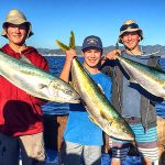
The summer season, typically kicking off in July, brings the famous "billfish runs" and tuna migrations. This is when the charter fleet is busiest, and boat ramps are at maximum capacity. Tournaments are frequent during this window, ranging from local bass battles in the bay to high-stakes offshore jackpots. Anglers should check the local event calendar, as a major tournament launch can delay your water entry by hours.
Daily timing is dictated by the trade winds. The mornings are generally calm, offering the best window for crossing the channel to the Coronado Islands (Mexican license required) or heading offshore. By 11:00 AM, the westerly sea breeze often picks up, creating chop in the main harbor and rough conditions on the outer banks. Plan your return trip to account for the afternoon texture.
Contact Information & Resources
For current access conditions and regulations, consult the managing agencies directly. The Cabrillo National Monument visitor center (619-523-4285) is an excellent resource for shore-based viewing conditions and tide information. For questions regarding the refuge boundaries in the South Bay, contact the San Diego Bay National Wildlife Refuge at 619-476-9150 (ext. 106). In the event of an on-water emergency, the US Coast Guard Sector San Diego monitors VHF Channel 16.
For precise locations of the boat ramps, real-time wind conditions, and the specific coordinates of the bait barges, consult the live dashboard and interactive maps below.


Leave a Reply