0%

Lake Sherwood Fishing Report Today 🎣

9 months ago · Updated 6 days ago

Lake Sherwood, Wisconsin: Summer Fishing Report

As the waters of Adams County warm into their established summer patterns, Lake Sherwood is offering some of the most consistent multi-species action in the region. Located in the heart of central Wisconsin's Tri-Lakes area, this 216-acre reservoir is a dynamic fishery that requires a specific tactical approach to master. Whether you are a local resident or a visiting angler, understanding how to navigate Sherwood's unique water clarity and structural layout is the key to a heavy livewell.

1. GO/NO-GO STATUS

Verdict: GO

Current conditions are highly favorable, and the bite is officially on. Summer weather patterns have pushed surface water temperatures into the low-to-mid 70s, accelerating fish metabolisms and driving them into predictable feeding routines. Lake Sherwood is notorious for its stained, turbid water clarity. This low visibility means the water absorbs heat quickly, and fish tend to hold much tighter to structural elements than they would in crystal-clear environments.

🎣 Nautrek
Private Beta
J
M
R
100+ anglers on the waitlist

The fishing network where your reputation matters.

Find trusted captains, join real trips with cost splitting, and build your Angler Rank. Your spots stay private — you decide who sees your intel.

✓ Verified anglers ✓ Real trips ✓ Spot privacy
Join the Waitlist — Free →

No spam. First 500 get founder perks.

Nautrek App

From a safety and navigation standpoint, the lake is fully open and safe for all watercraft. However, anglers must exercise caution regarding recreational boat traffic. As an all-sports lake surrounded by heavily developed residential parcels, midday wakeboarding and tubing traffic can make boat control difficult and push fish into a negative feeding mood. To maximize your success and safety, plan your primary fishing windows during the early morning or late evening hours.

2. SPECIES INTEL

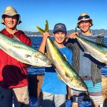
Primary Target: Largemouth Bass

Largemouth bass are the undisputed apex predators of Lake Sherwood's turbid waters. Recent Department of Natural Resources electrofishing surveys reveal a booming population, boasting a highly impressive relative abundance of 46 fish per mile. The size structure is equally exciting—over 70 percent of the bass exceed 12 inches, and nearly a quarter stretch past the 14-inch mark. These fish are exhibiting plump, healthy body conditions, aggressively feeding on the lake's abundant forage base.

Sleeper Pick: Walleye

While the majority of recreational anglers focus heavily on bass and panfish, Sherwood’s walleye population is a closely guarded secret among local guides. The state consistently stocks extended-growth walleyes here on an odd-year cycle. This aggressive management strategy has established a highly fishable population, with relative abundance hovering around 7 fish per mile and sizes ranging from 8.5 to over 18 inches. The dark water works to the walleye angler's advantage, allowing these light-sensitive predators to feed aggressively even during daylight hours.

Baitfish Report

The primary forage base driving the food web consists of golden shiners, alongside juvenile bluegill and pumpkinseed. The panfish population is incredibly dense, with bluegill abundance exceeding 100 fish per mile. Because predatory fish do not have to work hard to find a meal, your presentations must perfectly mimic the profile and vibration of a 3-to-5-inch sunfish or a slender, flashy shiner to trigger a strike.

3. TACTICAL STRATEGY

Where to Find Them

Lake Sherwood features a maximum depth of 27 feet and an average depth of 10 feet, characterized by a primarily sandy bottom. To find active fish, you must locate transitions and moving water. Start your morning patrol at the northeast corner near the Spring Brook Creek inlet. The inflowing water provides a slight temperature drop and higher dissolved oxygen levels, drawing in massive schools of golden shiners and the bass that hunt them.

As the sun climbs higher, transition toward the main basin drop-offs near the State Highway 13 public boat landing. Work the 8-to-12-foot weed edges where the vegetation meets the sandy basin. For midday walleye, rely on your electronics to locate the steep breaklines plunging into the 27-foot main hole. Fish will suspend just off the bottom in this darker, cooler water, waiting to ambush passing bait schools.

Lure and Bait Selection

  • Largemouth Bass: Because Lake Sherwood has exceptionally low water clarity, vibration and contrast are your best friends. Tie on a 3/8-ounce bladed jig, such as a Chatterbait, in a Black and Blue or Firetiger pattern. The dark silhouette stands out against the stained water, while the heavy vibration helps bass locate the bait via their lateral lines.
  • Walleye: Deploy a size 5 heavy metal jigging lure, like a Jigging Rap, in a Perch or Firetiger pattern. Vertically jig this along the deep 15-to-20-foot transitions, utilizing aggressive upward snaps followed by slack-line falls to trigger reaction strikes.
  • Live Bait Rigging: If you prefer live bait, a slip-bobber rig is deadly on the weed edges. Rig a lively jumbo leech or a large fathead minnow on a 1/16-ounce chartreuse tungsten teardrop jig. Set your bobber stop so the bait hovers exactly one foot above the tops of the submerged vegetation in the 10-foot depth zone. Use a medium-light spinning rod spooled with 15
    Editor's Choice: Must-Have Gear

    FISHINGSIR Next-Gen Waterproof Chest Waders

    ★★★★★ 4.4 (7,370+ reviews)
    • 2-Ply Tech: Upgraded nylon with 2.5x higher density than standard fabrics.
    • 100% Waterproof: Lab-approved intrusion resistance with taped visible seams.
    • Ultra-Lightweight: Designed for all-day comfort while hunting or fishing.
    Check Availability on Amazon

    ✓ Amazon's Choice | 100+ bought last month

    🛒 Tactical Gear for this Spot

    Bandit Walleye Deep

    Mandatory for reaching deep schools in 35-50ft mud flats.

    Check Price on Amazon #ad

    As an Amazon Associate I earn from qualifying purchases. #ad

    Loading forecast...

    Live Fishing Conditions: Tides, Weather & Waves

    Get real‑time tides, marine weather, swell and solunar activity for each spot so you know exactly when conditions line up for your best chance at a bite.

    🎣

    Lake Sherwood

    Loading coordinates...

    🌤️

    WEATHER CONDITIONS

    Weather
    -- °F
    --°C

    Loading...

    🌡️
    Feels Like --°F --°C
    💧
    Humidity --%
    💨
    Wind -- mph -- km/h
    🧭
    Direction --
    📊
    Pressure -- inHg -- hPa
    ☀️
    UV Index --
    🌊

    MARINE CONDITIONS

    🌊 Wave Height
    -- ft
    -- m
    Loading...
    🧭 Wave Direction
    --°
    Loading...
    ⏱️ Wave Period
    -- s
    Loading...
    📈 Tide Status
    -- ft
    -- m
    Loading...
    🌙

    LUNAR & SOLUNAR

    🌕

    Loading...

    Illumination: --%

    Major Period --:-- - --:-- --:-- - --:--
    Minor Period --:-- - --:-- --:-- - --:--
    🌅 Sunrise --:--
    🌇 Sunset --:--
    📅

    24-HOUR FORECAST

    Loading fishing conditions...

    Fishing Spots Map

    🎣
    Book a Fishing Charter near Lake Sherwood Fishing Report Today 🎣

    Local guides & charters. Verified captains, instant booking, best price guaranteed.

    See Available Trips →

    My location
    Loading map...

    Local Access & Facilities

    Local Access & Logistics: Lake Sherwood and the Santa Monica Mountains

    Situated in the heart of the Conejo Valley, the fishery surrounding Lake Sherwood offers a unique juxtaposition of manicured luxury and rugged, chaparral-covered wilderness. For the serious angler, this location serves as a strategic pivot point between the freshwater challenges of the inland reservoirs and the deep-water potential of the nearby Ventura and Malibu coastlines. The area is defined by its proximity to the Santa Monica Mountains National Recreation Area, a zone that demands a tactical approach to navigation due to its winding canyon roads and specific access restrictions.

    The atmosphere here shifts rapidly from the urban sophistication of Thousand Oaks to the wild, dry heat of the canyons. Anglers frequenting this zone are often targeting largemouth bass in the local impoundments or using the area as a staging ground for coastal runs. Unlike the industrial harbors further south, the vibe here is quieter and more secluded, though access requires careful planning. The terrain is characterized by coastal sage scrub and steep ridgelines, offering wind protection in certain pockets while funneling strong gusts in others.

    Navigating this region requires an understanding of the interplay between private property boundaries and public recreation zones. While the Lake Sherwood area itself is highly developed, the surrounding fishing grounds identified in the official recreation database—such as the Sepulveda Dam basin and the coastal access points—provide diverse opportunities. The following guide breaks down the logistical realities of fishing this complex interface of urban and wild environments.

    💡 Captain's Tip: Canyon Commutes

    When transiting from Thousand Oaks to the coast via the canyon roads, always check for road closures or fire warnings. The winding routes can add significant time to your dawn patrol if you get stuck behind slow-moving heavy machinery or cyclists.

    Access & Getting There

    The primary artery for reaching the fishing grounds around Lake Sherwood and Thousand Oaks is the US 101 Freeway. This route connects the inland valley to the coastal access points in Ventura and Oxnard. However, seasoned locals know that the 101 can be a bottleneck, particularly during the morning rush hour. For anglers towing trailers, the grades on the Conejo Grade can be steep; ensure your transmission and brakes are in top condition before descending toward the Oxnard Plain.

    For freshwater enthusiasts utilizing the Sepulveda Dam recreation area (identified as a key boat access point roughly 20 miles east), access is generally via the I-405 and US 101 interchange near Van Nuys. Directions indicate the site is located northwest of the intersection at Burbank and Woodley. This is an urban launch environment; expect tighter maneuvering spaces and higher traffic volumes compared to rural ramps. The facilities here are managed by the City of Los Angeles Parks, and while the site draws crowds for golf and tennis, the boat access remains a critical resource for urban anglers.

    Weather plays a critical role in access strategies here. The region is prone to Santa Ana winds—hot, dry gusts blowing offshore from the northeast. When these winds kick up, typically in the fall and winter, high-profile vehicles and boat trailers face hazardous driving conditions on the exposed canyon roads. Conversely, the "May Gray" and "June Gloom" marine layers can reduce visibility to near zero on the coastal side of the mountains until mid-morning. It is advisable to utilize the inland ramps during heavy marine layer events to avoid navigating the fog.

    Parking in the immediate vicinity varies significantly by specific location. For those accessing the Santa Monica Mountains trails or shore fishing spots, parking is often limited to trailheads which fill rapidly on weekends. The data highlights Cornerstone Plaza Parking and Ampco System Parking as reliable commercial lots, though they are located at a distance from the water, necessitating a "drop and park" strategy for kayakers or shore anglers. Note that trailheads like Sandstone Peak offer parking, but these are primarily for hikers and fill up by sunrise.

    💡 Captain's Tip: Trailer Safety

    Avoid Valet of the Dolls in Malibu if you are towing. While highly rated for standard vehicles, the tight confines of Pacific Coast Highway parking lots are notoriously difficult for maneuvering boat trailers.

    Lake Sherwood Pre-Trip Checklist

    Facilities & Amenities

    The infrastructure surrounding Lake Sherwood is a mix of high-end hospitality and scattered, specialized angling services. Unlike a dedicated fishing town where bait shops line the harbor, the services here are spread across the valley. You will not find a fuel dock or bait barge directly on the water at the inland locations. Anglers must fuel up at highway stations along the 101 corridor before hitching up.

    For tackle and bait, the logistics require a detour. Blue Moon Baits in Santa Paula (16.5 miles away) is a critical stop for live bait, particularly for those heading toward the river valleys or coastal estuaries. For gear, Tackle Express in Santa Clarita (23 miles away) is a top-tier outfitter known for servicing the bass community. If your itinerary takes you toward the coast, Hyun's Tackle Shop and Eric's Tackle Shop in Ventura are the established authorities for saltwater setups. Mavcco Market Fuel and Bait in Ventura Harbor is the nearest reliable source for marine fuel and frozen bait, operating from 5:30 AM, making it the only viable option for early risers needing supplies.

    The caliber of local expertise is high. Rich Tauber Fishing, based in Camarillo just over 10 miles away, represents the premier guide service for the local freshwater scene. For those looking to head offshore, Duke Sportfishing out of Oxnard and Ojai Angler Fishing Guide Service provide professional charter options. These operators are essential for visiting anglers who want to maximize their time, as the local reservoirs can be highly technical and pressure-sensitive.

    Lodging options reflect the upscale nature of the area. The Four Seasons Hotel Westlake Village offers luxury accommodations just under 4 miles from the center of the action. This proximity is excellent for maximizing sleep before a dawn launch. However, for those seeking a more rustic experience, options are currently limited. The Circle X Ranch Group Campground, a staple for outdoor enthusiasts in the Santa Monica Mountains, is currently closed until further notice. Anglers planning to camp should divert to Cross Campground in Santa Paula or look for availability at Santa Monica Mountains National Recreation Area sites that remain open.

    Key Facility Data

    Facility NameTypeDistance & Notes
    Rich Tauber FishingGuide Service10.3 miles. Top-rated freshwater guide. Opens 7:00 AM.
    Blue Moon BaitsBait Shop16.5 miles. Essential for live bait. Opens 9:30 AM.
    Mavcco Market Fuel and BaitFuel & Bait24.6 miles. Located in Ventura. Opens 5:30 AM for dawn patrol.
    Circle X RanchCampground8.4 miles. CURRENTLY CLOSED. Do not plan to stay here.
    Four Seasons WestlakeLodging3.8 miles. Nearest high-end accommodation.

    💡 Captain's Tip: Negative Knowledge

    There are no fish cleaning stations or dedicated wash-down areas listed for the immediate inland access points. If you are keeping your catch, bring a cooler with ice and plan to process your fish at home or at the coastal harbor facilities in Ventura.

    Permits, Regulations & Fees

    Fishing in this region falls under the jurisdiction of the State Fishing Agency (California Department of Fish and Wildlife). Anglers must possess a valid state fishing license. While the official recreation database notes that specific permit requirements for the spot were "null" in the scan, this typically indicates that standard state regulations apply rather than a lack of rules. Always carry your license and be aware of size and bag limits, which are strictly enforced to maintain the fishery.

    A critical regulatory note for this area involves the Hopper Mountain National Wildlife Refuge. Located approximately 17.9 miles away, this area is the gateway to California Condor country. It is closed to public use to protect these endangered birds. The refuge acts as a buffer for the Sespe Condor Sanctuary. Anglers exploring the backcountry creeks or hiking near the refuge boundaries must respect all "No Trespassing" signage. The preservation of this habitat is paramount, and federal wildlife officers patrol the perimeter.

    Cultural respect is also a significant aspect of accessing the Santa Monica Mountains. The Satwiwa Native American Indian Culture Center in Newbury Park serves as a reminder of the Chumash and Tongva heritage of this land. When fishing near shorelines or hiking to remote spots like the Grotto Trail, treat the land with "Kapu" (sacred respect). This means packing out all trash, staying on designated trails to avoid damaging native flora like the coastal sage scrub, and respecting the privacy of the ranching communities that still exist in the valleys.

    Events & Seasonal Information

    The fishing calendar in the Conejo Valley and surrounding mountains is dictated by the seasonal shift in temperatures and water levels. Spring brings the bass spawn in the local lakes, a time when sight fishing becomes a primary tactic. However, this is also when the "June Gloom" marine layer is thickest, often keeping the morning bite cooler and more active until nearly noon.

    Summer sees high traffic at all recreational facilities, including the Sepulveda Dam and coastal access points. The heat in the inland valleys can be intense, pushing fish deeper into the water column and making early morning or late evening the only productive times to be on the water. This is also the season when local rattlesnakes are most active on the trails leading to shore spots; vigilance is required when hiking in.

    While specific tournament dates vary annually, the presence of high-caliber guide services like Rich Tauber Fishing suggests a year-round focus on competitive bass fishing. Anglers should check local boards at Tackle Express for upcoming events that might crowd the water. Additionally, the Satwiwa Native American Indian Culture Center hosts workshops and programs on weekends, which can increase foot traffic around the Newbury Park access areas.

    Contact Information & Resources

    For the most current information on trail closures, fire danger, and campground status, the primary point of contact is the Santa Monica Mountains National Recreation Area visitor center. They can be reached at (805) 370-2301. For issues specifically related to the Sepulveda Dam recreation area, contact the managing office at (213) 452-3402.

    In terms of safety, cell reception can be spotty in the deeper canyons like Circle X Ranch. It is advisable to file a float plan or hike plan with a contact on land before venturing into the more remote sectors. For wildlife concerns, specifically regarding the Condor refuge, the Hopper Mountain NWR complex office can be contacted at 805-644-5185.

    For precise locations of the boat ramps, bait shops, and real-time weather conditions, consult the live dashboard and interactive maps below.

    🎣

    Lake Sherwood

    Thousand Oaks • California • 34.1989, -118.8376
    🅿️

    Parking

    5
    Cornerstone Plaza Parking
    ⭐ 5.0 24.6 mi
    📍 1990 S Bundy Dr, Los Angeles, CA 90025, USA
    🕒
    Monday: Open 24 hours
    Tuesday: Open 24 hours
    Wednesday: Open 24 hours
    Thursday: Open 24 hours
    Friday: Open 24 hours
    Saturday: Open 24 hours
    Sunday: Open 24 hours
    🚗 Get Directions
    Cycle Gear
    ⭐ 4.8 13.5 mi
    📍 21725 Vanowen St, Canoga Park, CA 91303, USA
    🕒
    Monday: 10:00 AM – 7:00 PM
    Tuesday: 10:00 AM – 7:00 PM
    Wednesday: 10:00 AM – 7:00 PM
    Thursday: 10:00 AM – 7:00 PM
    Friday: 10:00 AM – 7:00 PM
    Saturday: 10:00 AM – 6:00 PM
    Sunday: 10:00 AM – 6:00 PM
    🚗 Get Directions
    🐟

    Bait & Tackle

    5
    Mavcco Market Fuel and Bait
    ⭐ 5.0 24.6 mi
    📍 1404 Anchors Way, Ventura, CA 93001, USA
    🕒
    Monday: 5:30 AM – 5:30 PM
    Tuesday: 5:30 AM – 5:30 PM
    Wednesday: 5:30 AM – 5:30 PM
    Thursday: 5:30 AM – 5:30 PM
    Friday: 5:30 AM – 5:30 PM
    Saturday: 5:30 AM – 5:30 PM
    Sunday: 5:30 AM – 5:30 PM
    🚗 Get Directions
    Blue Moon Baits
    ⭐ 5.0 16.5 mi
    📍 335 S 5th St, Santa Paula, CA 93060, USA
    🕒
    Monday: 9:30 AM – 4:00 PM
    Tuesday: 9:30 AM – 4:00 PM
    Wednesday: 9:30 AM – 4:00 PM
    Thursday: 9:30 AM – 4:00 PM
    Friday: 9:30 AM – 4:00 PM
    Saturday: 10:00 AM – 3:00 PM
    Sunday: Closed
    🚗 Get Directions
    Tackle Express
    ⭐ 4.9 23.0 mi
    📍 22941 Soledad Canyon Rd, Santa Clarita, CA 91350, USA
    🕒
    Monday: 9:00 AM – 6:00 PM
    Tuesday: 9:00 AM – 6:00 PM
    Wednesday: 9:00 AM – 6:00 PM
    Thursday: 9:00 AM – 6:00 PM
    Friday: 9:00 AM – 6:00 PM
    Saturday: 9:00 AM – 5:00 PM
    Sunday: 10:00 AM – 4:00 PM
    🚗 Get Directions
    Hyun's Tackle Shop
    ⭐ 4.8 24.2 mi
    📍 3695 E Harbor Blvd Suite, Ventura, CA 93001, USA
    🕒
    Monday: 7:00 AM – 6:30 PM
    Tuesday: 7:00 AM – 6:30 PM
    Wednesday: 7:00 AM – 6:30 PM
    Thursday: 7:00 AM – 6:30 PM
    Friday: 7:00 AM – 6:30 PM
    Saturday: 7:00 AM – 6:30 PM
    Sunday: 10:00 AM – 4:30 PM
    🚗 Get Directions
    Eric's Tackle Shop
    ⭐ 4.8 25.2 mi
    📍 2127 E Thompson Blvd, Ventura, CA 93001, USA
    🕒
    Monday: 9:00 AM – 6:00 PM
    Tuesday: 9:00 AM – 6:00 PM
    Wednesday: 9:00 AM – 6:00 PM
    Thursday: 9:00 AM – 6:00 PM
    Friday: 9:00 AM – 6:00 PM
    Saturday: 9:00 AM – 5:00 PM
    Sunday: Closed
    🚗 Get Directions
    🚤

    Fishing Charters

    5
    Ojai Angler Fishing Guide Service
    ⭐ 5.0 32.3 mi
    📍 11311 Santa Ana Rd, Ventura, CA 93001, USA
    🕒
    Monday: 6:30 AM – 7:00 PM
    Tuesday: 6:30 AM – 7:00 PM
    Wednesday: 6:30 AM – 7:00 PM
    Thursday: 6:30 AM – 7:00 PM
    Friday: 6:30 AM – 7:00 PM
    Saturday: 6:30 AM – 7:00 PM
    Sunday: 6:30 AM – 7:00 PM
    🚗 Get Directions
    Rich Tauber Fishing
    ⭐ 5.0 10.3 mi
    📍 1985 Del Ciervo Pl, Camarillo, CA 93012, USA
    🕒
    Monday: 7:00 AM – 7:00 PM
    Tuesday: 7:00 AM – 7:00 PM
    Wednesday: 7:00 AM – 7:00 PM
    Thursday: 7:00 AM – 7:00 PM
    Friday: 7:00 AM – 7:00 PM
    Saturday: 7:00 AM – 7:00 PM
    Sunday: 7:00 AM – 7:00 PM
    🚗 Get Directions
    Duke Sportfishing
    ⭐ 5.0 22.2 mi
    📍 W Hemlock St, Oxnard, CA 93035, USA
    🕒
    Monday: Open 24 hours
    Tuesday: Open 24 hours
    Wednesday: Open 24 hours
    Thursday: Open 24 hours
    Friday: Open 24 hours
    Saturday: Open 24 hours
    Sunday: Open 24 hours
    🚗 Get Directions
    Kamryn Dawson Charters
    ⭐ 5.0 45.7 mi
    📍 141 W 22nd St, San Pedro, CA 90731, USA
    🕒
    Monday: 7:30 AM – 6:00 PM
    Tuesday: 7:30 AM – 6:00 PM
    Wednesday: 7:30 AM – 6:00 PM
    Thursday: 7:30 AM – 6:00 PM
    Friday: 7:30 AM – 6:00 PM
    Saturday: 7:30 AM – 6:00 PM
    Sunday: 7:30 AM – 6:00 PM
    🚗 Get Directions
    🏠

    Lodging

    5
    Caballero Ranch Manufactured Homes
    ⭐ 5.0 21.9 mi
    📍 15300 Brand Blvd, Mission Hills, CA 91345, USA
    🕒
    Monday: 9:00 AM – 5:00 PM
    Tuesday: 9:30 AM – 4:00 PM
    Wednesday: 9:30 AM – 4:00 PM
    Thursday: 9:00 AM – 5:00 PM
    Friday: 9:00 AM – 5:00 PM
    Saturday: 9:30 AM – 4:00 PM
    Sunday: Closed
    🚗 Get Directions
    Cross Campground
    ⭐ 4.9 21.5 mi
    📍 Santa Paula, CA 93060, USA
    🚗 Get Directions

    Boat Ramps

    3
    🚻

    Restrooms

    3
    👨‍👩‍👧‍👦

    Family Friendly

    2

    Accessibility

    Wheelchair Access

    Available

    🐕

    Pets Allowed

    Not Confirmed

    ⚠️ Some accessibility info not officially confirmed. Please verify with location directly.

    📍 Showing 28 facilities on map
    🎣
    Book a Fishing Charter near Lake Sherwood Fishing Report Today 🎣

    Local guides & charters. Verified captains, instant booking, best price guaranteed.

    See Available Trips →

    📊

    About Our Fishing Reports & Forecasts

    Our spot reports combine data-driven forecasts with curated local information. The forecast is generated by our proprietary Fishing Score algorithm (0–100%), which analyzes real-time data from Open-Meteo API, validated against NOAA CO-OPS tide gauges and USGS water-monitoring stations. The model weights tide dynamics (35%), wave energy (25%), wind patterns (20%) and time of day (20%)—factors shown to influence fish feeding behavior through marine-biology research and decades of charter log data.

    Access, facilities and services information for each fishing spot is sourced from official datasets such as Recreation.gov (RIDB), state park & wildlife agencies, and geospatial providers like Google Maps. These sections undergo scheduled re-validation every 3–6 months to ensure that boat ramps, park access, contact details and local services remain accurate.

    Narrative sections (catches, seasonal behavior, local tips) are synthesized from these data sources and refined following the Fishing Reports Today editorial guidelines, combining bibliographic research from ichthyology and oceanography with expert angler experience. Our team reviews reports on a regular basis, while the forecast model itself updates every 6 hours for real-time accuracy.

    ⚠️ Important: Always verify current local regulations, access restrictions and weather conditions before fishing. These reports are intended as a planning aid, not a guarantee of catches or safety. When in doubt, contact local authorities or park managers listed on the page.

    Learn more about our methodology & data sources

Leave a Reply

Your email address will not be published. Required fields are marked *