Panama City Fishing Report: Summer Patterns and Tactics
GO/NO-GO STATUS
Verdict: GO (with CAUTION for afternoon squalls)
The summer fishing season is in full swing along the Emerald Coast, bringing world-class angling opportunities both inshore and offshore. The current conditions yield a definitive "GO" status, but it comes with a mandatory weather advisory. The classic summer pattern dictates slick, calm mornings followed by the rapid development of intense, localized afternoon thunderstorms. Boaters must keep a watchful eye on the horizon and their marine radar apps; if you see towering cumulonimbus clouds building inland, it is time to adjust your positioning. Offshore anglers making the long run to deep water should plan to be heading back toward the pass by early afternoon to avoid getting caught in dangerous lightning storms. Furthermore, the summer heat is oppressive—pack double the water you think you need, utilize UV-protective clothing, and apply sunscreen liberally.
SPECIES INTEL
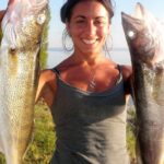
Primary Targets: Red Snapper and Bull Redfish
Offshore, the undisputed king of the summer season is the Red Snapper. These aggressive, hard-fighting bottom-dwellers are heavily congregated around deep-water wrecks, natural limestone ledges, and artificial reefs. Inshore, Redfish (both slot-sized schoolies and massive bull reds) are dominating the shallow flats and deep-water passes. The slot fish are actively hunting the grass beds, while the bulls are patrolling the deeper channels and bridge shadow lines waiting for the tide to flush bait their way.
From the editor
Tired of fishing with strangers you can’t trust?
Nautrek is the first social network for serious anglers — verified partners, real trips, cost splitting and intel sharing without burning your spots. Private beta now open.
While the offshore fleet is laser-focused on Red Snapper, inshore anglers are quietly loading the coolers with Mangrove Snapper. Often overlooked by visiting tourists, these incredibly intelligent and delicious fish are stacking up around shallow water structures, bridge pilings, and residential docks. Additionally, the mighty Tarpon is making its annual migration along the coastal beaches and passes. While notoriously difficult to hook and land, targeting these "Silver Kings" offers the ultimate light-tackle challenge.
Baitfish Report
The forage base is exceptionally strong right now. Menhaden (pogies) are schooling heavily in the bayous and back bays—look for nervous water or diving pelicans to locate the pods. Over the shallow grass flats, pinfish are ubiquitous and easily trapped or caught on hair hooks. Offshore, floating mats of Sargassum grass are acting as mobile ecosystems, holding small crabs and baitfish that are drawing in pelagic predators like Mahi-Mahi and Cobia.
TACTICAL STRATEGY
Inshore Flats and Bridges
Where: Focus your efforts on the grass flats surrounding the small islands near the North Bay bridge areas, as well as the 4-to-8-foot drop-offs along West Beach Drive. For bull reds, set up along the deeper edges of St. Andrews Pass during a falling tide.
Lure: For the early morning topwater bite, deploy a Heddon Super Spook Jr. or a Rapala Skitter Walk in the Silver Mullet or Bone color patterns. Once the sun gets high and the topwater bite dies, switch to a 1/4-ounce tungsten jig head paired with a 3rd Coast Lures split tail fluke or a D.O.A. Shrimp.
Color: Water clarity in the bays is currently very high. Stick to natural, translucent colors like New Penny, Clear/Gold Glitter, or Holographic Shrimp to avoid spooking line-shy fish.
Bait: For the bull reds in the pass, a half of a fresh blue crab or a heavy live pinfish fished on a fish-finder rig with a 5/0 circle hook is unbeatable.
Timing: The bite is heavily dictated by temperature and light penetration. You must be on your spot and casting at first light. The prime inshore window closes by 9:30 AM. The last hour of incoming daylight also offers a secondary feeding window.
Pro Tip: When targeting Mangrove Snapper around docks, use freshly cast-netted menhaden to chum the water. Squeeze the baitfish to release their oils and toss them up-current of the structure. This draws the snappers away from the pilings and into a feeding frenzy. Drop a live menhaden into the chum slick on a completely weightless rig using 15-pound fluorocarbon leader to trick these eagle-eyed fish.
Offshore Wrecks and Ledges
Where: To find quality Red Snapper and Grouper, you need to push past the heavily pressured nearshore reefs. Target structures at "The Edge," located approximately 20 miles offshore, or push out to "The Elbow" (80 miles offshore) where the bathymetry features sharp underwater drop-offs and ledges in 90 to 150 feet of water.
Bait: Live cigar minnows or pinfish are the gold standard. Rig them on a slip-lead bottom rig (Carolina rig) with enough weight to hold bottom in the current—usually 4 to 8 ounces depending on the drift.
Strategy: Keep a pitch bait ready on a medium-heavy spinning outfit. It is highly common for Mahi-Mahi or Cobia to swim right up to the boat while you are bottom fishing. A live bait or a brightly colored bucktail jig pitched to a cruising pelagic rarely gets ignored.
Pro Tip: Do not just blast past the Sargassum weed lines on your way to the offshore numbers. Slow down and troll Sea Striker spoons or fast-retrieve hard baits parallel to the grass. The Mahi-Mahi action is fantastic right now, with fish ranging from small "schoolies" to larger bulls pushing the 30-pound mark.
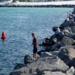
Land-Based & Surf Fishing
Where: The surf zones along the state park beaches and the Russell-Fields City Pier.
Strategy: Land-based anglers are seeing consistent action in the surf. Look for the deeper sloughs running parallel to the beach, specifically where the water color transitions from light aqua to deep emerald. Cast a standard double-drop pompano rig weighted with a pyramid sinker just past the first sandbar. This setup is highly effective for catching Whiting, Pompano, and the occasional cruising Redfish. If you are fishing the pier, keep a heavy rod rigged with a live cigar minnow ready for passing King Mackerel or migrating Tarpon.
REGULATIONS SNAPSHOT
Compliance is critical to maintaining our world-class fisheries. Below is a snapshot of the current rules for our primary targets. Note: Always verify with the Florida Fish and Wildlife Conservation Commission (FWC) or NOAA Fisheries before harvesting, as emergency closures or season extensions can occur.
*A State Reef Fish Angler designation is required for harvesting reef fish from a private vessel in Florida.
REGIONAL ALTERNATIVE
If the Gulf is churning with heavy surf or the offshore marine forecast predicts dangerous squalls, do not cancel your day on the water. Instead, pivot your strategy and head north to Deer Point Lake. Located just above North Bay, this expansive freshwater impoundment offers a fantastic sanctuary from coastal winds and saltwater chop.
Target Species: Largemouth Bass, Bluegill, and Shellcracker.
Tactical Approach: The lake is fed by natural springs and features abundant submerged timber and lily pad fields. Launch early and work topwater hollow-body frogs or buzzbaits over the vegetation for explosive Largemouth strikes. As the sun climbs, transition to pitching Texas-rigged plastic worms (in Watermelon Seed or Junebug colors) tight against the cypress tree roots and submerged laydowns. For panfish, a simple bobber rig with live crickets or red wigglers fished around the deeper dock pilings will provide non-stop action for anglers of all skill levels.
Tight lines!
Editor's Choice: Must-Have Gear
FISHINGSIR Next-Gen Waterproof Chest Waders
★★★★★4.4 (7,370+ reviews)
2-Ply Tech: Upgraded nylon with 2.5x higher density than standard fabrics.
100% Waterproof: Lab-approved intrusion resistance with taped visible seams.
Ultra-Lightweight: Designed for all-day comfort while hunting or fishing.
As an Amazon Associate I earn from qualifying purchases. #ad
Loading forecast...
Live Fishing Conditions: Tides, Weather & Waves
Get real‑time tides, marine weather, swell and solunar activity for each spot so you know exactly when conditions line up for your best chance at a bite.
🎣
Panama City
Loading coordinates...
🌤️
WEATHER CONDITIONS
--°F
--°C
Loading...
🌡️
Feels Like--°F--°C
💧
Humidity--%
💨
Wind-- mph-- km/h
🧭
Direction--
📊
Pressure-- inHg-- hPa
☀️
UV Index--
🌊
MARINE CONDITIONS
🌊Wave Height
-- ft
-- m
Loading...
🧭Wave Direction
--°
Loading...
⏱️Wave Period
-- s
Loading...
📈Tide Status
-- ft
-- m
Loading...
🌙
LUNAR & SOLUNAR
🌕
Loading...
Illumination: --%
Major Period--:-- - --:----:-- - --:--
Minor Period--:-- - --:----:-- - --:--
🌅Sunrise--:--
🌇Sunset--:--
📅
24-HOUR FORECAST
Loading fishing conditions...
Fishing Spots Map
🎣
Book a Fishing Charter near Panama City Fishing Report Today 🎣
Local guides & charters. Verified captains, instant booking, best price guaranteed.
There was an error loading the map. Please try refreshing the page.
Info
Local Access & Facilities
Panama City Pre-Trip Checklist
Local Access & Facilities
Panama City serves as a premier gateway to the Gulf of Mexico, offering a diverse fishery that ranges from the expansive grass flats of St. Andrews Bay to the deep blue canyons offshore. The atmosphere here is a distinct blend of working-class maritime heritage and high-end sportfishing capability. Anglers launching here are typically targeting Red Snapper and Grouper on the bottom, or chasing King Mackerel and Cobia during their migratory runs past the jetties.
The local topography is defined by the deep water access of the pass, which allows even larger sportfishers to clear the jetties quickly. Unlike shallower launches further east, the infrastructure here supports heavy vessels, making it a favorite hub for captains running serious offshore campaigns. The water transitions from the stained, nutrient-rich bay to the crystal clear Emerald Coast currents within just a few miles of the hill.
💡 Captain's Tip: Beat the Bridge Traffic
Traffic on Hwy 98 and the Hathaway Bridge can gridlock by mid-morning. Serious anglers tow their boats across town before 6:00 AM to ensure ample time for launching and bait acquisition before the bite starts.
Access & Getting There
Navigating to the launch points in Panama City requires strategic planning, primarily due to the geography of the bay system. The primary public access for trailer boaters is the Bob George Boat Ramp, located approximately 2.1 miles from the city center. This facility is well-regarded for its accessibility, but like all prime Gulf Coast ramps, trailer parking reaches capacity rapidly on weekends and during the height of Red Snapper season.
For those fishing from land or launching kayaks, Asbell Park offers a more relaxed entry point about 1.4 miles out. It is an excellent spot for targeting inshore species like Speckled Trout without the chaos of the main marina traffic. When utilizing downtown amenities, the City of Panama City Public Parking on Harrison Ave provides a reliable staging area, located just 1,183 feet from the waterfront district, though it is not designed for long-trailer configurations.
Weather patterns here dictate your launch strategy. The pass can become treacherous during strong outgoing tides opposed by a stiff southerly wind. In these conditions, experienced skippers often choose to fish the protected waters of the bay rather than risking the inlet. Always check the wind direction relative to the tide before committing to an offshore run.
💡 Captain's Tip: Trailer Security
While local lots are generally safe, secure all loose gear and lock your trailer coupling. At the Bob George Ramp, efficient launching is expected; have your vessel prepped in the staging lane, not on the ramp, to avoid drawing the ire of local commercial captains.
Facilities & Amenities
The logistical support for anglers in Panama City is top-tier, reflecting its status as a fishing capital. Howell Tackle Supply, located just 2.9 miles away on US-98, is a legendary institution. Opening at 6:30 AM on weekdays, it is the go-to spot for live bait and local intelligence on what the bottom fish are chewing. For those needing gear closer to the beach side, Half Hitch on Thomas Dr (5.7 miles away) opens at 6:00 AM and stocks a massive inventory of offshore trolling lures.
The charter fleet is concentrated heavily around Lagoon Drive, roughly 5 miles from the city center. Operations like Chances R Deep Sea Fishing and Long Shot Charters run out of this hub, providing access to heavy-duty offshore vessels. For inshore enthusiasts, Panama City Beach Inshore Fishing Charters specializes in the bay system. Note that while these marinas are well-equipped, fuel docks can get backed up in the afternoons; fueling your vessel on the trailer at a land-based station is often faster and cheaper.
Accommodation for the "dawn patrol" angler is best found at St. Andrews State Park Campground. Located 4.8 miles away, it puts you right at the mouth of the pass, allowing for the earliest possible start. For a more rugged experience, the Private Wilderness Camp in Youngstown offers a secluded base camp, though it is a 14-mile drive to the water.
Shop Name
Distance
Opening Time
Specialty
Howell Tackle Supply
2.9 mi
6:30 AM
Live Bait & Inshore Gear
Half Hitch
5.7 mi
6:00 AM
Offshore Trolling & Rigging
Anglers Tackle
5.7 mi
7:00 AM
General Tackle & Repair
Marlow's Bait and Bows
24 mi
5:30 AM
Early Bird Bait Service
Permits, Regulations & Fees
Fishing in this region is managed strictly by the State Fishing Agency, and enforcement is visible and active. The distinction between state and federal waters is critical here, as the boundary line sits 9 nautical miles offshore. Species like Red Snapper often have different season dates and bag limits depending on which side of that invisible line you are floating on. Ignorance of the GPS boundary is not accepted as an excuse by marine patrol.
Anglers should be particularly mindful of protected zones around St. Andrews State Park. While fishing is a major draw, specific areas near the jetties and swimming beaches may have seasonal restrictions to protect swimmers and boat traffic. Furthermore, if you are launching from NOAA - NMFS adjacent areas, be hyper-aware of federal property lines and restricted zones that may not be marked with standard civilian buoys.
💡 Captain's Tip: Venting Tools
When bottom fishing for reef fish in federal waters, you are required to have a venting tool or descending device rigged and ready. Wildlife officers frequently check for this specific gear during routine safety stops.
Events & Seasonal Information
The rhythm of Panama City is dictated by the migrations. Spring brings the Cobia run, where sight-fishing along the sandbars becomes the main event. Summer is dominated by the Federal Red Snapper season, which sees the boat ramps at maximum capacity. During these peak summer months, the afternoon sea breeze reliably kicks up around 1:00 PM, making the return trip through the pass choppy.
Winter fishing is quieter but excellent for Sheepshead around the pilings and bridges. Tournaments are a staple of the local culture, with high-stakes Billfish and Kingfish events occurring regularly out of the Lagoon Drive marinas. If you plan to visit during a major tournament weekend, expect accommodations like Marriott's Legends Edge to be booked months in advance, and trailer parking to be scarce.
Contact Information & Resources
For emergency assistance on the water, the US Coast Guard Station Panama City is the primary point of contact on VHF Channel 16. For issues regarding the boat ramps or public parking enforcement, contact the City of Panama City directly. Anglers staying at St. Andrews State Park should keep the park ranger station number handy for after-hours access issues.
Self-reliance is key when heading offshore. Ensure your EPIRB batteries are fresh and your float plan is filed with a contact on land. For precise locations of the boat ramps, bait shops, and real-time marine weather conditions, consult the live dashboard and interactive maps below.
Our spot reports combine data-driven forecasts with curated local information. The forecast is generated by our proprietary Fishing Score algorithm (0–100%), which analyzes real-time data from Open-Meteo API, validated against NOAA CO-OPS tide gauges and USGS water-monitoring stations. The model weights tide dynamics (35%), wave energy (25%), wind patterns (20%) and time of day (20%)—factors shown to influence fish feeding behavior through marine-biology research and decades of charter log data.
Access, facilities and services information for each fishing spot is sourced from official datasets such as Recreation.gov (RIDB), state park & wildlife agencies, and geospatial providers like Google Maps. These sections undergo scheduled re-validation every 3–6 months to ensure that boat ramps, park access, contact details and local services remain accurate.
Narrative sections (catches, seasonal behavior, local tips) are synthesized from these data sources and refined following the Fishing Reports Today editorial guidelines, combining bibliographic research from ichthyology and oceanography with expert angler experience. Our team reviews reports on a regular basis, while the forecast model itself updates every 6 hours for real-time accuracy.
⚠️ Important: Always verify current local regulations, access restrictions and weather conditions before fishing. These reports are intended as a planning aid, not a guarantee of catches or safety. When in doubt, contact local authorities or park managers listed on the page.
To provide the best experiences, we use technologies like cookies to store and/or access device information. Consenting to these technologies will allow us to process data such as browsing behavior or unique IDs on this site. Not consenting or withdrawing consent, may adversely affect certain features and functions.
Functional Always active
The technical storage or access is strictly necessary for the legitimate purpose of enabling the use of a specific service explicitly requested by the subscriber or user, or for the sole purpose of carrying out the transmission of a communication over an electronic communications network.
Preferences
The technical storage or access is necessary for the legitimate purpose of storing preferences that are not requested by the subscriber or user.
Statistics
The technical storage or access that is used exclusively for statistical purposes.The technical storage or access that is used exclusively for anonymous statistical purposes. Without a subpoena, voluntary compliance on the part of your Internet Service Provider, or additional records from a third party, information stored or retrieved for this purpose alone cannot usually be used to identify you.
Marketing & Affiliates
The technical storage or access is required to create user profiles to send advertising, or to track the user on a website or across several websites for similar marketing purposes, including affiliate tracking for products recommended in our reports.


Leave a Reply