0%

Charlarose Lake Fishing Report Today 🎣

9 months ago Β· Updated 2 weeks ago

Nestled in the rolling farmland of Hillsboro, Indiana, Charlarose Lake provides a unique and highly controlled angling environment. As a private, spring-fed body of water situated within the Charlarose Lake & Campground, this venue is meticulously maintained and stocked twice annually. Because it is fed by natural springs, the water remains remarkably clear and slightly cooler than surrounding public reservoirs, creating an oasis for both fish and anglers during the heat of the summer season. Whether you are pitching from the bank or launching a rented canoe, this comprehensive report breaks down exactly how to decode the water and maximize your hookups on this hidden Midwest gem.

1. GO/NO-GO STATUS

Verdict: GO

Current seasonal conditions are highly favorable for targeting the private waters of Charlarose Lake. As we push deep into the summer pattern, the stable weather and consistent barometric pressure have established a predictable daily feeding rhythm. Safety is rarely an issue on this sheltered waterbody, as wind chop is minimal compared to large public reservoirs, making it an ideal location for families and light watercraft. However, anglers should monitor the sky for pop-up afternoon thunderstorms, which are typical for the Midwest during this season. The spring-fed nature of the lake means water temperatures stay relatively moderated, preventing the severe stagnation and oxygen depletion that often plague smaller ponds in the region.

From the editor

Tired of fishing with strangers you can’t trust?

Nautrek is the first social network for serious anglers — verified partners, real trips, cost splitting and intel sharing without burning your spots. Private beta now open.

Join the Waitlist — Free → 100+ anglers on the list
Nautrek App

Pro Tip: Take advantage of the passing summer storm fronts. The sudden drop in barometric pressure just before a thunderstorm hits can trigger an aggressive, albeit brief, feeding frenzy among the resident largemouth bass. Position yourself near the primary drop-offs when you see the clouds building.

2. SPECIES INTEL

Because the lake is heavily managed and stocked twice a year, the biomass here is exceptionally dense. Understanding the hierarchy of the food chain is critical for selecting the right presentation and outsmarting fish that see a fair amount of angling pressure.

  • Primary Target: Largemouth Bass and Bluegill. The lake supports a booming population of panfish, which in turn feeds a healthy class of Largemouth Bass. The bluegill are eager to strike and provide constant action for light-tackle enthusiasts, while the bass are the main event for sport anglers looking for a heavy bend in the rod.
  • Sleeper Pick: Channel Catfish. Often overlooked by the RV crowd casting artificials, the stocked Channel Catfish grow to impressive dimensions in these waters. They utilize the deeper, cooler pockets of the lake during the day and become highly active scavengers as the sun sets.
  • Baitfish Report: The primary forage base consists of juvenile bluegill, crappie fry, and an abundance of terrestrial insects that blow off the surrounding campground foliage. Mimicking these specific food sources with small-profile presentations is your ticket to consistent bites.

3. TACTICAL STRATEGY

Approaching a pressured campground lake requires finesse. The fish see a lot of lures, so scaling down your presentation and targeting high-percentage holding zones is paramount to your success.

The Blueprint for Success

  • Where: Avoid the featureless shallow flats during the midday sun. Instead, focus your efforts on the transition zones near the sandy swimming beach where the bottom drops off into the central basin. The 8 to 12-foot depth contour is the primary travel corridor for cruising predators. Additionally, target the heavily shaded banks on the southern edge where overhanging trees provide a thick canopy. The shade creates a micro-climate of cooler water that holds resting bass throughout the afternoon.
  • Lure: For largemouth bass, leave the oversized swimbaits and loud crankbaits at home. Opt for a 3/16oz finesse jig paired with a compact craw trailer, or a 5-inch wacky-rigged Senko. For the bluegill and panfish, a 1/32oz or 1/64oz tungsten teardrop jig is absolutely deadly, especially when fished beneath a sensitive slip float.
  • Color: Water clarity is generally excellent due to the spring-fed source, so natural, muted tones excel here. Green Pumpkin, Watermelon Seed, and Black/Blue are the top choices for bass plastics. For panfish jigs, Pink, White, and Chartreuse stand out well against the submerged vegetation without spooking the fish.
  • Bait: If you are targeting the sleeper Channel Catfish, traditional baits reign supreme. Rig a chunk of nightcrawler or heavily scented commercial stink bait on a 2/0 circle hook. Use a slip-sinker rig (Carolina rig style) with a 1/2oz egg weight to keep the bait pinned to the bottom of the deepest basin while allowing the fish to run with it without feeling resistance.
  • Timing: The golden hours are non-negotiable. The first two hours of daylight and the final hour before sunset offer the most aggressive topwater and shallow-water bites. During the midday heat, you must slow down and fish vertically in the deeper, cooler pockets.

Pro Tip: Because this is a catch-and-release fishery, the bass are highly educated. When fishing soft plastics, let the bait sit motionless on the bottom for up to 10 seconds between twitches. The dead-sticking technique often outproduces aggressive hopping in pressured waters.

4. REGULATIONS SNAPSHOT

Charlarose Lake operates under private management, meaning the rules differ significantly from state-run public waters. Adhering to these regulations ensures the continued health of the fishery for future generations of campers and anglers.

SpeciesSize LimitBag LimitSeason Status
Largemouth BassN/A0 (Catch & Release)Open Year-Round (April-Nov)
Bluegill / PanfishN/A0 (Catch & Release)Open Year-Round (April-Nov)
Channel CatfishN/A0 (Catch & Release)Open Year-Round (April-Nov)

Key Notes: No Indiana state fishing license is required to fish Lake Charlarose. However, all anglers must purchase a daily fishing pass ($5) or a seasonal pass ($50) from the campground office. The lake is strictly a catch-and-release fishery. The use of barbless hooks is strongly encouraged by local guides to minimize handling stress on the fish. The campground and lake are accessible from April 1st through November 1st.

Pro Tip: Always wet your hands before handling fish, especially in the warmer summer months. Dry hands remove the protective slime coat from bass and panfish, leaving them susceptible to fatal infections after release.

5. REGIONAL ALTERNATIVE

If the campground is hosting a major event, or if you simply want to switch from still-water pond tactics to moving water, Sugar Creek at Shades State Park is your premier backup plan, located just 10 miles away.

Sugar Creek Tactical Overview

  • Target Species: Smallmouth Bass and River Catfish.
  • Access: Enter through Shades State Park. The creek winds through stunning sandstone cliffs and ravines, offering excellent wade fishing or canoe access. Note that a valid Indiana state fishing license is required here.
  • Approach: The water here is moving, so your tactics must adapt. Target the current seams, the tail-outs of riffles, and the deep, swirling pools behind large submerged boulders. Throw 1/8oz inline spinners (like a Rooster Tail in silver or white) to mimic fleeing minnows, or bounce a 1/4oz tube jig (Green Pumpkin) along the rocky bottom to imitate crawfish. The smallmouth here are aggressive and use the current to their advantage, providing a spectacular fight on light tackle.

Tight lines!

Editor's Choice: Must-Have Gear

FISHINGSIR Next-Gen Waterproof Chest Waders

β˜…β˜…β˜…β˜…β˜… 4.4 (7,370+ reviews)
  • 2-Ply Tech: Upgraded nylon with 2.5x higher density than standard fabrics.
  • 100% Waterproof: Lab-approved intrusion resistance with taped visible seams.
  • Ultra-Lightweight: Designed for all-day comfort while hunting or fishing.
Check Availability on Amazon

βœ“ Amazon's Choice | 100+ bought last month

πŸ›’ Tactical Gear for this Spot

Bandit Walleye Deep

Mandatory for reaching deep schools in 35-50ft mud flats.

Check Price on Amazon #ad

As an Amazon Associate I earn from qualifying purchases. #ad

Loading forecast...

Live Fishing Conditions: Tides, Weather & Waves

Get real‑time tides, marine weather, swell and solunar activity for each spot so you know exactly when conditions line up for your best chance at a bite.

🎣

Charlarose Lake

Loading coordinates...

🌀️

WEATHER CONDITIONS

Weather
-- Β°F
--Β°C

Loading...

🌑️
Feels Like --Β°F --Β°C
πŸ’§
Humidity --%
πŸ’¨
Wind -- mph -- km/h
🧭
Direction --
πŸ“Š
Pressure -- inHg -- hPa
β˜€οΈ
UV Index --
🌊

MARINE CONDITIONS

🌊 Wave Height
-- ft
-- m
Loading...
🧭 Wave Direction
--Β°
Loading...
⏱️ Wave Period
-- s
Loading...
πŸ“ˆ Tide Status
-- ft
-- m
Loading...
πŸŒ™

LUNAR & SOLUNAR

πŸŒ•

Loading...

Illumination: --%

Major Period --:-- - --:-- --:-- - --:--
Minor Period --:-- - --:-- --:-- - --:--
πŸŒ… Sunrise --:--
πŸŒ‡ Sunset --:--
πŸ“…

24-HOUR FORECAST

Loading fishing conditions...

Fishing Spots Map

🎣
Book a Fishing Charter near Charlarose Lake Fishing Report Today 🎣

Local guides & charters. Verified captains, instant booking, best price guaranteed.

See Available Trips β†’

My location
Loading map...

Local Access & Facilities

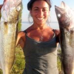
Situated in the heart of Destin, Florida, Charlarose Lake represents a unique intersection of residential calm and the high-octane energy of the "World's Luckiest Fishing Village." For the serious angler, this location offers more than just a spot to cast a line; it serves as a strategic waypoint near the bustling Harbor Boulevard. The fishery here is defined by its proximity to the Gulf of Mexico access points while maintaining the sheltered characteristics of an inland water body. The surrounding infrastructure caters heavily to the maritime industry, though navigating the dense commercial zones requires local know-how.

The atmosphere surrounding Charlarose Lake is distinctly Floridian, blending the rugged utility of working marinas with the manicured edges of coastal development. Anglers here are often targeting species that transition between the brackish inland waters and the nearby saltwater passes. The bottom topography in this region can be deceptive, requiring attention to depth sounders, especially when navigating the channels connecting to the broader Choctawhatchee Bay system. Whether you are launching a skiff for a technical inshore day or utilizing the shoreline, understanding the logistical footprint of Destin is essential for a successful trip.

Access to this fishery is heavily dictated by the flow of traffic along Highway 98 and the availability of specific launch infrastructure. While the area is tourism-centric, the facilities for dedicated anglers are robust if you know where to look. The following guide breaks down the essential access points, facility realities, and local intelligence required to fish Charlarose Lake and its surrounding waters effectively.

Access & Getting There

Reaching Charlarose Lake and the adjacent fishing grounds primarily involves navigating the arterial vein of Destin: Harbor Boulevard (Highway 98). Traffic congestion here is a well-documented reality, particularly during peak tourist seasons or weekend afternoons. Seasoned captains know that trailering a boat through this corridor requires patience and strategic timing. Early morning departures, ideally before 6:00 AM, are crucial not only for the bite but to avoid the gridlock that forms near the Marler Bridge.

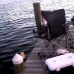
For boaters, the local access data indicates three primary launch candidates in the vicinity. The closest ramp is approximately 1.2 miles from the spot center, with additional options at 1.8 miles and 5.2 miles. Crucially, the data indicates that while these ramps offer trailer parking, they lack on-site amenities such as restrooms, showers, or fish cleaning stations. This is a vital detail for logistics; anglers must prepare to be self-sufficient at the launch site. Ensure your vessel is fully prepped before approaching the ramp lane to maintain efficiency in this high-pressure environment.

πŸ’‘ Captain's Tip: Launch Logistics

The local ramps allow for trailer parking but are "bare bones" regarding facilities. Do not expect wash-down hoses or restrooms at the launch itself. Handle all biological needs and gear prep at a gas station on Highway 98 before committing to the ramp.

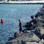
Shore access is available for those without vessels, with specific points identified suitable for families and general shore fishing. These spots are located roughly within the immediate vicinity of the lake's coordinates. When accessing these shoreline areas, be mindful of private property boundaries, which are common in this residential-heavy zone. The terrain is generally accessible, but standard safety precautions regarding footwear should be observed to avoid injury from debris or sharp limestone often found in Florida embankments.

Parking for non-trailered vehicles requires a strategic approach. The most reliable option for extended parking is the Public parking lot located at 2701 Scenic Hwy 98, approximately 2.4 miles away. Unlike many commercial lots in the area, this facility operates 24 hours a day, making it the superior choice for dawn patrol anglers or night fishing excursions. Other nearby lots, such as the UPS Store lot, are closer (0.6 miles) but may have enforcement restrictions for non-customers.

Charlarose Lake Pre-Trip Checklist

Facilities & Amenities

The infrastructure surrounding Charlarose Lake is robust, reflecting Destin's status as a premier fishing destination. However, the specialization of local shops varies, and knowing where to source specific gear is critical. For bait and tackle, the primary local provider is All Water Fishing, located just under a mile from the water on Harbor Boulevard. A critical logistical note for early risers: this shop opens at 10:00 AM throughout the week. This late opening time renders it unsuitable for stocking up before a sunrise launch. Serious anglers must secure bait the evening before or travel further to find early-morning service.

Facility NameTypeDistanceKey Notes
All Water FishingBait & Tackle0.9 milesOpens 10 AM. Plan accordingly.
Emerald LuresBait & Tackle11.0 milesLocated in Miramar Beach.
Public parkingParking2.4 milesOpen 24 Hours. Best for long sessions.
Cinnsational Saltwater FishingCharter0.6 milesLocated at East Pass Marina.

The charter fleet in this area is world-class. Operators like Cinnsational Saltwater Fishing and Twilight Fishing Charters are based out of the nearby East Pass Marina and Harbor Boulevard slips. These outfits are rated highly and are accustomed to serious clientele targeting big game. If you are looking to network or gather up-to-the-minute intelligence on the bite, walking the docks at East Pass Marina in the late afternoon when boats return is a time-honored tactic.

πŸ’‘ Captain's Tip: Bait Management

Since the nearest tackle shop, All Water Fishing, doesn't open until 10:00 AM, you cannot rely on it for live bait at sunrise. Cast net your own bait in the shallows near the shore access points or purchase frozen bait the night before.

For visiting anglers requiring accommodation, the area leans heavily toward RV and camping options, which suits the mobile fisherman well. Destin Village RV Lot #25 is the closest option at 6.5 miles. For a more scenic, nature-focused base camp, Camp Grayton Beach State Park offers a high-quality campground roughly 20 miles to the east. This state park is a fantastic logistical base if you prefer to escape the commercial density of downtown Destin after a day on the water.

Permits, Regulations & Fees

Fishing in Charlarose Lake and the surrounding Destin waters falls under the jurisdiction of the State Fishing Agency. Strict adherence to state licensing requirements is mandatory. Florida Fish and Wildlife Commission (FWC) officers are active in this high-traffic zone. You must possess a valid Florida saltwater fishing license if you are fishing from a boat or targeting saltwater species, even in brackish areas. If you are fishing from shore, a shore-based license is typically required unless you meet specific exemption criteria.

Conservation is paramount in this heavily pressured fishery. Be aware of slot limits and seasonal closures, particularly for high-value species like Red Snapper or Snook, which may seasonally inhabit connected waters. The local culture respects the "resource first" mentality. It is considered poor form to retain undersized fish or exceed bag limits, even if you think you are unobserved. Protected zones and specific gear restrictions may apply, so always consult the latest digital regulation charts before wetting a line.

While the provided data does not indicate specific launch fees for the identified ramps, it is standard practice in Destin for private marinas or improved public launches to charge a daily use fee. Always carry small bills or a credit card to handle potential parking or launch levies. The "Public parking" on Scenic Hwy 98 is a valuable asset, but always check signage for payment kiosks or time limits to avoid citations.

Events & Seasonal Information

Destin operates on a year-round fishing cycle, but the intensity shifts with the seasons. The presence of numerous 24-hour charter operations indicates a fishery that never truly sleeps. Summer brings the height of the pelagic migration offshore, which increases traffic at the ramps significantly. During these months, the "dawn patrol" rush is intense. If you are launching during the Destin Fishing Rodeo in October, expect delays and plan for extreme congestion at all water access points.

Winter fishing offers a reprieve from the crowds but demands attention to weather windows. The northern winds can make the open water choppy, pushing anglers into sheltered spots like Charlarose Lake. The charter fleets, such as Lindy Lou Charters and Intentional Fishing Charters, operate year-round, suggesting that holding fish are available even in cooler months. Monitoring their schedules can give you a clue as to when the bite is active.

πŸ’‘ Captain's Tip: Traffic Patterns

During peak season and tournament months, the boat ramp traffic jams can last hours. To beat the fleet, aim to be efficiently launched and clearing the no-wake zone while the rest of the harbor is still drinking coffee.

Contact Information & Resources

Safety and self-reliance are the hallmarks of an expert angler. While this area is urban, on-water emergencies require immediate professional response. For issues regarding regulations or wildlife, contact the regional State Fishing Agency office. For marina-specific inquiries, the East Pass Marina (where several charters dock) is a central hub of maritime activity and information.

Always file a float plan with a reliable contact on land, even for short trips in protected waters. The proximity to the Gulf means weather can shift rapidly. Ensure your VHF radio is functional and tuned to local working channels. For precise locations, real-time conditions, and detailed navigation aids, consult the live dashboard and interactive maps below.

🎣

Charlarose Lake

Destin β€’ Florida β€’ 30.3935, -86.4958
πŸ…ΏοΈ

Parking

5
The UPS Store- Parking Lot
⭐ 5.0 0.7 mi
πŸ“ 771 Harbor Blvd Suite 400, Destin, FL 32541, USA
πŸš— Get Directions
Public parking
⭐ 4.7 2.4 mi
πŸ“ 2701 Scenic Hwy 98, Destin, FL 32541, USA
πŸ•’
Monday: Open 24 hours
Tuesday: Open 24 hours
Wednesday: Open 24 hours
Thursday: Open 24 hours
Friday: Open 24 hours
Saturday: Open 24 hours
Sunday: Open 24 hours
πŸš— Get Directions
Fly VPS Credit Card Parking Lot
⭐ 4.6 7.8 mi
πŸ“ Valparaiso, FL 32580, USA
πŸš— Get Directions
Emerald Coast Paving
⭐ 4.4 17.3 mi
πŸ“ 457 Harstvedt Rd, Santa Rosa Beach, FL 32459, USA
πŸ•’
Monday: 7:00β€―AM – 7:00β€―PM
Tuesday: 7:00β€―AM – 7:00β€―PM
Wednesday: 7:00β€―AM – 7:00β€―PM
Thursday: 7:00β€―AM – 7:00β€―PM
Friday: 7:00β€―AM – 7:00β€―PM
Saturday: 8:00β€―AM – 6:00β€―PM
Sunday: 10:00β€―AM – 7:00β€―PM
πŸš— Get Directions
🐟

Bait & Tackle

2
Emerald Lures
⭐ 5.0 11.0 mi
πŸ“ 755 Grand Blvd PMB 357, Miramar Beach, FL 32550, USA
πŸ•’
Monday: 9:00β€―AM – 7:00β€―PM
Tuesday: 9:00β€―AM – 7:00β€―PM
Wednesday: 9:00β€―AM – 7:00β€―PM
Thursday: 9:00β€―AM – 7:00β€―PM
Friday: 9:00β€―AM – 7:00β€―PM
Saturday: Closed
Sunday: Closed
πŸš— Get Directions
All Water Fishing
⭐ 5.0 1.0 mi
πŸ“ 34 Harbor Blvd Kiosk 60D, Destin, FL 32541, USA
πŸ•’
Monday: 10:00β€―AM – 6:00β€―PM
Tuesday: 10:00β€―AM – 6:00β€―PM
Wednesday: 10:00β€―AM – 6:00β€―PM
Thursday: 10:00β€―AM – 6:00β€―PM
Friday: 11:00β€―AM – 7:00β€―PM
Saturday: 11:00β€―AM – 7:00β€―PM
Sunday: Closed
πŸš— Get Directions
🚀

Fishing Charters

5
Cinnsational Saltwater Fishing
⭐ 5.0 0.6 mi
πŸ“ East Pass Marina, 214 Harbor Blvd Slip#4, Destin, FL 32541, USA
πŸ•’
Monday: Open 24 hours
Tuesday: Open 24 hours
Wednesday: Open 24 hours
Thursday: Open 24 hours
Friday: Open 24 hours
Saturday: Open 24 hours
Sunday: Open 24 hours
πŸš— Get Directions
Lindy Lou Charters
⭐ 5.0 5.5 mi
πŸ“ 1318 Miracle Strip Pkwy SE, Fort Walton Beach, FL 32548, USA
πŸ•’
Monday: Open 24 hours
Tuesday: Open 24 hours
Wednesday: Open 24 hours
Thursday: Open 24 hours
Friday: Open 24 hours
Saturday: Open 24 hours
Sunday: Open 24 hours
πŸš— Get Directions
Intentional Fishing Charters
⭐ 5.0 6.1 mi
πŸ“ 100 Old Ferry Rd A, Dock Slip, #43, Shalimar, FL 32579, USA
πŸ•’
Monday: Open 24 hours
Tuesday: Open 24 hours
Wednesday: Open 24 hours
Thursday: Open 24 hours
Friday: Open 24 hours
Saturday: Open 24 hours
Sunday: Open 24 hours
πŸš— Get Directions
Twilight Fishing Charters
⭐ 5.0 0.7 mi
πŸ“ 210 Harbor Blvd, Destin, FL 32541, USA
πŸ•’
Monday: Open 24 hours
Tuesday: Open 24 hours
Wednesday: Open 24 hours
Thursday: Open 24 hours
Friday: Open 24 hours
Saturday: Open 24 hours
Sunday: Open 24 hours
πŸš— Get Directions
Got 2 Go Fishing Charters
⭐ 5.0 6.0 mi
πŸ“ 100 Old Ferry Rd, Shalimar, FL 32579, USA
πŸ•’
Monday: Open 24 hours
Tuesday: Open 24 hours
Wednesday: Open 24 hours
Thursday: Open 24 hours
Friday: Open 24 hours
Saturday: Open 24 hours
Sunday: Open 24 hours
πŸš— Get Directions
🏠

Lodging

5
Fort Walton Beach RV Park
⭐ 4.9 9.0 mi
πŸ“ 622 Gap Creek Dr, Fort Walton Beach, FL 32548, USA
πŸ•’
Monday: Open 24 hours
Tuesday: Open 24 hours
Wednesday: Open 24 hours
Thursday: Open 24 hours
Friday: Open 24 hours
Saturday: Open 24 hours
Sunday: Open 24 hours
πŸš— Get Directions
Grater RV Hideaway Cove
⭐ 4.7 15.6 mi
πŸ“ 2 Enda Ln, Mary Esther, FL 32569, USA
πŸ•’
Monday: 8:00β€―AM – 8:00β€―PM
Tuesday: 8:00β€―AM – 8:00β€―PM
Wednesday: 8:00β€―AM – 8:00β€―PM
Thursday: 8:00β€―AM – 8:00β€―PM
Friday: 8:00β€―AM – 8:00β€―PM
Saturday: 8:00β€―AM – 8:00β€―PM
Sunday: 8:00β€―AM – 8:00β€―PM
πŸš— Get Directions
SoWal Palms RV Park
⭐ 4.7 16.5 mi
πŸ“ 82 Veterans Rd, Santa Rosa Beach, FL 32459, USA
πŸ•’
Monday: 9:00β€―AM – 5:00β€―PM
Tuesday: 9:00β€―AM – 5:00β€―PM
Wednesday: 9:00β€―AM – 5:00β€―PM
Thursday: 9:00β€―AM – 5:00β€―PM
Friday: 9:00β€―AM – 5:00β€―PM
Saturday: 9:00β€―AM – 5:00β€―PM
Sunday: 9:00β€―AM – 5:00β€―PM
πŸš— Get Directions
βš“

Boat Ramps

3
🚻

Restrooms

3
πŸ‘¨β€πŸ‘©β€πŸ‘§β€πŸ‘¦

Family Friendly

2
β™Ώ

Accessibility

β™Ώ

Wheelchair Access

Not Confirmed

πŸ•

Pets Allowed

Not Confirmed

⚠️ Some accessibility info not officially confirmed. Please verify with location directly.

πŸ“ Showing 25 facilities on map
🎣
Book a Fishing Charter near Charlarose Lake Fishing Report Today 🎣

Local guides & charters. Verified captains, instant booking, best price guaranteed.

See Available Trips β†’

πŸ“Š

About Our Fishing Reports & Forecasts

Our spot reports combine data-driven forecasts with curated local information. The forecast is generated by our proprietary Fishing Score algorithm (0–100%), which analyzes real-time data from Open-Meteo API, validated against NOAA CO-OPS tide gauges and USGS water-monitoring stations. The model weights tide dynamics (35%), wave energy (25%), wind patterns (20%) and time of day (20%)β€”factors shown to influence fish feeding behavior through marine-biology research and decades of charter log data.

Access, facilities and services information for each fishing spot is sourced from official datasets such as Recreation.gov (RIDB), state park & wildlife agencies, and geospatial providers like Google Maps. These sections undergo scheduled re-validation every 3–6 months to ensure that boat ramps, park access, contact details and local services remain accurate.

Narrative sections (catches, seasonal behavior, local tips) are synthesized from these data sources and refined following the Fishing Reports Today editorial guidelines, combining bibliographic research from ichthyology and oceanography with expert angler experience. Our team reviews reports on a regular basis, while the forecast model itself updates every 6 hours for real-time accuracy.

⚠️ Important: Always verify current local regulations, access restrictions and weather conditions before fishing. These reports are intended as a planning aid, not a guarantee of catches or safety. When in doubt, contact local authorities or park managers listed on the page.

Learn more about our methodology & data sources β†’

Leave a Reply

Your email address will not be published. Required fields are marked *