0%

Niceville FL Fishing Report Today 🎣

9 months ago · Updated 2 weeks ago

Niceville-FL-fishing-report

Niceville & Choctawhatchee Bay Inshore Fishing Report

GO/NO-GO STATUS

Verdict: GO (WITH CAUTION FOR WIND DIRECTION)

The transition into the established summer pattern has fully activated the Choctawhatchee Bay system, giving anglers a definitive green light for inshore and brackish pursuits. The primary caution flag stems from the predictable summer wind cycles and afternoon thunderstorms. When the winds push 15 knots or higher from the south, the open waters of the bay can quickly turn into a steep, confused chop, making crossings to the Destin Pass hazardous for smaller skiffs. However, those same strong south winds make the northern shore of the bay (the Niceville side) the leeward bank, offering highly protected, fishable water in Boggy Bayou and Rocky Bayou.

Conversely, a strong north wind will turn the Niceville shoreline into a mud-churned mess. If a northern front blows through, you will be forced to run south or look to regional alternatives to find clean water. Access can be tricky during peak times; arrive at launches like the Florida Park Boat Ramp early to secure parking and avoid the mid-morning congestion,. Wear non-slip footwear, as the ramps can be exceptionally slick with algae during low tide cycles.

From the editor

Tired of fishing with strangers you can’t trust?

Nautrek is the first social network for serious anglers — verified partners, real trips, cost splitting and intel sharing without burning your spots. Private beta now open.

Join the Waitlist — Free → 100+ anglers on the list
Nautrek App

SPECIES INTEL

The warming waters have pushed the local biomass into high gear, offering a diverse mixed bag for inshore anglers.

Primary Target: Redfish & Spotted Seatrout

Slot-sized Redfish (Red Drum) and Spotted Seatrout are currently the most abundant and active species in the Niceville area,. Redfish are heavily utilizing the flooded marsh grass during high tide to root for crabs, falling back to the deeper edges as the tide recedes. The larger gator trout are solitary and hunting the edges of mullet schools, while the smaller schoolie trout are grouped up tightly over the mottled sand-and-grass bottoms.

Sleeper Pick: Mangrove Snapper

Often overlooked by anglers hyper-focused on the flats, the Mangrove Snapper is an aggressive, hard-fighting, and delicious target. They are currently staging thick around residential docks in Boggy Bayou and the deeper concrete pilings of the Mid-Bay Bridge,.

Baitfish Report

Forage is abundant right now. Schools of finger mullet are actively pushing along the shorelines, while pinfish are absolutely loaded in the turtle grass. You will also find small menhaden flickering in the deeper channels. Take a cast net if you have one; a quick throw near the boat ramps at first light can yield enough finger mullet to last the entire session. Matching your presentation to a 3-to-4-inch baitfish profile is the critical key to triggering strikes.

TACTICAL STRATEGY

Success in the Niceville bayous requires surgical precision and an understanding of how fish relate to structure during the warmer months.

Where to Deploy

Avoid aimlessly drifting the middle of the bayous. Instead, focus on the eastern shoreline of Rocky Bayou near the state park. Work the defined 4-to-8-foot drop-offs where the seagrass meets the deeper channel. Position your skiff or kayak upwind of the target structure and allow the natural drift to carry you silently into the strike zone. For dock fishing, target the older, barnacle-encrusted wooden docks in Boggy Bayou—specifically those with deep-water access at low tide. Shoreline anglers should note that an Eglin Recreation Permit is required for bank access near the Air Force base properties.

Lure Selection & Color

In the tannin-stained, slightly darker waters of the bayous, you need a lure that provides a solid silhouette and moves water.

  • Soft Plastics: A 1/4-ounce unpainted or chartreuse tungsten jig head paired with a 3-inch paddle tail. Rootbeer Gold or Houdini are the optimal colors for this water clarity. When retrieving, employ a slow, steady wind with occasional twitches to mimic a struggling baitfish.
  • Topwater: For the early morning grass bed bite, walk the dog with a topwater plug in a Bone or Chrome/Black colorway to mimic a wounded mullet. Do not stop the lure if a fish swirls and misses—keep it moving to trigger a reaction strike.

Pro Tip: When skipping soft plastics under Boggy Bayou docks, coat your paddle tails in a menhaden-based scent gel. The Mangrove Snapper and Redfish will hold on a second longer, giving you the necessary time to drive the hook home before they wrap you around a piling.

Bait & Rigging

If artificials aren't producing, pivot to live bait. A live finger mullet or a 3-inch pinfish hooked through the upper lip on a 3/0 inline circle hook is deadly. Fish this on a standard Carolina rig: a 1/2-ounce egg sinker above a sturdy swivel, followed by 18 to 24 inches of 20-pound fluorocarbon leader. The fluorocarbon is non-negotiable around the abrasive barnacles and oyster shells. If you cannot catch your own, purchase live bait at local shops in nearby Fort Walton Beach before heading to the ramp.

Timing the Bite

The bite window is heavily front-loaded right now. You want your first cast to land 30 minutes before sunrise. The action typically tapers off significantly by mid-morning as the sun penetrates the water column and temperatures spike. An incoming tide is ideal, as it flushes cooler, oxygen-rich, and clearer water from the Destin Pass up into the northern bayous.

Pro Tip: If you are forced to fish the

Editor's Choice: Must-Have Gear

FISHINGSIR Next-Gen Waterproof Chest Waders

★★★★★ 4.4 (7,370+ reviews)
  • 2-Ply Tech: Upgraded nylon with 2.5x higher density than standard fabrics.
  • 100% Waterproof: Lab-approved intrusion resistance with taped visible seams.
  • Ultra-Lightweight: Designed for all-day comfort while hunting or fishing.
Check Availability on Amazon

✓ Amazon's Choice | 100+ bought last month

🛒 Tactical Gear for this Spot

Bandit Walleye Deep

Mandatory for reaching deep schools in 35-50ft mud flats.

Check Price on Amazon #ad

As an Amazon Associate I earn from qualifying purchases. #ad

Loading forecast...

Live Fishing Conditions: Tides, Weather & Waves

Get real‑time tides, marine weather, swell and solunar activity for each spot so you know exactly when conditions line up for your best chance at a bite.

🎣

Niceville FL

Loading coordinates...

🌤️

WEATHER CONDITIONS

Weather
-- °F
--°C

Loading...

🌡️
Feels Like --°F --°C
💧
Humidity --%
💨
Wind -- mph -- km/h
🧭
Direction --
📊
Pressure -- inHg -- hPa
☀️
UV Index --
🌊

MARINE CONDITIONS

🌊 Wave Height
-- ft
-- m
Loading...
🧭 Wave Direction
--°
Loading...
⏱️ Wave Period
-- s
Loading...
📈 Tide Status
-- ft
-- m
Loading...
🌙

LUNAR & SOLUNAR

🌕

Loading...

Illumination: --%

Major Period --:-- - --:-- --:-- - --:--
Minor Period --:-- - --:-- --:-- - --:--
🌅 Sunrise --:--
🌇 Sunset --:--
📅

24-HOUR FORECAST

Loading fishing conditions...

Fishing Spots Map

🎣
Book a Fishing Charter near Niceville FL Fishing Report Today 🎣

Local guides & charters. Verified captains, instant booking, best price guaranteed.

See Available Trips →

My location
Loading map...

Local Access & Facilities

Niceville, Florida, offers a distinct tactical advantage for the serious angler looking to unlock the riches of the Choctawhatchee Bay without the immediate congestion of the tourist-heavy harbor to the south. Situated at the northern head of the bay, this fishery is defined by its deep bayous, grass flats, and proximity to the legendary pass in Destin. While the casual crowds flock to the "World's Luckiest Fishing Village" just across the Mid-Bay Bridge, veteran skippers know that launching from Niceville provides a quieter, more strategic entry point to targeting Bull Redfish, Speckled Trout, and the seasonal migratory species that patrol the Intracoastal Waterway.

The atmosphere here is decidedly more local and functional than the resort-lined coast. The topography is characterized by pine forests meeting brackish water, where the dark, tannin-stained runoff from the bayous mixes with the salty push from the Gulf. For the expert angler, this creates a dynamic nutrient-rich environment that holds baitfish year-round. The vibe is less about umbrella drinks and more about early morning engine checks and serious bay boat operations. It is a logistical stronghold for those who want to fish the bay’s northern structure or make the run to the pass on their own terms.

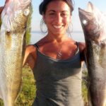
Primary targets in these waters shift with the barometer, but the constant draw is the inshore slam. The grass beds surrounding the bayous are prime territory for topwater action at first light. However, because Niceville sits in the shadow of Eglin Air Force Base, the fishery requires a high degree of situational awareness regarding restricted zones and military waters. This isn't just a place to wet a line; it is a launchpad for technical, chart-reading anglers who understand how wind direction and tide phases dictate the movement of bait across the bay's expansive flats.

Access & Getting There

Navigating to Niceville requires a strategic approach to traffic, particularly if you are towing a heavy rig. The primary arteries are State Road 20 running east-west and State Road 85 running north-south. Anglers coming from the north should be wary of the traffic patterns surrounding Eglin Air Force Base. The morning commute onto the base can cause significant delays on SR 85; seasoned locals know to time their arrival at the ramp well before the 06:00 military rush or wait until the mid-morning lull. If you are crossing the Mid-Bay Bridge from Destin, be prepared for tolls and potential bottlenecks during peak tourist seasons.

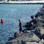
The boat launch situation in Niceville is functional but requires scouting. The data identifies three primary launch points within a 6-mile radius of the city center. These ramps generally offer direct access to the bayous and the open bay. However, "launch realities" here differ from the manicured marinas of Destin. Ramps can be steep, and traction can be an issue during extreme low tides when algae-slicked concrete is exposed. It is imperative to inspect the waterline before backing down, especially with a 2WD tow vehicle. The local ramps are less protected from the wind than the harbor, so crosswinds can make solo launching a challenge.

💡 Captain's Tip: Bridge Toll Strategy

If you are trailering back and forth from Destin, the Mid-Bay Bridge toll can add up quickly. However, the time saved bypassing the traffic jam on Highway 98 is often worth the cost. Always have a SunPass or exact change, though electronic billing is standard now.

Weather contingencies are critical in this open bay system. Choctawhatchee Bay is shallow and wide, meaning a stiff 15-knot wind can whip up a steep, confused chop that makes crossing from Niceville to the Destin Pass uncomfortable for smaller skiffs. If the forecast calls for strong south winds, the northern shore of the bay (Niceville side) becomes the leeward bank, offering protected water for wading or kayak fishing. Conversely, a strong north wind will turn the Niceville shoreline into a mud-churned mess, forcing you to run south to find clean water.

Parking logistics in Niceville differ from the massive public lots found in beach towns. While specific trailer parking capacities for the local ramps aren't detailed in the digital amenities data, the surrounding infrastructure suggests a "get in where you fit in" environment. For those without a trailer or meeting a guide, parking options like the 1280 Eglin Parkway N. Parking (7.5 miles out) or the Fly VPS Parking (4.2 miles out) serve as potential rendezvous points, though they are not designed for boat storage. Security is generally better here than in high-traffic tourist zones, but standard precautions apply: lock your hitch and strip your electronics.

Niceville FL Pre-Trip Checklist

Facilities & Amenities

The logistical footprint of Niceville is defined by what is absent as much as what is present. Unlike the commercial harbor in Destin, Niceville does not have a dense concentration of high-end tackle shops or fuel docks directly on the water. The data indicates that the serious outfitting hubs are located in the neighboring towns. Anglers must plan their fuel and ice stops before hitting the ramp. You will not find a "one-stop-shop" marina with live bait and diesel at every corner here.

For bait and specialized gear, you are looking at a short drive. Fresh Fish Live Bait (VHF CH 80) in Fort Walton Beach (9.5 miles away) is a key resource for live shrimp and pinfish. In Destin, All Water Fishing provides terminal tackle and local intelligence. Emerald Lures in Miramar Beach caters to the artificial enthusiast. The distance to these shops (8 to 15 miles) means that if you launch in Niceville at 5:00 AM without bait, you are making a significant detour to correct that mistake. Stock up the night before or plan your route to hit FWB or Destin on the way in.

💡 Captain's Tip: The Bait Gap

Since the primary bait shops are 9+ miles away in Destin or Fort Walton, highly recommend acquiring your live bait the evening before if you have a reliable aeration system. Otherwise, you'll be burning valuable fishing time driving to the coast before launching in the bay.

The charter fleet serving this area is world-class, but it is largely headquartered in Destin Harbor. Operators like Silver Lining Charter Fishing, O Sea D Fishing Charters, and Into The Blue Charters are based roughly 9 miles south. However, Code Blue Fishing Charters in Fort Walton Beach offers a slightly different angle on the bay. If you are booking a trip, clarify the pickup point. Many captains are willing to pick up clients at a Niceville dock to save them the drive into the heavy Destin traffic, but this must be arranged in advance.

Accommodation for the traveling angler is heavily skewed toward RV and camping options, which suits the rugged, self-sufficient vibe of the area. Forest Grove RV Park in Fort Walton Beach and Geronimo RV Park in Miramar Beach are highly rated options within striking distance. For those willing to drive a bit further for a more secluded experience, Blackwater Joe's offers cabins and camping roughly 23 miles out, placing you closer to the river systems. Note that there are no waterfront fishing lodges directly in Niceville listed; you are either camping or staying in standard hotels along the highway corridors.

Facility TypeNameDistance & LocationNotes
Bait & TackleAll Water Fishing8.9 mi (Destin)Opens 10 AM (Late for dawn patrol)
Bait & TackleFresh Fish Live Bait9.5 mi (FWB)Opens 6 AM; Monitors VHF CH 80
CharterCode Blue Charters9.6 mi (FWB)Operates 5 AM - 10 PM
CharterInto The Blue8.9 mi (Destin)Start times from 5:30 AM
Lodging (RV)Forest Grove RV Park9.9 mi (FWB)4.7 Rating; Reliable hookups

Permits, Regulations & Fees

Fishing in the waters surrounding Niceville requires strict adherence to Florida state regulations, but the local geography adds a layer of complexity due to the military presence. A standard Florida Saltwater Fishing License is the baseline requirement for anyone targeting Redfish, Trout, or Sheepshead. These funds contribute directly to the conservation of the bay's seagrass beds and oyster reefs, which are the lifeblood of this fishery.

The critical "local knowledge" regarding permits involves Eglin Air Force Base. Much of the shoreline along the northern and western parts of Choctawhatchee Bay borders Eglin property. If you intend to beach your boat, wade fish, or access specific shoreline areas that fall under military jurisdiction, you are required to possess an Eglin Recreation Permit. This is separate from your state license. Ignorance of this boundary is not a valid defense, and base patrols are vigilant. Always check the current Eglin iSportsman map to confirm which zones are open, as they close frequently for mission activity.

💡 Captain's Tip: Military Zones

Never anchor or drift into the restricted security zones surrounding military infrastructure or the bridge pilings marked with "Keep Out" signage. The fine is steep, and they will confiscate your gear. Keep a respectful distance from any grey hull vessels you see moving in the bay.

Cultural respect in this area centers on the "leave no trace" ethos, particularly around the bayous and the Niceville Children's Park shoreline access. These are community hubs, and locals are protective of them. Additionally, while not a formal law, proper etiquette dictates giving wide berth to wading birds and other anglers on the flats. The shallow water transmits noise efficiently; hull slap or a loud outboard can shut down a bite for everyone in a half-mile radius.

Events & Seasonal Information

The fishing calendar in Niceville is dictated by the water temperature and the migratory patterns through the Destin Pass. Spring and Fall are the transition seasons where the flats come alive. During the "Mullet Run" in late autumn, the bay shoreline explodes with activity as predators harass the bait schools migrating out toward the Gulf. This is the prime time for throwing topwater plugs and large swimbaits.

Summer brings the heat and the crowds to the south, but Niceville remains a relative sanctuary. The "Dawn Patrol" is essential from June through September; the bite is often over by 9:00 AM when the sun gets high and the water temps spike. Conversely, the winter months offer excellent sight fishing for Redfish on the low tides, provided you have the patience to work the negative tides slowly.

While Niceville itself is quieter, it feels the pulse of the massive tournaments hosted in Destin. The Destin Fishing Rodeo, held throughout October, is the marquee event. During this month, bait becomes scarce, boat ramps (even the remote ones) get crowded, and the bay traffic increases exponentially. If you are planning a trip in October, anticipate delays and competition for prime spots. Conversely, the winter months are the season of the locals, where you might have an entire bayou to yourself.

Contact Information & Resources

For emergency assistance on the water, the U.S. Coast Guard Station Destin is the primary responder, but response times to the northern bay can vary. It is vital to have a working VHF radio; cell service can be spotty in the deeper bayous. For issues regarding state fisheries, contact the Florida Fish and Wildlife Conservation Commission (FWC).

  • Emergency: 911
  • VHF Hail: Channel 16
  • Local Bait Intel: Fresh Fish Live Bait (VHF Ch 80)

Self-reliance is key when launching from Niceville. Unlike the full-service environment of a marina, you are often on your own at the municipal ramps. Ensure your battery is charged, your drain plug is in, and your safety kit is stocked before leaving the pavement. For precise locations of the boat ramps, specific parking lots, and real-time weather conditions, consult the live dashboard and interactive maps below.

🎣

Niceville FL

Niceville • Florida • 30.5202, -86.4865
🅿️

Parking

5
Fly VPS Credit Card Parking Lot
⭐ 4.6 4.2 mi
📍 Valparaiso, FL 32580, USA
🚗 Get Directions
1280 Eglin Parkway N. Parking
⭐ 4.5 7.5 mi
📍 1280 Eglin Pkwy, Shalimar, FL 32579, USA
🚗 Get Directions
Emerald Coast Paving
⭐ 4.4 18.8 mi
📍 457 Harstvedt Rd, Santa Rosa Beach, FL 32459, USA
🕒
Monday: 7:00 AM – 7:00 PM
Tuesday: 7:00 AM – 7:00 PM
Wednesday: 7:00 AM – 7:00 PM
Thursday: 7:00 AM – 7:00 PM
Friday: 7:00 AM – 7:00 PM
Saturday: 8:00 AM – 6:00 PM
Sunday: 10:00 AM – 7:00 PM
🚗 Get Directions
Rental Car Parking (Destin-Fort Walton Beach Airport Parking)
⭐ 4.3 4.0 mi
📍 1701 State Road 85 North, Eglin AFB, FL 32542, USA
🚗 Get Directions
🐟

Bait & Tackle

5
Hippies bait and tackle
⭐ 5.0 17.0 mi
📍 5393 Co Rd 393, Crestview, FL 32539, USA
🕒
Monday: 7:00 AM – 7:00 PM
Tuesday: 7:00 AM – 7:00 PM
Wednesday: 7:00 AM – 7:00 PM
Thursday: 7:00 AM – 7:00 PM
Friday: 7:00 AM – 7:00 PM
Saturday: 7:00 AM – 7:00 PM
Sunday: 7:00 AM – 7:00 PM
🚗 Get Directions
Emerald Lures
⭐ 5.0 14.3 mi
📍 755 Grand Blvd PMB 357, Miramar Beach, FL 32550, USA
🕒
Monday: 9:00 AM – 7:00 PM
Tuesday: 9:00 AM – 7:00 PM
Wednesday: 9:00 AM – 7:00 PM
Thursday: 9:00 AM – 7:00 PM
Friday: 9:00 AM – 7:00 PM
Saturday: Closed
Sunday: Closed
🚗 Get Directions
All Water Fishing
⭐ 5.0 8.9 mi
📍 34 Harbor Blvd Kiosk 60D, Destin, FL 32541, USA
🕒
Monday: 10:00 AM – 6:00 PM
Tuesday: 10:00 AM – 6:00 PM
Wednesday: 10:00 AM – 6:00 PM
Thursday: 10:00 AM – 6:00 PM
Friday: 11:00 AM – 7:00 PM
Saturday: 11:00 AM – 7:00 PM
Sunday: Closed
🚗 Get Directions
Three Rivers Bait and Tackle
⭐ 5.0 18.4 mi
📍 5185 FL-4, Baker, FL 32531, USA
🕒
Monday: 7:00 AM – 6:00 PM
Tuesday: 7:00 AM – 6:00 PM
Wednesday: 7:00 AM – 6:00 PM
Thursday: 7:00 AM – 6:00 PM
Friday: 7:00 AM – 6:00 PM
Saturday: 7:00 AM – 6:00 PM
Sunday: 7:00 AM – 4:00 PM
🚗 Get Directions
Fresh Fish Live Bait VHF CH 80
⭐ 5.0 9.5 mi
📍 232b Eglin Pkwy NE NW, Fort Walton Beach, FL 32547, USA
🕒
Monday: 6:00 AM – 6:00 PM
Tuesday: 6:00 AM – 6:00 PM
Wednesday: 6:00 AM – 6:00 PM
Thursday: 6:00 AM – 6:00 PM
Friday: 6:00 AM – 6:00 PM
Saturday: 6:00 AM – 6:00 PM
Sunday: 6:00 AM – 6:00 PM
🚗 Get Directions
🚤

Fishing Charters

5
Code Blue Fishing Charters
⭐ 5.0 9.6 mi
📍 200 Eglin Pkwy NE, Fort Walton Beach, FL 32547, USA
🕒
Monday: 5:00 AM – 10:00 PM
Tuesday: 5:00 AM – 10:00 PM
Wednesday: 5:00 AM – 10:00 PM
Thursday: 5:00 AM – 10:00 PM
Friday: 5:00 AM – 10:00 PM
Saturday: 5:00 AM – 10:00 PM
Sunday: 5:00 AM – 10:00 PM
🚗 Get Directions
O Sea D Fishing Charters
⭐ 5.0 8.9 mi
📍 214 Harbor Blvd, Destin, FL 32541, USA
🕒
Monday: 7:00 AM – 9:00 PM
Tuesday: 7:00 AM – 9:00 PM
Wednesday: 7:00 AM – 9:00 PM
Thursday: 7:00 AM – 9:00 PM
Friday: 7:00 AM – 9:00 PM
Saturday: 7:00 AM – 9:00 PM
Sunday: 7:00 AM – 9:00 PM
🚗 Get Directions
Silver Lining Charter Fishing
⭐ 5.0 8.8 mi
📍 116 Harbor Blvd, Destin, FL 32541, USA
🕒
Monday: 6:00 AM – 7:00 PM
Tuesday: 6:00 AM – 7:00 PM
Wednesday: 6:00 AM – 7:00 PM
Thursday: 6:00 AM – 7:00 PM
Friday: 6:00 AM – 7:00 PM
Saturday: 6:00 AM – 7:00 PM
Sunday: 6:00 AM – 7:00 PM
🚗 Get Directions
Into The Blue Charters
⭐ 5.0 8.9 mi
📍 404 Harbor Blvd, Destin, FL 32541, USA
🕒
Monday: 5:30 AM – 7:30 PM
Tuesday: 5:30 AM – 7:30 PM
Wednesday: 5:30 AM – 7:30 PM
Thursday: 5:30 AM – 7:30 PM
Friday: 5:30 AM – 7:30 PM
Saturday: 5:30 AM – 7:30 PM
Sunday: 5:30 AM – 7:30 PM
🚗 Get Directions
Grayton Girl Fishing Charters
⭐ 5.0 22.7 mi
📍 135 Arbor Ln, Santa Rosa Beach, FL 32459, USA
🕒
Monday: 7:00 AM – 5:00 PM
Tuesday: 7:00 AM – 5:00 PM
Wednesday: 7:00 AM – 5:00 PM
Thursday: 7:00 AM – 5:00 PM
Friday: 7:00 AM – 5:00 PM
Saturday: 7:00 AM – 5:00 PM
Sunday: 7:00 AM – 5:00 PM
🚗 Get Directions
🏠

Lodging

5
Geronimo RV Park
⭐ 4.7 12.3 mi
📍 75 Arnett Ln, Miramar Beach, FL 32550, USA
🕒
Monday: 9:00 AM – 5:00 PM
Tuesday: 9:00 AM – 5:00 PM
Wednesday: 9:00 AM – 5:00 PM
Thursday: 9:00 AM – 5:00 PM
Friday: 9:00 AM – 5:00 PM
Saturday: 9:00 AM – 5:00 PM
Sunday: 1:00 – 4:00 PM
🚗 Get Directions
Forest Grove RV Park
⭐ 4.7 9.9 mi
📍 1318 Lewis Turner Blvd, Fort Walton Beach, FL 32547, USA
🕒
Monday: 9:00 AM – 5:00 PM
Tuesday: 9:00 AM – 5:00 PM
Wednesday: 9:00 AM – 5:00 PM
Thursday: 9:00 AM – 5:00 PM
Friday: 9:00 AM – 5:00 PM
Saturday: 9:00 AM – 5:00 PM
Sunday: 9:00 AM – 4:00 PM
🚗 Get Directions
Live Oak Landing
⭐ 4.6 23.0 mi
📍 229 Pitts Ave, Freeport, FL 32439, USA
🕒
Monday: 9:00 AM – 3:00 PM
Tuesday: 9:00 AM – 3:00 PM
Wednesday: 9:00 AM – 3:00 PM
Thursday: 9:00 AM – 3:00 PM
Friday: 9:00 AM – 4:00 PM
Saturday: 9:00 AM – 4:00 PM
Sunday: 9:00 AM – 3:00 PM
🚗 Get Directions
Eagle's Landing RV Park
⭐ 4.6 20.4 mi
📍 4504 Log Lake Rd, Holt, FL 32564, USA
🕒
Monday: 10:00 AM – 9:00 PM
Tuesday: 10:00 AM – 9:00 PM
Wednesday: 10:00 AM – 9:00 PM
Thursday: 10:00 AM – 9:00 PM
Friday: 10:00 AM – 9:00 PM
Saturday: 10:00 AM – 9:00 PM
Sunday: 10:00 AM – 9:00 PM
🚗 Get Directions
Blackwater Joe's: Canoes Cabins Camping
⭐ 4.6 23.1 mi
📍 12375 Shammah Rd, Holt, FL 32564, USA
🕒
Monday: 8:00 AM – 5:00 PM
Tuesday: 8:00 AM – 5:00 PM
Wednesday: 8:00 AM – 5:00 PM
Thursday: 8:00 AM – 5:00 PM
Friday: 8:00 AM – 5:00 PM
Saturday: 8:00 AM – 5:00 PM
Sunday: 8:00 AM – 5:00 PM
🚗 Get Directions

Boat Ramps

3
🚻

Restrooms

3
👨‍👩‍👧‍👦

Family Friendly

2

Accessibility

Wheelchair Access

Not Confirmed

🐕

Pets Allowed

Not Confirmed

⚠️ Some accessibility info not officially confirmed. Please verify with location directly.

📍 Showing 28 facilities on map
🎣
Book a Fishing Charter near Niceville FL Fishing Report Today 🎣

Local guides & charters. Verified captains, instant booking, best price guaranteed.

See Available Trips →

📊

About Our Fishing Reports & Forecasts

Our spot reports combine data-driven forecasts with curated local information. The forecast is generated by our proprietary Fishing Score algorithm (0–100%), which analyzes real-time data from Open-Meteo API, validated against NOAA CO-OPS tide gauges and USGS water-monitoring stations. The model weights tide dynamics (35%), wave energy (25%), wind patterns (20%) and time of day (20%)—factors shown to influence fish feeding behavior through marine-biology research and decades of charter log data.

Access, facilities and services information for each fishing spot is sourced from official datasets such as Recreation.gov (RIDB), state park & wildlife agencies, and geospatial providers like Google Maps. These sections undergo scheduled re-validation every 3–6 months to ensure that boat ramps, park access, contact details and local services remain accurate.

Narrative sections (catches, seasonal behavior, local tips) are synthesized from these data sources and refined following the Fishing Reports Today editorial guidelines, combining bibliographic research from ichthyology and oceanography with expert angler experience. Our team reviews reports on a regular basis, while the forecast model itself updates every 6 hours for real-time accuracy.

⚠️ Important: Always verify current local regulations, access restrictions and weather conditions before fishing. These reports are intended as a planning aid, not a guarantee of catches or safety. When in doubt, contact local authorities or park managers listed on the page.

Learn more about our methodology & data sources

Leave a Reply

Your email address will not be published. Required fields are marked *