
Fishing the Shadow of the Palisades
The Hudson River along the Fort Lee, New Jersey shoreline offers a fishery defined by dramatic contrasts. To the west, the ancient basalt cliffs of the Palisades rise steeply, creating a windbreak and a stunning visual backdrop; to the east, the urban sprawl of Manhattan dominates the horizon. For the expert angler, this section of the river—located roughly at 40.85° N, 73.96° W—presents a complex hydrological environment where deep channel currents collide with structure, creating prime holding grounds for migratory striped bass and bluefish. The water here is dynamic, heavily influenced by the tidal push from the Atlantic and the freshwater discharge from the north.
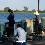
This is not a manicured resort fishery; it is an industrial and historic waterway that demands respect and navigational competence. The vibe is gritty and purposeful, frequented by serious captains who know how to play the tides around the George Washington Bridge pilings. While the shoreline offers pockets of serenity near historic sites, the main channel is a working highway for barges and tugs. Anglers targeting this zone must be comfortable maneuvering in heavy traffic and reading water that can shift from glass-calm to choppy confusion when the wind opposes the strong tidal flow.
Success in Fort Lee requires logistical precision. Unlike the dedicated fishing towns of the Jersey Shore or Montauk, this area lacks a centralized "fisherman’s wharf" atmosphere. You are fishing on the edge of a metropolis, meaning shore access is prized and boat ramps are functional rather than luxurious. The primary draw here is the seasonal run of game fish that funnel through this narrow stretch of the Hudson, using the structure and current breaks as ambush points. It is a fishery that rewards the prepared tactician who brings their own gear, bait, and local knowledge.
💡 Captain's Tip: Current Awareness
The Hudson River current near the George Washington Bridge is deceptively powerful. When the tide turns, the water moves with significant velocity. Ensure your trolling motor batteries are fully charged and your anchor rode is sufficient for depths exceeding 40 feet in the main channel.
Access & Getting There
Reaching the Fort Lee waterfront involves navigating some of the most congested roadways in the Northeast. The primary arteries are Interstate 95 and the Palisades Interstate Parkway. Seasoned locals know that timing is everything; attempting to tow a boat through the bridge approaches during rush hour is a recipe for frustration. The best strategy is a "dawn patrol" approach, hitting the road well before 5:00 AM to beat the commuter crush that inevitably builds on the approach to the George Washington Bridge.
The boat launch situation in this specific sector requires careful planning. The data indicates specific access coordinates near 40.85° N and 40.86° N, but these are often municipal or park-managed ramps that may lack the expansive infrastructure of coastal marinas. The ramps here can be steep, and during low tide, the drop-off at the end of the concrete can be severe. It is imperative to check the tide charts before launching or retrieving. A low-tide retrieval on a slick, algae-covered ramp with a heavy current sweeping sideways can test even the most experienced trailer driver.
Weather contingencies are critical in this corridor. The Palisades provide excellent shelter from westerly winds, creating a calm lane along the Jersey side even when the rest of the region is blowing hard. However, a strong north or south wind will funnel down the river valley. If the wind opposes the tide—specifically a south wind against an outgoing tide—the river can stack up into short, steep chop that is punishing for small skiffs. In these conditions, sticking close to the shoreline structure or shifting to the leeward side of bridge pilings is the only viable option.
Parking is the most significant logistical hurdle in Fort Lee. The available data highlights that street parking in the vicinity of nearby landmarks like the Hamilton Grange National Memorial is "very limited." For boaters, trailer parking is at a premium. Unlike the sprawling lots found at shore points, the lots here are often shared with park visitors and commuters. Security is generally decent due to the high visibility of public parks, but leaving gear exposed in the bed of a truck is never advisable in an urban interface zone.
💡 Captain's Tip: Launch Logistics
Because trailer parking is scarce and local streets are tight, have a "load and go" system ready. Prep your boat in the staging lane—straps off, plug in, gear loaded—before you hit the ramp. Lingering on the ramp to load coolers will cause gridlock and draw the ire of local regulars.
Hudson River, Fort Lee, NJ Pre-Trip Checklist
Facilities & Amenities
The infrastructure surrounding the Fort Lee fishing grounds is distinctively urban, meaning you will find plenty of convenience stores but very few specialized marine amenities immediately at the water's edge. The data indicates a significant gap in immediate bait and tackle availability. The nearest listed bait sources, such as In N’ Out Smoke Shop in Paterson (12.6 miles away) or Lucky’s Bait & Tackle in Staten Island (20.4 miles away), are substantial drives from the launch. This is a critical piece of "negative knowledge": do not arrive at the ramp expecting to buy live eels or fresh bunker. You must procure all bait and terminal tackle the day before or en route.
The charter fleet servicing this area does not typically dock in Fort Lee itself. Operators like RockFish Charters (Howard Beach, 15.2 miles) and Gypsea Fishing Charters (Brooklyn, 18 miles) run trips that may reach into the lower Hudson or surrounding bays, but they are based in the outer boroughs or Long Island. For the visiting angler, this means there is no local "dock talk" hub where you can walk up and ask a mate what's biting. You are largely on your own for real-time intelligence unless you are plugged into the local radio channels.
In terms of missing amenities, be aware that fuel docks are virtually non-existent on this immediate stretch of the Jersey side. Plan your fuel consumption carefully. If you are running a center console, fill up at a highway gas station before launching. The lack of a local marina fuel pump means that running dry on the river will result in a long, expensive tow from a commercial salvage operator. Similarly, ice is a commodity you should buy in bulk at a grocery store on the highway, as the immediate ramp areas often lack high-capacity ice vendors.
Lodging options are plentiful but generally cater to NYC tourists rather than anglers with boats. Listings like Camp Kinderland or scout camps are not suitable for transient anglers. For those towing boats, look for hotels along the Route 4 or Route 46 corridors west of Fort Lee, where parking lots are larger and surveillance is better. Avoid trying to park a trailer at hotels in the dense urban core or immediately adjacent to the bridge.
| Facility Name | Type | Distance | Notes |
|---|---|---|---|
| In N’ Out Smoke Shop | Bait/Supplies | 12.6 miles | Nearest bait source; Plan ahead. |
| RockFish Charters | Charter Fleet | 15.2 miles | Based in Howard Beach; High rating (4.9). |
| The Parking Spot Haynes | Parking | 15.7 miles | Airport parking; Not suitable for daily trailer use. |
| Hamilton Grange Visitor Center | Info/Restrooms | 2.2 miles | Good for area orientation and maps. |
Permits, Regulations & Fees
Navigating the regulatory landscape here is as complex as the currents. Because the Hudson River forms the border between New Jersey and New York, jurisdictional boundaries can be tricky. While the boat launch may be in New Jersey (Fort Lee), the channel markers often delineate the state line. Anglers should possess a valid fishing registration for the state they are launching from, but it is prudent to understand the reciprocity rules for the Hudson River. The State Fishing Agency manages the regulations, and strict size and bag limits for striped bass are enforced to protect the spawning stock.
Protected zones in this area are largely cultural and historical. The Hamilton Grange National Memorial and General Grant National Memorial are federally managed sites nearby. While these are primarily land-based attractions, the waters adjacent to parks and monuments may have specific restrictions regarding anchoring or beaching vessels. Respecting these "Kapu" (restricted) zones is essential not only for legal compliance but to maintain the relationship between the angling community and the National Park Service.
There is no specific "fishing permit" required to access the water itself, but parking fees at municipal ramps or adjacent lots are standard. These are often automated kiosks or app-based payment systems. Bring a credit card and a smartphone, as cash drop-boxes are becoming obsolete. Additionally, be mindful of the commercial traffic lanes. Anchoring in the navigable channel is a federal offense and creates a severe safety hazard. The Coast Guard and Harbor Police patrol this sector aggressively to ensure the safety of commercial transit.
Events & Seasonal Information
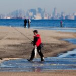
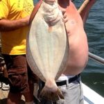
The rhythm of the Hudson River fishery is dictated by the migration of anadromous fish. The spring run, typically peaking from April through early June, sees the arrival of large striped bass moving upriver to spawn. This is the "main event" for local anglers. During this window, the river comes alive with boats drifting live bait or trolling tube and worm rigs. The fall run offers a second, often more aggressive bite as fish exit the estuaries to head south for the winter.
Summer in Fort Lee is characterized by slower fishing during the heat of the day and increased recreational boat traffic. The "dawn patrol" becomes essential during July and August, not just to beat the traffic on the GWB, but to capitalize on the bite before the sun drives the fish deep. The trade-off is the wind; summer afternoons often bring a stiff southerly breeze that bucks the outgoing tide, creating the choppy conditions mentioned earlier.
While there are no major professional tournaments hosted directly at the Fort Lee ramps, the area is part of the broader NY/NJ striped bass tournament circuit. Local clubs often hold seasonal derbies. Anglers should also be aware of non-fishing events, such as fleet weeks or fireworks displays, which can result in temporary security zones and river closures enforced by the Coast Guard. Checking the "Local Alerts" before hitching up the boat is standard procedure for the Hudson River regular.
💡 Captain's Tip: Seasonal Debris
During the spring thaw or after heavy rain events, the Hudson carries massive amounts of floating debris—whole trees, railroad ties, and pallets. Navigate with extreme caution, especially when running on plane in low light. A submerged log can take out a lower unit instantly.
Contact Information & Resources
For official information regarding park access, shoreline closures, and historical site hours, the National Park Service is the primary point of contact. The Hamilton Grange National Memorial can be reached at (646) 494-5366, and the General Grant National Memorial visitor center is available at (646) 670-7251. These offices can provide up-to-date information on parking availability and any special events that might impact access to the waterfront parks.
In terms of safety, self-reliance is key. While the Coast Guard is active in the harbor, response times can vary. Ensure you have a working VHF radio monitoring Channel 16. For non-emergency assistance or towing, you will likely be relying on commercial providers based out of nearby harbors in NY or NJ. Always file a float plan with a contact on land, detailing your launch point and expected return time, as cell service can be spotty directly under the cliffs of the Palisades.
For precise locations of the unnamed boat ramps, real-time wind conditions, and the exact boundaries of the state lines, consult the live dashboard and interactive maps below.

Leave a Reply