The summer weather patterns have firmly settled over the Florida Straits, offering anglers some of the calmest crossing windows of the entire year. The 70-mile open-water run from Key West to the Dry Tortugas is currently highly accessible for properly equipped private vessels, with sea states generally running a manageable 1 to 2 feet in the deep Gulf waters.
However, extreme caution must be exercised regarding the intense tropical heat and the predictable afternoon pop-up thunderstorms. These isolated squalls can generate localized winds exceeding 30 knots and significantly reduce visibility. Ensure your vessel is equipped with extensive hydration supplies, adequate shade, and a reliable EPIRB. Cellular service is completely non-existent once you leave the Marquesas Keys behind. If you are arriving via the Yankee Freedom ferry or the seaplane, be aware that you are exposed to the elements on Garden Key—bring ample sun protection and water.
From the editor
Tired of fishing with strangers you can’t trust?
Nautrek is the first social network for serious anglers — verified partners, real trips, cost splitting and intel sharing without burning your spots. Private beta now open.
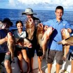
The pristine, unpressured waters of the Dry Tortugas act as a super-highway for pelagic species and a sanctuary for massive reef fish. Here is what is dominating the food chain right now:
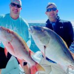
Primary Target: Mutton Snapper and Yellowtail Snapper. The reef complexes are absolutely thriving. Trophy-sized Mutton Snapper are congregating around the deeper structures and wrecks, while massive, aggressive schools of Yellowtail Snapper are dominating the mid-depth patch reefs.
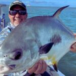
Sleeper Pick: Permit. While most visiting anglers focus heavily on bottom fishing for the cooler or trolling for pelagics, the deep wrecks and the western edges of the Tortugas Bank are currently holding large aggregations of spawning-class Permit. These fish offer world-class light-tackle battles and are frequently ignored by meat-fishermen.
Baitfish Report: The waters surrounding the park are currently loaded with schools of threadfin herring, small blue runners, and ballyhoo. You will also find ample pinfish around the patchy turtle grass beds near Fort Jefferson. Additionally, massive schools of glass minnows and silversides frequently sweep through the shallower reef structures. Matching this local forage size and profile is critical for tricking the older, wiser reef fish that reside in these heavily protected waters.
3. TACTICAL STRATEGY
Success in the Dry Tortugas requires precision. The water is gin-clear, and the fish, while abundant, have excellent eyesight.
Where to Target
For Yellowtail Snapper, anchor well upcurrent of the 40 to 60-foot patch reefs situated just outside the 1-nautical-mile diameter Garden Key harbor boundary. For heavyweight Mutton Snapper and Black Grouper, push further out to the 80 to 120-foot drop-offs on the eastern edge of the Tortugas Bank. If you are hunting the sleeper-pick Permit, use your marine electronics to scan isolated wrecks in 120 to 150 feet of water, looking for large marks suspended 20 to 30 feet above the main structure.
Lure and Color Selection
For deep jigging over the wrecks, deploy a 150g to 200g slow pitch jig. Silver, pink, and glow-in-the-dark patterns are highly effective in these deeper, low-light zones. For the shallow Yellowtail Snapper, utilize 1/16 oz to 1/8 oz lead-head jigs in chartreuse or pale pink to blend seamlessly with the water clarity.
Bait and Rigging
Yellowtail fishing requires deploying a heavy, continuous slick.
Pro Tip: Mix your frozen chum blocks with rolled oats and menhaden oil to create a milky cloud that suspends in the water column. Float small cut ballyhoo or silversides back into the slick on a freeline with your bail open, letting the bait drift naturally at the exact speed of the current.
For Mutton Snapper, drop a live pinfish or a butterflied ballyhoo on a long, 15 to 20-foot 40lb fluorocarbon leader using a fish-finder rig. The long leader is essential in the clear water to ensure the bait moves naturally near the bottom.
Pro Tip: If targeting Permit over the deep wrecks, a live silver dollar-sized blue crab hooked through the corner of the carapace and dropped on a simple knocker rig is absolutely irresistible.
Timing the Bite
Dawn and dusk are the golden hours. The first two hours of the incoming tide during the early morning low-light period will yield the most aggressive bites before the intense midday sun drives the fish deeper into the reef crevices.
4. REGULATIONS SNAPSHOT
The Dry Tortugas operates under complex jurisdictional boundaries managed jointly by the National Park Service and the Florida Fish and Wildlife Conservation Commission (FWC). A valid Florida saltwater fishing license is required for all anglers aged 16 and older.
Pro Tip: The 46-square-mile Research Natural Area (RNA) is a strict no-take, no-anchor zone. Fishing is only permitted within a 1-nautical-mile diameter around the Garden Key Light (excluding designated swimming areas) and in the open waters outside the RNA. Always keep your GPS chartplotter updated with the park boundaries to avoid hefty fines.
Non-stainless steel circle hooks are mandatory when fishing for reef species with natural bait. Furthermore, you must have a dehooking tool and a descending device rigged and ready to combat barotrauma for any released fish.
Target Species
Minimum Size Limit
Daily Bag Limit
Special Regulations
Mutton Snapper
18 inches
5 per person
Included in the 10-snapper aggregate limit.
Yellowtail Snapper
12 inches
10 per person
Included in the 10-snapper aggregate limit.
Black Grouper
24 inches
1 per person
Subject to seasonal closures; must be released if out of season.
Permit
22 inches fork length
1 per person
Strict vessel limit of 2 applies in the Special Permit Zone.
Note: Spearfishing and lobstering are strictly prohibited within all National Park boundaries. All spearfishing gear must be completely disassembled and stowed away while transiting through park waters.
5. REGIONAL ALTERNATIVE
If the offshore winds kick up or the 70-mile crossing across the open Gulf becomes unsafe for your vessel, your premier fallback destination is the Marquesas Keys. Located roughly 20 miles west of Key West, this unique circular atoll provides excellent shelter from rough seas and high winds.
Backup Tactical Plan
Access the Marquesas by launching from Key West and running the relatively protected channels westward, which keeps you out of the heavy offshore swells. Once there, shift your target species to Mangrove Snapper, Tarpon, and Barracuda. The Marquesas atoll features a massive inner lagoon known as Mooney Harbor, flanked by dense mangrove islands. Focus your efforts on the tidal outflows of the harbor and the deeper mangrove-lined channels along the perimeter of the atoll. Anchor upcurrent of the mangrove roots, deploy a fresh chum slick, and drift live pilchards or small pinfish back to the edges on light fluorocarbon leaders. The structure here is incredibly unforgiving, so lock down your drag and be prepared to muscle the fish away from the roots immediately upon hookup.
Tight lines!
Editor's Choice: Must-Have Gear
FISHINGSIR Next-Gen Waterproof Chest Waders
★★★★★4.4 (7,370+ reviews)
2-Ply Tech: Upgraded nylon with 2.5x higher density than standard fabrics.
100% Waterproof: Lab-approved intrusion resistance with taped visible seams.
Ultra-Lightweight: Designed for all-day comfort while hunting or fishing.
As an Amazon Associate I earn from qualifying purchases. #ad
Loading forecast...
Live Fishing Conditions: Tides, Weather & Waves
Get real‑time tides, marine weather, swell and solunar activity for each spot so you know exactly when conditions line up for your best chance at a bite.
🎣
Dry Tortugas National Park
Loading coordinates...
🌤️
WEATHER CONDITIONS
--°F
--°C
Loading...
🌡️
Feels Like--°F--°C
💧
Humidity--%
💨
Wind-- mph-- km/h
🧭
Direction--
📊
Pressure-- inHg-- hPa
☀️
UV Index--
🌊
MARINE CONDITIONS
🌊Wave Height
-- ft
-- m
Loading...
🧭Wave Direction
--°
Loading...
⏱️Wave Period
-- s
Loading...
📈Tide Status
-- ft
-- m
Loading...
🌙
LUNAR & SOLUNAR
🌕
Loading...
Illumination: --%
Major Period--:-- - --:----:-- - --:--
Minor Period--:-- - --:----:-- - --:--
🌅Sunrise--:--
🌇Sunset--:--
📅
24-HOUR FORECAST
Loading fishing conditions...
Fishing Spots Map
🎣
Book a Fishing Charter near Dry Tortugas National Park Fishing Report Today 🎣
Local guides & charters. Verified captains, instant booking, best price guaranteed.
There was an error loading the map. Please try refreshing the page.
Info
Local Access & Facilities
For the serious angler, Dry Tortugas National Park represents the ultimate frontier of Florida fishing. Located almost 70 miles west of Key West, this remote fishery is not a casual day trip; it is a logistical commitment that rewards preparation with access to pristine waters, superlative coral reefs, and a level of isolation rarely found in the continental United States. The park spans 100 square miles of mostly open water, anchored by seven small islands and the massive, unfinished masonry structure of Fort Jefferson on Garden Key.
The atmosphere here is defined by its rugged isolation and historical gravity. The stark contrast between the red brick of the largest masonry structure in the Americas and the brilliant turquoise waters creates a backdrop unlike any other. This is not a manicured marina environment; it is a wild, open-ocean destination where self-reliance is paramount. While the park is famous for bird life and the historic Carnegie Laboratory for Marine Ecology site on Loggerhead Key, anglers know it for the rich marine life patrolling the shoals and the hundreds of shipwrecks scattered across the bottom topography.
Because of its distance from the mainland, the Dry Tortugas acts as a sanctuary for marine species. The fishing here is managed strictly, but for those willing to make the long haul across the Florida Straits, the experience offers a glimpse into a marine ecosystem that has seen relatively minimal human impact compared to the rest of the Keys. Whether you are targeting reef dwellers near the Windjammer Wreck or patrolling the deeper channels, this location demands respect for both the ocean and the history preserved within it.
Access & Getting There
Reaching the Dry Tortugas is a significant undertaking that requires navigating approximately 70 miles of open water from Key West. There are no roads, bridges, or causeways connecting these islands to the mainland. For private vessel captains, this means a long run across the straits. The primary destination for boaters is Garden Key, home to the park headquarters and the main harbor area. Navigation requires careful attention to charts, as the area is riddled with shoals and coral heads that have claimed over 300 ships throughout history.
💡 Captain's Tip: The Fuel Equation
There is absolutely no fuel available at the Dry Tortugas. Captains must calculate their range conservatively, accounting for a 140-mile round trip plus loiter time, generator usage, and potential rough seas that can degrade fuel efficiency. If you cannot make the round trip with a healthy safety margin, do not attempt the crossing.
For those not running their own hulls, access is limited to the daily concession ferry, authorized charter boats, or seaplane services. The ferry and seaplanes are strictly for transport and sightseeing, meaning serious anglers looking to fish the waters freely usually arrive by private boat. If you are arriving by private vessel, you must file a boat permit at the Garden Key Visitor Center immediately upon arrival. The docks at Garden Key are available for loading and unloading, but specific slip availability can be limited and is generally first-come, first-served for short-term use.
Weather is the primary gatekeeper of this fishery. The crossing from Key West can be treacherous when winds oppose the current or during winter frontal passages. Because the park is mostly open water, there is little lee to be found once you leave the shelter of the Marquesas Keys until you reach the fort. It is critical to monitor marine forecasts for the entire Florida Straits, not just the destination. In high winds, the anchorage areas around the fort can become uncomfortable, though they offer the best protection available in the immediate area.
Dry Tortugas National Park Pre-Trip Checklist
Facilities & Amenities
The defining characteristic of the facilities at Dry Tortugas is their scarcity. This is a "pack in, pack out" location in the truest sense. There is no fresh water, no ice, no food service, and no fuel dock available to the public. The Garden Key Visitor Center, located inside Fort Jefferson, houses a small bookstore and souvenir shop, but it does not stock fishing tackle, bait, or provisions. Anglers must be completely self-sufficient for the duration of their stay.
Despite the lack of commercial amenities, the park offers unique infrastructure for those prepared to use it. The Garden Key Campground provides a primitive but spectacular overnight option. It is located just a short walk from the public dock and piers. The campground operates on a first-come, first-served basis. However, a critical piece of local knowledge is the park's overflow policy: in the event that regular campsites are full, an overflow area is made available. The park service states that campers arriving by boat will not be turned away once they have made the 70-mile journey, ensuring you have a place to stay even if the main sites are taken.
Facility Name
Type
Key Notes
Garden Key Campground
Accommodation
Primitive sites. Bring all water/food. Tables & grills provided.
Garden Key Visitor Center
Information
Located inside Fort Jefferson. Bookstore & orientation.
South Coaling Dock Ruins
Point of Interest
Historic structure near the main anchorage area.
Public Restroom
Sanitation
Composting toilets available near the campground/dock area.
💡 Captain's Tip: Trash Management
There are no trash bins or collection services on the island. You are legally required to carry out all trash and garbage upon departure. Plan your provisioning to minimize waste, as you will be hauling every wrapper, bottle, and line scrap back to Key West with you.
For lodging beyond camping, there are no hotels or rental units. The "accommodation" reality here is either a tent on the ground or a bunk on your boat. The campground provides picnic tables and grills, but you must bring charcoal or gas. The isolation means that if a piece of gear breaks, there is no West Marine or bait shop to save the day. Redundancy in tackle and engine parts is standard operating procedure for captains running this route.
Permits, Regulations & Fees
Fishing within the Dry Tortugas National Park is subject to a complex overlay of state and federal regulations designed to protect the coral reef ecosystem. While fishing is generally allowed, it is managed by the State Fishing Agency and specific park rules. A boat permit is required for all private vessels entering the park waters. This is distinct from a fishing license; it is an entry permit for the vessel itself. You can obtain this at the Garden Key headquarters.
The park includes specific zones where fishing may be restricted or prohibited to protect historical artifacts and marine life. For example, the area around the Garden Key Harbor and specific swim zones may be off-limits to hooks. The park is home to the Windjammer Wreck and other submerged cultural resources; anchoring on or fishing directly into these historic structures is often regulated to prevent damage. Always consult the current park map and regulations provided at the Visitor Center upon arrival.
Camping fees are currently set at $15 per night per campsite. This is a self-service fee area, so bring exact cash or a check. Holders of the Golden Age or Golden Access Pass are eligible for a 50% discount. It is important to note that fees paid for ferry transportation do not cover camping; these are separate costs. While no specific fishing permit beyond a standard Florida saltwater license is usually required, always verify current "Kapu" (restrictions) or protected zones, as regulations can shift to protect spawning aggregations or recovering reef tracts.
Events & Seasonal Information
The rhythm of the Dry Tortugas is dictated by the sun and the wind. The park is open 24 hours, allowing for overnight anchoring and camping. The most popular season for boaters is typically late spring through summer, when the winds in the Florida Straits are calmest, making the crossing more manageable. Winter brings regular cold fronts that can churn the 70-mile gap into a dangerous passage for small craft.
While there are no commercial fishing tournaments hosted directly on the island due to its National Park status, the area is a legendary waypoint for anglers during the seasonal pelagic migrations. The "event" here is the daily cycle of nature. Sunsets at Fort Jefferson are renowned as some of the best in the keys, offering a breathtaking view as the sun drops below the open horizon. For those diving or snorkeling, the summer months offer the clearest water and the best visibility for exploring the moat wall or the nearby patch reefs.
💡 Captain's Tip: The Dawn Patrol
The wind often picks up by mid-morning. Seasoned skippers know to plan their crossing or their run to the outer fishing grounds for the earliest light. By 10:00 AM, the trade winds can stiffen, making the open water chop uncomfortable for drifting or anchoring on the exposed reefs.
Contact Information & Resources
The primary managing agency is the National Park Service. Reliable communication is a safety necessity here; cell phone coverage is non-existent to spotty at best. VHF radio is the standard for local communication, but a satellite phone or EPIRB is essential for the crossing.
Emergency: Coast Guard Sector Key West (VHF Channel 16)
In an emergency, help is far away. Self-reliance cannot be overstated. Ensure your vessel is equipped with proper safety gear, signaling devices, and medical supplies before leaving the dock in Key West.
For precise locations of the anchorage zones, nearby wrecks, and real-time marine weather conditions, consult the live dashboard and interactive maps below.
Our spot reports combine data-driven forecasts with curated local information. The forecast is generated by our proprietary Fishing Score algorithm (0–100%), which analyzes real-time data from Open-Meteo API, validated against NOAA CO-OPS tide gauges and USGS water-monitoring stations. The model weights tide dynamics (35%), wave energy (25%), wind patterns (20%) and time of day (20%)—factors shown to influence fish feeding behavior through marine-biology research and decades of charter log data.
Access, facilities and services information for each fishing spot is sourced from official datasets such as Recreation.gov (RIDB), state park & wildlife agencies, and geospatial providers like Google Maps. These sections undergo scheduled re-validation every 3–6 months to ensure that boat ramps, park access, contact details and local services remain accurate.
Narrative sections (catches, seasonal behavior, local tips) are synthesized from these data sources and refined following the Fishing Reports Today editorial guidelines, combining bibliographic research from ichthyology and oceanography with expert angler experience. Our team reviews reports on a regular basis, while the forecast model itself updates every 6 hours for real-time accuracy.
⚠️ Important: Always verify current local regulations, access restrictions and weather conditions before fishing. These reports are intended as a planning aid, not a guarantee of catches or safety. When in doubt, contact local authorities or park managers listed on the page.
To provide the best experiences, we use technologies like cookies to store and/or access device information. Consenting to these technologies will allow us to process data such as browsing behavior or unique IDs on this site. Not consenting or withdrawing consent, may adversely affect certain features and functions.
Functional Always active
The technical storage or access is strictly necessary for the legitimate purpose of enabling the use of a specific service explicitly requested by the subscriber or user, or for the sole purpose of carrying out the transmission of a communication over an electronic communications network.
Preferences
The technical storage or access is necessary for the legitimate purpose of storing preferences that are not requested by the subscriber or user.
Statistics
The technical storage or access that is used exclusively for statistical purposes.The technical storage or access that is used exclusively for anonymous statistical purposes. Without a subpoena, voluntary compliance on the part of your Internet Service Provider, or additional records from a third party, information stored or retrieved for this purpose alone cannot usually be used to identify you.
Marketing & Affiliates
The technical storage or access is required to create user profiles to send advertising, or to track the user on a website or across several websites for similar marketing purposes, including affiliate tracking for products recommended in our reports.


Leave a Reply