0%

Deal Island Fishing Report Today 🎣

10 months ago Β· Updated 2 weeks ago

deal island fishing Report Today

GO/NO-GO STATUS

Verdict: GO - WITH CAUTION FOR HEAT AND AFTERNOON SQUALLS

Summer patterns are fully locked in across Tangier Sound and the waters surrounding Deal Island. With water temperatures steadily climbing into the low to mid-80s, the bite has become highly dependent on your timing and ability to beat the heat. Early mornings and late evenings are producing exceptional action, while the midday bite has slowed to a crawl as fish seek thermal refuge in deeper channels. Keep a vigilant watch on the horizon; pop-up afternoon thunderstorms are a daily threat this time of year and can create hazardous, choppy conditions for small skiffs and kayaks in the open sound. If you plan your trips around the low-light hours and remain weather-aware, the fishing is absolutely worth the trip.

SPECIES INTEL

Primary Target: Speckled Trout

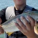
Spotted seatrout (specks) are the undisputed main draw right now. The shallow, grassy flats around Deal Island, the lower Manokin River, and the Tangier Sound shorelines are holding solid numbers of fish. Most catches are falling in the 16 to 22-inch range, with a few larger "gator" trout mixed in for anglers who are willing to grind out the early dawn hours.

🎣 Nautrek
Private Beta
J
M
R
100+ anglers on the waitlist

The fishing network where your reputation matters.

Find trusted captains, join real trips with cost splitting, and build your Angler Rank. Your spots stay private — you decide who sees your intel.

✓ Verified anglers ✓ Real trips ✓ Spot privacy
Join the Waitlist — Free →

No spam. First 500 get founder perks.

Nautrek App

Sleeper Pick: Sheepshead

Often completely overlooked by anglers casting the grass beds for rockfish and trout, sheepshead are holding tight to hard structure in Tangier Sound. In fact, these exact waters produced a state-record sheepshead a few summers ago. They offer a fantastic midday alternative when the shallow-water trout bite shuts down under the high sun.

Pro Tip: Sheepshead have incredibly hard, bony mouths and are notorious bait-stealers. Downsize your hooks to a #1 or 1/0 octopus hook, use braided line for maximum sensitivity, and set the hook the absolute second you feel a distinct "tap."

Baitfish Report

The Deal Island marshes are currently teeming with forage, creating a massive buffet for predatory gamefish. Peanut bunker (juvenile menhaden), finger mullet, and grass shrimp are abundant in the shallows. Most importantly, shedding blue crabs (peelers) are highly active, and local predators are aggressively patrolling the marsh edges specifically to hunt these vulnerable crabs.

TACTICAL STRATEGY

Where to Fish

Focus your efforts along the western shorelines of Little Deal Island and the mouth of the Manokin River. You are looking for submerged eelgrass and widgeon grass beds in 4 to 8 feet of water. During the outgoing tide, position your vessel down-current of marsh drains, creek mouths, and island cuts. Predators stack up in these exact ambush zones, waiting for baitfish and crabs to be flushed out of the safety of the shallow marsh into the deeper water.

Lure & Bait Selection

  • Lures: A 3/8-ounce lead jig head paired with a 4-inch paddletail is the most versatile search bait for covering water. For shallow grass beds where a jig might snag, a suspending twitchbait like a MirrOlure Catch 2000 or a Rapala Skitter Walk topwater plug is deadly.
  • Colors: Stick to pearl white, chartreuse, or electric chicken in stained water. If the water is running clear on an incoming tide, rootbeer, new penny, or motor oil colors mimic the local crabs and grass shrimp perfectly.
  • Bait: Halved peeler crabs or soft crabs drifted unweighted into marsh drains will draw violent strikes from red drum and striped bass. For sheepshead, drop fiddler crabs or sand fleas straight down on a 1/2-ounce bottom sweeper jig near submerged wood, dock pilings, or sunken oyster reefs.

Timing the Bite

The first two hours of daylight are critical for success. Combine a dawn start with a falling tide, and you have the highest probability of a multi-species morning. Once the sun is high and water temperatures peak, fish will retreat to deeper channels or seek shade under structure. The last hour of incoming daylight can also produce a flurry of topwater strikes.

Pro Tip: When fishing the shallow marsh drains, approach with absolute stealth. Use an electric trolling motor or drift silently with the wind. Banging boat hatches, dropping pliers, or running an outboard too close to the grass will send shockwaves through the water and scatter the fish long before you make your first cast.

REGULATIONS SNAPSHOT

Note: Always verify current Maryland Department of Natural Resources (DNR) regulations before harvesting, as emergency closures can occur.

SpeciesSize LimitBag LimitSeason Status
Striped Bass (Rockfish)19" Min - 24" Max1 per person/dayOpen (Closes mid-to-late July annually)
Speckled Trout14" Minimum4 per person/dayOpen Year-Round
Red Drum18" Min - 27" Max1 per person/dayOpen Year-Round
SheepsheadNo Minimum4 per person/dayOpen Year-Round

Pro Tip: Striped bass regulations in Maryland include a strict, mandatory summer closure period in the Chesapeake Bay and its tributaries to protect the species from catch-and-release mortality during extreme heat. This closure typically spans the last two weeks of July. Take advantage of the current open window, but practice careful handlingβ€”keep the fish in the water while unhooking them to ensure their survival.

REGIONAL ALTERNATIVE

Janes Island State Park (Crisfield, MD)

If the wind is blowing hard out of the west or southwest, making the open waters of Tangier Sound around Deal Island choppy and unfishable, head a few miles south to Janes Island State Park in Crisfield. The park offers an extensive, maze-like network of sheltered water trails and marsh canals that remain protected from heavy winds.

Tactical Approach

Launch from the state park marina and target the deep holes at the intersections of the marsh canals for summer flounder and small "puppy" red drum. Drift live minnows on a standard flounder rig, or bounce a 1/2-ounce bucktail dressed with a white curly-tail grub along the bottom. The highly protected nature of these winding waterways makes it an ideal, safe fallback location for kayakers and small-boat anglers when the main sound is simply too rough to navigate safely.

Tight lines!

Editor's Choice: Must-Have Gear

FISHINGSIR Next-Gen Waterproof Chest Waders

β˜…β˜…β˜…β˜…β˜… 4.4 (7,370+ reviews)
  • 2-Ply Tech: Upgraded nylon with 2.5x higher density than standard fabrics.
  • 100% Waterproof: Lab-approved intrusion resistance with taped visible seams.
  • Ultra-Lightweight: Designed for all-day comfort while hunting or fishing.
Check Availability on Amazon

βœ“ Amazon's Choice | 100+ bought last month

πŸ›’ Tactical Gear for this Spot

Bandit Walleye Deep

Mandatory for reaching deep schools in 35-50ft mud flats.

Check Price on Amazon #ad

As an Amazon Associate I earn from qualifying purchases. #ad

Loading forecast...

Live Fishing Conditions: Tides, Weather & Waves

Get real‑time tides, marine weather, swell and solunar activity for each spot so you know exactly when conditions line up for your best chance at a bite.

🎣

Deal Island

Loading coordinates...

🌀️

WEATHER CONDITIONS

Weather
-- Β°F
--Β°C

Loading...

🌑️
Feels Like --Β°F --Β°C
πŸ’§
Humidity --%
πŸ’¨
Wind -- mph -- km/h
🧭
Direction --
πŸ“Š
Pressure -- inHg -- hPa
β˜€οΈ
UV Index --
🌊

MARINE CONDITIONS

🌊 Wave Height
-- ft
-- m
Loading...
🧭 Wave Direction
--Β°
Loading...
⏱️ Wave Period
-- s
Loading...
πŸ“ˆ Tide Status
-- ft
-- m
Loading...
πŸŒ™

LUNAR & SOLUNAR

πŸŒ•

Loading...

Illumination: --%

Major Period --:-- - --:-- --:-- - --:--
Minor Period --:-- - --:-- --:-- - --:--
πŸŒ… Sunrise --:--
πŸŒ‡ Sunset --:--
πŸ“…

24-HOUR FORECAST

Loading fishing conditions...

Fishing Spots Map

🎣
Book a Fishing Charter near Deal Island Fishing Report Today 🎣

Local guides & charters. Verified captains, instant booking, best price guaranteed.

See Available Trips β†’

My location
Loading map...

Local Access & Facilities

Deal Island Pre-Trip Checklist

Local Access & Facilities

Deal Island represents the quintessential Chesapeake Bay marshland fishery, offering a rugged, historic atmosphere often referred to as the "Everglades of the North." Situated within the Deal Island Historic District, this area is defined by vast tidal wetlands, shallow cuts, and a labyrinth of channels that demand respect and navigational skill. For the expert angler, the draw here is not just the catch, but the technical challenge of fishing a landscape that shifts dramatically with the tide.

The vibe is decidedly remote and quiet, far removed from the manicured marinas of the western shore. Anglers here share the water with working watermen and an abundance of migratory waterfowl, particularly near the Blackwater National Wildlife Refuge. While the primary target species in these brackish waters include Striped Bass, Speckled Trout, and Blue Crabs, the surrounding protected zones serve as critical nurseries that fuel the entire regional fishery.

Access requires planning, as infrastructure is sparse and geared towards small skiffs and shallow-draft vessels. The area is steeped in history, from the working skipjacks to the nearby Harriet Tubman Underground Railroad National Monument. Success here depends on self-reliance, precise tide timing, and a deep appreciation for this delicate estuarine ecosystem.

πŸ’‘ Captain's Tip: GPS Advisory

Navigation software can be unreliable in the winding marsh roads. When heading to the nearby Blackwater NWR launch areas, input the physical address 2145 Key Wallace Drive rather than the general refuge name to avoid being routed to dead-end fire roads.

Access & Getting There

Reaching Deal Island generally involves traveling through the Eastern Shore's rural arteries. The primary approach is via Route 13, turning onto Deal Island Road (Route 363) from Princess Anne. Traffic is rarely an issue on these backroads, but deer crossings at dawn and dusk present a genuine hazard. For those accessing the broader marsh system via Blackwater NWR, the route involves taking Route 16 West from Cambridge to Egypt Road.

Launch facilities in the immediate vicinity are functional but rustic. The data indicates three specific boat ramp coordinates in the local area, approximately 1.2 miles from the central district. These are typically single-lane concrete or gravel ramps best suited for skiffs, Jon boats, and kayaks. A "soft launch" is noted on Route 335, which is ideal for paddle craft but challenging for trailered vessels during low water. The ramps can be slick at low tide, and seasoned locals know to check the tide charts meticulously; a negative low tide can leave larger bay boats stranded at the dock.

Weather plays a critical role in accessibility. The low-lying marsh offers zero protection from wind. If winds exceed 15 knots, the shallow sounds can chop up quickly, making the return trip wet and hazardous. During heavy rains or lunar high tides, parts of the access roads, particularly near the causeway, may succumb to tidal flooding. Always verify that the road to the ramp is passable before hitching the trailer.

Parking requires a strategic approach. The closest major designated parking area is at Webster's Cove, roughly 9.3 miles away. This lot is open 24 hours, making it a reliable option for overnight trips or alpine starts. Closer to the ramps, parking is often informal roadside pull-offs. Ensure your vehicle and trailer are fully off the pavement to allow passage for local crab trucks and emergency vehicles.

Facilities & Amenities

Infrastructure around Deal Island is limited, requiring anglers to be self-sufficient. There are no large-scale marine centers on the island itself. The nearest reliable provisioning points are in Princess Anne or Crisfield. Anglers should fill fuel tanks and coolers before leaving the highway, as dockside fuel is virtually non-existent in the immediate marsh creeks.

For bait and tackle, Tim & Doris’s Country Store and More in Crisfield (approx. 12.6 miles away) is a local staple, opening at 10:00 AM. For early risers needing gear before dawn, options are limited, so purchasing tackle the day before is essential. Wink's Sporting Goods in Princess Anne (14.1 miles away) is another solid option for regional knowledge and gear. For heavy-duty needs, Sea Hawk Sports Center in Pocomoke City offers a broader selection but is a 23.6-mile drive.

πŸ’‘ Captain's Tip: Dawn Patrol Provisions

Most local bait shops do not open until mid-morning. If you plan to launch at first light, secure your ice, fuel, and bait in Salisbury or Princess Anne the evening prior. Webster's Cove parking is open 24/7, but amenities there are zero.

Lodging options favor the rustic traveler. The historic Whitehaven Hotel, located 12 miles away via ferry or road, offers a bed-and-breakfast experience deeply tied to the river's history. For those towing campers, the Salisbury Camping and Adventure Park (19.4 miles) provides reliable hookups. There are essentially no luxury hotels in the immediate vicinity; this is a destination for those who prefer silence and starlight over room service.

Facility NameTypeDistanceContact / Notes
Tim & Doris’s Country StoreBait & Tackle12.6 miles(443) 523-4627
Wink's Sporting GoodsBait & Tackle14.1 miles(410) 621-0400
Webster's CoveParking9.3 milesOpen 24 Hours
Whitehaven HotelLodging12.0 miles(410) 603-2818
Midnight Sun ChartersCharter Fleet24.6 miles(804) 580-0245

Permits, Regulations & Fees

Fishing and boating in this region place you within or near sensitive federal lands, specifically the Blackwater National Wildlife Refuge and the Glenn Martin National Wildlife Refuge. Strict adherence to regulations is not just legal compliance; it is vital for the conservation of this "Wetland of International Importance." Fishing is generally permitted in designated tidal waters, but access to certain marsh interiors may be restricted to protect nesting waterfowl and eagles.

While general recreational fishing requires a standard Maryland tidal fishing license, specific activities like waterfowl hunting require distinct federal permits. The Blackwater NWR manages a quota hunt system for deer and turkey, often utilizing a lottery. If you are casting near hunt zones during the fall and winter seasons, be hyper-aware of your surroundings and respect the buffer zones between anglers and hunters. The refuge is home to the largest breeding population of bald eagles on the East Coast north of Florida; harassing wildlife carries severe federal penalties.

Cultural respect is paramount here. The watermen communities of Deal Island and nearby Smith Island have worked these waters for centuries. Navigational channels are their livelihood. Give wide berth to commercial crab boats and trotlines. Additionally, be mindful of private property lines which can be ambiguous in the marsh; stick to the main channels and marked public access points found on the Glenn Martin NWR maps.

Events & Seasonal Information

The rhythm of Deal Island is dictated by the migration of waterfowl and the seasonal movements of the blue crab. Late autumn and winter bring thousands of ducks and geese, transforming the soundscape of the marsh. For the angler, this means colder water but excellent visibility for targeting winter holdover Striped Bass in the deeper channels.

Summer is the peak season for recreational boating, though the heat and biting flies in the marsh can be intense. The best fishing windows are early morning, before the trade winds kick up across the shallow flats. While there are no major high-profile fishing tournaments hosted directly on the island's small ramps, the region participates in the broader Chesapeake Bay fishing culture, with local crabbing events and community gatherings often centered around the harvest.

πŸ’‘ Captain's Tip: The Fly Factor

In the summer months, a west wind blows biting flies out of the marsh and onto the water. Dress in long lightweight pants and sleeves, or fish the windward shorelines to keep the bugs at bay.

Contact Information & Resources

For the most current information on ramp conditions and closures, direct contact with the managing agencies is recommended. The Blackwater National Wildlife Refuge can be reached at 410-228-2677 for questions regarding access to refuge waters. For inquiries regarding the Glenn Martin NWR, call 410-228-2692.

Safety in this remote area is the responsibility of the skipper. Cell service can be spotty to non-existent in the lower marsh areas. A VHF radio is standard equipment for any boat venturing away from the launch. In an emergency, the Princess Anne area hosts the nearest significant emergency services.

For precise locations, real-time weather conditions, and detailed ramp maps, consult the live dashboard and interactive widgets below.
🎣

Deal Island

Deal Island Historic District β€’ Maryland β€’ 38.1480, -75.9468
πŸ…ΏοΈ

Parking

5
Webster's Cove parking lot
⭐ 5.0 9.3 mi
πŸ“ Dorsey Rd, Princess Anne, MD 21853, USA
πŸ•’
Monday: Open 24 hours
Tuesday: Open 24 hours
Wednesday: Open 24 hours
Thursday: Open 24 hours
Friday: Open 24 hours
Saturday: Open 24 hours
Sunday: Open 24 hours
πŸš— Get Directions
327 Dogwood Dr Parking
⭐ 5.0 22.8 mi
πŸ“ 327 Dogwood Dr, Salisbury, MD 21801, USA
πŸš— Get Directions
Wayne Street Garage
⭐ 4.8 23.1 mi
πŸ“ 200 Bateman St, Salisbury, MD 21804, USA
πŸ•’
Monday: Open 24 hours
Tuesday: Open 24 hours
Wednesday: Open 24 hours
Thursday: Open 24 hours
Friday: Open 24 hours
Saturday: Open 24 hours
Sunday: Open 24 hours
πŸš— Get Directions
🐟

Bait & Tackle

4
Sea Hawk Sports Center
⭐ 4.9 23.6 mi
πŸ“ 643 Ocean Hwy, Pocomoke City, MD 21851, USA
πŸ•’
Monday: 7:00β€―AM – 5:00β€―PM
Tuesday: 7:00β€―AM – 5:00β€―PM
Wednesday: 7:00β€―AM – 2:00β€―PM
Thursday: 7:00β€―AM – 5:00β€―PM
Friday: 7:00β€―AM – 6:00β€―PM
Saturday: 7:00β€―AM – 5:00β€―PM
Sunday: 7:00β€―AM – 3:00β€―PM
πŸš— Get Directions
Tim & Doris’s Country Store and More
⭐ 4.9 12.6 mi
πŸ“ 930 W Main St, Crisfield, MD 21817, USA
πŸ•’
Monday: Closed
Tuesday: 10:00β€―AM – 4:00β€―AM
Wednesday: 10:00β€―AM – 4:30β€―PM
Thursday: 10:00β€―AM – 4:00β€―PM
Friday: 10:00β€―AM – 4:30β€―PM
Saturday: 10:00β€―AM – 3:00β€―PM
Sunday: Closed
πŸš— Get Directions
LE Hitch & Sons
⭐ 4.7 18.5 mi
πŸ“ 14641 Merser Rd, Eden, MD 21822, USA
πŸ•’
Monday: 7:00β€―AM – 6:00β€―PM
Tuesday: 7:00β€―AM – 6:00β€―PM
Wednesday: 7:00β€―AM – 6:00β€―PM
Thursday: 7:00β€―AM – 6:00β€―PM
Friday: 7:00β€―AM – 6:00β€―PM
Saturday: 7:00β€―AM – 6:00β€―PM
Sunday: 7:00β€―AM – 2:00β€―PM
πŸš— Get Directions
Wink's Sporting Goods
⭐ 4.7 14.1 mi
πŸ“ 12122 Carole Ln # A, Princess Anne, MD 21853, USA
πŸ•’
Monday: Closed
Tuesday: 9:00β€―AM – 5:00β€―PM
Wednesday: 9:00β€―AM – 5:00β€―PM
Thursday: 9:00β€―AM – 5:00β€―PM
Friday: 9:00β€―AM – 5:00β€―PM
Saturday: 9:00β€―AM – 4:00β€―PM
Sunday: Closed
πŸš— Get Directions
🚀

Fishing Charters

1
Midnight Sun Charters
⭐ 5.0 24.6 mi
πŸ“ 989 Smith Point Rd, Reedville, VA 22539, USA
πŸ•’
Monday: 4:30β€―AM – 10:00β€―PM
Tuesday: 4:30β€―AM – 10:00β€―PM
Wednesday: 4:30β€―AM – 10:00β€―PM
Thursday: 4:30β€―AM – 10:00β€―PM
Friday: 4:30β€―AM – 10:00β€―PM
Saturday: 4:30β€―AM – 10:00β€―PM
Sunday: 4:30β€―AM – 10:00β€―PM
πŸš— Get Directions
🏠

Lodging

4
Salisbury Camping and Adventure Park
⭐ 4.8 19.4 mi
πŸ“ Camping and Adventure Park, 27157 Riverside Dr Ext, Salisbury, MD 21801, USA
πŸ•’
Monday: Closed
Tuesday: Closed
Wednesday: 9:00β€―AM – 5:00β€―PM
Thursday: 9:00β€―AM – 5:00β€―PM
Friday: 9:00β€―AM – 5:00β€―PM
Saturday: 9:00β€―AM – 5:00β€―PM
Sunday: 9:00β€―AM – 5:00β€―PM
πŸš— Get Directions
βš“

Boat Ramps

3
🚻

Restrooms

3
πŸ‘¨β€πŸ‘©β€πŸ‘§β€πŸ‘¦

Family Friendly

2
β™Ώ

Accessibility

β™Ώ

Wheelchair Access

Available

πŸ•

Pets Allowed

Not Confirmed

⚠️ Some accessibility info not officially confirmed. Please verify with location directly.

πŸ“ Showing 23 facilities on map
🎣
Book a Fishing Charter near Deal Island Fishing Report Today 🎣

Local guides & charters. Verified captains, instant booking, best price guaranteed.

See Available Trips β†’

πŸ“Š

About Our Fishing Reports & Forecasts

Our spot reports combine data-driven forecasts with curated local information. The forecast is generated by our proprietary Fishing Score algorithm (0–100%), which analyzes real-time data from Open-Meteo API, validated against NOAA CO-OPS tide gauges and USGS water-monitoring stations. The model weights tide dynamics (35%), wave energy (25%), wind patterns (20%) and time of day (20%)β€”factors shown to influence fish feeding behavior through marine-biology research and decades of charter log data.

Access, facilities and services information for each fishing spot is sourced from official datasets such as Recreation.gov (RIDB), state park & wildlife agencies, and geospatial providers like Google Maps. These sections undergo scheduled re-validation every 3–6 months to ensure that boat ramps, park access, contact details and local services remain accurate.

Narrative sections (catches, seasonal behavior, local tips) are synthesized from these data sources and refined following the Fishing Reports Today editorial guidelines, combining bibliographic research from ichthyology and oceanography with expert angler experience. Our team reviews reports on a regular basis, while the forecast model itself updates every 6 hours for real-time accuracy.

⚠️ Important: Always verify current local regulations, access restrictions and weather conditions before fishing. These reports are intended as a planning aid, not a guarantee of catches or safety. When in doubt, contact local authorities or park managers listed on the page.

Learn more about our methodology & data sources β†’

Leave a Reply

Your email address will not be published. Required fields are marked *