0%

Oceanside Fishing Report Today 🎣

11 months ago Β· Updated 2 days ago

GO/NO-GO STATUS

Verdict: GO

Late summer conditions in Southern California are currently offering some of the most dynamic fishing opportunities of the year, making this a definitive "GO" for anglers hitting the Oceanside area. The coastal waters have warmed significantly, drawing pelagic predators closer to shore and firing up the local kelp beds. Morning marine layers are standard right now, providing excellent low-light cover for early topwater bites before burning off into clear, sunny skies by midday.

Safety-wise, the offshore swell has been highly manageable, typically sitting in the two to three-foot range with longer intervals, making for a smooth ride out of the Oceanside Harbor breakwater. However, afternoon onshore winds can kick up a moderate chop, so small boaters and kayak anglers should plan to be off the water or tucked inside the harbor by early afternoon. For surf anglers, the tidal swings are moderate, creating safe but productive wading conditions along the beaches. Always keep an eye on the tidal charts, but right now, the environmental factors are heavily stacked in the angler's favor.

From the editor

Tired of fishing with strangers you can’t trust?

Nautrek is the first social network for serious anglers — verified partners, real trips, cost splitting and intel sharing without burning your spots. Private beta now open.

Join the Waitlist — Free → 100+ anglers on the list
Nautrek App

SPECIES INTEL

Primary Target

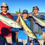
The undisputed kings of the late summer bite in Oceanside are California Yellowtail and Pacific Bonito. The warming water temperatures have pushed these aggressive pelagics well within reach of the half-day fleet and private boaters. Yellowtail in the fifteen to thirty-pound class are actively hunting along the deeper edges of the local kelp forests, while massive schools of bonito are blitzing baitballs anywhere from the kelp lines right up to the end of the Oceanside Pier. If you are looking for drag-screaming action, this is the time to target the surface and mid-water columns.

Sleeper Pick

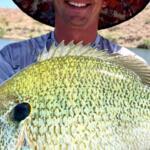
While everyone is looking offshore or crowding the end of the pier for pelagics, the Yellowfin Croaker and Barred Surfperch bite in the surf zone is quietly going off. This is the ultimate sleeper fishery right now. Many anglers completely overlook the skinny water, but the beaches are absolutely teeming with life. The croaker are feeding heavily in the skinny water troughs, providing constant rod-bending action for those willing to get their feet wet.

Baitfish Report

The local food chain is currently flush with forage. Massive schools of Pacific chub mackerel and anchovies are tightly balled up near the kelp stringers and circling the pilings of the Oceanside Pier. In the surf zone, the sand crab beds are fully populated and highly active. When selecting your artificials, you must match this hatch. Think silver, blue, and green profiles for the open water, and mottled sand or orange hues for the beach.

TACTICAL STRATEGY

Where

Precision is everything when fishing Oceanside. If you are hitting the surf, head directly to Oceanside Harbor Beach. Specifically, work the sandy stretch located exactly between the two jetties just south of the harbor entrance. There is a distinct trough here that holds fish on an incoming tide.

If you are fishing the Oceanside Pier, location dictates your catch. Bypass the crowded shallows and head to the mid-pier section to target the sandy drop-offs for California Halibut. For the bonito, you must secure a spot at the very end of the pier, casting out into the deeper, open water.

For boaters, push out to the local kelp beds sitting in 60 to 80 feet of water. Focus on the up-current, outside edges of the kelp where the baitfish are being pushed against the structure.

Lure

For the offshore and pier-end pelagics (Yellowtail and Bonito), tie on a surface iron like a Tady 45 or a 1-ounce to 2-ounce Kastmaster spoon. The heavy metal allows for long casts into breaking fish. If you are working the surf zone for croaker and perch, leave the heavy gear at home. Throw small pink Surfin' Merkin flies or a 2-inch motor oil colored grub on a Carolina rig.

Color

Water clarity is generally good to excellent right now. For your surface irons, the classic "Mint and White" or "Blue and White" patterns are outperforming everything else by mimicking the local mackerel. For spoons and jigs, stick to high-flash chrome and blue. In the surf, motor oil with red flake or natural sand colors will get the most aggressive strikes.

Pro Tip: When throwing surface irons for yellowtail, do not slow down your retrieve if a fish flashes behind your lure. A fleeing baitfish never slows down to get eaten; keep grinding that reel handle until the rod loads up heavily.

Bait

Live bait is king if you want guaranteed action. For the surf zone, fresh store-bought lug worms are currently producing bites on nearly every single cast. Alternatively, dig for live sand crabs right at the water's edge and pin them on a size 6 bait holder hook. For the boaters and pier anglers, fly-lining a live sardine or a small nose-hooked mackerel on a size 1/0 to 2/0 circle hook with light fluorocarbon leader (20-pound test) is the most lethal presentation for wary yellowtail and calico bass.

Pro Tip: When fishing lug worms in the surf, use a 3-ounce to 4-ounce sputnik or claw sinker. The coastal currents can be deceptive, and a standard pyramid sinker will often roll, causing massive tangles in your rig.

Timing

The bite windows are highly dictated by the tides and sun position. For the surf zone, you must be on the sand at first light, specifically targeting the incoming tide. The rising water pushes the sand crabs out of their beds and sends the croaker into a feeding frenzy. Offshore, the first two hours of daylight are prime for topwater yellowtail strikes, while the bonito tend to bite aggressively through the mid-morning and into the early afternoon whenever the tidal current is moving.

REGULATIONS SNAPSHOT

Always verify current California Department of Fish and Wildlife (CDFW) regulations before keeping any fish, as rules are strictly enforced. Note that a valid California fishing license is required everywhere except the public Oceanside Pier.

SpeciesMinimum Size LimitDaily Bag LimitSeason Status
California Yellowtail24 inches fork length10 (up to 5 under 24 inches)Open Year-Round
Kelp (Calico) Bass14 inches total length5 (combined with other bass)Open Year-Round
California Halibut22 inches total length5Open Year-Round
Pacific Bonito24 inches fork length10 (up to 5 under 24 inches)Open Year-Round
Yellowfin CroakerNo size limit10Open Year-Round

REGIONAL ALTERNATIVE

If the Oceanside coastal area becomes unfishable due to a localized algae bloom, heavy onshore winds, or if the pier is simply too crowded for comfort, your best backup plan is to head south toward San Diego and fish the protected waters of Mission Bay or the Shelter Island Pier.

Mission Bay offers miles of highly protected shorelines that are completely shielded from the open ocean swell. You can easily target Spotted Sand Bass and Halibut by walking the sandy beaches and casting 3-inch paddletail swimbaits in smelt patterns along the eelgrass drop-offs. If you prefer pier fishing, the Shelter Island Pier provides excellent deep-water access within the calm confines of San Diego Bay. The tactical approach here is to use high-low rigs tipped with cut squid or live ghost shrimp to target roaming schools of barred sand bass, sargo, and the occasional legal halibut. The protected nature of these southern bays ensures that even when the open ocean is angry, you can still salvage your day and bend a rod in comfort.

Tight lines!

Editor's Choice: Must-Have Gear

FISHINGSIR Next-Gen Waterproof Chest Waders

β˜…β˜…β˜…β˜…β˜… 4.4 (7,370+ reviews)
  • 2-Ply Tech: Upgraded nylon with 2.5x higher density than standard fabrics.
  • 100% Waterproof: Lab-approved intrusion resistance with taped visible seams.
  • Ultra-Lightweight: Designed for all-day comfort while hunting or fishing.
Check Availability on Amazon

βœ“ Amazon's Choice | 100+ bought last month

πŸ›’ Tactical Gear for this Spot

Bandit Walleye Deep

Mandatory for reaching deep schools in 35-50ft mud flats.

Check Price on Amazon #ad

As an Amazon Associate I earn from qualifying purchases. #ad

Loading forecast...

Live Fishing Conditions: Tides, Weather & Waves

Get real‑time tides, marine weather, swell and solunar activity for each spot so you know exactly when conditions line up for your best chance at a bite.

🎣

Oceanside

Loading coordinates...

🌀️

WEATHER CONDITIONS

Weather
-- Β°F
--Β°C

Loading...

🌑️
Feels Like --Β°F --Β°C
πŸ’§
Humidity --%
πŸ’¨
Wind -- mph -- km/h
🧭
Direction --
πŸ“Š
Pressure -- inHg -- hPa
β˜€οΈ
UV Index --
🌊

MARINE CONDITIONS

🌊 Wave Height
-- ft
-- m
Loading...
🧭 Wave Direction
--Β°
Loading...
⏱️ Wave Period
-- s
Loading...
πŸ“ˆ Tide Status
-- ft
-- m
Loading...
πŸŒ™

LUNAR & SOLUNAR

πŸŒ•

Loading...

Illumination: --%

Major Period --:-- - --:-- --:-- - --:--
Minor Period --:-- - --:-- --:-- - --:--
πŸŒ… Sunrise --:--
πŸŒ‡ Sunset --:--
πŸ“…

24-HOUR FORECAST

Loading fishing conditions...

Fishing Spots Map

🎣
Book a Fishing Charter near Oceanside Fishing Report Today 🎣

Local guides & charters. Verified captains, instant booking, best price guaranteed.

See Available Trips β†’

My location
Loading map...

Local Access & Facilities

Oceanside serves as a critical tactical pivot point for Southern California anglers, bridging the gap between the chaotic pressure of San Diego Bay and the open coastal stretches leading toward Orange County. This fishery is defined by its accessibility to deep water canyons and kelp lines without the excessive run times required from harbors further south. The atmosphere here strikes a balance between a working maritime hub and a recreational playground, where serious sportfishers share the water with recreational traffic.

The topography surrounding the harbor entrance is characterized by sandy beaches transitioning into structure-rich zones offshore. For the expert angler, the primary draw here is the versatility of the location. You are positioned to run offshore for pelagics during the summer season or work the coastal structure for calico bass and halibut when the conditions keep you closer to the hill. The harbor itself is a well-protected enclave, but the transition to the open Pacific can be dynamic depending on the swell direction.

Unlike the manicured resort feel of some southern marinas, Oceanside retains a functional, angler-centric vibe. It is a launchpad for those who value efficiency and proximity to productive grounds. Whether you are targeting yellowtail on the iron or setting up a drift for halibut, the logistics of this port allow for a streamlined "dawn patrol" execution that seasoned captains appreciate.

Access & Getting There

Reaching the Oceanside waterfront requires navigating the coastal corridors, typically via the Interstate 5 artery. While the highway provides direct access, seasoned locals know that the final mile to the water can be the difference between a stress-free launch and a logistical headache. Traffic congestion is a known variable in this region; however, the surface streets leading to the harbor are generally navigable for vehicles towing larger center consoles or trailer boats.

Parking strategy is paramount for the unguided angler. The crown jewel for overnight trips or ultra-early starts is Oceanside Harbor Lot 12. Located on North Pacific Street, this facility operates 24 hours a day, making it the only viable option for captains planning to clear the breakwall well before sunrise. In contrast, the Parking Structure on Civic Center Drive does not open its gates until 5:00 AM. For a serious offshore run, a 5:00 AM arrival is often too late, so prioritize Lot 12 to ensure your vessel is wet while the rest of the fleet is still parking.

πŸ’‘ Captain's Tip: The 5:00 AM Bottleneck

Avoid the Civic Center parking structure if you are targeting early bite windows. Its 5:00 AM opening time puts you behind the curve. Direct your rig to Oceanside Harbor Lot 12, which remains open 24 hours and accommodates the dawn patrol schedule essential for pelagic success.

For those launching trailer boats, Curtis Landing serves as a primary access point. The ramp conditions are generally reliable, but tidal swings can affect traction and depth. It is advisable to inspect the ramp during extreme low tides before committing a heavy hull. Additionally, a dedicated Kayak/Paddle Board Launch is available nearby, separating human-powered craft from the heavier mechanical traffic, which reduces ramp anxiety during the morning rush.

Shore access in this zone is robust, with specific points designated for families and foot-based anglers. These areas are wheelchair accessible, ensuring that the fishery remains inclusive. When accessing these shore points, be mindful of the swell exposure. Even protected jetties can experience wash-over during high surf advisories, so situational awareness is required when setting up gear near the waterline.

Oceanside Pre-Trip Checklist

Facilities & Amenities

The infrastructure in Oceanside is robust, but it requires specific "negative knowledge" to navigate effectively. The most critical logistical gap for the visiting angler is the bait situation. The data indicates that J & M Bait Distributors Inc is the primary source for bait, but it is located in San Marcos, roughly 10 miles inland. There is no heavy-duty tackle shop listed directly on the harbor apron in the immediate dataset.

This geographic reality dictates your preparation strategy. You cannot rely on grabbing fresh frozen squid or specialized terminal tackle at the ramp immediately before launch. You must secure your provisions at J & M Bait Distributors on your drive in, or ensure your vessel is fully stocked before leaving your home port. Failing to account for this 10-mile gap can result in a burned hour of prime fishing time retracing your route inland.

πŸ’‘ Captain's Tip: The Inland Pitstop

Do not wait until you hit the salt to buy your bait. J & M Bait Distributors is located inland in San Marcos. Make this your mandatory pitstop on the way to the coast, or you will find yourself dry on the docks.

For anglers looking to hire local expertise, Sea Star Fishing Charters is situated directly on Harbor Drive South. They are the premier operator in the immediate vicinity, maintaining a 5-star rating. Their location within the harbor complex suggests they are the go-to operation for those who prefer to step aboard a rigged vessel rather than trailering their own. Their proximity to the waterβ€”less than a mile from the primary access pointsβ€”makes them the logistical hub for charter operations.

Lodging options vary significantly in terms of logistical utility. For the trailer-boater who wants to wake up next to the ramp, Paradise by the Sea Beach RV Resort is the superior choice, located just 1.4 miles from the harbor. This proximity allows for maximum sleep and minimum transit time. Conversely, high-end options like The Lodge at Torrey Pines or Fairmont Grand Del Mar are located over 20 miles away. While luxurious, they add significant friction to an early morning departure and are not recommended for anglers focused purely on the fishing.

Facility NameTypeDistance from SpotKey Notes
Oceanside Harbor Lot 12Parking1.2 milesOpen 24 Hours. Ideal for trailers.
Parking StructureParking764 feetOpens 5:00 AM. Close at 1:00 AM.
Paradise by the Sea Beach RV ResortLodging1.4 milesNearest accommodation to launch.
J & M Bait DistributorsBait & Tackle10.1 milesNearest major bait supplier. Located inland.
Sea Star Fishing ChartersCharter0.8 milesLocated on Harbor Dr S. 5-Star rated.

Permits, Regulations & Fees

Navigating the regulatory environment in Oceanside requires adherence to standard California Department of Fish and Wildlife statutes. While no specific local permit is flagged in the immediate harbor data, the standard ocean enhancement stamp and saltwater fishing license are mandatory requirements. The region is patrolled by state game wardens who frequent the launch ramps and jetties. Compliance is not optional; ensure all licenses are digital or physical and easily accessible.

Conservation awareness is critical in this zone. While the harbor itself is a recreational zone, the nearby coastline interacts with various protected areas. The San Mateo Wilderness South Area is located roughly 21.5 miles north. While this is primarily a terrestrial conservation zone offering camping and hiking, its presence signals the general environmental sensitivity of the North County coast. Anglers running north toward the Orange County line should be vigilant of Marine Protected Areas (MPAs) that may not be physically marked with buoys.

Cultural respect is also a component of the local etiquette. The coastline here has deep historical significance. Access points often border private property or areas of local importance. The "Kapu" conceptβ€”respecting sacred boundaries and resourcesβ€”applies metaphorically here. Treat the ramp, the parking lots, and the water with respect. Wash down stations should be used efficiently, and noise discipline in the harbor during early hours is expected to maintain the relationship between the fishing fleet and the local residents.

Events & Seasonal Information

The rhythm of the Oceanside fishery is dictated by the Pacific seasonal shifts. The summer months bring the warm water currents that attract pelagic species within range of the local fleet. This is the high season for charters like Sea Star, and ramp traffic at Curtis Landing peaks significantly. During these windows, the competition for parking in Lot 12 becomes fierce. Arriving the night before or in the ultra-early hours is often the only way to secure a spot.

Winter transitions the fishery into a bottom-structure game. The crowds thin out, but the weather windows become narrower. Swell direction is a critical factor here. A strong west or northwest swell can make the harbor entrance technical for smaller skiffs. Always verify the swell period and height before committing to a sortie. The interior harbor basins can offer refuge for spotted bay bass and halibut during these rougher periods, providing a "save the day" option when the outside is blown out.

πŸ’‘ Captain's Tip: Swell Exposure

The transition from the harbor jetty to open water can be treacherous during winter swells. If the forecast calls for a significant northwest energy, check the entrance conditions from the jetty before launching a small skiff.

Contact Information & Resources

Self-reliance is the primary safety protocol in this region. While there are multiple public restrooms and amenities within a mile radiusβ€”including three distinct public restroom facilities near the waterβ€”emergency services are standard for an urban interface. Ensure you have VHF radio capability to contact the Harbor Master or the Coast Guard if mechanical failure occurs offshore.

For immediate logistical needs, the BikeLink eLockers at the Oceanside Coaster Station (1644 ft away) provide a resource for secure storage if you are utilizing multi-modal transport to reach the water. Always check local weather dashboards for real-time wind updates, as the afternoon trade winds can stand the chop up quickly in the channel.

For precise locations of the boat ramps, real-time wind conditions, and detailed bathymetry of the nearby canyons, consult the live dashboard and interactive maps below.
🎣

Oceanside

Oceanside β€’ California β€’ 33.1959, -117.3795
πŸ…ΏοΈ

Parking

5
Cycle Gear
⭐ 4.8 15.6 mi
πŸ“ 630 Nordahl Rd, San Marcos, CA 92069, USA
πŸ•’
Monday: 10:00β€―AM – 7:00β€―PM
Tuesday: 10:00β€―AM – 7:00β€―PM
Wednesday: 10:00β€―AM – 7:00β€―PM
Thursday: 10:00β€―AM – 7:00β€―PM
Friday: 10:00β€―AM – 7:00β€―PM
Saturday: 10:00β€―AM – 6:00β€―PM
Sunday: 10:00β€―AM – 6:00β€―PM
πŸš— Get Directions
Oceanside Harbor Lot 12
⭐ 4.8 1.2 mi
πŸ“ 1450 N Pacific St, Oceanside, CA 92054, USA
πŸ•’
Monday: Open 24 hours
Tuesday: Open 24 hours
Wednesday: Open 24 hours
Thursday: Open 24 hours
Friday: Open 24 hours
Saturday: Open 24 hours
Sunday: Open 24 hours
πŸš— Get Directions
Parking Structure
⭐ 4.7 764 ft
πŸ“ 557-599 Civic Center Dr, Oceanside, CA 92054, USA
πŸ•’
Monday: 5:00β€―AM – 1:00β€―AM
Tuesday: 5:00β€―AM – 1:00β€―AM
Wednesday: 5:00β€―AM – 1:00β€―AM
Thursday: 5:00β€―AM – 1:00β€―AM
Friday: 5:00β€―AM – 1:00β€―AM
Saturday: 5:00β€―AM – 1:00β€―AM
Sunday: 5:00β€―AM – 1:00β€―AM
πŸš— Get Directions
BikeLink eLockers: Oceanside Coaster Station
⭐ 4.5 0.3 mi
πŸ“ 101-199 S Cleveland St, Oceanside, CA 92054, USA
πŸ•’
Monday: 6:01β€―AM – 10:59β€―PM
Tuesday: 6:01β€―AM – 10:59β€―PM
Wednesday: 6:01β€―AM – 10:59β€―PM
Thursday: 6:01β€―AM – 10:59β€―PM
Friday: 6:01β€―AM – 10:59β€―PM
Saturday: 6:01β€―AM – 10:59β€―PM
Sunday: 6:01β€―AM – 10:59β€―PM
πŸš— Get Directions
🐟

Bait & Tackle

1
🚀

Fishing Charters

1
Sea Star Fishing Charters
⭐ 5.0 0.8 mi
πŸ“ 315 Harbor Dr S, Oceanside, CA 92054, USA
πŸ•’
Monday: 9:00β€―AM – 5:00β€―PM
Tuesday: 9:00β€―AM – 5:00β€―PM
Wednesday: 9:00β€―AM – 5:00β€―PM
Thursday: 9:00β€―AM – 5:00β€―PM
Friday: 9:00β€―AM – 5:00β€―PM
Saturday: 9:00β€―AM – 5:00β€―PM
Sunday: 9:00β€―AM – 5:00β€―PM
πŸš— Get Directions
🏠

Lodging

5
The Lodge at Torrey Pines
⭐ 4.7 21.6 mi
πŸ“ 11480 N Torrey Pines Rd, La Jolla, CA 92037, USA
πŸ•’
Monday: Open 24 hours
Tuesday: Open 24 hours
Wednesday: Open 24 hours
Thursday: Open 24 hours
Friday: Open 24 hours
Saturday: Open 24 hours
Sunday: Open 24 hours
πŸš— Get Directions
Paradise by the Sea Beach RV Resort
⭐ 4.6 1.4 mi
πŸ“ 1537 S Coast Hwy, Oceanside, CA 92054, USA
πŸ•’
Monday: 9:00β€―AM – 9:00β€―PM
Tuesday: 9:00β€―AM – 9:00β€―PM
Wednesday: 9:00β€―AM – 9:00β€―PM
Thursday: 9:00β€―AM – 9:00β€―PM
Friday: 9:00β€―AM – 9:00β€―PM
Saturday: 9:00β€―AM – 9:00β€―PM
Sunday: 9:00β€―AM – 9:00β€―PM
πŸš— Get Directions
βš“

Boat Ramps

3
🚻

Restrooms

3
πŸ‘¨β€πŸ‘©β€πŸ‘§β€πŸ‘¦

Family Friendly

2
β™Ώ

Accessibility

β™Ώ

Wheelchair Access

Available

πŸ•

Pets Allowed

Not Confirmed

⚠️ Some accessibility info not officially confirmed. Please verify with location directly.

πŸ“ Showing 20 facilities on map
🎣
Book a Fishing Charter near Oceanside Fishing Report Today 🎣

Local guides & charters. Verified captains, instant booking, best price guaranteed.

See Available Trips β†’

πŸ“Š

About Our Fishing Reports & Forecasts

Our spot reports combine data-driven forecasts with curated local information. The forecast is generated by our proprietary Fishing Score algorithm (0–100%), which analyzes real-time data from Open-Meteo API, validated against NOAA CO-OPS tide gauges and USGS water-monitoring stations. The model weights tide dynamics (35%), wave energy (25%), wind patterns (20%) and time of day (20%)β€”factors shown to influence fish feeding behavior through marine-biology research and decades of charter log data.

Access, facilities and services information for each fishing spot is sourced from official datasets such as Recreation.gov (RIDB), state park & wildlife agencies, and geospatial providers like Google Maps. These sections undergo scheduled re-validation every 3–6 months to ensure that boat ramps, park access, contact details and local services remain accurate.

Narrative sections (catches, seasonal behavior, local tips) are synthesized from these data sources and refined following the Fishing Reports Today editorial guidelines, combining bibliographic research from ichthyology and oceanography with expert angler experience. Our team reviews reports on a regular basis, while the forecast model itself updates every 6 hours for real-time accuracy.

⚠️ Important: Always verify current local regulations, access restrictions and weather conditions before fishing. These reports are intended as a planning aid, not a guarantee of catches or safety. When in doubt, contact local authorities or park managers listed on the page.

Learn more about our methodology & data sources β†’

Leave a Reply

Your email address will not be published. Required fields are marked *