The current conditions at Spring Lake present a prime autumnal window for anglers. As we navigate the heart of the fall transition, decreasing daylight hours and dropping overnight temperatures have pushed surface water temperatures down into the low-to-mid 60s. This thermal shift is the biological trigger local gamefish have been waiting for, initiating aggressive pre-winter feeding binges. The lake is currently stable, having recently completed its fall turnover, meaning the water column is oxygenated from top to bottom and fish are actively roaming rather than being confined to specific thermoclines.
Safety Advisory: While the weather is highly favorable for fishing, anglers must exercise caution regarding morning visibility. Dense radiation fog is heavily impacting the lake during the early dawn hours. If you are launching before sunrise, it is imperative to keep your navigation lights illuminated, reduce your motoring speed, and rely heavily on your GPS and sonar electronics until the morning sun burns off the haze. Additionally, with the water temperatures dropping, cold-water safety protocols should be observed. Always wear a properly fitted personal flotation device (PFD) while underway. There is no ice formation yet, so hard-water anglers will need to wait a few more months, but current open-water conditions are spectacular.
🎣Nautrek
Private Beta
J
M
R
100+ anglers on the waitlist
The fishing network where your reputation matters.
Find trusted captains, join real trips with cost splitting, and build your Angler Rank. Your spots stay private — you decide who sees your intel.
Right now, the most abundant and aggressive species dominating the catch reports are Largemouth Bass and Walleye. The bass are heavily focused on packing on weight before the winter freeze, pushing shallow during low-light conditions to ambush prey before retreating to the first major drop-offs during midday. Walleye, which spent the summer sulking in the deeper, cooler basins, are now pushing up the structural transitions, hunting in aggressive wolf packs along the primary contour lines.
Sleeper Pick: Jumbo Yellow Perch
While the majority of the boat traffic is focused on the bass and walleye bite, the true overlooked gems right now are the jumbo Yellow Perch. Most anglers completely miss this bite because they are fishing too fast or using oversized presentations. These schooling panfish are currently congregating in massive numbers over soft-bottom transition zones, feeding heavily on aquatic invertebrates and small baitfish. Locating a school can quickly lead to a fast and furious numbers game, providing exceptional table fare.
Pro Tip:When targeting these sleeper perch, keep a close eye on your side-imaging sonar. Perch schools often look like tightly packed, low-to-the-bottom clouds just off the edge of hard structure. Once you mark them, drop a marker buoy or lock your GPS anchor immediately, as they will roam if not actively engaged.
Baitfish Report
The primary forage driving the current feeding frenzy consists of juvenile gizzard shad and young-of-the-year bluegills. The shad are beginning to school tightly in the backs of the northern bays, seeking the warmest available water as the main lake cools. The juvenile bluegills are clinging to the remaining green vegetation. Matching your lure profile to a 2-to-3-inch baitfish is critical for success right now. If you are fishing near the weedlines, opt for a deeper, rounder bluegill profile. If you are chasing fish in open water or over points, a slender shad profile will yield the best results.
TACTICAL STRATEGY
Where to Target
To maximize your time on the water, bypass the shallow, dying vegetation in the southern flats and head directly toward the steep 8-to-12-foot drop-offs near the North Bay access ramp. The key to this pattern is finding the "greenest" remaining weeds. As the milfoil and coontail begin to die off and turn brown, they consume oxygen, pushing baitfish away. However, the isolated patches of green, healthy cabbage weeds are currently acting as magnets for both bait and predators. Position your boat over the 15-foot depths and cast parallel to the 8-to-12-foot weedline edge. Additionally, the rocky points adjacent to the old submerged roadbed on the eastern shoreline are holding excellent numbers of walleye during the twilight hours.
Lure Selection
For the Largemouth Bass, a 1/2-ounce tungsten football jig paired with a creature bait trailer is producing the highest quality bites. The heavier weight allows you to maintain bottom contact and punch through the remaining vegetation. For the Walleye, precision vertical jigging is the name of the game. A Rapala Jigging Rap in size #5 or #7, or a 1/4-ounce blade bait, will trigger reaction strikes from fish that are otherwise lethargic during the midday sun.
Color Patterns
Water clarity is currently sitting at about 4 to 6 feet of visibility, with a slight tannic stain from the decaying autumn leaves. For your bass jigs, stick to natural crawfish patterns: green pumpkin, brown, and subtle hints of orange. When deploying the Jigging Raps or blade baits for walleye, metallic finishes are outperforming matte colors. Chrome/Blue or Gold/Black are perfectly mimicking the flash of the schooling gizzard shad.
Bait and Rigging
If you prefer live bait, particularly for the jumbo perch and walleye, precision rigging is essential. Use a slip bobber rig paired with a 1/16-ounce tungsten teardrop jig, tipped with a lively crappie minnow or a medium golden shiner. Set your bobber stop so the bait hovers exactly 12 to 18 inches above the bottom. This keeps the bait in the strike zone while preventing it from burying into the soft substrate or bottom debris.
Pro Tip:When using live minnows on a slip bobber, hook the minnow lightly through the dorsal fin rather than the lips. This encourages the bait to swim frantically in a downward motion, sending distress vibrations through the water column that predatory fish find irresistible.
Timing the Bite
The feeding windows are highly predictable right now. The absolute best strike rates are occurring during the low-light dawn window, specifically from 6:00 AM until the sun breaches the tree line around 8:00 AM. There is a secondary, highly aggressive feeding period in the late afternoon from 4:00 PM until dusk. Midday fishing requires slowing down your presentation significantly and dead-sticking your baits close to the bottom structure.
REGULATIONS SNAPSHOT
Before hitting the water, ensure you are fully compliant with the current seasonal regulations for Spring Lake. Enforcement is active during the fall season.
Species
Size Limit
Daily Bag Limit
Season Status
Largemouth Bass
14-inch minimum
5 per angler
Open Year-Round
Walleye
15-inch minimum (only one over 20 inches)
3 per angler
Open (Closes March 1st)
Yellow Perch
No minimum size
15 per angler
Open Year-Round
REGIONAL ALTERNATIVE
If the wind picks up significantly from the north, making boat control on Spring Lake impossible, or if the primary boat ramps are overcrowded with weekend tournament traffic, your best fallback option is nearby Clear Creek Reservoir, located just 15 miles to the southwest. Clear Creek is heavily sheltered by old-growth timber along its northern banks, providing a glassy surface even on blustery days.
Access Clear Creek via the County Route 9 State Park launch. The primary target species here will be Smallmouth Bass and Crappie. The tactical approach is completely different: leave the heavy jigs behind and focus on finesse tactics. Target the submerged standing timber in 15 to 20 feet of water using drop-shot rigs with 3-inch finesse worms in natural shad colors, or suspend small tube jigs over the brush piles for the crappie. The water here is exceptionally clear, so downsize your fluorocarbon leader to 6-pound test to avoid spooking the highly pressured fish.
Pro Tip:When fishing the standing timber at Clear Creek, rely on your forward-facing sonar if you have it. Pitch your drop-shot directly to individual suspended fish rather than blindly casting into the wood, which will save you from constant snags and re-tying.
Tight lines!
Editor's Choice: Must-Have Gear
FISHINGSIR Next-Gen Waterproof Chest Waders
★★★★★4.4 (7,370+ reviews)
2-Ply Tech: Upgraded nylon with 2.5x higher density than standard fabrics.
100% Waterproof: Lab-approved intrusion resistance with taped visible seams.
Ultra-Lightweight: Designed for all-day comfort while hunting or fishing.
As an Amazon Associate I earn from qualifying purchases. #ad
Loading forecast...
Live Fishing Conditions: Tides, Weather & Waves
Get real‑time tides, marine weather, swell and solunar activity for each spot so you know exactly when conditions line up for your best chance at a bite.
🎣
Spring Lake, NK
Loading coordinates...
🌤️
WEATHER CONDITIONS
--°F
--°C
Loading...
🌡️
Feels Like--°F--°C
💧
Humidity--%
💨
Wind-- mph-- km/h
🧭
Direction--
📊
Pressure-- inHg-- hPa
☀️
UV Index--
🌊
MARINE CONDITIONS
🌊Wave Height
-- ft
-- m
Loading...
🧭Wave Direction
--°
Loading...
⏱️Wave Period
-- s
Loading...
📈Tide Status
-- ft
-- m
Loading...
🌙
LUNAR & SOLUNAR
🌕
Loading...
Illumination: --%
Major Period--:-- - --:----:-- - --:--
Minor Period--:-- - --:----:-- - --:--
🌅Sunrise--:--
🌇Sunset--:--
📅
24-HOUR FORECAST
Loading fishing conditions...
Fishing Spots Map
🎣
Book a Fishing Charter near Spring Lake, NK Fishing Report Today 🎣
Local guides & charters. Verified captains, instant booking, best price guaranteed.
There was an error loading the map. Please try refreshing the page.
Info
Local Access & Facilities
Spring Lake, New Jersey, presents a unique tactical scenario for the serious angler. Situated squarely between two of the state's most productive inlets—Shark River to the north and Manasquan River to the south—this location serves as a strategic pivot point for accessing the Atlantic's migratory highways. While the town itself is known for its quiet, Victorian charm and the freshwater lake that gives it its name, the saltwater game here is defined by surfcasting along the beachfront and accessing offshore grounds via the neighboring harbors. The atmosphere is distinct from the commercial bustle of Point Pleasant or the party vibe of Belmar; it is a stretch of coast that rewards the disciplined surfcaster and serves as a high-end launchpad for captains trailering their vessels to the most favorable inlet based on the day's wind and tide.
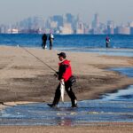
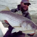
For the seasoned captain, the value of Spring Lake lies in its logistics. You are effectively positioning yourself within a three-mile radius of two major boat launches, allowing for a game-time decision on where to splash the boat. The shoreline here features a specific topography that attracts striped bass and bluefish during the spring and fall runs, often within casting distance of the sand. Unlike the rugged, lava-lined coasts of the Pacific, this is classic Jersey Shore territory: shifting sandbars, distinct cuts in the trough, and a reliance on reading the whitewater. The primary target species driving the local economy include Striped Bass, Fluke (Summer Flounder), and Bluefish, with offshore runs targeting Tuna and Mahi when the window opens.
The operational tempo here is dictated by the seasons and the tides. While the summer months bring crowds to the beaches, the "shoulder seasons" belong to the angler. The infrastructure supporting this fishery is robust but dispersed. You will not find a centralized "Spring Lake Marina" with fuel and ice; rather, you must rely on a network of specialized tackle shops, launch ramps, and support facilities located in the adjacent townships of Belmar, Wall, and Manasquan. Success in these waters requires understanding this decentralized layout and planning your logistics—fuel, bait, and launch—before you hitch the trailer.
Access & Getting There
Reaching Spring Lake is generally straightforward, with the primary artery being the Garden State Parkway. However, the final few miles to the water can be deceptive during peak hours. The most efficient approach for trailering captains is typically exiting the Parkway onto Route 34 or Route 138, filtering toward the coast. Traffic congestion is a genuine variable here, particularly on weekends during the summer season. The "dawn patrol" advantage is real; arriving before 6:00 AM not only secures parking but avoids the infamous Jersey Shore traffic bottlenecks that form on the main state highways leading into Belmar and Manasquan.
💡 Captain's Tip: Trailer Strategy
If you are arriving early or need a staging area before your launch slot opens, utilize the Garden State Parkway Park And Ride in Wall Township. It is open 24 hours and located just 3.8 miles from the fishing grounds, providing ample space to check bearings and rigging away from the tight coastal streets.
Launch Realities and Ramps
For boat owners, the primary access point is the Manasquan Boat Launch, located approximately 2.5 miles south of the central Spring Lake spot. This facility is the workhorse for the area. The ramps are generally well-maintained, but the popularity of the Manasquan Inlet means this location can reach capacity rapidly. The current strength in the Manasquan River can be significant; launching during a ripping outgoing tide requires a steady hand on the throttle and a well-coordinated crew on the lines. There are also unnamed overpass access points noted in the local data roughly 2 miles out, but these are often less developed and better suited for kayaks or light skiffs rather than heavy center consoles.
Shore access is excellent for surf anglers. The data indicates multiple shore access points suitable for families and serious casters alike. The beachfront along Spring Lake offers open access, though parking meters and seasonal beach badge requirements are strictly enforced during the day. Night fishing often provides relief from these restrictions, but always verify local signage. The topography of the beach changes with winter storms, so scouting the cuts at low tide is essential for productive high-tide sessions.
Parking and Staging
Parking with a trailer in Spring Lake proper can be challenging due to narrow residential streets and restrictions. The Garden State Parkway Park And Ride mentioned earlier is a critical asset for logistics. For those without trailers, street parking is available but competitive. The data highlights New Frontier Valet in Eatontown, but includes a critical operational note: "Avoid with trailers." Do not attempt to navigate heavy rigs into facilities not designed for them. Similarly, Country Club Services is listed nearby, but verify their lot capacity before committing. For long-term storage or staging during a multi-day trip, Snapbox Self-Storage is located about 17.5 miles away in Manchester Township, offering a secure option if you are staying inland.
Spring Lake, NK Pre-Trip Checklist
Facilities & Amenities
The region surrounding Spring Lake boasts a high density of fishing-specific infrastructure, though it is spread across several towns. You will not find a "one-stop-shop" at the water's edge in Spring Lake itself; instead, you must tap into the surrounding ecosystem of businesses. The caliber of the local fleet is high, with Belmar serving as the home port for many top-tier charter operations.
Bait & Tackle Logistics
The local tackle shops are institutions, catering to distinct styles of fishing. Gabriel Tackle Co. in Brick Township (8.5 miles away) is a reliable hub for inshore and offshore gear, maintaining hours that accommodate the serious angler (opening at 8:00 AM, which is suitable for mid-morning tides or gearing up the day before). For those headed further north or coming from the bay side, TN Tackle in Hazlet offers comprehensive service.
However, for the surfcaster who lives by the tide, Grumpys Tackle in Seaside Park (15.7 miles south) is the gold standard. Their operating hours are optimized for the dawn patrol, opening the doors at 04:30 AM. This is where you go for fresh bunker, custom plugs, and real-time intelligence on the surf bite. Charlies Bait n Tackle in Normandy Beach (10.3 miles) is another excellent option, opening at 7:00 AM. Up Front Bait and Tackle in Keyport is also available for those accessing the area from the north, with a 5:00 AM opening time that respects the early riser.
💡 Captain's Tip: The "Dawn Patrol" Resupply
If you are targeting the sunrise bite, Grumpys Tackle is your only viable option for fresh bait before 5:00 AM. Most other shops in the immediate vicinity do not open until 7:00 AM or 8:00 AM. Plan your bait run the evening before if you intend to fish the immediate Spring Lake surf at first light.
Charter Fleet and Guides
If you prefer to leave the helm to someone else, the charter fleet operating out of the nearby Belmar Marina (just 1.9 miles away) is world-class. Nearfall Fishing Charters and Finominal Sportfishing Charters are located practically next door to the Spring Lake zone. These outfits specialize in striped bass and bottom fishing. Chasin' Tail Sportfishing in Port Monmouth (20.2 miles) and Reel Happy Fishing Charters in Highlands (17.5 miles) are options if you are looking to depart from the Raritan Bay side to target specific migration patterns. The proximity of the Belmar fleet means you can stay in Spring Lake and be at the dock within 10 minutes.
Facility Name
Type
Distance / Location
Key Notes & Hours
Grumpys Tackle
Bait & Tackle
15.7 mi (Seaside Park)
Opens 04:30 AM. Essential for early bait.
Gabriel Tackle Co.
Bait & Tackle
8.5 mi (Brick Twp)
Opens 8:00 AM. Solid general outfitter.
Manasquan Boat Launch
Boat Ramp
2.5 mi (Manasquan)
Primary launch. Heavy current awareness required.
Nearfall Fishing Charters
Charter
1.9 mi (Belmar)
Rated 5.0. Very close proximity.
Garden State Parkway Park And Ride
Parking
3.8 mi (Wall Twp)
Open 24 Hours. Good for staging.
Lodging and Accommodation
Accommodation options directly in the data set lean towards camping and extended stay facilities, reflecting the outdoor nature of the region. Allaire State Park Group Campsite offers a rustic option just 5.1 miles away, perfect for anglers who want to maximize their budget for fuel and gear. For a more structured stay, Pine Grove Day Camp in Wall Township is nearby, though availability for transients should be checked. Javdeck Inc in Jackson Township and Quail Hill Scout Reservation offer alternative lodging logistics further inland. Note that high-end hotel accommodations are not explicitly detailed in this dataset, suggesting that anglers seeking luxury should look to the bed and breakfasts within Spring Lake proper or commercial hotels in Wall Township.
Permits, Regulations & Fees
Navigating the regulatory environment in New Jersey requires attention to detail. The official data indicates that fishing is allowed and managed by the State Fishing Agency. While no specific "Spring Lake" permit is flagged in the system, all saltwater anglers in New Jersey aged 16 and older must register with the New Jersey Saltwater Recreational Registry Program (NJSRRP). This is a free registration but is legally mandatory.
Gateway National Recreation Area (Sandy Hook), located approximately 17 miles north, introduces a different set of federal regulations if your trip takes you that far. The data lists specific fees for amenities like the "Sandy Hook Canoe Cruise" and seasonal beach parking. While Spring Lake itself is municipal, if you launch and run north to fish the Sandy Hook rips or the bay, be aware that you are entering National Park Service jurisdiction. The "Sandy Hook Beach Parking" facility listed has a phone number (732-872-5970) which can be a useful resource for checking real-time access status for the northern barrier spit.
Cultural respect and local ordinances are paramount. Spring Lake is a residential community with strict noise and parking enforcement. The concept of "Kapu" or sacred restriction may not be native to New Jersey, but the local equivalent is the privacy of beachfront homeowners and the strict enforcement of beach badge policies. Accessing the beach via established entry points is not just a courtesy; it is a legal requirement to avoid trespassing fines.
Events & Seasonal Information
The fishing calendar in this region is driven by the migration of Striped Bass. The spring run (April-June) and the fall run (October-December) are the peak operational windows. During these times, the local boat ramps at Manasquan and the charter docks in Belmar operate at maximum capacity. The summer season shifts focus to Fluke (Summer Flounder) and offshore pelagics. The data notes "Sandy Hook Canoe Cruises" during the summer, indicating that the calmer summer waters in the bay allow for paddle sports, which can be a conflict for powerboaters navigating the channels. Keep a sharp lookout for kayak fleets and paddleboards, especially near the inlet jetties during July and August.
💡 Captain's Tip: Summer Traffic
During the summer months, the waterways between Belmar and Manasquan become heavily trafficked recreational zones. The "Canoe Cruise" activities mentioned in the data suggest a high volume of non-motorized vessels. Reduce speed and increase vigilance when transiting the Intracoastal Waterway or near the inlet mouths.
Contact Information & Resources
Self-reliance is the rule, but knowing who to call is essential. For issues regarding the northern reaches and federal lands, the Gateway National Recreation Area contact line is 732-872-5970. For local parking and beach access questions, the municipal authorities in Spring Lake and the harbor masters in Belmar and Manasquan are the primary points of contact. Safety notes emphasize the need to "check weather and ocean conditions before fishing" and "wear appropriate footwear," particularly when navigating the slippery jetties or launching at low tide.
For precise locations, real-time wind conditions, and detailed bathymetry of the nearby inlets, consult the live dashboard and interactive maps below.
Our spot reports combine data-driven forecasts with curated local information. The forecast is generated by our proprietary Fishing Score algorithm (0–100%), which analyzes real-time data from Open-Meteo API, validated against NOAA CO-OPS tide gauges and USGS water-monitoring stations. The model weights tide dynamics (35%), wave energy (25%), wind patterns (20%) and time of day (20%)—factors shown to influence fish feeding behavior through marine-biology research and decades of charter log data.
Access, facilities and services information for each fishing spot is sourced from official datasets such as Recreation.gov (RIDB), state park & wildlife agencies, and geospatial providers like Google Maps. These sections undergo scheduled re-validation every 3–6 months to ensure that boat ramps, park access, contact details and local services remain accurate.
Narrative sections (catches, seasonal behavior, local tips) are synthesized from these data sources and refined following the Fishing Reports Today editorial guidelines, combining bibliographic research from ichthyology and oceanography with expert angler experience. Our team reviews reports on a regular basis, while the forecast model itself updates every 6 hours for real-time accuracy.
⚠️ Important: Always verify current local regulations, access restrictions and weather conditions before fishing. These reports are intended as a planning aid, not a guarantee of catches or safety. When in doubt, contact local authorities or park managers listed on the page.
To provide the best experiences, we use technologies like cookies to store and/or access device information. Consenting to these technologies will allow us to process data such as browsing behavior or unique IDs on this site. Not consenting or withdrawing consent, may adversely affect certain features and functions.
Functional Always active
The technical storage or access is strictly necessary for the legitimate purpose of enabling the use of a specific service explicitly requested by the subscriber or user, or for the sole purpose of carrying out the transmission of a communication over an electronic communications network.
Preferences
The technical storage or access is necessary for the legitimate purpose of storing preferences that are not requested by the subscriber or user.
Statistics
The technical storage or access that is used exclusively for statistical purposes.The technical storage or access that is used exclusively for anonymous statistical purposes. Without a subpoena, voluntary compliance on the part of your Internet Service Provider, or additional records from a third party, information stored or retrieved for this purpose alone cannot usually be used to identify you.
Marketing & Affiliates
The technical storage or access is required to create user profiles to send advertising, or to track the user on a website or across several websites for similar marketing purposes, including affiliate tracking for products recommended in our reports.


Leave a Reply