


Coalville Utah Pre-Trip Checklist
Local Access & Facilities
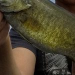
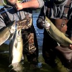
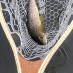
Coalville, Utah, serves as the gateway to a dual-nature fishery that demands a versatile approach from any serious angler. Situated in the high desert topography of Summit County, this location offers a distinct choice between the accessible, open waters of Echo Reservoir and the alpine seclusion of the Smith and Morehouse system. For the veteran captain, this area represents a transition zone where the high-traffic waters of the Wasatch Front give way to the rugged, conifer-lined slopes of the Uinta Mountains. The primary draw here is a robust population of rainbow and brown trout, alongside channel catfish that patrol the muddy bottoms of the lower elevation impoundments.
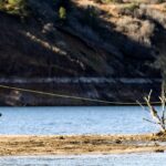
The atmosphere surrounding Coalville is strictly utilitarian functionality meeting high-altitude recreation. Unlike the manicured marinas of larger state parks, the facilities here are rugged and purpose-built. Echo Reservoir, sitting at an elevation of 5,560 feet, dominates the local landscape with its 1,450-acre surface area. It is an open setting, exposed to the elements, where wind patterns can shift rapidly across the water. In contrast, the drive toward the Smith and Morehouse Reservoir takes you up to 7,800 feet, immersing you in a dense aspen and conifer forest where the air is thinner, the water is colder, and the fishing requires a more tactical, stealthy approach.
Navigating this region requires an understanding of the elevation gradients. The logistical shift from the valley floor to the high guard stations changes everything from your trailering fuel consumption to the thermal layers you wear on the dawn patrol. This is not a location for the unprepared; the amenities are specific, the distances between tackle shops are significant, and the weather commands respect. Successful trips here are defined by logistical foresight rather than spur-of-the-moment decisions.
Access & Getting There
Accessing the Coalville fisheries is primarily dictated by the Interstate 80 corridor, which serves as the main artery for anglers arriving from Salt Lake City or Cheyenne. For those targeting Echo Reservoir, the logistics are straightforward but prone to heavy recreational traffic during peak summer weekends. The primary access is via Exit 164 on I-80. If you are hauling from Ogden, Interstate 84 provides a direct link. The proximity to the interstate makes Echo a convenient stop, but it also means the boat ramps can see significant congestion by mid-morning. The launch facilities here are managed by Echo Resort, and while functional, veteran skippers know that ramp etiquette here is paramount due to the volume of mixed-use boaters.
Reaching the high-country water at Smith and Morehouse Reservoir requires a different mindset and vehicle capability. From Coalville or Kamas, you will navigate roughly 12 to 18 miles of mountain roads. The route involves taking Highway 213 out of Oakley to the end of the pavement, followed by a 2-mile stretch of gravel to the campground and ramp entrance. While generally accessible, this final leg can be washboarded and dusty. Trailer bearings take a beating on these transitions, so visual inspections before the final ascent are recommended. The boat ramp at Smith and Morehouse is located on the northwest shore. It is a functional launch, but the steep topography of the Uintas means the ramp angle can be aggressive depending on water levels.
💡 Captain's Tip: Launch Timing
The boat ramp at Smith and Morehouse is positioned on the northwest shore. Due to the high canyon walls, early morning light hits this ramp later than you might expect. However, parking is limited. To secure a spot for your trailer without battling the mid-day kayak crowd, aim to have your hull wet by 6:30 AM.
Weather is the single biggest variable impacting access in this region. At Echo Reservoir, the open valley acts as a wind tunnel. When the prevailing westerlies kick up, usually by 11:00 AM, the chop on the main basin can make loading a boat solo a hazardous endeavor. At the higher elevation of Smith and Morehouse, the concern shifts to temperature and sudden storms. Even in July, morning temperatures can hover in the 40s. The road to the upper reservoir is subject to seasonal closure; winter snowpack dictates when the gate opens, typically not until late spring. Always verify the road status with the Kamas Ranger District before hitching up early in the season.
Parking strategies differ vastly between the two main bodies of water. Echo Resort offers developed parking suitable for larger rigs, though fees apply. At Smith and Morehouse, the parking is tighter and shared with hikers utilizing the trailhead. The campground loops are paved, but maneuvering a 25-foot center console through the tight turns of the Ledgefork or Smith and Morehouse campgrounds requires precision. There is limited overflow parking, so if the lot is full, you may be forced to backtrack significantly to find a turnaround.
Facilities & Amenities
The infrastructure around Coalville is designed for the self-reliant angler. While there are facilities, they are often focused on camping rather than specialized fishing support. The most critical piece of intelligence for an incoming captain is the lack of immediate tackle and bait shops. The nearest reliable outfitters, such as Utah Troutfitters Park City or Park City Fly Fishing Guides, are located approximately 16 to 19 miles away in Park City. EZ-Lure in Bountiful is nearly 40 miles out. This means if you break a rod tip or run out of specific tippet material at the ramp, your day is effectively over. You must bring every piece of terminal tackle, ice, and bait you intend to use.
The lodging options in the immediate vicinity favor the rustic. The Ledgefork Guard Station offers a unique opportunity to stay in a historic Forest Service cabin just above the reservoir. This facility provides a generator, running water, and a shower, allowing for a comfortable multi-day base camp without the need for a tent. However, it requires advanced reservations and fills up quickly. For those towing campers, the Ledgefork and Smith and Morehouse campgrounds offer paved driveways and vault toilets but lack electrical hookups. The "Double S&P" sites can accommodate up to 16 people, making them ideal for multi-boat flotillas, provided you book outside the 18-day window restrictions.
💡 Captain's Tip: Fuel Logistics
There is no fuel dock on the water at Smith and Morehouse, and options at Echo can be seasonal or limited. The last reliable stops for high-octane, ethanol-free marine gas are in the towns of Kamas or Coalville proper. Burn rates increase at high altitudes; top off your tanks before leaving the pavement in Oakley.
For anglers requiring high-end amenities, the proximity to Park City (roughly 20 miles) allows for a "commuter" fishing strategy. Hotels like the Stein Eriksen Lodge or Washington School House Hotel offer luxury accommodations, but the trade-off is a 30-to-40-minute drive to the launch ramp each morning. This is a common tactic for fly fishing guides who meet clients in Park City before transporting them to the water. The local charter fleet is heavily skewed toward fly fishing, with reputable operators like Utah Pro Fly Fishing specializing in the local trout waters. These guides generally provide all gear, which mitigates the lack of local tackle shops for their clients.
| Facility Name | Type | Key Features for Anglers | Distance from Hub |
|---|---|---|---|
| Echo Resort | Rec Area / Access | Main boat launch, paved parking, fee area, moderate use. | ~3.8 miles |
| Smith and Morehouse | Campground / Ramp | NW shore boat ramp, paved sites, no hookups, high elevation. | ~18.4 miles |
| Ledgefork Guard Station | Cabin Rental | Historic cabin, sleeps 8, generator power, immediate water access. | ~19.8 miles |
| Ledgefork Campground | Campground | Single/Double sites, vault toilets, near Smith & Morehouse trail. | ~19.8 miles |
A critical "negative knowledge" point for boaters is the specific restriction at Smith and Morehouse Reservoir: it is a wakeless speed water body. This regulation is strictly enforced. While motorized boats are permitted, this is not the place for high-speed run-and-gun tactics or watersports. It is an environment perfectly suited for trolling motors, drift boats, canoes, and kayaks. If you are running a bass boat with a 250HP outboard, you will be idling the entire day. Plan your battery capacity accordingly.
Permits, Regulations & Fees
Fishing in this region falls under the jurisdiction of the state fishing agency, and standard Utah state fishing licenses are required for all anglers. However, the management of the physical access points involves a mix of federal and private entities. Echo Reservoir recreation is managed by Echo Resort under an agreement with the Bureau of Reclamation. This concessionaire arrangement means that day-use fees are charged for accessing the developed areas and boat ramps. These fees contribute to the maintenance of the docks and parking lots, which are generally in better condition than primitive access points.
The Smith and Morehouse area operates under the Uinta-Wasatch-Cache National Forest. The campgrounds and day-use areas here are fee-based, and reservations are handled through the federal recreation portal. It is vital to understand the cancellation and change policies, which are strict—changes made outside the booking window incur service fees, and late cancellations can result in forfeiting usage fees. The Ledgefork Guard Station has its own specific set of rules, including a strict capacity limit of 8 people and a prohibition on pets inside the historic structure.
Conservation and respect for the resource are culturally embedded in the usage of these high-mountain waters. The "wakeless speed" rule at Smith and Morehouse is not just about safety; it is about preserving the shoreline from erosion and maintaining the tranquility of the high-altitude ecosystem. Anglers are guests in a habitat shared with moose, deer, and other wildlife. The Smith and Morehouse Trail, which connects the campgrounds, is a sensitive area where hikers and backpackers are common. Anglers accessing the water from the shore should be mindful of trail users and practice Leave No Trace principles strictly, packing out all monofilament and bait containers.
Events & Seasonal Information
The angling calendar in Coalville is dictated by the freeze-thaw cycle. Echo Reservoir, being lower, opens up earlier in the spring, offering a prime window for trout fishing right after ice-out when the fish are aggressive and patrolling the shallows. As summer progresses into July and August, the water temperature rises, pushing the trout deeper and slowing the bite during the heat of the day. This is when the Smith and Morehouse fishery shines. Its elevation at 7,800 feet keeps water temperatures cooler, prolonging the active feeding windows for trout well into the summer months.
Seasonal rhythms also dictate the boating conditions. In the late summer, water levels in Echo Reservoir can fluctuate significantly due to downstream irrigation demands. A ramp that is easily accessible in June might be high and dry by September. It is prudent to check current reservoir levels via the Bureau of Reclamation data before planning a late-season launch. Winter brings a different crowd, as the reservoirs freeze over and become destinations for ice fishing. However, access roads to the upper campgrounds are not plowed, limiting vehicle access to the lower elevation spots unless you are equipped with snowmobiles or track systems.
💡 Captain's Tip: The Wind Clock
Local captains set their watches by the canyon winds. At Echo Reservoir, the surface is often glass-calm until roughly 10:00 AM. Once the sun heats the valley floor, the thermal winds channel through the canyon, creating a chop that can make precise boat control difficult. Plan your finesse fishing for the early morning and switch to trolling or reaction baits once the breeze stiffens.
Contact Information & Resources
For the most current information regarding boat ramp status, water levels, and campground availability, direct communication with the managing agencies is recommended. The Echo Resort can be reached at 435.336.9894 for specific questions regarding the marina and launch fees. for inquiries regarding the Smith and Morehouse complex, including the Ledgefork Guard Station, contact the Kamas Ranger District at 435-783-4338 or the concessionaire line at 385-273-1100.
Safety in this region is a matter of self-reliance. Cell phone coverage can be spotty to non-existent in the upper reaches of the Weber River drainage and around Smith and Morehouse. File a float plan with someone on land before heading up the canyon. In the event of an emergency, response times will be significant due to the remote nature of the mountain roads. Ensure your vessel is equipped with all Coast Guard-required safety gear, and always have a secondary means of propulsion if you are on the wakeless waters of the upper reservoir.
For precise locations, real-time weather data, and detailed topographic views of the lake floors, consult the live dashboard and interactive maps located below.
Leave a Reply