
Situated within the high-altitude basin known as South Park, Spinney Mountain Reservoir represents a convergence of rolling prairie ecosystems and the dramatic backdrop of the Continental Divide. This fishery is defined by its exposure to the elements and its sweeping views of the College Peaks and surrounding fourteeners. For the serious angler, this location offers a rugged, open-water experience that contrasts sharply with the sheltered canyons found elsewhere in Colorado. The environment here is characterized by vast, grassy plains that drop abruptly into cold, productive waters, creating a unique biological engine that drives the local food web.
The atmosphere at Spinney Mountain is strictly utilitarian and nature-focused; this is not a manicured urban park with paved promenades. It is a destination where the wind dictates the strategy and the vastness of the landscape demands self-reliance. The reservoir serves as a critical component of the South Platte River system, a name synonymous with legendary western angling. While the scenery is dominated by the "Peaks to Prairies" transition zone, the underwater topography is equally significant, offering submerged channels and flats that attract seasoned boaters and wade fishermen alike.
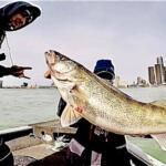
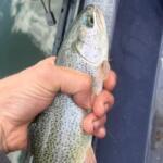
Anglers traveling here are typically targeting coldwater game fish that thrive in these high-elevation impoundments. The biological productivity of the reservoir, fed by the nutrient-rich South Platte, supports a robust population of fish that grow rapidly. However, the open nature of the terrain means that success is often determined by a captain's ability to read surface conditions and manage boat control in the face of the region's notorious winds.
Access & Getting There
Reaching Spinney Mountain Reservoir requires navigating the high country of Central Colorado. The primary access routes typically involve travel along US Highway 24, a corridor that winds through the heart of the state's mountainous terrain. Traffic in this region can be deceptive; while the roads are generally wide, weekend congestion during peak summer months and autumn leaf-peeping seasons can significantly alter travel times. Anglers towing vessels should be particularly mindful of the grades and weather conditions on the passes leading into the Hartsel area, as conditions can change rapidly from sun to hail or snow, even in late spring.
For boaters, the launch situation requires specific attention to logistics. The data indicates multiple boat launch facilities within an 8-mile radius of the central reference point. While the ramps are generally serviceable, the "South Park Breeze"—a euphemism for sustained winds often exceeding 20 knots—can make launching and retrieving a challenge. Experienced skippers know to time their arrival for the early morning lull. The sheer exposure of the ramps means there is little natural windbreak, so solo launching requires a well-rehearsed routine.
💡 Captain's Tip: Trailer Management
While boat ramps generally accommodate trailers, satellite parking areas like Charlie Meyers State Rec Parking and Highline are listed with no trailer parking capability. Drop your vessel at the designated ramp and ensure you are parking your rig in the correct lot to avoid fines or maneuvering nightmares.
Parking infrastructure is distributed across several key points. The Charlie Meyers State Rec Parking area is located approximately 3.5 miles from the central coordinate, serving as a primary staging ground for shore anglers and those with smaller craft. However, strictly observe signage regarding trailer prohibitions in specific satellite lots. For those exploring the wider area, the Florissant Fossil Beds National Monument Parking is roughly 20 miles away, offering a paved alternative for non-angling excursions, though it is not a staging ground for the reservoir itself.
Spinney Mountain Reservoir Pre-Trip Checklist
Facilities & Amenities
The infrastructure surrounding Spinney Mountain Reservoir is designed for the self-sufficient sportsman rather than the resort tourist. This is a "pack-it-in, pack-it-out" environment where amenities are sparse and functional. The primary sanitary facilities are vault toilets located at key access points and campgrounds. You will not find extensive marinas with fuel docks or full-service restaurants on the water. All fuel for vessels and tow vehicles should be purchased in the nearby towns of Hartsel or Lake George before entering the recreation area, as the reservoir itself lacks a commercial fuel dock.
Regarding provisions and tackle, the local ecosystem relies on a network of specialized shops located a significant distance from the water. Water Walker Guiding and Flies & Lies are approximately 29 miles away, while ArkAnglers is nearly 38 miles distant in Salida. This geographic reality necessitates a thorough gear check before leaving the pavement. Experts know that forgetting a specific tippet spool or spare prop nut here means a minimum one-hour round trip to rectify the mistake. These shops are highly specialized, however, catering to the technical demands of the South Platte drainage, so they are worth the stop en route rather than as an emergency detour.
💡 Captain's Tip: Supply Chain
With the nearest comprehensive tackle shops over 25 miles away, carry a "save-a-trip" kit including spare drain plugs, fuel filters, and a duplicate of your primary lure or fly selection. The isolation here is part of the charm, but it punishes the unprepared.
Lodging and camping options favor those willing to rough it or tow their accommodation. The Pulver Mountain Group Site, located about 9.6 miles away, is a standout facility for larger fishing parties. It features a pavilion, large communal campfire rings, and vault toilets, making it an excellent base camp for clubs or multi-boat flotillas. Note that this is a non-electric site, so onboard charging systems for trolling motors must be self-contained or generator-supported. For a standard campground closer to the action, Lazy Boy Campground is roughly 6.5 miles from the water. For those seeking a roof over their heads, options like Lost Valley Ranch offer a more upscale experience but are situated over 20 miles away, requiring a longer morning commute for dawn patrol launches.
Permits, Regulations & Fees
Navigating the regulatory landscape here is essential for both legal compliance and the preservation of this high-pressure fishery. The area falls under the jurisdiction of the Pike and San Isabel National Forests (PSICC) and state wildlife agencies. Anglers must possess a valid Colorado fishing license, and strict adherence to possession limits is enforced to maintain the quality of the fishery. The reservoir is often subject to specific seasonal closures or "Gold Medal" regulations depending on the specific section of water and time of year, so consulting the current year's brochure is mandatory.
A specific regulatory note for this region concerns the use of technology. The Forest Service has issued critical information regarding Unmanned Aircraft Systems (UAS) or drones. While they provide excellent aerial scouting footage, their use is heavily regulated to prevent harassment of wildlife and interference with wildfire suppression efforts. Given the dry, grassy nature of the surrounding prairie, fire danger is a constant concern; visitors should be hyper-aware of fire restrictions, especially when using the communal fire pits at Pulver Mountain.
Additionally, the proximity to the Florissant Fossil Beds National Monument (20 miles east) brings an added layer of conservation awareness to the region. While fishing is the primary draw at the reservoir, the surrounding land contains paleontological resources. The ethos of "Leave No Trace" is elevated here; removing rocks, artifacts, or disturbing the landscape is strictly prohibited to protect the historical integrity of the area.
Events & Seasonal Information
The fishing calendar at Spinney Mountain is dictated entirely by the elevation. The open water season is relatively short, typically running from ice-out in late spring until the freeze in late autumn. The "shoulder seasons" of May and October often produce the largest fish as they gorge to recover from spawning or prepare for winter. However, these are also the most volatile weather months, where a calm morning can turn into a blizzard by noon.
Daily rhythms are crucial for success. The wind in South Park is clockwork-reliable, usually remaining calm until mid-morning before the thermal gradients kick in and whip the reservoir into whitecaps. Experienced captains plan their runs to the far end of the lake at first light and work their way back toward the ramp as the breeze builds. Mid-day often requires drifting tactics or anchoring in protected coves, if they can be found.
While specific tournament dates fluctuate annually, the reservoir's reputation draws competitive anglers throughout the summer. The influx of boats during these events can crowd the ramps, so recreational anglers should check local boards or tackle shop reports for scheduled competitions to avoid the logistical bottleneck at the launch.
Contact Information & Resources
For the most current information regarding water levels, fire bans, and access road conditions, direct contact with the managing agencies is recommended. The Florissant Fossil Beds National Monument can be reached at (719) 748-3253 for regional queries, while the PSICC (Forest Service) manages the broader federal lands surrounding the water. For camping inquiries at the Pulver Mountain Group Site, email contact via tbolton@goexplorus.com is often more effective than phone calls due to the remote nature of the hosts.
Safety in this remote basin is the responsibility of the individual. Cell phone service can be spotty in the low points of the reservoir. Always file a float plan with someone on shore and ensure your vessel is equipped with all Coast Guard-required safety gear, particularly life jackets, as the cold water temperatures can induce hypothermia rapidly even in summer.
For precise locations of boat ramps, real-time weather data, and interactive navigation aids, consult the live dashboard and maps below.


Leave a Reply