Current seasonal transitions are creating optimal conditions for anglers willing to brave the shifting weather. As water temperatures begin their steady decline, the lake is entering its prime autumnal feeding window. Safety-wise, the reservoir is fully open and free of ice, but anglers must remain vigilant regarding the notorious South Park winds. Morning conditions are generally stable, but afternoon gusts can turn the surface treacherous for small watercraft. Always monitor the horizon for building storm cells, and ensure your personal flotation devices are worn, not just stowed. The dropping water clarity from recent turnover events is stabilizing, making this an excellent time to hit the water.
Nautrek is the first social network for serious anglers — verified partners, real trips, cost splitting and intel sharing without burning your spots. Private beta now open.
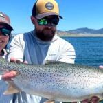
The trout are shifting from their deep-water summer haunts into shallower zones to aggressively pack on calories. Brown trout are particularly active as they prepare for their pre-spawn movements, displaying heightened aggression toward larger presentations.
Sleeper Pick: Northern Pike
Many anglers focus entirely on the gold-medal trout, completely bypassing the toothy predators lurking in the decaying vegetation. Pike are currently ambushing prey along the weed edges, utilizing the remaining cover before the vegetation fully dies back for the winter.
Baitfish Report
The forage base is currently dominated by juvenile yellow perch, crawfish, and the last significant hatches of Callibaetis and midges. Trout are keyed in on the crawfish along the rocky shorelines, while the pike are actively hunting the perch schools.
3. TACTICAL STRATEGY
Where
Focus your efforts on the northern shorelines near the dam and the submerged river channel drop-offs. The weedlines adjacent to the North Boat Ramp, specifically where the depth transitions from 8 to 14 feet, are holding significant numbers of cruising trout. For pike, target the decaying weed beds in the isolated coves on the southern edge, working the outer perimeter where the vegetation meets open water.
Lure Selection
For trout, articulated streamers are outperforming standard nymph rigs. A size 4 or 6 Autumn Splendor or an articulated Slumpbuster is highly effective. If you are spin casting, a 1/4oz Kastmaster or a Rapala Countdown (CD05) is the ticket. For the sleeper pike, upsize to a 5-inch soft plastic swimbait rigged on a 3/8oz jig head, or throw a classic loud spinnerbait.
Color
Water clarity is slightly stained from the seasonal turnover. For trout, lean heavily on copper, brown, and yellow combinations to mimic the abundant crawfish and perch fry. For pike, chartreuse and white or firetiger patterns are providing the necessary contrast to trigger reaction strikes.
Bait and Rigging
Note: This is a strictly artificial flies and lures only fishery. No organic bait, scent, or soft plastics with infused scent are permitted. Rig your streamers on a type 3 or type 5 sinking line to keep the fly in the strike zone longer. Use a short, stout leader—no longer than 7 feet of 2X or 3X fluorocarbon—to ensure solid hooksets on large fish. For pike, a wire bite tippet or heavy 40lb fluorocarbon shock leader is mandatory to prevent bite-offs.
Timing
The golden hours are dominating the bite. The first two hours of daylight provide the most aggressive surface and sub-surface action as fish push bait into the shallows. A secondary, highly productive window opens late in the afternoon, approximately two hours before sunset, especially if the wind lays down and allows for precise casting.
Pro Tip:When stripping streamers for these fall browns, employ a varied retrieve. A steady strip often results in followers, but adding a sudden, erratic pause mimics a dying baitfish and triggers the predatory instinct of a trailing trophy.
4. REGULATIONS SNAPSHOT
Tackle Restrictions: Artificial flies and lures only. No scented materials or organic baits of any kind.
Trout Limits: The daily bag and possession limit is one trout, which must be 20 inches or longer. All trout under 20 inches must be released immediately.
Northern Pike Limits: Unlimited. Anglers are highly encouraged to harvest all Northern Pike caught to protect the trout fishery.
Access: Day use only. The gates open and close according to seasonal hours posted at the entrance; ensure you are off the water and heading out before the evening closure.
5. REGIONAL ALTERNATIVE
The Dream Stream (South Platte River)
If the winds at the reservoir become unmanageable and unsafe for boating or shore casting, make the short drive downstream to the South Platte River section situated between Spinney Mountain and Eleven Mile reservoirs. This legendary tailwater offers refuge from the worst of the open-water gales.
Target Species: Migratory Brown Trout and Kokanee Salmon.
Tactical Approach: The fish here are highly pressured, requiring technical nymphing setups. Use a 9-foot 5X or 6X fluorocarbon leader. Target the deeper runs, seams, and the tail-outs of major pools. A two-fly rig featuring a size 18-20 red San Juan Worm or egg pattern trailed by a size 20-22 black Zebra Midge or RS2 is the standard recipe for success. Keep your indicators small and your mends clean to achieve the perfect drag-free drift.
Pro Tip:When fishing the tailwater alternative, approach the banks with extreme stealth. The water is often crystal clear, and heavy footfalls or casting shadows over the holding water will spook these educated fish before you even make your first cast.
Tight lines!
Editor's Choice: Must-Have Gear
FISHINGSIR Next-Gen Waterproof Chest Waders
★★★★★4.4 (7,370+ reviews)
2-Ply Tech: Upgraded nylon with 2.5x higher density than standard fabrics.
100% Waterproof: Lab-approved intrusion resistance with taped visible seams.
Ultra-Lightweight: Designed for all-day comfort while hunting or fishing.
As an Amazon Associate I earn from qualifying purchases. #ad
Loading forecast...
Live Fishing Conditions: Tides, Weather & Waves
Get real‑time tides, marine weather, swell and solunar activity for each spot so you know exactly when conditions line up for your best chance at a bite.
🎣
Colorado
Loading coordinates...
🌤️
WEATHER CONDITIONS
--°F
--°C
Loading...
🌡️
Feels Like--°F--°C
💧
Humidity--%
💨
Wind-- mph-- km/h
🧭
Direction--
📊
Pressure-- inHg-- hPa
☀️
UV Index--
🌊
MARINE CONDITIONS
🌊Wave Height
-- ft
-- m
Loading...
🧭Wave Direction
--°
Loading...
⏱️Wave Period
-- s
Loading...
📈Tide Status
-- ft
-- m
Loading...
🌙
LUNAR & SOLUNAR
🌕
Loading...
Illumination: --%
Major Period--:-- - --:----:-- - --:--
Minor Period--:-- - --:----:-- - --:--
🌅Sunrise--:--
🌇Sunset--:--
📅
24-HOUR FORECAST
Loading fishing conditions...
Fishing Spots Map
🎣
Book a Fishing Charter near Colorado Fishing Report Today 🎣
Local guides & charters. Verified captains, instant booking, best price guaranteed.
There was an error loading the map. Please try refreshing the page.
Info
Local Access & Facilities
Nestled between the rolling prairies of Western Kansas and the Continental Divide, this fishery represents the quintessential high-altitude Colorado experience. The angling environment here is defined by the dramatic granite walls of Eleven Mile Canyon and the sweeping vistas of South Park. Unlike the manicured reservoirs found closer to the Front Range, this area demands a degree of self-reliance and an appreciation for rugged topography. The South Platte River carves through this landscape, offering technical water that challenges even the most seasoned fly casters.
The atmosphere is distinctively alpine and raw. At elevations surpassing 8,500 feet, the air is thin, and the weather turns rapidly. You are trading concrete boat ramps for gravel aprons and cell service for solitude. The polished gray granite cliffs not only provide a stunning backdrop but also shelter the water from some of the harsher winds, creating unique microclimates for the hatch.
For the expert angler, the target list is diverse and rewarding. The cold, oxygenated flows support healthy populations of Rainbow, Brown, and Cutthroat Trout. In the nearby reservoirs and deeper pools, Kokanee Salmon and predatory Northern Pike patrol the depths. This is a fishery where understanding the relationship between the granite geology and the river's flow is key to locating the trophy holds.
Access & Getting There
Accessing the prime waters of this region requires navigating a mix of paved highways and rural county roads. The primary artery for the Eleven Mile Canyon area is Highway 24. From Lake George, you will turn onto County Road 96. Follow this road for approximately one mile before turning right into the canyon entrance. Be prepared for a scenic but slow drive; the road twists along the river, and wildlife crossings are frequent.
💡 Captain's Tip: Trailer Management
The infrastructure in Eleven Mile Canyon was not built for modern land yachts. Most parking aprons at Spillway and Cove campgrounds are gravel and cap out at 25 feet. If you are hauling a larger rig, scout your turnaround points on a map before committing to the narrower canyon roads.
For those targeting the Guffey Gorge (Paradise Cove) area, the approach involves County Road 11 (High Park Road) and Teller County Road 112. This is a rural agricultural zone. Traffic is generally light, but the roads can be deceptive. During the spring thaw or after afternoon thunderstorms, dirt sections can become slick. The descent into the gorge area involves a steep hill; ensure your brakes are in top condition if towing.
Parking requires a strategic approach, particularly at popular day-use sites like Guffey Gorge. This is a fee area with strictly designated parking. It is illegal to park on the county road, and enforcement is active. At the river access points within the National Forest, parking is often limited to gravel pull-outs. Early arrival, often before 7:00 AM during peak summer months, is necessary to secure a spot near the best holes.
Colorado Pre-Trip Checklist
Facilities & Amenities
Infrastructure in this region is "backcountry comfortable." You will not find full-service marinas with fuel docks or extensive ship stores on the water. Anglers must be self-sufficient regarding fuel; top off your tanks in Lake George, Salida, or Woodland Park before descending into the canyon or heading out to the remote stretches of South Park.
For tactical gear and local intelligence, the area is served by a few specialized outfitters. Tumbling Trout Outfitters in Lake George is the closest hub for the canyon angler. They are well-positioned for last-minute fly selection and river reports. For those coming from the west, The Next Eddy in Salida offers comprehensive support. These shops are not just retail points; they are information exchanges for current flow rates and hatch activity.
Shop Name
Specialization
Distance
Hours (Tue-Sat)
Tumbling Trout Outfitters
Fly fishing, river intel, gear
22.2 miles
7:00 AM – 4:00 PM
The Next Eddy
Full service outfitter, rentals
24.5 miles
9:00 AM – 5:00 PM
Lodging is primarily centered around camping, which puts you directly on the water for the dawn patrol. Spillway Campground is a strategic favorite for anglers, located near the dam base. It offers 23 reservable sites but note the lack of electrical hookups. Cove Campground is more primitive and intimate, ideal for those who want to wake up and cast immediately. Both feature vault toilets and hand pumps for water, but bringing a backup filtration system is always a pro move.
💡 Captain's Tip: Missing Amenities
There is no ice available at the boat ramps or campgrounds within the canyon. If you are keeping a limit of Kokanee or Trout, pack high-quality coolers with block ice from the highway towns before you enter the National Forest.
Permits, Regulations & Fees
This fishery is managed through a cooperation of state and federal agencies, primarily the US Forest Service (PSICC) and the state wildlife agency. Strict adherence to regulations ensures the sustainability of this high-pressure ecosystem. A valid Colorado fishing license is mandatory and must be carried at all times. Rangers actively patrol these waters, particularly near the campgrounds and day-use areas.
Specific zones have unique fee structures. Guffey Gorge is a day-use fee site, costing $6.00 per day. This fee pays for the maintenance of the vault toilets and trash service, which are critical in such a high-traffic swimming and fishing hole. Possession of alcohol is strictly prohibited at Guffey Gorge, a rule enforced to maintain a family-friendly and safe environment.
Anglers should be aware of "Kapu" or sacred/protected areas. The Florissant Fossil Beds National Monument is nearby; while primarily a geological site, it reminds visitors of the deep history of the land. Collecting specimens or disturbing rock features in the National Forest or Monument areas is a federal offense. Furthermore, the use of Unmanned Aircraft Systems (drones) is heavily regulated across the Pike and San Isabel National Forests. Unless you have a specific commercial permit, keep the drone in the truck to avoid hefty fines.
Events & Seasonal Information
The rhythm of this fishery is dictated by altitude and meltwater. Spring is a dynamic time; as the ice recedes, Bald Eagles are frequently spotted, and the water levels rise with the runoff. This is when the big Rainbows move, but the water can be stained and cold. Summer brings stable flows and the famous dry fly hatches that attract anglers from across the country. The "Golden Hour" here is not just about light; it is about the wind. The canyon walls can funnel afternoon gusts, so morning sessions are often the most productive for technical casting.
While large-scale boat tournaments are less common in the river sections, the seasonal runs of Kokanee Salmon in the late summer and early fall create a natural "tournament" atmosphere. Anglers line the deeper pools and reservoir inlets. During these windows, etiquette is paramount. Give your neighbor space, and be mindful of crossing lines in the current.
💡 Captain's Tip: Weather Watch
At 8,500 feet, UV exposure is extreme. Sun protection is not optional. Furthermore, summer afternoons often bring violent, fast-moving thunderstorms. If you see vertical cloud development over the peaks, get off the exposed water and seek lower ground immediately.
Contact Information & Resources
For the most current information on road closures, fire bans, and campsite availability, direct contact with the managing agencies is recommended. The Royal Gorge Field Office handles the BLM lands, including Guffey Gorge, while the Pike and San Isabel National Forests (PSICC) manage the canyon campgrounds.
Emergency Contacts: Royal Gorge Field Office: (719) 269-8500 Florissant Fossil Beds (NPS): (719) 748-3253 Campsite Management: (661) 702-1420
Cellular service is spotty to non-existent in the canyon bottoms. It is advisable to have a satellite messenger or leave a detailed float plan with someone on the "outside" before committing to a multi-day trip. For precise locations, boat ramp details, and real-time weather conditions, consult the live dashboard and interactive maps below.
Our spot reports combine data-driven forecasts with curated local information. The forecast is generated by our proprietary Fishing Score algorithm (0–100%), which analyzes real-time data from Open-Meteo API, validated against NOAA CO-OPS tide gauges and USGS water-monitoring stations. The model weights tide dynamics (35%), wave energy (25%), wind patterns (20%) and time of day (20%)—factors shown to influence fish feeding behavior through marine-biology research and decades of charter log data.
Access, facilities and services information for each fishing spot is sourced from official datasets such as Recreation.gov (RIDB), state park & wildlife agencies, and geospatial providers like Google Maps. These sections undergo scheduled re-validation every 3–6 months to ensure that boat ramps, park access, contact details and local services remain accurate.
Narrative sections (catches, seasonal behavior, local tips) are synthesized from these data sources and refined following the Fishing Reports Today editorial guidelines, combining bibliographic research from ichthyology and oceanography with expert angler experience. Our team reviews reports on a regular basis, while the forecast model itself updates every 6 hours for real-time accuracy.
⚠️ Important: Always verify current local regulations, access restrictions and weather conditions before fishing. These reports are intended as a planning aid, not a guarantee of catches or safety. When in doubt, contact local authorities or park managers listed on the page.
To provide the best experiences, we use technologies like cookies to store and/or access device information. Consenting to these technologies will allow us to process data such as browsing behavior or unique IDs on this site. Not consenting or withdrawing consent, may adversely affect certain features and functions.
Functional Always active
The technical storage or access is strictly necessary for the legitimate purpose of enabling the use of a specific service explicitly requested by the subscriber or user, or for the sole purpose of carrying out the transmission of a communication over an electronic communications network.
Preferences
The technical storage or access is necessary for the legitimate purpose of storing preferences that are not requested by the subscriber or user.
Statistics
The technical storage or access that is used exclusively for statistical purposes.The technical storage or access that is used exclusively for anonymous statistical purposes. Without a subpoena, voluntary compliance on the part of your Internet Service Provider, or additional records from a third party, information stored or retrieved for this purpose alone cannot usually be used to identify you.
Marketing & Affiliates
The technical storage or access is required to create user profiles to send advertising, or to track the user on a website or across several websites for similar marketing purposes, including affiliate tracking for products recommended in our reports.



Leave a Reply