
The Saguaro Lake Fishery: A Tonto Basin Oasis
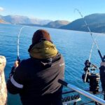
Set against a dramatic backdrop of rugged bluffs and the iconic Sonoran Desert skyline, Saguaro Lake represents a complex and rewarding fishery for the serious angler. Located just outside Mesa, Arizona, this reservoir on the Salt River offers a stark and beautiful contrast between the arid, cactus-studded landscape and the deep, cool waters that harbor significant game fish populations. For the experienced captain, the appeal here lies in the diversity of the structure; the lake features deep holes, submerged canyon walls, and riparian areas lined with cottonwoods and eel grass that provide prime ambush points for bass and trout.
The atmosphere at Saguaro Lake changes with the miles. Near the main launch areas, the energy is palpable, often busy with recreational boaters and day-trippers. However, as you navigate away from the primary marina zones toward the river end or tucked-away coves, the vibe shifts to the solitude of the Tonto National Forest. The topography here is unforgiving but majestic, with the Bulldog Cliffs casting long shadows over the water. This is not a manicured urban pond; it is a desert canyon reservoir where wind and heat dictate the day's strategy as much as the fishfinder.
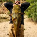
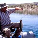
Target species here primarily include largemouth bass, which thrive in the eel grass and rock piles, and rainbow trout, often stocked and holdover in the cooler depths. The presence of the Lower Salt River connection ensures a steady flow and oxygenation that keeps the bite active even when valley temperatures soar. Whether you are flipping jigs into the heavy cover of the riparian shoreline or trolling deep channels near the dam, Saguaro Lake demands technical skill and local logistical knowledge.
Access & Getting There
Reaching Saguaro Lake requires navigating the Bush Highway, a scenic but heavily trafficked artery connecting the eastern Phoenix metro area to the Tonto National Forest. From Mesa, the most direct route involves taking Power Road northbound until it transitions into the Bush Highway. This route is paved and generally wide, suitable for towing larger bass boats or center consoles. However, captains should be aware that this road is a popular scenic drive, and traffic can bottleneck significantly on weekends, particularly during the wildflower season or when river floaters are active.
💡 Captain's Tip: The Apache Trail Challenge
While State Route 88, known as the Apache Trail, offers access to upper reaches and nearby Canyon Lake, it is notorious for being narrow with sharp, blind curves. If you are towing a rig longer than 20 feet, exercise extreme caution. Traffic can be heavy, and the shoulders are non-existent in many stretches.
For those targeting the upper lake or looking to launch near the river mouth, access points like the Larry Forbis Day Use Group Site are critical. Located approximately 3.2 miles from the main lake body, this site is accessed via a double-sided gate off the Bush Highway. Note that this specific access is seasonal and gated; you must have the combination provided with a reservation to enter. For general boat launching, the primary ramps are located near the main marina area, roughly 1,700 feet from the central coordinates of the lake. These ramps are paved but can become slick with algae, and the angle varies with the reservoir's water level.
Parking is a strategic consideration here. The Salt River Wild Horse Viewing Parking area is located about 3.1 miles away and offers a staging ground if you are meeting crew, but it is not a launch site. At facilities like Larry Forbis, parking is strictly limited to 10 designated vehicles per group reservation. If you are launching at the main ramps during peak season (April through September), the lots fill rapidly. Dawn patrol is not just a fishing strategy here; it is a parking necessity. Arriving after 6:00 AM often results in being turned away or forced to park miles from the water.
💡 Captain's Tip: Weather Contingencies
During the summer monsoon season (July-September), violent thunderstorms can roll over the Bulldog Cliffs with little warning. The geography of the canyon funnels wind, creating dangerous chop instantly. Always have an escape plan to a leeward cove or the marina when you see towering cumulus clouds building over the Superstition Mountains.
Saguaro Lake Pre-Trip Checklist
Facilities & Amenities
The infrastructure around Saguaro Lake is specialized and seasonal, requiring anglers to plan their logistics carefully. There is no comprehensive "superstore" at the water's edge. For bait and tackle, your last reliable stops are well before you hit the water. Liar's Korner Bait and Tackle Shop is located approximately 12.5 miles away in Mesa and is a staple for live bait and local intelligence. Further out, DD26 Fishing in Gilbert (19.3 miles) offers high-end gear. Do not expect to find specialized heavy tackle or specific electronics parts once you are on the Bush Highway.
Camping and lodging options are distinctively seasonal. Tortilla Campground, located about 8.2 miles away on AZ-88, is a winter-only facility, operating from October through April. It offers 30 sewage hookups and can accommodate RVs up to 32 feet, making it an excellent base camp for winter trout fishing. Conversely, the Larry Forbis Day Use Group Site is a summer-focused facility (April through September), designed for day trips rather than overnight stays. It features ramadas, grills, and vault toilets but no electricity or water hookups for boats.
For those seeking a more robust camping experience, Lost Dutchman State Park is 8.3 miles away and offers high-quality sites with proximity to the Superstition Wilderness, though it is not water-adjacent. If you require luxury accommodations or are hosting clients who prefer a resort experience, you must look toward Scottsdale. The Four Seasons Resort Scottsdale and The Phoenician are over 20 miles away, meaning a significant commute to the launch ramp in the morning.
💡 Captain's Tip: Fuel Logistics
While there are marinas in the Tonto Basin chain, relying on on-water fuel can be risky due to seasonal hours or pump outages. The prudent skipper fuels up in Mesa or Apache Junction before ascending the Bush Highway. There are no gas stations immediately adjacent to the remote ramp access points.
| Facility Name | Type | Seasonality | Key Features |
|---|---|---|---|
| Tortilla Campground | Winter Camping | Oct - April | RV access (32ft), sewage hookups, near Canyon Lake. |
| Larry Forbis Group Site | Day Use | April - Sept | River access, ramadas, gated entry, group capacity 75. |
| Burnt Corral Campground | Camping/Boat Launch | Year-round | Note: Access from Tortilla Flat is CLOSED. Detour via AZ-188. |
| Butcher Jones | Shore Access | Year-round | Family-friendly shore fishing, hiking trails. |
Permits, Regulations & Fees
Fishing and boating in the Tonto National Forest are governed by strict regulations designed to protect the fragile high-desert ecosystem and the cultural heritage of the area. A valid Arizona fishing license is mandatory for all anglers. Additionally, the Tonto Pass is generally required for parking and day use at developed recreation sites, including boat ramps and shoreline access points like Butcher Jones. These passes must be purchased in advance at local vendors, as automated machines at the sites are not always reliable.
Anglers must be aware of specific closures. The Goldfield Recreation Area, located northeast of Apache Junction, is currently closed to all entry for development. This affects access near Hackamore and Nodak Roads. Do not attempt to traverse this area to reach fishing spots. Furthermore, the Burnt Corral Campground and recreation site, while open, cannot be reached via the traditional Apache Trail (AZ-88) from Tortilla Flat due to road closures. Access requires a significant detour via AZ-188 and Globe, a critical detail for anyone planning a multi-lake trip.
The area surrounding Saguaro Lake is rich in history, home to the Salado culture who occupied the Tonto Basin centuries ago. The nearby Tonto National Monument protects cliff dwellings dating back to 1300 CE. Anglers exploring the shoreline or hiking to remote spots should treat all archaeological finds with "Kapu"—a sense of sacred restriction and respect. Removing artifacts or defacing rock walls is a severe federal offense. Respect private property boundaries, particularly near the wild horse viewing areas, and maintain a safe distance from the wildlife.
Events & Seasonal Information
The rhythm of Saguaro Lake is dictated by the extreme temperature fluctuations of the Sonoran Desert. The "high season" for human comfort is late fall through early spring, coinciding with the operation of winter campgrounds like Tortilla. During these months, trout stocking is common, and anglers can comfortably fish through the midday hours. However, this is also when the Apache Trail sees its heaviest tourist traffic, making trailering a boat a test of patience.
Summer brings the "dawn patrol" season. From May through September, temperatures routinely exceed 100°F. Serious anglers launch well before sunrise to target bass in the shallows before the sun drives the fish—and the fishermen—into the deep shade. This is also the season for river floaters and wakeboarders, turning the main basin into a washing machine by 10:00 AM. The Larry Forbis site is active during this window, catering to groups looking to escape the urban heat near the cool water of the Lower Salt River.
💡 Captain's Tip: Seasonal Road Alert
The closure of AZ-88 east of Tortilla Flat is a long-term situation. Do not trust older GPS data that routes you through the unpaved section to Apache Lake or Burnt Corral. The detour involves looping through Globe via US-60 and AZ-188, adding hours to the transit.
Contact Information & Resources
For the most current information on lake levels, ramp conditions, and fire restrictions, direct communication with the managing agencies is essential. The Mesa Ranger District manages the immediate area around Saguaro Lake and Tortilla Campground.
- Mesa Ranger District: (480) 610-3300
- Tonto Basin Ranger District: (602) 225-5395 (For Apache Lake/Burnt Corral inquiries)
- Tonto National Monument: (928) 467-2241
In the event of an emergency, cell service can be spotty in the canyons. A public cellular credit card phone is available at Tortilla Flat for 911 calls. Self-reliance is key; carry ample water, a first aid kit, and basic tools for both your vessel and your tow vehicle.
For precise locations, real-time weather conditions, and detailed maps of the boat ramps and amenities discussed, consult the live dashboard and interactive widgets below.


Leave a Reply