Verdict: CAUTION - TIME RESTRICTIONS STRONGLY ADVISED
With surface water temperatures pushing into the upper 80s and low 90s, and daytime air temperatures regularly exceeding 105 degrees, daytime fishing on Lake Pleasant has become physically taxing and highly unproductive. The lake is firmly entrenched in its peak summer pattern. A distinct thermocline has developed, pushing fish into deeper, cooler water during the sunlit hours. Recreational boating traffic, especially on weekends, creates significant chop and noise that further suppresses the daytime bite.
However, if you adjust your biological clock, the fishing is absolutely spectacular. Anglers willing to launch at 4:00 AM or fish through the night are being rewarded with some of the most consistent warm-water action in the state. Stable Central Arizona Project (CAP) water levels have kept the baitfish schools highly predictable. If you are launching between 9:00 AM and 5:00 PM, my advice is to stay home. If you are fishing the graveyard shift or the dawn patrol, you have a green light for an excellent outing.
🎣Nautrek
Private Beta
J
M
R
100+ anglers on the waitlist
The fishing network where your reputation matters.
Find trusted captains, join real trips with cost splitting, and build your Angler Rank. Your spots stay private — you decide who sees your intel.
Pro Tip:Hydration and sun protection are not optional out here right now. Bring twice as much water as you think you need, and if you are pushing into the mid-morning hours, a bimini top or sun shade is a mandatory safety feature.
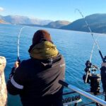
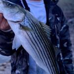
Stripers are currently the undisputed kings of Lake Pleasant. They are heavily schooled and aggressively pushing massive balls of threadfin shad toward the surface during the low-light hours. Once the sun breaks the horizon, these schools retreat to the 20 to 55-foot depth ranges, relating heavily to the thermocline and main lake structure.
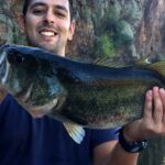
Secondary Target: Largemouth Bass
The daytime largemouth bite is notoriously tough right now, but the nighttime and twilight windows remain highly productive. The fish have abandoned the shallow, flooded salt cedars and are now stacked on offshore structure, submerged brush, and steep rocky drop-offs in 15 to 25 feet of water.
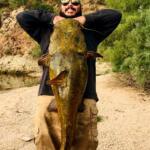
Sleeper Pick: Flathead Catfish
Most anglers ignore the whisker fish to chase boiling stripers, but the after-dark flathead bite is exceptional right now. Pushing deep into the northern coves and setting up near submerged creek channels with live bait is yielding some true desert monsters.
Baitfish Report: Threadfin Shad
Threadfin shad are the primary forage driving the entire ecosystem. They are currently suspended over deep water creek channels and congregating near main lake reefs. Matching the hatch requires downsizing your presentations to match the 2-inch to 3-inch profile of the current shad crop.
3. TACTICAL STRATEGY
To succeed on Lake Pleasant right now, you need to separate your strategy into two distinct windows: the low-light frenzy and the deep-water grind.
Where to Find Them
For early morning stripers, position your boat around the main lake humps and islands near Castle Creek and Pipeline Canyon. Keep your eyes peeled for surface boils. For largemouth bass, focus your efforts on the steep ledges and submerged brush piles in Humbug Creek and the deeper marina structures near Pleasant Harbor. Look for the 15 to 25-foot depth contour where the thermocline intersects with physical structure.
Lure Selection
When the stripers are boiling at first light, a walking topwater bait is deadly. The River2Sea Whopper Plopper 90 or a Zara Spook are perfect choices. Once the sun comes up and the fish move deep, transition to vertical jigging with a 1/2 ounce to 3/4 ounce jigging spoon. For largemouth, a finesse drop shot rig is absolutely mandatory. Use a 1/4 ounce tungsten teardrop weight to get down quickly through the water column.
Color Patterns
Water clarity in the main lake is remarkably clear right now. For topwater baits, stick to bone, translucent clear, or white patterns that mimic dying shad. For your drop shot plastics, natural desert tones are outperforming everything else. Morning Dawn, Green Pumpkin, and Pumpkin Punisher are the exact colors generating strikes from pressured fish.
Bait and Rigging
If you are targeting flathead catfish at night, live bluegill (caught legally on-site) or large chunks of cut carp are the ticket. Rig these on a slip-sinker rig with a 6/0 to 8/0 circle hook, allowing the bait to rest right on the bottom near the edges of submerged river channels.
Timing the Bite
I cannot stress this enough: timing is everything. The topwater window is incredibly brief, often lasting only from first light until about 45 minutes after sunrise. The nighttime bite is consistent from 9:00 PM until 3:00 AM, especially during a stable moon phase. Midday fishing is a waste of time and a risk to your health.
Pro Tip:Modern forward-facing sonar is a game-changer right now. When the topwater bite dies, use your electronics to scan the 20 to 30-foot depth range off main lake points. If you see suspended fish refusing to bite, drop a small finesse minnow directly on their noses and shake it gently without moving the weight.
4. REGULATIONS SNAPSHOT
Before hitting the water, ensure you are compliant with the current Arizona Game and Fish Department regulations for Lake Pleasant:
Largemouth and Smallmouth Bass: The daily bag limit is 6 fish in any combination.
Striped Bass: There is no daily bag limit and no possession limit for striped bass at Lake Pleasant. The department encourages anglers to harvest as many as possible to manage the population.
White Bass: There is no daily bag limit and no possession limit.
Catfish (Channel and Flathead): The daily bag limit is 10 fish in any combination.
Crappie: The daily bag limit is 15 fish.
Live Bait: Watercraft users must follow all aquatic invasive species protocols. Do not transport live baitfish away from the lake.
5. REGIONAL ALTERNATIVE
If the extreme heat, massive weekend boat wakes, or deep-water technical fishing at Lake Pleasant sounds unappealing, your best regional fallback is to pivot to the urban canal systems or the Salt River chain, specifically Saguaro Lake.
While Saguaro Lake also experiences high summer temperatures, its canyon walls provide significantly more shade during the early morning and late afternoon hours, granting you a slightly longer window of comfortable fishing. Access via the Saguaro del Norte recreation area puts you right into prime territory. Instead of hunting deep-water stripers, you can target largemouth bass by flipping Texas-rigged creature baits into the dense tule reeds and shaded pockets along the shoreline. The boat traffic can still be heavy, but the canyon geography forces a different style of fishing that many anglers find less frustrating than scanning open water for suspended fish.
Tight lines!
Editor's Choice: Must-Have Gear
FISHINGSIR Next-Gen Waterproof Chest Waders
★★★★★4.4 (7,370+ reviews)
2-Ply Tech: Upgraded nylon with 2.5x higher density than standard fabrics.
100% Waterproof: Lab-approved intrusion resistance with taped visible seams.
Ultra-Lightweight: Designed for all-day comfort while hunting or fishing.
As an Amazon Associate I earn from qualifying purchases. #ad
Loading forecast...
Live Fishing Conditions: Tides, Weather & Waves
Get real‑time tides, marine weather, swell and solunar activity for each spot so you know exactly when conditions line up for your best chance at a bite.
🎣
Lake Pleasant, Phoenix
Loading coordinates...
🌤️
WEATHER CONDITIONS
--°F
--°C
Loading...
🌡️
Feels Like--°F--°C
💧
Humidity--%
💨
Wind-- mph-- km/h
🧭
Direction--
📊
Pressure-- inHg-- hPa
☀️
UV Index--
🌊
MARINE CONDITIONS
🌊Wave Height
-- ft
-- m
Loading...
🧭Wave Direction
--°
Loading...
⏱️Wave Period
-- s
Loading...
📈Tide Status
-- ft
-- m
Loading...
🌙
LUNAR & SOLUNAR
🌕
Loading...
Illumination: --%
Major Period--:-- - --:----:-- - --:--
Minor Period--:-- - --:----:-- - --:--
🌅Sunrise--:--
🌇Sunset--:--
📅
24-HOUR FORECAST
Loading fishing conditions...
Fishing Spots Map
🎣
Book a Fishing Charter near Lake Pleasant, Phoenix Fishing Report Today 🎣
Local guides & charters. Verified captains, instant booking, best price guaranteed.
There was an error loading the map. Please try refreshing the page.
Info
Local Access & Facilities
An Oasis in the Hieroglyphic Mountains
Lake Pleasant serves as the crown jewel of water recreation for the North Phoenix valley, offering a stark, beautiful contrast between the arid Sonoran Desert landscape and deep, cool waters. Fed by the Central Arizona Project and held back by the massive New Waddell Dam, this reservoir is far more than a simple storage tank; it is a dynamic, 10,000-acre fishery that demands respect and strategy from serious anglers. The lake is framed by the rugged Hieroglyphic Mountains, creating a backdrop of red dirt and black lava rock that glows intensely during the dawn patrol hours favored by local pros.
For the seasoned captain, Lake Pleasant represents a unique challenge of depth and structure. Unlike the shallower, weed-choked ponds found elsewhere in the state, this is a deep-water canyon reservoir. The topography is steep, plunging rapidly from the rocky shorelines into significant depths where striped bass schools roam. The water here is typically clear, requiring light fluorocarbon leaders and finesse presentations, particularly when targeting the lake's pressured largemouth and white bass populations. The "vibe" here shifts dramatically from a quiet, tactical fishery at sunrise to a high-energy recreational hub by noon, making timing the most critical element of a successful trip.
The primary draw for sportfishing fleets here involves the "big three": Striped Bass, Largemouth Bass, and White Bass. While Channel Catfish and Black Crappie also inhabit these waters, the adrenaline of chasing boiling stripers or working the submerged structural elements for a double-digit largemouth is what brings the dedicated boats up Interstate 17. With 114 miles of shoreline to explore, there is ample room to escape the pressure, provided you have the navigation skills to work the northern arms of the lake.
Access & Getting There
Reaching Lake Pleasant requires a straightforward but strategic approach, especially for those towing heavy fiberglass. The primary artery for access is State Route 74, locally known as the Carefree Highway. Most anglers coming from the Phoenix metro area will shoot north on Interstate 17 before cutting west on SR-74. From there, the turn onto Castle Hot Springs Road leads you directly into the heart of the park's main access points. While the highways are generally wide and trailer-friendly, traffic on I-17 can be a bottleneck on Friday afternoons and Sunday evenings.
💡 Captain's Tip: The "Dawn Patrol" Commute
Traffic on the Carefree Highway can be deceptively fast. However, seasoned locals know that boat traffic lines up at the entry station well before sunrise on weekends. To maximize your time with lines in the water, aim to clear the entry gate by 5:00 AM during the summer months.
The launch infrastructure at Lake Pleasant is among the best in the Southwest, specifically designed to handle high-volume recreational traffic. The reservoir boasts a massive 10-lane boat ramp located on the western shore. This is not a cramped, single-lane ordeal; it is a wide, well-maintained concrete expanse that allows for efficient multiple-vessel launching. However, the sheer size of the ramp can lead to chaotic scenes during peak hours. Solo skippers should be particularly cautious of novice boaters who may struggle with trailer maneuvering on the wide apron. The ramp angle is generally consistent, but during extreme low water levels—common in Western reservoirs—the end of the concrete can become slick with algae.
Parking is abundant but not infinite. The facility provides designated parking for approximately 200 vehicles with trailers. While this sounds substantial, the lot fills rapidly during the spring striper run and summer weekends. Overflow parking is available, but it often involves a significant hike back to the ramp, which is less than ideal after a long day in the desert heat. Security is generally good within the park boundaries, with regular patrols by Maricopa County staff, but standard precautions regarding gear left in truck beds should always be observed.
Weather is the single biggest variable dictating access on Lake Pleasant. Because the lake sits in a canyon depression surrounded by the Hieroglyphic Mountains, it acts as a wind tunnel. When the afternoon thermals kick up, usually around 11:00 AM, the central basin can transform from glass to whitecaps in minutes. The 10-lane ramp is somewhat exposed to the prevailing fetch. If the wind is howling out of the west or southwest, retrieving a boat can become a white-knuckle experience. Experienced captains will often opt to launch and retrieve early to avoid the afternoon "washing machine" conditions.
Lake Pleasant, Phoenix Pre-Trip Checklist
Facilities & Amenities
The infrastructure at Lake Pleasant is bifurcated: excellent on-water facilities and camping, but a notable lack of specialized tackle retail immediately adjacent to the water. The Pleasant Harbor Marina is a full-service operation capable of handling 1,000 boats, offering fuel and basic supplies. However, for specialized angling needs, you are largely on your own once you pass the park gate. This is a "bring what you need" fishery.
One critical piece of "negative knowledge" for the traveling angler is the distance to quality bait and tackle shops. There are no high-end pro shops located directly on the shoreline. The closest reliable outfitter, Basstackle LLC, is located approximately 15.6 miles away in Phoenix. Similarly, The Stock Shop is roughly 16.8 miles from the water. If you break a rod tip or run out of live bait, it is a minimum 40-minute round trip to rectify the situation. You must verify your gear manifest before leaving the pavement of the city.
💡 Captain's Tip: Fuel Logistics
While there is a marina with fuel pumps, prices on the water are significantly higher than on land. The smart play is to top off your vessel and tow vehicle at the stations along Carefree Highway before entering the park limits.
For multi-day excursions, the lodging options are tailored toward the RV and camping crowd rather than hotel dwellers. The Roadrunner Campground and Desert Tortoise Campground are located directly within the park, offering immediate access to the water. These are not primitive gravel patches; many sites offer hookups and paved pads. For those seeking luxury, the JW Marriott Phoenix Desert Ridge Resort & Spa is the nearest high-end hotel, but it sits over 20 miles away, making it a poor choice for those targeting a first-light bite. The table below outlines key facilities for planning your logistics.
Facility Name
Type
Distance from Water
Key Features
Basstackle LLC
Tackle Shop
15.6 miles
Specialized bass gear, open 8 AM - 3 PM.
Roadrunner Campground
Lodging
On-Site (0.4 miles)
Paved sites, close to ramp, 4.6-star rating.
Desert Tortoise Campground
Lodging
On-Site (1.9 miles)
Camping, park managed, scenic views.
Pleasant Harbor Marina
Marina
On-Site
Fuel, 1,000 slips, general supplies.
No-Limit-Fishing
Charter
2.5 miles
Local guide service, 24-hour availability listed.
A unique feature of the area surrounding Lake Pleasant is the presence of several recreational shooting sites managed by the Bureau of Land Management (BLM). Sites like Saddleback Mountain and Baldy Mountain are located within a few miles of the lake. It is crucial for anglers to understand that these are designated areas for long-range rifle shooting. The noise from these ranges can sometimes be heard from the western arms of the lake, but they do not interfere with water access. Note that these ranges strictly prohibit shotguns and pistols; they are for precision rifle use only.
Permits, Regulations & Fees
Navigating the bureaucracy of Lake Pleasant is relatively simple, but compliance is strictly enforced. The lake falls under the jurisdiction of Maricopa County Parks & Recreation, while the fishery itself is managed by the Arizona Game and Fish Department. This means you are dealing with two separate fee structures: one for entering the park and launching your boat, and another for the privilege of fishing.
A valid Arizona state fishing license is mandatory for any angler 10 years of age or older. These can be purchased online or at the distant tackle shops mentioned earlier, but they are generally not sold at the park entry gate. Do not tow your boat all the way to the ramp assuming you can buy a license at the kiosk. The park entry fee is per vehicle and per watercraft. These fees contribute to the maintenance of the high-quality ramps and the clean restrooms found at the Ringtail Day Use Area and other access points.
💡 Captain's Tip: The Two-Pass System
Remember that your "Annual Park Pass" for Maricopa County covers entry, but often does not cover the boat launch fee. Ensure you have the specific "Watercraft" add-on or be prepared to pay the daily launch fee at the automated kiosks.
Conservation and cultural respect are paramount here. The area borders the Hell's Canyon Wilderness, a 9,951-acre protected area in the Hieroglyphic Mountains. While motorized vehicles are prohibited within the wilderness boundaries, the shoreline adjacent to these areas is sensitive. Anglers pushing deep into the creek arms should be mindful of "Kapu" or respectful behavior regarding the land. The mix of federal BLM land, county park land, and state waters creates a patchwork of regulations, but the rule of thumb is simple: Leave No Trace. The desert ecosystem is fragile; trash left on the red dirt shoreline stays there for decades.
Events & Seasonal Information
Lake Pleasant operates on a distinct seasonal rhythm driven by the extreme Arizona climate. The "high season" for human activity is summer, but for serious anglers, the heat dictates a nocturnal schedule. From June through September, the best fishing occurs under the lights. This is when the striper boil activity is at its peak, often occurring in the coolest part of the night or the very first grey light of dawn. During these months, recreational boat traffic (wakeboarders and jet skis) makes daytime fishing on the main lake nearly impossible.
Winter changes the dynamic entirely. The jet skis disappear, and the lake becomes the domain of the serious bass angler. The water cools, and the largemouth bass move to deeper structure. This is tournament season. Local clubs and regional circuits frequently utilize the 10-lane ramp for weigh-ins. If you are planning a trip between November and March, check the tournament schedules. A 100-boat tournament launch at 6:00 AM can clog the facility for an hour, delaying your recreational launch.
The transition periods—Spring and Fall—offer the best balance. The Billfish mentioned in ocean contexts obviously don't apply here, but the "Striped Bass run" in the spring mimics a saltwater blitz. Schools of white bass and stripers push shad into the coves, creating frantic surface action that can be seen from hundreds of yards away. This is the time to have topwater lures tied on and ready.
Contact Information & Resources
For the most current information on water levels, ramp closures, or fire restrictions, direct communication with the managing agencies is recommended. Maricopa County Parks & Recreation can be reached at 602-372-7460 or via email at lakepleasant@mail.maricopa.gov. They maintain the physical facilities and are the best source for questions regarding camping availability or ramp status.
For emergencies on the water, standard maritime VHF channels are monitored, but cell service is generally reliable on the main body of the lake. In immediate danger, dial 911. For non-emergency wildlife issues or regulatory questions, the Arizona Game and Fish Department is the authority. Self-reliance is key; always carry ample water and sun protection, as the desert sun is unforgiving even in winter.
For precise locations of the boat ramps, the specific coordinates of the deep-water marinas, and real-time weather conditions affecting the reservoir, consult the live dashboard and interactive maps below.
Our spot reports combine data-driven forecasts with curated local information. The forecast is generated by our proprietary Fishing Score algorithm (0–100%), which analyzes real-time data from Open-Meteo API, validated against NOAA CO-OPS tide gauges and USGS water-monitoring stations. The model weights tide dynamics (35%), wave energy (25%), wind patterns (20%) and time of day (20%)—factors shown to influence fish feeding behavior through marine-biology research and decades of charter log data.
Access, facilities and services information for each fishing spot is sourced from official datasets such as Recreation.gov (RIDB), state park & wildlife agencies, and geospatial providers like Google Maps. These sections undergo scheduled re-validation every 3–6 months to ensure that boat ramps, park access, contact details and local services remain accurate.
Narrative sections (catches, seasonal behavior, local tips) are synthesized from these data sources and refined following the Fishing Reports Today editorial guidelines, combining bibliographic research from ichthyology and oceanography with expert angler experience. Our team reviews reports on a regular basis, while the forecast model itself updates every 6 hours for real-time accuracy.
⚠️ Important: Always verify current local regulations, access restrictions and weather conditions before fishing. These reports are intended as a planning aid, not a guarantee of catches or safety. When in doubt, contact local authorities or park managers listed on the page.
To provide the best experiences, we use technologies like cookies to store and/or access device information. Consenting to these technologies will allow us to process data such as browsing behavior or unique IDs on this site. Not consenting or withdrawing consent, may adversely affect certain features and functions.
Functional Always active
The technical storage or access is strictly necessary for the legitimate purpose of enabling the use of a specific service explicitly requested by the subscriber or user, or for the sole purpose of carrying out the transmission of a communication over an electronic communications network.
Preferences
The technical storage or access is necessary for the legitimate purpose of storing preferences that are not requested by the subscriber or user.
Statistics
The technical storage or access that is used exclusively for statistical purposes.The technical storage or access that is used exclusively for anonymous statistical purposes. Without a subpoena, voluntary compliance on the part of your Internet Service Provider, or additional records from a third party, information stored or retrieved for this purpose alone cannot usually be used to identify you.
Marketing & Affiliates
The technical storage or access is required to create user profiles to send advertising, or to track the user on a website or across several websites for similar marketing purposes, including affiliate tracking for products recommended in our reports.


Leave a Reply