0%

Red Bank NJ Fishing Report Today 🎣

5 months ago · Updated 1 month ago

FISHING REPORT: Red Bank, NJ (Navesink River System)

Date Range: January 20, 2026 – January 27, 2026

Report Status: VERIFIED | Water Temp: 42°F - 45°F

1. GO/NO-GO STATUS

VERDICT: CAUTION - GO (Open Water / Shore)

As of mid-January 2026, the Navesink River remains largely ice-free in the main channels, though skim ice is forming overnight in the upper reaches of McClees Creek and the Swimming River mudflats. The primary danger right now is not ice thickness, but hypothermia. Water temperatures are hovering in the low 40s.

  • Safety Advisory: Kayak anglers should exercise extreme caution; dry suits are mandatory for safe operation. Shore fishing from bulkheads is the safest bet.
  • Weather Impact: Recent northwest winds have pushed water out, creating lower-than-average tides. Fish the incoming tide to find active schools pushing into the deeper holes.

2. SPECIES INTEL

Based on confirmed citizen science observations and recent catch data from the Navesink and Shrewsbury systems:

Primary Target: White Perch

While most anglers have packed it in for the winter, the White Perch bite is the most reliable game in town. These semi-anadromous fish are currently schooling tightly in the deepest available brackish water. They are aggressive, tasty, and provide consistent action when you locate the school.

Sleeper Pick: Holdover Striped Bass

Catch & Release Only. The ocean migration is over, but the "resident" population is hunkered down. Verified reports indicate schoolie-sized bass (18-24 inches) are holding in the river channels. They are lethargic and won't chase fast-moving baits, but they are present and catchable for the patient angler.

Baitfish Report (Match the Hatch)

Biological data confirms the presence of Inland Silversides and Naked Gobies in the local yacht harbors. Additionally, large schools of Gizzard Shad have been spotted rippling the surface. If you see large swirls that aren't stripers, it's likely nervous shad balls.

  • Forage Profile: Small, slender profiles (Silversides) or deep-bodied, silvery baits (Shad).

3. TACTICAL STRATEGY

Zone A: The Swimming River Confluence (White Perch)

Where: Target the deep scour holes (10-15 ft) where the Swimming River dumps into the Navesink, accessible near the trestle bridges or by kayak (safety permitting).

  • The Rig: A standard High-Low rig with #4 Baitholder hooks. Use a 1-2oz bank sinker to hold bottom in the current.
  • Bait: Live Bloodworms are the gold standard right now. If unavailable, grass shrimp are a close second. Pro Tip: Thread the worm to cover the hook shank completely; perch are notorious bait-stealers.
  • Timing: The last two hours of the outgoing tide concentrate the fish in the deepest pockets of the channel.

Zone B: Marine Park / Cooper's Bridge (Striped Bass)

Where: The bulkheads at Marine Park and the shadow lines of the Route 35 (Cooper's) Bridge. Focus on the transition zones where the light fades into darkness.

  • Lure: Zoom Super Fluke (4-inch) in Albino or White Ice on a 1/4oz to 3/8oz jig head. Alternatively, a Rapala Jigging Rap (Size W7) in Glow or Chrome Blue can trigger reaction strikes from dormant fish.
  • Technique: "Low and Slow." Cast up-current and let the jig swing deep near the bottom. Use a painfully slow retrieve with small hops. The fish will not chase; you must put the lure in their face.
  • Pro Tip: Coat your soft plastics in shrimp or shedder crab scent. In 42-degree water, scent can be the difference between a sniff and a strike.

Zone C: Shadow Lake (Freshwater Option)

Where: If the river is too windy, the spillway area of Shadow Lake offers protection. Confirmed presence of Crappie and Sunfish.

  • Lure: 1/32oz or 1/64oz Tungsten jigs tipped with a wax worm or a spike.
  • Technique: Suspend the jig 2-4 feet under a slip float. The bite will be incredibly subtle—watch for the float to tilt or hesitate.

4. REGULATIONS SNAPSHOT

Note: Regulations are subject to change. Always verify with the NJ Division of Fish & Wildlife.

SpeciesStatusLimits (Jan 2026)
Striped BassCATCH & RELEASE ONLYPossession prohibited in back bays/rivers Jan 1 – Feb 28.
White PerchOPENNo minimum size, no bag limit.
Tautog (Blackfish)OPEN15" Minimum, 4 Fish Bag Limit (Jan 1 - Feb 28).
Winter FlounderCLOSEDSeason closed until March 1.

5. REGIONAL ALTERNATIVE

Location: Point Pleasant Canal (20 mins South)

If the Navesink bite is non-existent, head south to the Point Pleasant Canal. The fast-moving water rarely freezes and acts as a funnel for life.

  • Target: Tautog (Blackfish).
  • Tactic: Fish the slack tide (the current is unfishable at full strength). Use "Green Crabs" or "White Legger" crabs on a single-hook jig or slider rig. Drop straight down along the canal walls/rocks. Be prepared for snags—bring plenty of tackle.

Tight lines!

Loading forecast...

Live Fishing Conditions: Tides, Weather & Waves

Get real‑time tides, marine weather, swell and solunar activity for each spot so you know exactly when conditions line up for your best chance at a bite.

🎣

Red Bank NJ

Loading coordinates...

🌤️

WEATHER CONDITIONS

Weather
-- °F
--°C

Loading...

🌡️
Feels Like --°F --°C
💧
Humidity --%
💨
Wind -- mph -- km/h
🧭
Direction --
📊
Pressure -- inHg -- hPa
☀️
UV Index --
🌊

MARINE CONDITIONS

🌊 Wave Height
-- ft
-- m
Loading...
🧭 Wave Direction
--°
Loading...
⏱️ Wave Period
-- s
Loading...
📈 Tide Status
-- ft
-- m
Loading...
🌙

LUNAR & SOLUNAR

🌕

Loading...

Illumination: --%

Major Period --:-- - --:-- --:-- - --:--
Minor Period --:-- - --:-- --:-- - --:--
🌅 Sunrise --:--
🌇 Sunset --:--
📅

24-HOUR FORECAST

Loading fishing conditions...

Fishing Spots Map

My location
Loading map...

Local Access & Facilities

Red Bank NJ Pre-Trip Checklist

Local Access & Facilities

Situated on the historic banks of the Navesink River, Red Bank serves as a strategic, albeit sophisticated, gateway to some of the most productive water in the Northeast. This isn't just a picturesque river town; it is the upper vascular system of the Sandy Hook Bay complex. For the serious angler, this location offers a protected launch point that eventually opens up to the ripping currents of the Shrewsbury River and the open Atlantic beyond the Hook. The bottom topography here transitions from the mud and clay of the riverbeds to the sandy channels that funnel migratory striped bass and fluke.

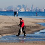
The atmosphere in Red Bank is distinct from the rugged, surf-casting culture of the outer beaches. Here, the vibe is a blend of suburban manicure and serious boating heritage. While the town itself offers high-end dining and walkable streets, the water access points are strictly business for captains looking to intercept the dawn bite. You are launching into a system where tidal flow dictates everything; the interplay between the Navesink and Shrewsbury rivers creates nutrient-rich pinch points that hold bait long before it reaches the ocean.

The primary draw for experts in this zone is the versatility of the fishery. In the shoulder seasons, the backwaters hold holdover stripers and winter flounder, while the main run brings heavy migratory bass right past the local docks. However, navigating the logistical landscape—from parking restrictions to bridge clearances—requires local intelligence. This guide breaks down the essential access points and facilities required to execute a successful trip in the Red Bank and Sandy Hook region.

💡 Captain's Tip: Tides Matter Here

The Navesink River currents can be deceivingly strong, especially near the bridges. When launching at the public ramps, ensure your engine is warmed up and reliable before drifting off the trailer, as the current can pin you against pilings quickly during a moon tide.

Access & Getting There

Reaching Red Bank is generally straightforward via the Garden State Parkway, arguably the most critical artery for New Jersey anglers. Exit 109 provides the most direct route into town. However, veteran captains know that summer traffic on the Parkway—and subsequently on Route 35—can be brutal. On weekends between Memorial Day and Labor Day, the "shore traffic" phenomenon is real. To ensure you are rigging up at the ramp by sunrise, plan to cross the Driscoll Bridge well before 6:00 AM.

For trailer boaters, the primary launch facility identified in the immediate vicinity is the Public Boat Ramp, located approximately 2.3 miles from the town center. While convenient, local ramps in this river system can be tight and often suffer from slick conditions at low tide. It is imperative to check the tide tables for the Navesink River specifically, not just Sandy Hook, as the lag time can be significant. There are also unnamed shore access points and street-end launches suitable for kayaks and car-toppers, particularly near the Marine Park Playground area, which offers family-friendly shore fishing access.

Weather plays a massive role in access strategies here. The Navesink is generally protected from the ocean swell, making it a viable "Save the Day" spot when the Atlantic is heaving. However, a strong Northwest wind can funnel down the river, creating a nasty chop that makes loading boats difficult. If the forecast calls for sustained winds over 15 knots from the NW, consider launching closer to the lee of the land or utilizing the facilities further east toward Gateway National Recreation Area.

Parking requires a defensive strategy. In town, street parking is heavily regulated, and trailer parking is non-existent outside of designated ramp lots. For those meeting a charter or carpooling, the Park & Ride on Hope Road in Eatontown (4.3 miles away) is a reliable rendezvous point with ample space. It operates from 4:00 AM to 2:00 AM, covering the vast majority of fishing windows. Avoid leaving vehicles in unauthorized retail lots, as towing is aggressive in this area.

Facilities & Amenities

Red Bank itself is more of a dining and cultural hub than a bait-and-tackle epicenter. For serious provisioning, you will need to travel slightly west to Keyport or south toward the coast. The local infrastructure for heavy gear is situated about 9 to 10 miles away. This means you must buy your flats of butterfish, eels, or clam chum before you get stuck in the final traffic stretch to the ramp. Do not expect to find a full-service offshore outfitter directly at the water's edge in downtown Red Bank.

Keyport Bait and Tackle (9.6 miles away) is a staple for the region, carrying the fresh bunk and specialized rigs required for Raritan Bay fishing. Similarly, Up Front Bait and Tackle offers early hours, opening at 5:00 AM most days, which is critical for the dawn patrol crowd. If you are heading further south or launching closer to the inlet, Dockside Bait and Tackle in Sewaren is another reliable option, though further out at 17 miles. The table below details the nearest reliable amenities for anglers.

💡 Captain's Tip: The "Iron Triangle" of Bait

Since Red Bank lacks a dedicated heavy-tackle shop right on the water, stop in Keyport on your way in. Up Front Bait and Tackle opens at 5:00 AM, allowing you to load up on fresh bunker and ice before hitting the Red Bank ramps.

Regarding charter operations, the heavy hitters and "party boats" are not docked in the Navesink. The major fleets, such as Gambler Deep Sea Fishing and Jersey Nutz Sport Fishing, operate out of Point Pleasant Beach, roughly 17 miles to the south. These operations are world-class for offshore seabass, fluke, and tuna trips. If you are looking for a head boat experience, you will need to drive south to the Manasquan Inlet area. Red Bank is better suited for private boaters or arranging pickups with smaller, light-tackle guide skiffs.

Lodging and Logistics: If you are trailing a boat and need a place to crash, options with trailer space are limited in the immediate downtown. Allaire State Park (15 miles away) offers camping facilities for those who prefer a rustic base camp. For standard accommodations, you may need to look toward the highway corridors in Eatontown or Tinton Falls. Note that the Gateway National Recreation Area also offers camping opportunities, specifically at Sandy Hook, which puts you right in the surf casting zone.

Facility NameTypeDistanceNotes / Hours
Keyport Bait and TackleBait & Tackle9.6 miRated 5/5. Open 10am-6pm (Check seasonal hours).
Up Front Bait and TackleBait & Tackle9.8 miOpens 5:00 AM. Critical for early starts.
Gambler Deep Sea FishingCharter / Headboat16.9 miLocated in Point Pleasant. Deep sea specialist.
Park & Ride (Eatontown)Parking4.3 miOpen 4:00 AM - 2:00 AM. Good for carpooling.
Gateway NRA (Sandy Hook)Access / Rec Area16.9 miMajor ocean access, camping, and surf fishing.

Permits, Regulations & Fees

Fishing the waters around Red Bank falls under the jurisdiction of the New Jersey Division of Fish and Wildlife. A critical requirement for all anglers targeting anadromous or marine species is the New Jersey Saltwater Recreational Registry Program (NJSRRP). This is a free registration, but it is mandatory. Law enforcement patrols both the ramps and the water frequently, and failure to produce your registry certificate is a common way to ruin a trip.

When accessing the Gateway National Recreation Area (Sandy Hook), federal rules apply. This is National Park Service land. While fishing is generally allowed, there are specific zones for swimming where surf casting is prohibited during lifeguarded hours. Additionally, nighttime fishing permits are often required for access to Sandy Hook after dark. These "fishing passes" allow you to park in designated lots overnight to fish the tide, a popular tactic for the fall run striper crowd.

Cultural respect and local ordinances are also paramount. The Navesink River is lined with high-value private property. Anglers must respect "Kapu" (forbidden) zones regarding private docks and bulkheads. Do not tie up to private pilings or trespass on private seawalls to fish. Stick to the designated Marine Park areas or public easements. Furthermore, the Statue of Liberty National Monument and National Parks of New York Harbor are nearby; these areas have strict security zones. approaching too close to security perimeters can result in immediate intervention by the Coast Guard.

Events & Seasonal Information

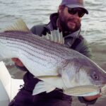
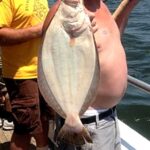
The fishing calendar here is dictated by migration. The spring run (April-June) sees large striped bass moving into Raritan Bay and up the Navesink to feed on bunker schools. This is the busiest time of year, and boat ramps can reach capacity by 5:00 AM on weekends. Summer shifts the focus to fluke (summer flounder) and bluefish, with recreational boat traffic increasing significantly. The river can become a washing machine of wakes by midday on a Saturday in July.

Fall (September-November) is the second peak season, often referred to as the "Fall Run." As water temperatures drop, fish pour out of the rivers and move south along the beach. This is excellent time for surf casting at nearby Sandy Hook. In terms of organized events, the Gateway National Recreation Area hosts unique activities like the Sandy Hook Canoe Cruise. These ranger-led paddling tours offer a stealthy way to observe the flats and channels near Skeleton Hill Island, providing excellent intel on bottom structure and bait concentrations without the noise of an outboard.

💡 Captain's Tip: Summer Wind Patterns

In the summer, the thermal seabreeze kicks in like clockwork around 11:00 AM. If you are fishing the open bay or the ocean side of Sandy Hook, plan your run back to the Navesink before the afternoon South wind builds a steep chop against the outgoing tide.

Contact Information & Resources

For official information regarding access status, closures, or permits, direct your inquiries to the managing federal agencies. The Gateway National Recreation Area can be reached at (718) 354-4606. They are the authority on beach access and the Sandy Hook unit. For the National Parks of New York Harbor, the contact number is (917) 731-1997.

Safety on the water is the responsibility of the captain. In an emergency, VHF Channel 16 is the standard for hailing the Coast Guard. However, for non-emergency questions regarding ramp conditions or local parking availability, calling the local bait shops like Keyport Bait and Tackle (732-377-0270) often yields the most real-time intelligence. Always file a float plan with a reliable contact on land before heading out.

For precise locations, real-time wind conditions, and detailed bathymetry of the Navesink channels, consult the live dashboard and interactive maps below.

🎣

Red Bank NJ

Red Bank • New Jersey • 40.3471, -74.0643
🅿️

Parking

5
Cycle Gear
⭐ 4.8 21.0 mi
📍 2052 Lincoln Hwy, Edison, NJ 08817, USA
🕒
Monday: 10:00 AM – 7:00 PM
Tuesday: 10:00 AM – 7:00 PM
Wednesday: 10:00 AM – 7:00 PM
Thursday: 10:00 AM – 7:00 PM
Friday: 10:00 AM – 7:00 PM
Saturday: 10:00 AM – 6:00 PM
Sunday: 10:00 AM – 6:00 PM
🚗 Get Directions
Best Buy Liquors
⭐ 4.6 16.6 mi
📍 1613 Neptune Ave, Brooklyn, NY 11224, USA
🕒
Monday: 9:00 AM – 9:00 PM
Tuesday: 9:00 AM – 9:00 PM
Wednesday: 9:00 AM – 9:00 PM
Thursday: 9:00 AM – 9:00 PM
Friday: 9:00 AM – 10:00 PM
Saturday: 9:00 AM – 10:00 PM
Sunday: 10:00 AM – 7:00 PM
🚗 Get Directions
Centerpark Century 21 Garage
⭐ 4.2 19.0 mi
📍 415 88th St, Brooklyn, NY 11209, USA
🕒
Monday: 7:00 AM – 7:00 PM
Tuesday: 7:00 AM – 7:00 PM
Wednesday: 7:00 AM – 7:00 PM
Thursday: 7:00 AM – 7:00 PM
Friday: 7:00 AM – 7:00 PM
Saturday: 7:00 AM – 7:00 PM
Sunday: 7:00 AM – 7:00 PM
🚗 Get Directions
Park & Ride
⭐ 4.2 4.3 mi
📍 732-750 Hope Rd, Eatontown, NJ 07724, USA
🕒
Monday: 4:00 AM – 2:00 AM
Tuesday: 4:00 AM – 2:00 AM
Wednesday: 4:00 AM – 2:00 AM
Thursday: 4:00 AM – 2:00 AM
Friday: 4:00 AM – 2:00 AM
Saturday: 4:00 AM – 2:00 AM
Sunday: 4:00 AM – 2:00 AM
🚗 Get Directions
🐟

Bait & Tackle

5
Keyport Bait and Tackle
⭐ 5.0 9.6 mi
📍 35 American Legion Dr, Keyport, NJ 07735, USA
🕒
Monday: 10:00 AM – 6:00 PM
Tuesday: 10:00 AM – 6:00 PM
Wednesday: 10:00 AM – 6:00 PM
Thursday: 10:00 AM – 7:00 PM
Friday: 10:00 AM – 7:00 PM
Saturday: 10:00 AM – 7:00 PM
Sunday: 10:00 AM – 4:00 PM
🚗 Get Directions
I&L Bait & Tackle
⭐ 4.9 22.0 mi
📍 9-05 Cross Bay Blvd, Broad Channel, NY 11693, USA
🕒
Monday: 11:00 AM – 6:00 PM
Tuesday: 11:00 AM – 6:00 PM
Wednesday: 11:00 AM – 6:00 PM
Thursday: 11:00 AM – 6:00 PM
Friday: 11:00 AM – 6:00 PM
Saturday: 9:00 AM – 1:00 PM
Sunday: 9:00 AM – 12:00 PM
🚗 Get Directions
Up Front Bait and Tackle
⭐ 4.8 9.8 mi
📍 229 W Front St, Keyport, NJ 07735, USA
🕒
Monday: 5:00 AM – 8:00 PM
Tuesday: 5:00 AM – 8:00 PM
Wednesday: 5:00 AM – 8:00 PM
Thursday: 5:00 AM – 8:00 PM
Friday: 5:00 AM – 8:00 PM
Saturday: 5:00 AM – 8:00 PM
Sunday: 5:00 AM – 5:00 PM
🚗 Get Directions
Dockside Bait and Tackle
⭐ 4.7 17.3 mi
📍 485 Cliff Rd, Sewaren, NJ 07077, USA
🕒
Monday: 6:00 AM – 7:00 PM
Tuesday: 6:00 AM – 7:00 PM
Wednesday: 6:00 AM – 7:00 PM
Thursday: 6:00 AM – 7:00 PM
Friday: 6:00 AM – 7:00 PM
Saturday: 6:00 AM – 7:00 PM
Sunday: 6:00 AM – 6:00 PM
🚗 Get Directions
🚤

Fishing Charters

5
Forever Two Worlds
⭐ 5.0 21.9 mi
📍 72-46 Thursby Ave, Far Rockaway, NY 11692, USA
🕒
Monday: Open 24 hours
Tuesday: Open 24 hours
Wednesday: Open 24 hours
Thursday: Open 24 hours
Friday: Open 24 hours
Saturday: Open 24 hours
Sunday: Open 24 hours
🚗 Get Directions
Gypsea Fishing Charters
⭐ 4.9 18.3 mi
📍 2501 Knapp St #1, Brooklyn, NY 11235, USA
🕒
Monday: Open 24 hours
Tuesday: Open 24 hours
Wednesday: Open 24 hours
Thursday: Open 24 hours
Friday: Open 24 hours
Saturday: Open 24 hours
Sunday: Open 24 hours
🚗 Get Directions
Hunter Fishing
⭐ 4.8 18.0 mi
📍 2771 Knapp St, Brooklyn, NY 11229, USA
🕒
Monday: Open 24 hours
Tuesday: Open 24 hours
Wednesday: Open 24 hours
Thursday: Open 24 hours
Friday: Open 24 hours
Saturday: Open 24 hours
Sunday: Open 24 hours
🚗 Get Directions
Jersey Nutz Sport Fishing
⭐ 4.8 17.0 mi
📍 311 Channel Dr, Point Pleasant Beach, NJ 08742, USA
🕒
Monday: Open 24 hours
Tuesday: Open 24 hours
Wednesday: Open 24 hours
Thursday: Open 24 hours
Friday: Open 24 hours
Saturday: Open 24 hours
Sunday: Open 24 hours
🚗 Get Directions
Gambler Deep Sea Fishing
⭐ 4.7 16.9 mi
📍 59 Inlet Dr, Point Pleasant Beach, NJ 08742, USA
🕒
Monday: 6:00 AM – 6:00 PM
Tuesday: 6:00 AM – 6:00 PM
Wednesday: 6:00 AM – 6:00 PM
Thursday: 6:00 AM – 6:00 PM
Friday: 6:00 AM – 6:00 PM
Saturday: 6:00 AM – 6:00 PM
Sunday: 6:00 AM – 6:00 PM
🚗 Get Directions
🏠

Lodging

5
Javdeck Inc
⭐ 5.0 19.3 mi
📍 1 Rose Dr, Jackson Township, NJ 08527, USA
🕒
Monday: 9:00 AM – 4:00 PM
Tuesday: 9:00 AM – 4:00 PM
Wednesday: 9:00 AM – 4:00 PM
Thursday: 9:00 AM – 4:00 PM
Friday: 9:00 AM – 4:00 PM
Saturday: 9:00 AM – 4:00 PM
Sunday: Closed
🚗 Get Directions
Pine Grove Day Camp
⭐ 4.9 15.2 mi
📍 4010 Herbertsville Rd, Wall Township, NJ 08724, USA
🕒
Monday: 9:00 AM – 5:00 PM
Tuesday: 9:00 AM – 5:00 PM
Wednesday: 9:00 AM – 5:00 PM
Thursday: 9:00 AM – 5:00 PM
Friday: 9:00 AM – 5:00 PM
Saturday: Closed
Sunday: Closed
🚗 Get Directions
Quail Hill Scout Reservation
⭐ 4.8 17.9 mi
📍 56 La Valley Dr, Manalapan Township, NJ 07726, USA
🕒
Monday: Closed
Tuesday: Closed
Wednesday: Closed
Thursday: Closed
Friday: 5:00 PM – 12:00 AM
Saturday: Open 24 hours
Sunday: 12:00 AM – 1:00 PM
🚗 Get Directions

Boat Ramps

3
🚻

Restrooms

3
👨‍👩‍👧‍👦

Family Friendly

2

Accessibility

Wheelchair Access

Not Confirmed

🐕

Pets Allowed

Not Confirmed

⚠️ Some accessibility info not officially confirmed. Please verify with location directly.

📍 Showing 28 facilities on map

📊

About Our Fishing Reports & Forecasts

Our spot reports combine data-driven forecasts with curated local information. The forecast is generated by our proprietary Fishing Score algorithm (0–100%), which analyzes real-time data from Open-Meteo API, validated against NOAA CO-OPS tide gauges and USGS water-monitoring stations. The model weights tide dynamics (35%), wave energy (25%), wind patterns (20%) and time of day (20%)—factors shown to influence fish feeding behavior through marine-biology research and decades of charter log data.

Access, facilities and services information for each fishing spot is sourced from official datasets such as Recreation.gov (RIDB), state park & wildlife agencies, and geospatial providers like Google Maps. These sections undergo scheduled re-validation every 3–6 months to ensure that boat ramps, park access, contact details and local services remain accurate.

Narrative sections (catches, seasonal behavior, local tips) are synthesized from these data sources and refined following the Fishing Reports Today editorial guidelines, combining bibliographic research from ichthyology and oceanography with expert angler experience. Our team reviews reports on a regular basis, while the forecast model itself updates every 6 hours for real-time accuracy.

⚠️ Important: Always verify current local regulations, access restrictions and weather conditions before fishing. These reports are intended as a planning aid, not a guarantee of catches or safety. When in doubt, contact local authorities or park managers listed on the page.

Learn more about our methodology & data sources

Leave a Reply

Your email address will not be published. Required fields are marked *