
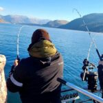
Situated in the heart of Putnam County, the fishery surrounding Interlachen offers a distinct "Old Florida" experience that stands in sharp contrast to the coastal scenes of the Sunshine State. This is a region defined by ancient sand pine scrub forests, interconnected chain lakes, and the vital arteries of the St. Johns River system. For the serious angler, this location serves as a strategic pivot point between the quiet, tannic inland lakes and the flowing, mineral-rich waters of the Ocala National Forest. The atmosphere here is rugged and unpretentious; you are far more likely to launch alongside a weathered aluminum skiff or a canoe than a high-gloss center console.
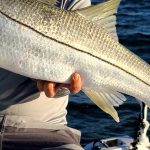
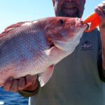
The primary draw for expert anglers in this sector is the diversity of water types. You have the closed systems of the local lakes, such as Lake Chipco and Lake Grandin, which offer technical bass fishing around cypress structures. However, the true gem for many is the proximity to the Salt Springs Recreation Area and the Welaka river corridor. Here, the subterranean mineral springs pump ancient water into the St. Johns, creating a unique salinity gradient that attracts striped bass, bluegill, and even Atlantic sturgeon. The bottom topography varies wildly, from the deep, limestone vents of the springs to the shallow, vegetated flats of Lake George.
Navigating this region requires a shift in mindset from open-water running to precise, channel-oriented navigation. The water levels can fluctuate based on rainfall and aquifer pressure, affecting launch capabilities at the more primitive ramps. This guide breaks down the logistical realities of accessing these waters, ensuring your vessel and crew are prepared for the specific challenges of the Florida scrubland.
Access & Getting There
Accessing the prime fishing grounds around Interlachen and the Ocala National Forest requires navigating a network of state roads that cut through dense forest. The primary artery is State Route 20, running east-west, but the serious angling action often requires diverting onto State Route 19 or County Road 315. Traffic here is generally light compared to the coast, but the two-lane roads can become bottlenecks if you get stuck behind heavy agricultural equipment or RV convoys. When towing a boat, allow extra braking distance; the rural roads are often unlit and deer crossings are frequent at dawn and dusk.
For those targeting the St. Johns River system via the Salt Springs Recreation Area, the approach involves a drive approximately 35 miles east of Ocala via SR 40, then north on SR 19. The entrance is situated on the right. The boat ramp at Salt Springs is a critical access point. It feeds directly into Salt Springs Run, which flows downstream into Lake George. Captains should note that while the ramp is paved and serviceable, the run itself can be narrow with idle-speed zones that must be respected to avoid manatee interactions and bottom strikes on submerged timber.
💡 Captain's Tip: Launch Logistics
The boat ramp at Salt Springs feeds into a run with specific salinity levels. Flush your engine after pulling out, even though it looks like freshwater; the magnesium, potassium, and sodium salts that give the springs their name can be corrosive over time.
Alternative launching is available at Lake Santa Fe to the north, roughly 12 miles from the central hub, or at the primitive launches near Lake Delancy. Be advised that the Lake Delancy area is significantly more rugged. The access roads here can be sandy and soft; 4WD is highly recommended if you are towing a heavier bass boat or skiff. During the dry season, the water line recedes significantly, potentially making the unimproved ramps unusable for fiberglass hulls.
Parking strategies vary by location. At Salt Springs, the facility is designed for high-volume recreational use, meaning trailer parking is available but fills rapidly on weekends. Conversely, spots like Yardslot in Melrose offer 24-hour access, which is crucial for anglers planning overnight trips or pre-dawn arrivals. Forest Hills Road offers trail parking, but security is minimal; ensure your vehicle is locked and valuables are out of sight.
Interlachen Florida Pre-Trip Checklist
Facilities & Amenities
The infrastructure in Interlachen and the surrounding Ocala National Forest is functional rather than luxurious. You will not find high-end marinas with concierge service here. Instead, you will find reliable, working-class amenities that cater to self-sufficient outdoorsmen. The Salt Springs Recreation Area acts as the primary marina hub in the immediate vicinity, offering a boat ramp, a designated swimming area (useful for cooling off after a long day on the water), and proximity to a gas station and grocery store within the community of Salt Springs.
For bait and tackle, local knowledge is key. Deep Creek Game Farm and Feed Store is a standout resource for the area. Located just 2.5 miles from the center of Interlachen, it opens at 5:30 AM Monday through Saturday. This early opening time is critical for the "dawn patrol" crowd looking to secure live bait before the sun hits the water. For those heading toward the river, Betcha Bass Baitshop in Welaka is the authority on river conditions and specific forage for the St. Johns system.
| Facility Name | Type | Distance & Logistics |
|---|---|---|
| Deep Creek Game Farm | Bait & Feed | 2.5 mi. Opens 5:30 AM. Primary stop for live bait. |
| Betcha Bass Baitshop | Bait & Tackle | 16.6 mi. Located in Welaka. Best for river intel. |
| Skaggs Online Solutions | Bait Shop | 7.0 mi. Opens 6:00 AM. Good secondary option. |
| Salt Springs Rec Area | Marina/Launch | 20.8 mi. Full hookups, boat ramp, and marina services. |
💡 Captain's Tip: Fuel Management
There are no fuel docks on the smaller inland lakes. If you are launching at Lake Delancy or primitive ramps, top off your tanks and bring jerry cans. The only reliable water-accessible amenities are near the Salt Springs marina and Welaka corridor.
Lodging options favor the adventurous. Lake Delancy West Campground offers a raw experience with dispersed camping and access to OHV trails. It is essential to note that this facility has limited staffing and requires self-reliance. For those requiring shore power and climate control, Salt Springs is the only campground in the Ocala National Forest with full hookups for RVs. Anglers looking for a roof over their heads should consider the Welaka Inn, which is well-positioned for river access, or local rentals like "Nicecampingbnb" in Hawthorne.
Permits, Regulations & Fees
Fishing this region puts you at the intersection of state and federal jurisdictions. The waters within the Ocala National Forest are subject to specific oversight. While a standard Florida freshwater fishing license is the baseline requirement, be aware of the specific "Kapu" (restrictions) regarding the springs. Fishing is often prohibited directly within the swimming zones of the springs to protect the water quality and swimmers. You must move downstream to Salt Springs Run to legally wet a line.
Lake Delancy West has specific regulations regarding wildlife. This is active bear country. The U.S. Forest Service mandates that all food must be stored in bear-proof containers or locked vehicles. This is not a suggestion; it is a requirement for visitor safety. Additionally, stay limits are strictly enforced across the forest: you are limited to a 14-day stay within any 30-day period. This prevents long-term homesteading at prime fishing camps.
Access fees apply at the federally managed recreation areas. Salt Springs generally charges a day-use fee for vehicle access and boat launching. If you are planning multiple trips, an annual pass for the National Forests in Florida may be more economical. Note that the Welaka National Fish Hatchery, while a fascinating side trip to view Gulf Striped Bass and Atlantic Sturgeon, is a working federal facility. The aquarium is open from 7:00 AM to 4:00 PM daily, but fishing directly in hatchery ponds is obviously prohibited.
💡 Captain's Tip: Seasonal Closure Alert
Major logging operations are scheduled for the Delancy area starting December 5, 2025 through mid-April 2026. This will close the Delancy Loops trailhead and segments of the trail. Check the status of Forest Road access before towing a trailer into this sector during winter months.
Events & Seasonal Information
The fishing calendar in Interlachen is driven by water temperature and rainfall. The summer months bring heavy humidity and daily thunderstorms; seasoned skippers know to be off the open water of Lake George by 2:00 PM when the convective storms build. Conversely, the winter months can be excellent for targeting big bass in the springs, as the constant 72-degree water output attracts fish seeking thermal refuge from the colder river water.
The Welaka National Fish Hatchery plays a significant role in the seasonal rhythms of the region, raising warm-water species that support the wider ecosystem. While there are no massive high-stakes tournaments in Interlachen proper, the connection to the St. Johns River means that the seasonal shad runs and subsequent bass spawns in the river system heavily influence local fishing pressure. Expect higher traffic at the Salt Springs ramp during the spring bedding season.
Contact Information & Resources
Reliable communication is vital in these rural sectors. Cell service can be spotty deep within the Ocala National Forest. It is advisable to file a float plan with a contact on land.
- Salt Springs Recreation Area: 352-685-2048 (For campsite and ramp status)
- Welaka National Fish Hatchery: 386-467-2374 (For aquarium hours and educational info)
- Lake Delancy West Info: 352-625-2520 (General Forest Service information)
For emergency assistance, standard 911 services apply, but response times can be long in the forest interior. Carry a basic tool kit and first aid supplies.
For precise locations, real-time weather data, and interactive navigation of the boat ramps mentioned above, consult the live dashboard and maps below.


Leave a Reply