0%

Bear Canyon Lake Fishing Report Today 🎣

7 months ago · Updated 3 weeks ago

Bear Canyon Lake Fishing Report: Mogollon Rim, Arizona

1. GO/NO-GO STATUS

Verdict: UNSAFE - TRY ALTERNATIVE

Current verified access reports indicate that the primary gateway to Bear Canyon Lake—Forest Road 300 (Rim Road)—remains heavily snowed in and officially closed to vehicular traffic for the winter-to-spring transition. Because the lake sits approximately 12 to 15 miles from the Highway 260 closure gate, reaching the water requires a grueling cross-country ski trek or a specialized snowmobile expedition. This is not a casual day trip under current conditions.

Furthermore, the active spring thaw is rapidly deteriorating any residual ice on the lake. The ice is rotting from the bottom up, creating highly unstable and dangerous conditions along the shoreline. Deep mud and melting snowpack make the steep canyon descent extremely hazardous. Anglers are strongly advised to hold off on Bear Canyon until the Forest Service officially opens the gates and the access roads dry out. See the Regional Alternative section below for the nearest fishable water.

From the editor

Tired of fishing with strangers you can’t trust?

Nautrek is the first social network for serious anglers — verified partners, real trips, cost splitting and intel sharing without burning your spots. Private beta now open.

Join the Waitlist — Free → 100+ anglers on the list
Nautrek App

2. SPECIES INTEL

Primary Target: Rainbow Trout

Once the lake becomes accessible, Rainbow Trout are the undisputed main attraction. The Arizona Game and Fish Department maintains a robust stocking schedule here, planting catchable-sized rainbows multiple times throughout the season. Early in the year, you will encounter a mix of fresh stockers and larger, darker holdover trout that survived the winter under the ice.

Sleeper Pick: Green Sunfish

Most anglers hike into Bear Canyon strictly for trout, completely ignoring the Green Sunfish. These aggressive panfish were illegally introduced into the fishery and directly compete with the native and stocked trout populations for resources. They hold tight to submerged timber and rocky crevices. Catching them provides non-stop action on ultralight tackle, and wildlife officials strongly encourage anglers to harvest every sunfish they catch to help rebalance the lake's ecosystem.

Baitfish Report

The high-country forage base is currently transitioning. Crayfish remain mostly dormant in the cold water. The trout are heavily keyed in on emerging aquatic insects, specifically chironomids (midges), and small winter-killed baitfish. Freshly stocked rainbows will also be looking for high-protein meals that mimic the hatchery pellets they were raised on.

Pro Tip: When targeting holdover trout in the early season, downsize your fluorocarbon tippet or leader to 2-pound test. These fish have spent the winter in crystal-clear water and have become highly line-shy. A stealthy, invisible presentation will drastically improve your strike rate.

3. TACTICAL STRATEGY

When the access roads finally clear, you need a precise game plan to tackle this canyon-bound waterbody. Historical spring patterns and bathymetry data dictate a specific approach. Bear Canyon Lake covers 60 surface acres and plunges to a maximum depth of 50 feet. It was formed by damming Bear Canyon Creek, meaning a submerged creek channel acts as a superhighway for cruising trout.

  • Where: Skip the shallow, featureless mud flats near the inlet. Focus your efforts on the steep, northern shoreline drop-offs. Because the canyon walls cast long shadows, the northern side receives the most direct sunlight, warming the water slightly and activating early insect hatches. Work the 8 to 15-foot depth contour, specifically targeting areas where submerged timber intersects with the steep rocky banks.
  • Lure: Precision casting is essential. Tie on a 1/16 ounce or 1/8 ounce Rooster Tail spinner, or a Rapala Countdown (CD03) to search the water column. If the fish are sluggish, a 1/32 ounce tungsten tear drop jig suspended under a slip float is deadly.
  • Color: Water clarity is typically very high, so natural presentations excel. Use silver blades with black or olive bodies to imitate local nymphs and minnows. If the water is stained from spring runoff, switch to gold blades with fluorescent orange or chartreuse accents to maximize flash and visibility.
  • Bait: For passive fishing, garlic-scented PowerBait in rainbow or chartreuse is highly effective for fresh stockers. Rig this on a slip-sinker setup: thread a 1/4 ounce egg sinker onto your main line, tie on a small barrel swivel, and attach an 18-inch leader of 4-pound fluorocarbon. The buoyant bait will float just above the bottom debris.
  • Timing: The canyon topography dictates the bite windows. The high walls block the sun at dawn and dusk. The most productive feeding window occurs mid-morning when direct sunlight finally penetrates the water, triggering the daily midge hatch, and again in the late afternoon just before the shadows completely cover the lake.

Pro Tip: Always carry a digital thermometer. In deep, narrow reservoirs like Bear Canyon, finding the optimal temperature band is everything. During the early season, look for surface water that is just two to three degrees warmer than the surrounding basin—this micro-climate will hold the most active, feeding trout.

4. REGULATIONS SNAPSHOT

Compliance with local regulations ensures the longevity of this pristine fishery. A valid Arizona state fishing license is required for all anglers aged 10 and older. Note that Bear Canyon is a strict primitive area with absolutely no garbage service.

SpeciesSize LimitBag LimitSeason Status
Rainbow TroutNo restriction6 per dayOpen Year-Round
Green SunfishNo restrictionUnlimited (Harvest encouraged)Open Year-Round

Access & Gear Note: Boating is restricted to electric motors or human-powered craft only. Gas motors are strictly prohibited. The area operates on a mandatory "Pack it in, Pack it out" policy.

5. REGIONAL ALTERNATIVE: WILLOW SPRINGS LAKE

Because Bear Canyon Lake is currently locked behind the Rim Road closure, Willow Springs Lake stands as your most viable high-country alternative. Located just off Highway 260, it offers a true early-season adventure for anglers willing to put in a little legwork.

Access and Conditions

Park safely near the highway closure gate. Reaching the water requires approximately a one-mile hike in. Exercise extreme caution upon arrival. The ice is currently in a rotting state, actively pulling away from the shoreline. Under no circumstances should you attempt to walk on the ice. Fish strictly from the bank in open water pockets.

Target Species and Tactics

Your primary targets here are holdover Rainbow Trout and the aggressive Tiger Trout. Tiger Trout are a sterile hybrid cross between a Brown Trout and a Brook Trout, stocked specifically to control nuisance fish. They exhibit a stunning vermiculation pattern across their backs and possess a highly predatory instinct, actively chasing down moving baits.

  • The Spot: Head directly to the rocky dam face. This structure is usually the first area to experience ice-off because the steep rocks absorb solar radiation, creating a pocket of warmer water that draws in bait and predators alike.
  • The Rig: Employ a slip bobber setup to keep your bait in the strike zone without snagging the rocky bottom. Set your bobber stop so your bait suspends 4 to 8 feet deep, right in the middle of the water column.
  • The Presentation: Tip a 1/32 ounce black or olive tungsten jig with a live wax worm or mealworm.

Pro Tip: Utilize a "dead stick" presentation when fishing the open water edges at Willow Springs. Cast your slip bobber rig parallel to the ice line and let the natural wind-chop impart a subtle, irresistible dancing action to the jig below. Do not over-jig; let the waves do the work to trigger strikes from cruising Tiger Trout.

Tight lines!

Editor's Choice: Must-Have Gear

FISHINGSIR Next-Gen Waterproof Chest Waders

★★★★★ 4.4 (7,370+ reviews)
  • 2-Ply Tech: Upgraded nylon with 2.5x higher density than standard fabrics.
  • 100% Waterproof: Lab-approved intrusion resistance with taped visible seams.
  • Ultra-Lightweight: Designed for all-day comfort while hunting or fishing.
Check Availability on Amazon

✓ Amazon's Choice | 100+ bought last month

🛒 Tactical Gear for this Spot

Bandit Walleye Deep

Mandatory for reaching deep schools in 35-50ft mud flats.

Check Price on Amazon #ad

As an Amazon Associate I earn from qualifying purchases. #ad

Loading forecast...

Live Fishing Conditions: Tides, Weather & Waves

Get real‑time tides, marine weather, swell and solunar activity for each spot so you know exactly when conditions line up for your best chance at a bite.

🎣

Bear Canyon Lake

Loading coordinates...

🌤️

WEATHER CONDITIONS

Weather
-- °F
--°C

Loading...

🌡️
Feels Like --°F --°C
💧
Humidity --%
💨
Wind -- mph -- km/h
🧭
Direction --
📊
Pressure -- inHg -- hPa
☀️
UV Index --
🌊

MARINE CONDITIONS

🌊 Wave Height
-- ft
-- m
Loading...
🧭 Wave Direction
--°
Loading...
⏱️ Wave Period
-- s
Loading...
📈 Tide Status
-- ft
-- m
Loading...
🌙

LUNAR & SOLUNAR

🌕

Loading...

Illumination: --%

Major Period --:-- - --:-- --:-- - --:--
Minor Period --:-- - --:-- --:-- - --:--
🌅 Sunrise --:--
🌇 Sunset --:--
📅

24-HOUR FORECAST

Loading fishing conditions...

Fishing Spots Map

🎣
Book a Fishing Charter near Bear Canyon Lake Fishing Report Today 🎣

Local guides & charters. Verified captains, instant booking, best price guaranteed.

See Available Trips →

My location
Loading map...

Local Access & Facilities

Tucked into the rugged terrain of Christopher Creek, Arizona, Bear Canyon Lake presents a unique logistical puzzle for the seasoned angler. Unlike manicured urban reservoirs with sprawling, paved marinas, this fishery demands a more tactical approach. The environment here is defined by its remote, high-country atmosphere, where dense timber and steep shorelines dictate how you deploy your gear. Experienced skippers and shore casters alike know that success here relies on preparation just as much as presentation.

The atmosphere surrounding the lake is decidedly rugged and distinctly off the beaten path. Official accessibility metrics confirm that there is absolutely no wheelchair access, meaning anglers must navigate uneven ground, dirt trails, and natural shoreline obstacles. This lack of concrete infrastructure naturally filters out casual visitors, leaving the prime holding waters to dedicated sportsmen who are willing to put in the physical effort. You will not find crowded, paved promenades here; instead, you will find quiet, timber-lined coves.

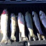
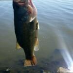
While the specific game fish species are managed tightly by local authorities, the draw for pros is the pristine freshwater environment. The local fishery is governed by the State Fishing Agency, which oversees the health of the aquatic ecosystem. Targeting the deep pockets and structured drop-offs requires careful planning, especially since the immediate lake perimeter is entirely trail-based. For the expert angler, understanding the layout of these trails and the distant boat ramps is the first step to mastering this remote Arizona water.

Access & Getting There

Navigating to the water's edge at Bear Canyon Lake requires understanding the stark difference between shore access and vessel launching. For shore-based anglers or those utilizing packable float tubes, the lake is highly accessible via established footpaths. The Merganser Trailhead is located a mere 0.2 miles from the primary access zone, providing a rapid, albeit rugged, descent to the water. Slightly further out, the Mallard Trailhead sits at 0.4 miles away, offering an alternative vector for anglers looking to distance themselves from the main entry points.

For captains hauling skiffs or heavy aluminum boats, the logistical reality shifts significantly. The immediate vicinity of the lake does not support direct trailer backing. Instead, the designated boat ramps are situated several miles away from the core trailhead zones. The closest unnamed ramp is located 5.6 miles out, with secondary options at 9.2 miles and 15.4 miles. These ramps do offer dedicated trailer parking, which is a crucial asset during peak season.

💡 Captain's Tip: Ramp Self-Reliance

The distant boat ramps feature trailer parking, but they are entirely devoid of amenities. There are no restrooms, no showers, no fish cleaning stations, and critically, no lighting. If you are launching before dawn, you must bring high-lumen headlamps and backup floodlights for safe trailer maneuvering.

Weather contingencies play a massive role in how you approach the launch. High-elevation winds can funnel through the canyons, making the exposed trails slippery and boat handling treacherous. The local safety notes explicitly mandate wearing appropriate footwear, a non-negotiable requirement when traversing the steep grades of the Merganser and Mallard trails after a heavy rain. If the wind picks up, shore anglers are advised to utilize the Rocky Point Picnic Area located 5.4 miles away, which offers a slightly more sheltered, family-friendly shoreline approach.

Parking your tow vehicle requires strategic forethought. While the distant boat ramps accommodate trailers, shore anglers utilizing the trailheads often rely on nearby vehicle storage lots. The Horton Springs Parking Lot is a reliable staging area located 6.8 miles from the main spot. For longer expeditions, the Ranch Road Vehicle Storage facility at 8.6 miles provides a highly-rated, secure location for leaving excess gear or secondary vehicles.

Parking FacilityDistanceTrailer ParkingRating
Horton Springs Parking Lot6.8 milesNo5.0
Ranch Road Vehicle Storage8.6 milesNo5.0
Washington Park Trailhead14.9 milesNo4.8
Little Bli19.5 milesNoUnrated
The Home Depot Parking Lot20.5 milesNo4.1

Bear Canyon Lake Pre-Trip Checklist

Facilities & Amenities

The infrastructure surrounding Bear Canyon Lake is highly localized and geared toward wilderness survival rather than resort-style comfort. Seasoned skippers know that preparation is paramount because you cannot simply idle up to a marina fuel dock or a waterside tackle shop here. The area operates on a "bring it with you" philosophy. Crucially, there are no charter operators based directly at this location, meaning you are entirely reliant on your own vessel and local knowledge.

When it comes to gearing up, Gilligan's Forest Lakes General Store is the sole recognized bait and tackle hub in the region. Located 12.4 miles from the lake, it serves as the final outpost for terminal tackle and local intelligence. However, its operating hours dictate your morning strategy. The shop does not open until 7:00 AM daily. For the serious angler looking to capitalize on the early morning bite, this means all bait, ice, and heavy gear must be procured the afternoon prior.

💡 Captain's Tip: The Restroom Logistics

While the boat ramps are primitive, there are three designated public restrooms located surprisingly close to the primary trailhead access points, ranging from 2,452 feet to 2,765 feet away. Utilize these facilities before making the final hike down the Mallard or Merganser trails.

Lodging logistics favor the camper and the RV traveler. The proximity of accommodations to the dawn patrol launch points varies, but they all offer a rustic, outdoorsman-friendly atmosphere. Crook Campground is the strategic favorite, sitting just 6.6 miles from the action. For those requiring full hookups and more space for large rigs, the Five Lakes RV Park at 13.3 miles and the Clint Wells RV Resort at 20.5 miles provide excellent staging grounds for multi-day tournament runs or extended backcountry trips.

Accommodation NameDistanceTypeRating
Crook Campground6.6 milesCampground4.8
Fr 171 Campground10.7 milesCampground4.8
Five Lakes RV Park13.3 milesRV Park5.0
Lil’ W Ranch17.6 milesRanch / Resort4.8
Clint Wells RV Resort20.5 milesRV Resort5.0

Permits, Regulations & Fees

Operating legally and respectfully at Bear Canyon Lake requires strict adherence to local mandates. The fishery is officially managed by the State Fishing Agency. This governing body utilizes a rule-based system to dictate seasonal closures, size limits, and allowable gear. Because this is a high-traffic natural resource, the regulations are designed to protect the delicate high-desert aquatic ecosystem from overfishing and habitat degradation.

Currently, official data indicates that there are no active environmental alerts or emergency closures in effect. However, the regulatory baseline demands that anglers always consult official state sources and local trailhead signage before making their first cast. The rules here are not merely suggestions; they are strictly enforced to maintain the caliber of the game fish populations that draw experts to these waters in the first place.

Furthermore, cultural respect and environmental stewardship are paramount. The lack of waste disposal facilities at the boat ramps and along the Merganser Trailhead means a strict "pack it in, pack it out" policy is in effect. Discarding monofilament line or bait containers along the primitive trails not only damages the ecosystem but jeopardizes future access for the angling community. The rule is simple: leave the rugged shoreline exactly as you found it.

Events & Seasonal Information

The rhythms of the season dictate the fishing strategy in Christopher Creek. During the peak summer months, the high elevation provides a brief respite from the extreme heat of the lower Arizona deserts, making it a prime destination for aggressive dawn and dusk topwater bites. However, this same elevation means that winter and early spring conditions can be brutally cold, often impacting the accessibility of the dirt trails and primitive boat launches.

💡 Captain's Tip: Sun and Shore Protection

Official safety protocols explicitly advise wearing heavy-duty sun protection and appropriate footwear. The UV index at this elevation is intense, and the rocky, unpaved shorelines near the Mallard Trailhead require sturdy hiking boots with aggressive tread to prevent ankle injuries while landing heavy fish.

Local weather patterns are the ultimate arbiter of your daily schedule. Interestingly, local safety advisories utilize boilerplate language reminding visitors to check "ocean conditions"—a quirk of the agency's broad safety protocols. For this inland lake, seasoned captains translate this to mean monitoring severe barometric drops, sudden canyon wind shears, and localized flash flood warnings that can rapidly alter the clarity and safety of the water.

Timing your strike is everything. Because the primary bait shop, Gilligan's, operates on a strict 7:00 AM to 6:00 PM schedule, anglers looking to intercept the early morning feed must be entirely self-sufficient before the sun breaches the canyon walls. By the time the shop opens, the prime morning window has often already closed, shifting the tactic to deep-water jigging or shaded shoreline casting.

Contact Information & Resources

Self-reliance is the defining characteristic of a successful trip to this area. Your primary point of contact for legal inquiries and current bag limits is the State Fishing Agency. Because cellular service can be highly unpredictable deep in the canyon and along the remote trailheads, downloading offline maps and carrying a satellite communication device is highly recommended for emergency situations.

Should you need to make physical contact with local resources, Gilligan's Forest Lakes General Store can be reached at (928) 535-4716 for localized tackle advice, though they do not offer charter services or on-water rescues. Always file a float plan or a hike plan with a trusted contact before descending the trails. For precise locations, trailhead coordinates, and real-time conditions, consult the live dashboard and maps below.

🎣

Bear Canyon Lake

Christopher Creek • Arizona • 34.3992, -111.0022
🅿️

Parking

5
Horton Springs Parking Lot
⭐ 5.0 6.8 mi
📍 Payson, AZ 85541, USA
🚗 Get Directions
Ranch Road Vehicle Storage
⭐ 5.0 8.6 mi
📍 1075 E Ranch Rd, Payson, AZ 85541, USA
🕒
Monday: 7:00 AM – 6:00 PM
Tuesday: 7:00 AM – 6:00 PM
Wednesday: 7:00 AM – 6:00 PM
Thursday: 7:00 AM – 6:00 PM
Friday: 7:00 AM – 6:00 PM
Saturday: 7:00 AM – 6:00 PM
Sunday: 7:00 AM – 6:00 PM
🚗 Get Directions
Washington Park Trailhead Parking
⭐ 4.8 14.9 mi
📍 Highline Trail, Payson, AZ 85541, USA
🚗 Get Directions
The Home Depot Parking Lot
⭐ 4.1 20.5 mi
📍 Home Depot, 2000 N Beeline Hwy, Payson, AZ 85541, USA
🚗 Get Directions
Little Bli
19.5 mi
📍 Forest Service Rd 9731H, Flagstaff, AZ 86024, USA
🚗 Get Directions
🐟

Bait & Tackle

1
Gilligan's Forest Lakes General Store
⭐ 4.7 12.4 mi
📍 2998 AZ-260, Forest Lakes Estates, AZ 85931, USA
🕒
Monday: 7:00 AM – 6:00 PM
Tuesday: 7:00 AM – 6:00 PM
Wednesday: 7:00 AM – 6:00 PM
Thursday: 7:00 AM – 6:00 PM
Friday: 7:00 AM – 7:00 PM
Saturday: 7:00 AM – 7:00 PM
Sunday: 7:00 AM – 6:00 PM
🚗 Get Directions
🏠

Lodging

5
Lil’ W Ranch
⭐ 4.8 17.6 mi
📍 190 Cornerstone Way, Payson, AZ 85541, USA
🕒
Monday: 9:00 AM – 3:00 PM
Tuesday: 9:00 AM – 3:00 PM
Wednesday: 9:00 AM – 3:00 PM
Thursday: 9:00 AM – 3:00 PM
Friday: 9:00 AM – 3:00 PM
Saturday: Closed
Sunday: Closed
🚗 Get Directions

Boat Ramps

3
🚻

Restrooms

3
👨‍👩‍👧‍👦

Family Friendly

2

Accessibility

Wheelchair Access

Limited

🐕

Pets Allowed

Not Confirmed

⚠️ Some accessibility info not officially confirmed. Please verify with location directly.

📍 Showing 19 facilities on map
🎣
Book a Fishing Charter near Bear Canyon Lake Fishing Report Today 🎣

Local guides & charters. Verified captains, instant booking, best price guaranteed.

See Available Trips →

📊

About Our Fishing Reports & Forecasts

Our spot reports combine data-driven forecasts with curated local information. The forecast is generated by our proprietary Fishing Score algorithm (0–100%), which analyzes real-time data from Open-Meteo API, validated against NOAA CO-OPS tide gauges and USGS water-monitoring stations. The model weights tide dynamics (35%), wave energy (25%), wind patterns (20%) and time of day (20%)—factors shown to influence fish feeding behavior through marine-biology research and decades of charter log data.

Access, facilities and services information for each fishing spot is sourced from official datasets such as Recreation.gov (RIDB), state park & wildlife agencies, and geospatial providers like Google Maps. These sections undergo scheduled re-validation every 3–6 months to ensure that boat ramps, park access, contact details and local services remain accurate.

Narrative sections (catches, seasonal behavior, local tips) are synthesized from these data sources and refined following the Fishing Reports Today editorial guidelines, combining bibliographic research from ichthyology and oceanography with expert angler experience. Our team reviews reports on a regular basis, while the forecast model itself updates every 6 hours for real-time accuracy.

⚠️ Important: Always verify current local regulations, access restrictions and weather conditions before fishing. These reports are intended as a planning aid, not a guarantee of catches or safety. When in doubt, contact local authorities or park managers listed on the page.

Learn more about our methodology & data sources

Leave a Reply

Your email address will not be published. Required fields are marked *