0%

Willow Springs Fishing Report Today 🎣

5 months ago · Updated 3 days ago

Willow Springs Lake, AZ – Mogollon Rim Fishing Report

Report Date: February 10, 2026

1. GO/NO-GO STATUS

Verdict: CAUTION – SHOULDER SEASON CONDITIONS

Safety Advisory: We are currently in a dangerous "shoulder season" transition. While overnight temperatures at 7,500ft are freezing, recent daytime highs have degraded the ice deck. DO NOT WALK ON THE ICE. The lake is currently a mix of open water and structural skim ice (rotten ice). Shoreline edges are particularly unstable.

Access Update: The Forest Service Road (FR 149) gate is CLOSED for the winter. Access requires parking at the gate near Highway 260 and hiking approximately 1 mile to the water. Snowshoes or cleats are highly recommended as the trail is currently a mix of packed snow and mud.

Weather Impact: Water temperatures are hovering in the 38°F – 42°F range. Fish are lethargic but acclimated. Expect gusty winds on the Rim; wind chill can drop well below freezing, so dress in heavy layers.

2. SPECIES INTEL

Primary Target: Rainbow Trout (Holdovers)

The hatchery trucks stopped rolling months ago, meaning the "stocker" Rainbows remaining in the lake have graduated to "holdover" status. These fish are smarter, harder fighting, and feature full fins and brighter colors than fresh planters. They are currently cruising the transition zones between shallow flats and deep water, looking to conserve energy while feeding.

Sleeper Pick: Tiger Trout

Why: Stocked as a bonus in late autumn, these aggressive Brown/Brook hybrids are more piscivorous (fish-eating) than Rainbows. They are prowling the weed lines and drop-offs. While Rainbows might nip at bait, Tigers will often strike reaction lures even in this cold water. Look for their distinctive maze-like vermiculated patterns.

Baitfish Report

  • Crayfish: Dormant and burrowed in the mud. Do not use large crawdad profiles right now—they look unnatural.
  • Active Forage: The trout are keyed in on mid-water column midge hatches and dying minnows. Match your presentation to small, suspended profiles (less than 2 inches).

3. TACTICAL STRATEGY

Where to Fish

Since you are hiking in, focus your efforts on the Dam Area and the North Shoreline (if ice-free). The dam area offers the quickest access to deep water (20-25ft) without needing to cast far. Avoid the shallow southern coves, which are likely choked with unfishable slush or thin ice.

Technique A: The "Dead Stick" Drift (Open Water)

If you find open water near the dam, fish are suspending 4-8 feet off the bottom.

  • Lure: 1/32oz or 1/64oz Tungsten Jig (Tear drop style).
  • Color: Zebra Midge, Blood Red, or Glow White.
  • Bait: Tip the jig with a single wax worm or a mealworm.
  • Rigging: Set a slip bobber to suspend the jig just above the weed tops. In the cold water, the "bobble" of the waves is often enough action. Do not over-jig.

Technique B: The Reaction Strike (Tiger Trout)

For the aggressive Tigers, you need to trigger a predatory response.

  • Lure: 1/8oz Kastmaster or heavy spoon.
  • Color: Gold (sunny days) or Copper (overcast).
  • Action: Cast out, let it sink to the bottom, then use a "lift-drop" retrieve. varied speed triggers strikes from lethargic fish.

Pro Tip: Scent is critical in cold water. Apply garlic or anise scent to your hard baits. Fish are moving slow and have time to inspect your lure; if it smells like plastic, they will turn away.

Timing: The bite is best mid-morning (9:00 AM – 11:00 AM) when the sun hits the water and activates the midge larvae, and again in the late afternoon (3:00 PM – 5:00 PM).

4. REGULATIONS SNAPSHOT

SpeciesBag LimitSize LimitNotes
Trout (All species)4 per dayNoneIncludes Rainbow, Brown, Brook, and Tiger Trout.
BassUnlimitedNoneCatch and release encouraged for larger specimens.
Sunfish/BluegillUnlimitedNone-

*Always check the 2026 AZ Game & Fish regulations for emergency closures before heading out.

5. REGIONAL ALTERNATIVE

If Willow Springs is unfishable due to ice/wind:

Alternative: Lower Salt River (Trout)

  • Location: Near Mesa, AZ (approx. 1.5 hours south of Willow Springs).
  • Conditions: flowing water (no ice), stocked regularly throughout winter.
  • Target: Rainbow Trout.
  • Tactic: Drift nightcrawlers or salmon eggs under a bobber in the slower pools near the Blue Point Bridge or Water Users recreation sites.
  • Why: It guarantees open water and active fish if the Rim lakes are locked up or unsafe.

Tight lines!

Loading forecast...

Live Fishing Conditions: Tides, Weather & Waves

Get real‑time tides, marine weather, swell and solunar activity for each spot so you know exactly when conditions line up for your best chance at a bite.

🎣

Willow Springs

Loading coordinates...

🌤️

WEATHER CONDITIONS

Weather
-- °F
--°C

Loading...

🌡️
Feels Like --°F --°C
💧
Humidity --%
💨
Wind -- mph -- km/h
🧭
Direction --
📊
Pressure -- inHg -- hPa
☀️
UV Index --
🌊

MARINE CONDITIONS

🌊 Wave Height
-- ft
-- m
Loading...
🧭 Wave Direction
--°
Loading...
⏱️ Wave Period
-- s
Loading...
📈 Tide Status
-- ft
-- m
Loading...
🌙

LUNAR & SOLUNAR

🌕

Loading...

Illumination: --%

Major Period --:-- - --:-- --:-- - --:--
Minor Period --:-- - --:-- --:-- - --:--
🌅 Sunrise --:--
🌇 Sunset --:--
📅

24-HOUR FORECAST

Loading fishing conditions...

Fishing Spots Map

My location
Loading map...

Local Access & Facilities

Perched at an elevation of 7,500 feet within the Apache-Sitgreaves National Forest, Willow Springs offers a distinct alpine fishery that contrasts sharply with the arid desert floors of Arizona. This location is defined by the dramatic Mogollon Rim—locally pronounced "muggy-own"—a massive escarpment that serves as the geographical divide for the region's high country. The atmosphere here is dominated by cool pine and aspen forests, creating a rugged yet accessible environment for serious anglers seeking relief from the heat.

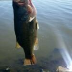
The primary draw for seasoned captains and anglers in this sector is the trout fishery, available in both Willow Springs Lake and adjacent streams. Unlike the manicured urban ponds of the valley, this is a high-country experience where weather patterns shift rapidly and bottom topography requires attention. The area serves as a strategic base camp, with Canyon Point providing the logistical hub for boaters targeting the deep pockets of the lake or the moving water of the nearby creeks.

💡 Captain's Tip: High Altitude Adjustments

At 7,500 feet, oxygen levels are lower, affecting both engine performance and physical stamina. Ensure your carbureted outboards are tuned for high elevation to avoid sluggish starts at the ramp.

Access & Getting There

Access to the Willow Springs area is straightforward but requires navigating mountain grades. The primary artery is Highway 260. Traffic can be heavy on weekends with recreational vehicles climbing from the valley. The main turnoff for the Canyon Point facility is located at Milepost 287, approximately 20 miles west of Heber and 4.5 miles east of the Rim Visitor Information Station.

For those towing vessels, the infrastructure is generally robust. The internal roads at the nearby Canyon Point Campground are paved, accommodating rigs up to 75 feet in length. However, the boat launch situation at Willow Springs Lake (roughly 5 miles from the campground base) can see congestion during peak summer mornings. The ramps are functional, but seasoned boaters know to arrive before dawn to secure trailer parking close to the water.

Weather is the single biggest variable for access in this region. During the "Monsoon Season" from late June through August, violent afternoon thunderstorms are clockwork occurrences. These storms bring lightning and sudden downdrafts that can make open water dangerous instantly. It is critical to monitor the sky to the south; when clouds build over the rim edge, it is time to get off the water.

💡 Captain's Tip: The Monsoon Rule

Local pros operate on a strict schedule during summer: launch at first light and be off the water by 1:00 PM. Afternoon electrical storms on the Rim are dangerous and move faster than most trolling motors.

Willow Springs Pre-Trip Checklist

Facilities & Amenities

The infrastructure around Willow Springs is designed for self-sufficient anglers and campers. Canyon Point serves as the primary facility, offering 113 campsites, showers, and restrooms. It acts as a reliable forward operating base for multi-day fishing trips. While the campground offers potable water and firewood, it does not have a dedicated marina fuel dock. Anglers must fuel their vessels on the highway before launching.

For immediate tackle needs, Gilligan's Forest Lakes General Store is the local staple, located just 2 miles from the main access points. They open at 7:00 AM, allowing for last-minute bait acquisition before hitting the water. While they carry essential trout gear, specialized fly-fishing equipment or heavy boat parts should be sourced in Payson or Heber prior to arrival.

It is important to note the "negative knowledge" for this area: there are no major marine repair facilities or large grocery chains in the immediate vicinity of Forest Lakes. The nearest full-service community is Overgaard, located 22 miles east on Highway 260. Plan your provisioning accordingly to avoid burning valuable fishing time on a 45-mile round trip for ice or food.

Local Lodging & Camping Overview

Facility NameDistanceTypeKey Feature
Canyon Point1.8 milesCampgroundPaved sites, 75ft max length, Showers
Five Lakes RV Park2.9 milesRV ParkFull hookups, close proximity
Fr 171 Campground4.5 milesCampgroundDispersed/Rustic feel
Mountain Retreat RV Park16.9 milesRV ParkOpen 24 hours, high rated

Permits, Regulations & Fees

Fishing activities in this sector are managed by the State Fishing Agency. Compliance is strictly enforced due to the high volume of visitors the Mogollon Rim attracts. While specific permit costs vary by season, a valid state fishing license is mandatory for all anglers. The area is also part of the Apache-Sitgreaves National Forest, meaning federal land use rules apply regarding camping and off-road travel.

Anglers should be aware of "Kapu" or general respect for the land. This area contains sensitive riparian zones and cultural history. The Sinkhole Trail and the edge of the Rim are environmentally fragile; tread lightly when accessing shore spots. Dispersed camping is allowed in designated areas like the Fr 237 Camping Area, but strict "pack it in, pack it out" ethics are expected to maintain the pristine nature of the high country.

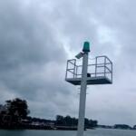
There are no specific restricted zones mentioned for the lake surface itself, but standard boating safety regulations are in effect. Life jackets must be accessible, and navigation rules apply. Always check the information boards at the Canyon Point entrance or the boat ramps for temporary closures related to fire danger or wildlife management.

Events & Seasonal Information

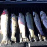
The rhythm of Willow Springs is dictated by the seasons. Summer offers a respite from the desert heat, with daytime temperatures generally 20 to 40 degrees cooler than the Phoenix area. This temperature drop activates the trout bite, particularly in the early morning and late evening hours. However, the monsoon rains in July and August can muddy the inflows, changing the most effective bait presentations.

While there are no major professional tournament circuits that regularly stop here, the area is popular for local club derbies and family-oriented fishing events. The Canyon Point Amphitheater frequently hosts educational programs led by Forest Service rangers on weekends, which can be a great resource for understanding local biology and current forest conditions.

Winter brings a hard stop to most easy access. Snowfall on the Rim can be significant, often closing forest roads and making the boat ramps inaccessible. The prime season for the serious angler runs from late April, once the ice melts, through October, before the first heavy snows close the high country.

💡 Captain's Tip: Fall Fishing

Late September to October is the "golden hour" for this fishery. The monsoon storms fade, the Aspen trees turn gold, and the trout feed aggressively before winter. Boat traffic also drops significantly after Labor Day.

Contact Information & Resources

For the most current facility conditions, direct inquiries to the Canyon Point facility management at 928-535-9859 or the general information line at (928) 535-0181. They can provide real-time updates on ramp status and campground capacity.

In terms of safety, cell service can be spotty in the deep pockets of the forest. It is advisable to have a float plan filed with someone on shore. For medical emergencies, the nearest major services are in Payson or Show Low, both significant drives from the water. Self-reliance is key in this environment.

For precise locations of the boat ramps, real-time weather radar, and detailed bathymetry, consult the live dashboard and interactive maps below.

🎣

Willow Springs

Forest Lakes • Arizona • 34.3489, -110.8297
🅿️

Parking

1
Horton Springs Parking Lot
⭐ 5.0 15.2 mi
📍 Payson, AZ 85541, USA
🚗 Get Directions
🐟

Bait & Tackle

1
Gilligan's Forest Lakes General Store
⭐ 4.7 2.0 mi
📍 2998 AZ-260, Forest Lakes Estates, AZ 85931, USA
🕒
Monday: 7:00 AM – 9:00 PM
Tuesday: 7:00 AM – 9:00 PM
Wednesday: 7:00 AM – 9:00 PM
Thursday: 7:00 AM – 9:00 PM
Friday: 7:00 AM – 9:00 PM
Saturday: 7:00 AM – 9:00 PM
Sunday: 7:00 AM – 9:00 PM
🚗 Get Directions
🏠

Lodging

5
Mountain Retreat RV Park
⭐ 5.0 16.9 mi
📍 2268 AZ-260, Heber-Overgaard, AZ 85933, USA
🕒
Monday: Open 24 hours
Tuesday: Open 24 hours
Wednesday: Open 24 hours
Thursday: Open 24 hours
Friday: Open 24 hours
Saturday: Open 24 hours
Sunday: Open 24 hours
🚗 Get Directions
Boulders RV Park
⭐ 4.9 13.9 mi
📍 1776 Black Canyon Rd, Heber, AZ 85928, USA
🕒
Monday: 7:00 AM – 7:00 PM
Tuesday: 7:00 AM – 7:00 PM
Wednesday: 7:00 AM – 7:00 PM
Thursday: 7:00 AM – 7:00 PM
Friday: 7:00 AM – 7:00 PM
Saturday: 7:00 AM – 7:00 PM
Sunday: 7:00 AM – 7:00 PM
🚗 Get Directions

Boat Ramps

3
🚻

Restrooms

3
👨‍👩‍👧‍👦

Family Friendly

2

Accessibility

Wheelchair Access

Available

🐕

Pets Allowed

Not Confirmed

⚠️ Some accessibility info not officially confirmed. Please verify with location directly.

📍 Showing 15 facilities on map

📊

About Our Fishing Reports & Forecasts

Our spot reports combine data-driven forecasts with curated local information. The forecast is generated by our proprietary Fishing Score algorithm (0–100%), which analyzes real-time data from Open-Meteo API, validated against NOAA CO-OPS tide gauges and USGS water-monitoring stations. The model weights tide dynamics (35%), wave energy (25%), wind patterns (20%) and time of day (20%)—factors shown to influence fish feeding behavior through marine-biology research and decades of charter log data.

Access, facilities and services information for each fishing spot is sourced from official datasets such as Recreation.gov (RIDB), state park & wildlife agencies, and geospatial providers like Google Maps. These sections undergo scheduled re-validation every 3–6 months to ensure that boat ramps, park access, contact details and local services remain accurate.

Narrative sections (catches, seasonal behavior, local tips) are synthesized from these data sources and refined following the Fishing Reports Today editorial guidelines, combining bibliographic research from ichthyology and oceanography with expert angler experience. Our team reviews reports on a regular basis, while the forecast model itself updates every 6 hours for real-time accuracy.

⚠️ Important: Always verify current local regulations, access restrictions and weather conditions before fishing. These reports are intended as a planning aid, not a guarantee of catches or safety. When in doubt, contact local authorities or park managers listed on the page.

Learn more about our methodology & data sources

Leave a Reply

Your email address will not be published. Required fields are marked *