0%

Barlett Lake Fishing Report Today 🎣

4 months ago · Updated 2 weeks ago

Bartlett Lake Fishing Report: Winter Finesse & Deep Schools

1. GO/NO-GO STATUS

Status: GO

Bartlett Lake is currently in a stable winter pattern. While morning air temperatures are crisp (requiring layers), the midday sun makes for comfortable angling. Water levels are hovering around 48-49% capacity, which exposes significant shoreline structure but also brings submerged rock reefs dangerously close to the surface—navigational caution is required near Moon Island and Panic Rock.

Weather Impact: Stable high pressure has settled in, meaning clear skies and post-frontal conditions. The bite is finesse-oriented but consistent for anglers willing to slow down.

2. SPECIES INTEL

Based on recent biological surveys and guide reports, here is the current biomass activity:

  • Primary Target: Largemouth & Smallmouth Bass (Micropterus salmoides/dolomieu)

    Activity Level: Moderate to High

    Bio-Note: Fish have transitioned to winter haunts. They are relating heavily to vertical structure and deep rock transitions rather than shallow flats. The "verified seasonal pattern" confirms bass are lethargic early but feed actively during the warmest part of the day (11:00 AM – 3:00 PM).
  • Sleeper Pick: Black Crappie (Pomoxis nigromaculatus)

    Activity Level: Rising

    Bio-Note: Schools are roaming open water or suspending tightly against vertical cliff walls. They are currently "just starting" to bunch up, making them a prime target for anglers with forward-facing sonar or good 2D sonar skills.
  • Forage/Baitfish Report:

    Threadfin Shad are the primary menu item. In winter, shad balls often tighten up and suspend in 20-40ft of water. Bass will position themselves directly under these bait balls.

Biological Ground Truth (Regional Context): While our bio-data confirms Rainbow Trout and Sonora Sucker activity in the region, these observations are concentrated in the Salt River and urban waterways, not Bartlett Lake itself. See the "Regional Alternative" section below if you are targeting trout.

3. TACTICAL STRATEGY

Phase 1: Deep Finesse (Bass)

With water temperatures in the low-to-mid 50s, the reaction bite is slow. You need to put the bait right on their nose.

  • Where: Focus on Yellow Cliffs, Moon Island (rocky points), and the steep walls near the Dam. Target depths of 15ft to 30ft. Look for "stair-step" ledges where bass can move vertically without swimming far.
  • The Rig: Drop Shot is king right now. Use a 3/16oz or 1/4oz tungsten cylinder weight to feel the bottom composition changes.
  • Lure Selection: 4.5" to 6" straight-tail worms.

    Top Colors: Morning Dawn (pink/purple), Oxblood, or Watermelon/Red Flake.
  • Technique: Cast to the ledge, let it hit bottom, and deadstick it. Shake the slack gently without moving the weight. The bite will feel like a heavy wet sock—reel down and sweep set.

Phase 2: The "Sleeper" School (Crappie)

Crappie are schooling up near vertical structure.

  • Where: Yellow Cliffs and the mouths of deep creek channels. Look for suspended returns on your sonar in 15-25ft of water over 40ft+ bottoms.
  • Lure: 1/16oz jig heads tipped with 2" Kalin’s Grubs (Blue Ice or Pearl color).
  • Pro Tip: If the jig bite is slow, switch to live minnows on a slip-bobber rig set to exactly the depth of the school seen on sonar.

Phase 3: Windy Banks (Reaction)

If the wind picks up in the afternoon, creating "mud lines" on rocky banks:

  • Lure: 3/8oz Double Willow Spinnerbait (White/Chartreuse) or a Keitech 3.8" Swing Impact on a ball head jig.
  • Technique: Slow roll it along the bottom in 5-10ft of water. The wind pushes plankton and shad against the bank, bringing active bass shallower.

4. REGULATIONS SNAPSHOT

SpeciesBag LimitSize LimitNotes
Bass (Largemouth/Smallmouth)6 (combined)13-inch minimumStrictly enforced. Catch & Release encouraged for trophy sizes.
CrappieUnlimitedNoneGreat table fare; selective harvest recommended to maintain school size.
Catfish (Flathead/Channel)25 (combined)NoneFlatheads over 20lbs are common; heavy gear required.

5. REGIONAL ALTERNATIVE

Location: Lower Salt River (Below Stewart Mountain Dam)

If Bartlett is too windy or the deep bite is too technical, the Lower Salt River is your best bet for cold-water action.

  • Target Species: Rainbow Trout (Stocked) and Sonora Sucker.
  • Bio-Verification: Recent citizen science data confirms active catches of Rainbow Trout and Suckers in this zone as of Jan 9, 2026.
  • Tactic: Drift salmon eggs or PowerBait (Garlic scent) under a bobber in the slack water behind boulders. For fly anglers, a Zebra Midge or Woolly Bugger is producing well.
  • Access: Blue Point Bridge or Water Users Recreation Site.

Tight lines!

Loading forecast...

Live Fishing Conditions: Tides, Weather & Waves

Get real‑time tides, marine weather, swell and solunar activity for each spot so you know exactly when conditions line up for your best chance at a bite.

🎣

Barlett Lake

Loading coordinates...

🌤️

WEATHER CONDITIONS

Weather
-- °F
--°C

Loading...

🌡️
Feels Like --°F --°C
💧
Humidity --%
💨
Wind -- mph -- km/h
🧭
Direction --
📊
Pressure -- inHg -- hPa
☀️
UV Index --
🌊

MARINE CONDITIONS

🌊 Wave Height
-- ft
-- m
Loading...
🧭 Wave Direction
--°
Loading...
⏱️ Wave Period
-- s
Loading...
📈 Tide Status
-- ft
-- m
Loading...
🌙

LUNAR & SOLUNAR

🌕

Loading...

Illumination: --%

Major Period --:-- - --:-- --:-- - --:--
Minor Period --:-- - --:-- --:-- - --:--
🌅 Sunrise --:--
🌇 Sunset --:--
📅

24-HOUR FORECAST

Loading fishing conditions...

Fishing Spots Map

My location
Loading map...

Local Access & Facilities

The following guide details the logistical realities of fishing Bartlett Lake and the surrounding Verde River system.

💡 Captain's Tip: Digital Preparation

Cellular service is notoriously spotty near the water. Download the Recreation.gov mobile app before leaving Carefree or Scottsdale to use the "Scan and Pay" feature for campsites, as remote areas often lack signal.

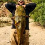
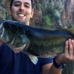
The Bartlett Lake Fishery

Nestled in the heart of the Tonto National Forest, this reservoir offers a distinct contrast to the more urbanized fisheries of Arizona. The atmosphere here is defined by the rugged Sonoran Desert landscape, where saguaro cacti line the banks and the Verde River flows into the main lake body. It is a location that balances accessibility with a sense of remote tranquility, particularly for anglers willing to venture away from the main marina.

While the main lake attracts recreational boaters, the river sections offer a quieter experience. The water conditions vary from the deep, open basins near the dam to the flowing, structure-rich waters of the river inlet. Experienced anglers appreciate this diversity, targeting game fish that patrol the transition zones between the river current and the lake's stillness.

The vibe shifts significantly depending on your launch point. The main marina buzzes with activity, while areas like Riverside Campground offer a primitive, "feet-in-the-sand" fishing experience. This is a fishery where reading the water levels and understanding the desert topography are just as important as bait selection.

Access & Getting There

Navigating the Route

Accessing the water requires navigating Bartlett Dam Road, which winds through the desert terrain. Most anglers approach from Cave Creek Road, turning east onto the dam road for approximately 13 miles. The drive is scenic but demands attention; the road is paved but can be narrow in sections with winding turns that require care when towing larger vessels.

For those targeting the river section via Riverside Campground, be prepared for a change in road surface. Approximately 13 miles in, just before the Jojoba Boating site, the route transitions to FR 19. This is a maintained gravel road that heads south for another 3 miles. While generally passable, recent rains can alter the condition of desert gravel roads quickly.

💡 Captain's Tip: Trailer Constraints

If you are heading to the primitive river areas, leave the big rig at home. Riverside Campground has a strict restriction on trailers, prohibiting anything over 16 feet. Heavy boat traffic is not permitted here, making it ideal for kayaks or shore casting.
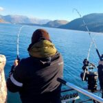
Launch Realities

Bartlett Marina serves as the primary commercial hub for launching motorized vessels. It is located roughly 1.1 miles from the main dam access point. The facilities here are designed to handle standard recreational traffic, but early arrival is recommended during peak weekends to secure parking and efficient ramp access.

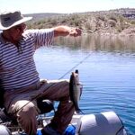
Alternatively, the Jojoba Boating Launch provides a dedicated ramp option roughly a mile from the marina area. For shore anglers and families, S B Cove offers accessible shoreline entry points suitable for setting up chairs and bank fishing without the stress of boat ramp logistics. These points are clearly marked on the interactive maps below.

Barlett Lake Fishing Report Today 🎣 Pre-Trip Checklist

Facilities & Amenities

Infrastructure at this location ranges from fully developed commercial services to completely primitive sites. Bartlett Marina is the center of gravity for amenities, providing the essential services required for a day on the water. However, anglers venturing to the river campgrounds must be entirely self-sufficient.

Riverside Campground is a prime example of this "pack it in, pack it out" mentality. While it offers peace and proximity to the water, there are zero potable water services available. You must bring every drop of water you intend to use. There are no hookups, and the site operates on a first-come, first-served basis.

Key Facility Data

Facility NameTypeKey FeaturesContact
Bartlett MarinaMarina / LaunchCommercial site, main boat access602-316-3378
Riverside CampgroundCampgroundNo motor boats, river access, no waterN/A (First-come)
Jojoba Boating LaunchBoat LaunchTrailer parking availableN/A
Desert Vista OHV AreaStaging AreaAccess to Verde River, 100+ miles of routesN/A

Lodging & Provisions

For those not camping, the nearest high-end accommodation is the Four Seasons Resort Scottsdale, located about 14 miles away. For a more rustic experience closer to the equestrian trails, Chaparosa Ranch and Donkey Holler Ranch are roughly 8 to 9 miles from the water. Anglers looking for general supplies should stock up in Carefree or Scottsdale before hitting Bartlett Dam Road, as retail options vanish once you enter the National Forest.

Permits, Regulations & Fees

The Tonto Pass System

Fishing and boating here fall under the jurisdiction of the Tonto National Forest. A valid Tonto Pass is generally required for parking and utilizing recreation sites. It is critical to purchase these passes before you arrive at the water's edge. The nearest fee machine is located at the Cave Creek Ranger Station.

Riverside Campground utilizes a specific fee structure ($16 per site, per night). While there is a "Scan and Pay" option via QR code on-site, the lack of reliable cellular service makes this risky if you haven't downloaded the app beforehand. Physical payment at a fee machine prior to arrival is the safest bet.

💡 Captain's Tip: Quiet Hours

If you are camping to get an early start, respect the generator rules. Quiet hours run from 10:00 PM to 6:00 AM. Running a generator during this window is a violation and disrupts the solitude that defines the river access points.

Protected Zones & Etiquette

Specific zones have unique restrictions to protect the resource. Riverside Campground strictly prohibits motor boats, preserving the area for non-motorized craft and shore fishing. Additionally, glass containers are prohibited in these areas to protect the shoreline and wading anglers. Adhering to the 14-day stay limit ensures equal access for all users of public lands.

Events & Seasonal Information

The fishing rhythm here is dictated by the desert seasons. High summer brings intense heat, making early morning "dawn patrol" or late evening sessions the only viable options for serious anglers. The water levels can fluctuate based on outflows from the dam and inflows from the Verde River, altering the shoreline topography significantly.

While the lake is open year-round, the WestWorld recreation area (roughly 19 miles away) hosts major events like the Barrett-Jackson Auto Auction and Arabian Horse Shows. During these signature events, traffic on the approach roads from Scottsdale can be heavier than usual. Check the local calendar if you plan to transit through the north Scottsdale corridor to reach the lake.

Contact Information & Resources

For current lake conditions, water levels, and closure notices, direct contact with the managing agencies is recommended. Self-reliance is key in this environment; always carry extra water and emergency supplies.

  • Bartlett Marina: 602-316-3378
  • WestWorld (Nearby Rec Area): 480-312-6802
  • Emergency: 911 (Note: Cell service is limited)

For precise locations of the boat ramps, real-time weather data, and detailed maps of the river inlet zones, consult the live dashboard and interactive widgets below.

🎣

Barlett Lake

Rio Verde • Arizona • 33.8236, -111.6346
🅿️

Parking

5
Parking
⭐ 5.0 13.1 mi
📍 W5MH+VR, Camp Creek, AZ 85262, USA
🚗 Get Directions
World Famous Fountain
⭐ 4.7 15.9 mi
📍 Lake, Fountain, Fountain Hills, AZ 85268, USA
🕒
Monday: 9:00 AM – 9:00 PM
Tuesday: 9:00 AM – 9:00 PM
Wednesday: 9:00 AM – 9:00 PM
Thursday: 9:00 AM – 9:00 PM
Friday: 9:00 AM – 9:00 PM
Saturday: 9:00 AM – 9:00 PM
Sunday: 9:00 AM – 9:00 PM
🚗 Get Directions
Four Peaks Trail
⭐ 4.7 13.3 mi
📍 Fort McDowell, AZ 85264, USA
🚗 Get Directions
Elite Garage Doors & Gates
⭐ 4.5 21.2 mi
📍 7652 E Greenway Rd Ste 100, Scottsdale, AZ 85260, USA
🕒
Monday: Open 24 hours
Tuesday: Open 24 hours
Wednesday: Open 24 hours
Thursday: Open 24 hours
Friday: Open 24 hours
Saturday: Open 24 hours
Sunday: Open 24 hours
🚗 Get Directions
🏠

Lodging

5
Chaparosa Ranch
⭐ 5.0 7.8 mi
📍 31316 N 152nd St, Scottsdale, AZ 85262, USA
🕒
Monday: 6:00 AM – 9:00 PM
Tuesday: 6:00 AM – 9:00 PM
Wednesday: 6:00 AM – 9:00 PM
Thursday: 6:00 AM – 9:00 PM
Friday: 6:00 AM – 9:00 PM
Saturday: 6:00 AM – 9:00 PM
Sunday: 6:00 AM – 9:00 PM
🚗 Get Directions
Youth Group Area
⭐ 4.8 7.7 mi
📍 Scout Camp Dr, Rio Verde, AZ 85263, USA
🚗 Get Directions

Boat Ramps

3
🚻

Restrooms

3
👨‍👩‍👧‍👦

Family Friendly

2

Accessibility

Wheelchair Access

Not Confirmed

🐕

Pets Allowed

Not Confirmed

⚠️ Some accessibility info not officially confirmed. Please verify with location directly.

📍 Showing 18 facilities on map

📊

About Our Fishing Reports & Forecasts

Our spot reports combine data-driven forecasts with curated local information. The forecast is generated by our proprietary Fishing Score algorithm (0–100%), which analyzes real-time data from Open-Meteo API, validated against NOAA CO-OPS tide gauges and USGS water-monitoring stations. The model weights tide dynamics (35%), wave energy (25%), wind patterns (20%) and time of day (20%)—factors shown to influence fish feeding behavior through marine-biology research and decades of charter log data.

Access, facilities and services information for each fishing spot is sourced from official datasets such as Recreation.gov (RIDB), state park & wildlife agencies, and geospatial providers like Google Maps. These sections undergo scheduled re-validation every 3–6 months to ensure that boat ramps, park access, contact details and local services remain accurate.

Narrative sections (catches, seasonal behavior, local tips) are synthesized from these data sources and refined following the Fishing Reports Today editorial guidelines, combining bibliographic research from ichthyology and oceanography with expert angler experience. Our team reviews reports on a regular basis, while the forecast model itself updates every 6 hours for real-time accuracy.

⚠️ Important: Always verify current local regulations, access restrictions and weather conditions before fishing. These reports are intended as a planning aid, not a guarantee of catches or safety. When in doubt, contact local authorities or park managers listed on the page.

Learn more about our methodology & data sources

Leave a Reply

Your email address will not be published. Required fields are marked *