Williamstown Fishing Report: Port Phillip Bay & Estuary Action
Williamstown offers a dynamic and highly accessible urban fishery at the northern reaches of Port Phillip Bay. Positioned right where the Yarra River meets the saltwater, this area features a diverse mix of deep dredged shipping channels, shallow weed beds, and heavily structured rocky foreshores. As the heat of summer fades and the autumn cooling trend sets in, the local waters become a transitional highway for both resident and migratory species. Whether you are launching a boat to sound out the reefs or walking the historic maritime piers, the current seasonal conditions provide exceptional angling opportunities for those who understand the local tidal movements and bathymetry.
1. GO/NO-GO STATUS
Verdict: GO (With Wind Caution)
The autumn transition delivers some of the most stable and comfortable fishing weather of the year in Melbourne, but Port Phillip Bay's temperament is entirely dictated by wind direction and velocity. Currently, conditions are prime for targeting the northern end of the bay, provided you keep a close eye on the forecast.
🎣Nautrek
Private Beta
J
M
R
100+ anglers on the waitlist
The fishing network where your reputation matters.
Find trusted captains, join real trips with cost splitting, and build your Angler Rank. Your spots stay private — you decide who sees your intel.
Wind is your primary adversary here. Anything under 15 knots from the north or northwest keeps the Williamstown foreshore relatively flat, sheltered, and highly fishable. However, if a strong southerly or south-westerly front is moving in, the bay can rapidly degenerate into a dangerous, short-period chop that bounces off the rock walls. In these conditions, small craft should avoid the open water entirely.
Safety Advisory: Williamstown is a major hub for heavy maritime and commercial shipping traffic. Always maintain a safe distance from the main transit channels and give way to large vessels. Additionally, water quality near the Yarra mouth can degrade after heavy inland rainfall; focus your efforts on the incoming tide, which pushes cleaner, high-salinity water from the southern bay into the local estuary systems.
While the massive breeding snapper of the spring run have largely dispersed, the local reefs are currently teeming with schooling "Pinkies" (juvenile snapper in the 28-40cm class). These fish are feeding aggressively over broken ground and rocky drop-offs as they pack on weight in the cooling water. Flathead are also holding in solid numbers along the sandy fringes of the weed beds, waiting in ambush for passing baitfish.
Sleeper Pick: Black Bream
Often bypassed by boaters racing out to deeper marks, the Black Bream fishery around Williamstown's infrastructure is world-class right now. These robust, intelligent fish are congregating around the heavily encrusted pylons of local piers and the lower reaches of the Yarra estuary, feeding on mussels and small crustaceans.
Baitfish Report:
The local forage base currently consists of whitebait, small southern calamari (squid), and migrating prawns. Match your lure profiles and bait selections to these natural food sources. You will also find schools of mullet and tailor pushing into the warmer thermal currents near the power station outflows.
3. TACTICAL STRATEGY
To maximize your success in this heavily fished urban environment, precision is key. Blind casting into the abyss rarely yields results; you must target specific structures and depth changes.
Boat and Kayak Anglers: The Football Ground Reef
Where: Position your vessel directly out from the Williamstown Cricket and Football Ground. Use your sounder to locate the broken rocky bottom and sharp depth transitions around the 8 to 10-meter mark. Predatory fish use these steep channel edges as highways, moving up onto the shallow reefs during low light to feed.
Timing: The first two hours of the run-in tide are critical, particularly if this window aligns with the low-light periods of dawn or dusk.
Lures: Drift over the reef edges casting 1/6oz tungsten jigheads rigged with 4-inch soft plastic paddle tails or Berkley Gulp Turtleback Worms.
Color:Motor Oil or Pumpkinseed patterns are absolute standouts in the slightly stained waters of the northern bay.
Bait: If anchoring, deploy a heavy, continuous berley trail of crushed pilchards. Fish unweighted fresh squid strips or whole pilchards on a light running sinker rig, allowing the bait to drift naturally down the back of your berley slick.
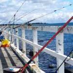
Land-Based Anglers: Ferguson Street & Gem Piers
Where: Ferguson Street Pier offers excellent deep-water access. Fish tight against the vertical pylons for resident bream, or cast long off the end of the structure to intercept cruising snapper and flathead.
Lures: For bream, use ultra-light crab imitation lures dropped vertically alongside the pylons. Let them sink slowly and watch your line for the slightest tick or hesitation.
Bait: Unweighted scrub worms, raw chicken breast lightly coated in garlic powder, or live bass yabbies work exceptionally well.
Pro Tip: Bream are incredibly easily spooked by heavy footsteps and shadows. Keep a low profile on the piers, fish light fluorocarbon leaders (4-6lb maximum), and avoid casting your shadow over the specific structure you are targeting.
The "Warmies" (Newport Power Station Outflow)
Located just around the corner from the main Williamstown strip, this artificial thermal plume is a major drawcard in cooling weather.
Tactics: Target tailor and Australian salmon by casting 15-20g metal slugs and retrieving them rapidly across the surface. For bottom-dwelling species like flathead and the occasional mulloway, fish large live baits or heavy soft vibes deep in the channel.
Pro Tip: The bite at the Warmies is heavily dependent on the power station actively generating electricity. Look for the steam stacks—if they are smoking, the warm water is flowing, and the baitfish will be thick.
4. REGULATIONS SNAPSHOT
The Victorian Fisheries Authority strictly enforces size and bag limits in Port Phillip Bay. Be aware of the latest updates to recreational fishing rules, particularly the reduced bag limits for pelagic species.
Target Species
Minimum Legal Size
Bag Limit
Snapper (Pinkies)
28 cm
10 (Maximum of 3 fish over 40cm)
Flathead (Excluding Dusky)
27 cm
20
Black Bream
28 cm
10
Yellowtail Kingfish
60 cm
2
Pro Tip: Black bream cannot be filleted on or in Victorian waters. They must be kept whole or in carcass form until you are away from the water. Always carry a wet towel to handle undersized fish gently before release to protect their vital slime coat.
5. REGIONAL ALTERNATIVE: Maribyrnong River Estuary
If a strong southerly buster blows out the open waters of Port Phillip Bay, do not pack up your gear. Head just 15 minutes inland to the highly sheltered waters of the Maribyrnong River estuary.
Where to go: Access the river via Footscray Park, the jetties near Anglers Tavern, or the Flemington Racecourse stretch. The high banks and urban infrastructure provide excellent windbreaks.
Target Species: Black Bream, Estuary Perch, and Mulloway.
Tactical Approach: Fish the incoming tide, which pushes clean, salty water upstream and triggers a feeding response. Use a finesse 1-3kg spin outfit to cast 80-100mm curl tail soft plastics or small hardbody vibes tight against bridge pylons, boat moorings, and floating pontoons. If you prefer bait fishing, a light running sinker rig with live scrub worms or peeled prawn will keep your rods bending all day in the protected water.
Tight lines!
Editor's Choice: Must-Have Gear
FISHINGSIR Next-Gen Waterproof Chest Waders
★★★★★4.4 (7,370+ reviews)
2-Ply Tech: Upgraded nylon with 2.5x higher density than standard fabrics.
100% Waterproof: Lab-approved intrusion resistance with taped visible seams.
Ultra-Lightweight: Designed for all-day comfort while hunting or fishing.
As an Amazon Associate I earn from qualifying purchases. #ad
Loading forecast...
Live Fishing Conditions: Tides, Weather & Waves
Get real‑time tides, marine weather, swell and solunar activity for each spot so you know exactly when conditions line up for your best chance at a bite.
🎣
Williamstown
Loading coordinates...
🌤️
WEATHER CONDITIONS
--°F
--°C
Loading...
🌡️
Feels Like--°F--°C
💧
Humidity--%
💨
Wind-- mph-- km/h
🧭
Direction--
📊
Pressure-- inHg-- hPa
☀️
UV Index--
🌊
MARINE CONDITIONS
🌊Wave Height
-- ft
-- m
Loading...
🧭Wave Direction
--°
Loading...
⏱️Wave Period
-- s
Loading...
📈Tide Status
-- ft
-- m
Loading...
🌙
LUNAR & SOLUNAR
🌕
Loading...
Illumination: --%
Major Period--:-- - --:----:-- - --:--
Minor Period--:-- - --:----:-- - --:--
🌅Sunrise--:--
🌇Sunset--:--
📅
24-HOUR FORECAST
Loading fishing conditions...
Fishing Spots Map
My location
Loading map...
Unable to load map
There was an error loading the map. Please try refreshing the page.
Info
Local Access & Facilities
Williamstown Pre-Trip Checklist
Local Access & Facilities
Williamstown stands as a historic maritime gateway, offering anglers a unique blend of urban accessibility and serious saltwater potential. Situated at the mouth of the Yarra River where it meets Port Phillip Bay, this fishery is characterized by its deep shipping channels, bluestone seawalls, and dynamic tidal flows. The atmosphere here is distinctly nautical, where the bustle of commercial shipping lanes intersects with a passionate local recreational fleet. For the experienced skipper, this is more than just a harbor; it is a strategic launchpad into the deeper waters of the bay.
The bottom topography varies drastically from the dredged mud of the channels to the rocky structures lining the foreshore. This diversity attracts a wide range of species, making it a favorite for those targeting bay staples in deeper pockets or working the structure for resident fish. The proximity to the city means the skyline is your backdrop, but the water conditions can rival open ocean swells when the wind bucks the tide. It is a fishery that rewards precision and respect for the heavy maritime traffic that shares these waters.
Seasoned anglers know that Williamstown is often the "Plan A" for accessing the northern reaches of the bay. Whether you are launching a heavy fiberglass center console or casting from the rocky groynes, the infrastructure here is designed to handle maritime activity. However, the urban setting brings its own set of logistical challenges, from parking scarcity to navigating busy fairways. Understanding the pulse of this port is essential for a seamless trip.
💡 Captain's Tip: Watch the Shipping Lanes
This is an active commercial port. Large vessels in the channel throw significant wakes and have limited maneuverability. Always maintain a wide berth and never anchor in the main shipping channel.
Access & Getting There
Reaching Williamstown requires navigating the urban arteries of the greater Melbourne area. The primary access routes can become heavily congested during commuter hours, so early "dawn patrol" departures are highly recommended to avoid the gridlock. The final approach to the waterfront takes you through historic streets that can be narrow, so maneuvering large trailers requires patience and awareness of parked cars. Plan your route to avoid the tightest residential corners if you are towing a beamier vessel.
The crown jewel for boaters is the Williamstown Boat Ramp. This facility is the primary insertion point for the area, featuring trailer parking and a paved launch surface. While the ramp is generally well-maintained, the surge of weekend warriors can lead to significant wait times. The ramp angle is suitable for most trailer boats, but skippers should always inspect the waterline for algae buildup, which can make the concrete treacherous at low tide.
Parking is a critical logistical component here. The Williamstown Boat Ramp offers dedicated trailer parking, a rare commodity in such an urban environment. However, capacity is finite. On prime weather days during the season, these spots fill up before the sun breaks the horizon. If you arrive late, you may find yourself circling for street parking, which is often time-restricted or unsuitable for long rigs. Security is generally good due to the high traffic, but standard precautions like locking hitches and removing valuables from truck beds apply.
For those fishing from land, Jawbone Reserve Playground and the surrounding shoreline offer excellent access points. These areas are suitable for shore fishing and are accessible to families. The terrain can be uneven, so sturdy footwear is advised. Weather plays a massive role in access here; strong southerly winds can turn the ramp and shoreline into a washing machine, making launch and retrieval dangerous. In such conditions, seeking a protected lee or postponing the trip is the mark of a prudent captain.
💡 Captain's Tip: Wind Awareness
Port Phillip Bay chop is short and sharp. If the forecast calls for winds opposing the tide, the sea state at the river mouth can deteriorate rapidly. Check the forecast specifically for the northern bay before launching.
Facilities & Amenities
While Williamstown is a developed harbor, anglers must be strategic about their supplies. A critical piece of "negative knowledge" for visiting anglers is the distance to specialized bait and tackle shops. There are no major tackle stores immediately adjacent to the ramp. The closest reliable options, such as Jan Juc Fishing Worms and Fish on bait & burley, are over 12 miles away. This means you must purchase your bait, ice, and terminal tackle before you reach the launch zone. Arriving at the ramp expecting to buy live bait on site will result in a frustrating delay.
The charter fleet in this area is top-tier, reflecting the serious nature of the fishery. Williamstown Charters operates directly out of Gem Pier, just a mile from the main fishing grounds. They are well-regarded for their local knowledge and ability to put clients on fish within sight of the city. For those willing to travel further for specific trips, Able fishing and charters operates out of Werribee South (approx. 12 miles away), and HOOOKN Fishing is located roughly 22 miles distant. These operators cater to anglers looking for guided experiences in the broader bay system.
Service Type
Provider Name
Distance & Location
Notes
Charter
Williamstown Charters
1 mi (Gem Pier)
Local specialist, open 24 hours.
Charter
Able fishing and charters
12.1 mi (Werribee South)
Highly rated, open 24 hours.
Bait & Tackle
Jan Juc Fishing Worms
12.7 mi (Werribee)
Opens 7:00 AM. Stock up en route.
Bait & Tackle
Fish on bait & burley
12.8 mi (Broadmeadows)
General supplies.
Accommodation options near the water vary. For those looking for a rustic, close-to-nature experience, The Pines Scout Camp is located just 2 miles from the action. However, anglers seeking luxury or full-service hotels will need to look further afield. The Park Hyatt Melbourne and Grand Hyatt Melbourne are approximately 6 miles away in the city center. For a balance of comfort and proximity, the Werribee Park Motor Inn is about 12 miles out, offering a practical base for those fishing the western side of the bay.
Fuel docks are not always available directly at every public ramp. It is standard practice for local captains to fuel up at highway service stations on the approach to Williamstown. This ensures you aren't reliant on marina hours or potentially higher fuel prices on the water. Additionally, while there are restrooms near the shore access points (approx. 1800-3000 ft away), they may not be open during pre-dawn hours, so plan accordingly.
💡 Captain's Tip: Supply Logistics
Since the nearest tackle shop is over 12 miles away, carry a comprehensive spare parts kit. A broken rod tip or lost terminal tackle can end your day early if you aren't self-sufficient.
Permits, Regulations & Fees
Fishing in these waters is managed by the State Fishing Agency, and strict adherence to regulations is not just a legal requirement but a cultural necessity to sustain the fishery. A valid recreational fishing license is generally required for all forms of angling in Victoria, unless you fall into an exempt category. These licenses should be purchased online prior to your trip, as on-site kiosks are rare or non-existent at the ramp itself.
Size and bag limits are strictly enforced, particularly for popular bay species. The Williamstown area is heavily patrolled by fisheries officers due to its high visibility and traffic. It is your responsibility to carry a measuring mat and current regulation guide. Ignorance of the rules regarding protected species or seasonal closures is not accepted as a valid defense. Catch-and-release is encouraged for larger breeding stock to ensure the future of the bay's ecosystem.
Cultural respect is also paramount. The waters of Port Phillip Bay have significant historical and cultural importance to the Indigenous people of the area. Anglers should treat the land and water with reverence, ensuring no trash is left behind and that wildlife is not harassed. Furthermore, access points like Jawbone Reserve are shared public spaces. Anglers must be courteous to walkers, families, and birdwatchers who also utilize the foreshore. Keeping the ramp area clear and moving efficiently is the unwritten law of the local boating community.
Events & Seasonal Information
The fishing calendar in Williamstown is dictated by the seasons of the bay. Summer brings warmer water and increased activity from pelagic species, but it also brings the crowds. During the peak summer months, the boat ramp can resemble a parking lot by mid-morning. The famous "Tea Tree" snapper run is a major event in the region, drawing anglers from all over the state. During this time, patience at the ramp is a critical piece of tackle.
Winter offers a different experience. The crowds thin out, and the dedicated angler can find solitude, though the conditions can be harsher. Strong southerly fronts can shut down fishing for days at a time. The best windows for fishing are often early mornings before the sea breeze kicks in, or late evenings when the wind drops out. In this urban environment, light pollution can actually aid night fishing operations, providing ambient light for rigging and navigation.
Tournaments are a feature of the local angling scene, often centered around the snapper season. During these events, the local facilities are stretched to capacity. If you are not participating in the tournament, it is often wise to avoid the main Williamstown Boat Ramp during weigh-in times or shotgun starts. Checking local club calendars can save you from getting stuck in a logjam of tournament boats.
Contact Information & Resources
For emergency assistance on the water, distinct protocols apply. In immediate life-threatening situations, dial 000 (Triple Zero). For maritime assistance, the local Coast Guard or Water Police monitor VHF radio channels. It is essential to have a working VHF radio on board, as cell phone coverage, while generally good in the bay, can be spotty in certain dead zones or during heavy weather.
Management of the boat ramp and foreshore is typically handled by the local council. Any issues with ramp infrastructure, such as damage to the pontoon or lighting failures, should be reported to the municipal authority. For the most current updates on fishability, wind warnings, and real-time ramp status, relying on digital resources is best. Local tackle shops, even those 12 miles away, often post reports on social media that can be invaluable for trip planning.
For precise locations, real-time weather conditions, and detailed bathymetry, consult the live dashboard and interactive maps below.
Our spot reports combine data-driven forecasts with curated local information. The forecast is generated by our proprietary Fishing Score algorithm (0–100%), which analyzes real-time data from Open-Meteo API, validated against NOAA CO-OPS tide gauges and USGS water-monitoring stations. The model weights tide dynamics (35%), wave energy (25%), wind patterns (20%) and time of day (20%)—factors shown to influence fish feeding behavior through marine-biology research and decades of charter log data.
Access, facilities and services information for each fishing spot is sourced from official datasets such as Recreation.gov (RIDB), state park & wildlife agencies, and geospatial providers like Google Maps. These sections undergo scheduled re-validation every 3–6 months to ensure that boat ramps, park access, contact details and local services remain accurate.
Narrative sections (catches, seasonal behavior, local tips) are synthesized from these data sources and refined following the Fishing Reports Today editorial guidelines, combining bibliographic research from ichthyology and oceanography with expert angler experience. Our team reviews reports on a regular basis, while the forecast model itself updates every 6 hours for real-time accuracy.
⚠️ Important: Always verify current local regulations, access restrictions and weather conditions before fishing. These reports are intended as a planning aid, not a guarantee of catches or safety. When in doubt, contact local authorities or park managers listed on the page.
To provide the best experiences, we use technologies like cookies to store and/or access device information. Consenting to these technologies will allow us to process data such as browsing behavior or unique IDs on this site. Not consenting or withdrawing consent, may adversely affect certain features and functions.
Functional Always active
The technical storage or access is strictly necessary for the legitimate purpose of enabling the use of a specific service explicitly requested by the subscriber or user, or for the sole purpose of carrying out the transmission of a communication over an electronic communications network.
Preferences
The technical storage or access is necessary for the legitimate purpose of storing preferences that are not requested by the subscriber or user.
Statistics
The technical storage or access that is used exclusively for statistical purposes.The technical storage or access that is used exclusively for anonymous statistical purposes. Without a subpoena, voluntary compliance on the part of your Internet Service Provider, or additional records from a third party, information stored or retrieved for this purpose alone cannot usually be used to identify you.
Marketing
The technical storage or access is required to create user profiles to send advertising, or to track the user on a website or across several websites for similar marketing purposes.


Leave a Reply