Geelong & Corio Bay Fishing Report: Autumn Transition Patterns
As the water temperatures steadily drop across Port Phillip Bay and the Bellarine Peninsula, the autumn transition brings some of the most dynamic and rewarding angling opportunities of the year to the Geelong region. The heavy summer recreational boating traffic has dissipated, leaving serious anglers with prime, undisturbed access to transitioning fish. The biological shift is well underway; water temperatures are hovering in that optimal cool-water zone, triggering heavy feeding responses from resident species before the deep winter chill sets in. Whether you are working the shallow seagrass beds, drifting the channel drop-offs, or dropping baits over the newly established artificial rocky reefs, the inner harbor is currently firing on all cylinders. Here is your comprehensive, guide-level tactical breakdown for the Geelong area.
1. GO/NO-GO STATUS
Verdict: GO for Inner Corio Bay / CAUTION for Offshore and The Heads
Weather & Safety Assessment: The inner harbor of Corio Bay, particularly around the Geelong waterfront, St Helens, and Limeburners Point, is offering fantastic shelter from the prevailing south-easterly afternoon winds. Water clarity remains excellent in the shallows, making sight-casting a viable option. For these protected inshore zones, it is a definitive GO.
However, if you are venturing toward the outer Bellarine Peninsula or the "Rip" at Point Lonsdale and Queenscliff, extreme CAUTION is advised. The current ocean swells combined with aggressive outgoing tides are making the Heads treacherous for all but the most experienced and well-equipped skippers. Land-based anglers working the Surf Coast rock platforms or the Barwon River mouth must remain hyper-vigilant for rogue waves on the flooding tide.
From the editor
Tired of fishing with strangers you can’t trust?
Nautrek is the first social network for serious anglers — verified partners, real trips, cost splitting and intel sharing without burning your spots. Private beta now open.
As the water cools to the 17 to 19-degree Celsius mark, flathead activity reaches its absolute peak in Corio Bay. These ambush predators are feeding aggressively to build energy reserves. Unlike the massive trophy dusky flathead found further east, Corio Bay predominantly holds high numbers of quality sand, rock, and yank flathead. They are currently congregating in 2 to 3 meters of water where tidal flow pushes baitfish over the flats.
Sleeper Pick: Sixspine Leatherjackets and Snook
While the crowds remain obsessed with late-season snapper or King George whiting, the structural edges around the bay are swarming with aggressive, oversized leatherjackets and cruising snook. Leatherjackets are stacking up heavily around the Queenscliff structures and the new artificial reefs. Meanwhile, snook are aggressively hunting baitfish under the artificial lights of Cunningham Pier after dark, providing thrilling light-tackle sport.
Baitfish Report
The bay is currently holding dense schools of silver whiting, pilchards, and small southern calamari. You will also notice a significant presence of sand eels and small crustaceans near the mudflats and weed margins. Matching your lure profiles and colors to these slender, silver, or natural-toned forage species is the key to consistent hookups.
3. TACTICAL STRATEGY
Where to Deploy
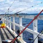
Focus your efforts on the transition zones near Limeburners Bay and the Grammar School Lagoon. Look for the distinct "edges" where the bottom substrate shifts from sand to mud, or along the margins of heavy seagrass beds. Anywhere there is a habitat change, flathead will be lying in wait. Alternatively, target the recently constructed Moolap Reef at Outer Harbour or Merv's Reef at St Helens. These structures, built from basalt and limestone and seeded with native flat oysters and blue mussels, have become absolute magnets for fish. For land-based anglers, Cunningham Pier is the ultimate night-shift destination.
Lure Selection
For flathead, utilize a 3.75-inch weedless soft plastic, such as a paddle tail or a Berkley Turtleback Worm. Rig these on a 1/8oz to 1/4oz jig head, depending on the wind and depth. If you are targeting snook and pinkie snapper under the pier lights, switch to a shallow-diving hardbody minnow or a 20g to 40g metal slug.
Color Theory
In the clear autumn water, natural presentations excel. Opt for Pumpkinseed, Motor Oil, or New Penny colored soft plastics to mimic worms and crustaceans. For metal slugs and hardbodies, chrome, silver, and white are non-negotiable to accurately replicate the resident pilchards and silver whiting.
Bait Recommendations
If you prefer soaking a bait, fresh is always best. Top baits currently producing in the bay include:
Southern Calamari: Fresh strips or tentacles are highly durable and irresistible to flathead and snapper.
Silver Whiting: Fished whole on a snelled rig for larger predators.
Pipis and Mussels: The absolute go-to for King George whiting when fished on a paternoster rig over broken ground.
Using a light fluorocarbon leader (around 10lb to 12lb) will help you secure more bites from wary fish in clear water.
Timing the Bite
The run-out tide is the golden window for flathead in the shallows, especially when the dropping water aligns with early morning or late afternoon low-light conditions. The receding water pulls baitfish off the flats and funnels them directly into the waiting mouths of predators. For snook and pinkies, fish the artificial lights of Cunningham Pier starting two hours after sundown.
Pro Tip: When fishing Corio Bay for flathead, your retrieve speed is the most critical factor. If you think you are fishing slow enough, fish slower. Keep that soft plastic in constant contact with the bottom substrate. Use a subtle double-hop followed by an extended pause to trigger reaction strikes from these bottom-dwelling ambush predators.
Pro Tip: When targeting leatherjackets around pier pylons or rocky reefs, incorporate a small length of light wire trace or utilize a long-shank hook. Their small, beak-like mouths are notorious for snipping through standard fluorocarbon leaders in a fraction of a second, costing you valuable tackle.
4. REGULATIONS SNAPSHOT
Always verify the latest Victorian Fisheries Authority (VFA) rules before hitting the water. Fish must be measured from the tip of the snout (with the mouth closed) to the end of the tail. Here are the critical regulations for our current primary targets:
Species
Minimum Size
Bag / Possession Limit
Important Notes
Snapper
28cm
10 (Max 3 over 40cm)
Must be kept whole or in carcass form while on or near the water; cannot be filleted on the boat.
Dusky Flathead
No minimum (Slot Limit)
5
Maximum size limit of 55cm. All larger breeding females must be safely released to protect the fishery.
King George Whiting
27cm
20
Handle with wet hands if releasing. Excellent table fare.
Bleed immediately and ice down for best eating quality, or utilize as premium fresh cut bait.
5. REGIONAL ALTERNATIVE
The Backup Plan: Queenscliff Pier & The Bellarine
If a strong westerly wind blows out the inner harbor, or you simply want a change of scenery, pack up your gear and head down the Bellarine Peninsula to Queenscliff Pier.
Access & Target Species: Queenscliff Pier offers phenomenal access to deep water and heavy kelp and seagrass beds. More importantly, it provides excellent shelter during adverse weather conditions. The primary targets here are Southern Calamari (squid) and King George Whiting.
Editor's Choice: Must-Have Gear
FISHINGSIR Next-Gen Waterproof Chest Waders
★★★★★4.4 (7,370+ reviews)
2-Ply Tech: Upgraded nylon with 2.5x higher density than standard fabrics.
100% Waterproof: Lab-approved intrusion resistance with taped visible seams.
Ultra-Lightweight: Designed for all-day comfort while hunting or fishing.
As an Amazon Associate I earn from qualifying purchases. #ad
Loading forecast...
Live Fishing Conditions: Tides, Weather & Waves
Get real‑time tides, marine weather, swell and solunar activity for each spot so you know exactly when conditions line up for your best chance at a bite.
🎣
Geelong
Loading coordinates...
🌤️
WEATHER CONDITIONS
--°F
--°C
Loading...
🌡️
Feels Like--°F--°C
💧
Humidity--%
💨
Wind-- mph-- km/h
🧭
Direction--
📊
Pressure-- inHg-- hPa
☀️
UV Index--
🌊
MARINE CONDITIONS
🌊Wave Height
-- ft
-- m
Loading...
🧭Wave Direction
--°
Loading...
⏱️Wave Period
-- s
Loading...
📈Tide Status
-- ft
-- m
Loading...
🌙
LUNAR & SOLUNAR
🌕
Loading...
Illumination: --%
Major Period--:-- - --:----:-- - --:--
Minor Period--:-- - --:----:-- - --:--
🌅Sunrise--:--
🌇Sunset--:--
📅
24-HOUR FORECAST
Loading fishing conditions...
Fishing Spots Map
My location
Loading map...
Unable to load map
There was an error loading the map. Please try refreshing the page.
Info
Local Access & Facilities
Situated on the western edge of the bay, Geelong serves as a vital maritime hub for anglers targeting the rich waters of Victoria. Unlike remote coastal outposts, this location offers a distinct urban fishing experience where manicured waterfronts collide with productive saltwater grounds. For the seasoned skipper, this area represents a strategic launchpad: it provides sheltered access compared to the open ocean swells found further south, making it a reliable option when coastal winds render offshore runs impossible.The atmosphere here is one of accessibility and infrastructure. The waterfront is highly developed, featuring the prominent Cunningham Pier and a surrounding precinct that balances recreational boating with commercial activity. While the vibe is decidedly metropolitan, the underwater topography in the surrounding bay commands respect. The area is known for its distinct channels and shallow flats, requiring navigational attentiveness despite the calm surface appearance. For the shore-bound angler, the integration of fishing access points within the city limits allows for quick sessions without the need for off-road travel.Professional anglers value this location for its logistical convenience. The proximity to major roadways allows for rapid deployment, yet the distance from the open ocean "Heads" means water conditions are generally more manageable for smaller vessels. Whether you are launching a trailer boat for a bay run or casting from the timber pilings of the pier, understanding the specific rhythm of this harbor—from its parking restrictions to its tidal movements—is essential for a successful outing.
💡 Captain's Tip: Bait Logistics
Do not expect to find fresh bait immediately at the boat ramp or pier. The specialized tackle shops are located in the surrounding suburbs like Drysdale and Ocean Grove. Stock up on ice and bait 10 to 12 miles out before you navigate the city traffic to the launch ramp.
Access & Getting There
Reaching the Geelong waterfront is straightforward via the main arterial highways, though captains towing wide beams should be mindful of urban traffic density during peak commuter hours. The primary access corridor leads directly to the foreshore, where the infrastructure is designed to handle significant visitation. However, because this is a multi-use precinct sharing space with playgrounds and promenades, navigating a trailer requires patience, particularly on weekends.The critical launch facility for serious boaters is Limeburners Point, located approximately 1.4 miles from the central waterfront area. This facility is the heartbeat of the local trailer boat fleet. It is engineered to handle recreational traffic, but seasoned locals know that efficiency here is paramount. The ramp area offers dedicated trailer parking, which is a significant asset in a city environment. However, during favorable weather windows, these spots reach capacity rapidly.For shore-based anglers or those meeting a vessel, parking strategy varies by time of day. The Promenade Car Park is a standout option for the "dawn patrol" or night operations, as it is open 24 hours a day. Located just 1,446 feet from the main activity hub, it provides a reliable fallback when street parking is congested. Alternatively, the Busport Car Park is exceptionally close—only 740 feet away—but is better suited for standard vehicles rather than heavy rigs.
💡 Captain's Tip: Night Operations
The Promenade Car Park is your best bet for overnight sessions or extreme early starts. Since it operates 24 hours, you avoid the risk of getting locked in or fined that comes with some of the other municipal lots closer to the retail district.
Geelong Pre-Trip Checklist
Facilities & Amenities
While the waterfront is teeming with general amenities, the specific infrastructure for heavy tackle and marine support requires a bit of travel. The immediate area is well-serviced for creature comforts; public restrooms are abundant, with facilities located 55 feet, 636 feet, and 671 feet from the central access points. This high density of amenities makes it an excellent location for guiding clients who require comfort, or for family-oriented shore fishing trips near Cunningham Pier Playground.However, a critical gap exists in immediate marine supply. There are no dedicated bait and tackle shops directly on the waterfront. To service your gear, you must look to the specialized hubs in the surrounding region. Drysdale Bait & Tackle is roughly 11.8 miles away and opens at 8:30 AM, making it a mid-morning resource rather than a pre-dawn stop. For those heading further east towards the Bellarine Peninsula, Taco Tackle in Ocean Grove (12.1 miles) and Burnside Country Furniture, Bait and Tackle in Queenscliff (18.3 miles) are the go-to outfitters. These shops are known for local intelligence and specific rigging advice that you won't find in general stores.For anglers looking to book heavy-tackle trips, the charter fleet is predominantly based out of Queenscliff, closer to the bay's entrance. Renowned operators like Big Red Fishing Charters and Ocean Grove Fishing Charters are stationed approximately 18.5 miles from the Geelong waterfront. These outfits are positioned to run through the "Heads" to offshore grounds, meaning you should plan your accommodation and driving logistics accordingly if you are fishing with them, rather than assuming a pickup at the city pier.
Lodging and Base Camps
Accommodation Name
Distance
Type
Notes
Werribee Park Motor Inn
23.7 miles
Hotel/Motel
Reliable parking; standard hours (8 AM - 8:30 PM).
Riverside Caravan Park
11.9 miles
Camping/Cabin
Located in Ocean Grove; good for trailer boats.
Honu Honi Surf Camp
13.5 miles
Surf Lodge
Located in Torquay; coastal vibe.
Bunjil's Lookout
17.2 miles
Free Camping
Open 24 hours; rugged option for self-sufficient anglers.
Permits, Regulations & Fees
Fishing in this region is governed by the State Fishing Agency, and strict adherence to licensing is mandatory. Victoria utilizes a recreational fishing license system that applies to all marine and estuarine waters. Patrols are frequent, particularly around high-visibility infrastructure like Limeburners Point and Cunningham Pier. It is the skipper's responsibility to ensure every person on board or on the shore holds a valid permit before a line hits the water.Conservation zones and size limits are strictly enforced to protect the bay's ecosystem. While the JSON data indicates no specific environmental alerts currently, anglers should always check the latest "State Fishing Agency" bulletins for seasonal closures, particularly regarding snapper or shellfish, which often have specific temporal protections in these bays.Cultural respect is also paramount. The waterfront is a shared public space. Anglers utilizing the Cunningham Pier area must be cognizant of the "families" and "shore fishing" designation. Casting heavy lead in crowded zones is not only dangerous but can lead to conflict and increased restrictions. Furthermore, when accessing spots like Bunjil's Lookout or areas near You Yangs (Big Rock Car Park), be respectful of the land, as these areas often hold cultural significance.
💡 Captain's Tip: Shore Etiquette
The Cunningham Pier is a mixed-use zone. When targeting fish from this structure, keep walkways clear of tackle boxes and bait buckets. Local authorities are quick to restrict access if anglers impede pedestrian flow or leave bait residue on the decking.
Events & Seasonal Information
The fishing calendar in Geelong is dictated by the seasonal movements of fish entering and exiting the bay. While the harbor offers protection, the bite is often influenced by the tidal push into the inner harbor. The 24-hour access at Promenade Car Park suggests a strong culture of night fishing, likely targeting species that move into the shallows under the cover of darkness to feed.Tournament seasons often bring increased traffic to the Limeburners Point ramp. During peak summer months, the bay comes alive, and the competition for parking spots can be fierce. Conversely, the cooler months often see a drop in recreational traffic, offering the dedicated pro a more solitary experience.Weather patterns here are generally more stable than the open coast, but the shallow nature of the bay means a stiff breeze can whip up a short, sharp chop quickly. The "Access Summary" notes explicitly to "Always check weather and ocean conditions before fishing." This is not boilerplate advice; the bay can become uncomfortable for small craft when the wind opposes the tide.
Contact Information & Resources
For emergency situations, immediate reliance on local emergency services is standard. For maritime specific issues, contact the local harbor master or coast guard equivalent. While specific phone numbers for the harbor master are not listed, the State Fishing Agency is the primary point of contact for regulatory questions.Safety on the water is self-regulated. Ensure your vessel is equipped with necessary safety gear, as checks at the ramp are common. For those heading to the You Yangs or inland spots like Big Rock Car Park, the contact number is 13 19 63 for park information.For precise locations, real-time wind conditions, and detailed bathymetry of the harbor channels, consult the live dashboard and interactive maps below.
Our spot reports combine data-driven forecasts with curated local information. The forecast is generated by our proprietary Fishing Score algorithm (0–100%), which analyzes real-time data from Open-Meteo API, validated against NOAA CO-OPS tide gauges and USGS water-monitoring stations. The model weights tide dynamics (35%), wave energy (25%), wind patterns (20%) and time of day (20%)—factors shown to influence fish feeding behavior through marine-biology research and decades of charter log data.
Access, facilities and services information for each fishing spot is sourced from official datasets such as Recreation.gov (RIDB), state park & wildlife agencies, and geospatial providers like Google Maps. These sections undergo scheduled re-validation every 3–6 months to ensure that boat ramps, park access, contact details and local services remain accurate.
Narrative sections (catches, seasonal behavior, local tips) are synthesized from these data sources and refined following the Fishing Reports Today editorial guidelines, combining bibliographic research from ichthyology and oceanography with expert angler experience. Our team reviews reports on a regular basis, while the forecast model itself updates every 6 hours for real-time accuracy.
⚠️ Important: Always verify current local regulations, access restrictions and weather conditions before fishing. These reports are intended as a planning aid, not a guarantee of catches or safety. When in doubt, contact local authorities or park managers listed on the page.
To provide the best experiences, we use technologies like cookies to store and/or access device information. Consenting to these technologies will allow us to process data such as browsing behavior or unique IDs on this site. Not consenting or withdrawing consent, may adversely affect certain features and functions.
Functional Always active
The technical storage or access is strictly necessary for the legitimate purpose of enabling the use of a specific service explicitly requested by the subscriber or user, or for the sole purpose of carrying out the transmission of a communication over an electronic communications network.
Preferences
The technical storage or access is necessary for the legitimate purpose of storing preferences that are not requested by the subscriber or user.
Statistics
The technical storage or access that is used exclusively for statistical purposes.The technical storage or access that is used exclusively for anonymous statistical purposes. Without a subpoena, voluntary compliance on the part of your Internet Service Provider, or additional records from a third party, information stored or retrieved for this purpose alone cannot usually be used to identify you.
Marketing
The technical storage or access is required to create user profiles to send advertising, or to track the user on a website or across several websites for similar marketing purposes.


Leave a Reply