Safety is always the primary concern when fishing the Bellarine Peninsula, particularly given its proximity to the notorious entrance of Port Phillip Bay. As we push deep into the autumn season, environmental conditions are shifting significantly. Water temperatures are cooling to approximately 16 degrees Celsius, and we are experiencing typical late-season overcast skies with moderate northerly winds.
The current verdict is a firm CAUTION. The overriding factor right now is the extreme tidal velocity. Driven by the New Moon phase, the tidal exchange pushing through The Rip is moving massive volumes of water. This creates fast-flowing currents, unpredictable eddies, and dangerous standing waves that can easily overwhelm small vessels. Boaters must exercise extreme vigilance near Lonsdale Bight and the Port Phillip Heads, ensuring all safety gear is accessible and lifejackets are worn at all times.
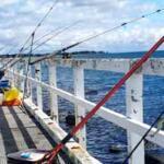
Land-based anglers will find that fishing during peak tidal flow is nearly impossible due to the sheer speed of the water dragging sinkers and lures away. Plan your trip meticulously around the tide charts and seek sheltered waters when the current is roaring. If you respect the tide and time your session correctly, the fishing is exceptional.
🎣Nautrek
Private Beta
J
M
R
100+ anglers on the waitlist
The fishing network where your reputation matters.
Find trusted captains, join real trips with cost splitting, and build your Angler Rank. Your spots stay private — you decide who sees your intel.
The thick seagrass paddocks and shallow reef margins around Queenscliff make it a premier, world-class destination for Southern Calamari. The cooling water temperatures are currently pushing larger, aggressive models into the shallows to hunt and prepare for spawning. These squid are highly active, especially during low-light conditions, making them the top target for both land-based and boat anglers.
Sleeper Pick: Silver Trevally
While the crowds are shoulder-to-shoulder casting squid jigs or hunting late-season King George Whiting, schools of hard-fighting Silver Trevally are often completely overlooked. These fish hold tight to the harbour infrastructure, pier pylons, and deep-water drop-offs. They provide exceptional light-tackle sport, are highly active during the cooler months, and make for fantastic table fare if bled immediately.
Baitfish Report
The local forage base currently consists of small silverfish, local shrimp, and grass whiting hiding within the extensive weed beds. During the tidal push, you will see clouds of these small baitfish being corralled against the pier pylons and the harbour rock walls. Match your presentations to these natural profiles. Translucent baits, silver flashes, and natural green or brown hues will perfectly mimic the terrified baitfish that the local predators are actively hunting.
Tactical Strategy
Where: For land-based Calamari, position yourself on the lower landing of the Queenscliff Pier and cast out over the dark weed patches toward Lonsdale Bight. For boaters, the 8 to 12-foot drop-offs along the Lonsdale Wall offer prime squid grounds. If you are targeting Silver Trevally, focus your efforts on The Cut at Queenscliff Harbour. You want to target the specific eddies and current seams that form just inside the harbour entrance during a run-in tide.
Gear: For squid, a 7'6" to 8'3" Egi-specific rod paired with a 2500-size spinning reel and 10lb braided line will give you the casting distance needed to reach the isolated weed patches. For Trevally, a 7-foot ultralight fast-action rod with 6lb braid and an 8lb fluorocarbon leader is ideal to detect subtle bites while providing enough abrasion resistance against the pylons.
Lure: For squid, utilize a Size 3.0 or 3.5 premium squid jig with a slow sink rate to keep it in the strike zone longer over the shallow weed. For Trevally, a 1/16oz tungsten jighead paired with a 2.5-inch curl-tail soft plastic is highly effective.
Color: Given the heavy cloud cover and overcast skies, UV-enhanced (Keimura) white or solid pink jigs will stand out best to Calamari. In brief windows of clear water and sunshine, switch immediately to a natural pilchard or grass whiting foil. For soft plastics targeting Trevally, "Motor Oil" or translucent silver colors are producing the best strike rates.
Bait: If you prefer bait fishing for squid, a whole silver whiting threaded onto a squid spike and suspended under a perfectly weighted float is deadly. For Trevally, use lightly weighted fresh pipis or small cubes of raw chicken marinated in tuna oil, drifted naturally down the face of the pylons.
Timing: Because of the extreme tidal flow associated with the New Moon, you must fish the slack water window. The bite will be concentrated strictly 90 minutes either side of the high or low tide change. Fast-flowing water here is unfishable; finding the slack water window is the absolute key to success. Dawn and dusk high tides will yield the most aggressive bites.
Pro Tip: When fishing The Cut for Trevally, watch closely for the subtle current seams where fast-moving water meets slack water. Trevally will sit just inside the slack water, expending very little energy, waiting to ambush baitfish swept past in the main current. Cast into the fast water and let your plastic drift naturally into the seam.
Pro Tip: Calamari have exceptional eyesight but are incredibly sensitive to unnatural resistance. If you are bait fishing with a silver whiting on a spike, ensure your float is balanced perfectly with split shot so the squid feels absolutely zero drag when it pulls the bait under. If they feel resistance, they will let go immediately.
Pro Tip: When targeting King George Whiting or Trevally in the harbour, your berley technique will make or break the session. Do not dump large amounts of berley at once, as the fast current will simply wash it away, taking the fish with it. Instead, use a weighted berley pot deployed right at the bottom, or throw small, consistent pinches of berley upstream of your fishing zone so it sinks perfectly into your strike zone.
Regulations Snapshot
Before heading out, ensure you are familiar with the current Victorian Fisheries Authority regulations. Please note that the waters around the Borough of Queenscliff intersect with the Port Phillip Heads Marine National Park. There are strict no-take zones in parts of Point Lonsdale and Swan Bay. Always check your GPS and local marine park boundaries before casting a line to ensure you are fishing in legal waters.
If the northerly winds howl or the currents at Queenscliff Harbour become completely unfishable, make the short drive to the Swan Bay Jetty. Swan Bay is a highly protected, shallow RAMSAR wetland area that offers excellent refuge from heavy swells and roaring currents. The jetty is a narrow pier situated over relatively shallow, weedy water that is shielded from the worst of the tidal pull.
This is a fantastic backup location for targeting Garfish, Flathead, and Gummy Sharks. To maximize your success here, switch to ultralight gear. Establish a fine, continuous berley trail using a mixture of breadcrumbs and tuna oil to draw the fish out of the weed beds. Suspend small pieces of fresh pipi, silverfish, or maggots on size 12 long-shank hooks under a sensitive quill float for the Garfish. While you wait on the float, cast a heavier rod with a chunk bait out into the deeper channels at the end of the pier for a chance at a cruising Gummy Shark or a solid Flathead.
Tight lines!
Editor's Choice: Must-Have Gear
FISHINGSIR Next-Gen Waterproof Chest Waders
★★★★★4.4 (7,370+ reviews)
2-Ply Tech: Upgraded nylon with 2.5x higher density than standard fabrics.
100% Waterproof: Lab-approved intrusion resistance with taped visible seams.
Ultra-Lightweight: Designed for all-day comfort while hunting or fishing.
As an Amazon Associate I earn from qualifying purchases. #ad
Loading forecast...
Live Fishing Conditions: Tides, Weather & Waves
Get real‑time tides, marine weather, swell and solunar activity for each spot so you know exactly when conditions line up for your best chance at a bite.
🎣
Queenscliff, Bellarine Peninsula
Loading coordinates...
🌤️
WEATHER CONDITIONS
--°F
--°C
Loading...
🌡️
Feels Like--°F--°C
💧
Humidity--%
💨
Wind-- mph-- km/h
🧭
Direction--
📊
Pressure-- inHg-- hPa
☀️
UV Index--
🌊
MARINE CONDITIONS
🌊Wave Height
-- ft
-- m
Loading...
🧭Wave Direction
--°
Loading...
⏱️Wave Period
-- s
Loading...
📈Tide Status
-- ft
-- m
Loading...
🌙
LUNAR & SOLUNAR
🌕
Loading...
Illumination: --%
Major Period--:-- - --:----:-- - --:--
Minor Period--:-- - --:----:-- - --:--
🌅Sunrise--:--
🌇Sunset--:--
📅
24-HOUR FORECAST
Loading fishing conditions...
Fishing Spots Map
My location
Loading map...
Unable to load map
There was an error loading the map. Please try refreshing the page.
Info
Local Access & Facilities
The Gateway to Port Phillip Bay and Bass Strait
Queenscliff serves as the strategic maritime heart of the Bellarine Peninsula, offering anglers immediate access to one of Australia's most dynamic waterways. Situated at the very mouth of Port Phillip Bay, this fishery is characterized by its proximity to "The Rip," a notorious entrance where tidal flows clash with Bass Strait swells, creating nutrient-rich feeding grounds for pelagic and reef species. Experienced skippers favor this location for its versatility; you can target King George Whiting and Calamari inside the harbor on rough days or punch out into the Strait for serious sport fishing when the weather holds.
The atmosphere here is distinctly nautical, blending historic maritime architecture with a working harbor vibe that caters heavily to the commercial and recreational fleet. Unlike the manicured resort docks found elsewhere, Queenscliff is a functional launchpad for serious fishing, featuring deep water access and rugged coastal geography. The primary draw for expert anglers here includes the seasonal runs of Snapper, the legendary Yellowtail Kingfish battles near the heads, and the year-round pursuit of premium table fish along the weed beds.
💡 Captain's Tip: Watch the Tide
The tidal exchange at the bay entrance is immense. Experienced locals know that fishing the slack tide is often critical for bottom fishing near the heads, as the current can make holding bottom impossible with standard lead during peak flow.
Access & Getting There
Reaching the Queenscliff fishery is generally a straightforward drive via the Bellarine Highway, though traffic can thicken during peak summer weekends and holiday periods. For those towing heavy rigs, the route is trailer-friendly, but navigators should remain alert for pedestrians and narrow streets once entering the historic township. The primary launch facility is the Queenscliff Boat Ramp, located directly adjacent to the ferry terminal, positioning you less than a mile from the open ocean.
The boat ramp setup is robust, designed to handle the heavy traffic of the bay, featuring trailer parking and a paved surface. According to local access data, the ramp area includes dedicated trailer parking, which is a critical asset given the popularity of this spot. However, the facility's proximity to the bay entrance means it is exposed to specific wind directions; strong easterlies can make launching and retrieving challenging, so having a competent deckhand to manage lines is advisable.
Wheelchair accessibility is rated as "yes" for this location, making it one of the more inclusive access points on the peninsula. While the data indicates no specific permit fees are currently required for the ramp, seasoned travelers know that regulations can shift; always scan the signage at the entry for the most current parking rules. The ramp is your immediate gateway, but be aware that shore access points are also available nearby for family-friendly sessions when the boat stays dry.
💡 Captain's Tip: Dawn Patrol Logistics
Parking at the Queenscliff ramp is a premium commodity. During the Snapper run, the trailer lot can reach capacity well before sunrise. Plan to arrive by 4:30 AM to secure a spot and prep your vessel without the pressure of a waiting line.
The infrastructure in Queenscliff is tailored to the needs of the independent angler, with a focus on utility over luxury. A standout feature for the early riser is Burnside Country Furniture, Bait and Tackle. Located just 1,400 feet from the water, this shop is the logistical hub for the fleet, opening as early as 6:30 AM on Saturdays and 7:00 AM on Fridays. Unlike generic big-box stores, this proximity allows for last-minute bait acquisition—fresh squid or pilchards—right before you hit the ramp.
For more extensive outfitting or specialized gear repairs, you may need to travel slightly inland. Taco Tackle is located approximately 7 miles away in Ocean Grove, and Drysdale Bait & Tackle is roughly 8 miles out, offering reliable alternatives if the local inventory runs low. Accommodations for visiting crews are solid, with the BIG4 Bellarine Holiday Park (5.9 miles) and Riverside Caravan Park (8.4 miles) providing suitable space for vehicles and trailers, ensuring your vessel is secure overnight.
It is important to note the geography regarding listed charters. The data highlights operators like Sorrento Fishing Charters and Bass Strait Charters, which are physically close (approx. 6.4 miles) but located across the bay entrance. For an angler launching at Queenscliff, these are accessible by boat across the water, but require a ferry ride or a long drive around the bay to reach by car. Focus your immediate logistical planning on the Queenscliff side unless you intend to cross the "Rip."
Facility Name
Type
Distance from Ramp
Key Notes
Burnside Bait & Tackle
Supplies
0.26 miles
Opens 6:30 AM Sat; Closest to ramp.
Queenscliff Boat Ramp
Launch
On-site
Trailer parking available; Paved.
Taco Tackle
Supplies
7.0 miles
Open 9 AM - 5 PM; Ocean Grove.
BIG4 Bellarine Park
Lodging
5.9 miles
Trailer-friendly accommodation.
💡 Captain's Tip: Fuel Management
While bait is close, on-water fuel options can be limited depending on the hour. Smart skippers top off their tanks at highway stations in Ocean Grove or Geelong before entering the Queenscliff bottleneck to avoid premium dockside prices or closed pumps.
Permits, Regulations & Fees
Fishing in this region is managed by the State Fishing Agency (Victorian Fisheries Authority), and strict adherence to regulations is not just legal prudence but a conservation necessity. The unique biodiversity of Port Phillip Bay and the Bass Strait entrance is protected by rigorous size and bag limits, particularly for slow-growing species like Snapper and King George Whiting. Rangers frequent the boat ramps, especially during peak season, so ensure your license is current and digital or physical copies are on hand.
While the provided access data indicates that the boat ramp fees are currently listed as "not required," this is an anomaly for such a high-quality facility in Victoria. Anglers should be prepared for potential parking meters or changes in management; always carry a credit card or coins for parking machines just in case. Ignorance of local parking ordinances is a quick way to ruin a successful trip with a fine on your windshield.
Cultural respect is also paramount. The Bellarine Peninsula holds significance for the Wadawurrung people. Anglers are encouraged to treat the coastline, particularly the rocky outcrops and dune systems, with care. Avoid trampling vegetation when accessing shore spots and ensure all trash, especially fishing line and bait bags, is packed out to protect the marine environment and maintain access for future generations.
Events & Seasonal Information
The fishing calendar in Queenscliff is dictated by the temperature and the migration of pelagics. The warmer months, typically November through April, see the highest traffic as the Snapper enter the bay and Kingfish patrol the heads. This is tournament season, and the ramp can become a hive of activity with competitive anglers vying for the best launch times. During these windows, patience at the ramp is as essential as the right bait.
Winter brings a different rhythm. The crowds thin out, leaving the water to the dedicated locals targeting Calamari and winter Whiting. The swells from the Bass Strait can be more punishing during these months, making the "Rip" unpassable at times. The best fishing windows often revolve around the tide changes; slack water is the golden hour here, regardless of the season, allowing baits to present naturally without being swept away by the fierce currents.
Contact Information & Resources
For emergency assistance or current maritime safety information, relying on local authorities is essential. The area is monitored, but self-reliance is key when venturing into the Bass Strait. Ensure your marine radio is functional and tuned to local repeater channels. While specific harbor master numbers are not provided in the immediate dataset, the local bait shops like Burnside Bait & Tackle (Phone: 0478 256 110) often serve as unofficial information bureaus for current bite reports and ramp conditions.
For precise locations of the boat ramps, real-time weather updates, and detailed facility maps, consult the live dashboard and interactive widgets below.
Our spot reports combine data-driven forecasts with curated local information. The forecast is generated by our proprietary Fishing Score algorithm (0–100%), which analyzes real-time data from Open-Meteo API, validated against NOAA CO-OPS tide gauges and USGS water-monitoring stations. The model weights tide dynamics (35%), wave energy (25%), wind patterns (20%) and time of day (20%)—factors shown to influence fish feeding behavior through marine-biology research and decades of charter log data.
Access, facilities and services information for each fishing spot is sourced from official datasets such as Recreation.gov (RIDB), state park & wildlife agencies, and geospatial providers like Google Maps. These sections undergo scheduled re-validation every 3–6 months to ensure that boat ramps, park access, contact details and local services remain accurate.
Narrative sections (catches, seasonal behavior, local tips) are synthesized from these data sources and refined following the Fishing Reports Today editorial guidelines, combining bibliographic research from ichthyology and oceanography with expert angler experience. Our team reviews reports on a regular basis, while the forecast model itself updates every 6 hours for real-time accuracy.
⚠️ Important: Always verify current local regulations, access restrictions and weather conditions before fishing. These reports are intended as a planning aid, not a guarantee of catches or safety. When in doubt, contact local authorities or park managers listed on the page.
To provide the best experiences, we use technologies like cookies to store and/or access device information. Consenting to these technologies will allow us to process data such as browsing behavior or unique IDs on this site. Not consenting or withdrawing consent, may adversely affect certain features and functions.
Functional Always active
The technical storage or access is strictly necessary for the legitimate purpose of enabling the use of a specific service explicitly requested by the subscriber or user, or for the sole purpose of carrying out the transmission of a communication over an electronic communications network.
Preferences
The technical storage or access is necessary for the legitimate purpose of storing preferences that are not requested by the subscriber or user.
Statistics
The technical storage or access that is used exclusively for statistical purposes.The technical storage or access that is used exclusively for anonymous statistical purposes. Without a subpoena, voluntary compliance on the part of your Internet Service Provider, or additional records from a third party, information stored or retrieved for this purpose alone cannot usually be used to identify you.
Marketing
The technical storage or access is required to create user profiles to send advertising, or to track the user on a website or across several websites for similar marketing purposes.


Leave a Reply