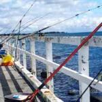
As late autumn settles over the South Gippsland coastline, Anderson Inlet undergoes a dramatic seasonal transition. The cooling water temperatures trigger aggressive feeding behaviors in resident estuarine species, making this a premier window for anglers visiting Inverloch. As a professional guide navigating these waters daily, I am seeing some of the most consistent action of the year across the shallow flats and deeper channels. Here is your comprehensive tactical breakdown for targeting this dynamic system.
1. GO/NO-GO STATUS
Verdict: GO
Current seasonal conditions are prime for estuarine and surf targets, but safety remains the ultimate priority. The Anderson Inlet bar requires extreme caution during this transitional weather period. When the outgoing tide meets a stiff south-westerly wind, it creates dangerous, steep standing waves at the entrance. Never attempt to cross the bar on the bottom half of the run-out tide.
🎣Nautrek
Private Beta
J
M
R
100+ anglers on the waitlist
The fishing network where your reputation matters.
Find trusted captains, join real trips with cost splitting, and build your Angler Rank. Your spots stay private — you decide who sees your intel.
For those fishing inside the inlet, the weather impact is highly manageable. Mild autumnal daytime temperatures make for comfortable sessions, while the morning easterly breezes provide perfectly glassed-out conditions along the northern shorelines. Water clarity within the inlet is currently excellent on the incoming tide, offering prime visibility for sight-casting over the sand flats. If you are a surf angler, the afternoon sea breezes will assist in casting heavy metals long distances from the beaches.
2. SPECIES INTEL
Primary Target: King George Whiting
The undisputed royalty of Anderson Inlet, King George Whiting, are schooling up tightly and feeding with urgency before the winter chill fully takes hold. Recent catches show a very healthy population of these prized table fish pushing over the shallow seagrass beds. They are utilizing the remaining warmer water pockets to hunt aggressively.
Sleeper Pick: Estuary Perch
While the masses focus their efforts on Whiting and Flathead, Estuary Perch are the ultimate sleeper pick right now. These structure-oriented predators are highly active along the snaggy margins and undercut banks of the inlet's tributaries. Because they require precise casting and a stealthy approach, they are frequently overlooked, leaving the best timber untouched by the weekend crowds.
Baitfish Report
The estuary floor is currently alive with forage. Bass yabbies (ghost shrimp) remain the dominant natural prey item, alongside juvenile yellow-eye mullet and small estuarine shrimp. Predators are highly tuned to these specific profiles. Matching your presentation to a fleeing prawn or a struggling yabby will yield the highest strike rates.
3. TACTICAL STRATEGY
Location Specifics
To consistently find King George Whiting, bypass the featureless deep water and focus your attention on the 4 to 8-foot sand patches interspersed among the heavy weed beds near Mahers Landing. On the incoming tide, the water pushing over the shallow sand flats warms slightly in the autumn sun, drawing the Whiting out of the deeper channels to feed.
If you are hunting Estuary Perch, navigate toward the mouth of Screw Creek or the upper reaches of the inlet. You must position your vessel to cast parallel to the submerged timber. For Dusky Flathead, focus on the steep drop-offs along the main channel edges just east of the Inverloch boat ramp, where ambush predators lie in wait for baitfish being swept off the flats.
Lure and Bait Selection
Lures: For Estuary Perch, a 65mm suspending jerkbait or a 2.5-inch paddle tail soft plastic rigged on a 1/16oz weedless jighead is deadly. For Flathead, upsize to a 3.5-inch to 4-inch curl tail grub on a 1/4oz jighead to maintain bottom contact in the channel currents.
Colors: Water clarity dictates color. In the clear incoming water, utilize natural prawn, motor oil, or bloodworm patterns. For hardbodies, a silver body with a black back perfectly mimics the juvenile mullet currently schooling in the system.
Bait: Freshly pumped bass yabbies are the ultimate Whiting candy. Rig them on a light paternoster setup utilizing size 6 long shank hooks and the lightest sinker the current will allow. Pipis and thin strips of fresh squid are excellent secondary options that resist the picking of nuisance fish.
Optimal Timing
The golden window for Anderson Inlet is the two hours immediately following the high tide as the water begins to run out. This outgoing flow pulls baitfish and crustaceans from the safety of the mangroves and weed beds, funneling them directly into the waiting mouths of predators. Combine this tide phase with the low light of dawn or dusk, and you have a recipe for a banner session.
Pro Tip: When targeting Whiting, deploy a lightly weighted berley pot filled with crushed pilchards and chook pellets directly onto the estuary floor. Keep the berley trail minimal but consistent to hold the school at the back of your boat without feeding them to satiation.
Pro Tip: When using soft plastics for Flathead, ensure your jighead is heavy enough to make consistent contact with the bottom. If you aren't puffing up small clouds of sand on the retrieve, you are fishing too high in the water column and will miss the strike zone of these ambush predators.
4. REGULATIONS SNAPSHOT
Victorian fisheries regulations are strictly enforced in this region, and ignorance is no excuse. Ensure you are familiar with the current rules before wetting a line.
Species
Minimum Size
Maximum Size
Bag Limit
King George Whiting
27cm
None
20 per person
Dusky Flathead
30cm
55cm
5 per person
Estuary Perch
27cm
None
5 per person (combined with Bass)
Pro Tip: Dusky Flathead are protected by a strict slot limit in Victoria. Any fish under 30cm or over 55cm must be released immediately with minimal handling to protect the breeding females. Additionally, all Flathead and Whiting must be kept whole or in carcass form until you are away from the water; they cannot be filleted on your boat.
5. REGIONAL ALTERNATIVE
If a strong southerly blow renders Anderson Inlet unfishable and the bar too dangerous to approach, do not pack up your gear. Your premium fallback option is the Tarwin River, located just a short drive to the east.
Target Species: Black Bream and Estuary Perch.
Access and Tactics: The Tarwin River offers excellent protection from coastal swells and heavy winds. Access is readily available via local fishing platforms, highway bridge pylons, and steep grassy banks. The tactical approach here requires finesse. Cast lightly weighted scrub worms or small grub-style soft plastics tight into the reed edges and submerged branches. Let the bait waft down naturally with the sluggish river current. The Bream here are easily spooked, so keep your leader light (4lb to 6lb fluorocarbon) and maintain a quiet profile on the bank.
Tight lines!
Editor's Choice: Must-Have Gear
FISHINGSIR Next-Gen Waterproof Chest Waders
★★★★★4.4 (7,370+ reviews)
2-Ply Tech: Upgraded nylon with 2.5x higher density than standard fabrics.
100% Waterproof: Lab-approved intrusion resistance with taped visible seams.
Ultra-Lightweight: Designed for all-day comfort while hunting or fishing.
As an Amazon Associate I earn from qualifying purchases. #ad
Loading forecast...
Live Fishing Conditions: Tides, Weather & Waves
Get real‑time tides, marine weather, swell and solunar activity for each spot so you know exactly when conditions line up for your best chance at a bite.
🎣
Inverloch
Loading coordinates...
🌤️
WEATHER CONDITIONS
--°F
--°C
Loading...
🌡️
Feels Like--°F--°C
💧
Humidity--%
💨
Wind-- mph-- km/h
🧭
Direction--
📊
Pressure-- inHg-- hPa
☀️
UV Index--
🌊
MARINE CONDITIONS
🌊Wave Height
-- ft
-- m
Loading...
🧭Wave Direction
--°
Loading...
⏱️Wave Period
-- s
Loading...
📈Tide Status
-- ft
-- m
Loading...
🌙
LUNAR & SOLUNAR
🌕
Loading...
Illumination: --%
Major Period--:-- - --:----:-- - --:--
Minor Period--:-- - --:----:-- - --:--
🌅Sunrise--:--
🌇Sunset--:--
📅
24-HOUR FORECAST
Loading fishing conditions...
Fishing Spots Map
My location
Loading map...
Unable to load map
There was an error loading the map. Please try refreshing the page.
Info
Local Access & Facilities
Inverloch serves as the dynamic gateway to Anderson Inlet, a complex estuarine system that demands respect and navigational precision from even the most seasoned skippers. Situated on the Victoria coastline, this fishery offers a distinct contrast between the sheltered, shifting channels of the inlet and the exposed, rugged waters of the Bass Strait. The bottom topography here is constantly evolving due to tidal movements and sandbar shifts, making local knowledge of the channels absolute gold for safe navigation and productive outings.
The atmosphere is a blend of a relaxed coastal holiday town and a serious launching point for trailered vessels. Unlike manicured urban marinas, Inverloch retains a raw, accessible feel where the conditions of the water dictate the day's schedule. Anglers here typically target a mix of estuarine species within the protected waters of the inlet, while larger vessels utilize the access points to push out toward the open ocean when the swell allows.
For the expert angler, success in Inverloch is often defined by timing the tides. The interplay between the massive tidal flush of Anderson Inlet and the ocean swell creates feeding windows that are short but intense. Whether you are wading the flats or navigating the channels in a center console, understanding the specific logistical footprint of this location is the first step toward a full cooler.
Access & Getting There
Reaching the fishing grounds at Inverloch requires navigating the coastal roads of Victoria, with the Bass Highway serving as the primary artery feeding into the area. Traffic flow is generally manageable, though peak holiday weekends can see congestion on the approaches to the main town. For captains trailering vessels, the primary logistical focus should be the Anderson Inlet Boat Ramp, located approximately 4.4 miles from the town center. This facility is the workhorse for the inlet, providing access to the deeper channels.
In addition to the main ramp at Anderson Inlet, the local infrastructure includes two closer, unnamed launch points located roughly 900 to 1,200 feet from the central hub. These spots are convenient but require a keen eye for tide levels; low water can make launching larger fiberglass hulls precarious. It is advisable to visually inspect these ramps at low tide before committing a heavy trailer to the descent. The proximity of these ramps to the town center makes them ideal for quick skiff deployments when conditions align.
💡 Captain's Tip: Parking Strategy
For overnight soak sessions or pre-dawn launches, utilize The Oaks Car Park. Unlike many coastal lots that close at dusk, this facility operates 24 hours a day, allowing you to keep your vehicle secure while you work the night tides.
Parking logistics vary significantly depending on your launch point. The Oaks Car Park, situated 5.6 miles from the main spot on Cape Paterson-Inverloch Rd, is a reliable option with a 5-star rating and 24-hour access. This is critical for anglers planning multi-tide shifts. Further out, the G.S.R.T. Carpark (14.8 miles away) also offers 24-hour access. However, be cautious with the Second Surf Carpark (7.4 miles away); while highly rated, it does not explicitly offer the same overnight reliability as The Oaks.
Inverloch Pre-Trip Checklist
Facilities & Amenities
The logistical hub for tackle and bait in the immediate area is Inverloch Fishing And Outdoors. Located just 0.2 miles from the water at 8 Williams St, this shop is incredibly convenient for last-minute terminal tackle needs. However, serious captains should note the operating hours: they open at 9:00 AM on weekdays and 8:00 AM on weekends. This is not a "dawn patrol" friendly schedule. If you plan to break the inlet mouth at first light, you must secure your bait and ice the evening before.
For those requiring heavy gear or specialized sporting equipment, Cargills Sports Store is located in nearby Wonthaggi, roughly 7.9 miles away. While it serves as a backup, it opens at 8:30 AM, reinforcing the need for self-reliance regarding early morning supplies. There is no major commercial fuel dock explicitly listed in the immediate harbor data, so topping off your tanks at a highway station before hitching the boat is standard procedure here.
💡 Captain's Tip: Charter Availability
Inverloch is primarily a private boat fishery. The nearest major charter operation, The Island Charter Boat, is based 23 miles away in Cape Woolamai. Do not expect to walk the docks here and hop on a headboat; this is a location for self-guided anglers.
Accommodation options are well-suited for anglers towing boats. Broadbeach Inverloch is located a mere 0.6 miles (approx. 3,400 ft) from the fishing grounds, minimizing the morning transit time. For a more secluded stay, Cocoa & Briar Cottages on the Bass Highway offers high-rated lodging about 2.6 miles out. Public amenities are decent, with multiple restrooms located within walking distance (800 to 1,600 feet) of the central waterfront, ensuring shore-based anglers have necessary facilities nearby.
Facility Name
Type
Distance
Key Note
Inverloch Fishing And Outdoors
Bait & Tackle
0.2 miles
Opens 9 AM (Weekdays) / 8 AM (Weekends)
Anderson Inlet Boat Ramp
Launch
4.4 miles
Primary access for Anderson Inlet
The Oaks Car Park
Parking
5.6 miles
Open 24 Hours
Broadbeach Inverloch
Lodging
0.6 miles
Prime location for trailer boaters
Permits, Regulations & Fees
Fishing activities in this region are managed by the State Fishing Agency. As with all Victorian waters, strict adherence to bag limits and size restrictions is mandatory. The inlet is a shared resource, and authorities are active in checking permits, especially during peak holiday seasons. While specific permit prices fluctuate, carrying a valid recreational fishing license is non-negotiable for all anglers aboard.
The area is marked as wheelchair accessible, indicating a level of infrastructure development that supports inclusive access, particularly around the main shore access points and jetties. However, when venturing into the protected zones or specific shoreline areas, be mindful of local signage. Some areas may be designated for swimming or conservation, particularly near the popular surf beaches like Second Surf.
Cultural respect is also paramount. The coastline and inlet have historical significance, and access points often border private land or sensitive dunes. Stick to marked paths and established boat ramps to avoid environmental degradation. There are no specific "Kapu" or indigenous restrictions listed in the immediate data, but the general rule of leaving the spot cleaner than you found it applies strictly here.
Events & Seasonal Information
The rhythm of Inverloch is dictated by the seasons and the tides. The 24-hour access at The Oaks and G.S.R.T. Carpark suggests a strong culture of night fishing, likely for species that move into the shallows under the cover of darkness. Summer brings the crowds, impacting launch times and trailer parking availability. During these peak months, the "early launch" strategy is less about fishing success and more about securing a parking spot before the holiday traffic swells.
The bait shop hours (opening at 8:00 AM on weekends versus 9:00 AM on weekdays) reflect a weekend-centric fishery. Anglers visiting mid-week during the off-season should anticipate a quieter town with potentially reduced services. Always check the local weather dashboard for wind warnings; the inlet can chop up quickly when the wind opposes the tide, turning a calm morning into a hazardous retrieval at the ramp.
💡 Captain's Tip: Supply Chain
Since local shops open late, purchase your frozen bait and ice the afternoon before your trip. Relying on a 9:00 AM opening time will cost you the prime morning bite.
Contact Information & Resources
For on-the-ground intelligence and gear, Inverloch Fishing And Outdoors can be reached at (03) 5674 3322. If you need to arrange accommodation close to the ramp, Broadbeach Inverloch is available at (03) 5674 6290. For those needing a rest stop further out, the Anderson Rest Area can be contacted at (03) 8391 3216.
Safety is the skipper's responsibility. Always file a float plan with a shore contact, especially when exiting the inlet mouth into the Bass Strait. Cell reception can be spotty offshore, so carry VHF radio gear. For precise locations, live tide data, and real-time conditions, consult the live dashboard and maps below.
🎣
Inverloch
Inverloch • Victoria • -38.6333, 145.7333
🅿️
Parking
5
The Oaks Car park
⭐ 5.05.6 mi
📍Cape Paterson-Inverloch Rd, The Oaks VIC 3995, Australia
Our spot reports combine data-driven forecasts with curated local information. The forecast is generated by our proprietary Fishing Score algorithm (0–100%), which analyzes real-time data from Open-Meteo API, validated against NOAA CO-OPS tide gauges and USGS water-monitoring stations. The model weights tide dynamics (35%), wave energy (25%), wind patterns (20%) and time of day (20%)—factors shown to influence fish feeding behavior through marine-biology research and decades of charter log data.
Access, facilities and services information for each fishing spot is sourced from official datasets such as Recreation.gov (RIDB), state park & wildlife agencies, and geospatial providers like Google Maps. These sections undergo scheduled re-validation every 3–6 months to ensure that boat ramps, park access, contact details and local services remain accurate.
Narrative sections (catches, seasonal behavior, local tips) are synthesized from these data sources and refined following the Fishing Reports Today editorial guidelines, combining bibliographic research from ichthyology and oceanography with expert angler experience. Our team reviews reports on a regular basis, while the forecast model itself updates every 6 hours for real-time accuracy.
⚠️ Important: Always verify current local regulations, access restrictions and weather conditions before fishing. These reports are intended as a planning aid, not a guarantee of catches or safety. When in doubt, contact local authorities or park managers listed on the page.
To provide the best experiences, we use technologies like cookies to store and/or access device information. Consenting to these technologies will allow us to process data such as browsing behavior or unique IDs on this site. Not consenting or withdrawing consent, may adversely affect certain features and functions.
Functional Always active
The technical storage or access is strictly necessary for the legitimate purpose of enabling the use of a specific service explicitly requested by the subscriber or user, or for the sole purpose of carrying out the transmission of a communication over an electronic communications network.
Preferences
The technical storage or access is necessary for the legitimate purpose of storing preferences that are not requested by the subscriber or user.
Statistics
The technical storage or access that is used exclusively for statistical purposes.The technical storage or access that is used exclusively for anonymous statistical purposes. Without a subpoena, voluntary compliance on the part of your Internet Service Provider, or additional records from a third party, information stored or retrieved for this purpose alone cannot usually be used to identify you.
Marketing
The technical storage or access is required to create user profiles to send advertising, or to track the user on a website or across several websites for similar marketing purposes.


Leave a Reply