The autumnal transition is in full swing across Port Phillip Bay. As water temperatures begin their steady decline, we are seeing a dramatic shift in the fishery that demands a change in angling tactics. The weather is becoming increasingly volatile, characterized by crisp mornings and periodic strong northerly winds. While the fishing is exceptional right now, the bay is notorious for chopping up quickly and creating a dangerous, short-period wind swell. Anglers in small vessels must monitor marine forecasts closely and plan their trips around dedicated weather windows. If the wind stays under 15 knots, it is a definitive "GO." Dress in layers, pack the thermals, and prepare for some of the most rewarding inshore fishing of the year. Note: Inexperienced boaters should strictly avoid the bay's entrance, known as "The Rip," during an outgoing tide conflicting with an onshore wind, as standing waves can form instantly.
Species Intel
Primary Targets: King George Whiting & Southern Calamari
As the larger migratory snapper begin to thin out and head for offshore waters, the spotlight shifts entirely to the bay's premium bread-and-butter species. King George Whiting (KGW) are schooling up heavily in the southern reaches of the bay. The cooling water triggers aggressive feeding behavior as they forage over weed beds and sand patches, fattening up for the winter. Simultaneously, Southern Calamari (squid) are showing up in excellent numbers and impressive hood sizes, thriving in the crystal-clear autumn water conditions that allow them to hunt visually.
From the editor
Tired of fishing with strangers you can’t trust?
Nautrek is the first social network for serious anglers — verified partners, real trips, cost splitting and intel sharing without burning your spots. Private beta now open.
While most anglers are focused on the shallows for whiting and squid, the deeper channels are holding fantastic numbers of Gummy Sharks. Often overlooked during the autumn months, these bottom-dwellers provide incredible sport and top-tier table fare. The cooler months often bring larger breeding females into the bay, cruising the muddy drop-offs in search of crustaceans and baitfish.
Pro Tip: Large female Gummy Sharks (over 1.4 meters in total length) are crucial for the breeding stock. Consider practicing catch-and-release on these larger models to ensure the future sustainability of the fishery, keeping the smaller males for the table.
Baitfish Report
The bay is currently holding large schools of whitebait, pilchards, and juvenile squid. With this forage base present, predators are keyed in on natural, flashy presentations. Matching the hatch means utilizing small, silver-profiled soft plastics for flathead and natural-colored jigs for cephalopods.
Tactical Strategy
Where to Find Them
For King George Whiting, focus your efforts on the southern peninsula. The broken weed beds and sand holes between Rosebud, Sorrento, and Portsea in 5 to 7 meters of water are highly productive. Look for sparse weed patches and small ledges using your sounder. If you are targeting Gummy Sharks, the deeper water around Mud Island and the edges of Symonds Channel (11 to 15 meters) are the zones to anchor up. You want to position your vessel on the edge of the channel drop-offs where the tidal flow funnels baitfish off the shallow flats and into the deeper gutters.
Land-Based & Kayak Approach
For land-based anglers, Mornington Pier is offering great access to squid and late-season pinky snapper, especially on the lee side during breezy conditions. Kayak anglers should look to launch from Safety Beach, paddling out to the extensive system of grass beds and local mussel farms. Drifting over these beds with a lightly weighted soft plastic or a trailing squid jig is a highly effective way to cover ground and locate active schools.
Lure & Bait Selection
When chasing Southern Calamari, clarity is everything. In clear water, utilize size 3.0 or 3.5 squid jigs in natural pilchard or grass whiting patterns. If you are fishing at dawn, dusk, or in overcast conditions, switch to jigs with a red foil base or green under-lights to maximize contrast and visibility. Retrieve with a slow, erratic jerking motion followed by a long pause to let the jig sink—this is almost always when the strike occurs.
For Whiting, bait is king. A cocktail bait consisting of a small piece of pipi tipped with a tiny strip of fresh squid is irresistible. Present this on an extended paternoster rig using a light fluorocarbon leader (10-12lb) and small size 4 or 6 flasher-style circle hooks. The tough squid strip helps keep the softer pipi secured to the hook during the cast and amidst the pecking of smaller nuisance fish.
For Gummy Sharks, fresh bait is non-negotiable. Chunks of freshly caught Australian salmon, silver trevally, or strips of the calamari you just caught in the shallows are perfect. Some seasoned locals also swear by chunks of cured eel. Rig these on a heavy 60-80lb mono leader with twin 6/0 suicide or circle hooks.
Timing the Bite
Tide is the most critical factor in Port Phillip Bay. For Whiting, the optimal bite window is the first two hours of the run-out tide, particularly when this coincides with early morning or late afternoon low-light conditions. Gummy sharks are highly active during the night or on a strong rising tide when they move out of the deep channels and up onto the mud banks to hunt.
Pro Tip: When fishing for Whiting at night or in deep water, use a high-modulus graphite rod. The sensitivity is critical to feeling your sinker bounce across the reef and sand, ensuring you are exactly in the strike zone and not buried in heavy weed.
Regulations Snapshot
Before heading out, ensure you are familiar with the current Victorian Fisheries Authority regulations. Heavy penalties apply for undersized fish and exceeding bag limits. Remember that sharks and snapper cannot be filleted while on the water; they must be kept in whole or carcass form until you return to the boat ramp or home.
Species
Minimum Size
Bag Limit
Special Notes
King George Whiting
27cm
20 per person
Measure from the tip of the snout to the tip of the tail.
Snapper
28cm
10 per person
No more than 3 fish may be equal to or exceed 40cm.
Gummy Shark
45cm
2 per person
Measured from the rear gill slit to the base of the tail fin. Limit is combined with School Shark.
Southern Calamari (Squid)
No minimum
10 per person
Combined limit includes octopus and cuttlefish.
Regional Alternative: Western Port Bay
If the northerly winds are howling and Port Phillip Bay becomes a washing machine, do not cancel your trip—redirect to Western Port Bay. Launching from Corinella or Hastings offers much more protected water during a stiff north wind. Western Port is a highly tidal, muddy, and channel-driven environment that fishes exceptionally well during the autumn transition.
Target the mudflats and channel edges on a run-in tide for fantastic Gummy Shark and Trevally action, or work the shallow weed banks for large King George Whiting. The tactics remain similar to Port Phillip, but you will need significantly heavier sinkers (often 4 to 8 ounces) to combat the raging currents of Western Port. A heavier braided mainline and a robust anchoring system with a quick-release buoy are absolute necessities here.
Tight lines!
Editor's Choice: Must-Have Gear
FISHINGSIR Next-Gen Waterproof Chest Waders
★★★★★4.4 (7,370+ reviews)
2-Ply Tech: Upgraded nylon with 2.5x higher density than standard fabrics.
100% Waterproof: Lab-approved intrusion resistance with taped visible seams.
Ultra-Lightweight: Designed for all-day comfort while hunting or fishing.
As an Amazon Associate I earn from qualifying purchases. #ad
Loading forecast...
Live Fishing Conditions: Tides, Weather & Waves
Get real‑time tides, marine weather, swell and solunar activity for each spot so you know exactly when conditions line up for your best chance at a bite.
🎣
Port Phillip
Loading coordinates...
🌤️
WEATHER CONDITIONS
--°F
--°C
Loading...
🌡️
Feels Like--°F--°C
💧
Humidity--%
💨
Wind-- mph-- km/h
🧭
Direction--
📊
Pressure-- inHg-- hPa
☀️
UV Index--
🌊
MARINE CONDITIONS
🌊Wave Height
-- ft
-- m
Loading...
🧭Wave Direction
--°
Loading...
⏱️Wave Period
-- s
Loading...
📈Tide Status
-- ft
-- m
Loading...
🌙
LUNAR & SOLUNAR
🌕
Loading...
Illumination: --%
Major Period--:-- - --:----:-- - --:--
Minor Period--:-- - --:----:-- - --:--
🌅Sunrise--:--
🌇Sunset--:--
📅
24-HOUR FORECAST
Loading fishing conditions...
Fishing Spots Map
My location
Loading map...
Unable to load map
There was an error loading the map. Please try refreshing the page.
Info
Local Access & Facilities
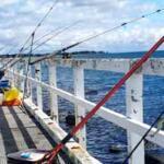
Port Phillip is a deceptively massive body of water that serves as the beating heart of Victoria’s saltwater angling scene. To the uninitiated, it might appear as a simple urban harbor, but seasoned skippers know it as a complex inland sea with its own distinct micro-climates, tidal idiosyncrasies, and specific bottom topography. The bay covers nearly 750 square miles, offering a diverse range of environments from the shallow seagrass beds of the Bellarine Peninsula to the deeper shipping channels that cut through the center. This is not a fishery where you can simply turn up and hope for the best; the sheer scale requires a strategic approach to logistics and access.
The atmosphere here shifts dramatically depending on your launch point. On the northern end, you are fishing against the backdrop of the Melbourne skyline, often contending with commercial shipping traffic and a bustling urban vibe. However, as you head south toward the Bellarine Peninsula, the environment transforms into a more rugged, coastal experience defined by tea tree-lined shores and exposed sandbars. The primary draw for the expert angler here is the legendary Snapper run, but the bay is also a world-class fishery for King George Whiting and Southern Calamari. Understanding the nuances of where to launch and where to stock up is as critical as your knot-tying skills.
For the traveling angler or the local looking to refine their strategy, navigating the shores of Port Phillip requires keen attention to wind and tide. The bay is notoriously shallow relative to its surface area, meaning a stiff breeze can whip up a dangerous chop in minutes. The facilities dotting the coastline are excellent, but they are spread out across a vast perimeter. Whether you are chasing the "Big Red" snapper in the pre-dawn darkness or drifting for whiting over the weed beds, knowing exactly which ramp offers the best shelter and where to find fresh bait at 5:00 AM will determine the success of your sortie.
💡 Captain's Tip: The Wind Factor
Port Phillip is essentially a shallow bowl. When the wind blows against the tide, particularly in the southern sections near the Heads, the sea state can stand up vertically very quickly. Always plan your launch ramp based on the wind direction; use the Bellarine ramps like St Leonards during south-westerlies for better protection.
Access & Getting There
Navigating to the prime fishing grounds of Port Phillip generally involves choosing a side: the eastern urban coastline or the western Bellarine Peninsula. The data specifically highlights the Bellarine access points, which are favored by serious anglers looking to escape the city crowds and access the prime whiting grounds. If you are driving from Melbourne, the route to the Bellarine Peninsula involves taking the Princes Freeway toward Geelong. Be aware that this route is a major commuter artery; leaving the city after 3:00 PM on a Friday can add an hour to your transit time. The savvy captain leaves the night before or well before dawn to beat the gridlock.
For those targeting the western and southern reaches of the bay, the Indented Head Boat Ramp is a primary strategic asset. Located roughly 8.8 miles from the central bay coordinates, this facility is a workhorse for the local fleet. The ramp features trailer parking, which is a critical commodity during the peak Snapper season. However, users should note that the facility does not list restrooms or showers directly at the ramp site. This means you need to handle your logistical comfort stops before you arrive at the launch. The ramp is well-positioned for accessing the mussel farms and deeper channels where snapper congregate.
Another vital access point is the St Leonards Boat Ramp, situated approximately 10.5 miles from the central zone. St Leonards is iconic among the whiting fraternity. The ramp here allows for direct access to the vast seagrass beds that define the southern Bellarine. Like Indented Head, this location offers trailer parking, but it can fill up rapidly during the summer holidays and on calm weekends. The approach to the ramp is generally straightforward, but during low tide, larger vessels should exercise caution regarding depth at the toe of the ramp. It is a popular launch for those intending to head further south toward Queenscliff without battling the rip currents right at the start of the day.
For smaller craft and kayakers, the Fairfax Street Boat Ramp offers a third alternative, also roughly 10.5 miles away. This tends to be a quieter option, suitable for those looking to fish the inshore reefs without the pressure of a high-volume commercial ramp. Parking here is available, but the lack of amenities like fish cleaning stations means you should be prepared to bring your catch home whole. The absence of lighting at some of these smaller ramps dictates that a headlamp and good deck lights are mandatory for those 4:00 AM "alpine starts."
💡 Captain's Tip: Parking Security
While the Bellarine ramps are generally safe, the isolation of spots like Indented Head during midweek sessions warrants caution. Always lock your trailer coupling and avoid leaving high-value electronics visible in your tow vehicle. At peak times, overflow parking spills onto the grass; ensure your 4WD is in 4-high if the ground is wet to avoid churning up the verge.
Shore-based anglers are not left out of the equation. Taylor Reserve and Wrathhall Reserve, both located about 8.8 miles from the center point, provide excellent shore access. These locations are classified as suitable for families and general shore fishing. The topography here usually consists of sand flats and broken weed beds, making them ideal for casting squid jigs or soaking baits for flathead. Parking is generally available nearby, but as with the boat ramps, these are popular picnic spots, so early arrival is recommended to secure a spot close to the water.
Port Phillip Pre-Trip Checklist
Facilities & Amenities
The infrastructure surrounding Port Phillip is robust, but it is highly decentralized. You will not find a single "mega-marina" that serves the whole bay; instead, you have specialized hubs. For bait and tackle, the Bellarine Peninsula is serviced by a few key establishments that understand the local fishery intimately. Performance Bait & Tackle in Portarlington is the closest major outfitter, located roughly 11.2 miles from the central fishing grounds. This shop is highly rated and is known for stocking the specific jigs and fresh baits required for the local whiting and squid population. Their hours, opening at 9:00 AM on weekdays, suggest they are a stop for the mid-morning angler or for stocking up the day before.
Further inland, about 16.5 miles away, lies Drysdale Bait & Tackle. This is a crucial logistical waypoint for anglers driving in from Geelong or Melbourne via the Bellarine Highway. Stopping here allows you to load up on ice, pilchards, and terminal tackle before you reach the coast, saving you from backtracking once you have launched. For those fishing the ocean side or the southern peninsula, Taco Tackle in Ocean Grove (21.2 miles away) and Bait & Tackle Direct Rosebud (19.9 miles away) are the go-to centers. These shops often carry heavier gear suitable for the offshore scene outside the Heads.
The charter fleet in Port Phillip is world-class, divided geographically by their home ports. On the eastern side, Gotta Love Fishing Victorian Charters operates out of St Kilda (15.1 miles away). This outfit is ideal for those staying in Melbourne who want a quick access trip to the snapper grounds without leaving the city limits. Conversely, for a more rugged experience closer to the ocean entrance, Joe Farr Fishing Charters in Blairgowrie (20.4 miles away) and Timeout Fishing Charters in Rye (20.7 miles away) are legendary. These captains specialize in the southern bay's fast water, targeting big squid and Kingfish. Sharkmen Charters out of Patterson Lakes (15.2 miles) covers the eastern seaboard, often focusing on the deeper channels.
A critical piece of "negative knowledge" for the visiting angler is the scarcity of fuel on the water at the smaller ramps. Locations like Indented Head and St Leonards do not have fuel docks. You must fuel your vessel on the trailer at a highway service station before launching. There is nothing worse than launching for a long run to the shipping channel only to realize you are low on reserves. Additionally, while the amenities data lists restrooms at a distance of roughly 8.8 miles (likely near the reserves), the ramps themselves are often bare-bones regarding sanitation. Plan accordingly.
For accommodation, the "Dawn Patrol" angler has several strategic options. If you are towing a boat and want secure, spacious grounds, the BIG4 Bellarine Holiday Park in Marcus Hill (19.3 miles away) is a top-tier choice. It offers cabins and sites that can accommodate trailers, and its location is central to both the Queenscliff and St Leonards ramps. For a more unique experience closer to the water, Coastal Glamp in Bellarine (13.9 miles away) offers a comfortable stay. On the western approach, the Werribee Park Motor Inn (15 miles away) serves as a reliable layover for those coming from the west side of Melbourne.
💡 Captain's Tip: Ice Logistics
Ice is a constant battle in the Australian summer. Many of the smaller coastal gas stations near St Leonards run out of block ice by mid-morning on weekends. The pro move is to buy your ice in bulk at a major supermarket or service station in Geelong or Drysdale (near Drysdale Bait & Tackle) before you hit the final coastal road.
Permits, Regulations & Fees
Fishing in Port Phillip is governed by the state fisheries agency, and strict adherence to regulations is not just a legal requirement but a cultural one. A Recreational Fishing License (RFL) is mandatory for all anglers between the ages of 18 and 70. These licenses are readily available online or at many of the bait shops listed, such as Performance Bait & Tackle. The revenue from these licenses goes directly back into maintaining the ramps and stocking programs, so carrying a valid license is a badge of honor among the local fleet.
The bay is home to several Marine National Parks and Sanctuaries where fishing is strictly prohibited. The most notable nearby is the Port Phillip Heads Marine National Park. It is the skipper's responsibility to know these boundaries intimately. GPS plotters should be updated with the latest zones, as the fines for fishing inside a sanctuary are substantial and can include the forfeiture of gear. These zones are established to protect the breeding grounds of the very species anglers prize, particularly the rock lobster and reef fish populations.
Cultural respect is also paramount. The coastline of Port Phillip holds significant value to the Indigenous people of the area. Anglers accessing shore spots like Taylor Reserve should be mindful of the environment, ensuring that no trash is left behind and that the dune vegetation is not trampled. Access to the water is a privilege, often crossing or bordering land that has been cared for over millennia. Furthermore, when parking at boat ramps, ensure you have paid any relevant launch fees. While the data indicates some ramps may not have explicit fee structures listed, local council parking meters are common and aggressively patrolled.
Events & Seasonal Information
The rhythm of Port Phillip is dictated by the seasons. The undisputed highlight of the calendar is the Snapper season, which generally kicks off in October and runs through December. During this window, the boat ramps at St Leonards and Indented Head can resemble busy highways at 4:00 AM. This is when the "Tea Tree" festival and other local events coincide with the migration of the fish. If you plan to fish during this peak, patience at the ramp is the most valuable piece of tackle you can bring.
Winter brings a different pace. The crowds dissipate, and the focus shifts to Calamari and King George Whiting. The cooler months often provide the clearest water, ideal for sight-casting squid over the weed beds near Indented Head. This is often considered the "connoisseur's season," where the fishing is technical and the solitude is rewarding. The south-westerly winds are prevalent in winter and spring, making the western side of the bay (the Bellarine) the leeward, protected shore, further cementing the value of the ramps in this guide.
Timing your day is critical. In summer, the sea breeze (southerly) reliably kicks in around early afternoon, turning the bay into a washing machine. The most productive window is almost always from first light until 11:00 AM. Experienced captains will have their catch on ice and be winching the boat onto the trailer just as the whitecaps begin to form. Ignoring the sea breeze pattern is the most common mistake made by visiting anglers.
💡 Captain's Tip: The "Tea Tree" Snap
Locals swear by the blooming of the Tea Tree (Manuka) along the coast as the biological indicator that the Snapper are entering the bay in force. When you see the white flowers on the drive down to the ramp, know that the big reds are likely chewing.
Contact Information & Resources
For any on-water emergencies, the local Water Police and Volunteer Marine Rescue (VMR) are the primary contacts. It is advisable to log your trip with the local Coast Guard via marine radio, typically on VHF Channel 16 or the local working channel. While specific phone numbers for the ramps are not listed, the managing agencies are typically the local councils (e.g., City of Greater Geelong for the Bellarine ramps). Report any damage to facilities or navigation hazards to them directly.
Self-reliance is key. Ensure your vessel is equipped with the mandatory safety gear for "Enclosed Waters," which in Victoria includes life jackets, flares, and a fire extinguisher. The weather can change faster than a forecast can update, so always keep a visual watch on the western horizon. For precise locations, live weather updates, and real-time conditions, consult the live dashboard and interactive maps below.
Our spot reports combine data-driven forecasts with curated local information. The forecast is generated by our proprietary Fishing Score algorithm (0–100%), which analyzes real-time data from Open-Meteo API, validated against NOAA CO-OPS tide gauges and USGS water-monitoring stations. The model weights tide dynamics (35%), wave energy (25%), wind patterns (20%) and time of day (20%)—factors shown to influence fish feeding behavior through marine-biology research and decades of charter log data.
Access, facilities and services information for each fishing spot is sourced from official datasets such as Recreation.gov (RIDB), state park & wildlife agencies, and geospatial providers like Google Maps. These sections undergo scheduled re-validation every 3–6 months to ensure that boat ramps, park access, contact details and local services remain accurate.
Narrative sections (catches, seasonal behavior, local tips) are synthesized from these data sources and refined following the Fishing Reports Today editorial guidelines, combining bibliographic research from ichthyology and oceanography with expert angler experience. Our team reviews reports on a regular basis, while the forecast model itself updates every 6 hours for real-time accuracy.
⚠️ Important: Always verify current local regulations, access restrictions and weather conditions before fishing. These reports are intended as a planning aid, not a guarantee of catches or safety. When in doubt, contact local authorities or park managers listed on the page.
To provide the best experiences, we use technologies like cookies to store and/or access device information. Consenting to these technologies will allow us to process data such as browsing behavior or unique IDs on this site. Not consenting or withdrawing consent, may adversely affect certain features and functions.
Functional Always active
The technical storage or access is strictly necessary for the legitimate purpose of enabling the use of a specific service explicitly requested by the subscriber or user, or for the sole purpose of carrying out the transmission of a communication over an electronic communications network.
Preferences
The technical storage or access is necessary for the legitimate purpose of storing preferences that are not requested by the subscriber or user.
Statistics
The technical storage or access that is used exclusively for statistical purposes.The technical storage or access that is used exclusively for anonymous statistical purposes. Without a subpoena, voluntary compliance on the part of your Internet Service Provider, or additional records from a third party, information stored or retrieved for this purpose alone cannot usually be used to identify you.
Marketing
The technical storage or access is required to create user profiles to send advertising, or to track the user on a website or across several websites for similar marketing purposes.


Leave a Reply